Dry season rice on flat areas of stream banks [Lao People's Democratic Republic]
- Creation:
- Update:
- Compiler: Bounthanom Bouahom
- Editor: –
- Reviewers: viengsavanh phimphachanhvongsod, Nicole Harari, Stephanie Jaquet, Alexandra Gavilano
technologies_2298 - Lao People's Democratic Republic
View sections
Expand all Collapse all1. General information
1.2 Contact details of resource persons and institutions involved in the assessment and documentation of the Technology
Key resource person(s)
land user:
ອໍ່າເລື່ອມ
Lao People's Democratic Republic
SLM specialist:
Theppadith
Taouy District of Agriculture and Forestry Office
Lao People's Democratic Republic
Name of project which facilitated the documentation/ evaluation of the Technology (if relevant)
Scaling-up SLM practices by smallholder farmers (IFAD)Name of the institution(s) which facilitated the documentation/ evaluation of the Technology (if relevant)
National Agriculture and Forestry Research Institute (NAFRI) - Lao People's Democratic Republic1.3 Conditions regarding the use of data documented through WOCAT
The compiler and key resource person(s) accept the conditions regarding the use of data documented through WOCAT:
Yes
1.4 Declaration on sustainability of the described Technology
Is the Technology described here problematic with regard to land degradation, so that it cannot be declared a sustainable land management technology?
No
2. Description of the SLM Technology
2.1 Short description of the Technology
Definition of the Technology:
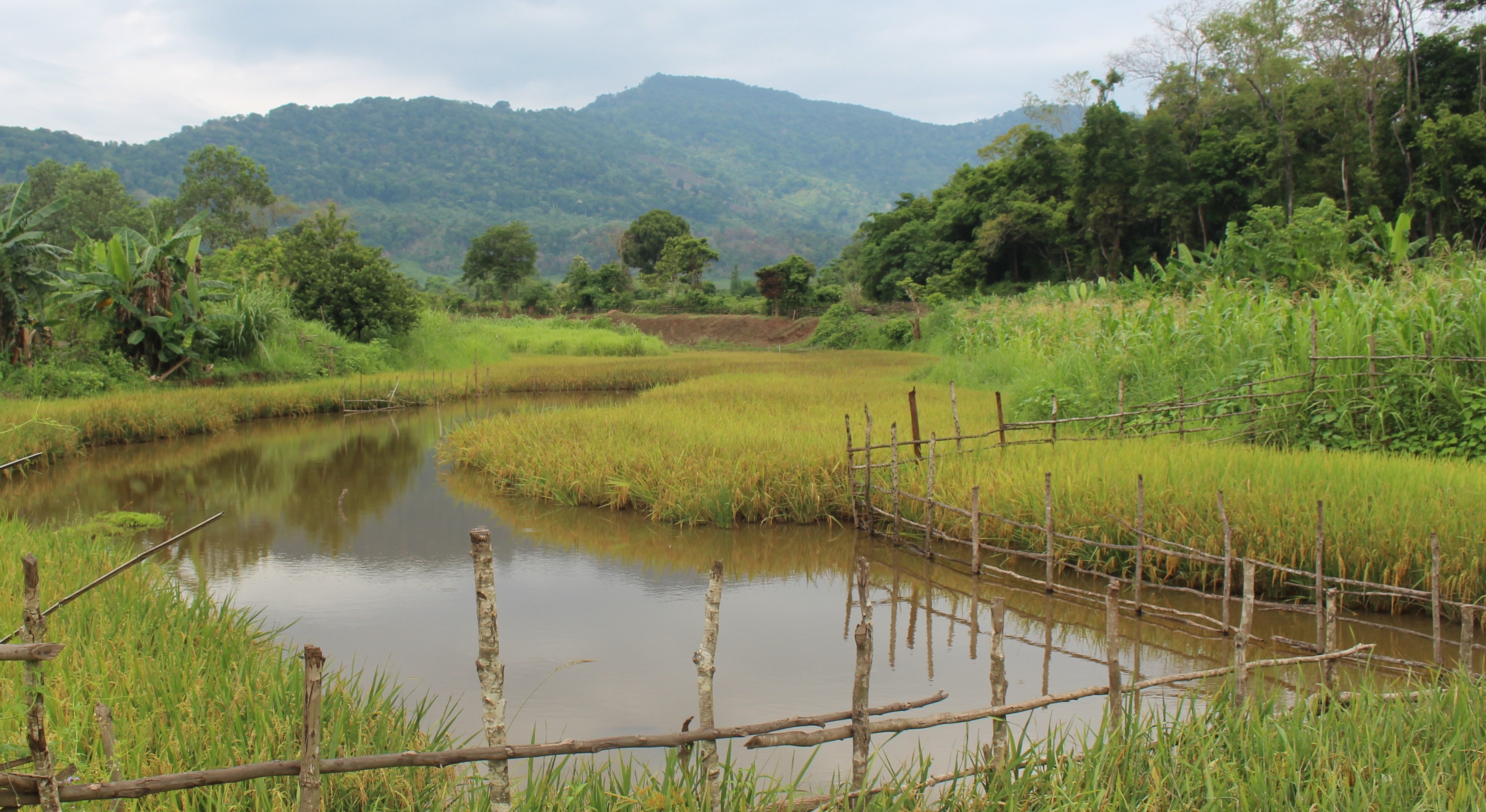
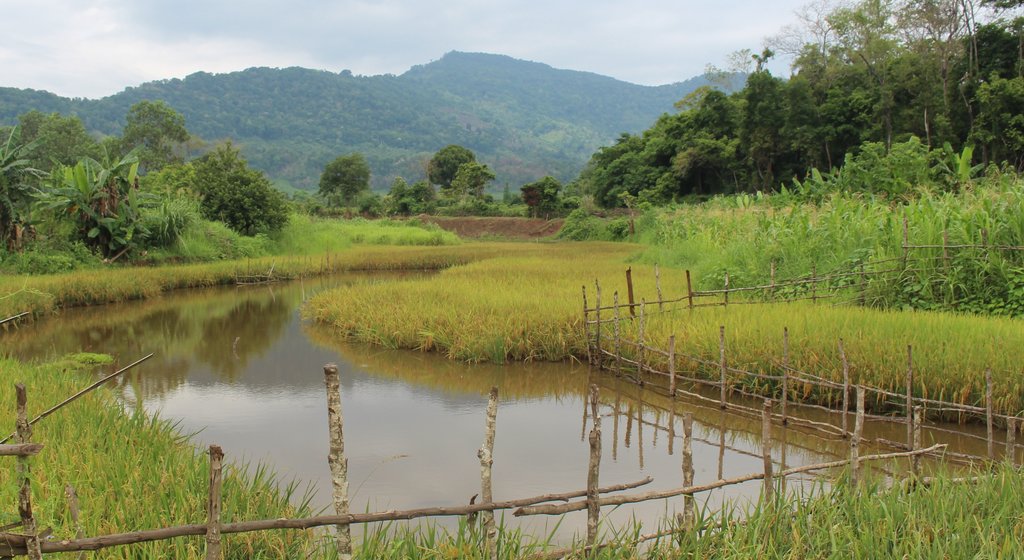
Dry season rice cultivation on flat areas of stream banks aiming towards replacement of harmful shifting cultivation practices in the upland areas and to improve livelihoods.
2.2 Detailed description of the Technology
Description:
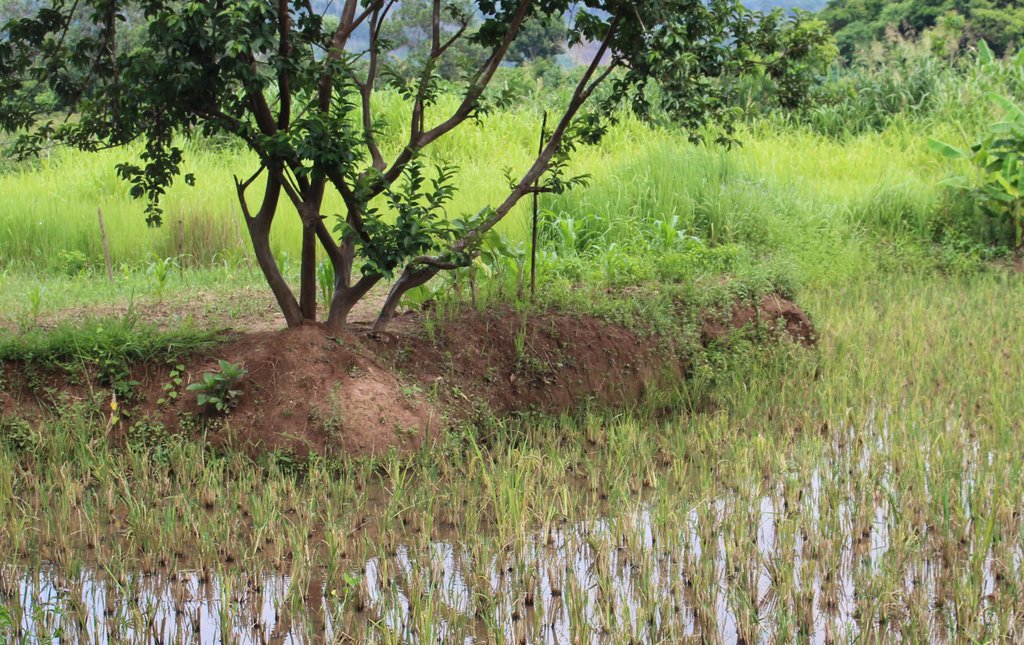
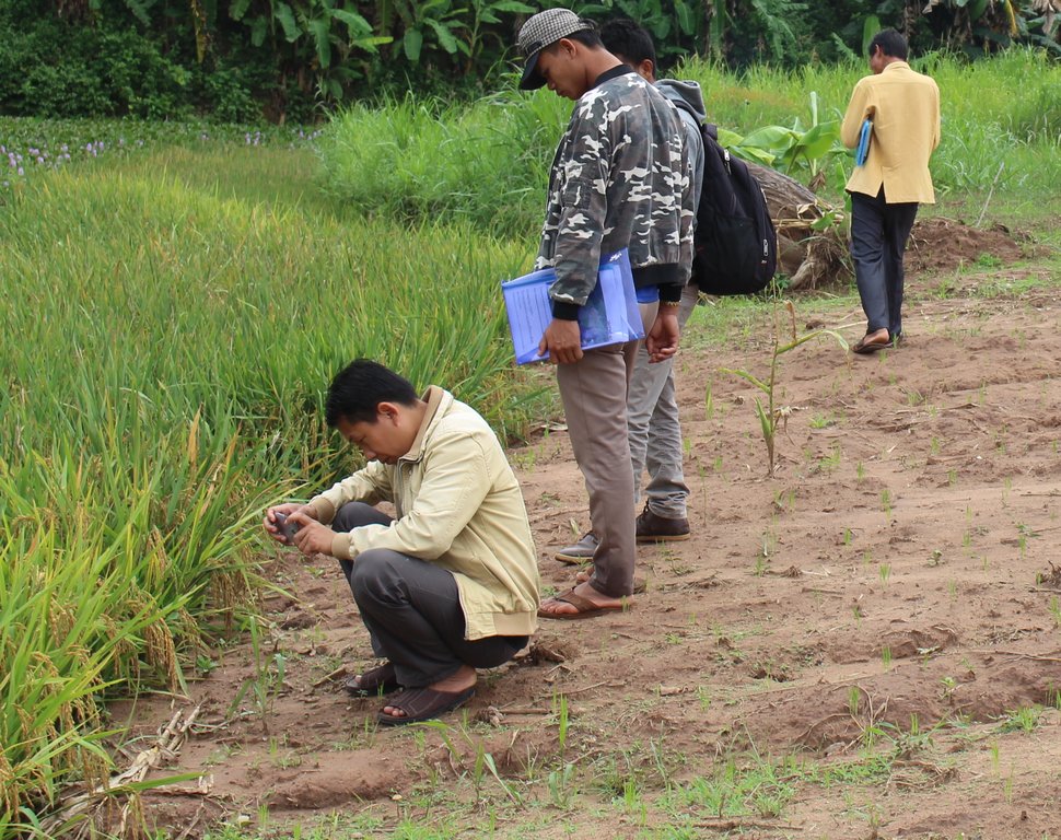
Technique on dry season rice cultivation on the banks of stream has been initiated by a Project of Oxfam Australia. Previously, the slash and burn agriculture was a main livelihood activity of local land users in mountainous areas and they had no experience regarding the cultivation of lowland rice. This, in fact, affected food insecurity among the local communities with limited arable land whilst population growth and increasing land pressure in the hill area. As a result, a Project supported by Oxfarm Australia that has been working in Ta Oy District since 1996 with the aim to reduce encroachment of isolated areas in natural forests. The Project e.g. has established the Natural Disaster Management Committee at village level. The project played an important role in providing options regarding permanent livelihood activities for local communities. Dry season rice cultivation along banks of streams was one of the potential alternatives for livelihood improvement particularly to ensure food security and to reduce the workload. At the beginning, the Project provided training to the local land users on how to use buffalos for ploughing as they never used this approach before. The Project also provided rice seedlings, agricultural tools (hoes and shovels) for the land preparation. During the first phase of the Project, there were only few households interested to participate as they were afraid that it would impose negative impacts on local culture and tradition. This because the land users believed that rice cultivation has only to grow in higher land areas and rice stems should not be soaked in water. Nevertheless, there were a number of households who decided to participate in the trial phase of the Project anyway. The Project encouraged them to contribute labour for the whole rice paddy development process and mainly also to support the excavation needed for the land preparation along the streams. Areas suitable to this technology should be on relatively flat land at similar level to the stream which allows simplified access to water. Usually, the land users start land preparation on December to January during the dry season. Before dry season, the land gets flooded every year and in consequence brings fertile deposits to the soils. Later, many land users expressed their interest to implement dry season rice cultivation on the river banks. As a result, village residents have expanded rice paddies wherever suitable. These terrains include stream areas very near to the village. Finally the land users got very happy to have own their paddies so near to the village. Inappropriate beliefs have been gradually eradicated prior to cultivate now lowland rice. Actually, households have more rice for household consumption although
it may be insufficient for all year round. This means that many land users still need to cultivate additional areas in the uplands due to limited land in the lowlands. But the general purposes of reducing significantly the swidden agriculture in the uplands and also to decrease labour for these activities has been achieved anyway. In addition, the land users could benefit from increased animal fodder in the form of rice straw during dry season and the rice straw for soil cover in the vegetable gardens to retain soil moisture. Moreover, people from neighbouring villages also learnt from this initiative and implemented it in their villages too.
2.3 Photos of the Technology
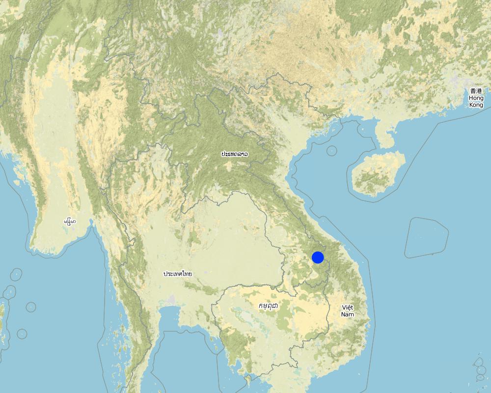
2.5 Country/ region/ locations where the Technology has been applied and which are covered by this assessment
Country:
Lao People's Democratic Republic
Region/ State/ Province:
Salavan province
Further specification of location:
Taouy district
Specify the spread of the Technology:
- evenly spread over an area
If precise area is not known, indicate approximate area covered:
- < 0.1 km2 (10 ha)
Map
×2.6 Date of implementation
If precise year is not known, indicate approximate date:
- 10-50 years ago
2.7 Introduction of the Technology
Specify how the Technology was introduced:
- through projects/ external interventions
Comments (type of project, etc.):
The Oxfarm Australia Project
3. Classification of the SLM Technology
3.1 Main purpose(s) of the Technology
- improve production
- reduce, prevent, restore land degradation
- adapt to climate change/ extremes and its impacts
- create beneficial social impact
3.2 Current land use type(s) where the Technology is applied

Cropland
- Annual cropping
Annual cropping - Specify crops:
- cereals - rice (wetland)
Number of growing seasons per year:
- 1
3.4 Water supply
Water supply for the land on which the Technology is applied:
- rainfed
3.5 SLM group to which the Technology belongs
- area closure (stop use, support restoration)
- water harvesting
3.6 SLM measures comprising the Technology

agronomic measures
- A1: Vegetation/ soil cover

management measures
- M1: Change of land use type
3.7 Main types of land degradation addressed by the Technology

water degradation
- Hw: reduction of the buffering capacity of wetland areas
3.8 Prevention, reduction, or restoration of land degradation
Specify the goal of the Technology with regard to land degradation:
- prevent land degradation
4. Technical specifications, implementation activities, inputs, and costs
4.1 Technical drawing of the Technology
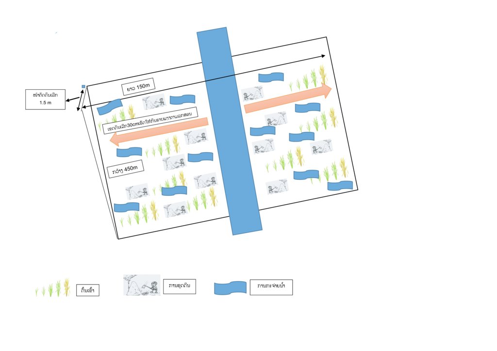
Technical specifications (related to technical drawing):
1. Dig to make flat land along to the banks of stream on December to January
2. Seedling preparation (January to February)
3. Ploughing
4. Transplanting of rice seedlings
5. Rice harvesting on April to May
Author:
Taouy District of Agriculture and Forestry Office's team
Date:
11/08/2017
4.2 General information regarding the calculation of inputs and costs
Specify how costs and inputs were calculated:
- per Technology area
Indicate size and area unit:
0,7
If using a local area unit, indicate conversion factor to one hectare (e.g. 1 ha = 2.47 acres): 1 ha =:
Hectare
other/ national currency (specify):
LAK
If relevant, indicate exchange rate from USD to local currency (e.g. 1 USD = 79.9 Brazilian Real): 1 USD =:
8000.0
Indicate average wage cost of hired labour per day:
50000
4.3 Establishment activities
| Activity | Timing (season) | |
|---|---|---|
| 1. | Flattening of soil bank terrain | December to January |
4.4 Costs and inputs needed for establishment
| Specify input | Unit | Quantity | Costs per Unit | Total costs per input | % of costs borne by land users | |
|---|---|---|---|---|---|---|
| Labour | Labour for flattening (not paid) | person day | 60.0 | 50000.0 | 3000000.0 | 100.0 |
| Equipment | Hoe | piece | 2.0 | 30000.0 | 60000.0 | 100.0 |
| Equipment | Shovel | piece | 2.0 | 20000.0 | 40000.0 | 100.0 |
| Equipment | Buffalo | head | 1.0 | 7000000.0 | 7000000.0 | 100.0 |
| Total costs for establishment of the Technology | 10100000.0 | |||||
| Total costs for establishment of the Technology in USD | 1262.5 | |||||
If land user bore less than 100% of costs, indicate who covered the remaining costs:
The Oxfarm Australia support 1 buffalo per household
4.5 Maintenance/ recurrent activities
| Activity | Timing/ frequency | |
|---|---|---|
| 1. | Labour for ploughing | December to January |
| 2. | Seedling preparation | End of January |
| 3. | Transplantation of the rice seedlings | One month after seeding |
| 4. | Rice harvesting | May |
4.6 Costs and inputs needed for maintenance/ recurrent activities (per year)
| Specify input | Unit | Quantity | Costs per Unit | Total costs per input | % of costs borne by land users | |
|---|---|---|---|---|---|---|
| Labour | Labour for seedling preparation | person day | 2.0 | 50000.0 | 100000.0 | 100.0 |
| Labour | Labour for transplanting | person day | 14.0 | 50000.0 | 700000.0 | 100.0 |
| Labour | Labour for harvesting | person day | 14.0 | 50000.0 | 700000.0 | 100.0 |
| Plant material | Seed of rice | kg | 10.0 | 4000.0 | 40000.0 | 100.0 |
| Total costs for maintenance of the Technology | 1540000.0 | |||||
| Total costs for maintenance of the Technology in USD | 192.5 | |||||
4.7 Most important factors affecting the costs
Describe the most determinate factors affecting the costs:
The preparation of the land takes lot of time and require more labour.
5. Natural and human environment
5.1 Climate
Annual rainfall
- < 250 mm
- 251-500 mm
- 501-750 mm
- 751-1,000 mm
- 1,001-1,500 mm
- 1,501-2,000 mm
- 2,001-3,000 mm
- 3,001-4,000 mm
- > 4,000 mm
Agro-climatic zone
- sub-humid
5.2 Topography
Slopes on average:
- flat (0-2%)
- gentle (3-5%)
- moderate (6-10%)
- rolling (11-15%)
- hilly (16-30%)
- steep (31-60%)
- very steep (>60%)
Landforms:
- plateau/plains
- ridges
- mountain slopes
- hill slopes
- footslopes
- valley floors
Altitudinal zone:
- 0-100 m a.s.l.
- 101-500 m a.s.l.
- 501-1,000 m a.s.l.
- 1,001-1,500 m a.s.l.
- 1,501-2,000 m a.s.l.
- 2,001-2,500 m a.s.l.
- 2,501-3,000 m a.s.l.
- 3,001-4,000 m a.s.l.
- > 4,000 m a.s.l.
Indicate if the Technology is specifically applied in:
- not relevant
5.3 Soils
Soil depth on average:
- very shallow (0-20 cm)
- shallow (21-50 cm)
- moderately deep (51-80 cm)
- deep (81-120 cm)
- very deep (> 120 cm)
Soil texture (topsoil):
- medium (loamy, silty)
Soil texture (> 20 cm below surface):
- medium (loamy, silty)
Topsoil organic matter:
- high (>3%)
5.4 Water availability and quality
Ground water table:
on surface
Availability of surface water:
good
Water quality (untreated):
for agricultural use only (irrigation)
Is water salinity a problem?
No
Is flooding of the area occurring?
Yes
5.5 Biodiversity
Species diversity:
- medium
Habitat diversity:
- medium
5.6 Characteristics of land users applying the Technology
Sedentary or nomadic:
- Sedentary
Market orientation of production system:
- subsistence (self-supply)
Off-farm income:
- less than 10% of all income
Relative level of wealth:
- average
Individuals or groups:
- individual/ household
Level of mechanization:
- manual work
- animal traction
Gender:
- men
Age of land users:
- elderly
5.7 Average area of land used by land users applying the Technology
- < 0.5 ha
- 0.5-1 ha
- 1-2 ha
- 2-5 ha
- 5-15 ha
- 15-50 ha
- 50-100 ha
- 100-500 ha
- 500-1,000 ha
- 1,000-10,000 ha
- > 10,000 ha
Is this considered small-, medium- or large-scale (referring to local context)?
- medium-scale
5.8 Land ownership, land use rights, and water use rights
Land ownership:
- individual, titled
Land use rights:
- individual
Water use rights:
- open access (unorganized)
5.9 Access to services and infrastructure
health:
- poor
- moderate
- good
education:
- poor
- moderate
- good
technical assistance:
- poor
- moderate
- good
employment (e.g. off-farm):
- poor
- moderate
- good
markets:
- poor
- moderate
- good
energy:
- poor
- moderate
- good
roads and transport:
- poor
- moderate
- good
drinking water and sanitation:
- poor
- moderate
- good
financial services:
- poor
- moderate
- good
6. Impacts and concluding statements
6.1 On-site impacts the Technology has shown
Socio-economic impacts
Production
crop production
Quantity before SLM:
500 kg/ha
Quantity after SLM:
1200 kg/0.7 ha
fodder production
Comments/ specify:
The rice straw can be used for livestock especially for cattle after rice harvest in dry season
animal production
Comments/ specify:
The better fodder situation (rice straw) improved the animal production.
risk of production failure
Comments/ specify:
The paddy field activity decreased risk of production failure as it get higher yield compare to upland rice cultivation.
product diversity
Comments/ specify:
The land users can have lowland rice, diversify the vegetable by getting rice straw to mulch the vegetable plot, and they can get fish from their paddy fields.
production area
Comments/ specify:
The upland production area decreased and is compensated only partly in the low lands (river banks)
land management
Income and costs
expenses on agricultural inputs
Comments/ specify:
The Oxfarm Australia Project provide one buffalo for land users and they use the traditional seedling variety each year.
workload
Comments/ specify:
Decreased workload as it is not labour intensive activity compare with upland rice activity.
Socio-cultural impacts
food security/ self-sufficiency
Comments/ specify:
Increase rice production for home consumption.
cultural opportunities
Comments/ specify:
Improve the land users believe that rice should not cultivate or soaked in water
recreational opportunities
Comments/ specify:
The land user can take a rest along to the paddy field where peaceful and good environment.
SLM/ land degradation knowledge
Comments/ specify:
The land users were able to generate better rice yield by simultaneous reduction of unsustainable slash and burn cultivation.
conflict mitigation
Comments/ specify:
Improve conflict mitigation from slash and burn shifting cultivation.
Ecological impacts
Biodiversity: vegetation, animals
plant diversity
Comments/ specify:
Increased the number of plant diversity in the river
habitat diversity
Comments/ specify:
Increased habitat diversity of aquaculture
6.2 Off-site impacts the Technology has shown
impact of greenhouse gases
Comments/ specify:
Decreasing emission of carbon and greenhouse gases by reduction of bush fires in the region due to the technology.
6.3 Exposure and sensitivity of the Technology to gradual climate change and climate-related extremes/ disasters (as perceived by land users)
Gradual climate change
Gradual climate change
| Season | increase or decrease | How does the Technology cope with it? | |
|---|---|---|---|
| annual temperature | increase | well | |
| annual rainfall | increase | well | |
| seasonal rainfall | wet/ rainy season | increase | well |
6.4 Cost-benefit analysis
How do the benefits compare with the establishment costs (from land users’ perspective)?
Short-term returns:
positive
Long-term returns:
positive
How do the benefits compare with the maintenance/ recurrent costs (from land users' perspective)?
Short-term returns:
positive
Long-term returns:
positive
6.5 Adoption of the Technology
- > 50%
Of all those who have adopted the Technology, how many did so spontaneously, i.e. without receiving any material incentives/ payments?
- 11-50%
6.6 Adaptation
Has the Technology been modified recently to adapt to changing conditions?
No
6.7 Strengths/ advantages/ opportunities of the Technology
| Strengths/ advantages/ opportunities in the land user’s view |
|---|
| Reduction of slash and burn cultivation areas through allocation of permanent agriculture land for local villagers. |
| Increased food security for households. |
| Change local belief and perceptions who never cultivated lowland rice and didn’t want to cultivate rice in flooded land. |
| Strengths/ advantages/ opportunities in the compiler’s or other key resource person’s view |
|---|
| The land user can use rice straws for animal fodder particularly during dry season due to limited natural grass for livestock. Besides this, rice straw provides a number of benefits including the use to cover on vegetable plots to retain soil moisture. |
| Reduce time and workload in relation to the paddy field is close to the village. |
6.8 Weaknesses/ disadvantages/ risks of the Technology and ways of overcoming them
| Weaknesses/ disadvantages/ risks in the land user’s view | How can they be overcome? |
|---|---|
| Insufficient suitable land availability along streams for lowland rice paddy. | Use the excavator for extend larger areas where possible. |
| Rice yields from dry season remain low due to issues with land availability thereby rice shortages persist within some households. | |
| Pest outbreaks, including aphids, grasshoppers, birds, and rats. | |
| The local land users lack of technical skills for dry season rice cultivation. | Training by agriculture experts |
7. References and links
7.1 Methods/ sources of information
- field visits, field surveys
1
- interviews with land users
1
When were the data compiled (in the field)?
17/05/2017
Links and modules
Expand all Collapse allLinks
No links
Modules
No modules


