Fish pond construction on slope area on clayey subsoil for water harvesting [Lao People's Democratic Republic]
- Creation:
- Update:
- Compiler: kang phanvongsa
- Editors: anousit namsena, Bounthanom Bouahom, Pasalath Khounsy
- Reviewers: Nicole Harari, Oulaytham Lasasimma, Stephanie Jaquet, Alexandra Gavilano
technologies_2920 - Lao People's Democratic Republic
View sections
Expand all Collapse all1. General information
1.2 Contact details of resource persons and institutions involved in the assessment and documentation of the Technology
Key resource person(s)
land user:
Amdang nep
Lao People's Democratic Republic
land user:
Amdo Kousoai
Lao People's Democratic Republic
Name of project which facilitated the documentation/ evaluation of the Technology (if relevant)
Scaling-up SLM practices by smallholder farmers (IFAD)Name of the institution(s) which facilitated the documentation/ evaluation of the Technology (if relevant)
National Agriculture and Forestry Research Institute (NAFRI) - Lao People's Democratic Republic1.3 Conditions regarding the use of data documented through WOCAT
The compiler and key resource person(s) accept the conditions regarding the use of data documented through WOCAT:
Yes
1.4 Declaration on sustainability of the described Technology
Is the Technology described here problematic with regard to land degradation, so that it cannot be declared a sustainable land management technology?
No
Comments:
Turn the land in slope area that spring water flow through to the ponds water harvesting and reduces leaching on soil surface
2. Description of the SLM Technology
2.1 Short description of the Technology
Definition of the Technology:
The methods for construction of earthen pond on slope area in adjacent to the village where it forms perennial water channels with clay soil which is unsuitable for other agricultural purposes. Therefore, Oxfam encouraged the construction of communal pond to create the interest for many households to build their own ponds.
2.2 Detailed description of the Technology
Description:
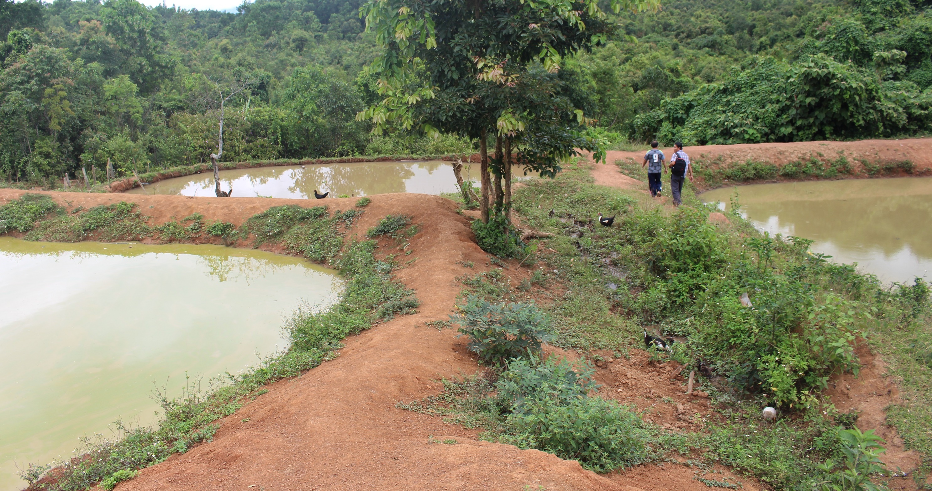
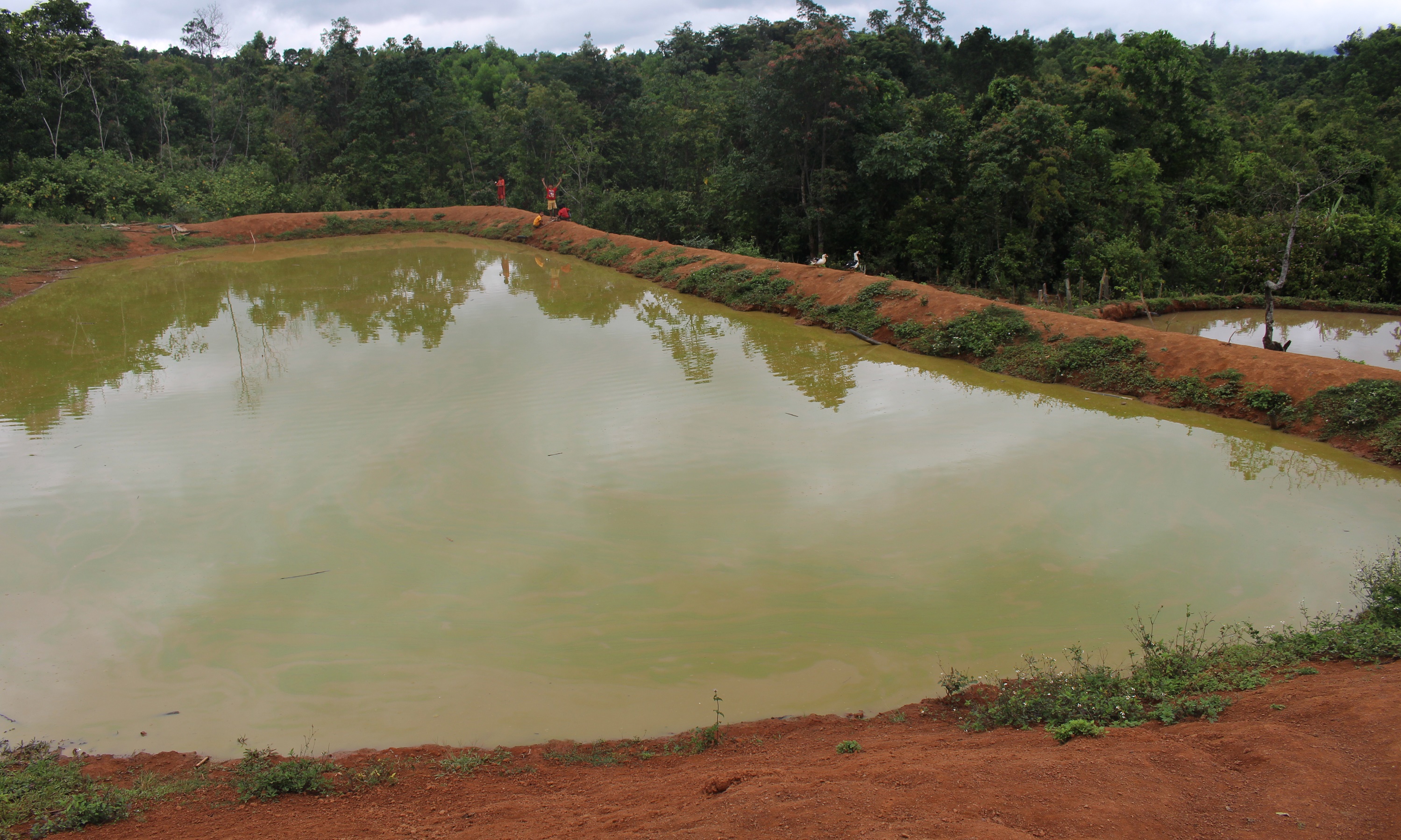
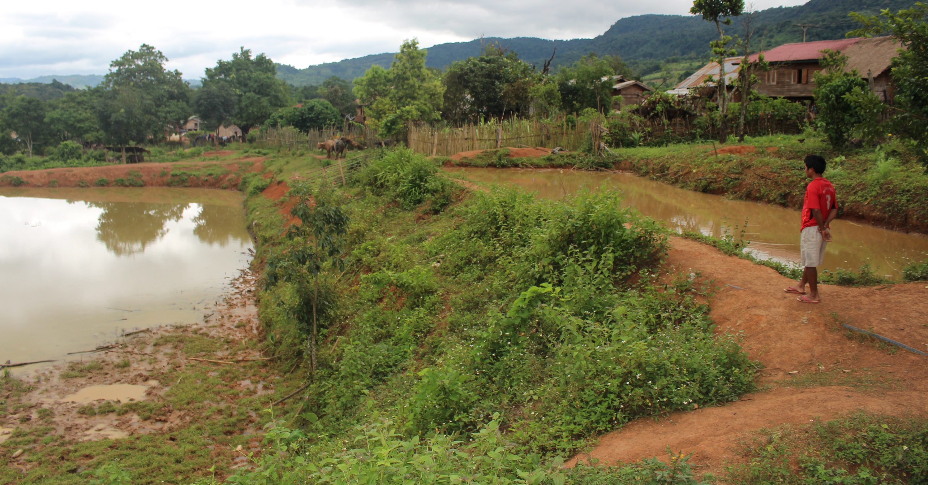
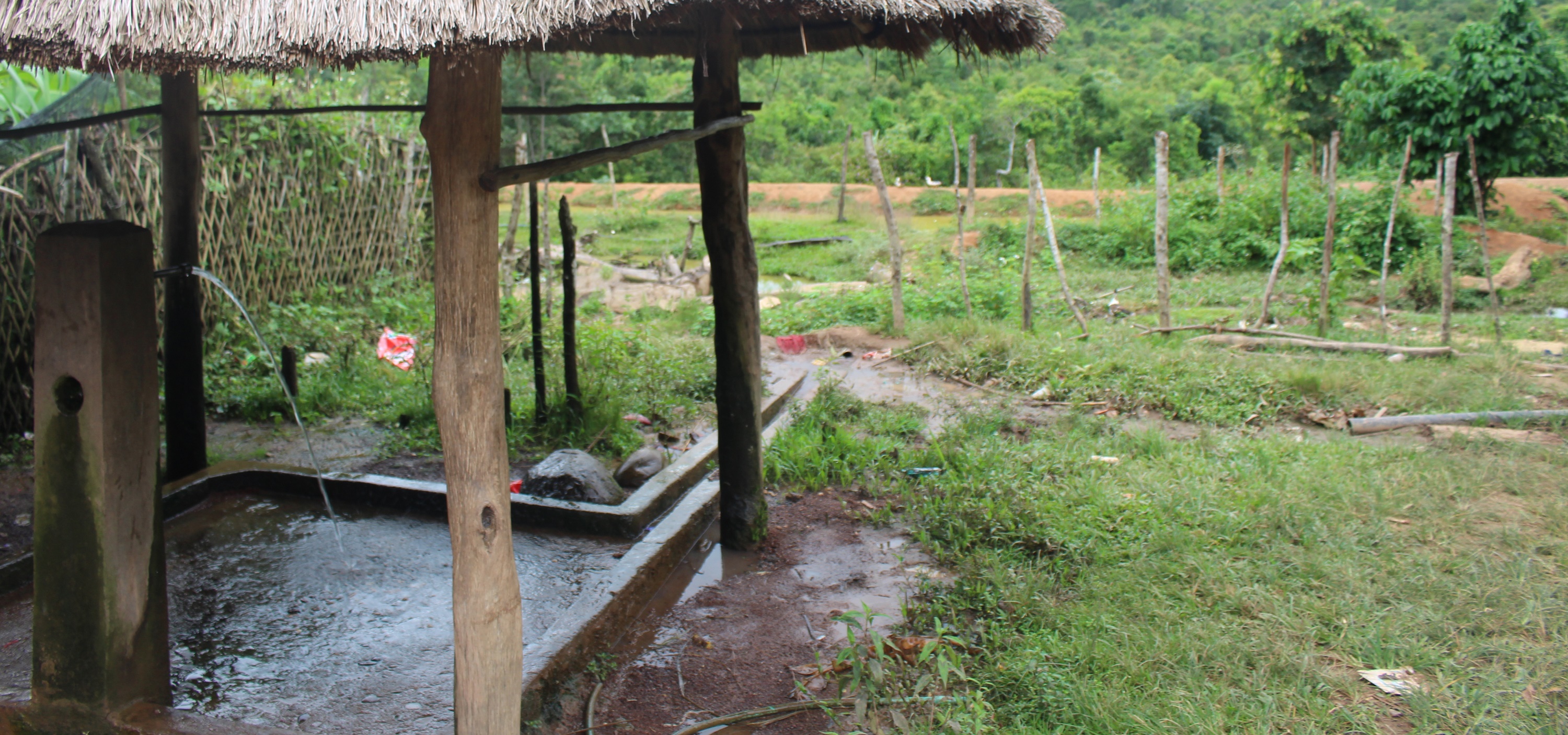
With the slope mountainous area, the top soil's soil nutrients and organisms are leached by heavy rain during wet season (July-November). This land was mainly used for Bong tree plantation (Nothaphoebe umbelliflora) and a variety of fruit trees; however, farmers have to wait for many years to be able to get small harvest from these trees. In 2004, an Oxfam Project promoted and encouraged local community to construct a communal mud-pond with a size of 50 x 40 m on steep terrains near the village. The project utilized the water resource potential by digging a pond for the villager's use as year round gravity fed water supply system. The project initially provided fish fingerlings (tilapia, silver barb: scientific name is Barbonymus gonionotus, and grass carp: scientific name is Ctenopharyngodon idella). The village residents realized immediately the significant benefits of the pond. Besides raising fishes in the pond, local people could use water for household gardening and as a source of drinking water for livestock (cow, water buffalo, pig, duck, etc). The pond is easy to manage and maintain whilst it is also more convenient to collect aquatic resources in proximity to the village. Typically, the potential site condition for pond construction is steep mountainous terrain with average slope of 10 -15 degrees. The soil property should be clay or silt clay which can hold the water.
Later after the community pond has been constructed some villagers who had potential land left constructed their individual ponds to improve their own production. This because they have seen the benefit of communal pond which can provide approximately 200 - 300 kg of fish per years. The individual pond construction reduced finally also conflicts caused by different issues of the community pond.
The construction of the pond is not very complicated. First, the water valves from GFS (provided by the Poverty Reduction Fund) turned off the sources water from the upstream area. Bush clearing, tree felling, stump removal and vegetation stockpiling (for burning) was then required on construction areaof the pond The pond size should be designed at a size of approx. 30 x 20m. Next step, the manual excavation works (by using hoes and shovels) should ba undertaken at upper section of the canal. The ground has to be excavated with an average depth between 0.5 – 1m and with the excavated soil pond dyke has to be alligned arround the pond area (square shape). The dykes soil has to be compressed to very compact barriers to prevent water leaking and dyke erosion (even small holes in dyke can rapidly enlarge, leading to the potential future damages and dyke bursting). The pond dyke’s height is 1.2m in hight and 2m wide with dyke slopes from the foot to the edge (where it also provides a walkway for feeding fishes or gardening) is approximately 45%. The design of the thick dyke is to ensure its stability from soil erosion as a result from a certain fish species that pierces the dyke slopes and rapid water flow. If the pond dyke is designed with fewer slopes, it will be susceptible to soil erosion. At least a drainage outlet is required with a P100 pipe for 4m long. The pipe should be installed with 1m height from the pond bottom at the outlet. This pipe will drain water and prevent overflow that may cause damage to the dyke. The pond area later need to be leveled by using hoes and shovels cut the undulating area. Then should be kept the pond bottom dry for at least one week to allow time for pond repair as well as to increase the production of the pond bottom, after that fill the water into the pond by turn on the inlet valves that have been turn off earlier. This pond construction method may require intensive labors and extensive time to complete. Funding for construction tools and construction method are still insufficient. However, this is the effective way to maximize water from perennial stream for integrated management and its benefits are considerable especially for fish consumption in household and selling for generate household income.
2.3 Photos of the Technology
Media Gallery
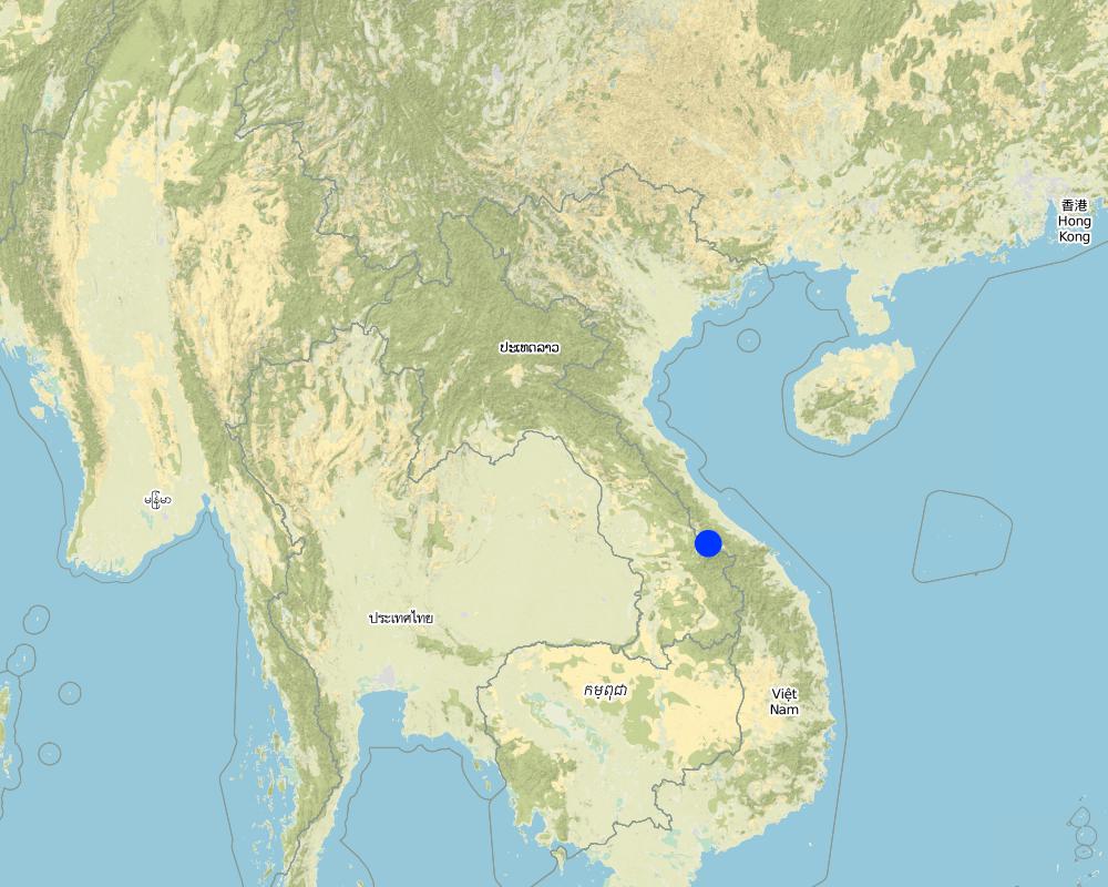
2.5 Country/ region/ locations where the Technology has been applied and which are covered by this assessment
Country:
Lao People's Democratic Republic
Region/ State/ Province:
Samoaui district, Salavan province
Further specification of location:
Tangko village
Specify the spread of the Technology:
- applied at specific points/ concentrated on a small area
Map
×2.6 Date of implementation
Indicate year of implementation:
2007
If precise year is not known, indicate approximate date:
- 10-50 years ago
2.7 Introduction of the Technology
Specify how the Technology was introduced:
- through projects/ external interventions
Comments (type of project, etc.):
Through an Oxfarm project encouragement
3. Classification of the SLM Technology
3.1 Main purpose(s) of the Technology
- reduce, prevent, restore land degradation
- create beneficial social impact
- reduce conflicts
3.2 Current land use type(s) where the Technology is applied

Waterways, waterbodies, wetlands
- Ponds, dams
Main products/ services:
Fish raising

Unproductive land
Specify:
the type of soil in that area are silt and heavy clay so water can not penetrate into the soil
Comments:
Number of growing seasons per year: 1
Livestock density: 2 pigs, 2 goat, 10 Poultry
3.3 Has land use changed due to the implementation of the Technology?
Has land use changed due to the implementation of the Technology?
- Yes (Please fill out the questions below with regard to the land use before implementation of the Technology)
Comments:
Before the application of the Technology the area was covered by several types of vegetation, and also by fruit trees of very low yield. It has taken a long period until the first harvest was possible. This compared to the short term benefits of fish raising.
3.4 Water supply
Water supply for the land on which the Technology is applied:
- rainfed
3.5 SLM group to which the Technology belongs
- cross-slope measure
- water harvesting
3.6 SLM measures comprising the Technology

structural measures
- S1: Terraces
- S5: Dams, pans, ponds
- S7: Water harvesting/ supply/ irrigation equipment

management measures
- M1: Change of land use type
3.7 Main types of land degradation addressed by the Technology

soil erosion by water
- Wg: gully erosion/ gullying

biological degradation
- Bc: reduction of vegetation cover
3.8 Prevention, reduction, or restoration of land degradation
Specify the goal of the Technology with regard to land degradation:
- adapt to land degradation
4. Technical specifications, implementation activities, inputs, and costs
4.1 Technical drawing of the Technology
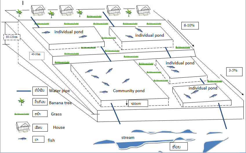
Technical specifications (related to technical drawing):
Generally pond construction in the village are the same structure because they relay on community's pond such oxfarm was excavated for them but smaller.
the area of community's pond is 50 x 30 m
the area of individual pond is 30 x 15 m
height of the pond dyke is 120 m, width 2m
depth of the water is 1m
Slope angle before 10-16% and after 3-5 % the implementation of the Technology
Construction material used include: hoe and shovel use for digging the soil to make the pond dykes or leveling the pond bottom. Inlet tube length 80m from water sources to the ponds and outlet by using concrete pipe p100 to prevent flooding.
Capacity of pond approximate 450 m3. Potential of pond is for water harvesting and reduce severe water runoff on the surface.
beneficial area of ponds is can produce fish and another living aquatic resources for self consumption.
Fish species used is Tilapia, common carp, grass carp, silver barb.
Author:
Phonesyri Phanvongsa
Date:
07/07/2017
4.2 General information regarding the calculation of inputs and costs
Specify how costs and inputs were calculated:
- per Technology unit
Specify unit:
individual fish pond
Specify dimensions of unit (if relevant):
30 X 15 meters
other/ national currency (specify):
kip
If relevant, indicate exchange rate from USD to local currency (e.g. 1 USD = 79.9 Brazilian Real): 1 USD =:
8400.0
Indicate average wage cost of hired labour per day:
35000 kip
4.3 Establishment activities
| Activity | Timing (season) | |
|---|---|---|
| 1. | weeding and cleaning the area | before onset of rain, January - Mach |
| 2. | Burning the vegetation | before onset of rain |
| 3. | Making pond dyke and add outlet pipe | before onset of rain |
| 4. | Fill the water into the pond | beginning of rain |
4.4 Costs and inputs needed for establishment
| Specify input | Unit | Quantity | Costs per Unit | Total costs per input | % of costs borne by land users | |
|---|---|---|---|---|---|---|
| Labour | labor for digging an individual fish pond (for individual fish pond ) | person-day | 180.0 | 35000.0 | 6300000.0 | 100.0 |
| Equipment | hoe | piece | 4.0 | 50000.0 | 200000.0 | 100.0 |
| Equipment | shovel | piece | 5.0 | 30000.0 | 150000.0 | 100.0 |
| Equipment | knife | piece | 2.0 | 30000.0 | 60000.0 | 100.0 |
| Construction material | pipe | m | 80.0 | 15000.0 | 1200000.0 | |
| Total costs for establishment of the Technology | 7910000.0 | |||||
| Total costs for establishment of the Technology in USD | 941.67 | |||||
4.5 Maintenance/ recurrent activities
| Activity | Timing/ frequency | |
|---|---|---|
| 1. | Drainage | After harvesting, the end of rainy season |
| 2. | Clean the pond bottom | After drainage |
| 3. | Repair the pond dyke | Before on set of rain |
| 4. | Refill the pond |
4.6 Costs and inputs needed for maintenance/ recurrent activities (per year)
| Specify input | Unit | Quantity | Costs per Unit | Total costs per input | % of costs borne by land users | |
|---|---|---|---|---|---|---|
| Labour | labor for drainage | person-day | 1.0 | 35000.0 | 35000.0 | 100.0 |
| Labour | clean the pond bottom | person-day | 2.0 | 35000.0 | 70000.0 | 100.0 |
| Labour | labor for repair pond dyke | person-day | 3.0 | 35000.0 | 105000.0 | 100.0 |
| Labour | refill the pond | person-day | 1.0 | 35000.0 | 35000.0 | 100.0 |
| Equipment | hoe | piece | 2.0 | 50000.0 | 100000.0 | 100.0 |
| Equipment | shovel | piece | 2.0 | 30000.0 | 60000.0 | 100.0 |
| Total costs for maintenance of the Technology | 405000.0 | |||||
| Total costs for maintenance of the Technology in USD | 48.21 | |||||
If land user bore less than 100% of costs, indicate who covered the remaining costs:
ທືນຜູ້ນຳໃຊ້ທີ່ດິນ 100%
4.7 Most important factors affecting the costs
Describe the most determinate factors affecting the costs:
Most important factors is labor for digging the pond
5. Natural and human environment
5.1 Climate
Annual rainfall
- < 250 mm
- 251-500 mm
- 501-750 mm
- 751-1,000 mm
- 1,001-1,500 mm
- 1,501-2,000 mm
- 2,001-3,000 mm
- 3,001-4,000 mm
- > 4,000 mm
Specify average annual rainfall (if known), in mm:
500.00
Specifications/ comments on rainfall:
Rainy season from May to November, highest rainfall between July to October. dry season from December to March April (rainfall)
Indicate the name of the reference meteorological station considered:
Samoaui Meteorological station
Agro-climatic zone
- humid
5.2 Topography
Slopes on average:
- flat (0-2%)
- gentle (3-5%)
- moderate (6-10%)
- rolling (11-15%)
- hilly (16-30%)
- steep (31-60%)
- very steep (>60%)
Landforms:
- plateau/plains
- ridges
- mountain slopes
- hill slopes
- footslopes
- valley floors
Altitudinal zone:
- 0-100 m a.s.l.
- 101-500 m a.s.l.
- 501-1,000 m a.s.l.
- 1,001-1,500 m a.s.l.
- 1,501-2,000 m a.s.l.
- 2,001-2,500 m a.s.l.
- 2,501-3,000 m a.s.l.
- 3,001-4,000 m a.s.l.
- > 4,000 m a.s.l.
Indicate if the Technology is specifically applied in:
- convex situations
5.3 Soils
Soil depth on average:
- very shallow (0-20 cm)
- shallow (21-50 cm)
- moderately deep (51-80 cm)
- deep (81-120 cm)
- very deep (> 120 cm)
Soil texture (topsoil):
- fine/ heavy (clay)
Soil texture (> 20 cm below surface):
- fine/ heavy (clay)
Topsoil organic matter:
- medium (1-3%)
5.4 Water availability and quality
Ground water table:
< 5 m
Availability of surface water:
good
Water quality (untreated):
good drinking water
Is water salinity a problem?
No
Is flooding of the area occurring?
No
5.5 Biodiversity
Species diversity:
- medium
Habitat diversity:
- medium
5.6 Characteristics of land users applying the Technology
Sedentary or nomadic:
- Sedentary
Market orientation of production system:
- subsistence (self-supply)
Off-farm income:
- 10-50% of all income
Relative level of wealth:
- average
Individuals or groups:
- individual/ household
Level of mechanization:
- manual work
Gender:
- men
Age of land users:
- youth
- middle-aged
5.7 Average area of land used by land users applying the Technology
- < 0.5 ha
- 0.5-1 ha
- 1-2 ha
- 2-5 ha
- 5-15 ha
- 15-50 ha
- 50-100 ha
- 100-500 ha
- 500-1,000 ha
- 1,000-10,000 ha
- > 10,000 ha
Is this considered small-, medium- or large-scale (referring to local context)?
- small-scale
5.8 Land ownership, land use rights, and water use rights
Land ownership:
- communal/ village
- individual, titled
Land use rights:
- individual
Water use rights:
- communal (organized)
5.9 Access to services and infrastructure
health:
- poor
- moderate
- good
education:
- poor
- moderate
- good
technical assistance:
- poor
- moderate
- good
employment (e.g. off-farm):
- poor
- moderate
- good
markets:
- poor
- moderate
- good
energy:
- poor
- moderate
- good
roads and transport:
- poor
- moderate
- good
drinking water and sanitation:
- poor
- moderate
- good
financial services:
- poor
- moderate
- good
6. Impacts and concluding statements
6.1 On-site impacts the Technology has shown
Socio-economic impacts
Production
crop production
Quantity before SLM:
20 kg
Quantity after SLM:
5 kg
Comments/ specify:
Loss of land for crop cultivation because the villagers turned the crop land to pond area
animal production
Quantity before SLM:
200 kg
Quantity after SLM:
300 kg
Comments/ specify:
Increase in aquatic product"bag" and decrease of hunting "bag"
production area
Quantity before SLM:
3 vegetable plots
Quantity after SLM:
2 vegetable plots
Comments/ specify:
because they moved crop their crop cultivation to an other, smaller area
Water availability and quality
water availability for livestock
Comments/ specify:
Previously the animal must to go to the river or stream to drink water after ponds has been constructed there is water available for animals in the ponds
Income and costs
workload
Comments/ specify:
Decreasing in the workload for land user as he does not have to go fishing in the stream far away from the village
Socio-cultural impacts
food security/ self-sufficiency
Comments/ specify:
Improved fish production and could contribute fish for home consumption for whole year
land use/ water rights
Comments/ specify:
Improved land use right for fish pond as individual households have their own fish pond
community institutions
Comments/ specify:
The village head did not supported the management of community pond (this caused fish depletion). Later, after the individual ponds have been constructed the village head steered the organization of maintenance work on the community pond. This allowed e.g. fishing during village festivals there. Individual ponds are maintained always by the owners themselves.
conflict mitigation
Comments/ specify:
Improved and reduced the conflict with neighbors regarding fishing as they conduct now their own fish ponds.
Ecological impacts
Water cycle/ runoff
harvesting/ collection of water
Comments/ specify:
Improved water runoff by construction of fish pond
Biodiversity: vegetation, animals
animal diversity
Comments/ specify:
Increase in aquatic animals regarding both quantity and species such as crab, snail and the land user can have exotic species of fish (Tilapia, common cap).
habitat diversity
Comments/ specify:
Decreased of vegetation on soil surface
6.2 Off-site impacts the Technology has shown
downstream siltation
Comments/ specify:
Reduced surface runoff by heavy rain
6.3 Exposure and sensitivity of the Technology to gradual climate change and climate-related extremes/ disasters (as perceived by land users)
Gradual climate change
Gradual climate change
| Season | increase or decrease | How does the Technology cope with it? | |
|---|---|---|---|
| annual temperature | increase | moderately | |
| seasonal temperature | wet/ rainy season | decrease | well |
| seasonal temperature | dry season | increase | very well |
| annual rainfall | increase | well | |
| seasonal rainfall | wet/ rainy season | increase | well |
| seasonal rainfall | dry season | decrease | not well |
Climate-related extremes (disasters)
Meteorological disasters
| How does the Technology cope with it? | |
|---|---|
| local rainstorm | moderately |
| local hailstorm | moderately |
| local windstorm | moderately |
Climatological disasters
| How does the Technology cope with it? | |
|---|---|
| cold wave | not well |
| drought | not well |
Hydrological disasters
| How does the Technology cope with it? | |
|---|---|
| flash flood | not well |
| landslide | moderately |
Biological disasters
| How does the Technology cope with it? | |
|---|---|
| epidemic diseases | moderately |
Other climate-related consequences
Other climate-related consequences
| How does the Technology cope with it? | |
|---|---|
| reduced growing period | moderately |
6.4 Cost-benefit analysis
How do the benefits compare with the establishment costs (from land users’ perspective)?
Short-term returns:
negative
Long-term returns:
neutral/ balanced
How do the benefits compare with the maintenance/ recurrent costs (from land users' perspective)?
Short-term returns:
slightly negative
Long-term returns:
positive
6.5 Adoption of the Technology
- 11-50%
If available, quantify (no. of households and/ or area covered):
5 households in Tangko village have their own private fish pond and some of them are taking the initiative to increase the number of individual fish pond where possible.
Of all those who have adopted the Technology, how many did so spontaneously, i.e. without receiving any material incentives/ payments?
- 51-90%
6.6 Adaptation
Has the Technology been modified recently to adapt to changing conditions?
Yes
other (specify):
Conflict mitigation
Specify adaptation of the Technology (design, material/ species, etc.):
At the beginning in 2004 only a community pond has been constructed. Later villagers started to construct also individual ponds to mitigate social tensions caused by weak coordination of maintenance work concerned with this community pond.
6.7 Strengths/ advantages/ opportunities of the Technology
| Strengths/ advantages/ opportunities in the land user’s view |
|---|
| As the individual fish ponds are located close to the house it is easily for the land users to go fishing and maintain whenever they want. This serves time. |
| All year round availability of water |
| Increased in food and nutrition security for household members |
| Strengths/ advantages/ opportunities in the compiler’s or other key resource person’s view |
|---|
| The villagers will be able to produce fish also for the next generation |
6.8 Weaknesses/ disadvantages/ risks of the Technology and ways of overcoming them
| Weaknesses/ disadvantages/ risks in the land user’s view | How can they be overcome? |
|---|---|
| Onset of heavy rain can damage the pond dykes and leading to erosion | |
| Floods in rainy season | Use bigger pipe for outlet |
| The technology is labour intensive regarding repair of the dykes | Use concrete dyke to make the dyke stronger |
| Weaknesses/ disadvantages/ risks in the compiler’s or other key resource person’s view | How can they be overcome? |
|---|---|
| The land user have not real experience and knowledge on pond construction (with regard to flash floods) | Organize training course on pond construction |
| The pond owner have no experience and knowledge on fish propagation. But not being able to propagate fish properly by themselves may increase their expenses in agriculture needlessly. | Organize training course to get fish breeding and propagation expertise |
7. References and links
7.1 Methods/ sources of information
- field visits, field surveys
1 time
- interviews with land users
2 persons
When were the data compiled (in the field)?
07/07/2017
Links and modules
Expand all Collapse allLinks
No links
Modules
No modules