Water Harvesting & Basin tillage [South Africa]
- Creation:
- Update:
- Compiler: Cobus Botha
- Editor: –
- Reviewers: David Streiff, Alexandra Gavilano
In-field water harvesting technique
technologies_968 - South Africa
View sections
Expand all Collapse all1. General information
1.2 Contact details of resource persons and institutions involved in the assessment and documentation of the Technology
Name of the institution(s) which facilitated the documentation/ evaluation of the Technology (if relevant)
Agricultural Research Council (ARC) - South Africa1.3 Conditions regarding the use of data documented through WOCAT
The compiler and key resource person(s) accept the conditions regarding the use of data documented through WOCAT:
Yes
1.5 Reference to Questionnaire(s) on SLM Approaches (documented using WOCAT)
Water Harvesting & Basin tillage (WHB) through demonstrations [South Africa]
Optimising rainwater use, reduce runoff by use of basins and reduce evaporation losses by applying a mulch (stone/reeds) on the runoff strip and in the basins.
- Compiler: Cobus Botha
2. Description of the SLM Technology
2.1 Short description of the Technology
Definition of the Technology:
In-field water harvesting technique
2.2 Detailed description of the Technology
Description:
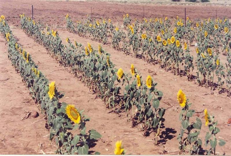
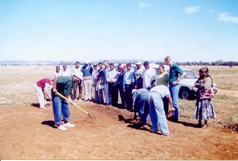
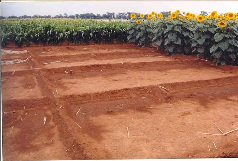
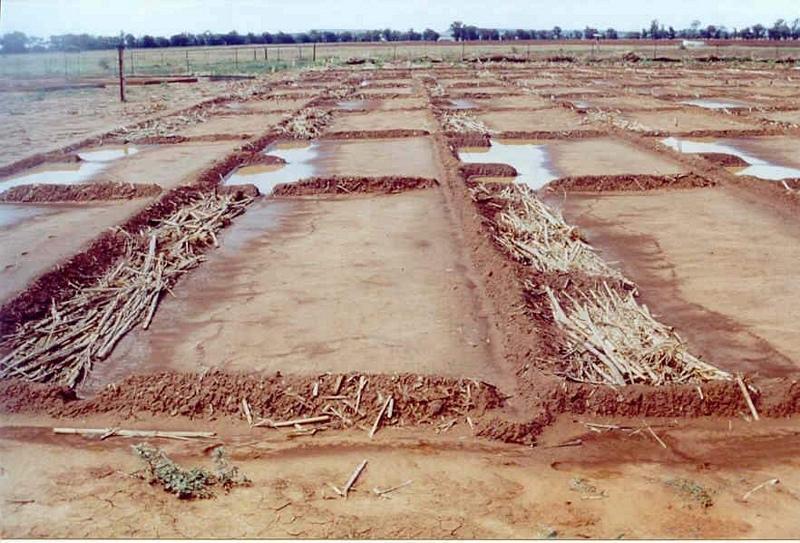
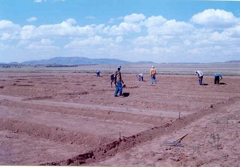
The technique consists of the construction of a 1 m wide basin with a 2 m wide runoff area. They are mulched with either straw or stones and, for the sake of comparison, the runoff area should be left bare. The soil is not tilled to encourage development of a crust, over which water runs off into the basin.
The basins collect the maximum amount of water during rain and because it accumulates in the basin, it is allowed more infiltration time. Mulch minimises evaporation and the efficiency varies with the type of mulch used.
The construction of basin and runoff areas and mulching maintenance involves keeping basins open and mulch intact.
This technique is used under semi-arid conditions on soils with very high clay contents. The depth of the profile must be greater or equal to 900 mm and the A-horizon must also be 250 mm or more.
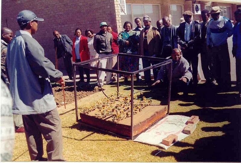
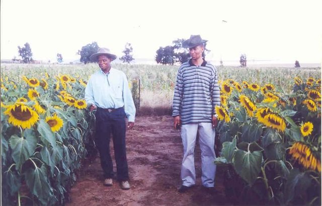
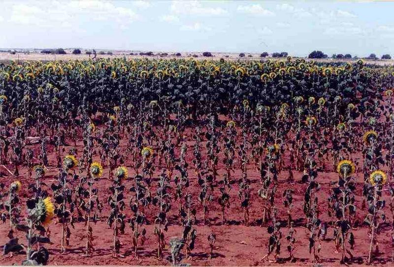
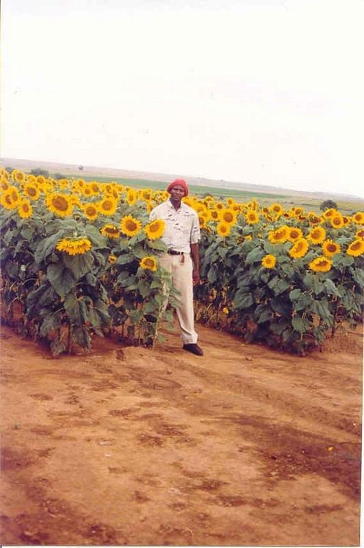
2.3 Photos of the Technology
Media Gallery
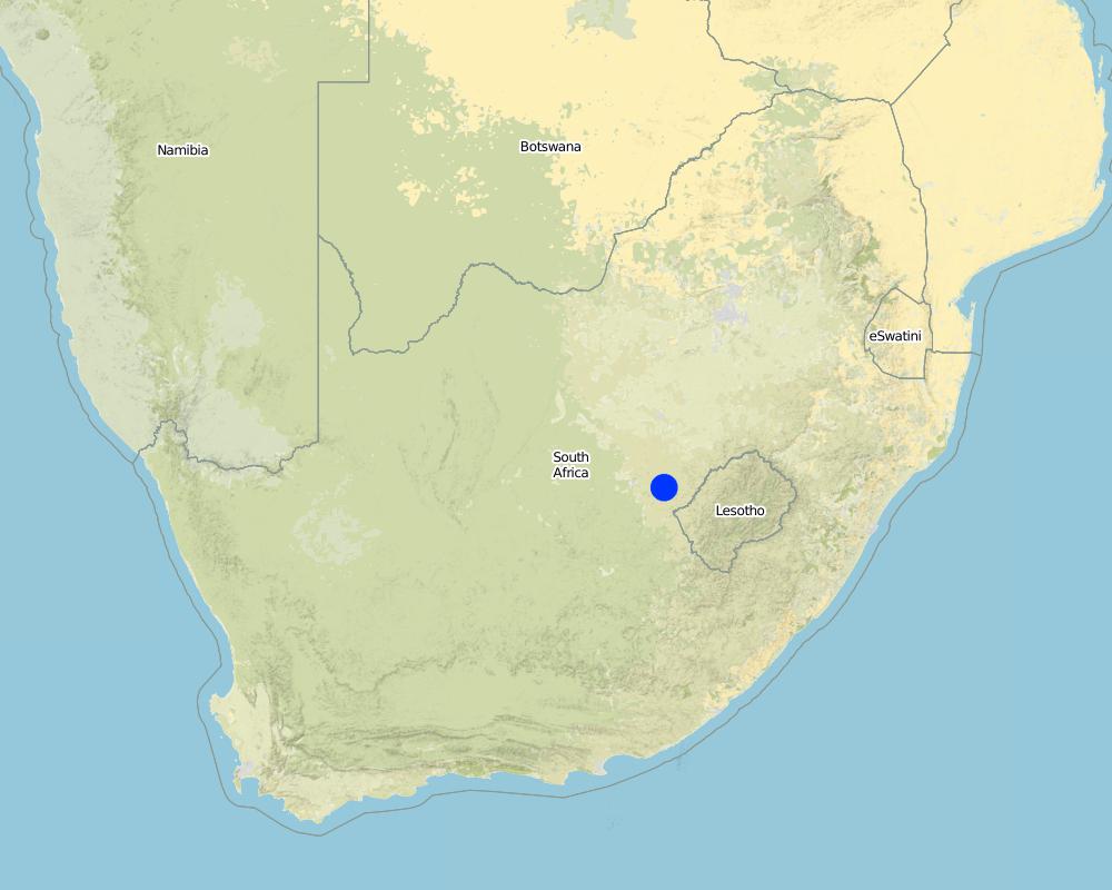
2.5 Country/ region/ locations where the Technology has been applied and which are covered by this assessment
Country:
South Africa
Region/ State/ Province:
Free State
Further specification of location:
Botshabelo, De Wetsdorp, Bloemfontein, Thaba Nchu
Specify the spread of the Technology:
- evenly spread over an area
If precise area is not known, indicate approximate area covered:
- 10-100 km2
Comments:
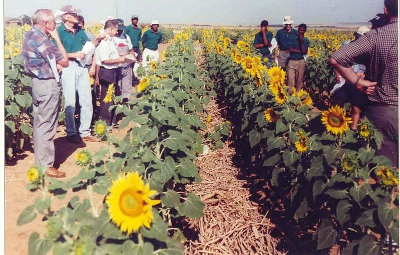
An area of approximately 750 000 ha east of Bloemfontein has been earmarked for developing farmers. The Water harvesting and Basin tillage technique has been employed in the scattered villages and two towns Thaba Nchu & Botshabelo.
Map
×2.6 Date of implementation
If precise year is not known, indicate approximate date:
- less than 10 years ago (recently)
2.7 Introduction of the Technology
Specify how the Technology was introduced:
- through projects/ external interventions
Comments (type of project, etc.):
Other methods of water harvesting is used elsewhere in Africa.
3. Classification of the SLM Technology
3.1 Main purpose(s) of the Technology
- adapt to climate change/ extremes and its impacts
3.2 Current land use type(s) where the Technology is applied

Cropland
- Annual cropping
Annual cropping - Specify crops:
- cereals - maize
- legumes and pulses - beans
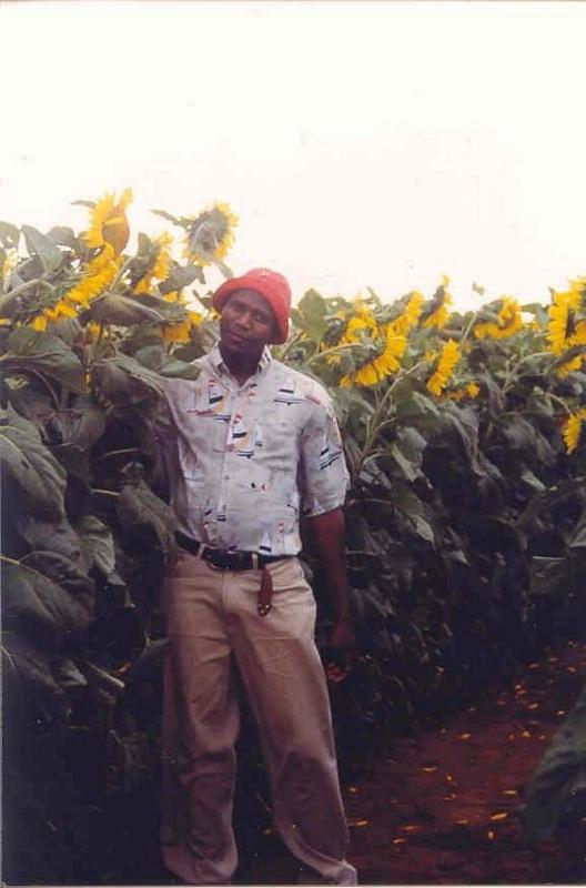
- oilseed crops - sunflower, rapeseed, other
Number of growing seasons per year:
- 1
Specify:
Longest growing period in days: 120; Longest growing period from month to month: Jan - April
Comments:
major cash crop: Sunflower
major food crop: Maize
other: Beans
Major land use problems (compiler’s opinion): The area is marginal for crop production because of relatively low and erratic rainfall and dominantly clay soils with high water losses due to runoff and evaporation from the soil surface.
Major land use problems (land users’ perception): Lack of good fertile soils and to little rain to produce a good crop.
3.3 Has land use changed due to the implementation of the Technology?
Has land use changed due to the implementation of the Technology?
- Yes (Please fill out the questions below with regard to the land use before implementation of the Technology)
Cropland
- Annual cropping
3.4 Water supply
Water supply for the land on which the Technology is applied:
- rainfed
3.5 SLM group to which the Technology belongs
- water harvesting
3.6 SLM measures comprising the Technology

agronomic measures
- A3: Soil surface treatment
- A7: Others
A3: Differentiate tillage systems:
A 3.1: No tillage
Comments:
Main measures: agronomic measures
Type of agronomic measures: mulching, mineral (inorganic) fertilizers, zero tillage / no-till
3.7 Main types of land degradation addressed by the Technology

soil erosion by water
- Wt: loss of topsoil/ surface erosion

chemical soil deterioration
- Cn: fertility decline and reduced organic matter content (not caused by erosion)

water degradation
- Ha: aridification
Comments:
Secondary types of degradation addressed: Wt: loss of topsoil / surface erosion, Cn: fertility decline and reduced organic matter content
Main causes of degradation: other human induced causes (specify) (Agricultural causes - Traditional, conventional cultivation methods not feasible), inputs and infrastructure: (roads, markets, distribution of water points, other, …) (Lack of knowledge)
Secondary causes of degradation: other natural causes (avalanches, volcanic eruptions, mud flows, highly susceptible natural resources, extreme topography, etc.) specify (Low and erratic rainfall events), poverty / wealth (Lack of captial - No resources to cultivate)
3.8 Prevention, reduction, or restoration of land degradation
Specify the goal of the Technology with regard to land degradation:
- prevent land degradation
4. Technical specifications, implementation activities, inputs, and costs
4.1 Technical drawing of the Technology
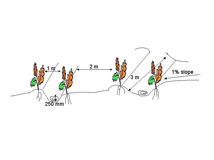
Technical specifications (related to technical drawing):
Technical specifications
Location: Glen. Free State
Technical knowledge required for field staff / advisors: moderate
Technical knowledge required for land users: moderate
Main technical functions: reduction of slope angle, increase of infiltration, increase / maintain water stored in soil, water harvesting / increase water supply
Mulching
Material/ species: Stone/straw
Remarks: <80 % stone; straw varies
Mineral (inorganic) fertilizers
Material/ species: N, P, K
Remarks: Basins/runoff areas
Zero tillage / no-till
Material/ species: Basins/runoff areas
Author:
Cobus Botha
4.5 Maintenance/ recurrent activities
| Activity | Timing/ frequency | |
|---|---|---|
| 1. | Preparation of basins | Before planting / Once in 10 years7 |
| 2. | Preparing seed bed | At planting / annual |
5. Natural and human environment
5.1 Climate
Annual rainfall
- < 250 mm
- 251-500 mm
- 501-750 mm
- 751-1,000 mm
- 1,001-1,500 mm
- 1,501-2,000 mm
- 2,001-3,000 mm
- 3,001-4,000 mm
- > 4,000 mm
Agro-climatic zone
- semi-arid
5.2 Topography
Slopes on average:
- flat (0-2%)
- gentle (3-5%)
- moderate (6-10%)
- rolling (11-15%)
- hilly (16-30%)
- steep (31-60%)
- very steep (>60%)
Landforms:
- plateau/plains
- ridges
- mountain slopes
- hill slopes
- footslopes
- valley floors
Altitudinal zone:
- 0-100 m a.s.l.
- 101-500 m a.s.l.
- 501-1,000 m a.s.l.
- 1,001-1,500 m a.s.l.
- 1,501-2,000 m a.s.l.
- 2,001-2,500 m a.s.l.
- 2,501-3,000 m a.s.l.
- 3,001-4,000 m a.s.l.
- > 4,000 m a.s.l.
5.3 Soils
Soil depth on average:
- very shallow (0-20 cm)
- shallow (21-50 cm)
- moderately deep (51-80 cm)
- deep (81-120 cm)
- very deep (> 120 cm)
Soil texture (topsoil):
- fine/ heavy (clay)
Topsoil organic matter:
- medium (1-3%)
If available, attach full soil description or specify the available information, e.g. soil type, soil PH/ acidity, Cation Exchange Capacity, nitrogen, salinity etc.
Soil fertility is low
Soil drainage / infiltration is poor
Soil water storage capacity is high
5.6 Characteristics of land users applying the Technology
Market orientation of production system:
- subsistence (self-supply)
- mixed (subsistence/ commercial)
Off-farm income:
- less than 10% of all income
Relative level of wealth:
- poor
Level of mechanization:
- manual work
- animal traction
Indicate other relevant characteristics of the land users:
100% of the land users are poor and own 100% of the land.
Market orientation of production system: Also commercial/ market but less common
Level of mechanization: Also mechanized, but less common
5.7 Average area of land used by land users applying the Technology
- < 0.5 ha
- 0.5-1 ha
- 1-2 ha
- 2-5 ha
- 5-15 ha
- 15-50 ha
- 50-100 ha
- 100-500 ha
- 500-1,000 ha
- 1,000-10,000 ha
- > 10,000 ha
6. Impacts and concluding statements
6.1 On-site impacts the Technology has shown
Socio-economic impacts
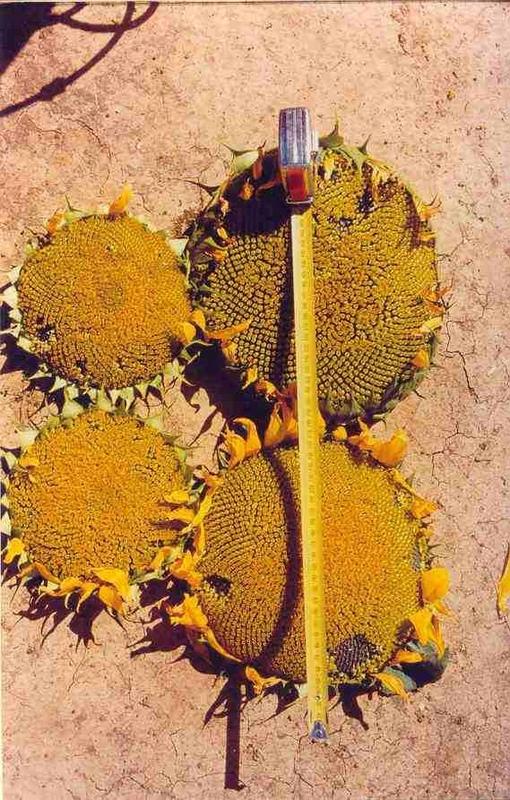
Production
crop production
Socio-cultural impacts
conflict mitigation
Ecological impacts
Water cycle/ runoff
surface runoff
Quantity before SLM:
19
Quantity after SLM:
0
Soil
soil moisture
soil loss
Quantity before SLM:
22.6
Quantity after SLM:
9
6.4 Cost-benefit analysis
How do the benefits compare with the establishment costs (from land users’ perspective)?
Short-term returns:
positive
Long-term returns:
very positive
How do the benefits compare with the maintenance/ recurrent costs (from land users' perspective)?
Short-term returns:
positive
Long-term returns:
positive
6.5 Adoption of the Technology
Comments:
There is a moderate trend towards spontaneous adoption of the Technology
6.7 Strengths/ advantages/ opportunities of the Technology
| Strengths/ advantages/ opportunities in the land user’s view |
|---|
| Can obtain higher crop yields in dry seasons. |
| Strengths/ advantages/ opportunities in the compiler’s or other key resource person’s view |
|---|
| Minimize runoff and evaporation losses. |
| More water available for plant growth that leads to higher yields. |
| Save on input costs (Use no-till). |
| Unemployed people in rural semi-arid areas can produce food for themselves. |
6.8 Weaknesses/ disadvantages/ risks of the Technology and ways of overcoming them
| Weaknesses/ disadvantages/ risks in the land user’s view | How can they be overcome? |
|---|---|
| Initially labour intensive to construct basins. |
| Weaknesses/ disadvantages/ risks in the compiler’s or other key resource person’s view | How can they be overcome? |
|---|---|
| Some soil movement into the basins. | |
| Organic mulch may absorb some rainwater. |
7. References and links
7.1 Methods/ sources of information
Links and modules
Expand all Collapse allLinks
Water Harvesting & Basin tillage (WHB) through demonstrations [South Africa]
Optimising rainwater use, reduce runoff by use of basins and reduce evaporation losses by applying a mulch (stone/reeds) on the runoff strip and in the basins.
- Compiler: Cobus Botha
Modules
No modules