Vegetated buffer strips [Italie]
- Création :
- Mise à jour :
- Compilateur : Nicola Dal Ferro
- Rédacteur : –
- Examinateur : Fabian Ottiger
Fasce tampone boscate
technologies_1646 - Italie
Voir les sections
Développer tout Réduire tout1. Informations générales
1.2 Coordonnées des personnes-ressources et des institutions impliquées dans l'évaluation et la documentation de la Technologie
Spécialiste GDT:
Morari Francesco
francesco.morari@unipd.it
University of Padova
Via 8 Febbraio 1848, 2, 35122 Padova PD, Italy
Italie
Nom du projet qui a facilité la documentation/ l'évaluation de la Technologie (si pertinent)
Preventing and Remediating degradation of soils in Europe through Land Care (EU-RECARE )Nom du ou des institutions qui ont facilité la documentation/ l'évaluation de la Technologie (si pertinent)
University of Padova (UNIPD) - Italie1.3 Conditions relatives à l'utilisation par WOCAT des données documentées
Quand les données ont-elles été compilées (sur le terrain)?
20/10/2014
Le compilateur et la(les) personne(s) ressource(s) acceptent les conditions relatives à l'utilisation par WOCAT des données documentées:
Oui
1.5 Référence au(x) questionnaire(s) sur les Approches de GDT
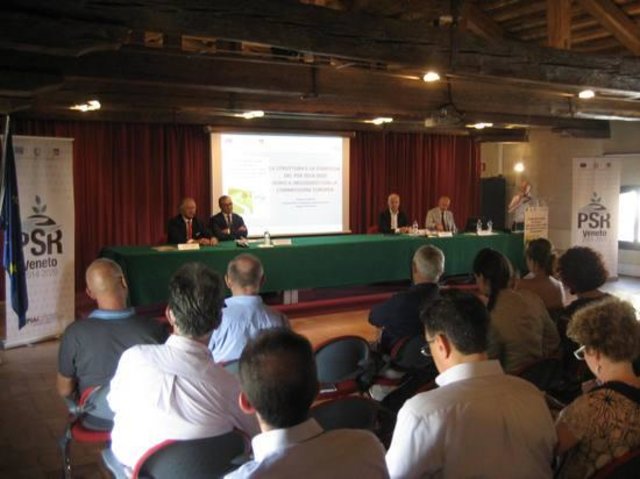
Rural development programme in the Veneto region [Italie]
Developing rural areas in the Veneto region through sustainable land management policies
- Compilateur : Nicola Dal Ferro
2. Description de la Technologie de GDT
2.1 Courte description de la Technologie
Définition de la Technologie:
Buffer vegetation of agricultural land bordering to prevent nonpoint surface water pollution and soil erosion
2.2 Description détaillée de la Technologie
Description:
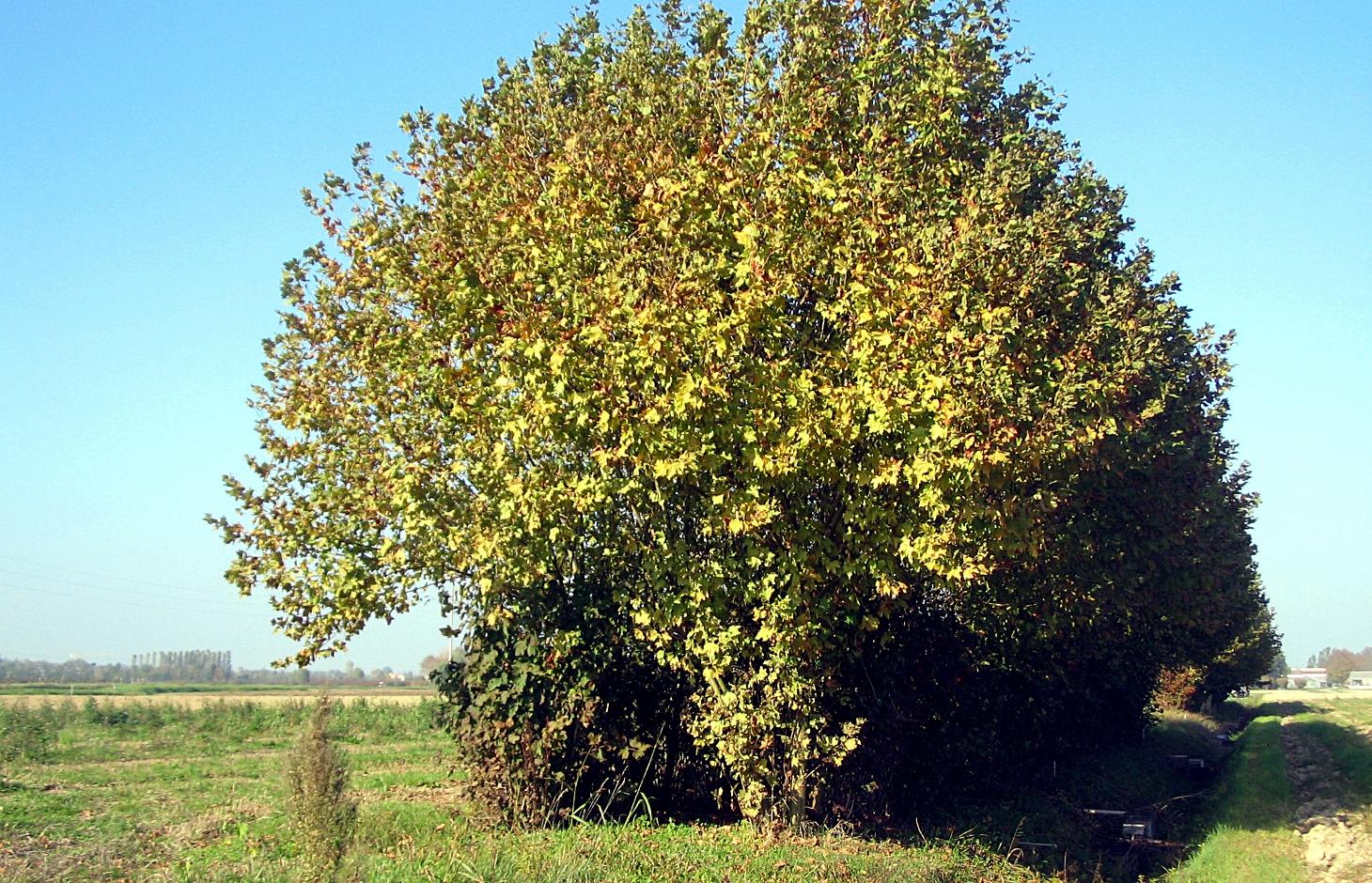
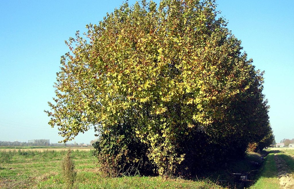
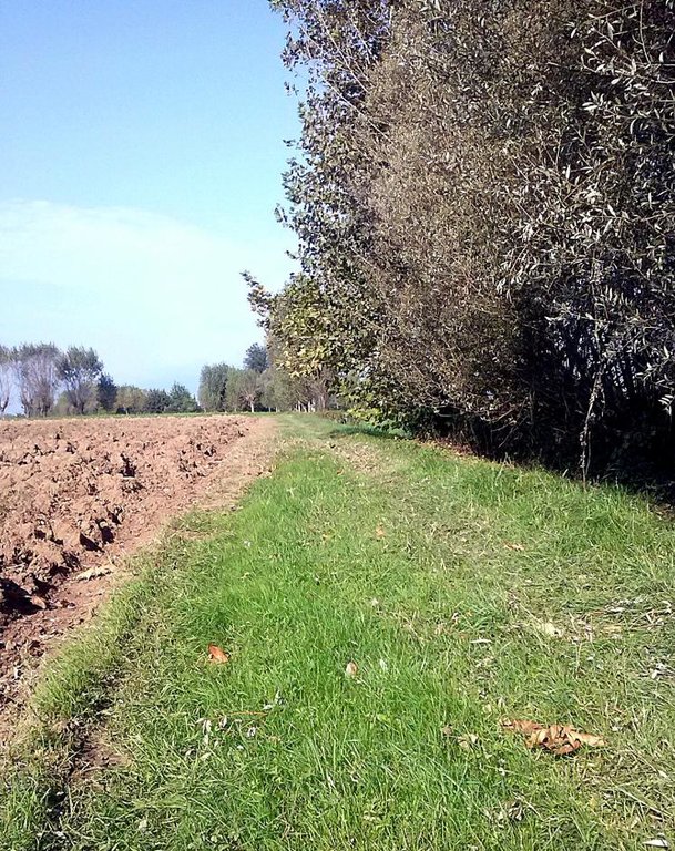
Vegetated buffer strips are agricultural areas with permanent vegetation designed to prevent surface water pollution and minimize soil erosion. In the Veneto region they are generally used along streams, canals and roads and can be composed of grass, hedges, trees or their combination. Buffer strips were a major component of agricultural landscape that has been replaced by intensive monoculture practices by increasing tillable areas. In recent years, the re-introduction of buffer zones in the Venetian plain (and generally in the whole territory of the region) has been supported as an agri-environmental measure for a sustainable land management.
Purpose of the Technology: Vegetated buffer strips, recently promoted by the regional government, are an efficient and economical way to improve surface water quality by agricultural nonpoint source pollution. Farmers take advantage of using buffer strips to help control soil erosion and sediment loss, stabilize riverbanks and reduce flood damage to crops. The continuous soil cover and diversification of habitats improve agroecosystem biodiversity and diversification of farmers income.
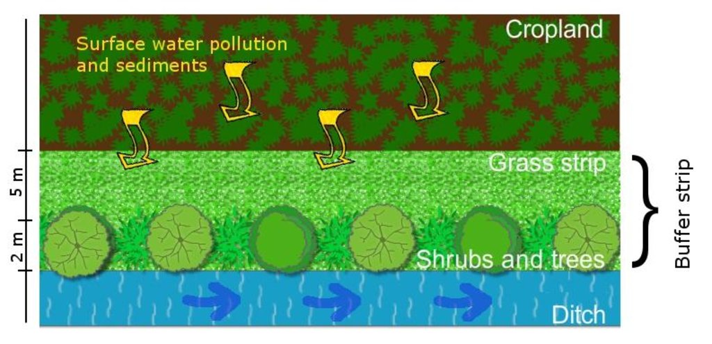
Establishment / maintenance activities and inputs: Vegetated buffer strips are generally composed of a shrub or tree belt of 1 m combined with an herbaceous band of 5 m, usually placed on the sides of cultivated fields in order to maximise their depuration efficacy as well as ensure crop production. Their function to reduce water pollution is optimal if arranged along a water course in order to intercept suspended solids and sediment-bound nutrients.
Natural / human environment: Adopting vegetated buffer strips achieves several environmental benefits with a low initial economic investment. The agroecosystem biodiversity is improved by the creation of continuous buffers that provide food, nesting cover, shaded environment and connecting corridors from one habitat to another to wildlife species, while the continuous soil cover with herbaceous and woody plants enhances soil protection and below-ground biodiversity. Water resources benefit from reduced nutrient supply and sediments that cause excessive growth of algae and diminish oxygen level of the water. Vegetated buffer strips, thanks to the maintenance and differentiation of species in the territory, enhance the quality of life through the improvement of agricultural landscape.
2.3 Photos de la Technologie
2.5 Pays/ région/ lieux où la Technologie a été appliquée et qui sont couverts par cette évaluation
Pays:
Italie
Région/ Etat/ Province:
Italy
Autres spécifications du lieu:
Veneto region
2.6 Date de mise en œuvre de la Technologie
Si l'année précise est inconnue, indiquez la date approximative: :
- il y a entre 10-50 ans
2.7 Introduction de la Technologie
Spécifiez comment la Technologie a été introduite: :
- au cours d'expérimentations / de recherches
3. Classification de la Technologie de GDT
3.1 Principal(aux) objectif(s) de la Technologie
- réduire, prévenir, restaurer les terres dégradées
3.2 Type(s) actuel(s) d'utilisation des terres, là où la Technologie est appliquée

Terres cultivées
- Cultures annuelles
Principales cultures (vivrières et commerciales):
Major cash crop: Maize
Other crops: Wheat, soybean
Commentaires:
Major land use problems (compiler’s opinion): Soils in the low Venetian plain of the Veneto region generally suffer from a loss of soil organic matter (SOM) that is strongly affected by their natural texture and climatic conditions. Moreover, in the last 50 years intensive tillage practices contributed to a further SOM decrease, estimated at 0.02-0.58 t/ha/y of carbon. The introduction of monoculture worsened the agro-ecosystem habitats and reduced soil biodiversity.
Major land use problems (land users’ perception): Decrease of productivity and the need of higher inputs of fertiliser.
3.3 Informations complémentaires sur l'utilisation des terres
Approvisionnement en eau des terres sur lesquelles est appliquée la Technologie:
- mixte: pluvial-irrigué
Commentaires:
Water supply: rainfed, full irrigation
Nombre de période de croissance par an: :
- 1
Précisez:
Longest growing period in days: 210 Longest growing period from month to month: March to OctoberSecond longest growing period in days: 180
3.4 Groupe de GDT auquel appartient la Technologie
- mesures en travers de la pente
3.5 Diffusion de la Technologie
Spécifiez la diffusion de la Technologie:
- répartie uniformément sur une zone
Si la Technologie est uniformément répartie sur une zone, indiquez la superficie couverte approximative:
- 100-1 000 km2
3.6 Mesures de GDT constituant la Technologie

pratiques végétales
- V1: Couverture d’arbres et d’arbustes
Commentaires:
Main measures: vegetative measures
Type of vegetative measures: aligned: -linear
3.7 Principaux types de dégradation des terres traités par la Technologie

érosion hydrique des sols
- Wt: perte de la couche superficielle des sols (couche arable)/ érosion de surface
- Wr: érosion des berges

dégradation biologique
- Bh: perte d’habitats

dégradation hydrique
- Hp: baisse de la qualité des eaux de surface
Commentaires:
Main type of degradation addressed: Wr: riverbank erosion, Bh: loss of habitats, Hp: decline of surface water quality
Secondary types of degradation addressed: Wt: loss of topsoil / surface erosion
Main causes of degradation: soil management (lack of organic input with fertilizations), population pressure (High demand for agricultural products and competition for land in densely populated area)
Secondary causes of degradation: crop management (annual, perennial, tree/shrub) (crop monoculture instead of crop rotation), deforestation / removal of natural vegetation (incl. forest fires) (mechanisation)
3.8 Prévention, réduction de la dégradation ou réhabilitation des terres dégradées
Spécifiez l'objectif de la Technologie au regard de la dégradation des terres:
- prévenir la dégradation des terres
- réduire la dégradation des terres
Commentaires:
Main goals: prevention of land degradation
Secondary goals: mitigation / reduction of land degradation
4. Spécifications techniques, activités, intrants et coûts de mise en œuvre
4.1 Dessin technique de la Technologie
4.2 Spécification/ explications techniques du dessin technique
An interposed area between the cropland and a water course is designed to intercept runoff and reduce surface water pollution (suspended solids, nutrients etc.).
Location: Veneto region
Technical knowledge required for field staff / advisors: moderate
Technical knowledge required for land users: moderate
Main technical functions: control of dispersed runoff: retain / trap, control of dispersed runoff: impede / retard, stabilisation of soil (eg by tree roots against land slides), improvement of water quality, buffering / filtering water, sediment retention / trapping, sediment harvesting, spatial arrangement and diversification of land use
Secondary technical functions: control of concentrated runoff: retain / trap, control of concentrated runoff: impede / retard, improvement of ground cover, increase of surface roughness, increase in organic matter, increase in nutrient availability (supply, recycling,…)
Aligned: -linear
Vegetative material: T : trees / shrubs
Spacing between rows / strips / blocks (m): 3-5
Vertical interval within rows / strips / blocks (m): 1-3
Trees/ shrubs species: oak, maple, hornbeam, willow, etc.
Grass species: mixed species
4.3 Informations générales sur le calcul des intrants et des coûts
autre/ monnaie nationale (précisez):
Euro €
Indiquer le taux de change du dollars en monnaie locale (si pertinent): 1 USD= :
0,8
Indiquez le coût salarial moyen de la main d'œuvre par jour:
21.00
4.4 Activités de mise en place/ d'établissement
| Activité | Type de mesures | Calendrier | |
|---|---|---|---|
| 1. | Planning, mulching, soli preparation, fertilisation | Végétale | |
| 2. | Purchase of seedlings and planting | Végétale | |
| 3. | Grass strip establishment | Végétale | |
| 4. | Machinery for mowing, pruning | Végétale |
4.5 Coûts et intrants nécessaires à la mise en place
| Spécifiez les intrants | Unité | Quantité | Coûts par unité | Coût total par intrant | % des coût supporté par les exploitants des terres | |
|---|---|---|---|---|---|---|
| Main d'œuvre | Planning, mulching, soli preparation, fertilisation | ha | 1,0 | 306,0 | 306,0 | |
| Main d'œuvre | Planting | ha | 1,0 | 2,5 | 2,5 | |
| Main d'œuvre | Grass strip establishment | ha | 1,0 | 152,0 | 152,0 | |
| Equipements | Machinery for mowing, pruning | ha | 1,0 | 4000,0 | 4000,0 | |
| Matériel végétal | Seedlings | ha | 1,0 | 119,0 | 119,0 | |
| Engrais et biocides | Fertilizer | ha | 1,0 | 14,0 | 14,0 | |
| Coût total de mise en place de la Technologie | 4593,5 | |||||
4.6 Activités d'entretien/ récurrentes
| Activité | Type de mesures | Calendrier/ fréquence | |
|---|---|---|---|
| 1. | Pruning, replanting, additional irrigation | Végétale | |
| 2. | Grass strip maintenance | Végétale |
4.7 Coûts et intrants nécessaires aux activités d'entretien/ récurrentes (par an)
| Spécifiez les intrants | Unité | Quantité | Coûts par unité | Coût total par intrant | % des coût supporté par les exploitants des terres | |
|---|---|---|---|---|---|---|
| Main d'œuvre | Pruning, replanting, additional irrigation | ha | 1,0 | 127,0 | 127,0 | |
| Main d'œuvre | Grass strip maintenance | ha | 1,0 | 127,0 | 127,0 | |
| Coût total d'entretien de la Technologie | 254,0 | |||||
4.8 Facteurs les plus importants affectant les coûts
Décrivez les facteurs les plus importants affectant les coûts :
Establishment costs (purchase of seedlings and planting) are the most important. After the establishment of buffer strip, costs are less relevant due to little work required for maintenance.
5. Environnement naturel et humain
5.1 Climat
Précipitations annuelles
- < 250 mm
- 251-500 mm
- 501-750 mm
- 751-1000 mm
- 1001-1500 mm
- 1501-2000 mm
- 2001-3000 mm
- 3001-4000 mm
- > 4000 mm
Zone agro-climatique
- subhumide
Thermal climate class: temperate
5.2 Topographie
Pentes moyennes:
- plat (0-2 %)
- faible (3-5%)
- modéré (6-10%)
- onduleux (11-15%)
- vallonné (16-30%)
- raide (31-60%)
- très raide (>60%)
Reliefs:
- plateaux/ plaines
- crêtes
- flancs/ pentes de montagne
- flancs/ pentes de colline
- piémonts/ glacis (bas de pente)
- fonds de vallée/bas-fonds
Zones altitudinales:
- 0-100 m
- 101-500 m
- 501-1000 m
- 1001-1500 m
- 1501-2000 m
- 2001-2500 m
- 2501-3000 m
- 3001-4000 m
- > 4000 m
5.3 Sols
Profondeur moyenne du sol:
- très superficiel (0-20 cm)
- superficiel (21-50 cm)
- modérément profond (51-80 cm)
- profond (81-120 cm)
- très profond (>120 cm)
Texture du sol (de la couche arable):
- grossier/ léger (sablonneux)
- moyen (limoneux)
Matière organique de la couche arable:
- moyen (1-3%)
- faible (<1%)
Si disponible, joignez une description complète du sol ou précisez les informations disponibles, par ex., type de sol, pH/ acidité du sol, capacité d'échange cationique, azote, salinité, etc.
Soil fertility is low-medium
Soil drainage/infiltration is medium
Soil water storage capacity is medium
5.4 Disponibilité et qualité de l'eau
Profondeur estimée de l’eau dans le sol:
< 5 m
Disponibilité de l’eau de surface:
bonne
Qualité de l’eau (non traitée):
eau potable
Commentaires et précisions supplémentaires sur la qualité et la quantité d'eau:
Ground water table: <5m a.s.l. (The area surrounding the Venice lagoon (1240 km2) is even below the sea level (down to -2 m) and currently cultivated due to land reclamation. As a result water table is kept artificially low)
Water quality (untreted): Good drinking water (groundwater) and for agricultural use only (surface water can be used for agricultural purposes but not as drinking water)
5.5 Biodiversité
Diversité des espèces:
- moyenne
Commentaires et précisions supplémentaires sur la biodiversité:
High population density, infrastructures and intensive agriculture practices affect the state of biodiversity.
5.6 Caractéristiques des exploitants des terres appliquant la Technologie
Orientation du système de production:
- commercial/ de marché
Revenus hors exploitation:
- 10-50% de tous les revenus
Niveau relatif de richesse:
- moyen
Individus ou groupes:
- individu/ ménage
Niveau de mécanisation:
- mécanisé/ motorisé
Genre:
- hommes
Indiquez toute autre caractéristique pertinente des exploitants des terres:
Land users applying the Technology are mainly common / average land users
Difference in the involvement of women and men: Farmers in the Veneto region are traditionally males due to historical and cultural reasons.
Population density: 200-500 persons/km2
Annual population growth: 0.5% - 1%
5.7 Superficie moyenne des terres détenues ou louées par les exploitants appliquant la Technologie
- < 0,5 ha
- 0,5-1 ha
- 1-2 ha
- 2-5 ha
- 5-15 ha
- 15-50 ha
- 50-100 ha
- 100-500 ha
- 500-1 000 ha
- 1 000-10 000 ha
- > 10 000 ha
Cette superficie est-elle considérée comme de petite, moyenne ou grande dimension (en se référant au contexte local)?
- petite dimension
5.8 Propriété foncière, droits d’utilisation des terres et de l'eau
Droits d’utilisation des terres:
- individuel
5.9 Accès aux services et aux infrastructures
santé:
- pauvre
- modéré
- bonne
éducation:
- pauvre
- modéré
- bonne
assistance technique:
- pauvre
- modéré
- bonne
emploi (par ex. hors exploitation):
- pauvre
- modéré
- bonne
marchés:
- pauvre
- modéré
- bonne
énergie:
- pauvre
- modéré
- bonne
routes et transports:
- pauvre
- modéré
- bonne
eau potable et assainissement:
- pauvre
- modéré
- bonne
services financiers:
- pauvre
- modéré
- bonne
6. Impacts et conclusions
6.1 Impacts sur site que la Technologie a montrés
Impacts socio-économiques
Production
production agricole
production de bois
Quantité avant la GDT:
0 t/100 linear metres
Quantité après la GDT:
1-1.5/100 linear metres
diversité des produits
Disponibilité et qualité de l'eau
disponibilité de l'eau potable
Revenus et coûts
diversité des sources de revenus
Impacts socioculturels
opportunités culturelles
possibilités de loisirs
apaisement des conflits
Impacts écologiques
Cycle de l'eau/ ruissellement
qualité de l'eau
ruissellement de surface
Sols
couverture du sol
perte en sol
cycle/ recharge des éléments nutritifs
Biodiversité: végétale, animale
biomasse/ au dessus du sol C
diversité végétale
diversité des habitats
6.2 Impacts hors site que la Technologie a montrés
disponibilité de l'eau
inondations en aval
pollution des rivières/ nappes phréatiques
capacité tampon/de filtration
dommages sur les champs voisins
6.3 Exposition et sensibilité de la Technologie aux changements progressifs et aux évènements extrêmes/catastrophes liés au climat (telles que perçues par les exploitants des terres)
Changements climatiques progressifs
Changements climatiques progressifs
| Saison | Type de changements/ extrêmes climatiques | Comment la Technologie fait-elle face à cela? | |
|---|---|---|---|
| températures annuelles | augmente | bien |
Extrêmes climatiques (catastrophes)
Catastrophes météorologiques
| Comment la Technologie fait-elle face à cela? | |
|---|---|
| pluie torrentielle locale | bien |
Catastrophes climatiques
| Comment la Technologie fait-elle face à cela? | |
|---|---|
| sécheresse | pas bien |
6.4 Analyse coûts-bénéfices
Quels sont les bénéfices comparativement aux coûts de mise en place (du point de vue des exploitants des terres)?
Rentabilité à court terme:
légèrement négative
Rentabilité à long terme:
positive
Quels sont les bénéfices comparativement aux coûts d'entretien récurrents (du point de vue des exploitants des terres)?
Rentabilité à court terme:
positive
Rentabilité à long terme:
positive
6.5 Adoption de la Technologie
Parmi tous ceux qui ont adopté la Technologie, combien d'entre eux l'ont fait spontanément, à savoir sans recevoir aucune incitation matérielle ou aucun paiement?
- 50-90%
Commentaires:
50% of land user families have adopted the Technology with external material support
Comments on acceptance with external material support: On average it was estimated that, among farmers adopting the technology, ca. half of them benefited of incentives.
50% of land user families have adopted the Technology without any external material support
Comments on spontaneous adoption: On average it was estimated that, among farmers adopting the technology, ca. half of them benefited of incentives.
6.7 Points forts/ avantages/ possibilités de la Technologie
| Points forts/ avantages/ possibilités du point de vue du compilateur ou d'une autre personne ressource clé |
|---|
|
protects soil from water erosion How can they be sustained / enhanced? long-term maintenance of buffer zones and soil cover |
|
protects surface water quality How can they be sustained / enhanced? combination with other sustainable technologies (e.g. reduction of pesticides). Spread over larger areas |
|
enhances agro-ecosystem biodiversity How can they be sustained / enhanced? improvement of connecting corridors between habitats |
|
diversifies farmer's production How can they be sustained / enhanced? improve farmers' education |
|
little costs compared to environmenmtal benefits How can they be sustained / enhanced? support farmers on decision making |
6.8 Faiblesses/ inconvénients/ risques de la Technologie et moyens de les surmonter
| Faiblesses/ inconvénients/ risques du point de vue de l’exploitant des terres | Comment peuvent-ils être surmontés? |
|---|---|
| sometimes difficult to adjust crop production requirements with buffer strip occupation of space | support farmers on decision making |
| Faiblesses/ inconvénients/ risques du point de vue du compilateur ou d'une autre personne ressource clé | Comment peuvent-ils être surmontés? |
|---|---|
| time-dependent buffer performance | Monitoring saturation-effect conditions in the medium, long-term |
| low efficacy if the technology is maintained in the short-term | improve effectiveness of subsidies to keep the technology in the long-term; increase farmers awareness on soil and water benefits |
7. Références et liens
7.2 Références des publications disponibles
Titre, auteur, année, ISBN:
Programma di sviluppo rurale per il veneto 2007-2013, Regione Veneto, 2007. Dipartimento Agricoltura e Sviluppo Rurale.
Liens et modules
Développer tout Réduire toutLiens

Rural development programme in the Veneto region [Italie]
Developing rural areas in the Veneto region through sustainable land management policies
- Compilateur : Nicola Dal Ferro
Modules
Aucun module trouvé


