Riverbed farming [Népal]
- Création :
- Mise à jour :
- Compilateur : Shreedip Sigdel
- Rédacteur : –
- Examinateurs : David Streiff, Alexandra Gavilano
Bagar Kheti (Main Contributors: Elam Plus and Hari Gurung, Helvetas Nepal)
technologies_1691 - Népal
Voir les sections
Développer tout Réduire tout1. Informations générales
1.2 Coordonnées des personnes-ressources et des institutions impliquées dans l'évaluation et la documentation de la Technologie
Spécialiste GDT:
Plus Elam
Helvetas
Spécialiste GDT:
Gurung Hari
Helvetas Nepal
Népal
Spécialiste GDT:
Merz Juerg
Helvetas Nepal
Suisse
Nom du ou des institutions qui ont facilité la documentation/ l'évaluation de la Technologie (si pertinent)
ICIMOD International Centre for Integrated Mountain Development (ICIMOD) - NépalNom du ou des institutions qui ont facilité la documentation/ l'évaluation de la Technologie (si pertinent)
HELVETAS (Swiss Intercooperation)1.3 Conditions relatives à l'utilisation par WOCAT des données documentées
Le compilateur et la(les) personne(s) ressource(s) acceptent les conditions relatives à l'utilisation par WOCAT des données documentées:
Oui
1.5 Référence au(x) Questionnaires sur les Approches de GDT (documentées au moyen de WOCAT)
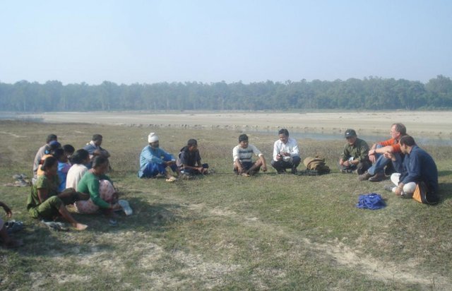
Land distribution and allocation for riverbed farming [Népal]
Riverbed farming provides landless and land-poor households with the possibility to earn an income from on-farm activities close to home
- Compilateur : Shreedip Sigdel
2. Description de la Technologie de GDT
2.1 Courte description de la Technologie
Définition de la Technologie:
Riverbed farming can be used to increase household income and to improve the food security of landless and land-poor households in the Terai area of Nepal.
2.2 Description détaillée de la Technologie
Description:
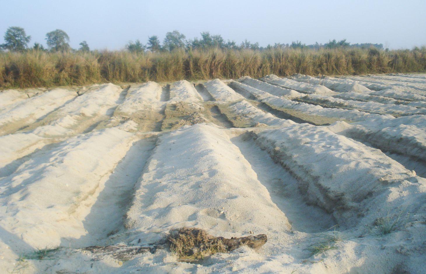
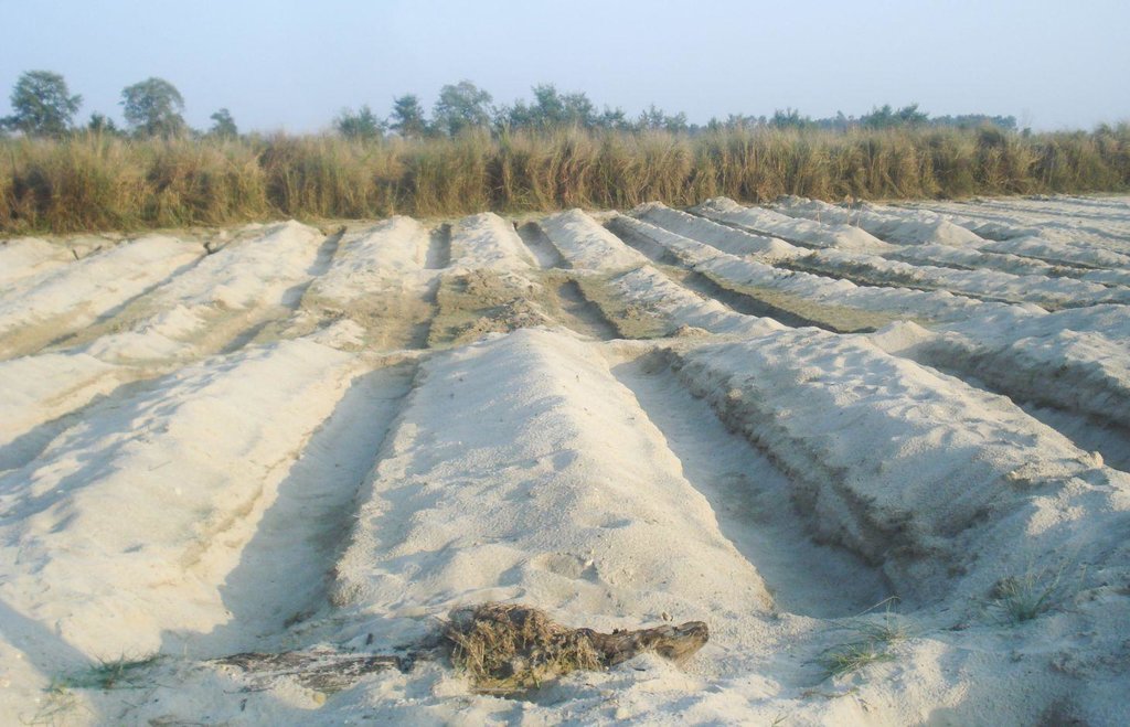
It is estimated that about 8,000 hectares of riverbed land would be suitable for agricultural cultivation in the Kailali and Kanchanpur Districts in the Western Terai areas of Nepal. After the river water recedes in the post-monsoon season, vegetables are planted in ditches dug into the seasonal sand banks; the crops are harvested before the onset of the next monsoon. In 2006, Elam Plus of HELVETAS Swiss Inter-cooperation Nepal, assessed local practices of riverbed farming and piloted an improved approach with 670 farmers, mostly from the indigenous Tharu community. During the first year they cultivated 43 hectares. Since the initial results indicated that riverbed farming could increase the target population’s income significantly, the programme was expanded from the initial two districts (Kailali and Kanchanpur) to two new districts (Banke, and Bardiya). The number of households was increased to 2000 in 2008 and 3165 in 2012 after the initiative won a Global Development Market Place award from the World Bank.
Establishment / maintenance activities and inputs: Requirements for riverbed farming:
• On average, the water table should not be lower than 1 m; when the water table is lower than this, too much labour is required.
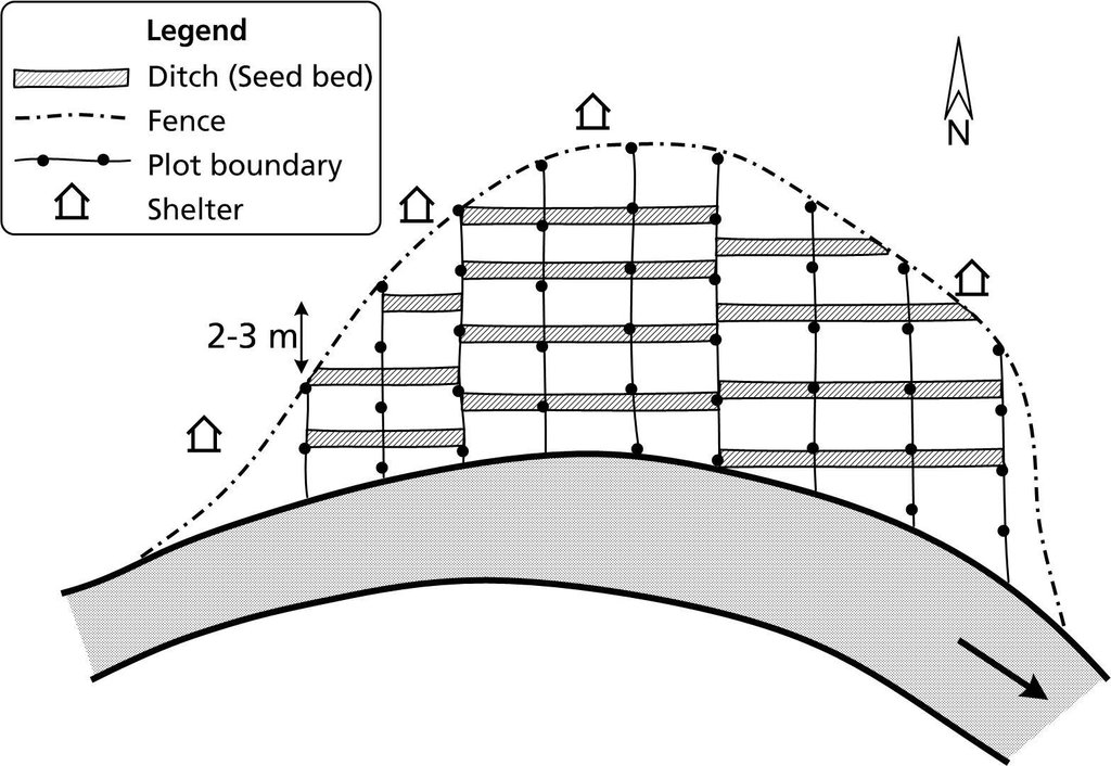
• Plots are allocated perpendicular to the river flow in order to give each farmer access to a variety of land types (and moisture levels) suitable for different crops.
• Ditches are up to 1 m deep and 1 m wide. The length depends on how much land is available.
• A row-to-row spacing of 2–3 m (between the ditches) and plant-to-plant spacing of 0.5–1 m is required depending on the crop.
• The ditches are dug in an east-west orientation to maximize the amount of sunshine they receive and to minimise the collection of sand carried by the prevailing winds.
• Riverbed farmers can build shelters close to their plots so that they can be close at hand to fend off thieves and wild animals.
2.3 Photos de la Technologie
2.5 Pays/ région/ lieux où la Technologie a été appliquée et qui sont couverts par cette évaluation
Pays:
Népal
Autres spécifications du lieu:
Kanchanpur, Kailali Districts
Spécifiez la diffusion de la Technologie:
- répartie uniformément sur une zone
Si la Technologie est uniformément répartie sur une zone, précisez la superficie couverte (en km2):
4,0
Commentaires:
Total area covered by the SLM Technology is 4 km2.
2.7 Introduction de la Technologie
Spécifiez comment la Technologie a été introduite: :
- par le biais de projets/ d'interventions extérieures
3. Classification de la Technologie de GDT
3.1 Principal(aux) objectif(s) de la Technologie
- créer un impact économique positif
- créer un impact social positif
3.2 Type(s) actuel(s) d'utilisation des terres, là où la Technologie est appliquée

Terres cultivées
- Cultures annuelles
Cultures annuelles - Précisez les cultures:
- légumes - autres
Nombre de période de croissance par an: :
- 1
Précisez:
Longest growing period from month to month: November to May
Commentaires:
Major land use problems (compiler’s opinion): Rivers in the Terai region change their course frequently and when they do, the adjacent lands are flooded. The riverbeds are flooded annually, while the riverbanks are only flooded during extreme events. The annually flooded riverbeds are seasonally dry (from September to May) and are a generally unused land resource. Landless and land- poor farmers can use this land to cultivate seasonal vegetables that are adapted to the environmental conditions prevalent on riverbeds.
3.5 Groupe de GDT auquel appartient la Technologie
- Amélioration de la couverture végétale/ du sol
- use different type of land for cultivation
3.6 Mesures de GDT constituant la Technologie

pratiques agronomiques
- A2: Matière organique/ fertilité du sol

structures physiques
- S3: Fossés étagés, canaux, voies d'eau
3.7 Principaux types de dégradation des terres traités par la Technologie

érosion hydrique des sols
- Wr: érosion des berges
Commentaires:
Main causes of degradation: floods
3.8 Prévention, réduction de la dégradation ou réhabilitation des terres dégradées
Spécifiez l'objectif de la Technologie au regard de la dégradation des terres:
- réduire la dégradation des terres
4. Spécifications techniques, activités, intrants et coûts de mise en œuvre
4.1 Dessin technique de la Technologie
Spécifications techniques (associées au dessin technique):
Plots for riverbed farming are allocated perpendicular to the river flow and the ditches are dug in an east-west orientation.
Technical knowledge required for land users: moderate
Main technical functions: increase / maintain water stored in soil, Support Income Generation
Secondary technical functions: improvement of ground cover, increase in organic matter, Stabilizes the soil
Auteur:
J Merz, AK Thaku
4.2 Informations générales sur le calcul des intrants et des coûts
Spécifiez la manière dont les coûts et les intrants ont été calculés:
- par superficie de la Technologie
Indiquez la taille et l'unité de surface:
ha
Indiquez la monnaie utilisée pour le calcul des coûts:
- dollars américains
4.3 Activités de mise en place/ d'établissement
| Activité | Calendrier des activités (saisonnier) | |
|---|---|---|
| 1. | Dig ditches in an east-west direction about 2 to 3 m apart. The ditches can be up to 1 m deep and 1 m wide; the length will depend on the shape of the land. | |
| 2. | Apply fertilizer: farmyard manure/compost about 12 tonnes; urea about 100 kg; di-ammonium phosphate (DAP) about 120 kg; and potash about 30 kg per ha. | |
| 3. | Plant seeds/seedlings using the appropriate row-to-row (RXR) and plant-to-plant (PXP) distance for at least one crop. A row-to-row distance of 3 m is required for bottle gourd, pumpkin, and water melon and 2 m for bitter gourd and cucumber; a plant-to-plant distance of 0.5 m is needed for cucumber and bitter gourd and 1 m for water melon, bottle gourd, and pumpkin. |
4.4 Coûts et intrants nécessaires à la mise en place
| Spécifiez les intrants | Unité | Quantité | Coûts par unité | Coût total par intrant | % des coût supporté par les exploitants des terres | |
|---|---|---|---|---|---|---|
| Main d'œuvre | Dig ditches and applying fertilizer and manure | ha | 1,0 | 232,0 | 232,0 | 100,0 |
| Equipements | Sprayer, watering cans,spade | ha | 1,0 | 42,0 | 42,0 | |
| Engrais et biocides | Seeds, chemical fertilizer | ha | 1,0 | 267,0 | 267,0 | |
| Matériaux de construction | Plastic bags,mulching material | ha | 1,0 | 21,0 | 21,0 | |
| Coût total de mise en place de la Technologie | 562,0 | |||||
| Coût total de mise en place de la Technologie en dollars américains (USD) | 562,0 | |||||
4.5 Activités d'entretien/ récurrentes
| Activité | Calendrier/ fréquence | |
|---|---|---|
| 1. | Water new plots every 2 to 3 days; as the seedlings mature, water weekly or as needed depending on the weather and the soilconditions. | |
| 2. | Replace seedlings that have died and replant seeds in places where they have not germinated | |
| 3. | Top dress with nitrogen, phosphorous, potassium | |
| 4. | Mulch with straw and grass | |
| 5. | Weed and protect plants as needed | |
| 6. | Protect the riverbed areas throughout the growing season as they are prone to attacks by thieves and wild animals, mainly jackals and monkeys. However, note that the reported losses to date have been very minimal. |
4.6 Coûts et intrants nécessaires aux activités d'entretien/ récurrentes (par an)
| Spécifiez les intrants | Unité | Quantité | Coûts par unité | Coût total par intrant | % des coût supporté par les exploitants des terres | |
|---|---|---|---|---|---|---|
| Main d'œuvre | Maintaining plots | ha | 1,0 | 42,0 | 42,0 | 100,0 |
| Equipements | Sprayer, watering cans,spade | ha | 1,0 | 28,0 | 28,0 | 25,0 |
| Engrais et biocides | Seeds, chemical fertilizer | ha | 1,0 | 84,0 | 84,0 | 25,0 |
| Matériaux de construction | Plastic bags, mulching material | ha | 1,0 | 11,0 | 11,0 | 50,0 |
| Coût total d'entretien de la Technologie | 165,0 | |||||
| Coût total d'entretien de la Technologie en dollars américains (USD) | 165,0 | |||||
4.7 Facteurs les plus importants affectant les coûts
Décrivez les facteurs les plus importants affectant les coûts :
All costs and amounts are rough estimates by the technicians and authors.
5. Environnement naturel et humain
5.1 Climat
Précipitations annuelles
- < 250 mm
- 251-500 mm
- 501-750 mm
- 751-1000 mm
- 1001-1500 mm
- 1501-2000 mm
- 2001-3000 mm
- 3001-4000 mm
- > 4000 mm
Zone agro-climatique
- humide
Thermal climate class: subtropics
5.2 Topographie
Pentes moyennes:
- plat (0-2 %)
- faible (3-5%)
- modéré (6-10%)
- onduleux (11-15%)
- vallonné (16-30%)
- raide (31-60%)
- très raide (>60%)
Reliefs:
- plateaux/ plaines
- crêtes
- flancs/ pentes de montagne
- flancs/ pentes de colline
- piémonts/ glacis (bas de pente)
- fonds de vallée/bas-fonds
Zones altitudinales:
- 0-100 m
- 101-500 m
- 501-1000 m
- 1001-1500 m
- 1501-2000 m
- 2001-2500 m
- 2501-3000 m
- 3001-4000 m
- > 4000 m
5.3 Sols
Profondeur moyenne du sol:
- très superficiel (0-20 cm)
- superficiel (21-50 cm)
- modérément profond (51-80 cm)
- profond (81-120 cm)
- très profond (>120 cm)
Texture du sol (de la couche arable):
- grossier/ léger (sablonneux)
Matière organique de la couche arable:
- faible (<1%)
Si disponible, joignez une description complète du sol ou précisez les informations disponibles, par ex., type de sol, pH/ acidité du sol, capacité d'échange cationique, azote, salinité, etc.
Soil fertility is medium
Soil drainage / infiltration is good
Soil water storage capacity is low
5.4 Disponibilité et qualité de l'eau
Profondeur estimée de l’eau dans le sol:
5-50 m
Disponibilité de l’eau de surface:
faible/ absente
Qualité de l’eau (non traitée):
eau potable
Commentaires et précisions supplémentaires sur la qualité et la quantité d'eau:
Ground water table: 30-50 m
5.5 Biodiversité
Diversité des espèces:
- faible
5.6 Caractéristiques des exploitants des terres appliquant la Technologie
Orientation du système de production:
- exploitation mixte (de subsistance/ commerciale)
Revenus hors exploitation:
- > 50% de tous les revenus
Niveau relatif de richesse:
- pauvre
Individus ou groupes:
- individu/ ménage
Indiquez toute autre caractéristique pertinente des exploitants des terres:
Population density: 200-500 persons/km2
5.7 Superficie moyenne des terres utilisées par les exploitants des terres appliquant la Technologie
- < 0,5 ha
- 0,5-1 ha
- 1-2 ha
- 2-5 ha
- 5-15 ha
- 15-50 ha
- 50-100 ha
- 100-500 ha
- 500-1 000 ha
- 1 000-10 000 ha
- > 10 000 ha
5.8 Propriété foncière, droits d’utilisation des terres et de l'eau
- landless
5.9 Accès aux services et aux infrastructures
santé:
- pauvre
- modéré
- bonne
éducation:
- pauvre
- modéré
- bonne
assistance technique:
- pauvre
- modéré
- bonne
emploi (par ex. hors exploitation):
- pauvre
- modéré
- bonne
marchés:
- pauvre
- modéré
- bonne
énergie:
- pauvre
- modéré
- bonne
routes et transports:
- pauvre
- modéré
- bonne
eau potable et assainissement:
- pauvre
- modéré
- bonne
services financiers:
- pauvre
- modéré
- bonne
6. Impacts et conclusions
6.1 Impacts sur site que la Technologie a montrés
Impacts socio-économiques
Revenus et coûts
revenus agricoles
diversité des sources de revenus
Commentaires/ spécifiez:
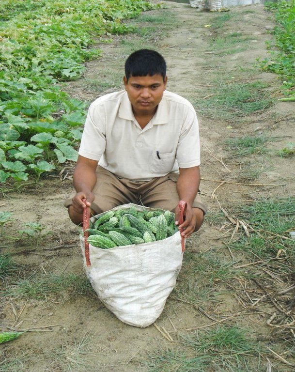
Provides vegetables for riverbed farming households
Autres impacts socio-économiques
dependent on external agricultural inputs
Impacts socioculturels
sécurité alimentaire/ autosuffisance
Commentaires/ spécifiez:
Riverbed crops can be exchanged for food grain; on average,this can provide an additional four month
apaisement des conflits
Commentaires/ spécifiez:
Conflicts can arise when the land is being allocated and border conflict can arise between different groups
situation des groupes socialement et économiquement désavantagés
Commentaires/ spécifiez:
Additional income can be used to cover school fees and health services
livelihood and human well-being
Commentaires/ spécifiez:
Provides alternative means of income as well as food security for landless and land-poor households
social status of local resource persons
need for income usually met by migration and by off-farm daily wage labour
Impacts écologiques
Cycle de l'eau/ ruissellement
qualité de l'eau
Commentaires/ spécifiez:
Excessive use of fertilizers may affect water quality and the use of pesticides in the case of massive pest invasions may affect the water quality as well
Sols
couverture du sol
perte en sol
Commentaires/ spécifiez:
Minimize soil loss due to wind erosion
Réduction des risques de catastrophe et des risques climatiques
impacts des inondations
Commentaires/ spécifiez:
Crops can be lost during floods, cold spells and hailstormes
6.2 Impacts hors site que la Technologie a montrés
Local availability of fresh vegetables
6.3 Exposition et sensibilité de la Technologie aux changements progressifs et aux évènements extrêmes/catastrophes liés au climat (telles que perçues par les exploitants des terres)
Changements climatiques progressifs
Changements climatiques progressifs
| Saison | Augmentation ou diminution | Comment la Technologie fait-elle face à cela? | |
|---|---|---|---|
| températures annuelles | augmente | bien |
Extrêmes climatiques (catastrophes)
Catastrophes hydrologiques
| Comment la Technologie fait-elle face à cela? | |
|---|---|
| inondation générale (rivière) | pas bien |
6.4 Analyse coûts-bénéfices
Quels sont les bénéfices comparativement aux coûts de mise en place (du point de vue des exploitants des terres)?
Rentabilité à court terme:
positive
Rentabilité à long terme:
positive
Quels sont les bénéfices comparativement aux coûts d'entretien récurrents (du point de vue des exploitants des terres)?
Rentabilité à court terme:
positive
Rentabilité à long terme:
positive
6.5 Adoption de la Technologie
Commentaires:
There is a moderate trend towards spontaneous adoption of the Technology
Comments on adoption trend: The majority of riverbed farmers among the first few groups to learn the technique continued riverbed farming after support for the project ended. In the third year, 55 of the original 61 groups were still farming on the riverbed even though they did not receive any agricultural inputs with the exception of support from the local resource persons. The local resource persons have organized themselves into an independent organisation that now provides technical support through the Micro Enterprise Development Fund and through individual channels. Now that Nepali farmers have started to farm the riverbeds in the Kailali and Kanchanpur Districts, the number of Indian farmers who previously farmed these riverbeds has drastically diminished.
6.7 Points forts/ avantages/ possibilités de la Technologie
| Points forts/ avantages/ possibilités du point de vue du compilateur ou d'une autre personne ressource clé |
|---|
|
Riverbed farming provides a new source of income for landless and land-poor households How can they be sustained / enhanced? Continue to provide technical support through local resource persons. These persons can be supported through district-based instruments such as the Micro Enterprise Development Fund. Local governing bodies such as the district development committees, municipalities, and village development committees, can support riverbed farming with their own funds; can support farmers with the land leasing process, can help to identify primary stakeholders, and can also help by promoting policies that are favourable towards riverbed farming. |
|
Riverbed farming has a very high cost-benefit ratio and a very low investment requirement. How can they be sustained / enhanced? Continue to promote this technology among primary stakeholders. |
|
All services including the supply of quality seeds, tools, and materials are now processed through the local agrovets and agricultural extension is available through local resource persons. These are locally available and of high quality. How can they be sustained / enhanced? Agrovets, local resource persons, and their associations may need further capacity building through different channels such as the Micro Enterprise Development Fund, and/or the District Agricultural Development Office |
6.8 Faiblesses/ inconvénients/ risques de la Technologie et moyens de les surmonter
| Faiblesses/ inconvénients/ risques du point de vue du compilateur ou d'une autre personne ressource clé | Comment peuvent-ils être surmontés? |
|---|---|
| Competition from riverbed products originating in India and a glut during the season | Riverbed farmer groups need to improve their understanding of the value chain and their access to markets. |
| Mineral fertilizer and biopesticides are now used to ensure a good harvest | Promote sustainable soil management practices including the use of farmyard manure, urine collection, and bio-pesticides |
| Land ownership of riverbed land is often contested | Long term leasehold agreements need to be negotiated with land owners |
7. Références et liens
7.1 Méthodes/ sources d'information
7.2 Références des publications disponibles
Titre, auteur, année, ISBN:
Riverbed farming manual and local resource person training modules. Kathmandu, Nepal, HELVETAS Swiss Intercooperation Nepal
Liens et modules
Développer tout Réduire toutLiens

Land distribution and allocation for riverbed farming [Népal]
Riverbed farming provides landless and land-poor households with the possibility to earn an income from on-farm activities close to home
- Compilateur : Shreedip Sigdel
Modules
Aucun module trouvé


