Hillside Terracing [Ethiopie]
- Création :
- Mise à jour :
- Compilateur : Hans Hurni
- Rédacteur : –
- Examinateurs : Fabian Ottiger, Alexandra Gavilano
Yegara irken (Amharic), Kenetawi metrebawi zala (Tigrigna)
technologies_1388 - Ethiopie
Voir les sections
Développer tout Réduire tout1. Informations générales
1.2 Coordonnées des personnes-ressources et des institutions impliquées dans l'évaluation et la documentation de la Technologie
Nom du ou des institutions qui ont facilité la documentation/ l'évaluation de la Technologie (si pertinent)
CDE Centre for Development and Environment (CDE Centre for Development and Environment) - Suisse1.3 Conditions relatives à l'utilisation par WOCAT des données documentées
Le compilateur et la(les) personne(s) ressource(s) acceptent les conditions relatives à l'utilisation par WOCAT des données documentées:
Oui
2. Description de la Technologie de GDT
2.1 Courte description de la Technologie
Définition de la Technologie:
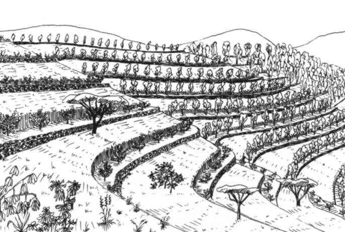
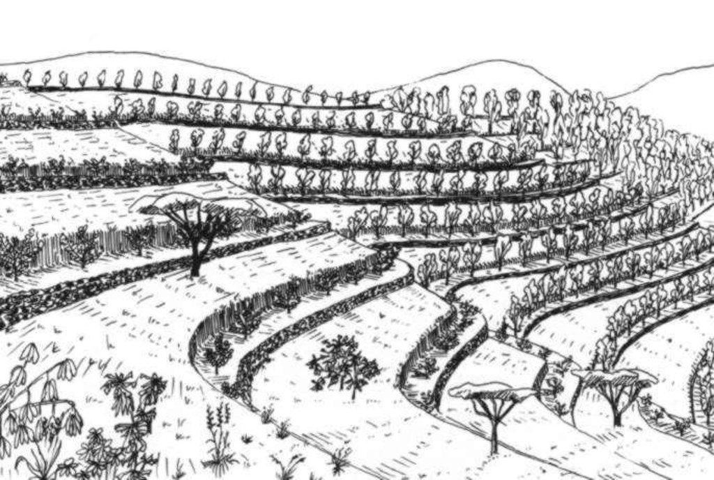
A hillside terrace is a structure along the contour, where a strip of land is levelled for tree planting.
2.2 Description détaillée de la Technologie
Description:
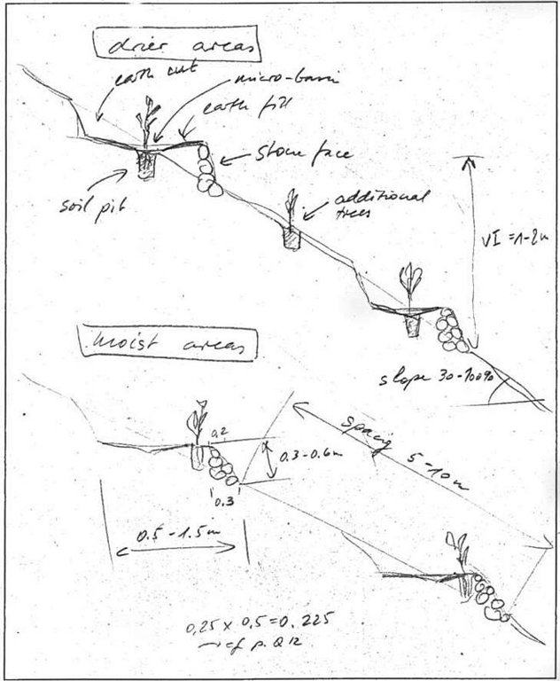
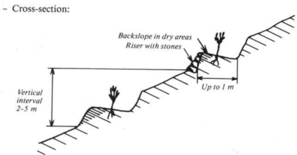
Hillside terraces are up to 1 metre wide and constructed at about 2-5 m vertical inteals. Hillside terraces should only be applied if there is a strong necessity of erosion control and/or water conservation justifying their construction. In Ethiopia and Eritrea, they have been mainly applied in the highlands, although the area of their applicability would be rather in the drier and lower lying agroclimatic zones. Slope range is 50-100%, soil range particularly on eavily degraded land. Hillside terraces are mainly used to prevent damage of flooding the area below steep slopes.
Hillside terraces help retain runoff and sediment on steep sloping land and to accommodate tree seedlings to be planted on them. They are also effective on badlands and in areas with low rainfall to conserve water. Hillside terraces are usually combined with area closure (against grazing). Little materials are needed for their construction: Line levels, digging instruments, stones, and other materials as needed for combined measures. Little management is needed for their maintenance, except for taking care of the tees planted, and for correcting damage that may be caused by livestock grazing.
2.3 Photos de la Technologie
2.5 Pays/ région/ lieux où la Technologie a été appliquée et qui sont couverts par cette évaluation
Pays:
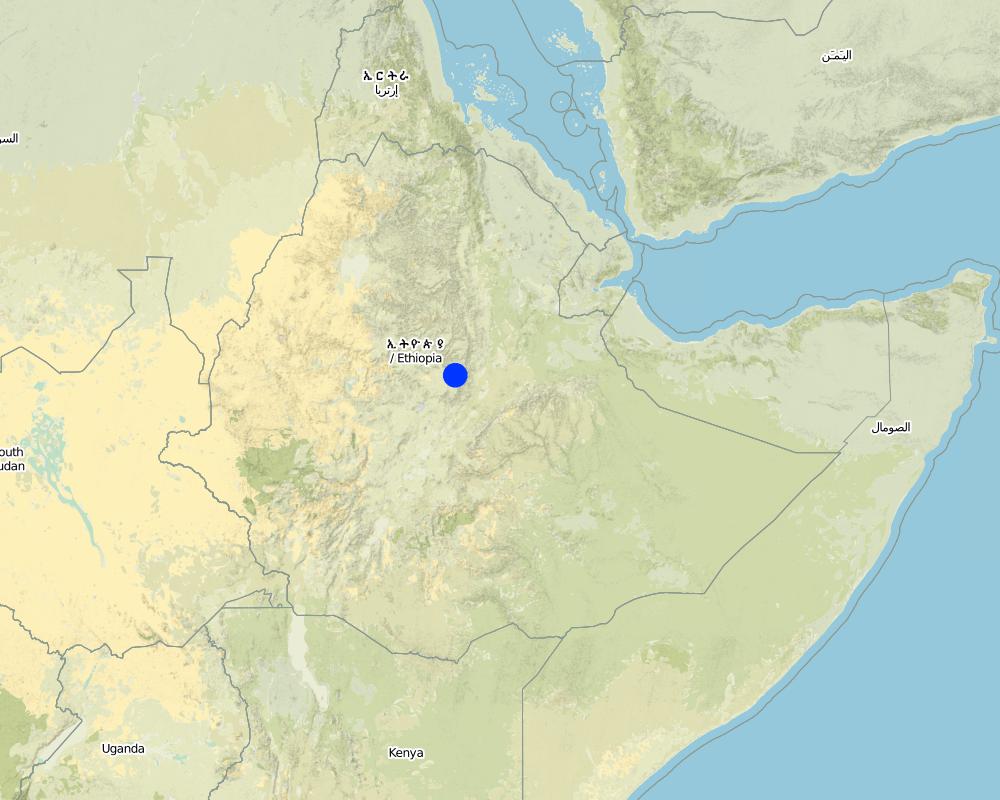
Ethiopie
Région/ Etat/ Province:
Harerge, Shewa, Wello, Tigray, Gonder, Sidamo, and Hamasien (Eritrea)
Spécifiez la diffusion de la Technologie:
- répartie uniformément sur une zone
S'il n'existe pas d'informations exactes sur la superficie, indiquez les limites approximatives de la zone couverte:
- 1 000-10 000 km2
Commentaires:
Total area covered by the SLM Technology is 1800 km2.
Map
×2.6 Date de mise en œuvre de la Technologie
Si l'année précise est inconnue, indiquez la date approximative: :
- il y a plus de 50 ans (technologie traditionnelle)
2.7 Introduction de la Technologie
Spécifiez comment la Technologie a été introduite: :
- par le biais de projets/ d'interventions extérieures
Commentaires (type de projet, etc.) :
Originated from engineering handbooks and Indian experience. Has been applied in Eritrea & Ethiopia since ~1978
3. Classification de la Technologie de GDT
3.2 Type(s) actuel(s) d'utilisation des terres, là où la Technologie est appliquée

Terres cultivées
- Plantations d’arbres ou de buissons
- Eucalyptus, Cupressus, Juniperus

Pâturages

Forêts/ bois
Produits et services:
- Bois de chauffage
- Autres produits forestiers
- Pâturage/ broutage
- Conservation/ protection de la nature
Commentaires:
Major land use problems (compiler’s opinion): High run-on from steep slopes onto cultivated land. Sheet and rill erosion from slopes, and subsequent gullying on cultivated land along footslopes. Lack of grass and woody biomass.
Major land use problems (land users’ perception): Lack of grazing for livestock. Lack of cultivation land. General food deficiency.
Grazingland comments: Insuffient land at curent population density and low productive farming systems.
Problems / comments regarding forest use: Almost the natural forest is not exist. Low growing condition.
Type of grazing system comments: Insuffient land at curent population density and low productive farming systems.
Constraints of wilderness: these are mainly badlands which are totally degraded
3.3 Est-ce que l’utilisation des terres a changé en raison de la mise en œuvre de la Technologie ?
Est-ce que l’utilisation des terres a changé en raison de la mise en œuvre de la Technologie ?
- Oui (Veuillez remplir les questions ci-après au regard de l’utilisation des terres avant la mise en œuvre de la Technologie)

Pâturages
Pâturage intensif/ production fourragère :
- Affouragement en vert/ zéro-pâturage
3.4 Approvisionnement en eau
Approvisionnement en eau des terres sur lesquelles est appliquée la Technologie:
- pluvial
Commentaires:
Water supply: Also full irrigation
3.5 Groupe de GDT auquel appartient la Technologie
- mesures en travers de la pente
3.6 Mesures de GDT constituant la Technologie

structures physiques
- S1: Terrasses
Commentaires:
Main measures: structural measures
3.7 Principaux types de dégradation des terres traités par la Technologie

érosion hydrique des sols
- Wt: perte de la couche superficielle des sols (couche arable)/ érosion de surface
- Wg: ravinement/ érosion en ravines
Commentaires:
Main type of degradation addressed: Wt: loss of topsoil / surface erosion
Secondary types of degradation addressed: Wg: gully erosion / gullying
4. Spécifications techniques, activités, intrants et coûts de mise en œuvre
4.1 Dessin technique de la Technologie
Spécifications techniques (associées au dessin technique):
Hillside terrace cross-section. Linied out along the contour, vertical interval between two terraces 2-5 m. (In: Soil Conservation in Ethiopia. CFSCDD, 1986)
Technical knowledge required for field staff / advisors: moderate
Technical knowledge required for land users: low
Main technical functions: reduction of slope angle, increase of infiltration, water harvesting / increase water supply
Secondary technical functions: reduction of slope length, improvement of ground cover, increase of surface roughness, increase / maintain water stored in soil
Trees/ shrubs species: Eucalyptus, Cupressus, Juniperus
Construction material (stone): Cut and fill with stone wall in front
Lateral gradient along the structure: 0%
For water harvesting: the ratio between the area where the harvested water is applied and the total area from which water is collected is: 1:10
Change of land use type: closed area
Other type of management: livestock management - prevention of grazing, cut and ary system
Auteur:
Joerg Wetzel, SCRP
4.2 Informations générales sur le calcul des intrants et des coûts
autre/ monnaie nationale (précisez):
Ethiopan Birr
Indiquez le taux de change des USD en devise locale, le cas échéant (p.ex. 1 USD = 79.9 réal brésilien): 1 USD = :
7,0
Indiquez le coût salarial moyen de la main d'œuvre par jour:
1.00
4.3 Activités de mise en place/ d'établissement
| Activité | Calendrier des activités (saisonnier) | |
|---|---|---|
| 1. | Transplanting | beginning of rainy season |
| 2. | Seeding | nurseries |
| 3. | Construction | dry season |
| 4. | Planting | beginning of rainy season |
| 5. | Community guarding of closed areas | annual |
4.4 Coûts et intrants nécessaires à la mise en place
Commentaires:
Duration of establishment phase: 12 month(s)
4.5 Activités d'entretien/ récurrentes
| Activité | Calendrier/ fréquence | |
|---|---|---|
| 1. | Weeding | rainy season /each cropping season |
| 2. | Control of grazing | always/annual |
| 3. | Care taking of seedlings | rainy season/each cropping season |
| 4. | communty guarding of closed areas | continuos / annual |
4.6 Coûts et intrants nécessaires aux activités d'entretien/ récurrentes (par an)
Commentaires:
Length of structure on an average slope
4.7 Facteurs les plus importants affectant les coûts
Décrivez les facteurs les plus importants affectant les coûts :
Slope, soil condition, length of terrace per hectare.
5. Environnement naturel et humain
5.1 Climat
Précipitations annuelles
- < 250 mm
- 251-500 mm
- 501-750 mm
- 751-1000 mm
- 1001-1500 mm
- 1501-2000 mm
- 2001-3000 mm
- 3001-4000 mm
- > 4000 mm
Spécifications/ commentaires sur les précipitations:
Annual rainfall: Also 1000-1500 mm
Zone agro-climatique
- humide
- subhumide
- semi-aride
- aride
Semi arid: Too little rainfall
5.2 Topographie
Pentes moyennes:
- plat (0-2 %)
- faible (3-5%)
- modéré (6-10%)
- onduleux (11-15%)
- vallonné (16-30%)
- raide (31-60%)
- très raide (>60%)
Reliefs:
- plateaux/ plaines
- crêtes
- flancs/ pentes de montagne
- flancs/ pentes de colline
- piémonts/ glacis (bas de pente)
- fonds de vallée/bas-fonds
Zones altitudinales:
- 0-100 m
- 101-500 m
- 501-1000 m
- 1001-1500 m
- 1501-2000 m
- 2001-2500 m
- 2501-3000 m
- 3001-4000 m
- > 4000 m
Commentaires et précisions supplémentaires sur la topographie:
Slopes on average: Everything below 16 % is to genly sloping to be useful
5.3 Sols
Profondeur moyenne du sol:
- très superficiel (0-20 cm)
- superficiel (21-50 cm)
- modérément profond (51-80 cm)
- profond (81-120 cm)
- très profond (>120 cm)
Texture du sol (de la couche arable):
- grossier/ léger (sablonneux)
- moyen (limoneux)
Matière organique de la couche arable:
- moyen (1-3%)
- faible (<1%)
5.6 Caractéristiques des exploitants des terres appliquant la Technologie
Revenus hors exploitation:
- moins de 10% de tous les revenus
Niveau relatif de richesse:
- très pauvre
- pauvre
Niveau de mécanisation:
- travail manuel
- traction animale
Indiquez toute autre caractéristique pertinente des exploitants des terres:
Population density: 50-100 persons/km2
Annual population growth: 2% - 3%
5% of the land users are very rich and own 10% of the land.
5% of the land users are rich and own 40% of the land.
20% of the land users are average wealthy and own 30% of the land.
60% of the land users are poor and own 10% of the land.
10% of the land users are poor and own 10% of the land.
Off-farm income specification: Labour offered to projects.
5.8 Propriété foncière, droits d’utilisation des terres et de l'eau
Propriété foncière:
- état
Droits d’utilisation des terres:
- communautaire (organisé)
- individuel
6. Impacts et conclusions
6.1 Impacts sur site que la Technologie a montrés
Impacts écologiques
Cycle de l'eau/ ruissellement
ruissellement de surface
Quantité avant la GDT:
60
Quantité après la GDT:
40
Sols
perte en sol
Quantité avant la GDT:
55
Quantité après la GDT:
30
6.4 Analyse coûts-bénéfices
Quels sont les bénéfices comparativement aux coûts de mise en place (du point de vue des exploitants des terres)?
Rentabilité à court terme:
négative
Rentabilité à long terme:
positive
Quels sont les bénéfices comparativement aux coûts d'entretien récurrents (du point de vue des exploitants des terres)?
Rentabilité à court terme:
positive
Rentabilité à long terme:
très positive
6.5 Adoption de la Technologie
Si disponible, quantifiez (nombre de ménages et/ou superficie couverte):
30600
De tous ceux qui ont adopté la Technologie, combien d'entre eux l'ont fait spontanément, à savoir sans recevoir aucune incitation matérielle, ou aucune rémunération? :
- 0-10%
Commentaires:
80% of land user families have adopted the Technology with external material support
30000 land user families have adopted the Technology with external material support
Comments on acceptance with external material support: estimates
2% of land user families have adopted the Technology without any external material support
600 land user families have adopted the Technology without any external material support
Comments on spontaneous adoption: estimates
There is a little trend towards spontaneous adoption of the Technology
Comments on adoption trend: Very recently, some villages have begun to see the value of hillside terracing, afforestations and area closure if they are given full responsibility to manage the area by a group of land users.
7. Références et liens
7.1 Méthodes/ sources d'information
7.2 Références des publications disponibles
Titre, auteur, année, ISBN:
Hurni H. : Soil Conservation in Ethiopia. Guidelines for Development Agents.. 1986.
Disponible à partir d'où? Coût?
SCRP Addis Abeba
Liens et modules
Développer tout Réduire toutLiens
Aucun lien
Modules
Aucun module trouvé


