Pasture management of a communal grazing land [Tadjikistan]
- Création :
- Mise à jour :
- Compilateur : Malgorzata Conder
- Rédacteur : –
- Examinateurs : David Streiff, Alexandra Gavilano
technologies_1555 - Tadjikistan
Voir les sections
Développer tout Réduire tout1. Informations générales
1.2 Coordonnées des personnes-ressources et des institutions impliquées dans l'évaluation et la documentation de la Technologie
Spécialiste GDT:
Nom du ou des institutions qui ont facilité la documentation/ l'évaluation de la Technologie (si pertinent)
CDE Centre for Development and Environment (CDE Centre for Development and Environment) - SuisseNom du ou des institutions qui ont facilité la documentation/ l'évaluation de la Technologie (si pertinent)
CARITAS (Switzerland) - Suisse1.3 Conditions relatives à l'utilisation par WOCAT des données documentées
Le compilateur et la(les) personne(s) ressource(s) acceptent les conditions relatives à l'utilisation par WOCAT des données documentées:
Oui
2. Description de la Technologie de GDT
2.1 Courte description de la Technologie
Définition de la Technologie:
Pasture management of a communal land through daily rotation
2.2 Description détaillée de la Technologie
Description:
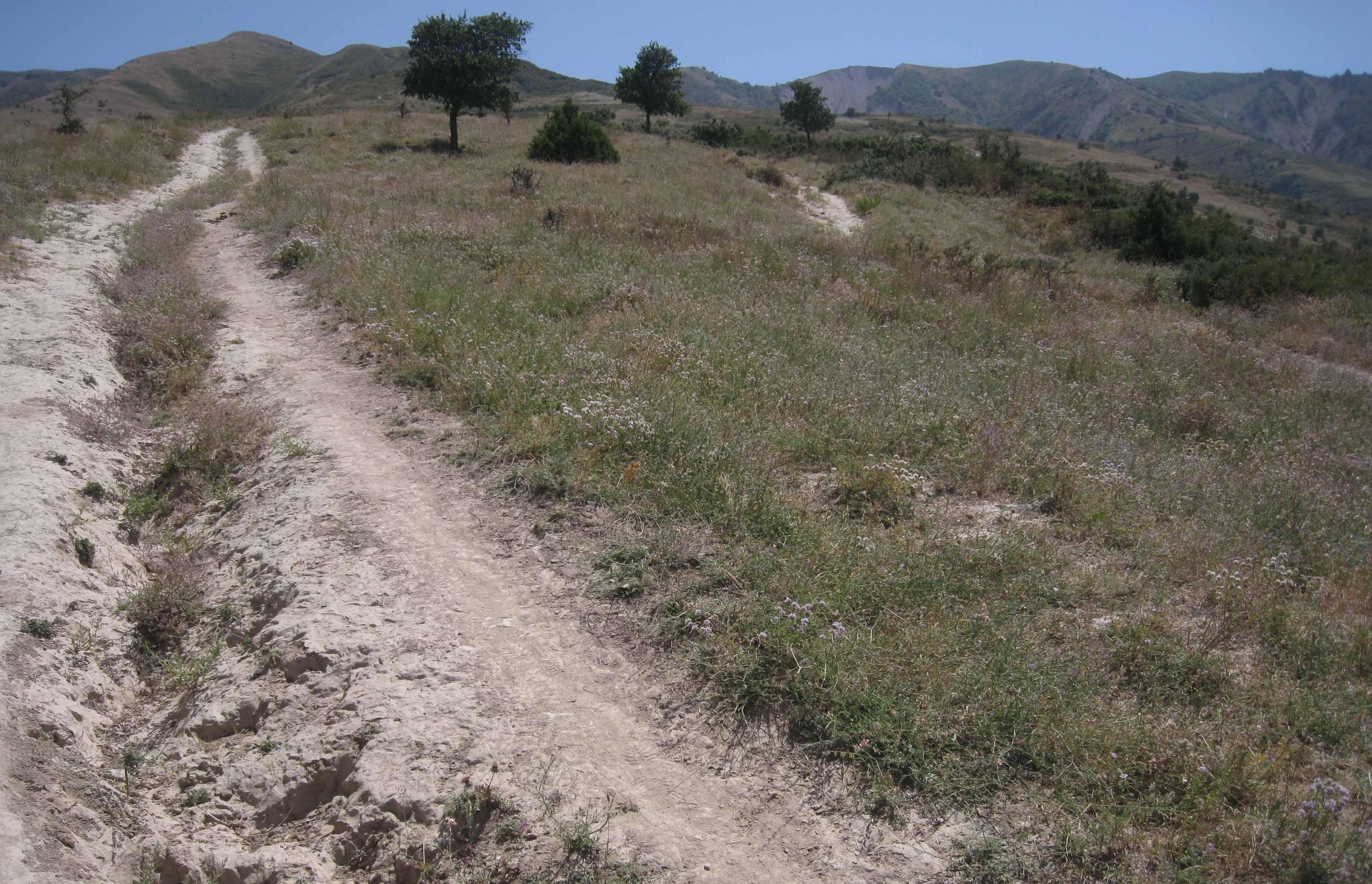
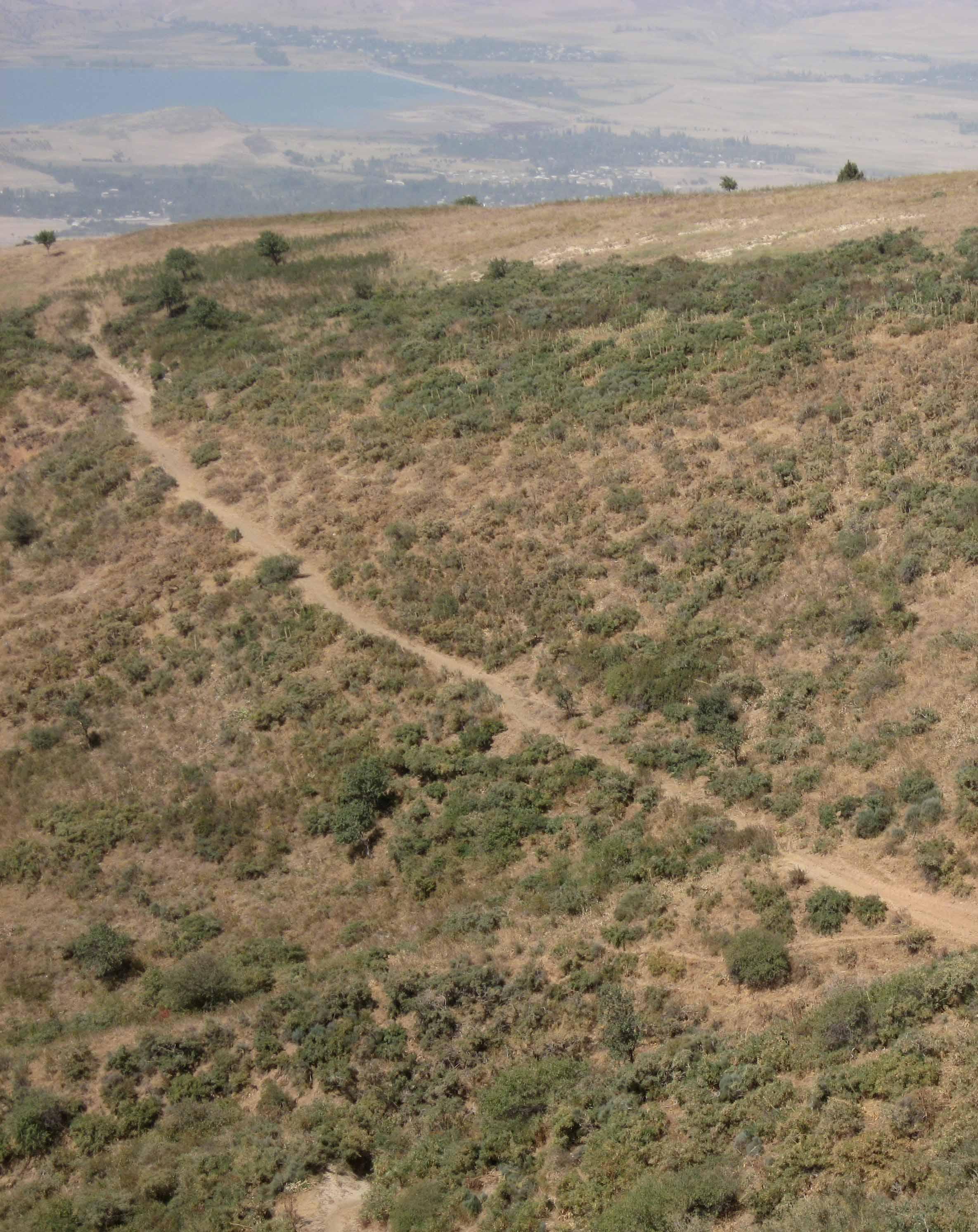
The total area of the pasture accounts for 300 – 500 ha. The pasture is property of the Doshmand village but it includes also some private properties, mainly potato and wheat crops. After the harvest, livestock is also grazing on these crops. Eighteen households are currently using the pasture with a total of 150 cows and 500 small animals. Additionally, three groups of herds from other villages graze irregularly on this pasture mainly on the lateral parts as it is less guarded by the villagers. The interviewee estimates that over 1000 cows, goats and sheep are coming from other villages. Other herds cross this pasture when migrating to or coming back from the summer pasture in spring and autumn, respectively. Nevertheless Doshmand residents claim that this intrusive grazing is accepted as “every animal has to be fed”. This shows the need of a pasture management not only on village but also on watershed level.
During Soviet time the inhabitants of Doshmand were forced to migrate to the valley. In 2003, the resettlement of the ancient location started with two families. Simultaneously, the pasture management was established and joined by each family who resettled. The controlled area is divided in 4 subparts. The herd switches daily within them. Every household looks after the herd for a day, which results in a rotational cycle of 18 days. There are no fixed and regular meetings for pasture management within the village pasture. However, two subsequent herders communicate to know where the herd has been grazing and where to graze the next time.
Purpose of the Technology: Purpose of the rotational grazing is to graze on one subpart, while the three other areas are resting. This reduces the impact of grazed and trampled areas per subpart and allows the growth and recovery of the vegetation in the other parts.
The task of herding is shared among the families. The rotational grazing is organized orally and freely, why it’s not sure if that approach is strictly binding. Discussions about pasture management rise only in case of need.
Establishment / maintenance activities and inputs: Doshmand village got the pasture in a good condition at the time of establishment. Vegetation cover was high. The only investment consisted in building a water point for the livestock. A further investment was to buy a water pipe and dig out a channel for the pipe to conduct the water from the water point to the village. Money was collected by the families and many villagers were involved in digging the channel.
No further input was and is required except coordination between the herders.
Natural / human environment: The pasture of Doshmand village is located in the middle and upper zone of the watershed. Thanks to the distance to other settlements, the pasture is less affected by overgrazing than other communal pastures in the watershed. Nevertheless, the pasture is heterogeneously grazed, with some areas which are difficult to access even for livestock and hence abundant vegetation. Other areas, especially those situated next to the village show a more bare vegetation cover.
2.3 Photos de la Technologie
Galerie Médias
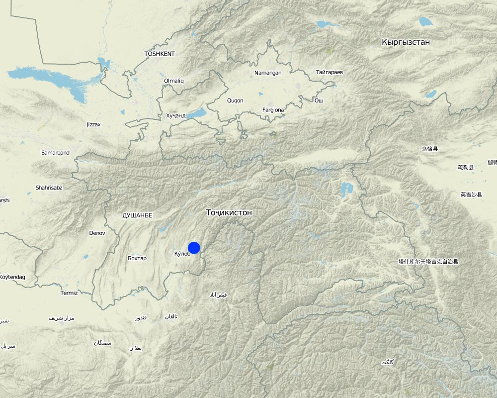
2.5 Pays/ région/ lieux où la Technologie a été appliquée et qui sont couverts par cette évaluation
Pays:
Tadjikistan
Région/ Etat/ Province:
Khatlon, Tajikistan
Autres spécifications du lieu:
Muminabad
Spécifiez la diffusion de la Technologie:
- répartie uniformément sur une zone
S'il n'existe pas d'informations exactes sur la superficie, indiquez les limites approximatives de la zone couverte:
- 1-10 km2
Commentaires:
Total area covered by the SLM Technology is 4 km2.
The Vakil (village representant) was not sure about the area, between 300 to 500 ha.
Map
×2.6 Date de mise en œuvre de la Technologie
Si l'année précise est inconnue, indiquez la date approximative: :
- il y a entre 10-50 ans
2.7 Introduction de la Technologie
Spécifiez comment la Technologie a été introduite: :
- grâce à l'innovation d'exploitants des terres
3. Classification de la Technologie de GDT
3.1 Principal(aux) objectif(s) de la Technologie
- réduire, prévenir, restaurer les terres dégradées
- préserver l'écosystème
3.2 Type(s) actuel(s) d'utilisation des terres, là où la Technologie est appliquée

Terres cultivées
- Cultures annuelles
Cultures annuelles - Précisez les cultures:
- céréales - blé de printemps
- céréales - blé d'hiver
- plantes à racines et à tubercules - pommes de terre
Nombre de période de croissance par an: :
- 1
Précisez:
Longest growing period in days: 160Longest growing period from month to month: April-Sept

Pâturages
Pâturage extensif:
- Pastoralisme de type semi-nomade
- rotational grazing
Commentaires:
Livestock density (if relevant):
> 100 LU /km2
Major land use problems (compiler’s opinion): Erosion
Overgrazing
Major land use problems (land users’ perception): increase of unpalatable vegetation
Semi-nomadism / pastoralism: Yes
Grazingland comments: Mainly summer pasture, normally no grazing from November/ December to February/ March
Type of grazing system comments: Mainly summer pasture, normally no grazing from November/ December to February/ March
3.4 Approvisionnement en eau
Approvisionnement en eau des terres sur lesquelles est appliquée la Technologie:
- pluvial
3.5 Groupe de GDT auquel appartient la Technologie
- pastoralisme et gestion des pâturages
3.6 Mesures de GDT constituant la Technologie

modes de gestion
- M2: Changement du niveau de gestion / d'intensification
Commentaires:
Main measures: management measures
3.7 Principaux types de dégradation des terres traités par la Technologie

érosion hydrique des sols
- Wo: effets hors-site de la dégradation

dégradation chimique des sols
- Cn: baisse de la fertilité des sols et réduction du niveau de matière organique (non causée par l’érosion)

dégradation physique des sols
- Pc: compaction

dégradation biologique
- Bc: réduction de la couverture végétale
- Bs: baisse de la qualité et de la composition/ diversité des espèces
Commentaires:
Main type of degradation addressed: Wo: offsite degradation effects, Pc: compaction, Bc: reduction of vegetation cover
Secondary types of degradation addressed: Cn: fertility decline and reduced organic matter content, Bs: quality and species composition /diversity decline
Main causes of degradation: overgrazing, land tenure (communal grazing land also used by other communes)
Secondary causes of degradation: deforestation / removal of natural vegetation (incl. forest fires), disturbance of water cycle (infiltration / runoff)
3.8 Prévention, réduction de la dégradation ou réhabilitation des terres dégradées
Spécifiez l'objectif de la Technologie au regard de la dégradation des terres:
- réduire la dégradation des terres
- restaurer/ réhabiliter des terres sévèrement dégradées
Commentaires:
Main goals: rehabilitation / reclamation of denuded land
Secondary goals: mitigation / reduction of land degradation
4. Spécifications techniques, activités, intrants et coûts de mise en œuvre
4.1 Dessin technique de la Technologie
Spécifications techniques (associées au dessin technique):
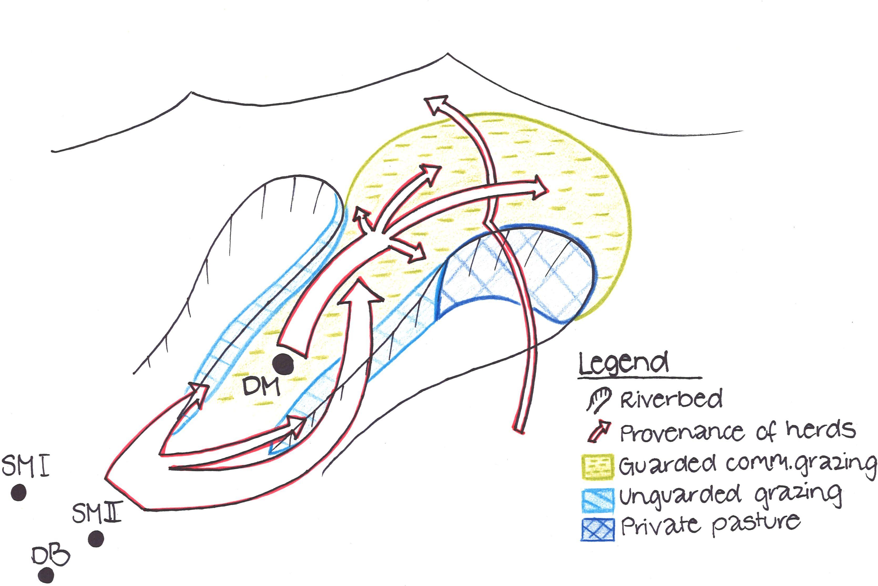
Livestock from Doshmand village (DM) is grazing in the four subparts of the communal pasture. Livestock from other villages, located in the valley Sarmadoni I (SMI) and II (SMII) and Dehibaland (DB), can invade the guarded and unguarded communal pasture of Doschmand. In spring and autumn also other livestock crosses Doshmand's pasture when migrating to or leaving the summer pasture.
Location: Chukurak watershed. Muminabad, Khatlon
Technical knowledge required for land users: low
Main technical functions: improvement of ground cover, increase of infiltration
Secondary technical functions: improvement of topsoil structure (compaction), stabilisation of soil (eg by tree roots against land slides), increase in organic matter
Change of land use practices / intensity level: Rotational grazing at village level
Auteur:
Malgorzata Conder
4.2 Informations générales sur le calcul des intrants et des coûts
Indiquez la monnaie utilisée pour le calcul des coûts:
- dollars américains
Indiquez le coût salarial moyen de la main d'œuvre par jour:
12.40
4.3 Activités de mise en place/ d'établissement
| Activité | Calendrier des activités (saisonnier) | |
|---|---|---|
| 1. | Coordination with villagers and herders | Reestablishment of village |
4.4 Coûts et intrants nécessaires à la mise en place
| Spécifiez les intrants | Unité | Quantité | Coûts par unité | Coût total par intrant | % du coût supporté par les exploitants des terres | |
|---|---|---|---|---|---|---|
| Main d'œuvre | Coordination with villagers and herders | - | 1,0 |
4.5 Activités d'entretien/ récurrentes
| Activité | Calendrier/ fréquence | |
|---|---|---|
| 1. | Consultation with village herders | If needed |
4.6 Coûts et intrants nécessaires aux activités d'entretien/ récurrentes (par an)
| Spécifiez les intrants | Unité | Quantité | Coûts par unité | Coût total par intrant | % du coût supporté par les exploitants des terres | |
|---|---|---|---|---|---|---|
| Main d'œuvre | Consultation with village herders | - | 1,0 |
4.7 Facteurs les plus importants affectant les coûts
Décrivez les facteurs les plus importants affectant les coûts :
There are no costly factors, the most important input is a good planning, coordination and consistent execution of the rotational grazing system.
The installation of a waterpoint would be needed but it is a very costly installation.
5. Environnement naturel et humain
5.1 Climat
Précipitations annuelles
- < 250 mm
- 251-500 mm
- 501-750 mm
- 751-1000 mm
- 1001-1500 mm
- 1501-2000 mm
- 2001-3000 mm
- 3001-4000 mm
- > 4000 mm
Spécifications/ commentaires sur les précipitations:
Annual rainfall (1,001-1,500 mm): Totally 800mm: 700mm in winter-spring, July-Sept dry season (At 1200mm asl, weather station Muminabad)
Annual rainfall (1,501-2,000 mm): Precipitation increases 60mm per 100m of altitude in average. Here up to 1600mm.
Zone agro-climatique
- subhumide
Thermal climate class: temperate
LPG from April until September
5.2 Topographie
Pentes moyennes:
- plat (0-2 %)
- faible (3-5%)
- modéré (6-10%)
- onduleux (11-15%)
- vallonné (16-30%)
- raide (31-60%)
- très raide (>60%)
Reliefs:
- plateaux/ plaines
- crêtes
- flancs/ pentes de montagne
- flancs/ pentes de colline
- piémonts/ glacis (bas de pente)
- fonds de vallée/bas-fonds
Zones altitudinales:
- 0-100 m
- 101-500 m
- 501-1000 m
- 1001-1500 m
- 1501-2000 m
- 2001-2500 m
- 2501-3000 m
- 3001-4000 m
- > 4000 m
Commentaires et précisions supplémentaires sur la topographie:
Slopes on average (steep): Some flanks up to approx. 40%
5.3 Sols
Profondeur moyenne du sol:
- très superficiel (0-20 cm)
- superficiel (21-50 cm)
- modérément profond (51-80 cm)
- profond (81-120 cm)
- très profond (>120 cm)
Texture du sol (de la couche arable):
- moyen (limoneux)
- fin/ lourd (argile)
Matière organique de la couche arable:
- abondant (>3%)
- moyen (1-3%)
Si disponible, joignez une description complète du sol ou précisez les informations disponibles, par ex., type de sol, pH/ acidité du sol, capacité d'échange cationique, azote, salinité, etc.
Topsoil organic matter (high): On some flanks with high vegetation cover, which are difficult to access by livestock
Soil fertility is low
Soil drainage / infiltration is medium
Soil water storage capacity is low near the villages and high on mountain slopes (off-village)
5.4 Disponibilité et qualité de l'eau
Profondeur estimée de l’eau dans le sol:
5-50 m
Disponibilité de l’eau de surface:
moyenne
Qualité de l’eau (non traitée):
faiblement potable (traitement nécessaire)
Commentaires et précisions supplémentaires sur la qualité et la quantité d'eau:
Water quality (untreated) is also for agricultural use only (irrigation)
5.5 Biodiversité
Diversité des espèces:
- élevé
5.6 Caractéristiques des exploitants des terres appliquant la Technologie
Orientation du système de production:
- subsistance (auto-approvisionnement)
Revenus hors exploitation:
- moins de 10% de tous les revenus
Niveau relatif de richesse:
- moyen
Individus ou groupes:
- groupe/ communauté
Genre:
- femmes
- hommes
Indiquez toute autre caractéristique pertinente des exploitants des terres:
Land users applying the Technology are mainly common / average land users
Population density: 100-200 persons/km2
Annual population growth: 1% - 2%
5.7 Superficie moyenne des terres utilisées par les exploitants des terres appliquant la Technologie
- < 0,5 ha
- 0,5-1 ha
- 1-2 ha
- 2-5 ha
- 5-15 ha
- 15-50 ha
- 50-100 ha
- 100-500 ha
- 500-1 000 ha
- 1 000-10 000 ha
- > 10 000 ha
Cette superficie est-elle considérée comme de petite, moyenne ou grande dimension (en se référant au contexte local)?
- petite dimension
Commentaires:
Around 3 ha, if 7.7 pers/household of totally 2350 ha pasture
5.8 Propriété foncière, droits d’utilisation des terres et de l'eau
Propriété foncière:
- état
Droits d’utilisation des terres:
- loué
Droits d’utilisation de l’eau:
- communautaire (organisé)
Commentaires:
Land ownership is based on the land user certificate conferred by the government
5.9 Accès aux services et aux infrastructures
santé:
- pauvre
- modéré
- bonne
éducation:
- pauvre
- modéré
- bonne
assistance technique:
- pauvre
- modéré
- bonne
emploi (par ex. hors exploitation):
- pauvre
- modéré
- bonne
marchés:
- pauvre
- modéré
- bonne
énergie:
- pauvre
- modéré
- bonne
routes et transports:
- pauvre
- modéré
- bonne
eau potable et assainissement:
- pauvre
- modéré
- bonne
services financiers:
- pauvre
- modéré
- bonne
6. Impacts et conclusions
6.1 Impacts sur site que la Technologie a montrés
Impacts socio-économiques
Production
production fourragère
production animale
Commentaires/ spécifiez:
Not the whole pastureland can be grazed at once
Disponibilité et qualité de l'eau
disponibilité de l'eau pour l'élevage
qualité de l'eau pour l'élevage
Impacts socioculturels
sécurité alimentaire/ autosuffisance
institutions communautaires
Livelihoods and human well-being
Commentaires/ spécifiez:
Strenghtening of the community sense and awareness through increased coordination for rotational grazing between villagers. Higher fodder availability leads to healthier livestock.
Impacts écologiques
Cycle de l'eau/ ruissellement
ruissellement de surface
évaporation
Sols
humidité du sol
encroûtement/ battance du sol
compaction du sol
Biodiversité: végétale, animale
biomasse/ au dessus du sol C
Réduction des risques de catastrophe et des risques climatiques
risques d'incendies
Autres impacts écologiques
Hazards towards adverse events
6.2 Impacts hors site que la Technologie a montrés
envasement en aval
capacité tampon/de filtration
dommages sur les infrastructures publiques/ privées
6.3 Exposition et sensibilité de la Technologie aux changements progressifs et aux évènements extrêmes/catastrophes liés au climat (telles que perçues par les exploitants des terres)
Changements climatiques progressifs
Changements climatiques progressifs
| Saison | Augmentation ou diminution | Comment la Technologie fait-elle face à cela? | |
|---|---|---|---|
| températures annuelles | augmente | bien |
Extrêmes climatiques (catastrophes)
Catastrophes météorologiques
| Comment la Technologie fait-elle face à cela? | |
|---|---|
| pluie torrentielle locale | pas bien |
| tempête de vent locale | bien |
Catastrophes climatiques
| Comment la Technologie fait-elle face à cela? | |
|---|---|
| sécheresse | pas bien |
Catastrophes hydrologiques
| Comment la Technologie fait-elle face à cela? | |
|---|---|
| inondation générale (rivière) | pas bien |
Autres conséquences liées au climat
Autres conséquences liées au climat
| Comment la Technologie fait-elle face à cela? | |
|---|---|
| réduction de la période de croissance | pas connu |
Commentaires:
Conduct the rotational grazing even more strictly
6.4 Analyse coûts-bénéfices
Quels sont les bénéfices comparativement aux coûts de mise en place (du point de vue des exploitants des terres)?
Rentabilité à court terme:
neutre / équilibrée
Rentabilité à long terme:
légèrement positive
Quels sont les bénéfices comparativement aux coûts d'entretien récurrents (du point de vue des exploitants des terres)?
Rentabilité à court terme:
neutre / équilibrée
Rentabilité à long terme:
positive
6.5 Adoption de la Technologie
Si disponible, quantifiez (nombre de ménages et/ou superficie couverte):
NA
Commentaires:
There is a little trend towards spontaneous adoption of the Technology
Comments on adoption trend: Effort is made to introduce more rotational grazing on cummunity level in the region with institutional support.
6.7 Points forts/ avantages/ possibilités de la Technologie
| Points forts/ avantages/ possibilités du point de vue de l'exploitant des terres |
|---|
| No big input, coordination between farmers exists anyway |
| Points forts/ avantages/ possibilités du point de vue du compilateur ou d'une autre personne ressource clé |
|---|
|
In a rotational grazing system at village level every family is responsible for the sustainability of the pasture How can they be sustained / enhanced? Give more responsability and co-determination to individuals |
|
High establishment potential as rotational grazing do not demand any costs, except coordination and organization on village level How can they be sustained / enhanced? Disseminate the idea of rotational grazing also on watershed level |
|
Ecologic benefits as high vegetation cover, less erosion etc. can be achieved without monetary investment How can they be sustained / enhanced? Spread knowledge of long-term effects by rotational grazing |
|
Being a pasture of a big area extent in the uphills, the good quality of the pasture plays an important role for all the settlements and cultivations downstream How can they be sustained / enhanced? Raise the awareness about the upstream-downstream interrelation in the watersheds |
6.8 Faiblesses/ inconvénients/ risques de la Technologie et moyens de les surmonter
| Faiblesses/ inconvénients/ risques du point de vue du compilateur ou d'une autre personne ressource clé | Comment peuvent-ils être surmontés? |
|---|---|
| In reality, rotational grazing is not executed strictly enough | Stricter separation of the subparts needed |
| Herds from other villages graze in the same pasture | Strenghten coordination of grazing between and within villages |
| Some flanks show high vegetation because they are not accessible for livestock and not because of the rotational grazing |
7. Références et liens
7.1 Méthodes/ sources d'information
Liens et modules
Développer tout Réduire toutLiens
Aucun lien
Modules
Aucun module trouvé