Trees in the riparian area as a protective and aesthetic advantage at Naro Moru River [Kenya]
- Création :
- Mise à jour :
- Compilateur : Manuel Fischer
- Rédacteur : –
- Examinateurs : David Streiff, Alexandra Gavilano
technologies_1580 - Kenya
Voir les sections
Développer tout Réduire tout1. Informations générales
1.2 Coordonnées des personnes-ressources et des institutions impliquées dans l'évaluation et la documentation de la Technologie
exploitant des terres:
Wanjiru Cecilia
Kenya
Nom du ou des institutions qui ont facilité la documentation/ l'évaluation de la Technologie (si pertinent)
CDE Centre for Development and Environment (CDE Centre for Development and Environment) - Suisse1.3 Conditions relatives à l'utilisation par WOCAT des données documentées
Le compilateur et la(les) personne(s) ressource(s) acceptent les conditions relatives à l'utilisation par WOCAT des données documentées:
Oui
2. Description de la Technologie de GDT
2.1 Courte description de la Technologie
Définition de la Technologie:
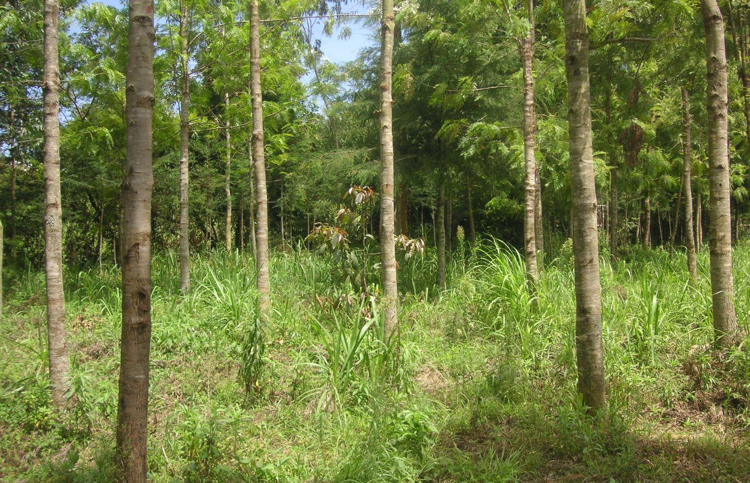
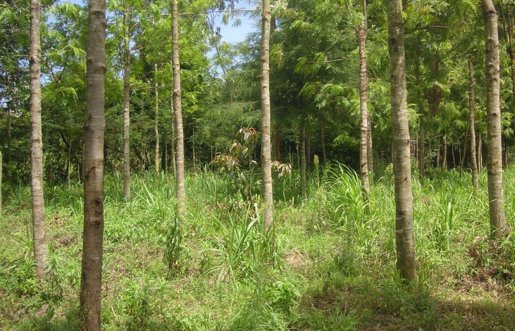
Trees are planted along the riparian zone to stabilize the riverbank and to prevent degradation. The wood can be used to establish a building or to generate income on the market.
2.2 Description détaillée de la Technologie
Description:
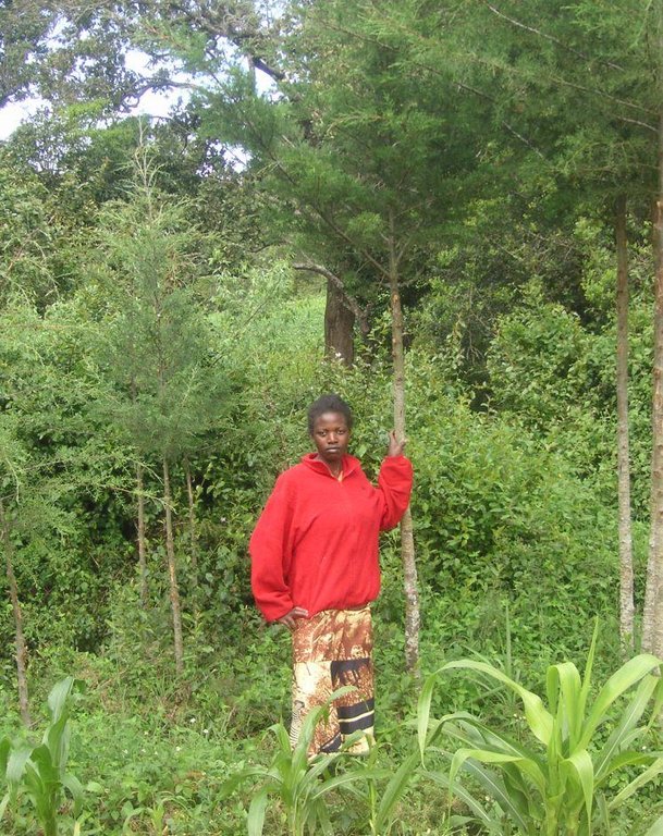
At the foot slopes of Mt. Kenya a farmer has developed a technology to protect the own land plot from riverbank erosion. The technology consists of three main measures: A wall along the riverbed, trees that are aligned on the wall as well as beside it and Napier grass wildly scattered between the trees. The wall was built on a highly exposed spot of the riverbank. Trees along and beside the wall ensure its stability. The combination of the two measures results in an effective protection of the riverbank in terms of erosion. Side effects of the technology are higher runoff during the dry season, better water quality due to less erosion and an improved riparian habitat for animals and plants.
Purpose of the Technology: For a small scale farmer, planting of trees can have advantages in an economic, an ecologic and an aesthetic point of view. The trees stabilize the soil, allow the riparian vegetation to establish, and prevent major damages through flooding. Furthermore, there are several advantages of an intact riparian zone, such as enhanced biodiversity, increased water quality as well as retention of agrochemicals. The trees also work as a kind of bank account, since the prices for wood are quite high. Trees can be cut and sold from time to time to generate an income that can be used for further investments like local entrepreneurship or building houses for family members. Last but not least, the farmer emphasized the beautiful appearance of the trees including the relatively cool micro- climate the trees are able to provide during the hot months of the dry period.
Establishment / maintenance activities and inputs: The trees were planted during the rainy season. Braches are pruned regularly and provide mulch material as well as fire wood. When trees are reaching maturity they will selectively be cut and replanted. The Napier grass is cut regularly for fodder to be feed to animals. At this particular time, there is a regular hay yield (weed). Seedlings for trees and the grasses are produced on site. Occasional pruning ensures fuel wood supply.
Natural / human environment: The plot is situated at the western side of Mt. Kenya in its foot zone, a moderate hilly region. Actually, the foot zone is a transition area between the humid mountain forest above elevations of 2500 m.a.s.l and the semi-arid savannah zone below 2000 m a.s.l. Although the region is located in the rain shadow of Mt. Kenya, there is just enough precipitation (740mm) to sustain rain fed agriculture and the farmers even benefit from a water project. During the last decades, the region has experienced a still continuing population growth which increases population pressure in the area. The good accessibility and the moderate tourism allow even off-farm income-generation.
2.3 Photos de la Technologie
2.5 Pays/ région/ lieux où la Technologie a été appliquée et qui sont couverts par cette évaluation
Pays:
Kenya
Région/ Etat/ Province:
Kenya/Central Province
Autres spécifications du lieu:
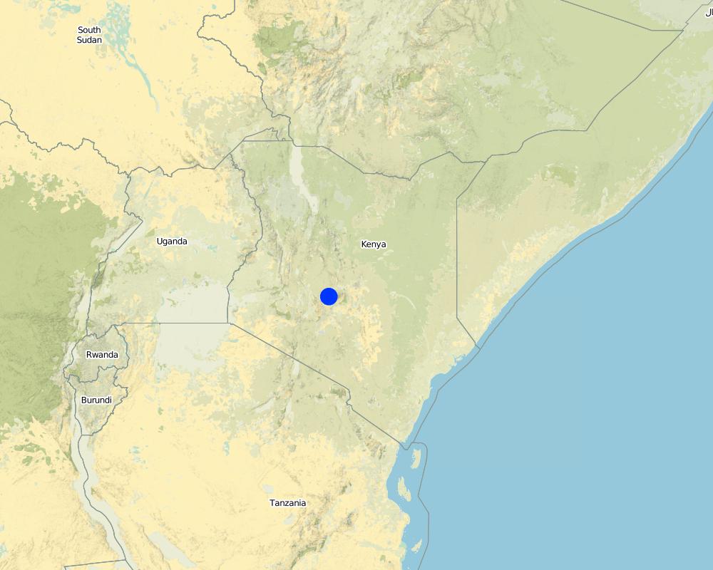
Naro Moru
Spécifiez la diffusion de la Technologie:
- répartie uniformément sur une zone
S'il n'existe pas d'informations exactes sur la superficie, indiquez les limites approximatives de la zone couverte:
- < 0,1 km2 (10 ha)
Map
×2.6 Date de mise en œuvre de la Technologie
Si l'année précise est inconnue, indiquez la date approximative: :
- il y a moins de 10 ans (récemment)
2.7 Introduction de la Technologie
Spécifiez comment la Technologie a été introduite: :
- grâce à l'innovation d'exploitants des terres
Commentaires (type de projet, etc.) :
The land user has enough space to afforest along the riparian. The main goals are to stabilise the riparian soil and to produce wood for use in the future.
3. Classification de la Technologie de GDT
3.1 Principal(aux) objectif(s) de la Technologie
- améliorer la production
- réduire, prévenir, restaurer les terres dégradées
3.2 Type(s) actuel(s) d'utilisation des terres, là où la Technologie est appliquée
Les divers types d'utilisation des terres au sein du même unité de terrain: :
Oui
Précisez l'utilisation mixte des terres (cultures/ pâturages/ arbres):
- Agroforesterie

Terres cultivées
- Cultures annuelles
Cultures annuelles - Précisez les cultures:
- cultures fourragères - graminées
Nombre de période de croissance par an: :
- 2
Précisez:
Longest growing period in days: 90 Longest growing period from month to month: april to may Second longest growing period in days: 90 Second longest growing period from month to month: october to november

Forêts/ bois
- Plantations d'arbres, boisements
Type d’arbres:
- Espèces de Cupressus (cyprès)
- Grevillea robusta (chêne d'Australie, Grevillée robuste)
Produits et services:
- Bois d'œuvre (de construction)
- Bois de chauffage
- Conservation/ protection de la nature
- Loisirs/ tourisme
Commentaires:
Trees/ shrubs species: Cypress, Grevillea, indigenous trees
Fruit trees / shrubs species: Napier grass
Major land use problems (compiler’s opinion): Surface water pollution and riverbank degradation as well as a diminished habitat of riparian flora and fauna.
Major land use problems (land users’ perception): An unstable riparian zone being eroded by the river and unattractive aesthetics.
Problems / comments regarding forest use: The purpose of the forest is mainly in a protective way. Later on, as soon as the trees are large enough, selective felling for construction is planned.
Forest products and services: timber, fuelwood, nature conservation / protection, recreation / tourism
Future (final) land use (after implementation of SLM Technology): Forests / woodlands: Fp: Plantations, afforestations
3.3 Est-ce que l’utilisation des terres a changé en raison de la mise en œuvre de la Technologie ?
Est-ce que l’utilisation des terres a changé en raison de la mise en œuvre de la Technologie ?
- Oui (Veuillez remplir les questions ci-après au regard de l’utilisation des terres avant la mise en œuvre de la Technologie)

Terres cultivées
- Cultures annuelles
3.5 Groupe de GDT auquel appartient la Technologie
- gestion des forêts naturelles et semi-naturelles
- Amélioration de la couverture végétale/ du sol
3.6 Mesures de GDT constituant la Technologie

pratiques végétales
- V1: Couverture d’arbres et d’arbustes

structures physiques
- S6: Murs, barrières, palissades, clôtures
Commentaires:
Main measures: vegetative measures
Secondary measures: structural measures
Type of vegetative measures: aligned: -linear, scattered / dispersed
3.7 Principaux types de dégradation des terres traités par la Technologie

érosion hydrique des sols
- Wt: perte de la couche superficielle des sols (couche arable)/ érosion de surface
- Wr: érosion des berges

dégradation biologique
- Bc: réduction de la couverture végétale
- Bs: baisse de la qualité et de la composition/ diversité des espèces

dégradation hydrique
- Hp: baisse de la qualité des eaux de surface
- Hw: réduction de la capacité tampon des zones humides
Commentaires:
Main type of degradation addressed: Wr: riverbank erosion, Bs: quality and species composition /diversity decline, Hp: decline of surface water quality
Secondary types of degradation addressed: Wt: loss of topsoil / surface erosion, Bc: reduction of vegetation cover, Hw: reduction of the buffering capacity of wetland areas
Main causes of degradation: deforestation / removal of natural vegetation (incl. forest fires), over-exploitation of vegetation for domestic use, population pressure, education, access to knowledge and support services
Secondary causes of degradation: floods
3.8 Prévention, réduction de la dégradation ou réhabilitation des terres dégradées
Spécifiez l'objectif de la Technologie au regard de la dégradation des terres:
- prévenir la dégradation des terres
- réduire la dégradation des terres
Commentaires:
Secondary goals: mitigation / reduction of land degradation
4. Spécifications techniques, activités, intrants et coûts de mise en œuvre
4.1 Dessin technique de la Technologie
Spécifications techniques (associées au dessin technique):
Indigenous trees, a wall and Napier grass are installed between the agricultural land and the river. The wall prevents erosion at a very endangered spot. The trees and the grass provide fodder and wood.
Location: Naro Moru. Nyeri / Central Province
Technical knowledge required for field staff / advisors: moderate
Technical knowledge required for land users: low
Main technical functions: increase of infiltration, improvement of water quality, buffering / filtering water, sediment retention / trapping, sediment harvesting, stabilization of riverbank by trees and grasses
Secondary technical functions: stabilisation of soil (eg by tree roots against land slides)
Aligned: -linear
Vegetative material: T : trees / shrubs
Number of plants per (ha): 200
Vertical interval between rows / strips / blocks (m): 0
Spacing between rows / strips / blocks (m): 1
Vertical interval within rows / strips / blocks (m): 1.5
Width within rows / strips / blocks (m): 2
Scattered / dispersed
Vegetative material: G : grass
Number of plants per (ha): 800
Trees/ shrubs species: Cypress, Grevillea, indigenous trees
Fruit trees / shrubs species: Napier grass
Wall/ barrier
Height of bunds/banks/others (m): 0.5m
Width of bunds/banks/others (m): 2m
Length of bunds/banks/others (m): 10m
Auteur:
Manuel Fischer
4.2 Informations générales sur le calcul des intrants et des coûts
Spécifiez la manière dont les coûts et les intrants ont été calculés:
- par entité de la Technologie
Indiquez la monnaie utilisée pour le calcul des coûts:
- dollars américains
Indiquez le coût salarial moyen de la main d'œuvre par jour:
2.70
4.3 Activités de mise en place/ d'établissement
| Activité | Calendrier des activités (saisonnier) | |
|---|---|---|
| 1. | Setting up a tree nursery | |
| 2. | Planting seedlings | during rainy season |
| 3. | Establishment of wall |
4.4 Coûts et intrants nécessaires à la mise en place
| Spécifiez les intrants | Unité | Quantité | Coûts par unité | Coût total par intrant | % des coût supporté par les exploitants des terres | |
|---|---|---|---|---|---|---|
| Main d'œuvre | Setting up a tree nursery | Persons/day | 5,0 | 3,3333 | 16,67 | 100,0 |
| Main d'œuvre | Planting seedlings | Persons/day | 25,0 | 3,3333 | 83,33 | 100,0 |
| Main d'œuvre | Establishment of wall | Persons/day | 5,0 | 3,3333 | 16,67 | 100,0 |
| Coût total de mise en place de la Technologie | 116,67 | |||||
| Coût total de mise en place de la Technologie en dollars américains (USD) | 116,67 | |||||
4.5 Activités d'entretien/ récurrentes
| Activité | Calendrier/ fréquence | |
|---|---|---|
| 1. | Replanting trees that dried up | |
| 2. | Cutting the Napier grass and pruning trees | during the rainy seasons = 4 months a year. 3 times a month |
4.6 Coûts et intrants nécessaires aux activités d'entretien/ récurrentes (par an)
| Spécifiez les intrants | Unité | Quantité | Coûts par unité | Coût total par intrant | % des coût supporté par les exploitants des terres | |
|---|---|---|---|---|---|---|
| Main d'œuvre | Replanting trees | Persons/day | 3,0 | 3,3333 | 10,0 | 100,0 |
| Main d'œuvre | Cutting the Napier grass and pruning trees | Persons/day | 12,0 | 3,33333 | 40,0 | 100,0 |
| Coût total d'entretien de la Technologie | 50,0 | |||||
| Coût total d'entretien de la Technologie en dollars américains (USD) | 50,0 | |||||
Commentaires:
Establishment has been carried out over a time period of 5 years. Considering this time frame, the establishment costs are smaller than the maintenance costs.
The costs per hectare were calculated for a riparian area with the length of 100 m and a width of 10 m, since hectares are difficult to apply in a riparian context. The determining factor for the costs is labour. In this case, the labour costs are quite high because the seedlings were produced in the own nursery. This explains the high labour costs. Some of the seedlings had to be replanted, because they dried up. The required equipment like a spade is available on nearly every farm or can be borrowed from neighbours and is thus not added to the costs.
5. Environnement naturel et humain
5.1 Climat
Précipitations annuelles
- < 250 mm
- 251-500 mm
- 501-750 mm
- 751-1000 mm
- 1001-1500 mm
- 1501-2000 mm
- 2001-3000 mm
- 3001-4000 mm
- > 4000 mm
Indiquez le nom de la station météorologique de référence considérée:
NS-Daten Eliza
Zone agro-climatique
- subhumide
Thermal climate class: subtropics. source: http://en.climate-data.org/location/103473/
5.2 Topographie
Pentes moyennes:
- plat (0-2 %)
- faible (3-5%)
- modéré (6-10%)
- onduleux (11-15%)
- vallonné (16-30%)
- raide (31-60%)
- très raide (>60%)
Reliefs:
- plateaux/ plaines
- crêtes
- flancs/ pentes de montagne
- flancs/ pentes de colline
- piémonts/ glacis (bas de pente)
- fonds de vallée/bas-fonds
Zones altitudinales:
- 0-100 m
- 101-500 m
- 501-1000 m
- 1001-1500 m
- 1501-2000 m
- 2001-2500 m
- 2501-3000 m
- 3001-4000 m
- > 4000 m
Commentaires et précisions supplémentaires sur la topographie:
Altitudinal zone: 2020
Slopes on average: Land plot has a slope between 5% and 9%
5.3 Sols
Profondeur moyenne du sol:
- très superficiel (0-20 cm)
- superficiel (21-50 cm)
- modérément profond (51-80 cm)
- profond (81-120 cm)
- très profond (>120 cm)
Matière organique de la couche arable:
- moyen (1-3%)
Si disponible, joignez une description complète du sol ou précisez les informations disponibles, par ex., type de sol, pH/ acidité du sol, capacité d'échange cationique, azote, salinité, etc.
Soil texture: mixture, because it is not red
Soil fertility is high
Soil drainage / infiltration is good
Soil water storage capacity very low - low
5.4 Disponibilité et qualité de l'eau
Profondeur estimée de l’eau dans le sol:
< 5 m
Disponibilité de l’eau de surface:
bonne
Qualité de l’eau (non traitée):
eau potable
Commentaires et précisions supplémentaires sur la qualité et la quantité d'eau:
Ground water table: <5 mjust along the river, deeper ground water level 50-100m
Water quality (untreated): From a water project
5.5 Biodiversité
Diversité des espèces:
- élevé
Commentaires et précisions supplémentaires sur la biodiversité:
Species diversity: Also medium
5.6 Caractéristiques des exploitants des terres appliquant la Technologie
Orientation du système de production:
- subsistance (auto-approvisionnement)
- exploitation mixte (de subsistance/ commerciale)
Revenus hors exploitation:
- moins de 10% de tous les revenus
Niveau relatif de richesse:
- moyen
Individus ou groupes:
- individu/ ménage
Niveau de mécanisation:
- travail manuel
Genre:
- femmes
- hommes
Indiquez toute autre caractéristique pertinente des exploitants des terres:
Land users applying the Technology are mainly common / average land users
Difference in the involvement of women and men: A clan uses the land commonly. Besides the base family (mother, father, son), the grandmother and an uncle use parts of the land. All of them apply the protective technologies in the riparian.
Population density: 200-500 persons/km2
5.7 Superficie moyenne des terres utilisées par les exploitants des terres appliquant la Technologie
- < 0,5 ha
- 0,5-1 ha
- 1-2 ha
- 2-5 ha
- 5-15 ha
- 15-50 ha
- 50-100 ha
- 100-500 ha
- 500-1 000 ha
- 1 000-10 000 ha
- > 10 000 ha
Cette superficie est-elle considérée comme de petite, moyenne ou grande dimension (en se référant au contexte local)?
- petite dimension
Commentaires:
Average area of land owned or leased by land users applying the Technology: < 0.5 ha for Riparian forest.
5.8 Propriété foncière, droits d’utilisation des terres et de l'eau
Propriété foncière:
- individu, sans titre de propriété
Droits d’utilisation des terres:
- individuel
Droits d’utilisation de l’eau:
- communautaire (organisé)
Commentaires:
Mostly small scale farmers are using the land.
5.9 Accès aux services et aux infrastructures
santé:
- pauvre
- modéré
- bonne
éducation:
- pauvre
- modéré
- bonne
assistance technique:
- pauvre
- modéré
- bonne
emploi (par ex. hors exploitation):
- pauvre
- modéré
- bonne
marchés:
- pauvre
- modéré
- bonne
routes et transports:
- pauvre
- modéré
- bonne
eau potable et assainissement:
- pauvre
- modéré
- bonne
services financiers:
- pauvre
- modéré
- bonne
6. Impacts et conclusions
6.1 Impacts sur site que la Technologie a montrés
Impacts socio-économiques
Production
production agricole
production fourragère
Commentaires/ spécifiez:
Napier grass yield has increased
production de bois
Commentaires/ spécifiez:
Before, there was only little wood production
Impacts socioculturels
connaissances sur la GDT/ dégradation des terres
Aesthetics
Impacts écologiques
Cycle de l'eau/ ruissellement
ruissellement de surface
drainage de l'excès d'eau
Sols
couverture du sol
perte en sol
Biodiversité: végétale, animale
espèces bénéfiques
Réduction des risques de catastrophe et des risques climatiques
impacts des inondations
Autres impacts écologiques
Riverbank erosion
6.2 Impacts hors site que la Technologie a montrés
flux des cours d'eau fiables et stables en saison sèche
envasement en aval
pollution des rivières/ nappes phréatiques
dommages sur les infrastructures publiques/ privées
6.3 Exposition et sensibilité de la Technologie aux changements progressifs et aux évènements extrêmes/catastrophes liés au climat (telles que perçues par les exploitants des terres)
Changements climatiques progressifs
Changements climatiques progressifs
| Saison | Augmentation ou diminution | Comment la Technologie fait-elle face à cela? | |
|---|---|---|---|
| températures annuelles | augmente | bien |
Extrêmes climatiques (catastrophes)
Catastrophes météorologiques
| Comment la Technologie fait-elle face à cela? | |
|---|---|
| pluie torrentielle locale | bien |
| tempête de vent locale | bien |
Catastrophes climatiques
| Comment la Technologie fait-elle face à cela? | |
|---|---|
| sécheresse | bien |
Catastrophes hydrologiques
| Comment la Technologie fait-elle face à cela? | |
|---|---|
| inondation générale (rivière) | bien |
Autres conséquences liées au climat
Autres conséquences liées au climat
| Comment la Technologie fait-elle face à cela? | |
|---|---|
| réduction de la période de croissance | bien |
6.4 Analyse coûts-bénéfices
Quels sont les bénéfices comparativement aux coûts de mise en place (du point de vue des exploitants des terres)?
Rentabilité à court terme:
très négative
Rentabilité à long terme:
très positive
Quels sont les bénéfices comparativement aux coûts d'entretien récurrents (du point de vue des exploitants des terres)?
Rentabilité à court terme:
négative
Rentabilité à long terme:
très positive
6.5 Adoption de la Technologie
- cas isolés/ expérimentaux
Si disponible, quantifiez (nombre de ménages et/ou superficie couverte):
1 household
De tous ceux qui ont adopté la Technologie, combien d'entre eux l'ont fait spontanément, à savoir sans recevoir aucune incitation matérielle, ou aucune rémunération? :
- 91-100%
Commentaires:
Comments on acceptance with external material support: The WRUA has been distributing seedlings among the riparian farmers. Quantification is not possible.
100% of land user families have adopted the Technology without any external material support
6.7 Points forts/ avantages/ possibilités de la Technologie
| Points forts/ avantages/ possibilités du point de vue de l'exploitant des terres |
|---|
|
There is a recreational aspect of the riparian zone. Especially during hot days the farmer is enjoying the slightly colder temperatures because of the canopy and the cooling stream. The aesthetic aspects of the riparian are also enhanced. How can they be sustained / enhanced? If the canopy of the riparian is maintained, it can serve still as recreation area and convince with beautiful looks. |
|
Long term benefits in terms of wood and timber provided by the trees. How can they be sustained / enhanced? If trees are not chopped too early, they will have a good price on the market. |
|
The maintenance of the riparian is not tiring and still gives a good harvest. How can they be sustained / enhanced? Benefits can be sustained by continuing the management practices. |
|
Diversification: Formerly, there was maize at the river, but it died due to cold temperatures. Forests do not die due to frost. How can they be sustained / enhanced? Every plant has its special needs that should be kept in mind. |
| Points forts/ avantages/ possibilités du point de vue du compilateur ou d'une autre personne ressource clé |
|---|
|
Wood production through selective felling is sustainable. How can they be sustained / enhanced? No widespread felling of trees, only selective intervention. |
|
Fodder production enables the keeping of cattle. How can they be sustained / enhanced? Before dry periods, some fodder should be stored to ensure fodder supplies. |
6.8 Faiblesses/ inconvénients/ risques de la Technologie et moyens de les surmonter
| Faiblesses/ inconvénients/ risques du point de vue de l’exploitant des terres | Comment peuvent-ils être surmontés? |
|---|---|
| There is less crop yield, because an area of the plot was formerly used for maize production and now it is part of the riparian. | The productive and protective benefits of the riparian overcome decreased size of the agricultural plot. |
7. Références et liens
7.1 Méthodes/ sources d'information
Liens et modules
Développer tout Réduire toutLiens
Aucun lien
Modules
Aucun module trouvé


