Establishment of intensive grazing areas on low productive slopes [Grèce]
- Création :
- Mise à jour :
- Compilateur : Costas Kosmas
- Rédacteur : –
- Examinateurs : Ursula Gaemperli, Gudrun Schwilch, Alexandra Gavilano
Βοσκότοπος
technologies_2900 - Grèce
Voir les sections
Développer tout Réduire tout1. Informations générales
1.2 Coordonnées des personnes-ressources et des institutions impliquées dans l'évaluation et la documentation de la Technologie
Nom du projet qui a facilité la documentation/ l'évaluation de la Technologie (si pertinent)
Interactive Soil Quality assessment in Europe and China for Agricultural productivity and Environmental Resilience (EU-iSQAPER)Nom du ou des institutions qui ont facilité la documentation/ l'évaluation de la Technologie (si pertinent)
Agricultural University of Athens (AUAb) - Grèce1.3 Conditions relatives à l'utilisation par WOCAT des données documentées
Le compilateur et la(les) personne(s) ressource(s) acceptent les conditions relatives à l'utilisation par WOCAT des données documentées:
Oui
1.4 Déclaration sur la durabilité de la Technologie décrite
Est-ce que la Technologie décrite ici pose problème par rapport à la dégradation des terres, de telle sorte qu'elle ne peut pas être déclarée comme étant une technologie de gestion durable des terres?
Oui
Commentaires:
This technology favors soil erosion and land degradation for a short period (about one month) after sowing the plants.
2. Description de la Technologie de GDT
2.1 Courte description de la Technologie
Définition de la Technologie:
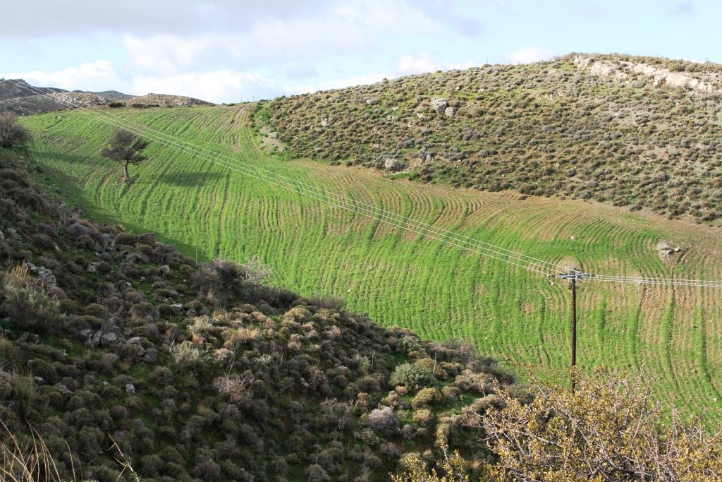
This technology consists of (a) ploughing the soil, (b) sowing the plants usually vetch or oat or in combination in November and (c) grazing the growing plants during spring. The main purpose of this technology is to increase the produced palatable biomass in a grazing land in which the biomass production is very low under natural conditions.
2.2 Description détaillée de la Technologie
Description:
The technology is applied on semi-arid areas of Asteroussia Mountains of Crete used as grazing land with an annual rainfall between 501-750 mm. These areas are usually highly degraded, characterized by steep mountainous slopes (31-60%). This technology was mainly found in shallow (depth: 21-50 cm), moderately fine textured soils which moderate concentrations of soil organic matter (1-3%). The stock breeders in the region use a special regime for transferring livestock grazing rights from the communities to individuals. Nowadays the off farm income of breeders is between 10-50% of their total income.
Looking back, in the early 1950s to the 1980s the Asteroussia Mountains were a livestock-specialized area. Livestock production was based on controlled summer grazing in the mountains and overwintering in the lowlands. After the early 1960s, the area increasingly felt the impact of agricultural mechanization and - by consequence - excessive under-occupied rural labor force, which led to disproportionate out-migration from the area. In areas where limited natural capital was already fully utilized, such as in Asteroussia Mountains, further growth through increasing flocks was only possible by importing fodder. In a parallel, increasing intensification of agriculture in the nearby Messara plain limited the opportunities for the tradition of transhumance. Throughout the mid-1980s–2010s the economy remained livestock-dominated but the population decline continued. However, the presence of foreign migrants offering cheap labor from the early 1990s onwards contributed to keep many farms active.
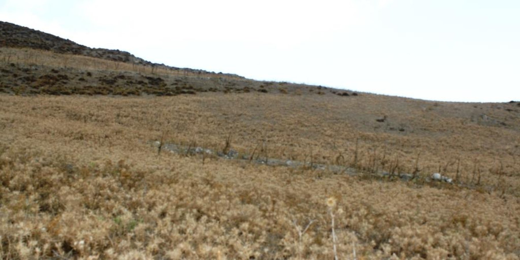
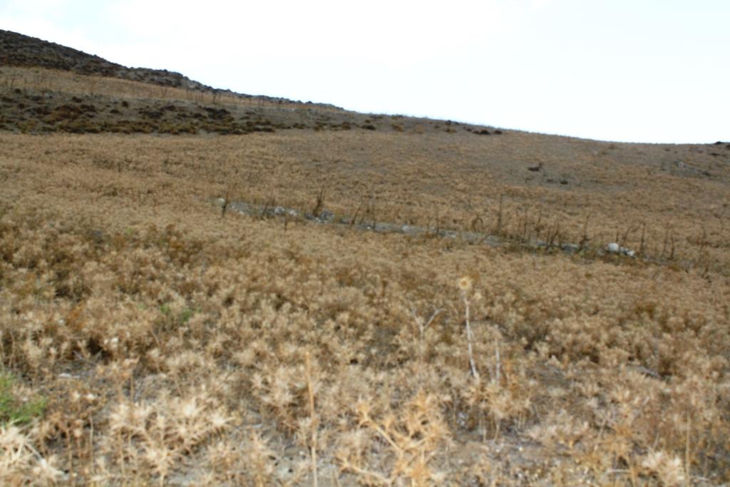
Coming back to the technology, it consists of: (a) clearing natural vegetation, usually perennial shrubs accompanied with annual plants including mainly grasses, (b) sowing of high value palatable plant species for animals such as oat, vetch, etc. during winter, (c) allowing plants to grow adequately, and (d) grazing by the animals mainly during spring for a period of about one month, and (e) keeping the land bare until next wet cultivation period starts. The purpose is to increase the available biomass for the grazing animals in areas of low productivity of natural vegetation suitable for them. The major activities consists of clearing the land, plowing usually by a bulldoze type tractor, sowing the seeds and adding appropriate fertilizers. However, the establishment of this technology may face problems in clearing natural vegetation, if the existing Greek institutional framework does not allow doing it. Land degradation and desertification are very frequent processes in semi-arid areas and both processes have been enhanced in the last decades by climatic variations and human activities. The EU-funded research project DESIRE in Eastern and Western Europe, Latin America, Africa and Asia have identified soil erosion, forest fires, and overgrazing among the most important causes of land degradation. The main benefit of this technology therefore is the increase in the amount of high quality palatable biomass for the grazing animals in degraded lands. Land users like this technology, if the number of animals is high, as without the technology they face problems of feeding them. However, such an action increases the cost of animal production such as milk. In addition, soil erosion problems are expected since land remains bare for some period of the year especially after sowing the plants.
2.3 Photos de la Technologie
Galerie Médias

Remarques générales concernant les photos:
Down-slope ploughing is more secure for the farmer and less energy consumption for the machine used.
2.5 Pays/ région/ lieux où la Technologie a été appliquée et qui sont couverts par cette évaluation
Pays:
Grèce
Région/ Etat/ Province:
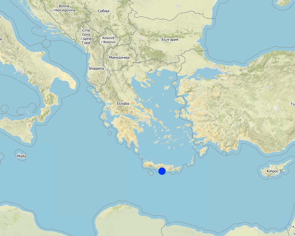
Crete, Heraklion province
Autres spécifications du lieu:
Asteroussia Mountain, Paranimfi
Spécifiez la diffusion de la Technologie:
- répartie uniformément sur une zone
S'il n'existe pas d'informations exactes sur la superficie, indiquez les limites approximatives de la zone couverte:
- < 0,1 km2 (10 ha)
Commentaires:
Isolated fields with relatively deep soils and low slope gradient
Map
×2.6 Date de mise en œuvre de la Technologie
Si l'année précise est inconnue, indiquez la date approximative: :
- il y a entre 10-50 ans
2.7 Introduction de la Technologie
Spécifiez comment la Technologie a été introduite: :
- dans le cadre d'un système traditionnel (> 50 ans)
Commentaires (type de projet, etc.) :
The technology continues to be applied since farmers are trying to produce more palatable biomass for the grazing animals as the productivity of the land with the natural vegetation is low.
3. Classification de la Technologie de GDT
3.1 Principal(aux) objectif(s) de la Technologie
- améliorer la production
- créer un impact économique positif
3.2 Type(s) actuel(s) d'utilisation des terres, là où la Technologie est appliquée

Pâturages
Pâturage extensif:
- Ranching
Pâturage intensif/ production fourragère :
- Prairies améliorées
Type d'animal:
- caprine
- ovins
Produits et services:
- viande
- lait
Commentaires:
Number of growing seasons per year: 1
Livestock density: 20-25 animals/ha
3.3 Est-ce que l’utilisation des terres a changé en raison de la mise en œuvre de la Technologie ?
Est-ce que l’utilisation des terres a changé en raison de la mise en œuvre de la Technologie ?
- Oui (Veuillez remplir les questions ci-après au regard de l’utilisation des terres avant la mise en œuvre de la Technologie)
Commentaires:
Natural vegetation consisting mainly of shruby vegetation.
3.4 Approvisionnement en eau
Approvisionnement en eau des terres sur lesquelles est appliquée la Technologie:
- pluvial
3.5 Groupe de GDT auquel appartient la Technologie
- pastoralisme et gestion des pâturages
3.6 Mesures de GDT constituant la Technologie

pratiques agronomiques
- A1: Couverture végétale/ du sol

pratiques végétales
- V2: Herbes et plantes herbacées pérennes
3.7 Principaux types de dégradation des terres traités par la Technologie

érosion hydrique des sols
- Wt: perte de la couche superficielle des sols (couche arable)/ érosion de surface
3.8 Prévention, réduction de la dégradation ou réhabilitation des terres dégradées
Spécifiez l'objectif de la Technologie au regard de la dégradation des terres:
- réduire la dégradation des terres
4. Spécifications techniques, activités, intrants et coûts de mise en œuvre
4.1 Dessin technique de la Technologie
Spécifications techniques (associées au dessin technique):
The technical specifications of the technology are known to almost all the people working on animal feeding. It requires a field of at least one hectare with the following soil characteristics: (a) soil depth of at least 30 cm, (b) soil texture medium to fine, (c) slope gradient less than 25%. In addition, the annual rainfall must be greater than 350 mm with an annual air temperature higher than 12° C.
Auteur:
Costas Kosmas
Date:
05/07/2017
4.2 Informations générales sur le calcul des intrants et des coûts
Spécifiez la manière dont les coûts et les intrants ont été calculés:
- par superficie de la Technologie
Indiquez la taille et l'unité de surface:
one hectare
Indiquez la monnaie utilisée pour le calcul des coûts:
- dollars américains
Indiquez le coût salarial moyen de la main d'œuvre par jour:
40
4.3 Activités de mise en place/ d'établissement
| Activité | Calendrier des activités (saisonnier) | |
|---|---|---|
| 1. | Clearing the field by mouldboard plough. | November |
4.4 Coûts et intrants nécessaires à la mise en place
| Spécifiez les intrants | Unité | Quantité | Coûts par unité | Coût total par intrant | % du coût supporté par les exploitants des terres | |
|---|---|---|---|---|---|---|
| Main d'œuvre | Clearing the field | person - days | 2,0 | 40,0 | 80,0 | 100,0 |
| Equipements | Tractor equiped with a mouldboard | 1 | 1,0 | 60,0 | 60,0 | 100,0 |
| Coût total de mise en place de la Technologie | 140,0 | |||||
| Coût total de mise en place de la Technologie en dollars américains (USD) | 140,0 | |||||
4.5 Activités d'entretien/ récurrentes
| Activité | Calendrier/ fréquence | |
|---|---|---|
| 1. | Ploughing | once per year |
| 2. | Fertilization | once per year |
| 3. | Sowing | once per year |
4.6 Coûts et intrants nécessaires aux activités d'entretien/ récurrentes (par an)
| Spécifiez les intrants | Unité | Quantité | Coûts par unité | Coût total par intrant | % du coût supporté par les exploitants des terres | |
|---|---|---|---|---|---|---|
| Main d'œuvre | Ploughing | person-days | 0,2 | 40,0 | 8,0 | 100,0 |
| Main d'œuvre | Sowing | person-days | 0,2 | 40,0 | 8,0 | 100,0 |
| Main d'œuvre | Fertilizing | person-days | 0,2 | 400,0 | 80,0 | 100,0 |
| Equipements | Tractor equiped with a mouldboard | 1 | 0,5 | 60,0 | 30,0 | 100,0 |
| Matériel végétal | Seed | Kg/ha | 250,0 | 0,2 | 50,0 | 100,0 |
| Engrais et biocides | Fertilization | Kg/ha | 350,0 | 0,4 | 140,0 | 100,0 |
| Coût total d'entretien de la Technologie | 316,0 | |||||
| Coût total d'entretien de la Technologie en dollars américains (USD) | 316,0 | |||||
4.7 Facteurs les plus importants affectant les coûts
Décrivez les facteurs les plus importants affectant les coûts :
Fertilizers and seeds
5. Environnement naturel et humain
5.1 Climat
Précipitations annuelles
- < 250 mm
- 251-500 mm
- 501-750 mm
- 751-1000 mm
- 1001-1500 mm
- 1501-2000 mm
- 2001-3000 mm
- 3001-4000 mm
- > 4000 mm
Spécifiez la pluviométrie moyenne annuelle (si connue), en mm:
670,00
Spécifications/ commentaires sur les précipitations:
Low-elevation areas receive an annual rainfall ranging between 500-750 mm, while the upper mountainous area (highest elevation: 1231 m at the sea level) receives up to 1250 mm of rain.
Indiquez le nom de la station météorologique de référence considérée:
Hellenic National Meteorological Service, station of Gortina
Zone agro-climatique
- semi-aride
The majority of the area is characterized by an average air temperature ranging between 15°C and 18°C. Rainfall is falling from late fall to middle spring. The ETo (Potential Evapotranspiration) is high receiving values up to 1650 mm.
5.2 Topographie
Pentes moyennes:
- plat (0-2 %)
- faible (3-5%)
- modéré (6-10%)
- onduleux (11-15%)
- vallonné (16-30%)
- raide (31-60%)
- très raide (>60%)
Reliefs:
- plateaux/ plaines
- crêtes
- flancs/ pentes de montagne
- flancs/ pentes de colline
- piémonts/ glacis (bas de pente)
- fonds de vallée/bas-fonds
Zones altitudinales:
- 0-100 m
- 101-500 m
- 501-1000 m
- 1001-1500 m
- 1501-2000 m
- 2001-2500 m
- 2501-3000 m
- 3001-4000 m
- > 4000 m
Indiquez si la Technologie est spécifiquement appliquée dans des:
- non pertinent
Commentaires et précisions supplémentaires sur la topographie:
Hilly areas of various slopes and landforms. The Technology is only suitable for slope gradients less than 25%.
5.3 Sols
Profondeur moyenne du sol:
- très superficiel (0-20 cm)
- superficiel (21-50 cm)
- modérément profond (51-80 cm)
- profond (81-120 cm)
- très profond (>120 cm)
Texture du sol (de la couche arable):
- moyen (limoneux)
- fin/ lourd (argile)
Texture du sol (> 20 cm sous la surface):
- moyen (limoneux)
- fin/ lourd (argile)
Matière organique de la couche arable:
- moyen (1-3%)
Si disponible, joignez une description complète du sol ou précisez les informations disponibles, par ex., type de sol, pH/ acidité du sol, capacité d'échange cationique, azote, salinité, etc.
These soils are characterized by a surface A-horizon usually 12-18 cm thick and an underlying cambic B-horizon. Leptosols or Cambisols are the dominant soil units in the area. Soils are mainly moderately fine-textured. The 15-30 cm soil depth class is dominant throughout the area. Relatively deep soils (class 30-60 cm) have been mapped in patches. Some of these areas are used as cropland and grazing land. Slope gradient ranges between 2% and 60%. The slope class 35-60% is the dominant class covering the 49% of the total land. The minimum soil depth necessary for the Technology is 30 cm.
5.4 Disponibilité et qualité de l'eau
Profondeur estimée de l’eau dans le sol:
> 50 m
Disponibilité de l’eau de surface:
faible/ absente
Qualité de l’eau (non traitée):
eau potable
La salinité de l'eau est-elle un problème? :
Non
La zone est-elle inondée?
Non
5.5 Biodiversité
Diversité des espèces:
- élevé
Diversité des habitats:
- moyenne
Commentaires et précisions supplémentaires sur la biodiversité:
The most important land cover types are schlerophyllous vegetation, transitional woodland-shrubs and sparsely vegetated areas covering the 88% of the total area. The rest of the area is covered by agricultural crops, mainly olive trees and cereals. The dominant woody plant species in the area include Olea sylvestris, Olea Europa, Salix alba (along watercourses), Pyrus amygdaliformis, Prunus webbii, Thymus capitatus, Salvia triloba, Flomis lanata, Flomis fruticosa, Sarcopoterium spinosum, Calicotome vilosa, Scilla maritime, Asfodelus aestivus, Euphorbia characias. Overgrazing coupled with frequent fires shaped the vegetation pattern in the area determining the predominance of the less palatable fire-tolerant plant species. The above-mentioned state of biodiversity existed before clearing the land even in degraded areas.
5.6 Caractéristiques des exploitants des terres appliquant la Technologie
Sédentaire ou nomade:
- Sédentaire
Orientation du système de production:
- exploitation mixte (de subsistance/ commerciale)
Revenus hors exploitation:
- 10-50% de tous les revenus
Niveau relatif de richesse:
- moyen
Individus ou groupes:
- individu/ ménage
Niveau de mécanisation:
- mécanisé/ motorisé
Genre:
- hommes
Age des exploitants des terres:
- personnes d'âge moyen
5.7 Superficie moyenne des terres utilisées par les exploitants des terres appliquant la Technologie
- < 0,5 ha
- 0,5-1 ha
- 1-2 ha
- 2-5 ha
- 5-15 ha
- 15-50 ha
- 50-100 ha
- 100-500 ha
- 500-1 000 ha
- 1 000-10 000 ha
- > 10 000 ha
Cette superficie est-elle considérée comme de petite, moyenne ou grande dimension (en se référant au contexte local)?
- moyenne dimension
5.8 Propriété foncière, droits d’utilisation des terres et de l'eau
Propriété foncière:
- état
- individu, avec titre de propriété
Droits d’utilisation des terres:
- communautaire (organisé)
Droits d’utilisation de l’eau:
- communautaire (organisé)
Commentaires:
Nowadays in Crete livestock grazing is allowed due to a special regime for transferring grazing rights from the communities to individuals (Papanastasis, 1993).
5.9 Accès aux services et aux infrastructures
santé:
- pauvre
- modéré
- bonne
éducation:
- pauvre
- modéré
- bonne
assistance technique:
- pauvre
- modéré
- bonne
emploi (par ex. hors exploitation):
- pauvre
- modéré
- bonne
marchés:
- pauvre
- modéré
- bonne
énergie:
- pauvre
- modéré
- bonne
routes et transports:
- pauvre
- modéré
- bonne
eau potable et assainissement:
- pauvre
- modéré
- bonne
services financiers:
- pauvre
- modéré
- bonne
6. Impacts et conclusions
6.1 Impacts sur site que la Technologie a montrés
Impacts socio-économiques
Production
production fourragère
Commentaires/ spécifiez:
Increase in biomass production for feeding the animals
production animale
Commentaires/ spécifiez:
In consequence of increased fodder production
Impacts écologiques
Cycle de l'eau/ ruissellement
ruissellement de surface
Commentaires/ spécifiez:
There are not available data on surface runoff for the area.
Sols
humidité du sol
Quantité avant la GDT:
-1
Quantité après la GDT:
1
perte en sol
Quantité avant la GDT:
1
Quantité après la GDT:
-1
Commentaires/ spécifiez:
Increase in soil erosion due to removal of natural vegetation
Biodiversité: végétale, animale
diversité végétale
Commentaires/ spécifiez:
Because the natural vegetation is cleared.
6.2 Impacts hors site que la Technologie a montrés
inondations en aval
Commentaires/ spécifiez:
The soil sediments are transported in the low land of Messara valley or into the sea.
6.3 Exposition et sensibilité de la Technologie aux changements progressifs et aux évènements extrêmes/catastrophes liés au climat (telles que perçues par les exploitants des terres)
Changements climatiques progressifs
Changements climatiques progressifs
| Saison | Augmentation ou diminution | Comment la Technologie fait-elle face à cela? | |
|---|---|---|---|
| températures annuelles | augmente | modérément |
6.4 Analyse coûts-bénéfices
Quels sont les bénéfices comparativement aux coûts de mise en place (du point de vue des exploitants des terres)?
Rentabilité à court terme:
positive
Rentabilité à long terme:
positive
Quels sont les bénéfices comparativement aux coûts d'entretien récurrents (du point de vue des exploitants des terres)?
Rentabilité à court terme:
positive
Rentabilité à long terme:
positive
6.5 Adoption de la Technologie
- > 50%
De tous ceux qui ont adopté la Technologie, combien d'entre eux l'ont fait spontanément, à savoir sans recevoir aucune incitation matérielle, ou aucune rémunération? :
- 91-100%
6.6 Adaptation
La Technologie a-t-elle été récemment modifiée pour s'adapter à l'évolution des conditions?
Non
6.7 Points forts/ avantages/ possibilités de la Technologie
| Points forts/ avantages/ possibilités du point de vue de l'exploitant des terres |
|---|
| The advantage of the technology is the increase of biomass production for feeding the animals in areas of low natural grass production. |
| Points forts/ avantages/ possibilités du point de vue du compilateur ou d'une autre personne ressource clé |
|---|
| The advantage of the technology is the increase of biomass production for feeding the animals in areas of low natural grass production. |
6.8 Faiblesses/ inconvénients/ risques de la Technologie et moyens de les surmonter
| Faiblesses/ inconvénients/ risques du point de vue de l’exploitant des terres | Comment peuvent-ils être surmontés? |
|---|---|
| Decline of biodiversity | |
| Create some problems of soil erosion during installation |
| Faiblesses/ inconvénients/ risques du point de vue du compilateur ou d'une autre personne ressource clé | Comment peuvent-ils être surmontés? |
|---|---|
| Decline of biodiversity | |
| Soil erosion at the initial stage of ploughing the land | From the increase in soil plant cover |
7. Références et liens
7.1 Méthodes/ sources d'information
- visites de terrain, enquêtes sur le terrain
Mapping the whole area in a scale 1:30,000
- interviews/entretiens avec les exploitants des terres
Land users have complete questionnaires during the execution of the EU research project LEDDRA
Quand les données ont-elles été compilées (sur le terrain)?
14/09/2016
7.2 Références des publications disponibles
Titre, auteur, année, ISBN:
Costas Kosmas, Vassilis Detsis, Mina Karamesouti, Kate Kounalaki, Penny Vassiliou and Luca Salvati. 2015. Exploring Long-Term Impact of Grazing Management on Land Degradation in the Socio-Ecological System of Asteroussia Mountains, Greece Land 4:541-559 doi:10.3390/land4030541.
Disponible à partir d'où? Coût?
URL: http://www.mdpi.com/2073-445X/4/3/541/htm
Titre, auteur, année, ISBN:
Papanastasis, V., 1993. Legal status of land tenure and use and its implication for open landscapes of western Crete. Landscape and Urban Planning, 24, 273-277.
7.3 Liens vers les informations pertinentes en ligne
Titre/ description:
European framework EC-DG RTD, 7th Framework Research Programme (sub-priority ENV-2009-2.1.3.2), Research on Desertification Process and Land Degradation, project LEDDRA (243857): Land and Ecosystem Degradation and Desertification: Assessing the Fit of Responses.
Liens et modules
Développer tout Réduire toutLiens
Aucun lien
Modules
Aucun module trouvé