Stone lines [ອູເຈນດາ]
- ການສ້າງ:
- ປັບປູງ:
- ຜູ້ສັງລວມຂໍ້ມູນ: Wilson Bamwerinde
- ບັນນາທິການ: –
- ຜູ້ທົບທວນຄືນ: Fabian Ottiger
Ennyiriri z'amayinja eziziyiza ettaka okutwalibwa enkuba (Luganda)
technologies_1589 - ອູເຈນດາ
ເບິ່ງພາກສ່ວນ
ຂະຫຍາຍທັງໝົດ ຍຸບທັງໝົດ1. ຂໍ້ມູນທົ່ວໄປ
1.2 ຂໍ້ມູນ ການຕິດຕໍ່ພົວພັນ ຂອງບຸກຄົນທີ່ສໍາຄັນ ແລະ ສະຖາບັນ ທີ່ມີສ່ວນຮ່ວມ ໃນການປະເມີນເອກກະສານ ເຕັກໂນໂລຢີ
ຜຸ້ຊ່ຽວຊານ ດ້ານການຄຸ້ມຄອງ ທີ່ດິນແບບຍືນຍົງ:
ຜຸ້ຊ່ຽວຊານ ດ້ານການຄຸ້ມຄອງ ທີ່ດິນແບບຍືນຍົງ:
ຊື່ໂຄງການ ທີ່ອໍານວຍຄວາມສະດວກ ໃນການສ້າງເອກກະສານ/ປະເມີນ ເຕັກໂນໂລຢີ (ຖ້າກ່ຽວຂ້ອງ)
The Transboundary Agro-ecosystem Management Project for the Kagera River Basin (GEF-FAO / Kagera TAMP )ຊື່ສະຖາບັນ (ຫຼາຍສະຖາບັນ) ທີ່ອໍານວຍຄວາມສະດວກ ໃນການສ້າງເອກກະສານ / ປະເມີນ ເຕັກໂນໂລຢີ (ຖ້າກ່ຽວຂ້ອງ)
Food and Agriculture Organization of the United Nations (FAO) - ອີຕາລີ1.3 ເງື່ອນໄຂ ກ່ຽວກັບ ການນໍາໃຊ້ຂໍ້ມູນເອກະສານ ທີ່ສ້າງຂື້ນ ໂດຍຜ່ານ ອົງການພາບລວມຂອງໂລກ ທາງດ້ານແນວທາງ ແລະ ເຕັກໂນໂລຢີ ຂອງການອານຸລັກ ທໍາມະຊາດ (WOCAT)
ເມື່ອໃດທີ່ໄດ້ສັງລວມຂໍ້ມູນ (ຢູ່ພາກສະໜາມ)?
05/12/2013
ຜູ້ປ້ອນຂໍ້ມູນ ແລະ ບຸກຄົນສຳຄັນ ທີ່ໃຫ້ຂໍ້ມູນ (ຫຼາຍ) ຍິນຍອມ ຕາມເງື່ອນໄຂ ໃນການນຳໃຊ້ຂໍ້ມູນ ເພື່ອສ້າງເປັນເອກກະສານຂອງ WOCAT:
ແມ່ນ
1.5 ອ້າງອີງເຖິງແບບສອບສອບຖາມ (ຫຼາຍ) ທາງດ້ານວິທີການ ໃນການຄຸ້ມຄອງ ທີ່ດິນແບບຍືນຍົງ

FFS/SLM Community Initiative [ອູເຈນດາ]
Farmers are organized to promote adoption of sustainable land management best practices within the community
- ຜູ້ສັງລວມຂໍ້ມູນ: Wilson Bamwerinde
2. ການອະທິບາຍ ເຕັກໂນໂລຢີ ຂອງການຄຸ້ມຄອງ ທີ່ດິນແບບຍືນຍົງ
2.1 ຄໍາອະທິບາຍສັ້ນຂອງ ເຕັກໂນໂລຢີ
ການກຳໜົດຄວາມໝາຍ ຂອງເຕັກໂນໂລຢີ:
Stone lines are built along a contour to control soil erosion on a degraded steep slope.
2.2 ການອະທິບາຍ ລາຍລະອຽດ ຂອງເຕັກໂນໂລຢີ
ການພັນລະນາ:
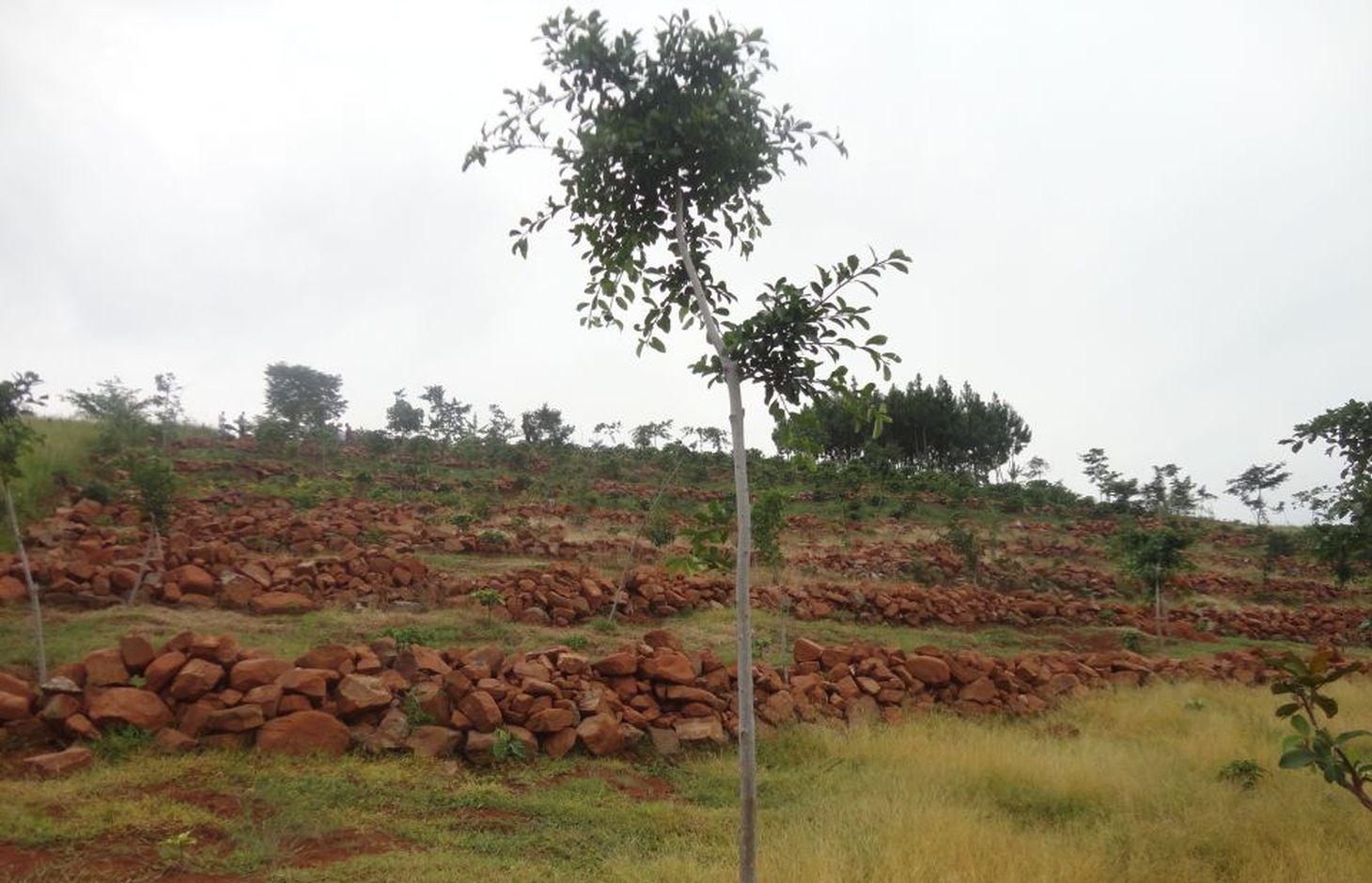
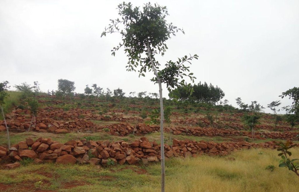
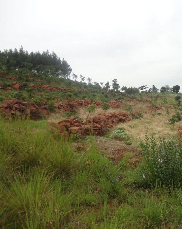
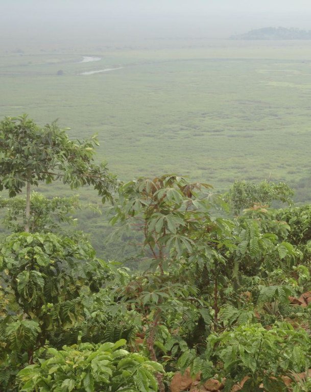
Most of the traditional cropland in Rakai District is fairly flat. However, there are many hectares of very steep, stony, wind-swept slopes facing the Kagera River Valley and Lake Victoria. These slopes have been degraded for a long time because when it rains the runoff is very fast and carries away soil and crops. The swampy Kagera river flood plains below the slopes are fertile because of the deposits of top soil carried from the slopes. Over the last 3 years, farmers have changed from the traditional farming practice where cultivation was done with little or no protection of soil and water movement on the steep slopes to using stone lines along a contour. The stone lines are arranged along the contour to act as a barrier that slows down the speed of water and soil, improve infiltration, mitigate land slides and trap sediment thereby reducing the extent of erosion.
Purpose of the Technology: The technical objective of stone lines is to minimize water and soil movement down the slope and, over time, enable the building of a terrace from the accumulation of soil on the upper side of the barrier.
Establishment / maintenance activities and inputs: The stones are arranged along the contour, guided by a rope. The contour is determined using an A-Frame. The other tools required to establish stone lines are hand hoes, pick axes, and pangas. Establishment requires a lot of labor by which the following activities are accomplished: (i) stones exposed by decades of runoff on hillsides are dug up, collected and placed along contours in a field 200 m by 300 m. The width of each stone line is 0.4 m to 0.6 m and 0.5 m high. The length is dependent on the size of the field across the slope. The spacing from one line to another is 8 m to 12 m, depending on the steepness of the slope. (ii) The exposed sandy loam top soil is very dry and dusty even in the rainy season. Digging with hand hoes loosens the soil. (iii) Following the contour, circular pits of 0.45 m diameter and 0.3 m depth are dug 1.50 m apart, in the middle of every 2 stone lines. In these holes, robusta coffee seedlings are planted. (iv) Beans may be planted throughout the field as a cover crop. The farmer field school (FFS) approach is used because many farmers participate together in completing the establishment tasks. The stone lines are maintained by ensuring that stones which move off the main line are put back and the weeds which grow among the stones are removed to avoid competition with the main crops.
Natural / human environment: There is no known threat to stone lines once they have been established. The runoff cannot gather enough speed between the lines to sweep the stones away because of the short distance. The main offsite benefit is that sediment deposits and water runoff do not destroy crops in the valley below and the Kagera River is protected from silting.
2.3 ຮູບພາບຂອງເຕັກໂນໂລຢີ
2.5 ປະເທດ / ເຂດ / ສະຖານທີ່ບ່ອນທີ່ ເຕັກໂນໂລຢີ ໄດ້ຮັບການນໍາໃຊ້ ແລະ ທີ່ຖືກປົກຄຸມດ້ວຍການປະເມີນຜົນ
ປະເທດ:
ອູເຈນດາ
ພາກພື້ນ / ລັດ / ແຂວງ:
Uganda
ຂໍ້ມູນເພີ່ມເຕີມຂອງສະຖານທີ່:
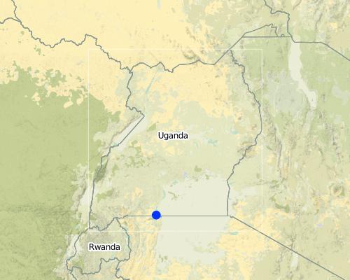
Rakai District
ຄວາມຄິດເຫັນ:
Boundary points of the Technology area: -0.96681 31.69066; -0.96706 31.69111; -0.96717 31.69033; -0.96757 31.69038; -0.96774 31.69073
Map
×2.6 ວັນທີໃນການຈັດຕັ້ງປະຕິບັດ
ຖ້າຫາກວ່າ ບໍ່ຮູ້ຈັກ ປີທີ່ຊັດເຈນ ແມ່ນໃຫ້ປະມານ ວັນທີເອົາ:
- ຕໍ່າກວ່າ 10 ປີ ຜ່ານມາ (ມາເຖິງປະຈຸບັນ)
2.7 ການນໍາສະເໜີ ເຕັກໂນໂລຢີ
ໃຫ້ລະບຸ ເຕັກໂນໂລຢີ ໄດ້ຖືກຈັດຕັ້ງປະຕິບັດຄືແນວໃດ?
- ໂດຍຜ່ານໂຄງການ / ການຊ່ວຍເຫຼືອຈາກພາຍນອກ
ຄວາມຄິດເຫັນ (ປະເພດ ໂຄງການ ແລະ ອື່ນໆ):
Introduced and supported by Kagera TAMP as an SLM technology
3. ການໃຈ້ແຍກ ເຕັກໂນໂລຢີ ໃນການຄຸ້ມຄອງ ດິນແບບຍືນຍົງ
3.1 ຈຸດປະສົງຫຼັກ (ຫຼາຍ) ຂອງເຕັກໂນໂລຢີ
- ຫຼຸດຜ່ອນ, ປ້ອງກັນ, ຟື້ນຟູ ການເຊື່ອມໂຊມຂອງດິນ
3.2 ປະເພດການນໍາໃຊ້ທີ່ດິນ ໃນປະຈຸບັນ() ທີ່ເຕັກໂນໂລຢີ ໄດ້ຖືກນໍາໃຊ້

ດິນທີ່ປູກພືດ
- ພືດຢືນຕົ້ນ (ບໍ່ແມ່ນໄມ້)
- ເປັນໄມ້ຢືນຕົ້ນ ແລະ ໄມ້ພຸ່ມ ຈາກການປູກພືດ
ການປູກພືດຫຼັກ (ທີ່ສາມາດສ້າງລັບຮັບ ເປັນເງິນສົດ ແລະ ເປັນພືດສະບຽງອາຫານ):
Major cash crop perennial (non-woody) cropping: Banana
Major food crop perennial (non-woody) cropping: Potatoes
Major other crop perennial (non-woody) cropping: Maize, beans
Major cash crop tree and shrub cropping: Coffee
ຄວາມຄິດເຫັນ:
Major land use problems (compiler’s opinion): Surface soil erosion is rampant, carrying away all the top soil with valuable nutrients towards to the marshes below.
Major land use problems (land users’ perception): The land is infertile and no crops can grow in that area.
3.3 ຂໍ້ມູນເພີ່ມເຕີມກ່ຽວກັບການນໍາໃຊ້ທີ່ດິນ
ຈໍານວນ ລະດູການ ປູກໃນປີໜຶ່ງ:
- 2
ລະບຸ ຊະນິດ:
Longest growing period in days: 150 Longest growing period from month to month: February to June Second longest growing period in days: 120 Second longest growing period from month to month: September to November
3.4 ການນໍາໃຊ້ເຕັກໂນໂລຢີ ທີ່ຢູ່ໃນກຸ່ມການຄຸ້ມຄອງ ທີ່ດິນແບບຍືນຍົງ
- ມາດຕະການ ຕັດຂວາງ ກັບຄວາມຄ້ອຍຊັນ
3.5 ການຂະຫຍາຍເຕັກໂນໂລຢີ
ຄວາມຄິດເຫັນ:
Total area covered by the SLM Technology is 0.06 m2.
Currently about 3 ha but the area is still being expanded by the farmers.
3.6 ມາດຕະການ ການຄຸ້ມຄອງ ທີ່ດິນແບບຍືນຍົງ ປະກອບດ້ວຍ ເຕັກໂນໂລຢີ

ມາດຕະການໂຄງສ້າງ
- S6: ແລວກັນເຈື່ອນ, ຮົ້ວ
ຄວາມຄິດເຫັນ:
Main measures: structural measures
3.7 ປະເພດດິນເຊື່ອມໂຊມ ຫຼັກທີ່ໄດ້ນໍາໃຊ້ ເຕັກໂນໂລຢີ

ດິນເຊາະເຈື່ອນ ໂດຍນໍ້າ
- Wt: ການສູນເສຍຊັ້ນໜ້າດິນ / ການເຊາະເຈື່ອນຜິວໜ້າດິນ
- Wo: ຜົນກະທົບ ຂອງການເຊື່ອມໂຊມ ຕໍ່ພື້ນທີ່ພາຍນອກ
ຄວາມຄິດເຫັນ:
Main type of degradation addressed: Wt: loss of topsoil / surface erosion
Secondary types of degradation addressed: Wo: offsite degradation effects
Main causes of degradation: deforestation / removal of natural vegetation (incl. forest fires) (Deforestation for fuel wood and agricultural land), education, access to knowledge and support services (inadequate agricultural extension services)
3.8 ການປ້ອງກັນ, ການຫຼຸດຜ່ອນ, ຫຼືການຟື້ນຟູຂອງການເຊື່ອມໂຊມຂອງດິນ
ໃຫ້ລະບຸ ເປົ້າໝາຍ ເຕັກໂນໂລຢີ ທີ່ພົວພັນ ກັບຄວາມເຊື່ອມໂຊມຂອງດິນ:
- ຫຼຸດຜ່ອນການເຊື່ອມໂຊມຂອງດິນ
- ການຟື້ນຟູ / ຟື້ນຟູດິນທີ່ຊຸດໂຊມ
ຄວາມຄິດເຫັນ:
Main goals: mitigation / reduction of land degradation
Secondary goals: rehabilitation / reclamation of denuded land
4. ຂໍ້ກໍາໜົດ, ກິດຈະກໍາການປະຕິບັດ, ວັດຖຸດິບ, ແລະຄ່າໃຊ້ຈ່າຍ
4.1 ເຕັກນິກ ໃນການແຕ້ມແຜນວາດ ເຕັກໂນໂລຢີ
4.2 ການແຕ້ມແຜນວາດອະທິບາຍເຕັກນິກ
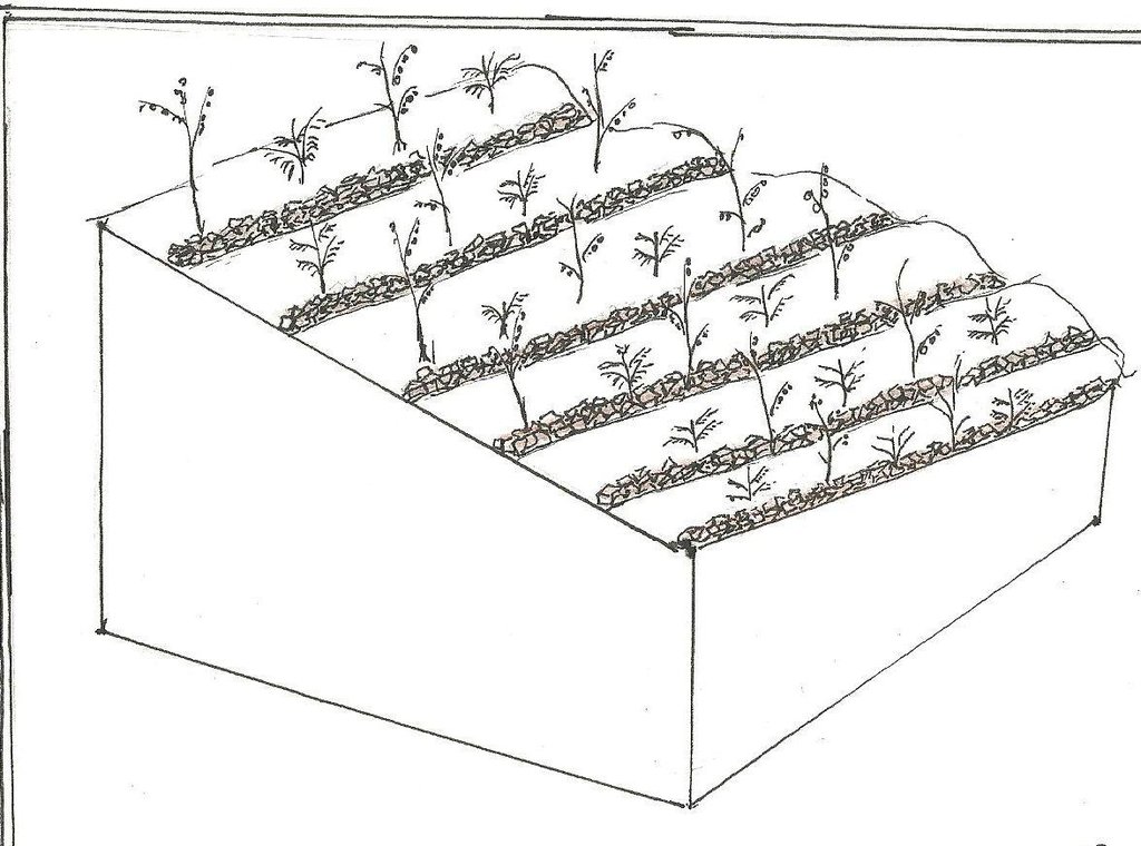
Stone lines on a steep slope. In between is a young coffee plantation.
Location: Katongero. Rakai District
Date: 5-DEC-2013
Technical knowledge required for field staff / advisors: moderate (Technical skill required is keeping the line on the contour)
Technical knowledge required for land users: low (No prior knowledge required)
Main technical functions: control of dispersed runoff: impede / retard, increase of infiltration, sediment retention / trapping, sediment harvesting
Secondary technical functions: reduction of slope length, water harvesting / increase water supply
Wall/ barrier
Vertical interval between structures (m): 3
Spacing between structures (m): n/a
Depth of ditches/pits/dams (m): n/a
Width of ditches/pits/dams (m): n/a
Length of ditches/pits/dams (m): n/a
Height of bunds/banks/others (m): 0.3
Width of bunds/banks/others (m): 0.3
Length of bunds/banks/others (m): 300
Construction material (stone): Big and small stones piled to 0.3 m high, 300 m along a contour
Slope (which determines the spacing indicated above): 38-45%
Lateral gradient along the structure: < 1%
4.3 ຂໍ້ມູນທົ່ວໄປກ່ຽວກັບການຄິດໄລ່ປັດໃຈຂາເຂົ້າໃນການຜະລິດ ແລະ ມູນຄ່າອື່ນໆ
ສະກຸນເງິນອື່ນໆ / ປະເທດອື່ນໆ (ລະບຸ):
UGX
ລະບຸ ອັດຕາແລກປ່ຽນ ຈາກໂດລາ ເປັນເງິນຕາທ້ອງຖີ່ນ (ຖ້າກ່ຽວຂ້ອງ): 1 ໂດລາ =:
2500.0
ລະບຸ ຄ່າຈ້າງ ຄ່າແຮງງານສະເລ່ຍ ຕໍ່ ວັນ:
10000.00
4.4 ການສ້າງຕັ້ງກິດຈະກໍາ
| ກິດຈະກໍາ | ປະເພດ ມາດຕະການ | ໄລຍະເວລາ | |
|---|---|---|---|
| 1. | Collection and laying of stones | ໂຄງສ້າງ | Dry season |
4.5 ຕົ້ນທຶນ ແລະ ປັດໄຈຂາເຂົ້າທີ່ຈໍາເປັນໃນຈັດຕັ້ງປະຕິບັດ
| ລະບຸ ປັດໃຈ ນໍາເຂົ້າ ໃນການຜະລີດ | ຫົວໜ່ວຍ | ປະລິມານ | ຕົ້ນທຶນ ຕໍ່ຫົວໜ່ວຍ | ຕົ້ນທຶນທັງໝົດ ຂອງປັດໃຈຂາເຂົ້າ ໃນການຜະລິດ | % ຂອງຕົ້ນທຶນທັງໝົດ ທີ່ຜູ້ນໍາໃຊ້ທີ່ດິນ ໃຊ້ຈ່າຍເອງ | |
|---|---|---|---|---|---|---|
| ແຮງງານ | Labour | ha | 1.0 | 1200.0 | 1200.0 | 100.0 |
| ອຸປະກອນ | Tools | ha | 1.0 | 60.0 | 60.0 | 100.0 |
| ຕົ້ນທຶນທັງໝົດ ໃນການຈັດຕັ້ງປະຕິບັດ ເຕັກໂນໂລຢີ | 1260.0 | |||||
ຄວາມຄິດເຫັນ:
Duration of establishment phase: 12 month(s)
4.6 ບໍາລຸງຮັກສາ / ແຜນຈັດຕັ້ງປະຕິບັດ ກິດຈະກໍາ
| ກິດຈະກໍາ | ປະເພດ ມາດຕະການ | ໄລຍະເວລາ / ຄວາມຖີ່ | |
|---|---|---|---|
| 1. | Repair of lines | ໂຄງສ້າງ | wet season |
4.7 ຄ່າໃຊ້ຈ່າຍ ແລະ ປັດໄຈນໍາເຂົ້າທີ່ຈໍາເປັນສໍາລັບການບໍາລຸງຮັກສາກິດຈະກໍາ / ແຜນປະຕິບັດ (ຕໍ່ປີ)
| ລະບຸ ປັດໃຈ ນໍາເຂົ້າ ໃນການຜະລີດ | ຫົວໜ່ວຍ | ປະລິມານ | ຕົ້ນທຶນ ຕໍ່ຫົວໜ່ວຍ | ຕົ້ນທຶນທັງໝົດ ຂອງປັດໃຈຂາເຂົ້າ ໃນການຜະລິດ | % ຂອງຕົ້ນທຶນທັງໝົດ ທີ່ຜູ້ນໍາໃຊ້ທີ່ດິນ ໃຊ້ຈ່າຍເອງ | |
|---|---|---|---|---|---|---|
| ແຮງງານ | Labour | ha | 1.0 | 120.0 | 120.0 | 100.0 |
| ຕົ້ນທຶນທັງໝົດ ທີ່ໃຊ້ໃນການບໍາລຸງຮັກສາ ເຕັກໂນໂລຢີ | 120.0 | |||||
ຄວາມຄິດເຫັນ:
Machinery/ tools: n/a
The calculations reflect costs of establishing the technology on a steep slope (38% to 45%) in December of 2013.
4.8 ປັດໄຈ ທີ່ສໍາຄັນ ທີ່ສົ່ງຜົນກະທົບ ຕໍ່ຄ່າໃຊ້ຈ່າຍ
ໃຫ້ອະທິບາຍ ປັດໃຈ ທີ່ສົ່ງຜົນກະທົບ ຕໍ່ຕົ້ນທຶນ ໃນການຈັດຕັ້ງປະຕິບັດ:
Labor is the factor that influences costs. Digging up and carrying stones up and across slopes is a labor intensive activity.
5. ສະພາບແວດລ້ອມທໍາມະຊາດ ແລະ ມະນຸດ
5.1 ອາກາດ
ປະລິມານນໍ້າຝົນປະຈໍາປີ
- < 250 ມີລິແມັດ
- 251-500 ມີລິແມັດ
- 501-750 ມີລິແມັດ
- 751-1,000 ມີລິແມັດ
- 1,001-1,500 ມີລິແມັດ
- 1,501-2,000 ມີລິແມັດ
- 2,001-3,000 ມີລິແມັດ
- 3,001-4,000 ມີລິແມັດ
- > 4,000 ມີລິແມັດ
ຂໍ້ມູນສະເພາະ / ຄວາມເຫັນກ່ຽວກັບ ປະລິມານນໍ້າຝົນ:
1501-2000 mm (Ranked 1, 1950 mm)
1001-1500 mm (Ranked 2, To a limited extend)
ເຂດສະພາບອາກາດກະສິກໍາ
- ຄວາມຊຸ່ມ
Thermal climate class: tropics. LGP >270 days
5.2 ພູມິປະເທດ
ຄ່າສະເລ່ຍ ຄວາມຄ້ອຍຊັນ:
- ພື້ນທີ່ຮາບພຽງ (0-2%)
- ອ່ອນ (3-5 %)
- ປານກາງ (6-10 %)
- ມ້ວນ (11-15 %)
- ເນີນ(16-30%)
- ໍຊັນ (31-60%)
- ຊັນຫຼາຍ (>60%)
ຮູບແບບຂອງດິນ:
- ພູພຽງ / ທົ່ງພຽງ
- ສັນພູ
- ເປີ້ນພູ
- ເນີນພູ
- ຕີນພູ
- ຮ່ອມພູ
ເຂດລະດັບສູງ:
- 0-100 ແມັດ a.s.l.
- 101-500 ແມັດ a.s.l.
- 501-1,000 ແມັດ a.s.l.
- 1,001-1,500 ແມັດ a.s.l.
- 1,501-2,000 ແມັດ a.s.l.
- 2,001-2,500 ແມັດ a.s.l.
- 2,501-3,000 ແມັດ a.s.l.
- 3,001-4,000 ແມັດ a.s.l.
- > 4,000 ແມັດ a.s.l.
ໃຫ້ລະບຸ ເຕັກໂນໂລຢີ ທີ່ໄດ້ຖືກນຳໃຊ້:
- ລັກສະນະກີ່ວ
ຄຳເຫັນ ແລະ ຂໍ້ມູນສະເພາະ ເພີ່ມເຕີມ ກ່ຽວກັບ ພູມີປະເທດ:
Altitudinal zone: 1001-1500 m a.s.l. (1270 m to 1300 m a.s.l.)
Slopes on average: Steep (ranked 1, the slopes of Rakai district where the technology is applied are steep) and moderate (ranked 2, to a limited extent, towards the top of the hill)
5.3 ດິນ
ຄວາມເລິກ ຂອງດິນສະເລ່ຍ:
- ຕື້ນຫຼາຍ (0-20 ຊັງຕີແມັດ)
- ຕື້ນ (21-50 ຊຕມ)
- ເລີກປານກາງ (51-80 ຊຕມ)
- ເລິກ (81-120 ຊມ)
- ເລິກຫຼາຍ (> 120 cm)
ເນື້ອດິນ (ໜ້າດິນ):
- ປານກາງ (ດິນໜຽວ, ດິນໂຄນ)
ຊັ້ນອິນຊີວັດຖຸ ເທິງໜ້າດິນ:
- ຕໍາ່ (<1 %)
ຖ້າເປັນໄປໄດ້ ແມ່ນໃຫ້ຕິດຄັດ ການພັນລະນາດິນ ຫຼື ຂໍ້ມູນສະເພາະຂອງດິນ, ຕົວຢ່າງ, ຄຸນລັກສະນະ ປະເພດຂອງດິນ, ຄ່າຄວາມເປັນກົດ / ເປັນດ່າງຂອງດິນ, ສານອາຫານ, ດິນເຄັມ ແລະ ອື່ນໆ.
Soil fertility: Medium
Soil drainage/infiltration: Good
Soil water storage capacity: Low
5.4 ມີນໍ້າ ແລະ ຄຸນນະພາບ
ລະດັບ ນໍ້າໃຕ້ດິນ:
> 50 ແມັດ
ການມີນໍ້າ ເທິງໜ້າດິນ:
ປານກາງ
ຄຸນນະພາບນໍ້າ (ບໍ່ມີການບໍາບັດ):
ບໍ່ມີນໍ້າດື່ມ (ຮຽກຮ້ອງໃຫ້ມີການບຳບັດນ້ຳ)
5.5 ຊີວະນາໆພັນ
ຄວາມຫຼາກຫຼາຍ ທາງສາຍພັນ:
- ຕໍ່າ
5.6 ຄຸນລັກສະນະ ຂອງຜູ້ນໍາໃຊ້ທີ່ດິນ ທີ່ໄດ້ນໍາໃຊ້ເຕັກໂນໂລຢີ
ລະບົບ ການຕະຫຼາດ ແລະ ຜົນຜະລິດ:
- ກຸ້ມຕົນເອງ (ພໍພຽງ)
ລາຍຮັບ ທີ່ບໍ່ໄດ້ມາຈາກ ການຜະລິດ ກະສິກໍາ:
- ໜ້ອຍກ່ວາ 10 % ຂອງລາຍຮັບທັງໝົດ
ລະດັບຄວາມຮັ່ງມີ:
- ສະເລ່ຍ
ບຸກຄົນ ຫຼື ກຸ່ມ:
- ບຸກຄົນ / ຄົວເຮືອນ
ລະດັບ ການຫັນເປັນກົນຈັກ:
- ການໃຊ້ແຮງງານຄົນ
ເພດ:
- ຜູ້ຍິງ
- ຜູ້ຊາຍ
ໃຫ້ລະບຸ ຄຸນລັກສະນະ ຂອງຜູ້ນໍາໃຊ້ທີ່ດິນ:
Land users applying the Technology are mainly common / average land users
Difference in the involvement of women and men: Men and women work together
Population density: 50-100 persons/km2
Annual population growth: 2% - 3%
and own 20% of the land.
and own 20% of the land.
70% of the land users are average wealthy and own 50% of the land (All land users currently applying the technology are average users).
and own 10% of the land.
Off-farm income specification: Farming is mostly subsistence
Level of mechanization: Manual work (no other form is used in the area)
Market orientation: Subsistence (mostly)
5.7 ພື້ນທີ່ສະເລ່ຍຂອງທີ່ດິນ ຫຼື ເຊົ່າໂດຍຜູ້ໃຊ້ທີ່ດິນການນໍາໃຊ້ ເຕັກໂນໂລຢີ
- <0.5 ເຮັກຕາ
- 0.5-1 ເຮັກຕາ
- 1-2 ເຮັກຕາ
- 2-5 ເຮັກຕາ
- 5-15 ເຮັກຕາ
- 15-50 ເຮັກຕາ
- 50-100 ເຮັກຕາ
- 100-500 ເຮັກຕາ
- 500-1,000 ເຮັກຕາ
- 1,000-10,000 ເຮັກຕາ
- > 10,000 ເຮັກຕາ
ຖືໄດ້ວ່າ ເປັນຂະໜາດນ້ອຍ, ກາງ ຫຼື ໃຫຍ່ (ອີງຕາມເງື່ອນໄຂ ສະພາບຄວາມເປັນຈິງ ຂອງທ້ອງຖີ່ນ)? :
- ຂະໜາດນ້ອຍ
ຄວາມຄິດເຫັນ:
Average area of land owned or leased by land users applying the Technology: Also 1-2 ha and 5-15 ha (both ranked 2)
5.8 ເຈົ້າຂອງທີ່ດິນ, ສິດໃຊ້ທີ່ດິນ, ແລະ ສິດທິການນໍາໃຊ້ນໍ້າ
ເຈົ້າຂອງດິນ:
- ບຸກຄົນ, ບໍ່ມີຕໍາແໜ່ງ
ສິດທິ ໃນການນໍາໃຊ້ທີ່ດິນ:
- ບຸກຄົນ
ສິດທິ ໃນການນໍາໃຊ້ນໍ້າ:
- ເປີດກວ້າງ (ບໍ່ມີການຈັດຕັ້ງ)
5.9 ການເຂົ້າເຖິງການບໍລິການ ແລະ ພື້ນຖານໂຄງລ່າງ
ສຸຂະພາບ:
- ທຸກຍາກ
- ປານກາງ
- ດີ
ການສຶກສາ:
- ທຸກຍາກ
- ປານກາງ
- ດີ
ການຊ່ວຍເຫຼືອ ດ້ານວິຊາການ:
- ທຸກຍາກ
- ປານກາງ
- ດີ
ການຈ້າງງານ (ຕົວຢ່າງ, ການເຮັດກິດຈະກໍາອື່ນ ທີ່ບໍ່ແມ່ນ ການຜະລິດກະສິກໍາ):
- ທຸກຍາກ
- ປານກາງ
- ດີ
ຕະຫຼາດ:
- ທຸກຍາກ
- ປານກາງ
- ດີ
ພະລັງງານ:
- ທຸກຍາກ
- ປານກາງ
- ດີ
ຖະໜົນຫົນທາງ ແລະ ການຂົນສົ່ງ:
- ທຸກຍາກ
- ປານກາງ
- ດີ
ການດື່ມນໍ້າ ແລະ ສຸຂາພິບານ:
- ທຸກຍາກ
- ປານກາງ
- ດີ
ການບໍລິການ ທາງດ້ານການເງິນ:
- ທຸກຍາກ
- ປານກາງ
- ດີ
6. ຜົນກະທົບ ແລະ ລາຍງານສະຫຼຸບ
6.1 ການສະແດງຜົນກະທົບ ພາຍໃນພື້ນທີ່ ທີ່ໄດ້ຈັດຕັ້ງປະຕິບັດ ເຕັກໂນໂລຢີ
ຜົນກະທົບທາງເສດຖະກິດສັງຄົມ
ການຜະລິດ
ການຜະລິດພືດ
ເນື້ອທີ່ການຜະລິດ
ລາຍໄດ້ ແລະ ຄ່າໃຊ້ຈ່າຍ
ລາຍຮັບ ຈາກການຜະລີດ
ມີວຽກໜັກ
ຄວາມຄິດເຫັນ / ລະບຸແຈ້ງ:
The hard labor is a challenge to women and children who play a major role in cultivation
ຜົນກະທົບດ້ານວັດທະນາທໍາສັງຄົມ
ສະຖາບັນ ການຈັດຕັ້ງຊຸມຊົນ
ການຫຼຸດຜ່ອນ ຂໍ້ຂັດແຍ່ງ
Improved livelihoods and human well-being
ຄວາມຄິດເຫັນ / ລະບຸແຈ້ງ:
There is more arable land, reducing pressure on land and generally improving productivity.
ຜົນກະທົບຕໍ່ລະບົບນິເວດ
ວົງຈອນນໍ້າ / ນໍ້າ
ການໄຫຼ ຂອງນໍ້າໜ້າດິນ
ດິນ
ຄວາມຊຸ່ມຂອງດິນ
ການສູນເສຍດິນ
ອິນຊີວັດຖຸໃນດິນ / ຢູ່ລຸ່ມຊັ້ນດິນ C
ຊີວະນານາພັນ: ສັດ, ພືດ
ມວນຊີວະພາບ / ຢູ່ເທິງຊັ້ນດິນ C
ຄວາມຫຼາກຫຼາຍຂອງພືດ
ການຄວບຄຸມສັດຕູພືດ / ພະຍາດ
ຄວາມຄິດເຫັນ / ລະບຸແຈ້ງ:
May harbor weeds and crop pests
6.2 ຜົນກະທົບທາງອ້ອມ ຈາກການນໍາໃຊ້ເຕັກໂນໂລຢີ
ນໍ້າຖ້ວມຢູ່ເຂດລຸ່ມນໍ້າ
ການທັບຖົມ ຂອງດິນຕະກອນ ຢູ່ເຂດລຸ່ມນໍ້າ
ມົນລະພິດ ທາງນໍ້າ / ນໍ້າໄຕ້ດິນ
6.3 ການປ້ອງກັນ ແລະ ຄວາມບອບບາງ ຂອງເຕັກໂນໂລຢິ ໃນການປ່ຽນແປງສະພາບດິນຟ້າອາກາດ ແລະ ກ່ຽວຂ້ອງກັບອາກາດທີ່ມີການປ່ຽນແປງທີ່ຮຸນແຮງ / ໄພພິບັດທາງທໍາມະຊາດ (ຮັບຮູ້ໄດ້ໂດຍຜູ້ນໍາໃຊ້ທີ່ດິນ)
ການປ່ຽນແປງດິນຟ້າອາກາດ ເທື່ອລະກ້າວ
ການປ່ຽນແປງດິນຟ້າອາກາດ ເທື່ອລະກ້າວ
| ລະດູການ | ຮູບແບບ ການປ່ຽນແປງດິນຟ້າອາກາດ / ທີ່ຮ້າຍແຮງ | ການນໍາໃຊ້ ເຕັກໂນໂລຢີ ສາມາດ ຮັບມື ໄດ້ຄືແນວໃດ? | |
|---|---|---|---|
| ອຸນຫະພູມປະຈໍາປີ | ເພີ່ມຂື້ນ | ດີ |
ອາກາດ ທີ່ກ່ຽວພັນກັບຄວາມຮຸນແຮງ (ໄພພິບັດທາງທໍາມະຊາດ)
ໄພພິບັດທາງອຸຕຸນິຍົມ
| ການນໍາໃຊ້ ເຕັກໂນໂລຢີ ສາມາດ ຮັບມື ໄດ້ຄືແນວໃດ? | |
|---|---|
| ພະຍຸຝົນ | ດີ |
ໄພພິບັດທາງພູມອາກາດ
| ການນໍາໃຊ້ ເຕັກໂນໂລຢີ ສາມາດ ຮັບມື ໄດ້ຄືແນວໃດ? | |
|---|---|
| ແຫ້ງແລ້ງ | ດີ |
ຜົນສະທ້ອນສະພາບອາກາດອື່ນໆທີ່ກ່ຽວຂ້ອງ
ຜົນສະທ້ອນສະພາບອາກາດອື່ນໆທີ່ກ່ຽວຂ້ອງ
| ການນໍາໃຊ້ ເຕັກໂນໂລຢີ ສາມາດ ຮັບມື ໄດ້ຄືແນວໃດ? | |
|---|---|
| ໄລຍະເວລາການຂະຫຍາຍຕົວຫຼຸດລົງ | ດີ |
ຄວາມຄິດເຫັນ:
n/a
6.4 ການວິເຄາະຕົ້ນທຶນ ແລະ ຜົນປະໂຫຍດ
ຈະເຮັດປະໂຫຍດເພື່ອປຽບທຽບກັບຄ່າໃຊ້ຈ່າຍກັບສິ່ງກໍ່ສ້າງ (ຈາກທັດສະນະຂອງຜູ້ນຳໃຊ້ທີ່ດິນ) ໄດ້ແນວໃດ?
ຜົນຕອບແທນ ໃນໄລຍະຍາວ:
ຜົນກະທົບທາງບວກຫຼາຍ
ຈະໄດ້ຮັບຜົນປະໂຫຍດເມື່ອປຽບທຽບກັບ / ຄ່າໃຊ້ຈ່າຍໃນການບຳລຸງຮັກສາທີເ່ກີດຂື້ນອິກ (ຈາກທັດສະນະຄະຕິຂອງຜູ້ນຳໃຊ້ທີ່ດິນ) ໄດ້ແນວໃດ?
ຜົນຕອບແທນ ໃນໄລຍະຍາວ:
ຜົນກະທົບທາງບວກຫຼາຍ
6.5 ການປັບຕົວຮັບເອົາເຕັກໂນໂລຢີ
ຖ້າຫາກວ່າມີ, ປະລິມານ (ຈໍານວນຂອງຄົວເຮືອນ / ເນື້ອທີ່ການຄຸ້ມຄອງ):
15
ທັງໝົດນັ້ນ ແມ່ນໃຜ ທີ່ເປັນຜູ້ປັບຕົວ ໃນການນໍາໃຊ້ ເຕັກໂນໂລຢີ, ມີຈັກຄົນ ທີ່ສາມາດເຮັດເອງໄດ້, ຕົວຢ່າງ, ປາດສະຈາກ ການຊ່ວຍເຫຼືອ ທາງດ້ານອຸປະກອນ / ການຈ່າຍເປັນເງິນ?
- 90-100%
ຄວາມຄິດເຫັນ:
100% of land user families have adopted the Technology without any external material support
15 land user families have adopted the Technology without any external material support
Comments on spontaneous adoption: Adoption has been spontaneous, through farmer to farmer learning
There is a moderate trend towards spontaneous adoption of the Technology
Comments on adoption trend: The technology has been mainly taken up by members of Farmer Field School. The labor cost makes it too demanding for an individual but some households with several members in the family have adopted outside the FFS method.
6.7 ຈຸດແຂງ / ຂໍ້ດີ / ໂອກາດ ໃນການນໍາໃຊ້ ເຕັກໂນໂລຢີ
| ຈຸດແຂງ / ຂໍ້ດີ / ໂອກາດໃນການນໍາໃຊ້ທີ່ດິນ |
|---|
|
Having more land means more options for crop diversity How can they be sustained / enhanced? Scale up the technology |
|
There is improved food security How can they be sustained / enhanced? Establish stone lines on more disused land |
| ຈຸດແຂງ / ຈຸດດີ / ໂອກາດ ຈາກທັດສະນະຂອງຜູ້ປ້ອນຂໍ້ມູນ ຫຼື ບຸກຄົນສຳຄັນ |
|---|
|
Increases cropland available for cultivation How can they be sustained / enhanced? Sustain adoption through farmer-to-farmer visits |
|
Increases rain water infiltration, reducing flooding offsite How can they be sustained / enhanced? Encourage government to scale up the technology |
|
Stone lines are robust and require little maintenance once established How can they be sustained / enhanced? Help farmers adopt because sustainability is easy |
|
Offsite benefits are as important as they are onsite How can they be sustained / enhanced? Encourage catchment level participation including downstream farmers |
6.8 ຈຸດອ່ອນ / ຂໍ້ເສຍ / ຄວາມສ່ຽງ ໃນການນໍາໃຊ້ ເຕັກໂນໂລຢີ ແລະ ວິທີການແກ້ໄຂບັນຫາ
| ຈຸດອ່ອນ / ຂໍ້ເສຍ / ຄວາມສ່ຽງໃນມຸມມອງຂອງຜູ້ນໍາໃຊ້ທີ່ດິນ | ມີວິທີການແກ້ໄຂຄືແນວໃດ? |
|---|---|
| It has become more expensive to hire labor for other farm activities | Work in groups, one farm at a time |
| ຈຸດອ່ອນ/ຂໍ້ບົກຜ່ອງ/ຄວາມສ່ຽງ ຈາກທັດສະນະຂອງຜູ້ປ້ອນຂໍ້ມູນ ຫຼື ບຸກຄົນສຳຄັນ | ມີວິທີການແກ້ໄຂຄືແນວໃດ? |
|---|---|
| Expensive to the farmer | Help government and the private sector to subsidize cost to the farmer |
| Labor to dig up and transport stones is very heavy | Encourage community level approach like Farmer field School |
7. ເອກະສານອ້າງອີງ ແລະ ການເຊື່ອມຕໍ່
7.2 ເອກກະສານອ້າງອີງທີ່ເປັນບົດລາຍງານ
ຫົວຂໍ້, ຜູ້ຂຽນ, ປີ, ISBN:
Kagera TAMP project website
ມີຢູ່ໃສ?ມູນຄ່າເທົ່າໃດ?
http://www.fao.org/nr/kagera/en/
ຂໍ້ມູນການເຊື່ອມຕໍ່ ແລະ ເນື້ອໃນ
ຂະຫຍາຍທັງໝົດ ຍຸບທັງໝົດການເຊື່ອມຕໍ່

FFS/SLM Community Initiative [ອູເຈນດາ]
Farmers are organized to promote adoption of sustainable land management best practices within the community
- ຜູ້ສັງລວມຂໍ້ມູນ: Wilson Bamwerinde
ເນື້ອໃນ
ບໍ່ມີເນື້ອໃນ


