Contour bunds for crops and forest/rangeland [Нигер]
- Шинийг нээх:
- Шинэчлэх:
- Эмхэтгэгч: Dieter Nill
- Хянан тохиолдуулагч: –
- Хянагчид: Deborah Niggli, David Streiff
Banquettes agricoles et sylvo-pastorales (French)
technologies_1652 - Нигер
Бүлгүүдийг үзэх
Бүгдийг дэлгэх Бүгдийг хаах1. Ерөнхий мэдээлэл
1.2 Технологийг үнэлэх, баримтжуулах ажилд хамаарах мэдээлэл өгсөн хүмүүс, байгууллагуудын холбоо барих мэдээлэл
ГТМ мэргэжилтэн:
Mamadou Abdou Gaoh Sani
mamadou.sani@giz.de
Programme d’Appui à l’agriculture Productive (PROMAP)
Niamey, Niger
Нигер
ГТМ мэргэжилтэн:
Dorlöchter-Sulser Sabine
Misereor
Герман
Технологи баримтжуулах/үнэлэх ажилд дэмжлэг үзүүлсэн төслийн нэр (шаардлагатай бол)
Programme d’Appui à l’agriculture Productive (GIZ / PROMAP)Технологи баримтжуулах/үнэлэх ажилд дэмжлэг үзүүлсэн байгууллага(ууд)-ын нэр (шаардлагатай бол)
Deutsche Gesellschaft für Internationale Zusammenarbeit (GIZ) GmbH (GIZ) - ГерманТехнологи баримтжуулах/үнэлэх ажилд дэмжлэг үзүүлсэн байгууллага(ууд)-ын нэр (шаардлагатай бол)
Misereor - Герман1.3 ВОКАТ-аар баримтжуулсан өгөгдлийг ашиглахтай холбоотой нөхцөл
Мэдээллийг хэзээ (газар дээр нь) цуглуулсан бэ?
01/07/2012
Эмхэтгэгч болон гол мэдээлэгч хүн(хүмүүс) WOCAT аргачлалаар баримтжуулсан мэдээллийг ашиглахтай холбоотой нөхцлийг хүлээн зөвшөөрсөн:
Тийм
1.4 Технологи тогтвортой гэдгийг баталгаажуулах
Энэ технологийг газрын доройтлыг бууруулж, газрын тогтвортой менежментийг хангахад тохиромжтой гэж үзэж болох уу?
Үгүй
2. ГТМ Технологийн тодорхойлолт
2.1 Технологийн товч тодорхойлолт
Технологийн тодорхойлолт:
Contour bunds, built with earth or stones, increase the amount of water available to crops and vegetation, thus contributing to the restoration of degraded land
2.2 Технологийн дэлгэрэнгүй тодорхойлолт
Тодорхойлолт:
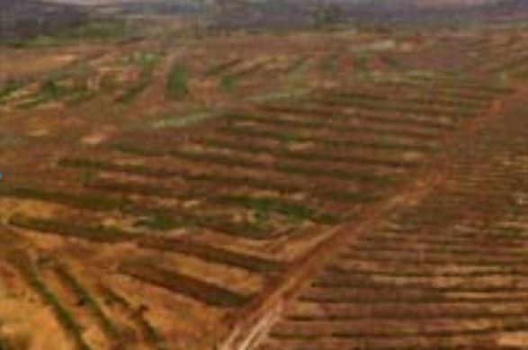
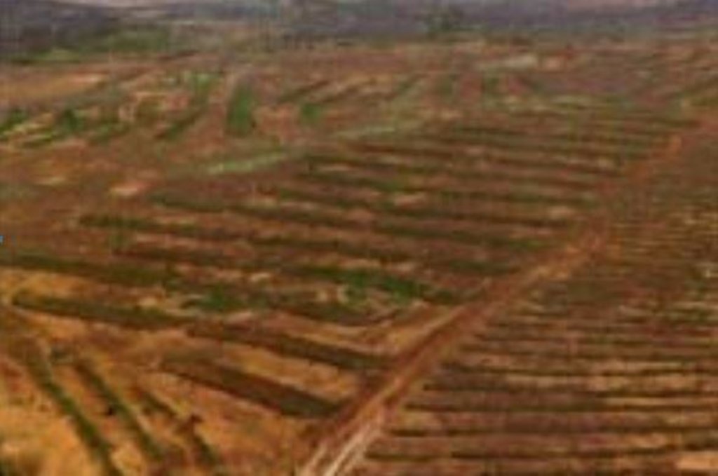
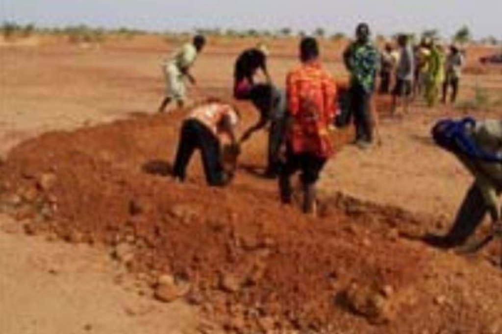
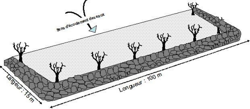
A contour bund is a rectangular structure consisting of bunds built with earth or stone or a combination of both, which can be permeable or impermeable. The bottom bund is up to 80 m long, and the wingwalls extend up to 15 m upslope. The contour bunds are built in staggered rows along the natural contour of the land with the open end facing uphill. Patches in the same row are spaced 6 m apart, and the rows are positioned about 25 m apart, depending of the gradient of the slope. Downslope of the structure, a water collection ditch 0.50 m wide and 0.30 m deep is dug. The earth excavated from the ditch is piled up and compacted to construct the main bund. When used for growing crops, a third of the total surface area inside the contour bunds is loosened by subsoiling. The remaining two thirds of the surface are left unworked and serve as a catchment area. This doubles or triples the volume of water available to crops. Trees are planted along the main bund to stabilise the structure.
Contour bunds for forest/rangeland work as contour bunds on cropland (described above), except that the sizing is slightly different. The main bund of patches used for this purpose is up to 100 m long and the rows are spaced up to 30 m apart.
In Niger, contour bunds for forest/rangeland are used to restore land in plateau areas which have been completely degraded and denuded by severe water and wind erosion. Contour bunds for growing crops are recommended for the restoration of pediments, particularly in areas where land use pressure is high. The technique is recommended for areas with a low gradient and rainfall of less than 600 mm.
The bunds capture and retain runoff for several days. Infiltration of the water into the soil increases, and there is a gradual build-up of sediment behind the bunds, creating favourable conditions for the establishment of vegetation. Contour bunds for crops increase the area of land that can be farmed and its productivity thanks to their capacity to retain runoff and the shelter provided by trees planted along the bottom bund, which protects the crops. An advantage from the perspective of watershed development is that contour bunds constructed on plateaux areas protect areas downstream against heavy runoff.
Before constructing the contour bunds, it is essential to clarify the ownership status of the land where the measures are to be implemented and who the users will be, with a view to avoiding disputes later on.
When constructing the contour bunds, it is important to mark out the contour lines correctly and ensure that the earth is firmly compacted.
With some upkeep, stone or stone-lined contour bunds last at least 20 years. Earthen bunds do not last as long. Good vegetation cover established along the bunds increases their lifetime.
The Sahel is a region where the population has always faced a high degree of climate variability, manifested both in terms of time (unexpected dry spells can occur during the rainy season) and in terms of space (rainfall can vary greatly from one area to another). The population is mainly composed of small farmers and livestock keepers.
Over the last two decades, the effects of climate change have exacerbated the already difficult conditions. Accord¬ing to projections made by climatologists, the Sahel will experience a rise in temperatures combined with highly variable rainfall and an increase in extreme weather events.
The Soil and Water conservation and rehabilitation techniques have helped people in the Sahel to manage their ecosystems more effectively and improve their productive land. As a result, communities are better prepared to cope with environmental changes (changes in the climate, land degradation, etc.) and the im¬pact of shocks, particularly droughts.
2.3 Технологийн гэрэл зураг
2.5 Энэ үнэлгээнд хамрагдсан технологийг хэрэгжүүлсэн улс орон/ бүс нутаг/ байршил
Улс:
Нигер
Улс/аймаг/сум:
Niger
Байршлын дэлгэрэнгүй тодорхойлолт:
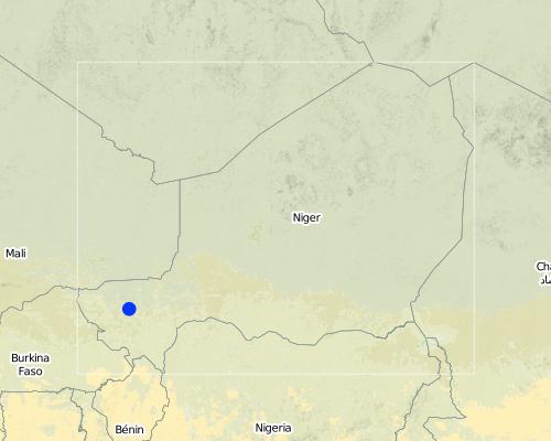
Regions of Tillabéri, Filingué, Ouallam, Téra and Tahoua
Map
×2.6 Хэрэгжсэн хугацаа
Байгуулсан тодорхой оныг мэдэхгүй бол баримжаа хугацааг тодорхойл:
- 10-50 жилийн өмнө
2.7 Технологийн танилцуулга
Технологийг хэрхэн нэвтрүүлснийг тодорхойл:
- Гадны төсөл/хөтөлбөрийн дэмжлэгтэйгээр
Тайлбар (төслийн төрөл г.м.):
Developed, implemented and disseminated as part of projects and programmes undertaken from the 1980s onwards to combat desertification and improve natural resource management. Implemented by GIZ (German Federal Enterprise for International Cooperation), PDRT (Projet de développement rural de Tahoua - Tahoua Rural Development Project), PASP (Projet de protection intégrée des ressources agro-sylvo-pastorales Tillabéri-Nord - Project for the Integrated Protection of Agricultural, Forest and Rangeland Resources in Tillabéri-Nord)
3. ГТМ технологийн ангилал
3.1 Технологийн үндсэн зорилго (ууд)
- газрын доройтлыг бууруулах, сэргийлэх, нөхөн сэргээх
- уур амьсгалын өөрчлөлт/ экстрим байдал болон түүний нөлөөлөлд дасан зохицох
3.2 Технологи нэвтрүүлсэн газрын одоогийн газар ашиглалтын хэлбэр(үүд)

Тариалангийн талбай
- Нэг наст үр тариа
- Мод, сөөг тарих
Гол нэрийн үр тариа (арилжааны болон хүнсний таримал):
major cash crop: Ground nut
major food crops: Millet
other: Sorghum, cow pea and mangoes

Байгалийн ой / модтой газар
(Таримал) байгалийн ой/мод бүхий газар:
- Сонгомол огтлол
Бүтээгдэхүүн ба үйлчилгээ:
- Мод бэлтгэл
- Түлшний мод
- Жимс, самар
- Ойн бусад дагалт бүтээгдэхүүн
- Бэлчээрийн талбай/Хариулгатай бэлчээрлэлт
Тайлбар:
Major land use problems (compiler’s opinion): crusting, surface runoff, water and wind erosion, unadapted land use methods, rapidly growing population increasing pressure on land, reduced or abandoned fallow periods, insecure access to land
Type of cropping system and major crops comments: farmers are mainly agropastoralists with some communities specialised on pure pastoralism
Constraints of forested government-owned land or commons
3.3 Газар ашиглалтын тухай нэмэлт мэдээлэл
Технологи хэрэгжүүлсэн газрын усан хангамж:
- Байгалийн усалгаатай
Жилд ургамал ургах улирлын тоо:
- 1
Тодорхойлно уу:
Longest growing period in days: 120; Longest growing period from month to month: August to October
Малын нягт (шаардлагатай бол):
1-10 LU /km2
3.4 Технологи ГТМ-ийн аль бүлэгт хамаарах вэ
- ХАА-н ойжуулалт
- Налуугийн арга хэмжээ
3.5 Технологийн хамрах талбай
Технологи өргөн дэлгэрсэн эсхийг тодорхойл:
- газар дээр жигд тархсан
Технологи газар нутгийн хэмжээнд жигд тархсан бол түүний эзлэх талбайг дундажаар тооцож тэмдэглэ:
- 10-100 км2
3.6 Технологийг бүрдүүлэх ГТМ арга хэмжээ

Ургамлын арга хэмжээ
- V1: Мод ба бут, сөөг

Барилга байгууламжийн арга хэмжээ
- S2: Далан, хаалт
Тайлбар:
Type of vegetative measures: aligned: -contour
3.7 Технологид харгалзах газрын доройтлын төрөл

хөрс усаар эвдрэх
- Wt: Хөрсний гадаргын угаагдал

хөрсний химийн доройтол
- Cn: Үржил шим ба ялзмаг буурах (элэгдлийн шалтгаангүй)

хөрсний физик доройтол
- Pc: Хөрс дагтарших
- Pk: Гадарга дээр хагсах, хагарах

биологийн доройтол
- Bc: Ургамлан нөмрөг багасах

усны доройтол
- Ha: Хуурайшилт
Тайлбар:
Main causes of degradation: soil management (Unadapted landuse methods, reduced or abandoned fallow periods), crop management (annual, perennial, tree/shrub) (Neglect of fallow periods and crop rotation), droughts (due to heat waves), population pressure (rapidly growing population increasing pressure on land), land tenure (insecure access to land and collectively managed common land), poverty / wealth (very poor population)
Secondary causes of degradation: deforestation / removal of natural vegetation (incl. forest fires) (deforestation through overgrazing and fire wood collection), over-exploitation of vegetation for domestic use (firewood collection), overgrazing (cattle, sheep and goats), change in temperature (Climate change: heat waves), change of seasonal rainfall (more variable onset of rain), Heavy / extreme rainfall (intensity/amounts) (more variable and intensive rains), wind storms / dust storms (frequent storms), floods (due to intensive rain storms), labour availability (some migration of men to nearby cities), education, access to knowledge and support services (high level of illiteracy)
3.8 Газрын доройтлоос урьдчилан сэргийлэх, сааруулах ба нөхөн сэргээх
Газрын доройтолтой холбоотойгоор Технологи ямар зорилго тавьсан болохыг тодорхойл:
- Хүчтэй доройтсон газрыг нөхөн сэргээх/ сайжруулах
4. Техникийн нөхцөл, хэрэгжүүлсэн үйл ажиллагаа, материал ба зардал
4.1 Технологийн техник зураг
4.2 Техникийн үзүүлэлт/ техникийн зургийн тайлбар
Technical knowledge required for field staff / advisors: moderate
Technical knowledge required for land users: low
Main technical functions: control of dispersed runoff: retain / trap, control of dispersed runoff: impede / retard, control of concentrated runoff: retain / trap, control of concentrated runoff: impede / retard, improvement of ground cover, stabilisation of soil (eg by tree roots against land slides), increase in nutrient availability (supply, recycling,…), increase of infiltration, increase / maintain water stored in soil, water harvesting / increase water supply, sediment retention / trapping, sediment harvesting, promotion of vegetation species and varieties (quality, eg palatable fodder)
Secondary technical functions: improvement of surface structure (crusting, sealing), improvement of topsoil structure (compaction), increase in organic matter, reduction in wind speed
Aligned: -contour
Vegetative material: T : trees / shrubs
Vegetation is used for stabilisation of structures.
4.3 Материал болон зардалд хамаарах ерөнхий мэдээлэл
Үнэ өртөгийг тооцоход ашигласан мөнгөн нэгж:
- Америк доллар
4.4 Бий болгох үйл ажиллагаа
| Үйл ажиллагаа | Арга хэмжээний төрөл | Хугацаа | |
|---|---|---|---|
| 1. | The contour bunds are built in staggered rows along the natural contour of the land with the open end facing uphill. | Барилга байгууламжийн | |
| 2. | Downslope of the structure, a water collection ditch 0.50 m wide and 0.30 m deep is dug. | Барилга байгууламжийн | |
| 3. | The earth excavated from the ditch is piled up and compacted to construct the main bund | Барилга байгууламжийн | |
| 4. | When used for growing crops, a third of the total surface area inside the contour bunds is loosened by subsoiling | Барилга байгууламжийн | |
| 5. | Trees are planted along the main bund to stabilise the structure | Ургамлын |
4.6 Арчилгаа/ урсгал үйл ажиллагаа
| Үйл ажиллагаа | Арга хэмжээний төрөл | Хугацаа/ давтамж | |
|---|---|---|---|
| 1. | Damages caused by excessive rainfall need to be repaired quickly | Барилга байгууламжийн |
4.8 Зардалд нөлөөлж байгаа хамгийн чухал хүчин зүйл
Өртөг, зардалд нөлөөлөх гол хүчин зүйл:
Labour: 54 man-days per ha.
Equipment: pickaxes, shovels, wheelbarrows, water-tube level.
Other costs: hire of machine for subsoiling (1 day per ha).
5. Байгаль ба нийгмийн нөхцөл
5.1 Уур амьсгал
Жилийн нийлбэр хур тундас
- < 250 мм
- 251-500 мм
- 501-750 мм
- 751-1,000 мм
- 1,001-1,500 мм
- 1,501-2,000 мм
- 2,001-3,000 мм
- 3,001-4,000 мм
- > 4,000 мм
Агро-уур амьсгалын бүс
- хагас хуурай
Thermal climate class: subtropics
5.2 Гадаргын хэлбэр
Дундаж налуу:
- хавтгай (0-2 %)
- бага зэрэг налуу (3-5 %)
- дунд зэрэг налуу (6-10 % )
- хэвгий (11-15 %)
- налуу (16-30 %)
- их налуу (31-60 % )
- эгц налуу (>60 %)
Гадаргын хэлбэр:
- тэгш өндөрлөг / тал
- нуруу
- уулын энгэр
- дов толгод
- бэл
- хөндий
Өндрийн бүслүүр:
- 0-100 д.т.д. м.
- 101-500 д.т.д. м.
- 501-1,000 д.т.д м.
- 1,001-1,500 д.т.д м.
- 1,501-2,000 д.т.д м.
- 2,001-2,500 д.т.д. м.
- 2,501-3,000 д.т.д. м.
- 3,001-4,000 д.т.д м.
- > 4,000 д.т.д. м.
5.3 Хөрс
Хөрсний дундаж зузаан:
- маш нимгэн (0-20 см)
- нимгэн (21-50 см)
- дунд зэрэг зузаан (51-80 см)
- зузаан (81-120 cм)
- маш зузаан (>120 cм)
Хөрсний бүтэц (өнгөн хөрс):
- дундаж (элсэнцэр, шавранцар)
- нарийн /хүнд (шаварлаг)
Өнгөн хөрсөнд агуулагдах ялзмаг:
- бага (<1 % )
Боломжтой бол хөрсний бүрэн тодорхойлолт, боломжит мэдээллийг өгнө үү, жишээ нь хөрсний төрөл, хөрсний урвалын орчин/хүчиллэг байдал, катион солилцох чадавхи, азотын хэмжээ, давсжилт г.м.
Soil texture (topsoil): Fine to medium (sandy to clayey loams)
Soil fertility is very low - medium
Soil drainage / infiltration is poor - medium
Soil water storage capacity is low - medium
5.4 Усны хүртээмж ба чанар
Гүний усны түвшин:
5-50 м
Гадаргын усны хүртээмж:
дунд зэрэг
Усны чанар (цэвэршүүлээгүй):
зөвхөн газар тариалангийн зориулалтаар ашиглах (усалгаа)
5.5 Биологийн олон янз байдал
Зүйлийн олон янз байдал:
- Бага
5.6 Технологи нэвтрүүлсэн газар ашиглагчдын тухай мэдээлэл
Суурьшмал эсвэл нүүдлийн:
- Хагас-нүүдэлийн
Үйлдвэрлэлийн системийн зах зээлийн чиг баримжаа:
- амь зуух арга хэлбэрийн (өөрийгөө хангах)
- холимог (амь зуух/ худалдаа наймаа
Бусад эх үүсвэрээс олох орлого:
- Нийт орлогын 10-50 %
Чинээлэг байдлын түвшин:
- нэн ядуу
- ядуу
Механикжилтын түвшин:
- гар ажил
- ердийн хөсөг
Хүйс:
- эрэгтэй
Газар ашиглагчдын бусад шинж чанарыг тодорхойл:
Population density: 10-50 persons/km2
Annual population growth: 3% - 4%
Off-farm income specification: men migrate temporarily or permanently to cities for off-farm income, women and men seasonally carry out paid farm work
Market orientation of production system: Most households crop for subsistence (mainly for small agropastoralists), but surplus is sold on market (medium agropastoralists). Commercial markets: some vegetable growing and pastoralists.
Level of mechanization: Ox and donkey for animal traction
5.7 Технологи нэвтрүүлсэн газар ашиглагчийн өмчилж буй, эзэмшиж буй, түрээсэлж буй эсвэл ашиглаж буй (ашиглах эрх) газрын талбай
- < 0.5 га
- 0.5-1 га
- 1-2 га
- 2-5 га
- 5-15 га
- 15-50 га
- 50-100 га
- 100-500 га
- 500-1,000 га
- 1,000-10,000 га
- > 10,000 га
Энэ талбай том, жижиг, дунд алинд хамаарах вэ (орон нутгийн нөхцөлд харгалзуулна уу)?
- бага-хэмжээний
5.8 Газар эзэмшил, газар ашиглах эрх, ус ашиглах эрх
Газар өмчлөл:
- төрийн
- нэгдлийн/ тосгон
Газар ашиглах эрх:
- нээлттэй хүртэх (зохион байгуулалтгүй)
Ус ашиглах эрх:
- нээлттэй хүртэх (зохион байгуулалтгүй)
5.9 Дэд бүтэц, үйлчилгээний хүртээмж
эрүүл мэнд:
- ядуу
- дунд зэргийн
- сайн
боловсрол:
- ядуу
- дунд зэргийн
- сайн
техник зөвлөгөө:
- ядуу
- дунд зэргийн
- сайн
хөдөлмөр эрхлэлт (жишээ нь, ХАА-аас өөр):
- ядуу
- дунд зэргийн
- сайн
зах зээл:
- ядуу
- дунд зэргийн
- сайн
эрчим хүчний хангамж:
- ядуу
- дунд зэргийн
- сайн
зам тээвэр:
- ядуу
- дунд зэргийн
- сайн
усан хангамж ба ариутгал:
- ядуу
- дунд зэргийн
- сайн
санхүүгийн үйлчилгээ:
- ядуу
- дунд зэргийн
- сайн
6. Үр нөлөө ба дүгнэлт
6.1 Технологийн талбайд үзүүлсэн нөлөө
Нийгэм-эдийн засгийн үр нөлөө
Үйлдвэрлэл
газар тариалангийн үйлдвэрлэл
тэжээл үйлдвэрлэл
малын бүтээмж
модлогийн бүтээмж
бүтээмж буурах эрсдэл
үйлдвэрлэлийн газар
Усны хүртээмж ба чанар
тариалангийн усалгааны усны хэрэгцээ
Орлого, зарлага
тухайн аж ахуйн орлого
Нийгэм-соёлын үр нөлөө
хүнсний аюулгүй байдал/ өөрийн хэрэгцээг хангах
ГТМ/ газрын доройтлын мэдлэг
livelihood and human well-being
Тайлбар/ тодорхой дурьдах:
Contour bunds for crops increase the area of land that can be farmed and its productivity thanks to their capacity to retain runoff and the shelter provided by trees planted along the bottom bund, which protects the crops
Экологийн үр нөлөө
Усны эргэлт/ илүүдэл
ус хураах / цуглуулах
гадаргын урсац
гүний усны түвшин / уст давхарга
Хөрс
хөрсний чийг
хөрсөн бүрхэвч
хөрс алдагдах
хөрс хагарах/ хагсах
хөрс нягтрах
шимт бодисын эргэлт/ сэргэлт
хөрсний органик нэгдэл/ хөрсөнд агуулагдах карбон
Биологийн олон янз байдал: ургамал, амьтан
газрын дээрхи / доорхи карбон
ургамлын төрөл, зүйл
Уур амьсгал болон гамшгийн эрсдлийг бууруулах
салхины хурд
6.2 Технологийн талбайн гадна үзүүлсэн үр нөлөө
голын адагт үерлэх
голын адагт лаг шавар хуримтлагдах
6.3 Технологийн уур амьсгалын өөрчлөлт, цаг агаарын гамшигт үзэгдэлд өртөх байдал ба эмзэг байдал (газар ашиглагчийн бодлоор)
Уур амьсгалын аажим өөрчлөлт
Уур амьсгалын аажим өөрчлөлт
| Улирал | Уур амьсгалын өөрчлөлт/экстрим үзэгдлийн төрөл | Технологи түүний нөлөөг хэрхэн бууруулж байна? | |
|---|---|---|---|
| жилийн дундаж температур | Өсөлт | сайн |
Уур амьсгалаас хамаарах аюул (гамшиг)
Цаг уурын гамшигт үзэгдэл
| Технологи түүний нөлөөг хэрхэн бууруулж байна? | |
|---|---|
| орон нутгийн аадар бороо | муу |
| орон нутгийн салхин шуурга | сайн |
Уур амьсгалын гамшиг
| Технологи түүний нөлөөг хэрхэн бууруулж байна? | |
|---|---|
| ган гачиг | сайн |
Усзүйн гамшиг
| Технологи түүний нөлөөг хэрхэн бууруулж байна? | |
|---|---|
| усны үер (гол) | муу |
Уур амьсгалд хамаарах бусад үр дагавар
Уур амьсгалд хамаарах бусад үр дагавар
| Технологи түүний нөлөөг хэрхэн бууруулж байна? | |
|---|---|
| цргалтын хугацаа багасах | мэдэхгүй |
Тайлбар:
Physical structures can be biologically stabilized through planting of grass, bushes or trees. Damages are generally small but need to be repaired quickly.
6.4 Өртөг ба ашгийн шинжилгээ
Бий болгох зардалтай харьцуулахад ямар ашиг өгсөн бэ (газар ашиглагчийн бодлоор)?
Богино хугацаанд эргэн төлөгдөх байдал:
эерэг
Урт хугацаанд эргэн төлөгдөх байдал:
эерэг
Арчилгаа/урсгал зардалтай харьцуулахад ямар ашиг өгсөн бэ (газар ашиглагчийн бодлоор)?
Богино хугацаанд эргэн төлөгдөх байдал:
эерэг
Урт хугацаанд эргэн төлөгдөх байдал:
эерэг
6.5 Технологи нэвтрүүлэлт
Технологи нэвтрүүлсэн хүмүүсээс хэд нь өөрийн хүчээр технологийг хэрэгжүүлсэн бэ, өөрөөр хэлбэл гадны тусламж дэмжлэг авалгүйгээр?
- 10-50%
Тайлбар:
The techniques were implemented with food for work in the 1990s to 2000. At the end, the work provided by land users was not compensated. Only small equipment and transportation were provided for free.
50% of land user families have adopted the Technology without any external material support
There is a little trend towards spontaneous adoption of the Technology
Some adoption (without support by the project) has been observed in some places. The level of replication is however limited to locations where stones are available nearby. Otherwise transportation becomes a problem. Potential for replication depends on the type of terrain, there being a nearby supply of the materials needed (stone). Subsoiling needs mechanical treatment by tractor.
6.7 Технологийн давуу тал/боломжууд
| Газар ашиглагчдын тодорхойлсон давуу тал/боломжууд |
|---|
| Contour bunds for crops increase the area of land that can be farmed and its productivity thanks to their capacity to retain runoff and the shelter provided by trees planted along the bottom bund, which protects the crops. |
| Эмхэтгэгч, бусад мэдээлэл өгсөн хүмүүсийн өнцгөөс тодорхойлсон давуу тал/боломжууд |
|---|
|
In a low-rainfall scenario, the construction of contour bunds helps to restore vegetation cover on vast areas of denuded land from the first year after they are established. Infiltration of the water into the soil increases, and there is a gradual build-up of sediment behind the bunds, creating favourable conditions for the establishment of vegetation. |
| Good vegetation cover established along the bunds con- tributes to lowering soil temperature and providing pro- tection from wind erosion along the entire length of the patch. |
| The construction of contour bunds upstream of river basins reduces the risk of gully erosion and siltation downstream. |
| In Niger, it is mainly women who have benefitted from efforts to rehabilitate land on the plateaux. With the support of development projects, women were able to secure five-year leases from land owners. |
| This technique transforms unproductive land into land that is economically valuable. |
6.8 Технологийн дутагдалтай/сул тал/аюул болон тэдгээрийг хэрхэн даван туулах арга зам
| Газар ашиглагч нарын тодорхойлсон сул тал/ дутагдал/ эрсдэл | Тэдгээрийг хэрхэн даван туулах вэ? |
|---|---|
| There are also disadvantages associated with subsoiling in the contour bunds. Although subsoiling permits rapid, relatively deep infiltration, the water is situated below the level where the roots of young crops or grasses are growing, which means that the infiltrated water is not used optimally in the initial stages. Furthermore, the surface of the subsoiled land becomes hard again after several years of cultivation, because the soil structure is broken down owing to a concentration of fine particles of earth in the grooves of the subsoil, which can clog up the pores of the soil. |
| Эмхэтгэгч, бусад мэдээлэл өгсөн хүмүүсийн өнцгөөс тодорхойлсон сул тал/ дутагдал/ эрсдэл | Тэдгээрийг хэрхэн даван туулах вэ? |
|---|---|
| Patches with impermeable bunds are not appropriate when there are heavy rains, as the flow of water can destroy the bunds. | The extensive work required to construct the contour bunds means that the community must be strongly motivated and well organised. |
| Contour bunds for growing crops can be used to restore land that has become unproductive. This technique is not, however, very cost-effective, because of the scale of the work involved. | When constructing the contour bunds, it is important to mark out the contour lines correctly and ensure that the earth is firmly compacted. |
| The distribution of water in the contour bunds is often uneven, because the terrain is not level, which means that production varies considerably from one area to another | |
| When there is heavy rain, runoff accumulates at the lowest point of the collection ditch, which can sometimes cause rilling | |
| There is a risk of the patches becoming waterlogged, which can damage the crops |
7. Ном зүй ба холбоосууд
7.1 Мэдээлэл цуглуулсан арга/эх үүсвэр
- Хээрийн уулзалт, судалгаа
- Газар ашиглагчтай хийсэн ярилцлага
7.2 Ном, хэвлэлийн ишлэл
Гарчиг, зохиогч, он, ISBN:
Good Practices in Soil and Water Conservation. A contribution to adaptation and farmers´ resilience towards climate change in the Sahel. Published by GIZ in 2012.
Хаанаас авч болох вэ? Зардал?
http://agriwaterpedia.info/wiki/Main_Page
Холбоос ба модулууд
Бүгдийг дэлгэх Бүгдийг хаахХолбоосууд
Холбоос байхгүй байна
Модулууд
Модуль байхгүй байна


