Check dam for land [Хятад]
- Шинийг нээх:
- Шинэчлэх:
- Эмхэтгэгч: Fei WANG
- Хянан тохиолдуулагч: –
- Хянагчид: David Streiff, Alexandra Gavilano
淤地坝,谷坊
technologies_1455 - Хятад
Бүлгүүдийг үзэх
Бүгдийг дэлгэх Бүгдийг хаах1. Ерөнхий мэдээлэл
1.2 Технологийг үнэлэх, баримтжуулах ажилд хамаарах мэдээлэл өгсөн хүмүүс, байгууллагуудын холбоо барих мэдээлэл
ГТМ мэргэжилтэн:
Mu Xingming
Institute of Soil and Water Conservation, CAS and MWR
Хятад
ГТМ мэргэжилтэн:
Wen Zhongmin
Institute of Soil and Water Conservation, CAS and MWR
Хятад
ГТМ мэргэжилтэн:
ГТМ мэргэжилтэн:
Chen Yun-ming
Institute of Soil and Water Conservation, CAS and MWR
Хятад
Технологи баримтжуулах/үнэлэх ажилд дэмжлэг үзүүлсэн байгууллага(ууд)-ын нэр (шаардлагатай бол)
Northwest A&F University (NWAFU) - Хятад1.3 ВОКАТ-аар баримтжуулсан өгөгдлийг ашиглахтай холбоотой нөхцөл
Эмхэтгэгч болон гол мэдээлэгч хүн(хүмүүс) WOCAT аргачлалаар баримтжуулсан мэдээллийг ашиглахтай холбоотой нөхцлийг хүлээн зөвшөөрсөн:
Тийм
1.5 ГТМ Арга барилын Асуулга (ууд) руу хандах (ВОКАТ ашиглан баримтжуулсан)
Project of check-dam for land [Хятад]
Approach of check dam for land is a kind of soil and water conservation activity to reduce the sediment discharge and improve the agricultural condition through building a dam across the valley in order to silt the sediment from upstream untill it convert to land with few soil erosion and …
- Эмхэтгэгч: Fei WANG
2. ГТМ Технологийн тодорхойлолт
2.1 Технологийн товч тодорхойлолт
Технологийн тодорхойлолт:
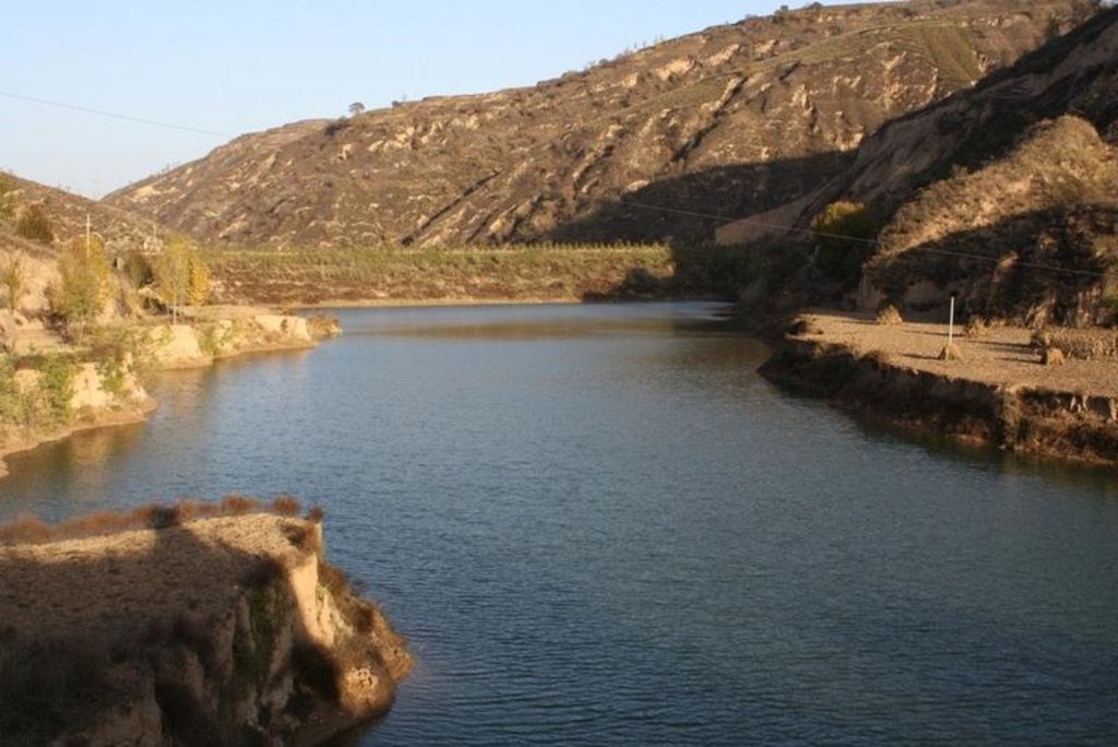
Check dam for land is a structural SLM practice that is constructed in the valley of a watershed in order to slow down the runoff and increase sedimentation. After this, the land quality of the controlling area will increase because soil and water conditions in this place are improved.
2.2 Технологийн дэлгэрэнгүй тодорхойлолт
Тодорхойлолт:
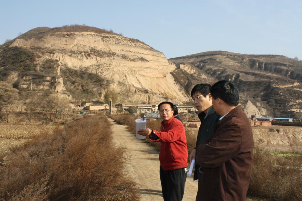
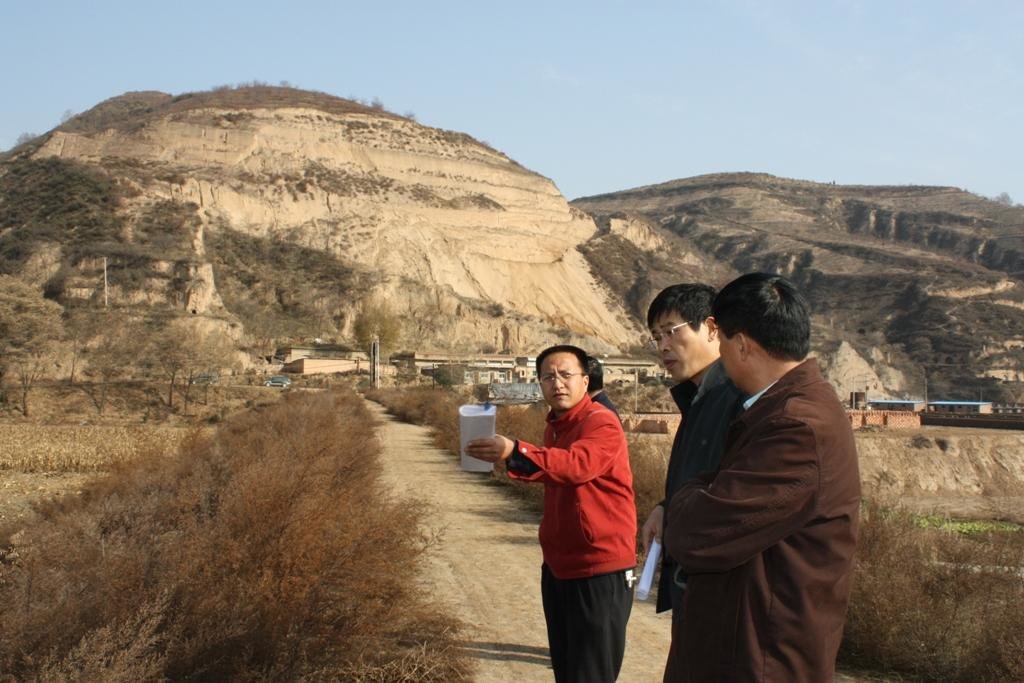
The check dam is a small dam designed to reduce flow velocity, control soil erosion, and allow to settle on the bed of the valley. The whole system includes main body of dam, spillway, overflow and supporting measures. The check dam for land is a small dam mainly for land after it is filled up by the sediment from upstream area, from several years to 20 years in common, it could be flat land in the valley, not mainly for water collection (different from reservior).
Purpose of the Technology: Check dams in the Loess Plateau are very common. There are many advantages. The check dam could not only reduce the erosion of the gullies, furthermore it retain the sediment in the flow and this decreases the sediment of the Yellow River. The check dam is good quality land for the soils because of the sedimentation of organic matter and other nutrients from topsoil . In this region soils are deep and very fertile because most soil is from the top soil upstream. The soil moisture of check dam is also much better than in any other places in the watershed because the flood should go away from its surface and the water inflitration is great in raining seasons.
Establishment / maintenance activities and inputs: The establishment needs enough money because it has to be safe enough, and the maintenance cost is not so high. The catchment with great soil erosion is better when we considered the formation time of land.
Natural / human environment: The controlling area of check dam for land varies greatly from 30 square km or more. Since the "Grain for Green" Project of China in 1999, the soil erosion on the slope decreased. The time from reservoir to land need more time because there is less and less sediment from upstream and the sedimentation changed slowly.
2.3 Технологийн гэрэл зураг
2.5 Энэ үнэлгээнд хамрагдсан технологийг хэрэгжүүлсэн улс орон/ бүс нутаг/ байршил
Улс:
Хятад
Улс/аймаг/сум:
Shaanxi Province
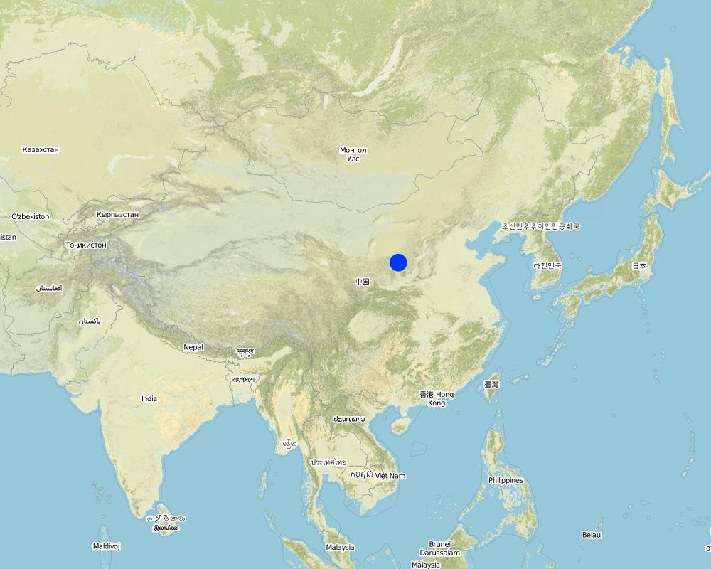
Байршлын дэлгэрэнгүй тодорхойлолт:
Yanhe River Basin
Технологи өргөн дэлгэрсэн эсхийг тодорхойл:
- тодорхой газар хэрэгжсэн/ жижиг талбайд төвлөрсөн
Тайлбар:
Boundary points of the Technology area: Only one check-dam for land is listed here.
Total area covered by the SLM Technology is 19.4 km2.
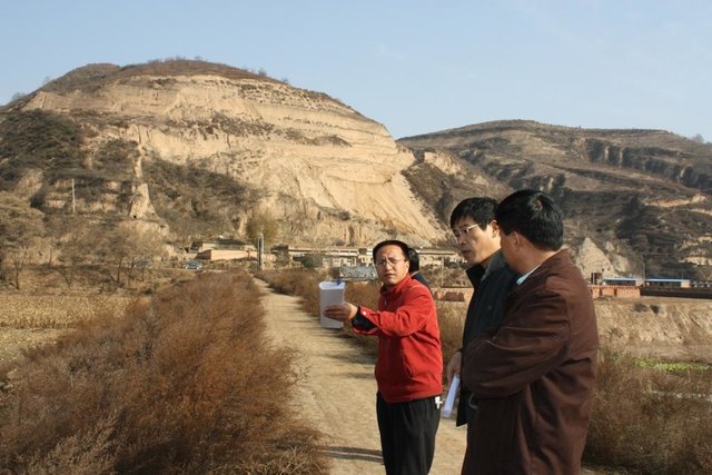
The total area with different measures is almost 2000 km2 . Yanhe River is a first class branch of Yellow River, China. The average channel slope is 3.26‰, and the area of whole basin is 7,687 km2. It is situated in the semi-arid North Temperate Zone with an average annual precipitation varying from 500 to 550 mm, and an average annual air temperature ranging from 8.5 to 11.4℃. It is in hilly gully area of the Loess Plateau covered by loess. The landform is broken seriously. The gully density (the length of channel in one km2) is amount to 2.1 to 4.6 km•km-2. The soil loss is severe all along.
The Ganguyi Hydrology Station (109°48′E, 36°42′N) located in the Ganguyi Town, Baota Country, Yan’an City, Shaanxi Province. The area up Ganguyi Hydrology Station is 5,891 km2, including of Jingbian County(256km2), Zhidan County(708km2), Ansai County(2,699km2) and Baota County(2,228km2). The average annual runoff is 0.22 billion m3, and the runoff modulus accounting for 4,776.36 m3•km-2•yr-1. The average annual sediment flow is 4.776 million tons, and the sediment flow modulus accounting for 8,100 t•km-2•yr-1. The coarse sediment (sediment particle diameter not less than 0.05 mm) flow modulus is 2,430 t•km-2•yr-1 on the Ganguyi Hydrology Station.
Map
×2.6 Хэрэгжсэн хугацаа
Байгуулсан тодорхой оныг мэдэхгүй бол баримжаа хугацааг тодорхойл:
- 10-50 жилийн өмнө
2.7 Технологийн танилцуулга
Технологийг хэрхэн нэвтрүүлснийг тодорхойл:
- Туршилт/судалгааны үр дүн
Тайлбар (төслийн төрөл г.м.):
It is an old methodology in the Loess Plateau. Since 2003, the check dam had been determined as "Highlight Project " of the Ministry of Water Resources in order to expand in the whole area of the Yellow River Basin.
3. ГТМ технологийн ангилал
3.1 Технологийн үндсэн зорилго (ууд)
- газрын доройтлыг бууруулах, сэргийлэх, нөхөн сэргээх
3.2 Технологи нэвтрүүлсэн газрын одоогийн газар ашиглалтын хэлбэр(үүд)
Нэг газр нутгийн хэмжээнд хэрэгжих холимог газар ашиглалт:
Тийм
Газар ашиглалтын холимог тогтолцоог (тарилан/бэлчээр/ой мод) тодорхойл:
- ХАА-ой-бэлчээрийн цогц систем

Тариалангийн талбай
- Нэг наст үр тариа
- Мод, сөөг тарих
Нэг наст үр тариа - Таримлыг тодорхойлно уу:
- үр тариа - эрдэнэ шиш
- үр тариа - шар будаа
- цэцэгс
- тэжээлийн ургамал - царгас
- буурцагт ургамал - шош
- тосны ургамал - наран цэцэг, рапс ба бусад
- үндэст/булцуут ургамал– төмс
- buckwheat
Мод, бут тариалах - Таримлыг тодорхойлно уу:
- хасарваань
- жимс (алим, лийр г.м.)
Тодорхойлно уу:
Longest growing period in days: 300Longest growing period from month to month: March to NovemberSecond longest growing period in days: 200Second longest growing period from month to month: April to October

Усан зам, усан сан, ус намгархаг газар
- Цөөрөм, далан
Тайлбар:
major crop: beans, sunflower, apple, Chinese date, alfalfa, potato, millets, maize, buckwheat
Major land use problems (compiler’s opinion): Normally, the bed of valley is V-shaped and is covered by grass and trees. For the seasonal torrent or flash, it is very difficult to plant crops. The gully also cuts down by runoff and extends because of erosion's gravity .
Major land use problems (land users’ perception): It can not be used as agricultural purpose, especially to get more food.
Future (final) land use (after implementation of SLM Technology): Cropland: Ca: Annual cropping
Livestock is grazing on crop residues
3.3 Технологи хэрэгжүүлснээр газар ашиглалтад өөрчлөлт гарсан уу?
Технологи хэрэгжүүлснээр газар ашиглалтад өөрчлөлт гарсан уу?
- Тийм (Технологи хэрэгжүүлэхээс өмнөх үеийн газар ашиглалтын талаархи асуулгыг бөглөнө үү)

Тариалангийн талбай
- Нэг наст үр тариа
3.4 Усан хангамж
Технологи хэрэгжүүлсэн газрын усан хангамж:
- Байгалийн усалгаатай
3.5 Технологи ГТМ-ийн аль бүлэгт хамаарах вэ
- Налуугийн арга хэмжээ
- гадаргын усны менежмент (булаг, гол, нуур, тэнгис гэх мэт)
3.6 Технологийг бүрдүүлэх ГТМ арга хэмжээ

Барилга байгууламжийн арга хэмжээ
- S5: Далан, усан сан, цөөрөм
- S11: Бусад
Тайлбар:
Main measures: structural measures
3.7 Технологид харгалзах газрын доройтлын төрөл

хөрс усаар эвдрэх
- Wg: Гуу жалгын элэгдэл
- Wo: Усны элэгдлийн дам нөлөө
Тайлбар:
Main type of degradation addressed: Wg: gully erosion / gullying
Secondary types of degradation addressed: Wo: offsite degradation effects
Secondary causes of degradation: Heavy / extreme rainfall (intensity/amounts) (It is the reason of erosion that influence the valley.)
3.8 Газрын доройтлоос урьдчилан сэргийлэх, сааруулах ба нөхөн сэргээх
Газрын доройтолтой холбоотойгоор Технологи ямар зорилго тавьсан болохыг тодорхойл:
- газрын доройтлоос урьдчилан сэргийлэх
- Газрын доройтлыг бууруулах
Тайлбар:
Main goals: prevention of land degradation
Secondary goals: mitigation / reduction of land degradation
4. Техникийн нөхцөл, хэрэгжүүлсэн үйл ажиллагаа, материал ба зардал
4.1 Технологийн техник зураг
Техник тодорхойлолт (техник зургийн тайлбар):
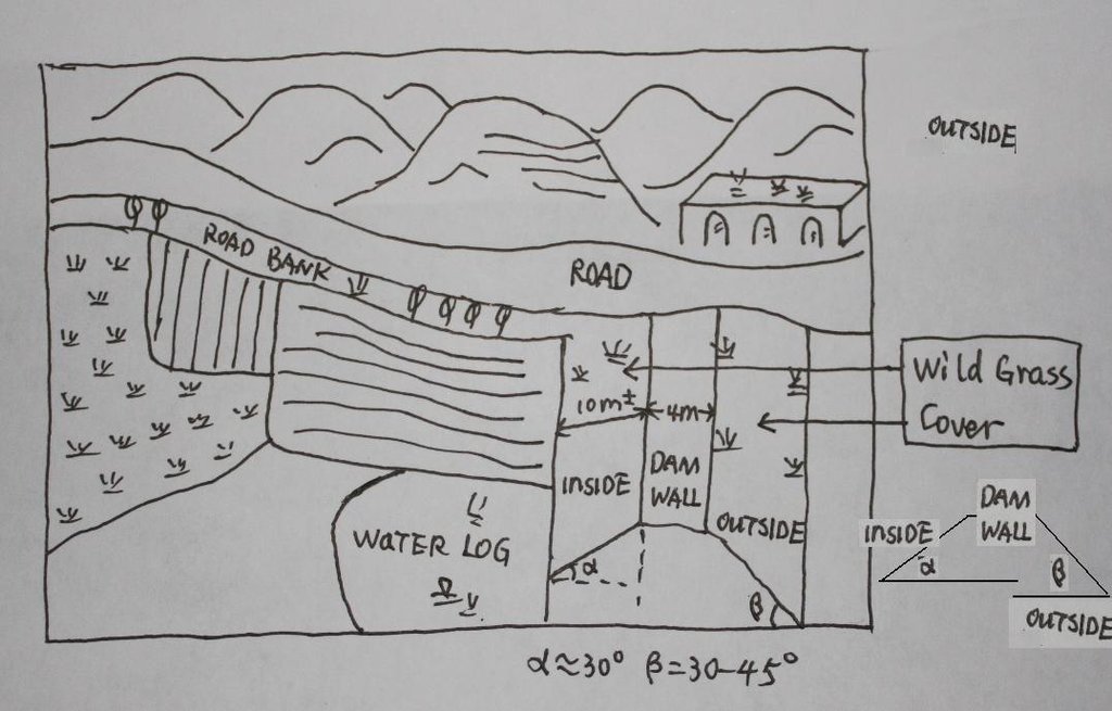
The check dam land.
Location: Mazhuang Watershed. Baota County, Yan'an City, Shaanxi China
Date: 2008-10-20
Technical knowledge required for field staff / advisors: high (The design and construction need professional knowledge.)
Technical knowledge required for land users: low (it is easy to use, like alluvial land or wide terrace.)
Main technical functions: control of concentrated runoff: retain / trap
Spillway
Vertical interval between structures (m): 3
Spacing between structures (m): 6
Height of bunds/banks/others (m): 4
Width of bunds/banks/others (m): 6
Length of bunds/banks/others (m): 100
Dam/ pan/ pond
Vertical interval between structures (m): 10
Spacing between structures (m): 100
Depth of ditches/pits/dams (m): 10
Width of ditches/pits/dams (m): 50-100
Length of ditches/pits/dams (m): 300-1000
Construction material (earth): The earth-bank dam is built in Yanhe River Basin.
Construction material (stone): to build the spillways
Slope (which determines the spacing indicated above): 2-5%
If the original slope has changed as a result of the Technology, the slope today is: 2%
Lateral gradient along the structure: 2%
Specification of dams/ pans/ ponds: Capacity 180000m3
Catchment area: 58.3km2m2
Slope of dam wall inside: 30%;
Slope of dam wall outside: 60%
Dimensions of spillways: 3m
Vegetation is used for stabilisation of structures.
Зохиогч:
Wang Fei, Yangling, Shaanxi Province, China
4.2 Материал болон зардалд хамаарах ерөнхий мэдээлэл
Үнэ өртөгийг тооцоход ашигласан мөнгөн нэгж:
- Ам.доллар
Хэрэв боломжтой бол үндэсний валютын Америк доллартай харьцах харьцааг бичнэ үү (тухайлбал, 1 ам.дол. = 79,9 Бразил реал): 1 ам.дол. =:
-2.17
Хөлсний ажилчны нэг өдрийн цалингийн хэмжээг тодорхойлно уу:
8.80
4.3 Бий болгох үйл ажиллагаа
| Үйл ажиллагаа | Хугацаа (улирал) | |
|---|---|---|
| 1. | Field survey and location selection | Before design |
| 2. | Design | before construction |
| 3. | Build the dam wall | |
| 4. | Check and accept | After the construction |
4.4 Бий болгоход шаардагдсан зардал, хөрөнгийн өртөг
| Зардлын нэр, төрөл | Хэмжих нэгж | Тоо хэмжээ | Нэгжийн үнэ | Зардал бүрийн нийт өртөг | Нийт дүнгээс газар ашиглагчийн төлсөн % | |
|---|---|---|---|---|---|---|
| Хөдөлмөр эрхлэлт | Building the wall/ field survey and planning | Person/day | 180.0 | 8.8 | 1584.0 | 90.0 |
| Хөдөлмөр эрхлэлт | Building the wall/ field survey | Machine/hrs | 75.0 | 43.8 | 3285.0 | |
| Барилгын материал | Stone | m^3 | 40.0 | 26.35 | 1054.0 | |
| Технологи бий болгох нийт үнэ өртөг | 5923.0 | |||||
| Технологи бий болгох нийт үнэ өртөг, ам.доллар | -2729.49 | |||||
Тайлбар:
Duration of establishment phase: 1 month(s)
4.5 Арчилгаа/ урсгал үйл ажиллагаа
| Үйл ажиллагаа | Хугацаа/ давтамж | |
|---|---|---|
| 1. | check the dam wall | annually |
4.6 Арчилгаа/урсгал ажилд шаардагдсан зардал, хөрөнгийн өртөг (нэг жилд)
| Зардлын нэр, төрөл | Хэмжих нэгж | Тоо хэмжээ | Нэгжийн үнэ | Зардал бүрийн нийт өртөг | Нийт дүнгээс газар ашиглагчийн төлсөн % | |
|---|---|---|---|---|---|---|
| Хөдөлмөр эрхлэлт | check annualy the dam wall | Person/day | 15.0 | 8.8 | 132.0 | |
| Технологийн арчилгаа/урсгал үйл ажиллагаанд шаардагдах нийт үнэ өртөг | 132.0 | |||||
| Технологи арчилах ба урсгал ажлын нийт үнэ өртөг, ам.доллар | -60.83 | |||||
Тайлбар:
Machinery/ tools: crawler type bulldozer, giant jet, tractor, traditional tools, ruler,
The grass on both sides of check wall is natural grass.
4.7 Зардалд нөлөөлж байгаа хамгийн чухал хүчин зүйл
Өртөг, зардалд нөлөөлөх гол хүчин зүйл:
The wide of dam wall affects the cost greatly, the wider, more expensive.The labour cost and the distance of rock quarry are also important.
5. Байгаль ба нийгмийн нөхцөл
5.1 Уур амьсгал
Жилийн нийлбэр хур тундас
- < 250 мм
- 251-500 мм
- 501-750 мм
- 751-1,000 мм
- 1,001-1,500 мм
- 1,501-2,000 мм
- 2,001-3,000 мм
- 3,001-4,000 мм
- > 4,000 мм
Хур тунадасны талаархи тодорхойлолт/ тайлбар:
The mean annual rainfall in the basin is 515.2 mm in the duration from 1952 to 2000. The rainfall from May to Oct accounts for 446.8 mm, up to 86.7%; and that from Jun to Sep accounts for 367.6 mm, up
Агро-уур амьсгалын бүс
- хагас хуурай
Thermal climate class: temperate. The accumulating time that temperature above 0 ℃ about 3800 hours, and that above 10 ℃ is more than 3200 hours
It is based on the classification sysytem only based on the rainfall.
5.2 Гадаргын хэлбэр
Дундаж налуу:
- хавтгай (0-2 %)
- бага зэрэг налуу (3-5 %)
- дунд зэрэг налуу (6-10 % )
- хэвгий (11-15 %)
- налуу (16-30 %)
- их налуу (31-60 % )
- эгц налуу (>60 %)
Гадаргын хэлбэр:
- тэгш өндөрлөг / тал
- нуруу
- уулын энгэр
- дов толгод
- бэл
- хөндий
Өндрийн бүслүүр:
- 0-100 д.т.д. м.
- 101-500 д.т.д. м.
- 501-1,000 д.т.д м.
- 1,001-1,500 д.т.д м.
- 1,501-2,000 д.т.д м.
- 2,001-2,500 д.т.д. м.
- 2,501-3,000 д.т.д. м.
- 3,001-4,000 д.т.д м.
- > 4,000 д.т.д. м.
Технологи дараах асуудалд хандсан эсэхийг тодорхойл:
- хотгор нөхцөл
Гадаргын талаархи тодорхойлолт ба бусад тайлбар:
Altitudinal zone: All check dam and check dam liand here is in such altitudinal zonation.
Slopes on average: Based on 1:100 thousand scale landform map
5.3 Хөрс
Хөрсний дундаж зузаан:
- маш нимгэн (0-20 см)
- нимгэн (21-50 см)
- дунд зэрэг зузаан (51-80 см)
- зузаан (81-120 cм)
- маш зузаан (>120 cм)
Хөрсний бүтэц (өнгөн хөрс):
- дундаж (элсэнцэр, шавранцар)
Өнгөн хөрсөнд агуулагдах ялзмаг:
- бага (<1 % )
Боломжтой бол хөрсний бүрэн тодорхойлолт, боломжит мэдээллийг өгнө үү, жишээ нь хөрсний төрөл, хөрсний урвалын орчин/хүчиллэг байдал, катион солилцох чадавхи, азотын хэмжээ, давсжилт г.м.
Soil depth on average: The depth of Loess varies from nearly 30 m to more than 100 m in Yanhe River Basin. The depth of soil is less than this but it could be nearly 10 meters in commom.
Soil texture: There are more than 50% soil particle which are fine sand with size between 0.05 and 0.1 mm
Soil fertility very low: Lack of N, P and SOM
Topsoil organic matter: <0.5%
Soil drainage / infiltration good: The inflitration in Loess is very fast, but it prones to sealing when flashing
Soil water storage capacity low: Evaporation and drainage are easy
5.4 Усны хүртээмж ба чанар
Гүний усны түвшин:
5-50 м
Гадаргын усны хүртээмж:
дунд зэрэг
Усны чанар (цэвэршүүлээгүй):
муу чанарын ундны ус (цэвэршүүлэх шаардлагатай)
Усны чанар, нөөцийн талаархи тайлбар ба бусад тодорхойлолт:
Availability of surface water also poor/ none and: Nearly all the branches of Yanhe are seasonal rivers
Availability of surface water medium: It is very stable in this region
Water quality (untreated): Good quality for there are few pollution sources
5.5 Биологийн олон янз байдал
Зүйлийн олон янз байдал:
- дунд зэрэг
Биологийн олон янз байдлын талаархи тайлбар ба бусад тодорхойлолт:
It is very stable in this region
5.6 Технологи нэвтрүүлсэн газар ашиглагчдын тухай мэдээлэл
Үйлдвэрлэлийн системийн зах зээлийн чиг баримжаа:
- холимог (амьжиргаа ба худалдаанд)
- худалдаа наймааны/ зах зээлийн
Бусад эх үүсвэрээс олох орлого:
- Нийт орлогын 10-50 %
Чинээлэг байдлын түвшин:
- дундаж
Хувь хүн эсвэл бүлэг:
- бүлэг / олон нийтийн
Механикжилтын түвшин:
- ердийн хөсөг
- механикжсан / мотортой
Хүйс:
- эмэгтэй
- эрэгтэй
Газар ашиглагчдын бусад шинж чанарыг тодорхойл:
Land users applying the Technology are mainly Leaders / privileged
Difference in the involvement of women and men: No clear difference
Population density: 50-100 persons/km2
Annual population growth: < 0.5%
(The Check dam for land are build together in some villages for all the people funded by national sub).
Level of mechanization also manual work: The harvesting and other management are by hand
Level of mechanization animal traction: Tillage with animal power mostly
Level of mechanization mechanized/motorized: Tillage with machine in large area check-dam land.
Market orientation of production system mixed: Some production for themselves, but most of production is exchanged on the market.
5.7 Газар ашиглагчийн технологи нэвтрүүлсэн газрын дундаж талбайн хэмжээ
- < 0.5 га
- 0.5-1 га
- 1-2 га
- 2-5 га
- 5-15 га
- 15-50 га
- 50-100 га
- 100-500 га
- 500-1,000 га
- 1,000-10,000 га
- > 10,000 га
Энэ талбай том, жижиг, дунд алинд хамаарах вэ (орон нутгийн нөхцөлд харгалзуулна уу)?
- бага-хэмжээний
Тайлбар:
According to 0.054 ha per capita
5.8 Газар эзэмшил, газар ашиглах эрх, ус ашиглах эрх
Газар өмчлөл:
- төрийн
- нэгдлийн/ тосгон
Газар ашиглах эрх:
- хувь хүн
Ус ашиглах эрх:
- нээлттэй хүртэх (зохион байгуулалтгүй)
Тайлбар:
Like other rural areas in China
5.9 Дэд бүтэц, үйлчилгээний хүртээмж
эрүүл мэнд:
- ядуу
- дунд зэргийн
- сайн
боловсрол:
- ядуу
- дунд зэргийн
- сайн
хөдөлмөр эрхлэлт (жишээ нь, ХАА-аас өөр):
- ядуу
- дунд зэргийн
- сайн
зам тээвэр:
- ядуу
- дунд зэргийн
- сайн
усан хангамж ба ариутгал:
- ядуу
- дунд зэргийн
- сайн
санхүүгийн үйлчилгээ:
- ядуу
- дунд зэргийн
- сайн
6. Үр нөлөө ба дүгнэлт
6.1 Технологийн талбайд үзүүлсэн нөлөө
Нийгэм-эдийн засгийн үр нөлөө
Үйлдвэрлэл
газар тариалангийн үйлдвэрлэл
ГТМ хэрэгжихээс өмнөх тоо хэмжээ:
600
ГТМ хэрэгжиснээс хойшхи тоо хэмжээ:
6000
бүтээмж буурах эрсдэл
ГТМ хэрэгжихээс өмнөх тоо хэмжээ:
4500kg/ha
ГТМ хэрэгжиснээс хойшхи тоо хэмжээ:
2500kg/ha
Тайлбар/ тодорхой дурьдах:
In extreme year with great rainfall, low yield of check dam land
бүтээгдэхүүний олон янз хэлбэр
үйлдвэрлэлийн газар
ГТМ хэрэгжихээс өмнөх тоо хэмжээ:
950
ГТМ хэрэгжиснээс хойшхи тоо хэмжээ:
59
Нийгэм-соёлын үр нөлөө
үндэсний институц
нийгэм, эдийн засгийн хувьд эмзэг бүлгийнхний нөхцөл байдал
ГТМ хэрэгжихээс өмнөх тоо хэмжээ:
200 kg
ГТМ хэрэгжиснээс хойшхи тоо хэмжээ:
350 kg
Livelihoods and human well-being
Экологийн үр нөлөө
Усны эргэлт/ илүүдэл
усны урсац
гүний усны түвшин / уст давхарга
ГТМ хэрэгжихээс өмнөх тоо хэмжээ:
8 m
ГТМ хэрэгжиснээс хойшхи тоо хэмжээ:
4-6m
Хөрс
хөрсний чийг
ГТМ хэрэгжихээс өмнөх тоо хэмжээ:
12-16%
ГТМ хэрэгжиснээс хойшхи тоо хэмжээ:
16-22%
хөрс алдагдах
ГТМ хэрэгжихээс өмнөх тоо хэмжээ:
60t/ha/yr
ГТМ хэрэгжиснээс хойшхи тоо хэмжээ:
5t/ha/yr
Экологийн бусад үр нөлөө
long time period to form land
Тайлбар/ тодорхой дурьдах:
Sediment from slope decelerate the process of building arable land. In other words the economic function can not appear soon.
6.2 Технологийн талбайн гадна үзүүлсэн үр нөлөө
хуурай улиралд ашиглах найдвартай, тогтвортой урсац
голын адагт үерлэх
ГТМ хэрэгжихээс өмнөх тоо хэмжээ:
2events/yr
ГТМ хэрэгжиснээс хойшхи тоо хэмжээ:
nearly no
газар доорхи ус/голын усны бохирдол
6.3 Технологийн уур амьсгалын өөрчлөлт, цаг агаарын гамшигт үзэгдэлд өртөх байдал ба эмзэг байдал (газар ашиглагчийн бодлоор)
Уур амьсгалын аажим өөрчлөлт
Уур амьсгалын аажим өөрчлөлт
| Улирал | Өсөх эсвэл буурах | Технологи түүний нөлөөг хэрхэн бууруулж байна? | |
|---|---|---|---|
| жилийн дундаж температур | Өсөлт | сайн |
Уур амьсгалаас хамаарах аюул (гамшиг)
Цаг уурын гамшигт үзэгдэл
| Технологи түүний нөлөөг хэрхэн бууруулж байна? | |
|---|---|
| орон нутгийн аадар бороо | сайн |
| орон нутгийн салхин шуурга | сайн |
Уур амьсгалын гамшиг
| Технологи түүний нөлөөг хэрхэн бууруулж байна? | |
|---|---|
| ган гачиг | сайн |
Усзүйн гамшиг
| Технологи түүний нөлөөг хэрхэн бууруулж байна? | |
|---|---|
| усны үер (гол) | сайн |
Уур амьсгалд хамаарах бусад үр дагавар
Уур амьсгалд хамаарах бусад үр дагавар
| Технологи түүний нөлөөг хэрхэн бууруулж байна? | |
|---|---|
| цргалтын хугацаа багасах | мэдэхгүй |
Тайлбар:
The better condition of soil and water of check dam land improves the capacity of land tp cope with the changing climate.
6.4 Өртөг ба ашгийн шинжилгээ
Бий болгох зардалтай харьцуулахад ямар ашиг өгсөн бэ (газар ашиглагчийн бодлоор)?
Богино хугацаанд эргэн төлөгдөх байдал:
бага зэрэг сөрөг
Урт хугацаанд эргэн төлөгдөх байдал:
эерэг
Арчилгаа/урсгал зардалтай харьцуулахад ямар ашиг өгсөн бэ (газар ашиглагчийн бодлоор)?
Богино хугацаанд эргэн төлөгдөх байдал:
эерэг
Урт хугацаанд эргэн төлөгдөх байдал:
эерэг
Тайлбар:
In the first stage, there is no economic output but the check dam is going to fill up with sediments. Afterwards the check dam forms land and with it benefit which would keep up a long time.
6.5 Технологи нэвтрүүлэлт
- 11-50%
Боломжтой бол, тоогоор илэрхийл (өрхийн тоо эсвэл бүрхэх талбай):
675 households in an area of 19.4 km^2 (11 percent of the area)
Технологи нэвтрүүлсэн хүмүүсээс хэд нь өөрийн хүчээр технологийг хэрэгжүүлсэн бэ, өөрөөр хэлбэл гадны тусламж дэмжлэг авалгүйгээр?
- 0-10%
Тайлбар:
100% of land user families have adopted the Technology with external material support
675 land user families have adopted the Technology with external material support
Comments on acceptance with external material support: All the lands (cropland on the slope or check dam land and forest et al, ) are shared evenly by people. Of course, the work like to build check dam should be finished by all the families.
Comments on spontaneous adoption: No single farmer or family can finish this work because the land right and great investment.
There is a strong trend towards spontaneous adoption of the Technology
Comments on adoption trend: More and more local farmers want to get more check dam land for its long-term benefits.
6.7 Технологийн давуу тал/боломжууд
| Газар ашиглагчдын тодорхойлсон давуу тал/боломжууд |
|---|
|
The yield of check dam land is much higher than that on the slope land. How can they be sustained / enhanced? Ask the local people to do more work without payment because they would get more benefits from this land as such. |
|
The yield is stable because the soil moisture is good even in dry year How can they be sustained / enhanced? Use the land efficient and mainten it. |
| Эмхэтгэгч, бусад мэдээлэл өгсөн хүмүүсийн өнцгөөс тодорхойлсон давуу тал/боломжууд |
|---|
|
It could reduce the soil erosion originated from the gully. How can they be sustained / enhanced? The local people know this benefit that make them try to find chance to build check dam. |
|
The dam can retain the flow and sediment and reduces the sediment delivery of the downstream. How can they be sustained / enhanced? Ask the people or government of the lower reaches to combat soil erosion through the building of check dams. |
|
The check dam land is fertile and productive How can they be sustained / enhanced? When we make the plan or design the construction, we should better take this into account. |
|
Land is fertile and productive How can they be sustained / enhanced? Improve the awareness of local people to use this technology. |
|
The ceck dam can be used as rural road. How can they be sustained / enhanced? When we make the plan or design the construction, we should better take this into account. |
6.8 Технологийн дутагдалтай/сул тал/аюул болон тэдгээрийг хэрхэн даван туулах арга зам
| Газар ашиглагч нарын тодорхойлсон сул тал/ дутагдал/ эрсдэл | Тэдгээрийг хэрхэн даван туулах вэ? |
|---|---|
| It is too expensive to build the check dam. | Ask the government or other organization and person to invest in check dams.The local people can work together without payment. |
| Эмхэтгэгч, бусад мэдээлэл өгсөн хүмүүсийн өнцгөөс тодорхойлсон сул тал/ дутагдал/ эрсдэл | Тэдгээрийг хэрхэн даван туулах вэ? |
|---|---|
| The land in a check dam with less and less soil erosion on the slope, needs longer time to form | It is difficult to overcome this because the control of erosion on slope has higher priority. We can find how to use the water or the temporary wetland. |
| The input of check dam is quite high. | Ask the government or other organization and person to invest in check dams. The local people can work together without payment. |
7. Ном зүй ба холбоосууд
7.1 Мэдээлэл цуглуулсан арга/эх үүсвэр
7.2 Ном, хэвлэлийн ишлэл
Гарчиг, зохиогч, он, ISBN:
Soil and water conservation records of Shaanxi Province. 2000. Shaanxi People's Press, Xi'an City, China
Хаанаас авч болох вэ? Зардал?
Library of ISWC, CAS
Холбоос ба модулууд
Бүгдийг дэлгэх Бүгдийг хаахХолбоосууд

Project of check-dam for land [Хятад]
Approach of check dam for land is a kind of soil and water conservation activity to reduce the sediment discharge and improve the agricultural condition through building a dam across the valley in order to silt the sediment from upstream untill it convert to land with few soil erosion and …
- Эмхэтгэгч: Fei WANG
Модулууд
Модуль байхгүй байна


