Afforestation /Tree planting [ยูกันดา]
- ผู้สร้างสรรค์:
- การอัพเดท:
- ผู้รวบรวม: Wilson Bamwerinde
- ผู้เรียบเรียง: –
- ผู้ตรวจสอบ: Fabian Ottiger
Okubyara emiti ahiyabire etari (Runyankore)
technologies_1577 - ยูกันดา
ดูส่วนย่อย
ขยายทั้งหมด ย่อทั้งหมด1. ข้อมูลทั่วไป
1.2 รายละเอียดที่ติดต่อได้ของผู้รวบรวมและองค์กรที่เกี่ยวข้องในการประเมินและการจัดเตรียมทำเอกสารของเทคโนโลยี
ผู้เชี่ยวชาญ SLM:
ผู้เชี่ยวชาญ SLM:
Mpiirwe Emmy
Dept. of Agriculture, Mbarara District Local Government
Mbarara District
ยูกันดา
ผู้เชี่ยวชาญ SLM:
Mazimakwo Kukundakwe
Kabale District
ยูกันดา
ชื่อของโครงการซึ่งอำนวยความสะดวกในการทำเอกสารหรือการประเมินเทคโนโลยี (ถ้าเกี่ยวข้อง)
The Transboundary Agro-ecosystem Management Project for the Kagera River Basin (GEF-FAO / Kagera TAMP )ชื่อขององค์กรซึ่งอำนวยความสะดวกในการทำเอกสารหรือการประเมินเทคโนโลยี (ถ้าเกี่ยวข้อง)
Food and Agriculture Organization of the United Nations (FAO) - อิตาลีชื่อขององค์กรซึ่งอำนวยความสะดวกในการทำเอกสารหรือการประเมินเทคโนโลยี (ถ้าเกี่ยวข้อง)
Ministry of Agriculture, Animal Industry, and Fisheries of Uganda (MAAIF) - ยูกันดา1.3 เงื่อนไขการใช้ข้อมูลที่ได้บันทึกผ่านทาง WOCAT
ผู้รวบรวมและวิทยากรหลักยอมรับเงื่อนไขเกี่ยวกับการใช้ข้อมูลที่ถูกบันทึกผ่านทาง WOCAT:
ใช่
1.5 อ้างอิงไปที่แบบสอบถามเรื่องแนวทาง SLM

Afforestation/Tree planting [ยูกันดา]
Tree planting carried out by individual land users on hilly slopes to improve soil cover ,reduce wind strength , provide wood fuel & household income.
- ผู้รวบรวม: Wilson Bamwerinde
2. การอธิบายลักษณะของเทคโนโลยี SLM
2.1 การอธิบายแบบสั้น ๆ ของเทคโนโลยี
คำจำกัดความของเทคโนโลยี:
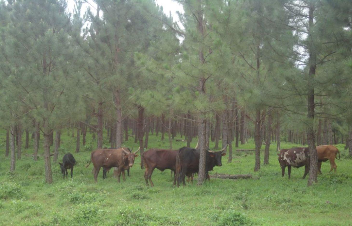
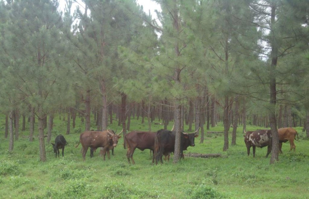
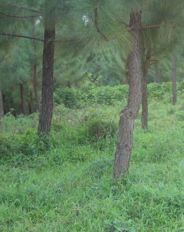
Pine tree forests have been strategically planted on previously bare ridges and slopes to mitigate mass soil movement.
2.2 การอธิบายแบบละเอียดของเทคโนโลยี
คำอธิบาย:
The technology has mitigated soil erosion and damage on road infrastructure by fast flowing runoff, and rejuvenated biodiversity in the area. Much forest cover in Mwizi has been decimated as the need for fuel wood, charcoal and land for agriculture has increased. Coupled with changing weather patterns, human and livestock pressure, many ridges and hilly slopes have been left bare. With annual rainfall of over 1200 mm, runoff often causes extensive damage to cropland and road infrastructure.
In Rubagano, the Forest Department of the Government of Uganda set aside over 20 km2 of degraded ridges and hilly slopes for tree planting. The department planted the first part as a demonstration. The other part is being planted by individuals. Projects such as ULAMP (5 to 10 years ago) and Kagera TAMP (since 2011) have worked with the communities in the area, encouraging the technology by supplying Pinus spp seedlings, training farmers to start their own tree nurseries and forming Farmer Field Schools as vehicles for generation of community consensus on sustainable land management interventions.
Purpose of the Technology: The objectives of afforestation are to provide protection of the land against soil erosion, to return productivity to degraded hilly slopes, to reduce crop (banana) devastation caused by strong winds during rainy season, to grow the capacity of available fuel wood in the area, to diversify future households incomes and protect public infrastructure, especially the road network during the rainy season.
Establishment / maintenance activities and inputs: Most of the older trees, 3 years and over, were planted from seedlings bought from established tree growers. Currently, the Farmer Field Schools are planting seedlings from their own nurseries. In the nursery, plastic sleeves called poly-pots are packed with top-soil mixed with animal manure to provide a growing medium. A calculated amount of sand is added to enhance drainage. Sowing, watering and root pruning are carried out manually.
Out on the hilly slopes, the land user establishes the woodlot and maintains the trees using his own resources. Field trainers facilitated by Kagera TAMP provide technical guidance to farmers regularly.
Natural / human environment: Woodlots are established on degraded hilly slopes or any other land use type that is not under crop production. The trees need to be protected against destruction by wild fires and livestock.
2.3 รูปภาพของเทคโนโลยี
2.5 ประเทศภูมิภาค หรือสถานที่ตั้งที่เทคโนโลยีได้นำไปใช้และได้รับการครอบคลุมโดยการประเมินนี้
ประเทศ:
ยูกันดา
ภูมิภาค/รัฐ/จังหวัด:
Uganda
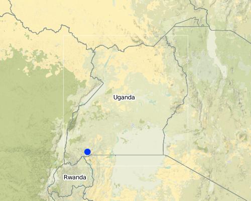
ข้อมูลจำเพาะเพิ่มเติมของสถานที่ตั้ง :
Mbarara
แสดงความคิดเห็น:
Boundary points of the Technology area: -0.85203 30.62232; -0.85792 30.62021; -0.85850 30.62204
Map
×2.6 วันที่การดำเนินการ
ถ้าไม่รู้ปีที่แน่นอน ให้ระบุวันที่โดยประมาณ:
- น้อยกว่า 10 ปี (ไม่นานนี้)
2.7 คำแนะนำของเทคโนโลยี
ให้ระบุว่าเทคโนโลยีถูกแนะนำเข้ามาอย่างไร:
- ทางโครงการหรือจากภายนอก
ความคิดเห็น (ประเภทของโครงการ เป็นต้น) :
2 years for concerted project initiative but more than 10 years for land user initiative.
3. การจัดประเภทของเทคโนโลยี SLM
3.1 วัตถุประสงค์หลักของเทคโนโลยี
- ลด ป้องกัน ฟื้นฟู การเสื่อมโทรมของที่ดิน
- สร้างผลกระทบทางด้านเศรษฐกิจที่เป็นประโยชน์
3.2 ประเภทของการใช้ที่ดินในปัจจุบันที่ได้นำเทคโนโลยีไปใช้

ป่า/พื้นที่ทำไม้
ผลิตภัณฑ์และบริการ:
- ไม้ซุง
- ไม้ที่นำมาทำเป็นเชื้อเพลิง
- การป้องกันภัยธรรมชาติ

การใช้ที่ดินแบบผสมผสาน (รวมถึงวนเกษตร)
- การปลูกพืชร่วมกับปศุสัตว์ (Agro-pastoralism)
- ปศุสัตว์ร่วมกับการทำป่าไม้ (Silvo-pastoralism)
แสดงความคิดเห็น:
Major land use problems (compiler’s opinion): Soil erosion on hilly slopes denuded by livestock overgrazing.
Major land use problems (land users’ perception): Continuous loss of soil and livestock pasture due to lack of, or inadequate vegetation cover
Plantation forestry: It takes long to harvest.
Problems / comments regarding forest use: The adoption is slow because trees take long period to mature and it is expensive in establishment stage.
3.3 ข้อมูลเพิ่มเติมเกี่ยวกับการใช้ที่ดิน
การใช้น้ำของที่ดินที่มีการใช้เทคโนโลยีอยู่:
- จากน้ำฝน
จำนวนของฤดูเพาะปลูกต่อปี:
- 2
ระบุ:
Longest growing period in days: 120 Longest growing period from month to month: September to December Second longest growing period in days: 90 Second longest growing period from month to month: March to May
3.4 กลุ่ม SLM ที่ตรงกับเทคโนโลยีนี้
- การปลูกป่าร่วมกับพืช
3.5 กระจายตัวของเทคโนโลยี
แสดงความคิดเห็น:
Total area covered by the SLM Technology is 3.5 m2.
Tree planting is continuous over a 20 km2 area.
3.6 มาตรการ SLM ที่ประกอบกันเป็นเทคโนโลยี

มาตรการจัดการพืช
- A1: พืช/สิ่งปกคลุมดิน

มาตรการอนุรักษ์ด้วยวิธีพืช
- V1: ต้นไม้และพุ่มไม้คลุมดิน
แสดงความคิดเห็น:
Main measures: vegetative measures
Type of vegetative measures: aligned: -against wind
3.7 รูปแบบหลักของการเสื่อมโทรมของที่ดินที่ได้รับการแก้ไขโดยเทคโนโลยี

การกัดกร่อนของดินโดยน้ำ
- Wt (Loss of topsoil): การสูญเสียดินชั้นบนหรือการกัดกร่อนที่ผิวดิน

การเสื่อมโทรมของดินทางด้านชีวภาพ
- Bc (Reduction of vegetation cover): การลดลงของจำนวนพืชที่ปกคลุมดิน
แสดงความคิดเห็น:
Main type of degradation addressed: Wt: loss of topsoil / surface erosion, Bc: reduction of vegetation cover
Main causes of degradation: deforestation / removal of natural vegetation (incl. forest fires) (Cutting of short savannah trees for fuel & agricuture land .), overgrazing (Communal and with large herds (over 150 per household)), droughts (Extended droughts over several years in the past decade)
Secondary causes of degradation: over-exploitation of vegetation for domestic use (Thatch, mulch, etc.)
3.8 การป้องกัน การลดลง หรือการฟื้นฟูความเสื่อมโทรมของที่ดิน
ระบุเป้าหมายของเทคโนโลยีกับความเสื่อมโทรมของที่ดิน:
- ป้องกันความเสื่อมโทรมของที่ดิน
- ลดความเสื่อมโทรมของดิน
แสดงความคิดเห็น:
Main goals: mitigation / reduction of land degradation
Secondary goals: prevention of land degradation
4. ข้อมูลจำเพาะด้านเทคนิค กิจกรรมการนำไปปฏิบัติใช้ ปัจจัยนำเข้า และค่าใช้จ่าย
4.1 แบบแปลนทางเทคนิคของเทคโนโลยี
ผู้เขียน:
Byonabye Proscovia, Kagera TAMP, Kabale
4.2 ข้อมูลจำเพาะด้านเทคนิคและการอธิบายแบบแปลนทางเทคนิค
Location: Rubagano, Mwizi, Mbarara District. Uganda
Date: 5-DEC-2013
Technical knowledge required for field staff / advisors: high (A good grounding in planted forest management including best practices and what could go wrong.)
Technical knowledge required for land users: high (Needs technical knowledge on seedling, planting, thinning weeding and spacing; maintenance including protection from fires and disease)
Main technical functions: control of concentrated runoff: impede / retard, improvement of ground cover, improvement of surface structure (crusting, sealing)
Secondary technical functions: control of raindrop splash, control of dispersed runoff: retain / trap, increase of infiltration, increase / maintain water stored in soil, reduction in wind speed, increase of biomass (quantity)
Aligned: -against wind
Vegetative material: T : trees / shrubs
Number of plants per (ha): 1000
Vertical interval between rows / strips / blocks (m): 3
Spacing between rows / strips / blocks (m): 3
Trees/ shrubs species: Trees (pine spp.) planted from seedlings
Slope (which determines the spacing indicated above): 15-25%
4.3 ข้อมูลทั่วไปเกี่ยวกับการคำนวณปัจจัยนำเข้าและค่าใช้จ่าย
อื่นๆ หรือสกุลเงินประจำชาติ (ระบุ):
UGX
ระบุอัตราแลกเปลี่ยนจากดอลลาร์สหรัฐเป็นสกุลเงินท้องถิ่น (ถ้าเกี่ยวข้อง) คือ 1 เหรียญสหรัฐ =:
2600.0
ระบุค่าเฉลี่ยของค่าจ้างในการจ้างแรงงานต่อวัน:
3.85
4.4 กิจกรรมเพื่อการจัดตั้ง
| กิจกรรม | ประเภทของมาตรการ | ช่วงเวลาดำเนินการ | |
|---|---|---|---|
| 1. | Digging holes | ด้วยวิธีพืช | Beginning of rainy season |
| 2. | Buying tree seedlings | ด้วยวิธีพืช | Beginning of rainy season |
| 3. | Transporting seedlings to the site | ด้วยวิธีพืช | Beginning of rainy season |
| 4. | Planting tree seedlings | ด้วยวิธีพืช | Beginning of rainy season |
| 5. | Fencing | ด้วยวิธีพืช | Any time before the beginning of relevant rainy season |
4.5 ค่าใช้จ่ายของปัจจัยนำเข้าที่จำเป็นสำหรับการจัดตั้ง
| ปัจจัยนำเข้า | หน่วย | ปริมาณ | ค่าใช้จ่ายต่อหน่วย | ค่าใช้จ่ายทั้งหมดต่อปัจจัยนำเข้า | %ของค่าใช้จ่ายที่ก่อให้เกิดขึ้นโดยผู้ใช้ที่ดิน | |
|---|---|---|---|---|---|---|
| แรงงาน | Labour | ha | 1.0 | 18.63 | 18.63 | 100.0 |
| อุปกรณ์ | Tools | ha | 1.0 | 3.0 | 3.0 | 100.0 |
| วัสดุด้านพืช | Seedlings | ha | 1.0 | 6.8 | 6.8 | |
| ค่าใช้จ่ายทั้งหมดของการจัดตั้งเทคโนโลยี | 28.43 | |||||
แสดงความคิดเห็น:
Duration of establishment phase: 12 month(s)
US $ per unit and US$ per hectare is not quantified because labour was contracted yearly at a cost of Shs 3,000,000.
4.6 การบำรุงรักษาสภาพหรือกิจกรรมที่เกิดขึ้นเป็นประจำ
| กิจกรรม | ประเภทของมาตรการ | ช่วงระยะเวลา/ความถี่ | |
|---|---|---|---|
| 1. | Weeding | ด้วยวิธีพืช | Once every rainy season |
| 2. | Pruning | ด้วยวิธีพืช |
4.7 ค่าใช้จ่ายของปัจจัยนำเข้าและกิจกรรมที่เกิดขึ้นเป็นประจำที่ต้องการการบำรุงรักษา (ต่อปี)
| ปัจจัยนำเข้า | หน่วย | ปริมาณ | ค่าใช้จ่ายต่อหน่วย | ค่าใช้จ่ายทั้งหมดต่อปัจจัยนำเข้า | %ของค่าใช้จ่ายที่ก่อให้เกิดขึ้นโดยผู้ใช้ที่ดิน | |
|---|---|---|---|---|---|---|
| แรงงาน | Labour | ha | 1.0 | 9.0 | 9.0 | 100.0 |
| อุปกรณ์ | Tools | ha | 1.0 | 3.0 | 3.0 | 100.0 |
| วัสดุด้านพืช | Seedlings | ha | 1.0 | 0.7 | 0.7 | |
| ค่าใช้จ่ายทั้งหมดของการบำรุงรักษาสภาพเทคโนโลยี | 12.7 | |||||
แสดงความคิดเห็น:
Machinery/ tools: pangas, hand hoes
Planting 900 pine tree seedlings per hectare (on average), at 3m by 3m spacing.
4.8 ปัจจัยสำคัญที่สุดที่มีผลกระทบต่อค่าใช้จ่าย
ปัจจัยสำคัญที่สุดที่มีผลกระทบต่อค่าใช้จ่ายต่างๆ:
Availability and cost of labour are the most determinate factors affecting establishment and maintenance of the technology.
5. สิ่งแวดล้อมทางธรรมชาติและของมนุษย์
5.1 ภูมิอากาศ
ฝนประจำปี
- < 250 ม.ม.
- 251-500 ม.ม.
- 501-750 ม.ม.
- 751-1,000 ม.ม.
- 1,001-1,500 ม.ม.
- 1,501-2,000 ม.ม.
- 2,001-3,000 ม.ม.
- 3,001-4,000 ม.ม.
- > 4,000 ม.ม.
ข้อมูลจำเพาะ/ความคิดเห็นเรื่องปริมาณน้ำฝน:
September to December and March to May rains. Altit
เขตภูมิอากาศเกษตร
- กึ่งชุ่มชื้น
Thermal climate class: tropics. Average annual temperature 18°C to 24°C, very close to the equator.
5.2 สภาพภูมิประเทศ
ค่าเฉลี่ยความลาดชัน:
- ราบเรียบ (0-2%)
- ลาดที่ไม่ชัน (3-5%)
- ปานกลาง (6-10%)
- เป็นลูกคลื่น (11-15%)
- เป็นเนิน (16-30%)
- ชัน (31-60%)
- ชันมาก (>60%)
ธรณีสัณฐาน:
- ที่ราบสูง/ที่ราบ
- สันเขา
- ไหล่เขา
- ไหล่เนินเขา
- ตีนเนิน
- หุบเขา
ระดับความสูง:
- 0-100 เมตร
- 101-500 เมตร
- 501-1,000 เมตร
- 1,001-1,500 เมตร
- 1,501-2,000 เมตร
- 2,001-2,500 เมตร
- 2,501-3,000 เมตร
- 3,001-4,000 เมตร
- > 4,000 เมตร
ให้ระบุถ้าเทคโนโลยีได้ถูกนำไปใช้:
- บริเวณแอ่งบนที่ราบ (concave situations)
ความคิดเห็นและข้อมูลจำเพาะเพิ่มเติมเรื่องสภาพภูมิประเทศ:
Altitudinal zone: The plantation area ranges between 1650 and 1850 m a.s.l.
5.3 ดิน
ค่าเฉลี่ยความลึกของดิน:
- ตื้นมาก (0-20 ซ.ม.)
- ตื้น (21-50 ซ.ม.)
- ลึกปานกลาง (51-80 ซ.ม.)
- ลึก (81-120 ซ.ม.)
- ลึกมาก (>120 ซ.ม.)
เนื้อดิน (ดินชั้นบน):
- หยาบ/เบา (ดินทราย)
อินทรียวัตถุในดิน:
- ต่ำ (<1%)
(ถ้ามี) ให้แนบคำอธิบายเรื่องดินแบบเต็มหรือระบุข้อมูลที่มีอยู่ เช่น ชนิดของดิน ค่า pH ของดินหรือความเป็นกรดของดิน ความสามารถในการแลกเปลี่ยนประจุบวก ไนโตรเจน ความเค็ม เป็นต้น:
Soil depth on average: Very shallow (it is easy to reach the underground rock)
Soil texture: Coarse/light (rocky and coarse)
Soil fertility: Very low (ranked 1, soil fertility was poor) and low (ranked 2)
Topsoil organic matter: Low (the land was bare with rocky soil)
Soil drainage/infiltration: Medium (water infiltrates slowly/easily)
Soil water storage capacity: Low (the soil drains easily)
5.4 ความเป็นประโยชน์และคุณภาพของน้ำ
ระดับน้ำใต้ดิน:
> 50 เมตร
น้ำไหลบ่าที่ผิวดิน:
ไม่ดีหรือไม่มีเลย
คุณภาพน้ำ (ที่ยังไม่ได้บำบัด):
เป็นน้ำเพื่อการดื่มที่ไม่ดี (จำเป็นต้องได้รับการบำบัด)
ความคิดเห็นและข้อมูลจำเพาะเพิ่มเติมเรื่องคุณภาพและปริมาณน้ำ:
Ground water table: >50m (It is very hard to reach ground water table)
Availability of surface water: Poor/none (while the rainfall is good, permanent wells are scarce. Runoff dams behind natural rock formations or concrete walls on a rock base, but quickly drys up after the rainy season)
Water quality (untreated): Poor drinking water (treatement required, while it looks a muddy brown, it has been used for drinking and other domestic purposes without observable harm to the users)
5.5 ความหลากหลายทางชีวภาพ
ความหลากหลายทางชนิดพันธุ์:
- ต่ำ
ความคิดเห็นและข้อมูลจำเพาะเพิ่มเติมของความหลากหลายทางชีวภาพ:
Slowly rejuvenating since the establishment of the technology.
5.6 ลักษณะของผู้ใช้ที่ดินที่นำเทคโนโลยีไปปฏิบัติใช้
แนวทางการตลาดของระบบการผลิต:
- ผสม (การเลี้ยงชีพ/ทำการค้า)
รายได้ที่มาจากนอกฟาร์ม:
- 10-50% ของรายได้ทั้งหมด
ระดับของความมั่งคั่งโดยเปรียบเทียบ:
- พอมีพอกิน
- รวย
เป็นรายบุคคล/ครัวเรือน:
- เป็นรายบุคคล/ครัวเรือน
เพศ:
- ชาย
ระบุลักษณะอื่นๆที่เกี่ยวข้องของผู้ใช้ที่ดิน:
Land users applying the Technology are mainly common / average land users
Difference in the involvement of women and men: In Rubagano, the women are mostly involved in ensuring food security of the household and are not normally involved in aforestation. However, the Farmer Field School methodology has brought many women on board and, helped by the understanding that fuel wood collection is a women's role, women are developing interest in the technology.
Population density: 100-200 persons/km2
Annual population growth: 3% - 4%
10% of the land users are very rich and own 40% of the land.
40% of the land users are rich and own 30% of the land.
40% of the land users are average wealthy and own 20% of the land.
10% of the land users are poor and own 10% of the land.
Off-farm income specification: The technology is new and apart from providing grazing land in the short to medium term, it will yield dividends in 20 to 25 years. Meanwhile, those who are keen on the technology continue to depend on their usual income generating activities, on-farm or off-farm.
Market orientation: Mixed (Land user wanted to reduce soil erosion , increase fuel wood , diversify future income of households)
5.7 พื้นที่เฉลี่ยของที่ดินที่เป็นเจ้าของหรือเช่าโดยผู้ใช้ที่ดินที่นำเทคโนโลยีไปปฏิบัติใช้
- < 0.5 เฮกตาร์
- 0.5-1 เฮกตาร์
- 1-2 เฮกตาร์
- 2-5 เฮกตาร์
- 5-15 เฮกตาร์
- 15-50 เฮกตาร์
- 50-100 เฮกตาร์
- 100-500 เฮกตาร์
- 500-1,000 เฮกตาร์
- 1,000-10,000 เฮกตาร์
- >10,000 เฮกตาร์
พิจารณาว่าเป็นขนาดเล็ก กลาง หรือขนาดใหญ่ (ซึ่งอ้างอิงถึงบริบทระดับท้องถิ่น):
- ขนาดเล็ก
แสดงความคิดเห็น:
Most households have less than 1 ha. Few land users have 5-15 ha.
5.8 กรรมสิทธิ์ในที่ดิน สิทธิในการใช้ที่ดินและสิทธิในการใช้น้ำ
กรรมสิทธิ์ในที่ดิน:
- รายบุคคล ไม่ได้รับสิทธิครอบครอง
- รายบุคคล ได้รับสิทธิครอบครอง
สิทธิในการใช้ที่ดิน:
- รายบุคคล
แสดงความคิดเห็น:
The land users own land individually inherited or bought by the holders. Water harvesting and storage in underground tanks is slowly introducing individual water rights and household water security.
5.9 การเข้าถึงบริการและโครงสร้างพื้นฐาน
สุขภาพ:
- จน
- ปานกลาง
- ดี
การศึกษา:
- จน
- ปานกลาง
- ดี
ความช่วยเหลือทางด้านเทคนิค:
- จน
- ปานกลาง
- ดี
การจ้างงาน (เช่น ภายนอกฟาร์ม):
- จน
- ปานกลาง
- ดี
ตลาด:
- จน
- ปานกลาง
- ดี
พลังงาน:
- จน
- ปานกลาง
- ดี
ถนนและการขนส่ง:
- จน
- ปานกลาง
- ดี
น้ำดื่มและการสุขาภิบาล:
- จน
- ปานกลาง
- ดี
บริการด้านการเงิน:
- จน
- ปานกลาง
- ดี
6. ผลกระทบและสรุปคำบอกกล่าว
6.1 ผลกระทบในพื้นที่ดำเนินการ (On-site) จากการใช้เทคโนโลยี
ผลกระทบทางด้านเศรษฐกิจและสังคม
การผลิต
การผลิตไม้
แสดงความคิดเห็น/ระบุ:
Quantification of benefits is difficult at the moment because there is no harvest from the planted trees now.
ความหลากหลายของผลิตภัณฑ์
รายได้และค่าใช้จ่าย
รายได้จากฟาร์ม
ความหลากหลายของแหล่งผลิตรายได้
ภาระงาน
แสดงความคิดเห็น/ระบุ:
The costs of maintainance.
ผลกระทบด้านสังคมวัฒนธรรมอื่น ๆ
SLM หรือความรู้เรื่องความเสื่อมโทรมของที่ดิน
แสดงความคิดเห็น/ระบุ:
The land was bare before, land slides were destroying infrastructure like roads. Problem well mitigated.
Improved livelihoods and human well-being
แสดงความคิดเห็น/ระบุ:
Not yet to reap the economic benefits of tree planting because trees have not matured.
ผลกระทบด้านนิเวศวิทยา
วัฐจักรน้ำหรือน้ำบ่า
น้ำไหลบ่าที่ผิวดิน
การระบายน้ำส่วนเกิน
น้ำบาดาลหรือระดับน้ำในแอ่งน้ำบาดาล
การระเหย
ดิน
ความชื้นในดิน
สิ่งปกคลุมดิน
การสูญเสียดิน
ความหลากหลายทางชีวภาพของพืชและสัตว์
มวลชีวภาพ/เหนือดินชั้น C
ความหลากหลายทางชีวภาพของพืช
ความหลากหลายของสัตว์
ลดความเสี่ยงของภัยพิบัติ
ความเสี่ยงจากไฟ
แสดงความคิดเห็น/ระบุ:
With dense forest come the risk of fire. this is common in a neighboring district (Kiruhura) but is not yet a problem in Rubagano.
ความเร็วของลม
6.2 ผลกระทบนอกพื้นที่ดำเนินการ (Off-site) จากการใช้เทคโนโลยี
น้ำท่วมพื้นที่ท้ายน้ำ
การทับถมของดินตะกอนพื้นที่ท้ายน้ำ
ความเสียหายต่อพื้นที่เพาะปลูกของเพื่อนบ้าน
ความเสียหายต่อโครงสร้างพื้นฐานของรัฐหรือของเอกชน
6.3 การเผชิญและความตอบสนองของเทคโนโลยีต่อการเปลี่ยนแปลงสภาพภูมิอากาศที่ค่อยเป็นค่อยไป และสภาพรุนแรงของภูมิอากาศ / ภัยพิบัติ (ที่รับรู้ได้โดยผู้ใช้ที่ดิน)
การเปลี่ยนแปลงสภาพภูมิอากาศที่ค่อยเป็นค่อยไป
การเปลี่ยนแปลงสภาพภูมิอากาศที่ค่อยเป็นค่อยไป
| ฤดู | ประเภทของการเปลี่ยนแปลงสภาพภูมิอากาศที่ค่อยเป็นค่อยไป และสภาพรุนแรงของภูมิอากาศ | เทคโนโลยีมีวิธีการรับมืออย่างไร | |
|---|---|---|---|
| อุณหภูมิประจำปี | เพิ่มขึ้น | ดี |
สภาพรุนแรงของภูมิอากาศ (ภัยพิบัติ)
ภัยพิบัติทางอุตุนิยมวิทยา
| เทคโนโลยีมีวิธีการรับมืออย่างไร | |
|---|---|
| พายุฝนประจำท้องถิ่น | ดี |
| พายุลมประจำท้องถิ่น | ดี |
ภัยพิบัติจากสภาพภูมิอากาศ
| เทคโนโลยีมีวิธีการรับมืออย่างไร | |
|---|---|
| ภัยจากฝนแล้ง | ดี |
ผลลัพธ์ตามมาที่เกี่ยวข้องกับภูมิอากาศอื่น ๆ
ผลลัพธ์ตามมาที่เกี่ยวข้องกับภูมิอากาศอื่น ๆ
| เทคโนโลยีมีวิธีการรับมืออย่างไร | |
|---|---|
| ช่วงการปลูกพืชที่ลดลงมา | ดี |
แสดงความคิดเห็น:
Once established, the pine trees can tolerate all kinds of weather extremes. However, before the initial 12 or so months of establishment, the seedlings are very sensitive to drought and dry spells and will likely dry up because irrigation is not an option in Rubagano, water sources being quite scarce. Mulching helps in preserving soil moisture but the mulch should be at least 30cm away from the plant to avoid destruction by pests.
6.4 การวิเคราะห์ค่าใช้จ่ายและผลประโยชน์ที่ได้รับ
ผลประโยชน์ที่ได้รับเปรียบเทียบกับค่าใช้จ่ายในการจัดตั้งเป็นอย่างไร (จากมุมมองของผู้ใช้ที่ดิน)
ผลตอบแทนระยะสั้น:
เป็นกลางหรือสมดุล
ผลตอบแทนระยะยาว:
ด้านบวกอย่างมาก
ผลประโยชน์ที่ได้รับเปรียบเทียบกับค่าใช้จ่ายในการบำรุงรักษาหรือต้นทุนที่เกิดขึ้นซ้ำอีก เป็นอย่างไร (จากมุมมองของผู้ใช้ที่ดิน)
ผลตอบแทนระยะสั้น:
เป็นกลางหรือสมดุล
ผลตอบแทนระยะยาว:
ด้านบวกอย่างมาก
แสดงความคิดเห็น:
The land users expect to benefit from the technology when fully established.
6.5 การปรับตัวของเทคโนโลยี
ถ้ามีข้อมูลให้บอกปริมาณด้วย (จำนวนของครัวเรือนหรือครอบคลุมพื้นที่):
125
จากทั้งหมดที่ได้รับเทคโนโลยีเข้ามามีจำนวนเท่าใดที่ทำแบบทันที โดยไม่ได้รับการจูงใจด้านวัสดุหรือการเงินใด ๆ:
- 0-10%
แสดงความคิดเห็น:
100% of land user families have adopted the Technology with external material support
125 land user families have adopted the Technology with external material support
Comments on acceptance with external material support: While the external material contribution was by way of tree seedlings and contributed probably just 5%, all seedlings were supplied by the project.
Comments on spontaneous adoption: Land users have committed their own resources (over 95% of total establishment costs) but all received the seedlings, at least initially, form the project. The incentive was a wake-up call and the farmers have adopted the technology with enthusiasm.
There is a moderate trend towards spontaneous adoption of the Technology
Comments on adoption trend: The trend is slow due to high cost of initial investment and limited land for tree planting.
6.7 จุดแข็ง / ข้อได้เปรียบ / โอกาสของเทคโนโลยี
| จุดแข็ง / ข้อได้เปรียบ / โอกาสในทัศนคติของผู้ใช้ที่ดิน |
|---|
|
Protection of soil cover. How can they be sustained / enhanced? Fencing off the woodlots from livestock and other land users. |
|
Provision of fuel woodl. How can they be sustained / enhanced? Regular pruning and thinning. |
| จุดแข็ง / ข้อได้เปรียบ / โอกาสในทัศนคติของผู้รวบรวมหรือวิทยากรหลัก |
|---|
|
The technology has improved soil cover and reduced soil erosion. How can they be sustained / enhanced? More effort should be put into mobilization of land users in order to scale up best practices onto other areas with bare hills and slopes. |
|
The technology provides an easier alternative source of fuel wood from the remaining pockets of natural woodland. How can they be sustained / enhanced? Regular thinning should provide even more fuel wood and convince land users, especially women, of the advantages accruing from adopting the technology. |
|
Diversification of future household income. How can they be sustained / enhanced? Regular monitoring of the growth of trees to check for pests & diseases. |
|
improvement of micro climate conditions. How can they be sustained / enhanced? Planting trees that have little negative effects on other crops in other land use types. |
6.8 จุดอ่อน / ข้อเสียเปรียบ / ความเสี่ยงของเทคโนโลยีและวิธีการแก้ไข
| จุดอ่อน / ข้อเสียเปรียบ / ความเสี่ยงในทัศนคติของผู้รวบรวมหรือวิทยากรหลัก | มีวิธีการแก้ไขได้อย่างไร |
|---|---|
| Loss of biodiversity due to trees suppressing under growth of other species. | Copicing to raise the canopy and experimenting with multistory cropping could improve sunlight penetration and improve the emergence of undergrowth. |
7. การอ้างอิงและการเชื่อมต่อ
7.2 การอ้างอิงถึงสิ่งตีพิมพ์
หัวข้อ, ผู้เขียน, ปี, หมายเลข ISBN:
Kagera TAMP project website
ชื่อเรื่อง ผู้เขียน ปี ISBN:
http://www.fao.org/nr/kagera/en/
ลิงก์และโมดูล
ขยายทั้งหมด ย่อทั้งหมดลิงก์

Afforestation/Tree planting [ยูกันดา]
Tree planting carried out by individual land users on hilly slopes to improve soil cover ,reduce wind strength , provide wood fuel & household income.
- ผู้รวบรวม: Wilson Bamwerinde
โมดูล
ไม่มีโมดูล


