Pasture management through rotational grazing [ทาจิกิสถาน]
- ผู้สร้างสรรค์:
- การอัพเดท:
- ผู้รวบรวม: Malgorzata Conder
- ผู้เรียบเรียง: –
- ผู้ตรวจสอบ: Deborah Niggli
technologies_1585 - ทาจิกิสถาน
ดูส่วนย่อย
ขยายทั้งหมด ย่อทั้งหมด1. ข้อมูลทั่วไป
1.2 รายละเอียดที่ติดต่อได้ของผู้รวบรวมและองค์กรที่เกี่ยวข้องในการประเมินและการจัดเตรียมทำเอกสารของเทคโนโลยี
ผู้เชี่ยวชาญ SLM:
1.3 เงื่อนไขการใช้ข้อมูลที่ได้บันทึกผ่านทาง WOCAT
วันที่เก็บรวบรวมข้อมูล(ภาคสนาม) :
03/09/2012
ผู้รวบรวมและวิทยากรหลักยอมรับเงื่อนไขเกี่ยวกับการใช้ข้อมูลที่ถูกบันทึกผ่านทาง WOCAT:
ใช่
1.4 การเปิดเผยเรื่องความยั่งยืนของเทคโนโลยีที่ได้อธิบายไว้
เทคโนโลยีที่ได้อธิบายไว้นี้เป็นปัญหาของความเสื่อมโทรมโทรมของที่ดินหรือไม่ จึงไม่ได้รับการยอมรับว่าเป็นเทคโนโลยีเพื่อการจัดการที่ดินอย่างยั่งยืน:
ไม่ใช่
2. การอธิบายลักษณะของเทคโนโลยี SLM
2.1 การอธิบายแบบสั้น ๆ ของเทคโนโลยี
คำจำกัดความของเทคโนโลยี:
Rotational grazing on private grazing land used as daily pastures
2.2 การอธิบายแบบละเอียดของเทคโนโลยี
คำอธิบาย:
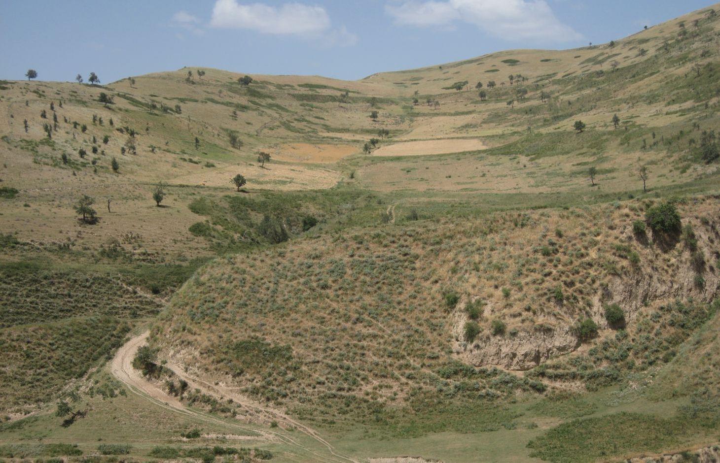
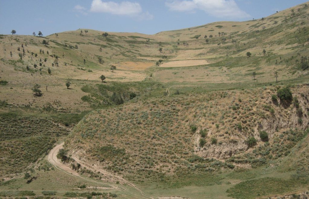
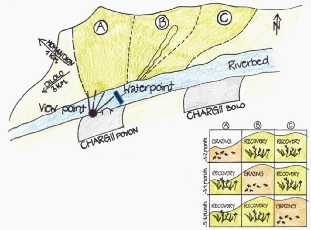
A riverbed divides the pasture where rotational grazing is practiced with the village Chargii poyon, where the certified land user and owner of the pasture lives. From a view point nearby his house, he has a good view on and hence a good control over the pasture area. This allows him to keep intrusive livestock outside, having a limited number of grazing livestock in the pasture. The area encompasses 119 ha, from which 5 ha are rented out as crop land.
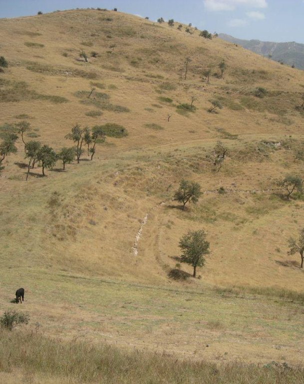
Land tenure conflicts about this pasture existed over many years, because there wasn’t declared any owner. The certified land user of Chargii poyon claims to possess the pasture since 1999. It is unclear how he got the land transferred. Being aware of the ongoing degradation of this land, the certified land user divided the area into 3 parts and introduced controlled grazing in 2007. While one part is being grazed the other two lie fallow. After one to two months of grazing in one area, the herds move to the next area. The rotation phases depend on the availability of grass. In June 2012, at the moment of documentation, there were 145 cows and some 30 goats and sheep. The number of animals is varying seasonally, with a higher amount of animals in summer than in winter. Compared to other pastures in summer, more grass in available on the pasture with rotational grazing. In winter grass availability is comparable between the pastures. This may explain why a higher number of livestock is recorded on the pasture with rotational grazing in summer.
The pasture is controlled by the farmer and further 4 people to avoid livestock intrusion.
In a seminar organized by Caritas Switzerland, the farmer learned about increasing long-term productivity of pastures by vegetation recovery. The idea of pasture rotation convinced him in order to raise productivity on long-term. The main reasons for changing the pasture management were the advanced stage of deforestation, increasing overgrazing, and the additional source to get the land taxes paid. The management of the pasture by rotational grazing on three areas allows the non-grazed areas to rest and recover. Less grazed and trampled areas result in an increase of the vegetation cover and thus to higher fodder quality, as well as increased soil stability and therefore a reduced risk of disasters, such as floods.
The farmer expected that the implementation of land conservation measures would stop the on-going pasture degradation and would assure long-term and sustainable use of the land. Despite the rotating system, the grazing land is still overgrazed and shows signs indicating moderate erosion, but it is less degraded than other pastures in the watershed. The area being the most far away from the settlement is in best conditions. The closer to the riverbed the more degraded and eroded the pasture is.
Additional measures are necessary to reduce soil erosion and gully formation in the area
Livestock owners have to pay a fee to the farmer for grazing cows, but not for grazing sheep and goats. The amount of the fee depends on the provenance of the herder. Fees vary greatly between the villages. Because of solidarity, Chargii villagers pay much less than herders from villages located further away. Momandion villagers pay 3 times, Dilolo villagers even 9 times more than Chargi villagers. But the certified land user claims to be flexible in the amount of fees for poor herders. He has to pay taxes to the government for the property and salary to the surveillants. If more money is available, also generated by the fees, the certified land user claims to invest a part of the money into the pasture. He would like to build another water point and to plant trees in the upper area. Livestock could graze in more remote areas which would reduce the pressure on the pastures in the lower area and decrease the soil compaction.
The pasture is located in the middle zone of the Obishur watershed and on the foothill above the riverbed plain. This pasture, located between the villages of Chargi poyon, Chargi bolo and Momandion and not far from Dilolo village, is a reachable place for many livestock of private households. In the riverbed, the only water point is installed where livestock is watered at midday. Due to tree cutting in the past, only a few shady places exist. Vegetation cover varies depending on the exposition of the slopes and the accessibility of the pasture. North-facing slopes have a more abundant vegetation cover. Some flanks are difficult to reach because of dense thorn bushes. A big gully, hardly accessible by livestock, is about to be covered again by naturally re-growing bushes and trees. Nevertheless, signs of erosion and rill building can be observed. Due to the closeness to the villages and to the pressure on natural resources it is crucial to sustain a controlled pasture management.
2.3 รูปภาพของเทคโนโลยี
2.5 ประเทศภูมิภาค หรือสถานที่ตั้งที่เทคโนโลยีได้นำไปใช้และได้รับการครอบคลุมโดยการประเมินนี้
ประเทศ:
ทาจิกิสถาน
ภูมิภาค/รัฐ/จังหวัด:
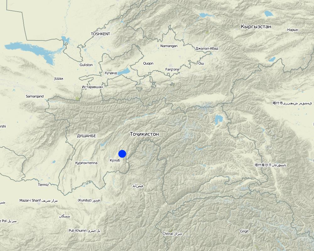
Khatlon, Tajikistan
ข้อมูลจำเพาะเพิ่มเติมของสถานที่ตั้ง :
Muminabad
Map
×2.6 วันที่การดำเนินการ
ถ้าไม่รู้ปีที่แน่นอน ให้ระบุวันที่โดยประมาณ:
- น้อยกว่า 10 ปี (ไม่นานนี้)
2.7 คำแนะนำของเทคโนโลยี
ให้ระบุว่าเทคโนโลยีถูกแนะนำเข้ามาอย่างไร:
- ทางโครงการหรือจากภายนอก
ความคิดเห็น (ประเภทของโครงการ เป็นต้น) :
Idea of how to improve ground cover was initiated by a workshop from Caritas, but the rotational grazing was introduced by the farmer himself in 2007
3. การจัดประเภทของเทคโนโลยี SLM
3.1 วัตถุประสงค์หลักของเทคโนโลยี
- ปรับปรุงการผลิตให้ดีขึ้น
- ลด ป้องกัน ฟื้นฟู การเสื่อมโทรมของที่ดิน
3.2 ประเภทของการใช้ที่ดินในปัจจุบันที่ได้นำเทคโนโลยีไปใช้

ทุ่งหญ้าเลี้ยงสัตว์
ทุ่งหญ้าเลี้ยงสัตว์ที่ใช้พื้นที่กว้าง:
- กึ่งเร่ร่อน / อาจมีการทำทุ่งหญ้าเลี้ยงสัตว์ร่วมด้วย (Semi-nomadism/ pastoralism)
- rotational grazing
แสดงความคิดเห็น:
Major land use problems (compiler’s opinion): Overgrazed pasture with frequent big gullies, rills and trampled areas. Almost complete deforestation of the grazing land.
Major land use problems (land users’ perception): Lack of water availability and water points for grazing livestock. Gradual degradation and erosion of the pasture which has to be stopped.
Grazingland comments: Rotation within 119 ha of grazing land
3.3 ข้อมูลเพิ่มเติมเกี่ยวกับการใช้ที่ดิน
การใช้น้ำของที่ดินที่มีการใช้เทคโนโลยีอยู่:
- จากน้ำฝน
จำนวนของฤดูเพาะปลูกต่อปี:
- 1
ระบุ:
Longest growing period in days: 180, Longest growing period from month to month: April-Sept/Oct
ความหนาแน่นของปศุสัตว์ (ถ้าเกี่ยวข้อง):
> 100 LU /km2
3.4 กลุ่ม SLM ที่ตรงกับเทคโนโลยีนี้
- ระบบหมุนเวียน (การปลูกพืชหมุนเวียน การพักดิน การเกษตรแบบไร่เลื่อนลอย)
- การจัดการปศุสัตว์และทุ่งหญ้าเลี้ยงสัตว์
3.5 กระจายตัวของเทคโนโลยี
ระบุการกระจายตัวของเทคโนโลยี:
- กระจายไปอย่างสม่ำเสมอในพื้นที่
ถ้าหากว่าเทคโนโลยีได้มีการกระจายออกไปอย่างสม่ำเสมอในพื้นที่ ให้ระบุปริมาณพื้นที่ที่ได้รับการครอบคลุมถึง:
- 1-10 ตร.กม.
แสดงความคิดเห็น:
Total area covered by the SLM Technology is 1.14 m2.
Total area is 119 ha, but 5 ha out of it are rented for cropping
3.6 มาตรการ SLM ที่ประกอบกันเป็นเทคโนโลยี

มาตรการอนุรักษ์ด้วยการจัดการ
- M2: การเปลี่ยนแปลงของการจัดการหรือระดับความเข้มข้น
3.7 รูปแบบหลักของการเสื่อมโทรมของที่ดินที่ได้รับการแก้ไขโดยเทคโนโลยี

การกัดกร่อนของดินโดยน้ำ
- Wt (Loss of topsoil): การสูญเสียดินชั้นบนหรือการกัดกร่อนที่ผิวดิน
- Wg (Gully erosion): การกัดกร่อนแบบร่องธารหรือการทำให้เกิดร่องน้ำเซาะ

การเสื่อมโทรมของดินทางด้านเคมี
- Cn (Fertility decline): ความอุดมสมบูรณ์และปริมาณอินทรียวัตถุในดินถูกทำให้ลดลงไป (ไม่ได้เกิดจากสาเหตุการกัดกร่อน)

การเสื่อมโทรมของดินทางด้านกายภาพ
- Pc (Compaction): การอัดแน่น

การเสื่อมโทรมของดินทางด้านชีวภาพ
- Bc (Reduction of vegetation cover): การลดลงของจำนวนพืชที่ปกคลุมดิน
แสดงความคิดเห็น:
Main causes of degradation: overgrazing, governance / institutional (No/ Insufficient management planning and control), livestock pressure (Due to subsistence of the population)
Secondary causes of degradation: deforestation / removal of natural vegetation (incl. forest fires), disturbance of water cycle (infiltration / runoff) (impact of overgrazing and deforestation), education, access to knowledge and support services
3.8 การป้องกัน การลดลง หรือการฟื้นฟูความเสื่อมโทรมของที่ดิน
ระบุเป้าหมายของเทคโนโลยีกับความเสื่อมโทรมของที่ดิน:
- ลดความเสื่อมโทรมของดิน
- ฟื้นฟูบำบัดที่ดินที่เสื่อมโทรมลงอย่างมาก
4. ข้อมูลจำเพาะด้านเทคนิค กิจกรรมการนำไปปฏิบัติใช้ ปัจจัยนำเข้า และค่าใช้จ่าย
4.1 แบบแปลนทางเทคนิคของเทคโนโลยี
4.2 ข้อมูลจำเพาะด้านเทคนิคและการอธิบายแบบแปลนทางเทคนิค
The hilly pasture of 114 ha in total is divided more or less vertically in 3 areas. In each area, the pasture between the ridge and the riverbed is covered. After having grazed one area for approximately one to two months, the herd moves to the next part. This means that two areas rest and grasses recover, while one is being grazed.
Location: Chargii poyon. Muminobod, Kathlon, Tajikistan
Technical knowledge required for field staff / advisors: low (When benefits of pasture management are known and understood, high technical knowledge isn't required)
Technical knowledge required for land users: low (When benefits of pasture management are known and understood, high technical knowledge isn't required)
Main technical functions: control of concentrated runoff: impede / retard, control of concentrated runoff: drain / divert, improvement of ground cover, increase of infiltration
Secondary technical functions: increase of surface roughness, improvement of surface structure (crusting, sealing), improvement of topsoil structure (compaction), stabilisation of soil (eg by tree roots against land slides), increase in organic matter, increase / maintain water stored in soil, sediment retention / trapping, sediment harvesting
Change of land use practices / intensity level: In 2007 controlled and rotational grazing was introduced where no pasture management existed before
4.3 ข้อมูลทั่วไปเกี่ยวกับการคำนวณปัจจัยนำเข้าและค่าใช้จ่าย
อื่นๆ หรือสกุลเงินประจำชาติ (ระบุ):
Somoni
ระบุอัตราแลกเปลี่ยนจากดอลลาร์สหรัฐเป็นสกุลเงินท้องถิ่น (ถ้าเกี่ยวข้อง) คือ 1 เหรียญสหรัฐ =:
4.83
ระบุค่าเฉลี่ยของค่าจ้างในการจ้างแรงงานต่อวัน:
12.40
4.4 กิจกรรมเพื่อการจัดตั้ง
| กิจกรรม | ประเภทของมาตรการ | ช่วงเวลาดำเนินการ | |
|---|---|---|---|
| 1. | Introduction/information of pasture management among the herders | ด้วยการจัดการ | once in 2007 |
4.5 ค่าใช้จ่ายของปัจจัยนำเข้าที่จำเป็นสำหรับการจัดตั้ง
แสดงความคิดเห็น:
Duration of establishment phase: 1 month(s)
4.6 การบำรุงรักษาสภาพหรือกิจกรรมที่เกิดขึ้นเป็นประจำ
| กิจกรรม | ประเภทของมาตรการ | ช่วงระยะเวลา/ความถี่ | |
|---|---|---|---|
| 1. | Salary for 5 people to guard pasture and herders: Monthly salary 70 Som/pers, pers d unknown | ด้วยการจัดการ | every day, from spring until autumn |
| 2. | Annual Rent | ด้วยการจัดการ | once a year |
4.7 ค่าใช้จ่ายของปัจจัยนำเข้าและกิจกรรมที่เกิดขึ้นเป็นประจำที่ต้องการการบำรุงรักษา (ต่อปี)
| ปัจจัยนำเข้า | หน่วย | ปริมาณ | ค่าใช้จ่ายต่อหน่วย | ค่าใช้จ่ายทั้งหมดต่อปัจจัยนำเข้า | %ของค่าใช้จ่ายที่ก่อให้เกิดขึ้นโดยผู้ใช้ที่ดิน | |
|---|---|---|---|---|---|---|
| แรงงาน | labour | ha | 1.0 | 590.3 | 590.3 | 100.0 |
| ค่าใช้จ่ายทั้งหมดของการบำรุงรักษาสภาพเทคโนโลยี | 590.3 | |||||
แสดงความคิดเห็น:
Costs which concern the information transfer to the herders is not calculated, as it is done informally. Only guardening by the employed people is monetarised.
4.8 ปัจจัยสำคัญที่สุดที่มีผลกระทบต่อค่าใช้จ่าย
ปัจจัยสำคัญที่สุดที่มีผลกระทบต่อค่าใช้จ่ายต่างๆ:
The farmer already owns the land user certificate for the property and only has to pay annual taxes and the people who control the pasture. He covers these costs with the rent he gets for the grazing livestock.
5. สิ่งแวดล้อมทางธรรมชาติและของมนุษย์
5.1 ภูมิอากาศ
ฝนประจำปี
- < 250 ม.ม.
- 251-500 ม.ม.
- 501-750 ม.ม.
- 751-1,000 ม.ม.
- 1,001-1,500 ม.ม.
- 1,501-2,000 ม.ม.
- 2,001-3,000 ม.ม.
- 3,001-4,000 ม.ม.
- > 4,000 ม.ม.
ข้อมูลจำเพาะ/ความคิดเห็นเรื่องปริมาณน้ำฝน:
Totally 800mm: 700mm in winter-spring, July-Sept dry season (At 1200mm asl, wheater station Muminabad). Precipitation increases 60mm per 100m of altitude in average.
เขตภูมิอากาศเกษตร
- กึ่งชุ่มชื้น
Thermal climate class: temperate
5.2 สภาพภูมิประเทศ
ค่าเฉลี่ยความลาดชัน:
- ราบเรียบ (0-2%)
- ลาดที่ไม่ชัน (3-5%)
- ปานกลาง (6-10%)
- เป็นลูกคลื่น (11-15%)
- เป็นเนิน (16-30%)
- ชัน (31-60%)
- ชันมาก (>60%)
ธรณีสัณฐาน:
- ที่ราบสูง/ที่ราบ
- สันเขา
- ไหล่เขา
- ไหล่เนินเขา
- ตีนเนิน
- หุบเขา
ระดับความสูง:
- 0-100 เมตร
- 101-500 เมตร
- 501-1,000 เมตร
- 1,001-1,500 เมตร
- 1,501-2,000 เมตร
- 2,001-2,500 เมตร
- 2,501-3,000 เมตร
- 3,001-4,000 เมตร
- > 4,000 เมตร
5.3 ดิน
ค่าเฉลี่ยความลึกของดิน:
- ตื้นมาก (0-20 ซ.ม.)
- ตื้น (21-50 ซ.ม.)
- ลึกปานกลาง (51-80 ซ.ม.)
- ลึก (81-120 ซ.ม.)
- ลึกมาก (>120 ซ.ม.)
เนื้อดิน (ดินชั้นบน):
- ปานกลาง (ดินร่วน ทรายแป้ง)
- ละเอียด/หนัก (ดินเหนียว)
อินทรียวัตถุในดิน:
- ต่ำ (<1%)
5.4 ความเป็นประโยชน์และคุณภาพของน้ำ
ระดับน้ำใต้ดิน:
5-50 เมตร
น้ำไหลบ่าที่ผิวดิน:
ไม่ดีหรือไม่มีเลย
คุณภาพน้ำ (ที่ยังไม่ได้บำบัด):
เป็นน้ำเพื่อการดื่มที่ไม่ดี (จำเป็นต้องได้รับการบำบัด)
5.5 ความหลากหลายทางชีวภาพ
ความหลากหลายทางชนิดพันธุ์:
- ต่ำ
5.6 ลักษณะของผู้ใช้ที่ดินที่นำเทคโนโลยีไปปฏิบัติใช้
แนวทางการตลาดของระบบการผลิต:
- เพื่อการยังชีพ (หาเลี้ยงตนเอง)
รายได้ที่มาจากนอกฟาร์ม:
- < 10% ของรายได้ทั้งหมด
ระดับของความมั่งคั่งโดยเปรียบเทียบ:
- รวย
เป็นรายบุคคล/ครัวเรือน:
- เป็นรายบุคคล/ครัวเรือน
เพศ:
- ชาย
ระบุลักษณะอื่นๆที่เกี่ยวข้องของผู้ใช้ที่ดิน:
Land users applying the Technology are mainly Leaders / privileged
Difference in the involvement of women and men: Men are taking decisions and administrating the property whereas women are working on the field. Privileged land user because he owns a big area.
Population density: 100-200 persons/km2
Annual population growth: 1% - 2% (Farmer owns a big property of 119 ha).
Off-farm income specification: Additionally bee-keeping
5.7 พื้นที่เฉลี่ยของที่ดินที่เป็นเจ้าของหรือเช่าโดยผู้ใช้ที่ดินที่นำเทคโนโลยีไปปฏิบัติใช้
- < 0.5 เฮกตาร์
- 0.5-1 เฮกตาร์
- 1-2 เฮกตาร์
- 2-5 เฮกตาร์
- 5-15 เฮกตาร์
- 15-50 เฮกตาร์
- 50-100 เฮกตาร์
- 100-500 เฮกตาร์
- 500-1,000 เฮกตาร์
- 1,000-10,000 เฮกตาร์
- >10,000 เฮกตาร์
พิจารณาว่าเป็นขนาดเล็ก กลาง หรือขนาดใหญ่ (ซึ่งอ้างอิงถึงบริบทระดับท้องถิ่น):
- ขนาดกลาง
5.8 กรรมสิทธิ์ในที่ดิน สิทธิในการใช้ที่ดินและสิทธิในการใช้น้ำ
กรรมสิทธิ์ในที่ดิน:
- รัฐ
สิทธิในการใช้ที่ดิน:
- เช่า
สิทธิในการใช้น้ำ:
- เกี่ยวกับชุมชน (ถูกจัดระเบียบ)
แสดงความคิดเห็น:
Land ownership is based on the land user certificate conferred by the government.
5.9 การเข้าถึงบริการและโครงสร้างพื้นฐาน
สุขภาพ:
- จน
- ปานกลาง
- ดี
การศึกษา:
- จน
- ปานกลาง
- ดี
ความช่วยเหลือทางด้านเทคนิค:
- จน
- ปานกลาง
- ดี
การจ้างงาน (เช่น ภายนอกฟาร์ม):
- จน
- ปานกลาง
- ดี
ตลาด:
- จน
- ปานกลาง
- ดี
พลังงาน:
- จน
- ปานกลาง
- ดี
ถนนและการขนส่ง:
- จน
- ปานกลาง
- ดี
น้ำดื่มและการสุขาภิบาล:
- จน
- ปานกลาง
- ดี
บริการด้านการเงิน:
- จน
- ปานกลาง
- ดี
6. ผลกระทบและสรุปคำบอกกล่าว
6.1 ผลกระทบในพื้นที่ดำเนินการ (On-site) จากการใช้เทคโนโลยี
ผลกระทบทางด้านเศรษฐกิจและสังคม
การผลิต
พื้นที่สำหรับการผลิต
การจัดการที่ดิน
รายได้และค่าใช้จ่าย
รายได้จากฟาร์ม
ความเหลื่อมล้ำทางเศรษฐกิจ
ผลกระทบด้านสังคมวัฒนธรรมอื่น ๆ
ความมั่นคงด้านอาหาร / พึ่งตนเองได้
สถานการณ์ด้านสุขภาพ
สถาบันของชุมชน
การบรรเทาความขัดแย้ง
contribution to human well-being
แสดงความคิดเห็น/ระบุ:
The farmer possessing the user certificate of the land states that even poor families are allowed to graze their livestock for a low rent and thus this pasture management seems to lead to more equity among the farmers of different economic classes. The better the livestock is fed, the higher the value of livestock and the wealthier the households are. But this statement could not be verified and should be taken with precaution.
ผลกระทบด้านนิเวศวิทยา
วัฐจักรน้ำหรือน้ำบ่า
ปริมาณน้ำ
น้ำไหลบ่าที่ผิวดิน
การระเหย
ดิน
ความชื้นในดิน
สิ่งปกคลุมดิน
การสูญเสียดิน
การเกิดแผ่นแข็งที่ผิวดิน /การเกิดชั้นดาน
การอัดแน่นของดิน
อินทรียวัตถุในดิน/ต่ำกว่าดินชั้น C
ความหลากหลายทางชีวภาพของพืชและสัตว์
มวลชีวภาพ/เหนือดินชั้น C
ความหลากหลายทางชีวภาพของพืช
ความหลากหลายของสัตว์
6.2 ผลกระทบนอกพื้นที่ดำเนินการ (Off-site) จากการใช้เทคโนโลยี
น้ำท่วมพื้นที่ท้ายน้ำ
6.3 การเผชิญและความตอบสนองของเทคโนโลยีต่อการเปลี่ยนแปลงสภาพภูมิอากาศที่ค่อยเป็นค่อยไป และสภาพรุนแรงของภูมิอากาศ / ภัยพิบัติ (ที่รับรู้ได้โดยผู้ใช้ที่ดิน)
การเปลี่ยนแปลงสภาพภูมิอากาศที่ค่อยเป็นค่อยไป
การเปลี่ยนแปลงสภาพภูมิอากาศที่ค่อยเป็นค่อยไป
| ฤดู | ประเภทของการเปลี่ยนแปลงสภาพภูมิอากาศที่ค่อยเป็นค่อยไป และสภาพรุนแรงของภูมิอากาศ | เทคโนโลยีมีวิธีการรับมืออย่างไร | |
|---|---|---|---|
| อุณหภูมิประจำปี | เพิ่มขึ้น | ดี |
สภาพรุนแรงของภูมิอากาศ (ภัยพิบัติ)
ภัยพิบัติทางอุตุนิยมวิทยา
| เทคโนโลยีมีวิธีการรับมืออย่างไร | |
|---|---|
| พายุฝนประจำท้องถิ่น | ดี |
| พายุลมประจำท้องถิ่น | ดี |
ภัยพิบัติจากสภาพภูมิอากาศ
| เทคโนโลยีมีวิธีการรับมืออย่างไร | |
|---|---|
| ภัยจากฝนแล้ง | ดี |
ภัยพิบัติจากน้ำ
| เทคโนโลยีมีวิธีการรับมืออย่างไร | |
|---|---|
| น้ำท่วมตามปกติ (แม่น้ำ) | ดี |
ผลลัพธ์ตามมาที่เกี่ยวข้องกับภูมิอากาศอื่น ๆ
ผลลัพธ์ตามมาที่เกี่ยวข้องกับภูมิอากาศอื่น ๆ
| เทคโนโลยีมีวิธีการรับมืออย่างไร | |
|---|---|
| ช่วงการปลูกพืชที่ลดลงมา | ไม่ทราบ |
แสดงความคิดเห็น:
Thanks to a better vegetation cover, the infiltration of rainwater is facilitated which results in an increase in soil moisture and thus to a higher resilience to droughts or higher temperatures.
6.4 การวิเคราะห์ค่าใช้จ่ายและผลประโยชน์ที่ได้รับ
ผลประโยชน์ที่ได้รับเปรียบเทียบกับค่าใช้จ่ายในการจัดตั้งเป็นอย่างไร (จากมุมมองของผู้ใช้ที่ดิน)
ผลตอบแทนระยะสั้น:
ด้านบวก
ผลตอบแทนระยะยาว:
ด้านบวกอย่างมาก
ผลประโยชน์ที่ได้รับเปรียบเทียบกับค่าใช้จ่ายในการบำรุงรักษาหรือต้นทุนที่เกิดขึ้นซ้ำอีก เป็นอย่างไร (จากมุมมองของผู้ใช้ที่ดิน)
ผลตอบแทนระยะสั้น:
ด้านบวก
ผลตอบแทนระยะยาว:
ด้านบวกอย่างมาก
แสดงความคิดเห็น:
Establishment and maintenance cost are low. Input consists mainly of the establishment of a pasture management which is based on dissemination of knowledge and information
6.5 การปรับตัวของเทคโนโลยี
แสดงความคิดเห็น:
1 land user families have adopted the Technology without any external material support
At the time of documentation it wasn't known if there exist other land users with a similar technology. There are more farmers grazing on that rotational pasture than in the very beginning.
Precondition is a big grazing land property, but only a small amount of farmers do own such a property.
6.7 จุดแข็ง / ข้อได้เปรียบ / โอกาสของเทคโนโลยี
| จุดแข็ง / ข้อได้เปรียบ / โอกาสในทัศนคติของผู้ใช้ที่ดิน |
|---|
| Equity amongst the farmers through flexible renting prices |
| จุดแข็ง / ข้อได้เปรียบ / โอกาสในทัศนคติของผู้รวบรวมหรือวิทยากรหลัก |
|---|
| No high establishment and maintenance cost |
| No high physical inputs required |
| Economic (better fodder quality) and ecological benefits (grass recovery, erosion reduction) can be seen as a direct result of pasture rotation |
| It is a good platform to share and spread knowledge of good practices, as over time many farmers come regularly to graze |
6.8 จุดอ่อน / ข้อเสียเปรียบ / ความเสี่ยงของเทคโนโลยีและวิธีการแก้ไข
| จุดอ่อน / ข้อเสียเปรียบ / ความเสี่ยงในทัศนคติของผู้ใช้ที่ดิน | มีวิธีการแก้ไขได้อย่างไร |
|---|---|
| Other cost intensive investments required like building another waterpipe and planting trees |
| จุดอ่อน / ข้อเสียเปรียบ / ความเสี่ยงในทัศนคติของผู้รวบรวมหรือวิทยากรหลัก | มีวิธีการแก้ไขได้อย่างไร |
|---|---|
| Precondition for such a setup is that one farmer owns the user certificates for a big grazing land, which is unusual. It is not clear how he got the user rights. | Ideally communal grazing land would be divided among several households sharing access to pastures |
| The pasture shows still a lot of signs of erosion and degraded areas. | Less livestock or division into more parts to allow the vegetation cover to rest for a longer time span. Enhance a homogeneous grazing of upper and more distant parts of the pasture. Control if pasture management is adhered consequently. Additional conservation measures such as resowing of specific areas, or fencing of badly degraded areas such as gullies. |
| This system works when there are communal pastures in the surrounding area. On the here documented pasture, less livestock is kept than on communal pastures. This lower density of livestock is not realistic at watersheds level, because it might raise the pressure on land in the other pastures. | Rotating within the grazing land just combats the fact that there is too much livestock compared to the available area |
| It is not clear whether the main motivation of this private pasture is to stop degradation or to collect the renting fees | Elaborate an investment plan showing how the collected fees will be reinvested into grazing land infrastructure and how much is taken for reimbursing the efforts of the certified land user. |
| It is not known whether the different fee levels according to the herders provenance does not create discontentment | Transparent price structure |
7. การอ้างอิงและการเชื่อมต่อ
7.1 วิธีการและแหล่งข้อมูล
- ไปเยี่ยมชมภาคสนาม การสำรวจพื้นที่ภาคสนาม
- การสัมภาษณ์กับผู้ใช้ที่ดิน
ลิงก์และโมดูล
ขยายทั้งหมด ย่อทั้งหมดลิงก์
ไม่มีลิงก์
โมดูล
ไม่มีโมดูล


