Adapted management of organic soils [เยอรมนี]
- ผู้สร้างสรรค์:
- การอัพเดท:
- ผู้รวบรวม: Johanna Fick
- ผู้เรียบเรียง: –
- ผู้ตรวจสอบ: Fabian Ottiger, David Streiff
technologies_1697 - เยอรมนี
ดูส่วนย่อย
ขยายทั้งหมด ย่อทั้งหมด1. ข้อมูลทั่วไป
1.2 รายละเอียดที่ติดต่อได้ของผู้รวบรวมและองค์กรที่เกี่ยวข้องในการประเมินและการจัดเตรียมทำเอกสารของเทคโนโลยี
ผู้เชี่ยวชาญ SLM:
Baum Sarah
+49 531 596 5237
sarah.baum@thuenen.de
Thünen Institute of Rural Studies
Bundesallee 50, D-38116 Braunschweig, Lower Saxony, Germany
เยอรมนี
ชื่อของโครงการซึ่งอำนวยความสะดวกในการทำเอกสารหรือการประเมินเทคโนโลยี (ถ้าเกี่ยวข้อง)
Book project: Making sense of research for sustainable land management (GLUES)ชื่อของโครงการซึ่งอำนวยความสะดวกในการทำเอกสารหรือการประเมินเทคโนโลยี (ถ้าเกี่ยวข้อง)
Climate Change - Land Use Strategies (CC-LandStraD / GLUES)ชื่อขององค์กรซึ่งอำนวยความสะดวกในการทำเอกสารหรือการประเมินเทคโนโลยี (ถ้าเกี่ยวข้อง)
Thünen Institute (Thünen Institute) - เยอรมนี1.3 เงื่อนไขการใช้ข้อมูลที่ได้บันทึกผ่านทาง WOCAT
วันที่เก็บรวบรวมข้อมูล(ภาคสนาม) :
29/07/2015
ผู้รวบรวมและวิทยากรหลักยอมรับเงื่อนไขเกี่ยวกับการใช้ข้อมูลที่ถูกบันทึกผ่านทาง WOCAT:
ใช่
1.5 อ้างอิงไปที่แบบสอบถามเรื่องแนวทาง SLM
Open dialogue platform on sustainable land management [เยอรมนี]
Establishing a dialogue platform on sustainable land management which is open to all stakeholders
- ผู้รวบรวม: Johanna Fick
2. การอธิบายลักษณะของเทคโนโลยี SLM
2.1 การอธิบายแบบสั้น ๆ ของเทคโนโลยี
คำจำกัดความของเทคโนโลยี:
Re-wetting of organic soils and following adapted management suitable for wet conditions like extensive grazing land or paludiculture.
2.2 การอธิบายแบบละเอียดของเทคโนโลยี
คำอธิบาย:
In peat lands, formed over centuries, reducing the ground water level leads to min-eralization: this results in greenhouse gas (GHG) emissions and leaching of dis-solved organic nutrients into adjacent water bodies. Furthermore, drainage leads to the destruction of highly specialized ecosystems. Re-wetting, by removing of drain-age systems (etc.), means the restoration of a higher ground water level which can reduce GHG emissions in the long term. Re-wetting to a water-level of 10 cm below the soil surface is ideal for reducing GHG emissions and preventing peat mineraliza-tion. One prerequisite for re-wetting is that soil degradation and peat mineralization are not too advanced. An adequate water supply must be available. Re-wetting also affects adjacent areas so possible impacts such as flooding of settlements and in-frastructure must be considered.
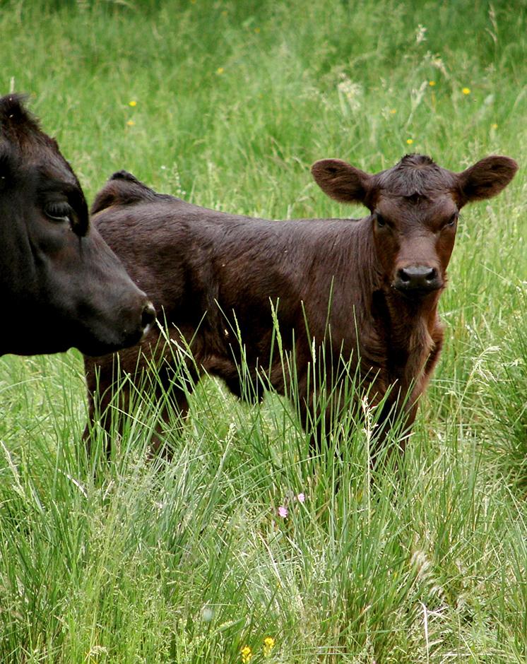
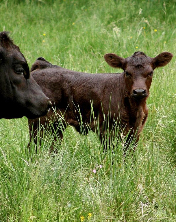
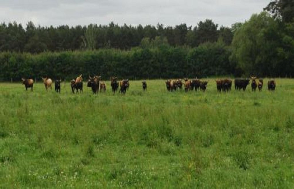
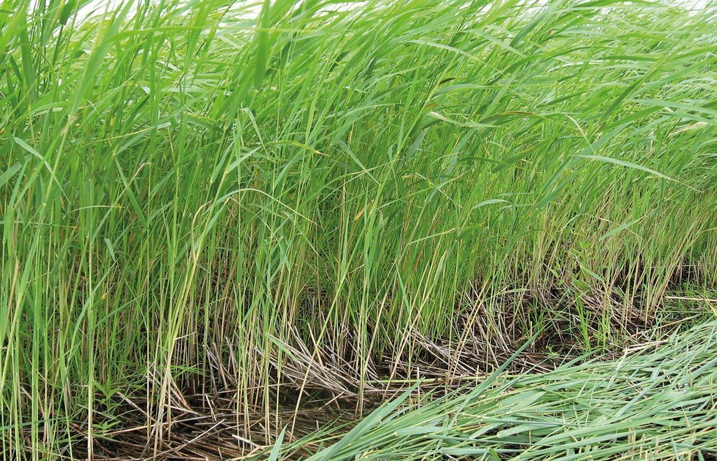
Purpose of the Technology: Land uses suitable for the soil conditions after re-wetting are extensive grazing, or paludiculture. Paludiculture is the cultivation of wet organic soils by preserving or renewing peat by planting and harvesting specific trees (e.g. alder), reeds and sedges. On fens, alder trees (for wood /biomass production) or plant species grown for their products (e.g. for thatch) or bioenergy, including the common reed, reed canary grass or cat’s-tail, can be cultivated. On peat bogs sphagnum farming as a peat substitute in horticulture, or as a medicinal plant, is possible. The first harvest of the common reed can take place four years post-establishment; thereafter annually. Alternatively, extensive livestock grazing with water buffalo or suitable breeds of cattle like Galloway or Heck has potential for re-wetted land. Year-round grazing is possible with a carrying capacity of up to 0.7 livestock units/ha.
Establishment / maintenance activities and inputs: Apart from avoiding huge amounts of GHG emissions and bringing land into alter-native production, further aims of re-wetting and adapting land use are:
- soil protection (soil structure, water content, peat protection);
- water protection (water quality, buffering / filtering water);
- protection of the landscape’s water regime and material balance (solute transport);
- biodiversity protection (retaining a sensitive ecosystem with specialized/ threatened species); and
- flood protection (organic soils can quickly absorb large amount of water).
There are many advantages for the environment while still creating a (modest) in-come for land users. Unlike most other bioenergy production chains (e.g. maize, rapeseed) which do not have these environmental co-benefits, paludiculture with the common reed can become a sustainable production system.
Natural / human environment: The Altmark region is located on the North German Plain. The region is predomi-nantly characterized by agriculture but has many forests too. Because of the high proportion of grassland, cattle are important. The use of biomass for bioenergy was increasing and many biogas plants were established in the last few years. Fens are mostly located in Altmark-County Salzwedel. Here, the average population density (42.7 inhabitants km2) is relatively low in the German context and the annual precipi-tation of 466mm is also below the overall German average.
2.3 รูปภาพของเทคโนโลยี
2.5 ประเทศภูมิภาค หรือสถานที่ตั้งที่เทคโนโลยีได้นำไปใช้และได้รับการครอบคลุมโดยการประเมินนี้
ประเทศ:
เยอรมนี
ภูมิภาค/รัฐ/จังหวัด:
Germany, Saxony-Anhalt
ข้อมูลจำเพาะเพิ่มเติมของสถานที่ตั้ง :
Altmarkkreis Salzwedel and district Stendal (total area of region: 4744 km²)
แสดงความคิดเห็น:
Potential area: 288 km2 (~ 6% of the region). The area stated is the area that is potentially usable for the technology due to available geographical data; requirements: fen (Nieder- und Anmoor), area under agricultural land use, outside of nature protection areas (national parc, nature reserve, FFH area, SPA area, Ramsar). Due to re-wetting restrictions by factors like nowadays water level in the area, settlements etc., the effective area suitable will be lower.
Boundary points of the Technology area: 52.842906; 10.760956
52.351751; 11.858462
52.541514; 12.187856
52.870405; 12.231025
53.050502; 11.633261
2.6 วันที่การดำเนินการ
ถ้าไม่รู้ปีที่แน่นอน ให้ระบุวันที่โดยประมาณ:
- น้อยกว่า 10 ปี (ไม่นานนี้)
2.7 คำแนะนำของเทคโนโลยี
ให้ระบุว่าเทคโนโลยีถูกแนะนำเข้ามาอย่างไร:
- ในช่วงการทดลองหรือการทำวิจัย
ความคิดเห็น (ประเภทของโครงการ เป็นต้น) :
answer refers to re-wetting
3. การจัดประเภทของเทคโนโลยี SLM
3.2 ประเภทของการใช้ที่ดินในปัจจุบันที่ได้นำเทคโนโลยีไปใช้

พื้นที่ปลูกพืช
- การปลูกพืชล้มลุกอายุปีเดียว

ทุ่งหญ้าเลี้ยงสัตว์
ทุ่งหญ้าเลี้ยงสัตว์ที่ใช้พื้นที่กว้าง:
- การทำฟาร์มปศุสัตว์ (Ranching)
ชนิดพันธุ์สัตว์และผลิตภัณฑ์หลัก:
Main species: Water buffalo, adapted cattles (e.g. Heck cattle, Galloway)
แสดงความคิดเห็น:
Major land use problems (compiler’s opinion): Drainage causes mineralization, sagging and reduction of organic matter of organic soils as well as high GHG emissions, disturbed water regimes, destruction of valuable ecosystems and loss of ecosystem services.
Major land use problems (land users’ perception): Long term use of drained organic soils leads to soil degradation and lower productivity. Thus, more fertilizer is needed. Due to sagging of organic soils, ditches and drainages need to be renewed every 10-15 years.
Ranching: Water buffalo, adapted cattles (e.g. Heck cattle, Galloway)
Grazingland comments: extensive grassland use with mowing and/or grazing; or paludiculture (e.g. Common Reed)
Future (final) land use (after implementation of SLM Technology): Grazing land: Ge: Extensive grazing land
Type of grazing system comments: extensive grassland use with mowing and/or grazing; or paludiculture (e.g. Common Reed)
ถ้าการใช้ที่ดินมีการเปลี่ยนแปลงเนื่องมาจากการนำเทคโนโลยีไปปฏิบัติใช้ ให้ระบุการใช้ที่ดินก่อนนำเทคโนโลยีไปปฏิบัติใช้:
Cropland: Ca: Annual cropping
3.3 ข้อมูลเพิ่มเติมเกี่ยวกับการใช้ที่ดิน
แสดงความคิดเห็น:
Water supply: rainfed, rainfed
จำนวนของฤดูเพาะปลูกต่อปี:
- 1
ระบุ:
Longest growing period in days: 234Longest growing period from month to month: Spring-autumn
ความหนาแน่นของปศุสัตว์ (ถ้าเกี่ยวข้อง):
50-100 LU /km2
3.4 กลุ่ม SLM ที่ตรงกับเทคโนโลยีนี้
- การป้องกัน / การจัดการพื้นที่ชุ่มน้ำ
- Re-wetting of organic soils
3.5 กระจายตัวของเทคโนโลยี
แสดงความคิดเห็น:
Total area covered by the SLM Technology is 288 m2.
Potential area: 288 km2 (~ 6% of the region). The area stated is the area that is potentially usable for the technology due to available geographical data; requirements: fen (Nieder- und Anmoor), area under agricultural land use, outside of nature protection areas (national parc, nature reserve, FFH area, SPA area, Ramsar). Due to re-wetting restrictions by factors like nowadays water level in the area, settlements etc., the effective area suitable will be lower.
3.6 มาตรการ SLM ที่ประกอบกันเป็นเทคโนโลยี

มาตรการอนุรักษ์ด้วยวิธีพืช
- V2: หญ้าและไม้ยืนต้น
- V5: อื่นๆ

มาตรการอนุรักษ์ด้วยโครงสร้าง
- S11: อื่น ๆ

มาตรการอนุรักษ์ด้วยการจัดการ
- M1: การเปลี่ยนรูปแบบของการใช้ประโยชน์ที่ดิน
- M2: การเปลี่ยนแปลงของการจัดการหรือระดับความเข้มข้น
- M3: การวางผังตามสิ่งแวดล้อมทางธรรมชาติและสิ่งแวดล้อมของมนุษย์
แสดงความคิดเห็น:
Main measures: vegetative measures, structural measures, management measures
Specification of other vegetative measures: paludiculture
Specification of other structural measures: removal of drainage system, dykes, etc. allowing rise in groundwater level
Type of vegetative measures: in blocks
3.7 รูปแบบหลักของการเสื่อมโทรมของที่ดินที่ได้รับการแก้ไขโดยเทคโนโลยี

การเสื่อมโทรมของดินทางด้านเคมี
- Cn (Fertility decline): ความอุดมสมบูรณ์และปริมาณอินทรียวัตถุในดินถูกทำให้ลดลงไป (ไม่ได้เกิดจากสาเหตุการกัดกร่อน)

การเสื่อมโทรมของดินทางด้านกายภาพ
- Pc (Compaction): การอัดแน่น
- Ps (Subsidence of organic soils): การยุบตัวของดินอินทรีย์ การทรุดตัวของดิน
- Pu (Loss of bio-productive function): การสูญเสียหน้าที่การผลิตทางชีวภาพอันเนื่องมาจากกิจกรรม อื่นๆ

การเสื่อมโทรมของดินทางด้านชีวภาพ
- Bh (Loss of habitat): การสูญเสียแหล่งที่อยู่
- Bs (Quality and species composition): องค์ประกอบหรือความหลากหลายทางคุณภาพและชนิดพันธุ์ลดลง

การเสื่อมโทรมของน้ำ
- Ha (Aridification): การเกิดความแห้งแล้ง
- Hg (Change in groundwater): การเปลี่ยนแปลงของน้ำบาดาลหรือระดับน้ำในแอ่งน้ำบาดาล
- Hq (Decline of groundwater quality): การลดลงของคุณภาพน้ำบาดาล
- Hw (Reduction of the buffering capacity of wetland): การลดลงของความทนทานต่อการเปลี่ยนแปลง ของพื้นที่ชุ่มน้ำ
แสดงความคิดเห็น:
Main type of degradation addressed: Pc: compaction, Ps: subsidence of organic soils, settling of soil, Pu: loss of bio-productive function due to other activities
Secondary types of degradation addressed: Cn: fertility decline and reduced organic matter content, Bh: loss of habitats, Bs: quality and species composition /diversity decline, Ha: aridification, Hg: change in groundwater / aquifer level, Hq: decline of groundwater quality, Hw: reduction of the buffering capacity of wetland areas
Main causes of degradation: soil management (drainage), disturbance of water cycle (infiltration / runoff) (drainage)
Secondary causes of degradation: crop management (annual, perennial, tree/shrub) (ploughing, fertilization)
3.8 การป้องกัน การลดลง หรือการฟื้นฟูความเสื่อมโทรมของที่ดิน
ระบุเป้าหมายของเทคโนโลยีกับความเสื่อมโทรมของที่ดิน:
- ลดความเสื่อมโทรมของดิน
แสดงความคิดเห็น:
Main goals: mitigation / reduction of land degradation
4. ข้อมูลจำเพาะด้านเทคนิค กิจกรรมการนำไปปฏิบัติใช้ ปัจจัยนำเข้า และค่าใช้จ่าย
4.1 แบบแปลนทางเทคนิคของเทคโนโลยี
ผู้เขียน:
Sarah Baum, Thünen Institute of Rural Studies, Bundesallee 50, D-38116, Braunschweig, Germany
4.2 ข้อมูลจำเพาะด้านเทคนิคและการอธิบายแบบแปลนทางเทคนิค
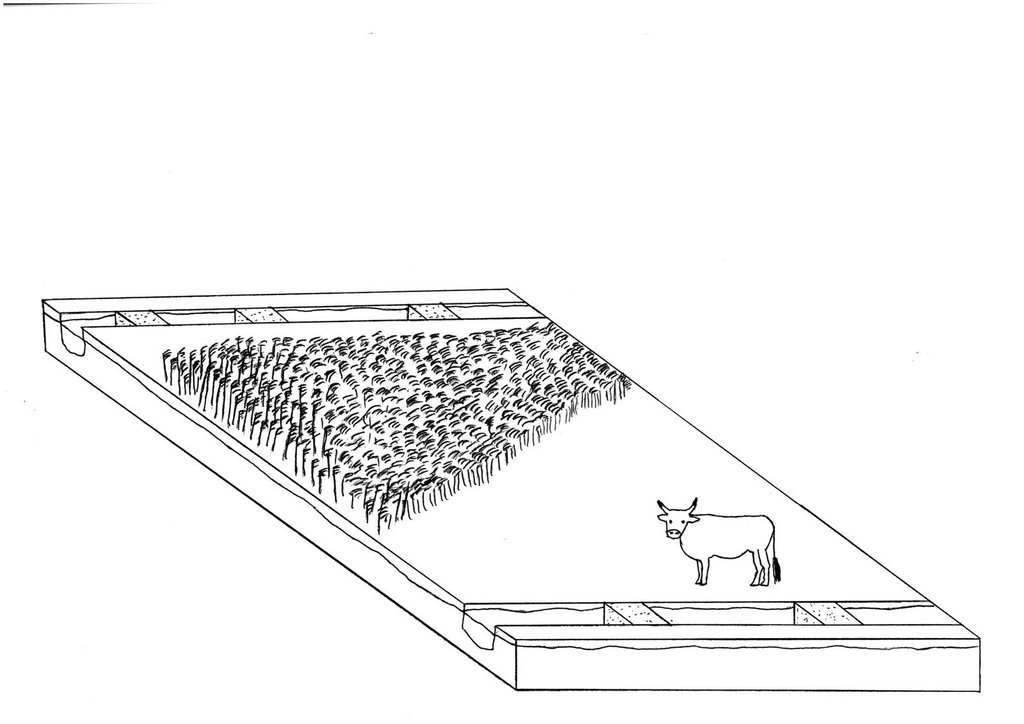
Re-wetting of a fen with adapted agricultural land use afterwards: extensive grazing with cattle and paludiculture in Common Reed production.
Date: 07/2015
Technical knowledge required for field staff / advisors: high
Technical knowledge required for land users: high
Technical knowledge required for planners: high (Re-wetting concerns large areas)
Main technical functions: increase in organic matter, increase / maintain water stored in soil, increase of groundwater level / recharge of groundwater, improvement of water quality, buffering / filtering water
In blocks
Vegetative material: G : grass, O : other
Number of plants per (ha): G: full coverage, O: 5000
Vertical interval within rows / strips / blocks (m): O: 2m
Width within rows / strips / blocks (m): O: 1m
Grass species: Grasses for extensive grassland use
Other species: Paludicultures like Common reed, Reed Canary grass
Slope (which determines the spacing indicated above): ~0%
Gradient along the rows / strips: ~0%
Structural measure: close/chamber ditches for groundwater level rise
Change of land use type: Crop land or intensive grassland to extensive grassland or paludiculture: see 2.5.2.2
Change of land use practices / intensity level: extensification
Layout change according to natural and human environment: Closed and chambered ditches/removed drainage systems: see 2.5.3.2
4.4 กิจกรรมเพื่อการจัดตั้ง
| กิจกรรม | ประเภทของมาตรการ | ช่วงเวลาดำเนินการ | |
|---|---|---|---|
| 1. | For fen re-wetting, removal or blocking of drainage systems like ditches, pumping stations, dykes or drainages is necessary. Extent depends strongly on local site conditions! (examples chosen from Landesumweltamt Brandenburg (2004)). | ด้วยโครงสร้าง | |
| 2. | Extensive grassland or paludiculture | ด้วยการจัดการ | |
| 3. | Extensive grassland: if field is not already used as grassland but as cropland: grassland sowing | ด้วยวิธีพืช | July/August |
| 4. | Extensive grassland: natural spread: no input | ด้วยวิธีพืช | |
| 5. | Paludiculture: planting Common Reed | ด้วยวิธีพืช | Spring |
4.5 ค่าใช้จ่ายของปัจจัยนำเข้าที่จำเป็นสำหรับการจัดตั้ง
| ปัจจัยนำเข้า | หน่วย | ปริมาณ | ค่าใช้จ่ายต่อหน่วย | ค่าใช้จ่ายทั้งหมดต่อปัจจัยนำเข้า | %ของค่าใช้จ่ายที่ก่อให้เกิดขึ้นโดยผู้ใช้ที่ดิน | |
|---|---|---|---|---|---|---|
| แรงงาน | Labour | ha | 1.0 | 300.0 | 300.0 | 100.0 |
| อุปกรณ์ | Machine use | ha | 1.0 | 400.0 | 400.0 | 100.0 |
| วัสดุด้านพืช | Seedling | ha | 1.0 | 2500.0 | 2500.0 | 100.0 |
| อื่น ๆ | Removal of drainage | ha | 1.0 | 200.0 | 200.0 | 100.0 |
| อื่น ๆ | Ditch filling | ha | 1.0 | 100.0 | 100.0 | 100.0 |
| อื่น ๆ | Make-ready and set-up cost | ha | 1.0 | 2500.0 | 2500.0 | 100.0 |
| ค่าใช้จ่ายทั้งหมดของการจัดตั้งเทคโนโลยี | 6000.0 | |||||
4.6 การบำรุงรักษาสภาพหรือกิจกรรมที่เกิดขึ้นเป็นประจำ
| กิจกรรม | ประเภทของมาตรการ | ช่วงระยะเวลา/ความถี่ | |
|---|---|---|---|
| 1. | water level management: weir control ~once a week: efforts depends strongly on local conditions. Control is also necessary when weirs are used to ensure controlled water level. | ด้วยโครงสร้าง | |
| 2. | extensive grassland: mowing | ด้วยวิธีพืช | 2 times per year |
| 3. | extensive grassland: grazing with water buffalo, adapted cattles (e.g. Heck cattle, Galloway) | ด้วยวิธีพืช | year round |
| 4. | paludiculture (Common Reed): harvesting | ด้วยวิธีพืช | Winter (ideally: frozen ground)/first harvest 4 years after establishment, thereafter annually |
| 5. | management | จัดการพืช | yearly |
4.7 ค่าใช้จ่ายของปัจจัยนำเข้าและกิจกรรมที่เกิดขึ้นเป็นประจำที่ต้องการการบำรุงรักษา (ต่อปี)
| ปัจจัยนำเข้า | หน่วย | ปริมาณ | ค่าใช้จ่ายต่อหน่วย | ค่าใช้จ่ายทั้งหมดต่อปัจจัยนำเข้า | %ของค่าใช้จ่ายที่ก่อให้เกิดขึ้นโดยผู้ใช้ที่ดิน | |
|---|---|---|---|---|---|---|
| แรงงาน | Labour | ha | 1.0 | 250.0 | 250.0 | 100.0 |
| อุปกรณ์ | Machine use | ha | 1.0 | 600.0 | 600.0 | 100.0 |
| อื่น ๆ | Management | ha | 1.0 | 150.0 | 150.0 | 100.0 |
| ค่าใช้จ่ายทั้งหมดของการบำรุงรักษาสภาพเทคโนโลยี | 1000.0 | |||||
แสดงความคิดเห็น:
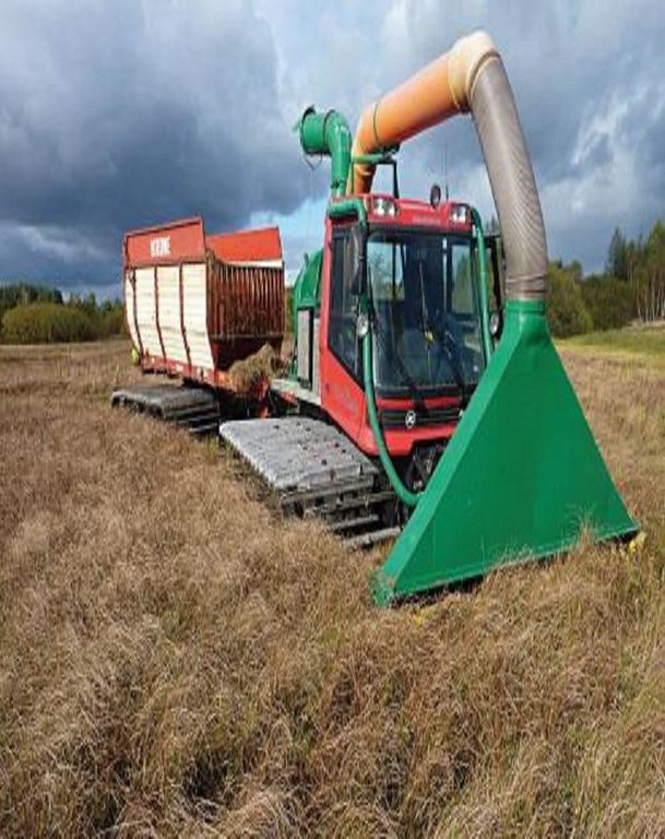
Machinery/ tools: paludiculture: harvest in winter (frozen soil): normal machinery. If soil is not frozen: special machinery: snow groomer (crawler chain) modified as harvester
4.8 ปัจจัยสำคัญที่สุดที่มีผลกระทบต่อค่าใช้จ่าย
ปัจจัยสำคัญที่สุดที่มีผลกระทบต่อค่าใช้จ่ายต่างๆ:
Only rough estimates on costs and income can be given due to the very new and innovative technology. The technology is still in the introductory phase at present
5. สิ่งแวดล้อมทางธรรมชาติและของมนุษย์
5.1 ภูมิอากาศ
ฝนประจำปี
- < 250 ม.ม.
- 251-500 ม.ม.
- 501-750 ม.ม.
- 751-1,000 ม.ม.
- 1,001-1,500 ม.ม.
- 1,501-2,000 ม.ม.
- 2,001-3,000 ม.ม.
- 3,001-4,000 ม.ม.
- > 4,000 ม.ม.
ข้อมูลจำเพาะ/ความคิดเห็นเรื่องปริมาณน้ำฝน:
Annual rainfall: 500-750 mm, 750-1000 mm, 1000-1500 mm, 1500-2000 mm
250-500mm: This only characterises the Altmark region (average 460mm); more rainfall is possible!
เขตภูมิอากาศเกษตร
- ชื้น
- กึ่งชุ่มชื้น
Thermal climate class: temperate. Altmark region
5.2 สภาพภูมิประเทศ
ค่าเฉลี่ยความลาดชัน:
- ราบเรียบ (0-2%)
- ลาดที่ไม่ชัน (3-5%)
- ปานกลาง (6-10%)
- เป็นลูกคลื่น (11-15%)
- เป็นเนิน (16-30%)
- ชัน (31-60%)
- ชันมาก (>60%)
ธรณีสัณฐาน:
- ที่ราบสูง/ที่ราบ
- สันเขา
- ไหล่เขา
- ไหล่เนินเขา
- ตีนเนิน
- หุบเขา
ระดับความสูง:
- 0-100 เมตร
- 101-500 เมตร
- 501-1,000 เมตร
- 1,001-1,500 เมตร
- 1,501-2,000 เมตร
- 2,001-2,500 เมตร
- 2,501-3,000 เมตร
- 3,001-4,000 เมตร
- > 4,000 เมตร
ความคิดเห็นและข้อมูลจำเพาะเพิ่มเติมเรื่องสภาพภูมิประเทศ:
Altitudinal zone: 0-100 m a.s.l. (this only characterises the Altmark region), 500-1000 m a.s.l., 1000-1500 m a.s.l.
5.3 ดิน
ค่าเฉลี่ยความลึกของดิน:
- ตื้นมาก (0-20 ซ.ม.)
- ตื้น (21-50 ซ.ม.)
- ลึกปานกลาง (51-80 ซ.ม.)
- ลึก (81-120 ซ.ม.)
- ลึกมาก (>120 ซ.ม.)
อินทรียวัตถุในดิน:
- สูง (>3%)
(ถ้ามี) ให้แนบคำอธิบายเรื่องดินแบบเต็มหรือระบุข้อมูลที่มีอยู่ เช่น ชนิดของดิน ค่า pH ของดินหรือความเป็นกรดของดิน ความสามารถในการแลกเปลี่ยนประจุบวก ไนโตรเจน ความเค็ม เป็นต้น:
Soil depth on average: shallow (21-50 cm) (refers to histic layer), moderately deep (51-80 cm), deep (81-120 cm), very deep (> 120 cm)
Soil fertility is very low-low
Soil drainage/infiltration is good
Soil water storage capacity is very high
5.4 ความเป็นประโยชน์และคุณภาพของน้ำ
ระดับน้ำใต้ดิน:
ที่ผิวดิน
น้ำไหลบ่าที่ผิวดิน:
เกินพอ
คุณภาพน้ำ (ที่ยังไม่ได้บำบัด):
เป็นน้ำใช้เพื่อการเกษตรเท่านั้น (การชลประทาน)
ความคิดเห็นและข้อมูลจำเพาะเพิ่มเติมเรื่องคุณภาพและปริมาณน้ำ:
Seasonal fluctuations (surface water): Wet conditions throughout the year.
5.5 ความหลากหลายทางชีวภาพ
ความหลากหลายทางชนิดพันธุ์:
- สูง
ความคิดเห็นและข้อมูลจำเพาะเพิ่มเติมของความหลากหลายทางชีวภาพ:
Not high in number but in quality! Highly specified species. Depends on definition of Biodiversity
5.6 ลักษณะของผู้ใช้ที่ดินที่นำเทคโนโลยีไปปฏิบัติใช้
แนวทางการตลาดของระบบการผลิต:
- ทำการค้า/การตลาด
เป็นรายบุคคล/ครัวเรือน:
- กลุ่ม/ชุมชน
ระดับของการใช้เครื่องจักรกล:
- การใช้เครื่องจักรหรือเครื่องยนต์
เพศ:
- หญิง
- ชาย
ระบุลักษณะอื่นๆที่เกี่ยวข้องของผู้ใช้ที่ดิน:
Population density: 10-50 persons/km2
Annual population growth: negative
Market orientation of production system: nature conservation
Market orientation of cropland production system: Comercial/market (cows for dairy farming and reed sold for bioenergy and thatching)
Market orientation of grazing land production system: Comercial/market (Grazing, mowing; paludiculture )
5.7 พื้นที่เฉลี่ยของที่ดินที่เป็นเจ้าของหรือเช่าโดยผู้ใช้ที่ดินที่นำเทคโนโลยีไปปฏิบัติใช้
- < 0.5 เฮกตาร์
- 0.5-1 เฮกตาร์
- 1-2 เฮกตาร์
- 2-5 เฮกตาร์
- 5-15 เฮกตาร์
- 15-50 เฮกตาร์
- 50-100 เฮกตาร์
- 100-500 เฮกตาร์
- 500-1,000 เฮกตาร์
- 1,000-10,000 เฮกตาร์
- >10,000 เฮกตาร์
5.8 กรรมสิทธิ์ในที่ดิน สิทธิในการใช้ที่ดินและสิทธิในการใช้น้ำ
กรรมสิทธิ์ในที่ดิน:
- รัฐ
- เป็นแบบชุมชนหรือหมู่บ้าน
- NGO
สิทธิในการใช้ที่ดิน:
- รายบุคคล
สิทธิในการใช้น้ำ:
- รายบุคคล
แสดงความคิดเห็น:
Land owners can re-wet their land and manage it suitable for wet conditions afterwards. The state or NGO, for example, can buy land and re-wet it; normally followed by nature protection. This technology can not be done by one land user. It has major impacts off-sites and reflects normally more then one farmer.
6. ผลกระทบและสรุปคำบอกกล่าว
6.1 ผลกระทบในพื้นที่ดำเนินการ (On-site) จากการใช้เทคโนโลยี
ผลกระทบทางด้านเศรษฐกิจและสังคม
การผลิต
การผลิตพืชผล
การผลิตพืชที่ใช้เลี้ยงปศุสัตว์
คุณภาพพืชที่ใช้เลี้ยงปศุสัตว์
การผลิตสัตว์
การเสี่ยงต่อความล้มเหลวในการผลิต
พื้นที่สำหรับการผลิต
การจัดการที่ดิน
ความเป็นประโยชน์และคุณภาพของน้ำ
ความต้องการน้ำจากการชลประทาน
รายได้และค่าใช้จ่าย
ค่าใช่จ่ายของปัจจัยการผลิตทางการเกษตร
แสดงความคิดเห็น/ระบุ:
Thorugh extensification
รายได้จากฟาร์ม
ความหลากหลายของแหล่งผลิตรายได้
แสดงความคิดเห็น/ระบุ:
possibly
ความเหลื่อมล้ำทางเศรษฐกิจ
ภาระงาน
แสดงความคิดเห็น/ระบุ:
Thorugh extensification
ผลกระทบด้านนิเวศวิทยา
วัฐจักรน้ำหรือน้ำบ่า
ปริมาณน้ำ
คุณภาพน้ำ
น้ำไหลบ่าที่ผิวดิน
น้ำบาดาลหรือระดับน้ำในแอ่งน้ำบาดาล
ดิน
ความชื้นในดิน
สิ่งปกคลุมดิน
แสดงความคิดเห็น/ระบุ:
In terms of former cropland
การสูญเสียดิน
การอัดแน่นของดิน
การหมุนเวียนและการเติมของธาตุอาหาร
แสดงความคิดเห็น/ระบุ:
Extensive usage
อินทรียวัตถุในดิน/ต่ำกว่าดินชั้น C
ความหลากหลายทางชีวภาพของพืชและสัตว์
ความหลากหลายทางชีวภาพของพืช
ความหลากหลายทางชีวภาพของสัตว์
ความหลากหลายของสัตว์
ลดความเสี่ยงของภัยพิบัติ
การปล่อยคาร์บอนและก๊าซเรือนกระจก
จำนวนก่อน SLM:
15-30
หลังจาก SLM:
0.8
แสดงความคิดเห็น/ระบุ:
Before conserv.: Ca. 15-30 tCO2eq/ha*a quantify (indicate unit) after conserv.: 0-8 tCO2equ/ha*a specify: mean reduction potential peat bogs: 15tCO2equ/ha*a; fens: 30tCO2equ/ha*a
ผลกระทบด้านนิเวศวิทยาอื่น ๆ
Value for nature conservation/relevant species
6.2 ผลกระทบนอกพื้นที่ดำเนินการ (Off-site) จากการใช้เทคโนโลยี
การไหลของน้ำคงที่และสม่ำเสมอในช่วงฤดูแล้ง
แสดงความคิดเห็น/ระบุ:
Perhaps
น้ำท่วมพื้นที่ท้ายน้ำ
การเกิดมลพิษในน้ำบาดาลหรือแม่น้ำ
ความสามารถต้านทานการเปลี่ยนแปลง / ความสามารถในการคัดกรอง
ความเสียหายต่อพื้นที่เพาะปลูกของเพื่อนบ้าน
แสดงความคิดเห็น/ระบุ:
Re-wetting is only possible on larger scales
6.3 การเผชิญและความตอบสนองของเทคโนโลยีต่อการเปลี่ยนแปลงสภาพภูมิอากาศที่ค่อยเป็นค่อยไป และสภาพรุนแรงของภูมิอากาศ / ภัยพิบัติ (ที่รับรู้ได้โดยผู้ใช้ที่ดิน)
การเปลี่ยนแปลงสภาพภูมิอากาศที่ค่อยเป็นค่อยไป
การเปลี่ยนแปลงสภาพภูมิอากาศที่ค่อยเป็นค่อยไป
| ฤดู | ประเภทของการเปลี่ยนแปลงสภาพภูมิอากาศที่ค่อยเป็นค่อยไป และสภาพรุนแรงของภูมิอากาศ | เทคโนโลยีมีวิธีการรับมืออย่างไร | |
|---|---|---|---|
| อุณหภูมิประจำปี | เพิ่มขึ้น | ไม่ค่อยดี |
สภาพรุนแรงของภูมิอากาศ (ภัยพิบัติ)
ภัยพิบัติทางอุตุนิยมวิทยา
| เทคโนโลยีมีวิธีการรับมืออย่างไร | |
|---|---|
| พายุฝนประจำท้องถิ่น | ดี |
| พายุลมประจำท้องถิ่น | ไม่ทราบ |
ภัยพิบัติจากสภาพภูมิอากาศ
| เทคโนโลยีมีวิธีการรับมืออย่างไร | |
|---|---|
| ภัยจากฝนแล้ง | ไม่ค่อยดี |
ภัยพิบัติจากน้ำ
| เทคโนโลยีมีวิธีการรับมืออย่างไร | |
|---|---|
| น้ำท่วมตามปกติ (แม่น้ำ) | ดี |
ผลลัพธ์ตามมาที่เกี่ยวข้องกับภูมิอากาศอื่น ๆ
ผลลัพธ์ตามมาที่เกี่ยวข้องกับภูมิอากาศอื่น ๆ
| เทคโนโลยีมีวิธีการรับมืออย่างไร | |
|---|---|
| ช่วงการปลูกพืชที่ลดลงมา | ดี |
6.4 การวิเคราะห์ค่าใช้จ่ายและผลประโยชน์ที่ได้รับ
ผลประโยชน์ที่ได้รับเปรียบเทียบกับค่าใช้จ่ายในการจัดตั้งเป็นอย่างไร (จากมุมมองของผู้ใช้ที่ดิน)
ผลตอบแทนระยะสั้น:
ด้านลบอย่างมาก
ผลตอบแทนระยะยาว:
ด้านลบ
ผลประโยชน์ที่ได้รับเปรียบเทียบกับค่าใช้จ่ายในการบำรุงรักษาหรือต้นทุนที่เกิดขึ้นซ้ำอีก เป็นอย่างไร (จากมุมมองของผู้ใช้ที่ดิน)
ผลตอบแทนระยะสั้น:
ด้านลบอย่างมาก
ผลตอบแทนระยะยาว:
ด้านลบ
แสดงความคิดเห็น:
Depends strongly on subsidies and other incentive mechanisms as well as opportunity costs (regionally different). Further, if re-wetting is not financed by the land user the economic benefit is greater but even less as before re-wetting.
6.5 การปรับตัวของเทคโนโลยี
จากทั้งหมดที่ได้รับเทคโนโลยีเข้ามามีจำนวนเท่าใดที่ทำแบบทันที โดยไม่ได้รับการจูงใจด้านวัสดุหรือการเงินใด ๆ:
- 0-10%
แสดงความคิดเห็น:
100% of land user families have adopted the Technology with external material support
There is no trend towards spontaneous adoption of the Technology
Comments on adoption trend: There is no increasing trend to adopt the technology as it is not economically attractive for farmer. But for environment groups (NGOs), without an economical interest, this measure can be interesting.
6.7 จุดแข็ง / ข้อได้เปรียบ / โอกาสของเทคโนโลยี
| จุดแข็ง / ข้อได้เปรียบ / โอกาสในทัศนคติของผู้รวบรวมหรือวิทยากรหลัก |
|---|
|
By re-wetting organic soil huge amounts of GHG emissions can be avoided on a relatively small area How can they be sustained / enhanced? Financial incentives for farmers are needed e.g. based on GHG-mitigation potential. Alternatively, areas can be bought by e.g. NGOs or government for re-wetting/ nature protection |
|
Paludiculture on re-wetted soils allows an adapted agricultural land use How can they be sustained / enhanced? Financial incentives (e.g. subside payments) for farmers are needed |
|
Extensive grassland cultivation on re-wetted soils allows an adapted agricultural land use (grazing/mowing) How can they be sustained / enhanced? Financial incentives (e.g. subside payments) for farmers are needed |
| The use of fertilizer and manure inputs leads to pollution of water bodies. The water quality will be enhanced by less fertilizer/manure input through this technology compared to intensive agriculture. |
| Due to the technology, higher water retention, flood prevention and biodiversity can increase compared to use of drained organic soils. |
6.8 จุดอ่อน / ข้อเสียเปรียบ / ความเสี่ยงของเทคโนโลยีและวิธีการแก้ไข
| จุดอ่อน / ข้อเสียเปรียบ / ความเสี่ยงในทัศนคติของผู้ใช้ที่ดิน | มีวิธีการแก้ไขได้อย่างไร |
|---|---|
| On re-wetted soil land use options are very restricted due to wet soil conditions. | Financial incentives for farmers are needed. |
| จุดอ่อน / ข้อเสียเปรียบ / ความเสี่ยงในทัศนคติของผู้รวบรวมหรือวิทยากรหลัก | มีวิธีการแก้ไขได้อย่างไร |
|---|---|
| High opportunity cost for land users: income from intensive cropland on drained soils is higher than income from re-wetted soils with extensive land use. | The technology could be economically attractive if farmers get financial incentives for applying it (re-wetting and adapted extensive usage). It would become even more attractive if no incentives were paid for e.g. maize production on drained organic soils (those incentives are actually paid if the maize is used for bioenergy production). |
7. การอ้างอิงและการเชื่อมต่อ
7.2 การอ้างอิงถึงสิ่งตีพิมพ์
หัวข้อ, ผู้เขียน, ปี, หมายเลข ISBN:
Bonn A, et al. (2014) Klimaschutz durch Wiedervernässung von kohlenstoffreichen Böden. In: Naturkapital und Klimapolitik-Synergien und Konflikte.
ชื่อเรื่อง ผู้เขียน ปี ISBN:
Naturkapital Deutschland TEEB DE Report. Technische Universität Berlin Helmholtz-Zentrum für Umweltforschung-UFZ, Berlin, Leipzig
หัวข้อ, ผู้เขียน, ปี, หมายเลข ISBN:
Wichtmann W, Wichmann S (2011) Environmental, Social and Economic Aspects of a Sustainable Biomass Production.
ชื่อเรื่อง ผู้เขียน ปี ISBN:
Journal of Sustainable Energy & Environment, Special Issue (2011):77-81
7.3 เชื่อมโยงกับข้อมูลที่มีอยู่บนออนไลน์
URL:
http://www.duene-greifswald.de/de/projekte.php_enim.php
URL:
http://www.naturkapital-teeb.de/publikationen/projekteigene-publikationen.html
URL:
http://daten.ktbl.de/feldarbeit/home.html
URL:
https://www.stmelf.bayern.de/idb/default.html
URL:
ttps://www.google.de/search?q=Leitfaden+zur+Renaturierung+von+Feuchtgebieten+in+Brandenburg.+&ie=utf-8&oe=utf-8&gws_rd=cr&ei=btyoVebdJcGYsAH4tpWoCA
ลิงก์และโมดูล
ขยายทั้งหมด ย่อทั้งหมดลิงก์

Open dialogue platform on sustainable land management [เยอรมนี]
Establishing a dialogue platform on sustainable land management which is open to all stakeholders
- ผู้รวบรวม: Johanna Fick
โมดูล
ไม่มีโมดูล


