Grass reseeding technology [เคนยา]
- ผู้สร้างสรรค์:
- การอัพเดท:
- ผู้รวบรวม: Kevin Mganga
- ผู้เรียบเรียง: –
- ผู้ตรวจสอบ: Rima Mekdaschi Studer
Reseeding
technologies_2288 - เคนยา
ดูส่วนย่อย
ขยายทั้งหมด ย่อทั้งหมด1. ข้อมูลทั่วไป
1.2 รายละเอียดที่ติดต่อได้ของผู้รวบรวมและองค์กรที่เกี่ยวข้องในการประเมินและการจัดเตรียมทำเอกสารของเทคโนโลยี
ชื่อขององค์กรซึ่งอำนวยความสะดวกในการทำเอกสารหรือการประเมินเทคโนโลยี (ถ้าเกี่ยวข้อง)
Department of Range and Wildlife Sciences, South Eastern Kenya University (SEKU) - เคนยา1.3 เงื่อนไขการใช้ข้อมูลที่ได้บันทึกผ่านทาง WOCAT
วันที่เก็บรวบรวมข้อมูล(ภาคสนาม) :
01/01/2016
ผู้รวบรวมและวิทยากรหลักยอมรับเงื่อนไขเกี่ยวกับการใช้ข้อมูลที่ถูกบันทึกผ่านทาง WOCAT:
ใช่
1.4 การเปิดเผยเรื่องความยั่งยืนของเทคโนโลยีที่ได้อธิบายไว้
เทคโนโลยีที่ได้อธิบายไว้นี้เป็นปัญหาของความเสื่อมโทรมโทรมของที่ดินหรือไม่ จึงไม่ได้รับการยอมรับว่าเป็นเทคโนโลยีเพื่อการจัดการที่ดินอย่างยั่งยืน:
ไม่ใช่
1.5 อ้างอิงไปที่แบบสอบถามเรื่องแนวทาง SLM
Projet lutte contre l‘erosion, recuperation et mise en … [บูร์กินาฟาโซ]
Une approche intégrée et multipartite au Sud Ouest du Burkina Faso, basée sur l’aménagement des bassins versants et sur la gestion durable des terres avec un fort accent sur la participation locale. Elle réalise des mesures physiques et biologiques de lutte contre l’érosion, d’adaptation au changement climatique et exécute des …
- ผู้รวบรวม: Rebecka Ridder
2. การอธิบายลักษณะของเทคโนโลยี SLM
2.1 การอธิบายแบบสั้น ๆ ของเทคโนโลยี
คำจำกัดความของเทคโนโลยี:
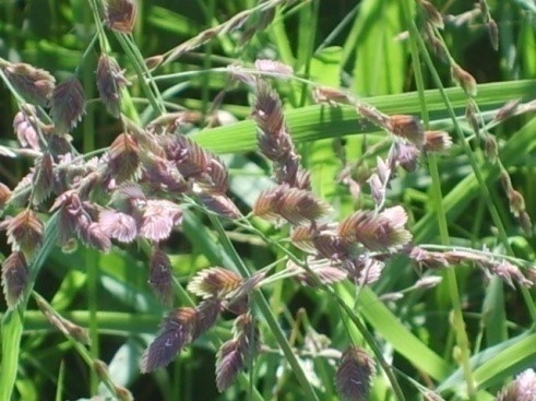
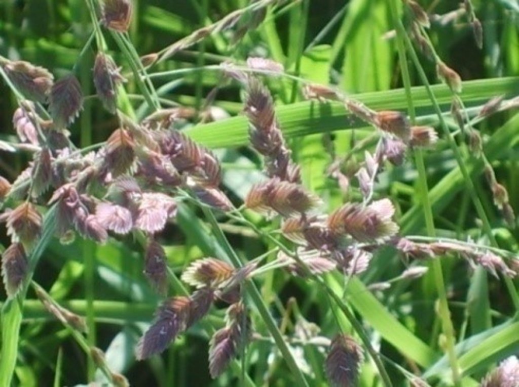
Grass reseeding is a sustainable land management practice aimed at rehabilitating degraded grazing pastures and provide livestock feed. This is mainly done using indigenous perennial grass species.
2.2 การอธิบายแบบละเอียดของเทคโนโลยี
คำอธิบาย:
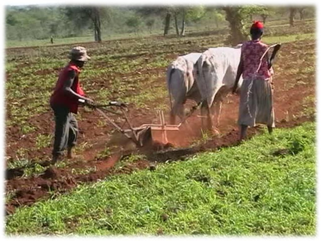
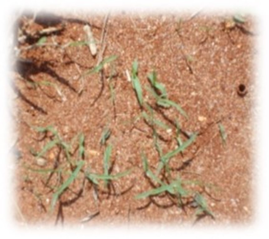
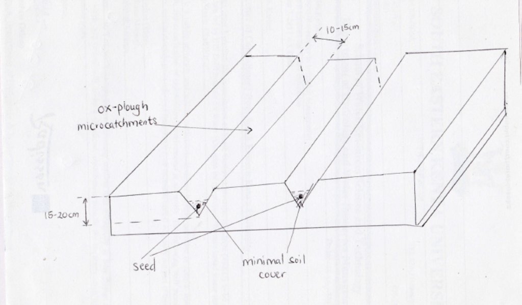
Grass reseeding technology is a sustainable land management practice especially among the pastoral and agro-pastoral communities inhabiting the arid and semi-arid rangelands of the world. Seed bed preparation involves clearing of invasive bush patches and creation of furrow micro-catchments across the slope using an ox-driven plough (traditional) or shallow and light ploughing using a tractor (modern) . Grass seeds are sown along the furrow micro-catchments created directly in the existing but degraded grazing land and are covered with light soil because the indigenous grass seeds are very small in size. This will support faster emergence of grass seedlings with least resistance. Slope should be generally flat or very gentle slope (<5%) to reduce the speed of run-off, thus prevent soil erosion and consequently the washing away of the sown grass seeds. Eroded and deposited seeds will eventually lead to uneven establishment of pasture, mainly concentrated downslope. Minimal soil disturbance by ox-plough or tractor facilitates root penetration of the seedlings and also helps breaking the soil hard-pan formed by continuous hoof action by grazing animals.
Micro-catchments created promotes in-situ rain-water harvesting, thus prolong availability of water for emerging seedlings. The main purpose for this technology is to rehabilitate degraded natural pastures and provide a continuous source of livestock feed especially during lean periods. Use of indigenous grass species is advocated for better results e.g. successful establishment and subsequent development. Ecological impacts of this technology include better soil coverage and reduced soil erosion. In addition to rehabilitating degraded natural pastures and improving pasture quality and quantity for livestock production, grass reseeding technology has additional socio-economic impacts notably improving rural livelihoods. This is through sale of hay and grass seed and excess milk in the local market, additional sources of income.
2.3 รูปภาพของเทคโนโลยี
2.5 ประเทศภูมิภาค หรือสถานที่ตั้งที่เทคโนโลยีได้นำไปใช้และได้รับการครอบคลุมโดยการประเมินนี้
ประเทศ:
เคนยา
ภูมิภาค/รัฐ/จังหวัด:
Eastern
ข้อมูลจำเพาะเพิ่มเติมของสถานที่ตั้ง :
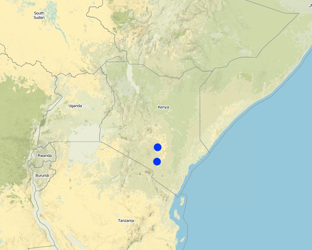
Kibwezi
แสดงความคิดเห็น:
Arid and Semi-Arid Lands (ASALS) in Kenya
Map
×2.6 วันที่การดำเนินการ
ถ้าไม่รู้ปีที่แน่นอน ให้ระบุวันที่โดยประมาณ:
- 10-50 ปี
2.7 คำแนะนำของเทคโนโลยี
ให้ระบุว่าเทคโนโลยีถูกแนะนำเข้ามาอย่างไร:
- ในช่วงการทดลองหรือการทำวิจัย
3. การจัดประเภทของเทคโนโลยี SLM
3.1 วัตถุประสงค์หลักของเทคโนโลยี
- ปรับปรุงการผลิตให้ดีขึ้น
- ลด ป้องกัน ฟื้นฟู การเสื่อมโทรมของที่ดิน
- ลดความเสี่ยงของภัยพิบัติ
- ชะลอการเปลี่ยนแปลงภูมิอากาศของโลกและผลกระทบ
3.2 ประเภทของการใช้ที่ดินในปัจจุบันที่ได้นำเทคโนโลยีไปใช้

ทุ่งหญ้าเลี้ยงสัตว์
ทุ่งหญ้าเลี้ยงสัตว์ที่ใช้พื้นที่กว้าง:
- การเลี้ยงสัตว์แบบเร่ร่อนไปตามที่ต่าง ๆ (Nomadism)
- กึ่งเร่ร่อน / อาจมีการทำทุ่งหญ้าเลี้ยงสัตว์ร่วมด้วย (Semi-nomadism/ pastoralism)
- การทำฟาร์มปศุสัตว์ (Ranching)
3.3 ข้อมูลเพิ่มเติมเกี่ยวกับการใช้ที่ดิน
การใช้น้ำของที่ดินที่มีการใช้เทคโนโลยีอยู่:
- จากน้ำฝน
จำนวนของฤดูเพาะปลูกต่อปี:
- 2
ระบุ:
Bimodal rainfall pattern (March-May) and (October-December)
ความหนาแน่นของปศุสัตว์ (ถ้าเกี่ยวข้อง):
On average 2-3 cattle, 7-8 goats, 2 sheep per household
3.4 กลุ่ม SLM ที่ตรงกับเทคโนโลยีนี้
- การจัดการปศุสัตว์และทุ่งหญ้าเลี้ยงสัตว์
- การรบกวนดินให้น้อยที่สุด
- การเก็บเกี่ยวน้ำ
3.5 กระจายตัวของเทคโนโลยี
ระบุการกระจายตัวของเทคโนโลยี:
- ใช้ ณ จุดที่เฉพาะเจาะจงหรือเน้นไปยังบริเวณพื้นที่ขนาดเล็ก
แสดงความคิดเห็น:
Practiced among several agropastoral and pastoral households in the arid and semi-arid lands
3.6 มาตรการ SLM ที่ประกอบกันเป็นเทคโนโลยี

มาตรการอนุรักษ์ด้วยวิธีพืช
- V2: หญ้าและไม้ยืนต้น

มาตรการอนุรักษ์ด้วยโครงสร้าง
- S4: คูน้ำแนวระดับ หลุม
3.7 รูปแบบหลักของการเสื่อมโทรมของที่ดินที่ได้รับการแก้ไขโดยเทคโนโลยี

การกัดกร่อนของดินโดยน้ำ
- Wt (Loss of topsoil): การสูญเสียดินชั้นบนหรือการกัดกร่อนที่ผิวดิน

การเสื่อมโทรมของดินทางด้านกายภาพ
- Pc (Compaction): การอัดแน่น
- Pi (Soil sealing)

การเสื่อมโทรมของดินทางด้านชีวภาพ
- Bc (Reduction of vegetation cover): การลดลงของจำนวนพืชที่ปกคลุมดิน
- Bh (Loss of habitat): การสูญเสียแหล่งที่อยู่
- Bq (Quantity/biomass decline): การลดลงของปริมาณหรือมวลชีวภาพ
- Bs (Quality and species composition): องค์ประกอบหรือความหลากหลายทางคุณภาพและชนิดพันธุ์ลดลง
3.8 การป้องกัน การลดลง หรือการฟื้นฟูความเสื่อมโทรมของที่ดิน
ระบุเป้าหมายของเทคโนโลยีกับความเสื่อมโทรมของที่ดิน:
- ลดความเสื่อมโทรมของดิน
- ฟื้นฟูบำบัดที่ดินที่เสื่อมโทรมลงอย่างมาก
4. ข้อมูลจำเพาะด้านเทคนิค กิจกรรมการนำไปปฏิบัติใช้ ปัจจัยนำเข้า และค่าใช้จ่าย
4.1 แบบแปลนทางเทคนิคของเทคโนโลยี
4.2 ข้อมูลจำเพาะด้านเทคนิคและการอธิบายแบบแปลนทางเทคนิค
15-20 cm deep and 10-15 cm wide furrow micro-catchments across the slope. Spacing between furrows is 15-20 cm and depends mostly on plant species. Seeds are sown along the microcatchments intentionally built to harvest rainwater. Flat or very gentle (<5%) slope to reduce the speed of run-off.
4.3 ข้อมูลทั่วไปเกี่ยวกับการคำนวณปัจจัยนำเข้าและค่าใช้จ่าย
ให้ระบุว่าค่าใช้จ่ายและปัจจัยนำเข้าได้รับการคำนวณอย่างไร:
- ต่อพื้นที่ที่ใช้เทคโนโลยี
ระบุขนาดและหน่วยพื้นที่:
Hectare
ระบุสกุลเงินที่ใช้คำนวณค่าใช้จ่าย:
- ดอลลาร์สหรัฐ
ระบุค่าเฉลี่ยของค่าจ้างในการจ้างแรงงานต่อวัน:
5
4.4 กิจกรรมเพื่อการจัดตั้ง
| กิจกรรม | ประเภทของมาตรการ | ช่วงเวลาดำเนินการ | |
|---|---|---|---|
| 1. | Creation of furrow micro-catchments with ox-plough | จัดการพืช | Before onset of the rains |
| 2. | Sowing (seed placement and covering with soil) | จัดการพืช | Before onset of the rains |
| 3. | Gapping (reseeding gaps with poor establishment and cover) | ด้วยวิธีพืช | After establishment |
4.5 ค่าใช้จ่ายของปัจจัยนำเข้าที่จำเป็นสำหรับการจัดตั้ง
| ปัจจัยนำเข้า | หน่วย | ปริมาณ | ค่าใช้จ่ายต่อหน่วย | ค่าใช้จ่ายทั้งหมดต่อปัจจัยนำเข้า | %ของค่าใช้จ่ายที่ก่อให้เกิดขึ้นโดยผู้ใช้ที่ดิน | |
|---|---|---|---|---|---|---|
| แรงงาน | Casual and Household labour | person-days | 4.0 | 5.0 | 20.0 | 100.0 |
| อุปกรณ์ | Hiring ox-driven plough | person-days | 4.0 | 100.0 | 400.0 | 100.0 |
| วัสดุด้านพืช | Seeds | kgs | 5.0 | 10.0 | 50.0 | 100.0 |
| ค่าใช้จ่ายทั้งหมดของการจัดตั้งเทคโนโลยี | 470.0 | |||||
4.6 การบำรุงรักษาสภาพหรือกิจกรรมที่เกิดขึ้นเป็นประจำ
| กิจกรรม | ประเภทของมาตรการ | ช่วงระยะเวลา/ความถี่ | |
|---|---|---|---|
| 1. | Gapping (i.e. reseeding bare areas (patches) with poor germination and cover) | ด้วยวิธีพืช | Seasonal |
แสดงความคิดเห็น:
Gapping is done to ensure uniform plant cover
4.7 ค่าใช้จ่ายของปัจจัยนำเข้าและกิจกรรมที่เกิดขึ้นเป็นประจำที่ต้องการการบำรุงรักษา (ต่อปี)
| ปัจจัยนำเข้า | หน่วย | ปริมาณ | ค่าใช้จ่ายต่อหน่วย | ค่าใช้จ่ายทั้งหมดต่อปัจจัยนำเข้า | %ของค่าใช้จ่ายที่ก่อให้เกิดขึ้นโดยผู้ใช้ที่ดิน | |
|---|---|---|---|---|---|---|
| แรงงาน | Casual and household labour | person-days | 1.0 | 5.0 | 5.0 | 100.0 |
| อุปกรณ์ | Ox-driven plough | person-days | 1.0 | 100.0 | 100.0 | 100.0 |
| วัสดุด้านพืช | Seed | kg | 1.0 | 10.0 | 10.0 | 100.0 |
| ค่าใช้จ่ายทั้งหมดของการบำรุงรักษาสภาพเทคโนโลยี | 115.0 | |||||
4.8 ปัจจัยสำคัญที่สุดที่มีผลกระทบต่อค่าใช้จ่าย
ปัจจัยสำคัญที่สุดที่มีผลกระทบต่อค่าใช้จ่ายต่างๆ:
Seed availability in the 'informal markets' i.e. between farmers and farmer groups, research organisation, influences the cost of grass seed. This is mainly determined by the preceding rainy season.
5. สิ่งแวดล้อมทางธรรมชาติและของมนุษย์
5.1 ภูมิอากาศ
ฝนประจำปี
- < 250 ม.ม.
- 251-500 ม.ม.
- 501-750 ม.ม.
- 751-1,000 ม.ม.
- 1,001-1,500 ม.ม.
- 1,501-2,000 ม.ม.
- 2,001-3,000 ม.ม.
- 3,001-4,000 ม.ม.
- > 4,000 ม.ม.
ระบุปริมาณน้ำฝนเฉลี่ยรายปี (ถ้ารู้) :หน่วย ม.ม.
700.00
ข้อมูลจำเพาะ/ความคิดเห็นเรื่องปริมาณน้ำฝน:
Highly variable in space, time and season
ระบุชื่อของสถานีตรวดวัดอากาศที่ใช้อ้างอิงคือ:
Meteorological Station - South Eastern Kenya University
เขตภูมิอากาศเกษตร
- กึ่งแห้งแล้ง
5.2 สภาพภูมิประเทศ
ค่าเฉลี่ยความลาดชัน:
- ราบเรียบ (0-2%)
- ลาดที่ไม่ชัน (3-5%)
- ปานกลาง (6-10%)
- เป็นลูกคลื่น (11-15%)
- เป็นเนิน (16-30%)
- ชัน (31-60%)
- ชันมาก (>60%)
ธรณีสัณฐาน:
- ที่ราบสูง/ที่ราบ
- สันเขา
- ไหล่เขา
- ไหล่เนินเขา
- ตีนเนิน
- หุบเขา
ระดับความสูง:
- 0-100 เมตร
- 101-500 เมตร
- 501-1,000 เมตร
- 1,001-1,500 เมตร
- 1,501-2,000 เมตร
- 2,001-2,500 เมตร
- 2,501-3,000 เมตร
- 3,001-4,000 เมตร
- > 4,000 เมตร
ให้ระบุถ้าเทคโนโลยีได้ถูกนำไปใช้:
- บริเวณสันเขา (convex situations)
ความคิดเห็นและข้อมูลจำเพาะเพิ่มเติมเรื่องสภาพภูมิประเทศ:
Altitude 900 m above sea level
Slope angle - flat 0-2% and gentle 3-5 % slopes
5.3 ดิน
ค่าเฉลี่ยความลึกของดิน:
- ตื้นมาก (0-20 ซ.ม.)
- ตื้น (21-50 ซ.ม.)
- ลึกปานกลาง (51-80 ซ.ม.)
- ลึก (81-120 ซ.ม.)
- ลึกมาก (>120 ซ.ม.)
เนื้อดิน (ดินชั้นบน):
- หยาบ/เบา (ดินทราย)
- ปานกลาง (ดินร่วน ทรายแป้ง)
เนื้อดินล่าง (> 20 ซ.ม.ต่ำจากผิวดิน):
- หยาบ/เบา (ดินทราย)
- ปานกลาง (ดินร่วน ทรายแป้ง)
อินทรียวัตถุในดิน:
- ต่ำ (<1%)
5.4 ความเป็นประโยชน์และคุณภาพของน้ำ
ระดับน้ำใต้ดิน:
5-50 เมตร
น้ำไหลบ่าที่ผิวดิน:
ปานกลาง
คุณภาพน้ำ (ที่ยังไม่ได้บำบัด):
เป็นน้ำเพื่อการดื่มที่ไม่ดี (จำเป็นต้องได้รับการบำบัด)
ความเค็มของน้ำเป็นปัญหาหรือไม่:
ไม่ใช่
กำลังเกิดน้ำท่วมในพื้นที่หรือไม่:
ไม่ใช่
ความคิดเห็นและข้อมูลจำเพาะเพิ่มเติมเรื่องคุณภาพและปริมาณน้ำ:
Seasonal flactuation depending on rainfall
5.5 ความหลากหลายทางชีวภาพ
ความหลากหลายทางชนิดพันธุ์:
- ปานกลาง
ความหลากหลายของแหล่งที่อยู่:
- ปานกลาง
ความคิดเห็นและข้อมูลจำเพาะเพิ่มเติมของความหลากหลายทางชีวภาพ:
Due to intensive utilisation of natural pastures, notably due to overgrazing, indigenous pasture species are depleted and replaced by less preferred invasive plant species. However, reseeded pastures reverses this trend by re-introducing various species the indigenous pastures which can naturally co-exist and reduce competition with other herbaceaous plant species, thereby increases biodiversity.
5.6 ลักษณะของผู้ใช้ที่ดินที่นำเทคโนโลยีไปปฏิบัติใช้
อยู่กับที่หรือเร่ร่อน:
- อยู่กับที่
- กึ่งเร่ร่อน
แนวทางการตลาดของระบบการผลิต:
- เพื่อการยังชีพ (หาเลี้ยงตนเอง)
- ผสม (การเลี้ยงชีพ/ทำการค้า)
รายได้ที่มาจากนอกฟาร์ม:
- 10-50% ของรายได้ทั้งหมด
ระดับของความมั่งคั่งโดยเปรียบเทียบ:
- จน
- พอมีพอกิน
เป็นรายบุคคล/ครัวเรือน:
- เป็นรายบุคคล/ครัวเรือน
- กลุ่ม/ชุมชน
ระดับของการใช้เครื่องจักรกล:
- งานที่ใช้แรงกาย
- การใช้กำลังจากสัตว์
เพศ:
- หญิง
- ชาย
อายุของผู้ใช้ที่ดิน:
- ผู้เยาว์
- วัยกลางคน
5.7 พื้นที่เฉลี่ยของที่ดินที่เป็นเจ้าของหรือเช่าโดยผู้ใช้ที่ดินที่นำเทคโนโลยีไปปฏิบัติใช้
- < 0.5 เฮกตาร์
- 0.5-1 เฮกตาร์
- 1-2 เฮกตาร์
- 2-5 เฮกตาร์
- 5-15 เฮกตาร์
- 15-50 เฮกตาร์
- 50-100 เฮกตาร์
- 100-500 เฮกตาร์
- 500-1,000 เฮกตาร์
- 1,000-10,000 เฮกตาร์
- >10,000 เฮกตาร์
พิจารณาว่าเป็นขนาดเล็ก กลาง หรือขนาดใหญ่ (ซึ่งอ้างอิงถึงบริบทระดับท้องถิ่น):
- ขนาดเล็ก
- ขนาดกลาง
5.8 กรรมสิทธิ์ในที่ดิน สิทธิในการใช้ที่ดินและสิทธิในการใช้น้ำ
กรรมสิทธิ์ในที่ดิน:
- เป็นแบบชุมชนหรือหมู่บ้าน
- รายบุคคล ได้รับสิทธิครอบครอง
สิทธิในการใช้ที่ดิน:
- เกี่ยวกับชุมชน (ถูกจัดระเบียบ)
- รายบุคคล
สิทธิในการใช้น้ำ:
- เกี่ยวกับชุมชน (ถูกจัดระเบียบ)
- รายบุคคล
แสดงความคิดเห็น:
Communal land use right - e.g. common grazing land, reserved and seasonal grazing areas (large scale)
Individual land use right - e.g. individual pasture establishment within individual owned land
Communal water use rights - e.g. watering point, river, lake, stream, community water reservoir, boreholes
Individual water use rights - e.g. individual tap water, roof water catchment
5.9 การเข้าถึงบริการและโครงสร้างพื้นฐาน
สุขภาพ:
- จน
- ปานกลาง
- ดี
การศึกษา:
- จน
- ปานกลาง
- ดี
ความช่วยเหลือทางด้านเทคนิค:
- จน
- ปานกลาง
- ดี
การจ้างงาน (เช่น ภายนอกฟาร์ม):
- จน
- ปานกลาง
- ดี
ตลาด:
- จน
- ปานกลาง
- ดี
พลังงาน:
- จน
- ปานกลาง
- ดี
ถนนและการขนส่ง:
- จน
- ปานกลาง
- ดี
น้ำดื่มและการสุขาภิบาล:
- จน
- ปานกลาง
- ดี
บริการด้านการเงิน:
- จน
- ปานกลาง
- ดี
6. ผลกระทบและสรุปคำบอกกล่าว
6.1 ผลกระทบในพื้นที่ดำเนินการ (On-site) จากการใช้เทคโนโลยี
ผลกระทบทางด้านเศรษฐกิจและสังคม
การผลิต
การผลิตพืชที่ใช้เลี้ยงปศุสัตว์
คุณภาพพืชที่ใช้เลี้ยงปศุสัตว์
รายได้และค่าใช้จ่าย
รายได้จากฟาร์ม
ความหลากหลายของแหล่งผลิตรายได้
ผลกระทบด้านนิเวศวิทยา
ดิน
สิ่งปกคลุมดิน
การสูญเสียดิน
6.2 ผลกระทบนอกพื้นที่ดำเนินการ (Off-site) จากการใช้เทคโนโลยี
ความสามารถต้านทานการเปลี่ยนแปลง / ความสามารถในการคัดกรอง
แสดงความคิดเห็น/ระบุ:
Reseeded areas improve the soil hydrological properties by reducing impact of rain drops thus reducing soil disturbance and increasing water infiltration capacity. Consequently, run-off and sediment production, an index of soil erosion, is greatly reduced.
6.3 การเผชิญและความตอบสนองของเทคโนโลยีต่อการเปลี่ยนแปลงสภาพภูมิอากาศที่ค่อยเป็นค่อยไป และสภาพรุนแรงของภูมิอากาศ / ภัยพิบัติ (ที่รับรู้ได้โดยผู้ใช้ที่ดิน)
การเปลี่ยนแปลงสภาพภูมิอากาศที่ค่อยเป็นค่อยไป
การเปลี่ยนแปลงสภาพภูมิอากาศที่ค่อยเป็นค่อยไป
| ฤดู | ประเภทของการเปลี่ยนแปลงสภาพภูมิอากาศที่ค่อยเป็นค่อยไป และสภาพรุนแรงของภูมิอากาศ | เทคโนโลยีมีวิธีการรับมืออย่างไร | |
|---|---|---|---|
| ฝนประจำปี | ลดลง | ดี |
6.4 การวิเคราะห์ค่าใช้จ่ายและผลประโยชน์ที่ได้รับ
ผลประโยชน์ที่ได้รับเปรียบเทียบกับค่าใช้จ่ายในการจัดตั้งเป็นอย่างไร (จากมุมมองของผู้ใช้ที่ดิน)
ผลตอบแทนระยะสั้น:
ด้านบวกเล็กน้อย
ผลตอบแทนระยะยาว:
ด้านบวก
ผลประโยชน์ที่ได้รับเปรียบเทียบกับค่าใช้จ่ายในการบำรุงรักษาหรือต้นทุนที่เกิดขึ้นซ้ำอีก เป็นอย่างไร (จากมุมมองของผู้ใช้ที่ดิน)
ผลตอบแทนระยะสั้น:
ด้านบวกเล็กน้อย
ผลตอบแทนระยะยาว:
ด้านบวก
6.5 การปรับตัวของเทคโนโลยี
- 10-50%
จากทั้งหมดที่ได้รับเทคโนโลยีเข้ามามีจำนวนเท่าใดที่ทำแบบทันที โดยไม่ได้รับการจูงใจด้านวัสดุหรือการเงินใด ๆ:
- 50-90%
6.6 การปรับตัว
เทคโนโลยีได้รับการปรับเปลี่ยนเมื่อเร็วๆนี้ เพื่อให้ปรับตัวเข้ากับสภาพที่กำลังเปลี่ยนแปลงหรือไม่:
ไม่ใช่
6.7 จุดแข็ง / ข้อได้เปรียบ / โอกาสของเทคโนโลยี
| จุดแข็ง / ข้อได้เปรียบ / โอกาสในทัศนคติของผู้ใช้ที่ดิน |
|---|
| Diversification of sources of livestock forage especially during the dry season (fodder reserves) |
| Diversification of source of income through sale of grass hay and seeds |
| Improving the environment i.e. rehabilitating degraded grazing land |
| จุดแข็ง / ข้อได้เปรียบ / โอกาสในทัศนคติของผู้รวบรวมหรือวิทยากรหลัก |
|---|
| Reliable source of livestock forage especially during periods of drought |
| Diversification of source of income through sale of grass hay and seeds |
| Improving the environment i.e. rehabilitating degraded grazing land |
| Climate change mitigation through carbon (C) sequestration |
6.8 จุดอ่อน / ข้อเสียเปรียบ / ความเสี่ยงของเทคโนโลยีและวิธีการแก้ไข
| จุดอ่อน / ข้อเสียเปรียบ / ความเสี่ยงในทัศนคติของผู้ใช้ที่ดิน | มีวิธีการแก้ไขได้อย่างไร |
|---|---|
| Successful establishment is dependant on amount, distribution and duration (rainy days) of rainfall in the area | Improved rainwater harvesting and storage technologies |
| Seed availability - quantity and quality | Large scale production of good quality indigenous seed to supply the pastoral and agropastoral communities at a subsidized price |
| จุดอ่อน / ข้อเสียเปรียบ / ความเสี่ยงในทัศนคติของผู้รวบรวมหรือวิทยากรหลัก | มีวิธีการแก้ไขได้อย่างไร |
|---|---|
| Rainfed and climatic (rainfall dependent) | Improved rainwater harvesting and storage technologies |
| Seed availability - quantity and quality | Large scale production of good quality indigenous seed to supply the pastoral and agropastoral communities at a subsidized price |
| Low uptake/interest among the youth, students | Sensitization of the youth as a source of income (business) |
7. การอ้างอิงและการเชื่อมต่อ
7.1 วิธีการและแหล่งข้อมูล
7.2 การอ้างอิงถึงสิ่งตีพิมพ์
หัวข้อ, ผู้เขียน, ปี, หมายเลข ISBN:
KZ Mganga, NKR Musimba, DM Nyariki. 2015. Competition indices of three perennial grasses used to rehabilitate degraded semi-arid rangelands in Kenya. The Rangelands Journal 37: 489-495
ชื่อเรื่อง ผู้เขียน ปี ISBN:
The Rangeland Journal website, US Dollars $25
หัวข้อ, ผู้เขียน, ปี, หมายเลข ISBN:
KZ Mganga, NKR Musimba, DM Nyariki. 2015. Combining sustainable land management technologies to combat land degradation and improve rural livelihoods in semi-arid lands in Kenya. Environmental Management 56: 1538-1548
ชื่อเรื่อง ผู้เขียน ปี ISBN:
Environmental Management Journal website, US Dollars $38
หัวข้อ, ผู้เขียน, ปี, หมายเลข ISBN:
KZ Mganga, NKR Musimba, MM Nyangito, DM Nyariki, AW Mwang’ombe. 2015. The choice of grass species to combat desertification in semi-arid Kenyan rangelands is greatly influenced by their forage value for livestock. Grass and Forage Science 70: 161-167.
ชื่อเรื่อง ผู้เขียน ปี ISBN:
Grass and Forage Science Journal website, US Dollars $38
7.3 เชื่อมโยงกับข้อมูลที่มีอยู่บนออนไลน์
ชื่อเรื่องหรือคำอธิบาย:
Competition indices of three perennial grasses used to rehabilitate degraded semi-arid rangelands in Kenya
URL:
http://www.publish.csiro.au/rj/RJ15023
ชื่อเรื่องหรือคำอธิบาย:
Combining sustainable land management technologies to combat land degradation and improve rural livelihoods in semi-arid lands in Kenya
URL:
https://link.springer.com/article/10.1007/s00267-015-0579-9
ชื่อเรื่องหรือคำอธิบาย:
The choice of grass species to combat desertification in semi-arid Kenyan rangelands is greatly influenced by their forage value for livestock
URL:
http://onlinelibrary.wiley.com/doi/10.1111/gfs.12089/abstract
ลิงก์และโมดูล
ขยายทั้งหมด ย่อทั้งหมดลิงก์

Projet lutte contre l‘erosion, recuperation et mise en … [บูร์กินาฟาโซ]
Une approche intégrée et multipartite au Sud Ouest du Burkina Faso, basée sur l’aménagement des bassins versants et sur la gestion durable des terres avec un fort accent sur la participation locale. Elle réalise des mesures physiques et biologiques de lutte contre l’érosion, d’adaptation au changement climatique et exécute des …
- ผู้รวบรวม: Rebecka Ridder
โมดูล
ไม่มีโมดูล


