Grass Covered Riparian Buffer Strips [นอร์เวย์]
- ผู้สร้างสรรค์:
- การอัพเดท:
- ผู้รวบรวม: Kamilla Skaalsveen
- ผู้เรียบเรียง: Zhanguo Bai
- ผู้ตรวจสอบ: Fabian Ottiger, Alexandra Gavilano
Grasdekt buffersone
technologies_1656 - นอร์เวย์
- บทสรุปทั้งหมดในรูปแบบของ PDF
- บทสรุปทั้งหมดในรูปแบบของ PDF เพื่อพิมพ์
- บทสรุปทั้งหมดในรูปหน้าเว็บ
- บทสรุปทั้งหมด (ไม่มีการจัดเรียง)
- Grass buffer zones alongside waterways in cropland: 3 กุมภาพันธ์ 2023 (public)
- Grass buffer zones alongside waterways in cropland: 17 มิถุนายน 2022 (inactive)
- Grass Covered Riparian Buffer Strips: 5 กันยายน 2019 (inactive)
- Grass Covered Riparian Buffer Strips: 16 มีนาคม 2017 (inactive)
- Grass Covered Riparian Buffer Strips: 16 มีนาคม 2017 (inactive)
ดูส่วนย่อย
ขยายทั้งหมด ย่อทั้งหมด1. ข้อมูลทั่วไป
1.2 รายละเอียดที่ติดต่อได้ของผู้รวบรวมและองค์กรที่เกี่ยวข้องในการประเมินและการจัดเตรียมทำเอกสารของเทคโนโลยี
ชื่อของโครงการซึ่งอำนวยความสะดวกในการทำเอกสารหรือการประเมินเทคโนโลยี (ถ้าเกี่ยวข้อง)
Preventing and Remediating degradation of soils in Europe through Land Care (EU-RECARE )ชื่อขององค์กรซึ่งอำนวยความสะดวกในการทำเอกสารหรือการประเมินเทคโนโลยี (ถ้าเกี่ยวข้อง)
Norwegian Institute for Agricultural and Environme (Norwegian Institute for Agricultural and Environme) - นอร์เวย์1.3 เงื่อนไขการใช้ข้อมูลที่ได้บันทึกผ่านทาง WOCAT
ผู้รวบรวมและวิทยากรหลักยอมรับเงื่อนไขเกี่ยวกับการใช้ข้อมูลที่ถูกบันทึกผ่านทาง WOCAT:
ใช่
1.5 Reference to Questionnaire(s) on SLM Approaches (documented using WOCAT)
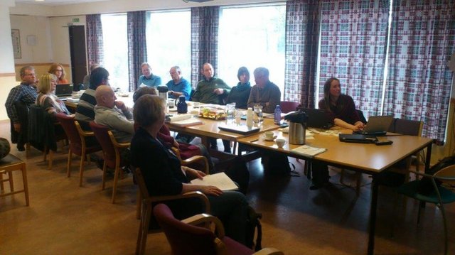
Regional Environmental program [นอร์เวย์]
Regulations and financial grants for reduction of pollution and promotion of the cultural landscape.
- ผู้รวบรวม: Kamilla Skaalsveen
2. การอธิบายลักษณะของเทคโนโลยี SLM
2.1 การอธิบายแบบสั้น ๆ ของเทคโนโลยี
คำจำกัดความของเทคโนโลยี:
Establishment of grass covered vegetation strips along cropland waterways for reduced erosion and infiltration of surface runoff.
2.2 การอธิบายแบบละเอียดของเทคโนโลยี
คำอธิบาย:
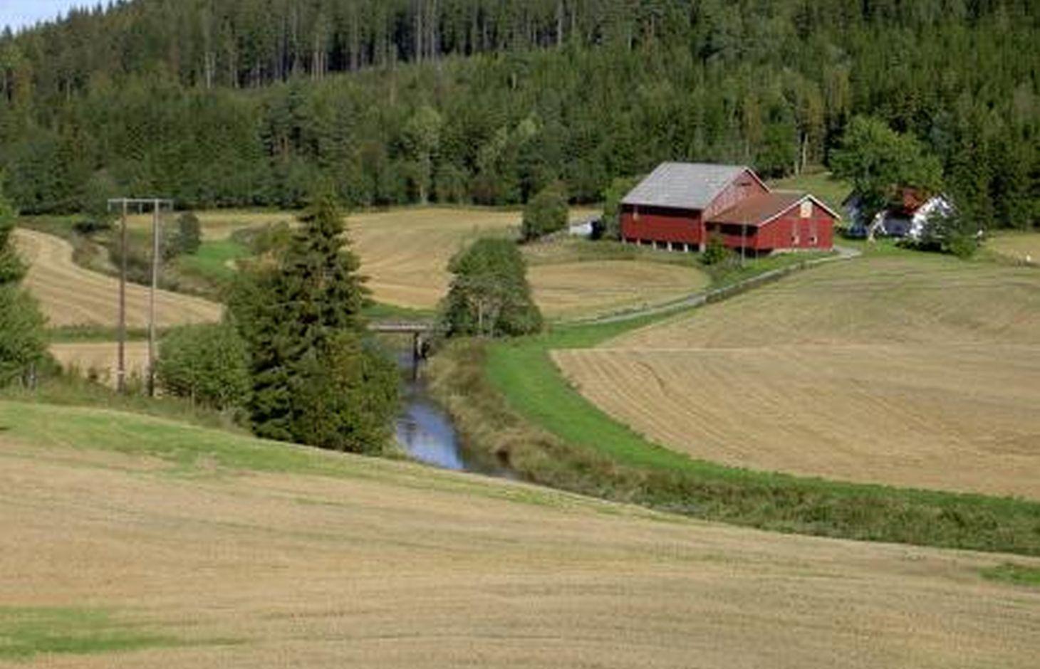
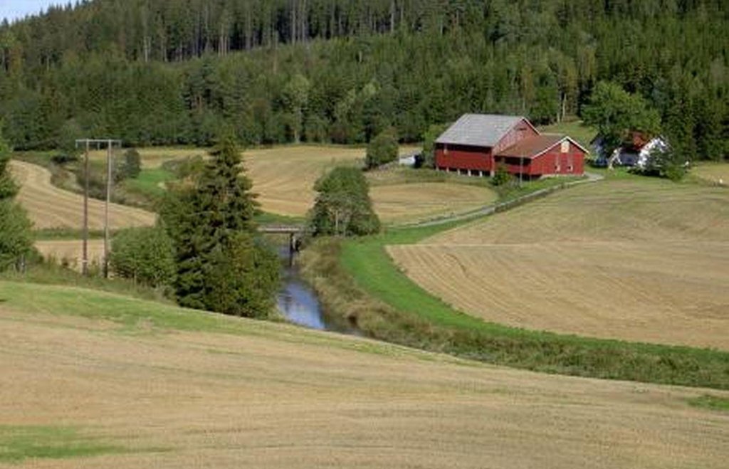
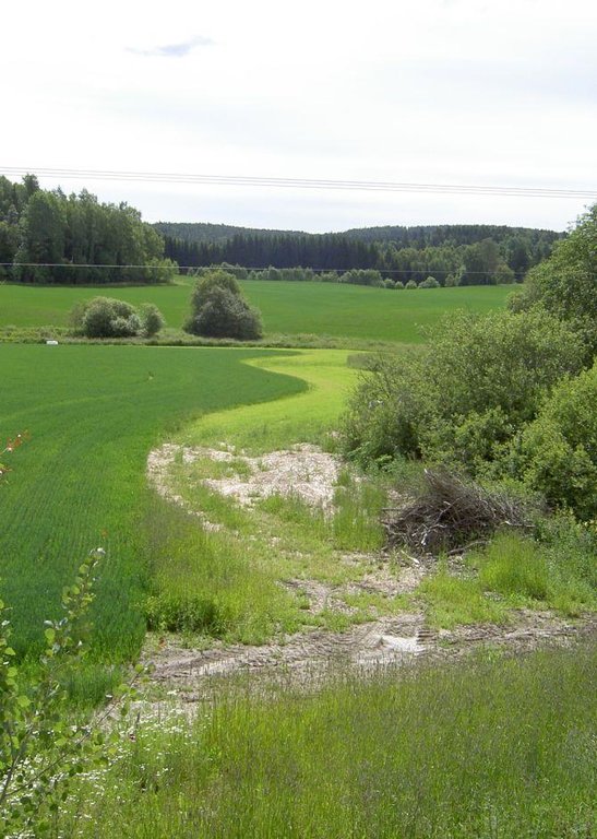
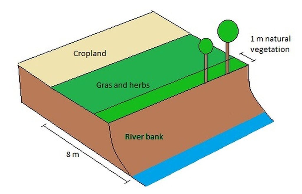
The farmers leave a strip of cropland for grass and herbs to grow along rivers, streams and lakes that intersect their cropland areas. Regulations that origins from the Morsa project (morsa.org) require vegetation zones with a width of approximately eight meters. The establishment of these buffer zones is of high importance in areas regularly exposed to flooding.
Purpose of the Technology: The buffer strips are a measure to slow down surface runoff for more water to infiltrate and for particles carried by the water to settle in the vegetation. It is also meant to contribute to reduce erosion and increase the binding of phosphorous to soil particles, as well as the uptake by the vegetation. A decreased input of particles and nutrients to the cropland waterways is desirable both in order to limit soil loss and to prevent eutrophication of downstream waterbodies.
Establishment / maintenance activities and inputs: To sow grass is recommended when establishing grass covered riparian buffer strips. Robust and dense grass types with a high demand of nutrients are often the most suited for the purpose. The grass strips should generally not be plowed, fertilized or treated by herbicides, but some exceptions may be made. The degree of which it is harvested varies with the grass type and if it is used for animal fodder.
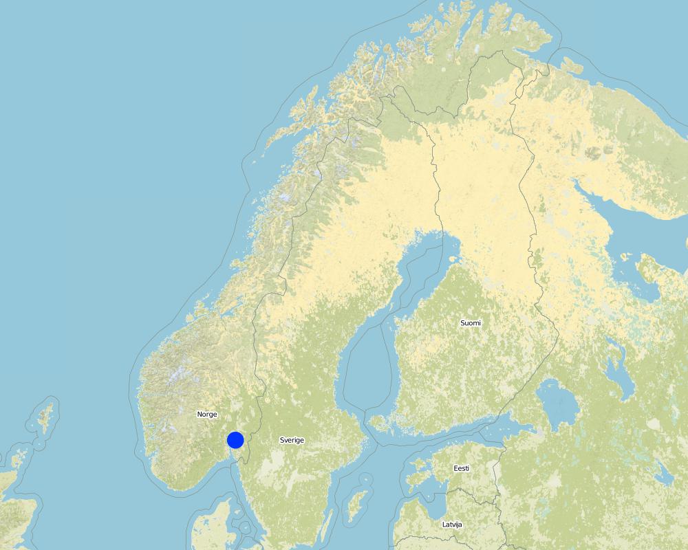
Natural / human environment: The Kråkstad River is mainly situated in Ski commune in Akershus County in South-Eastern parts of Norway. The river catchment is a western tributary of the Vannsjø-Hobøl watercourse, also known as the Morsa watercourse. The Kråkstad River catchment constitutes of a total area of about 22 km², consisting mainly of cropland and forest/woodland. The recipient Vannsjø is a eutrophic lake with a history of algal blooms of e.g. toxic cyanobacterias. The lake is both used as a drinking water source and for recreational purposes, and the Morsa project was established in order to find measures to improve the water quality of Vannsjø.
2.3 รูปภาพของเทคโนโลยี
2.5 ประเทศภูมิภาค หรือสถานที่ตั้งที่เทคโนโลยีได้นำไปใช้และได้รับการครอบคลุมโดยการประเมินนี้
ประเทศ:
นอร์เวย์
ภูมิภาค/รัฐ/จังหวัด:
Akershus
ข้อมูลจำเพาะเพิ่มเติมของสถานที่ตั้ง :
Ski
ระบุการกระจายตัวของเทคโนโลยี:
- กระจายไปอย่างสม่ำเสมอในพื้นที่
If the Technology is evenly spread over an area, specify area covered (in km2):
4.3
แสดงความคิดเห็น:
Boundary points of the Technology area: (59.595, 10.896), (59.611, 10.866), (59.670, 10.869), (59.676, 10.849), (59.717, 10.844), (59.723, 10.893), (59.694, 10.969), (59.655, 10.952), (59.668, 10.904), (59.629, 10.915)
Total area covered by the SLM Technology is 4.3 km2.
Map
×2.6 วันที่การดำเนินการ
ถ้าไม่รู้ปีที่แน่นอน ให้ระบุวันที่โดยประมาณ:
- 10-50 ปี
2.7 คำแนะนำของเทคโนโลยี
ให้ระบุว่าเทคโนโลยีถูกแนะนำเข้ามาอย่างไร:
- ในช่วงการทดลองหรือการทำวิจัย
ความคิดเห็น (ประเภทของโครงการ เป็นต้น) :
The Morsa Project (morsa.org)
3. การจัดประเภทของเทคโนโลยี SLM
3.2 ประเภทของการใช้ที่ดินในปัจจุบันที่ได้นำเทคโนโลยีไปใช้

พื้นที่ปลูกพืช
- การปลูกพืชล้มลุกอายุปีเดียว
Annual cropping - Specify crops:
- cereals - other
- small grains
จำนวนของฤดูเพาะปลูกต่อปี:
- 1
ระบุ:
Longest growing period in days: 135Longest growing period from month to month: May to mid September

ป่า/พื้นที่ทำไม้
ผลิตภัณฑ์และบริการ:
- ไม้ที่นำมาทำเป็นเชื้อเพลิง
แสดงความคิดเห็น:
Major cash crop annual cropping: Small grain
Major cash crop tree/shrub cropping: Fire wood
Major land use problems (compiler’s opinion): Erosion, flooding and landslides, eutrophication of rivers and lakes.
Major land use problems (land users’ perception): Cropland is occupied by the buffer strips, which may lead to decreased production and loss of income.
3.4 การใช้น้ำ
การใช้น้ำของที่ดินที่มีการใช้เทคโนโลยีอยู่:
- จากน้ำฝน
3.5 กลุ่ม SLM ที่ตรงกับเทคโนโลยีนี้
- มาตรการปลูกพืชขวางความลาดชัน (cross-slope measure)
- การจัดการน้ำผิวดิน (น้ำพุ แม่น้ำทะเลสาบ ทะเล)
3.6 มาตรการ SLM ที่ประกอบกันเป็นเทคโนโลยี

มาตรการอนุรักษ์ด้วยวิธีพืช
- V2: หญ้าและไม้ยืนต้น
แสดงความคิดเห็น:
Main measures: vegetative measures
3.7 รูปแบบหลักของการเสื่อมโทรมของที่ดินที่ได้รับการแก้ไขโดยเทคโนโลยี

การกัดกร่อนของดินโดยน้ำ
- Wt (Loss of topsoil): การสูญเสียดินชั้นบนหรือการกัดกร่อนที่ผิวดิน
- Wg (Gully erosion): การกัดกร่อนแบบร่องธารหรือการทำให้เกิดร่องน้ำเซาะ
- Wm (Mass movement): การเคลื่อนตัวของมวลดินหรือดินถล่ม
- Wr (Riverbank erosion): การกัดกร่อนริมฝั่งแม่น้ำ

การเสื่อมโทรมของน้ำ
- Hp (Decline of surface water quality): การลดลงของคุณภาพน้ำที่ผิวดิน
แสดงความคิดเห็น:
Main type of degradation addressed: Wt: loss of topsoil / surface erosion, Hp: decline of surface water quality
Secondary types of degradation addressed: Wg: gully erosion / gullying, Wm: mass movements / landslides, Wr: riverbank erosion
Main causes of degradation: soil management (Use of fertilizer and heavy machinery (compression of the soil and low infiltration rate)), crop management (annual, perennial, tree/shrub), Heavy / extreme rainfall (intensity/amounts) (More flooding and erosion), floods
Secondary causes of degradation: deforestation / removal of natural vegetation (incl. forest fires) (The runoff has a lower retention time in the forest. Leads to higher velocity and more flooding of downstream cropland areas), change of seasonal rainfall (Heavier rainfall events due to climate change), land tenure, governance / institutional
3.8 การป้องกัน การลดลง หรือการฟื้นฟูความเสื่อมโทรมของที่ดิน
ระบุเป้าหมายของเทคโนโลยีกับความเสื่อมโทรมของที่ดิน:
- ป้องกันความเสื่อมโทรมของที่ดิน
- ลดความเสื่อมโทรมของดิน
แสดงความคิดเห็น:
Main goals: mitigation / reduction of land degradation
Secondary goals: prevention of land degradation
4. ข้อมูลจำเพาะด้านเทคนิค กิจกรรมการนำไปปฏิบัติใช้ ปัจจัยนำเข้า และค่าใช้จ่าย
4.1 แบบแปลนทางเทคนิคของเทคโนโลยี
ข้อมูลจำเพาะด้านเทคนิค (แบบแปลนทางเทคนิคของเทคโนโลยี):
A technical drawing of a grass covered riperian buffer strip with grass cover and riperian vegetation
Technical knowledge required for field staff / advisors: low
Technical knowledge required for land users: low
Main technical functions: control of concentrated runoff: impede / retard
Secondary technical functions: control of raindrop splash, control of dispersed runoff: retain / trap, control of dispersed runoff: impede / retard, control of concentrated runoff: retain / trap, improvement of ground cover, increase of surface roughness, increase of infiltration, increase / maintain water stored in soil, improvement of water quality, buffering / filtering water, sediment retention / trapping, sediment harvesting
Aligned: -along boundary
Vegetative material: T : trees / shrubs
Vegetative measure: Along waterways
Vegetative material: G : grass
Vegetative measure: Vegetative material: G : grass
Vegetative measure: Vegetative material: G : grass
Vegetative measure: Vegetative material: G : grass
Trees/ shrubs species: Naturally
Grass species: Seeded
ผู้เขียน:
Kamilla Skaalsveen
4.2 ข้อมูลทั่วไปเกี่ยวกับการคำนวณปัจจัยนำเข้าและค่าใช้จ่าย
อื่นๆ หรือสกุลเงินประจำชาติ (ระบุ):
Kroner (NOK)
If relevant, indicate exchange rate from USD to local currency (e.g. 1 USD = 79.9 Brazilian Real): 1 USD =:
7.73
ระบุค่าเฉลี่ยของค่าจ้างในการจ้างแรงงานต่อวัน:
827.00
4.3 กิจกรรมเพื่อการจัดตั้ง
| กิจกรรม | Timing (season) | |
|---|---|---|
| 1. | Plowing | 1 time/yr |
| 2. | Harrowing | 2-3 times/yr |
| 3. | Sawing grass | 2-3 times/yr |
| 4. | Harvesting grass | 2-3 times/yr |
4.4 ค่าใช้จ่ายของปัจจัยนำเข้าที่จำเป็นสำหรับการจัดตั้ง
| ปัจจัยนำเข้า | หน่วย | ปริมาณ | ค่าใช้จ่ายต่อหน่วย | ค่าใช้จ่ายทั้งหมดต่อปัจจัยนำเข้า | %ของค่าใช้จ่ายที่ก่อให้เกิดขึ้นโดยผู้ใช้ที่ดิน | |
|---|---|---|---|---|---|---|
| แรงงาน | Plowing | zone/farmer/day | 1.0 | 321.0 | 321.0 | 7.0 |
| แรงงาน | Harrowing | zone/farmer/day | 1.0 | 321.0 | 321.0 | 7.0 |
| แรงงาน | Sawing grass | zone/farmer/day | 1.0 | 321.0 | 321.0 | 7.0 |
| แรงงาน | Harvesting grass | zone/farmer/day | 1.0 | 321.0 | 321.0 | 7.0 |
| ค่าใช้จ่ายทั้งหมดของการจัดตั้งเทคโนโลยี | 1284.0 | |||||
| Total costs for establishment of the Technology in USD | 166.11 | |||||
4.5 การบำรุงรักษาสภาพหรือกิจกรรมที่เกิดขึ้นเป็นประจำ
| กิจกรรม | ช่วงระยะเวลา/ความถี่ | |
|---|---|---|
| 1. | Plowing | Once every 6th year |
| 2. | Harrowing | 2-3 times/yr |
| 3. | Sawing grass | 2-3 times/yr |
| 4. | Harvesting grass | 2-3 times/yr |
4.6 ค่าใช้จ่ายของปัจจัยนำเข้าและกิจกรรมที่เกิดขึ้นเป็นประจำที่ต้องการการบำรุงรักษา (ต่อปี)
| ปัจจัยนำเข้า | หน่วย | ปริมาณ | ค่าใช้จ่ายต่อหน่วย | ค่าใช้จ่ายทั้งหมดต่อปัจจัยนำเข้า | %ของค่าใช้จ่ายที่ก่อให้เกิดขึ้นโดยผู้ใช้ที่ดิน | |
|---|---|---|---|---|---|---|
| แรงงาน | Plowing | zone/farmer/day | 1.0 | 53.0 | 53.0 | 100.0 |
| แรงงาน | Harrowing | zone/farmer/day | 1.0 | 321.0 | 321.0 | |
| แรงงาน | Sawing grass | Day | 1.0 | 321.0 | 321.0 | |
| แรงงาน | Harvesting grass | Day | 1.0 | 321.0 | 321.0 | |
| ค่าใช้จ่ายทั้งหมดของการบำรุงรักษาสภาพเทคโนโลยี | 1016.0 | |||||
| Total costs for maintenance of the Technology in USD | 131.44 | |||||
5. สิ่งแวดล้อมทางธรรมชาติและของมนุษย์
5.1 ภูมิอากาศ
ฝนประจำปี
- < 250 ม.ม.
- 251-500 ม.ม.
- 501-750 ม.ม.
- 751-1,000 ม.ม.
- 1,001-1,500 ม.ม.
- 1,501-2,000 ม.ม.
- 2,001-3,000 ม.ม.
- 3,001-4,000 ม.ม.
- > 4,000 ม.ม.
เขตภูมิอากาศเกษตร
- กึ่งชุ่มชื้น
- กึ่งแห้งแล้ง
Thermal climate class: temperate
Thermal climate class: boreal
5.2 สภาพภูมิประเทศ
ค่าเฉลี่ยความลาดชัน:
- ราบเรียบ (0-2%)
- ลาดที่ไม่ชัน (3-5%)
- ปานกลาง (6-10%)
- เป็นลูกคลื่น (11-15%)
- เป็นเนิน (16-30%)
- ชัน (31-60%)
- ชันมาก (>60%)
ธรณีสัณฐาน:
- ที่ราบสูง/ที่ราบ
- สันเขา
- ไหล่เขา
- ไหล่เนินเขา
- ตีนเนิน
- หุบเขา
ระดับความสูง:
- 0-100 เมตร
- 101-500 เมตร
- 501-1,000 เมตร
- 1,001-1,500 เมตร
- 1,501-2,000 เมตร
- 2,001-2,500 เมตร
- 2,501-3,000 เมตร
- 3,001-4,000 เมตร
- > 4,000 เมตร
5.3 ดิน
ค่าเฉลี่ยความลึกของดิน:
- ตื้นมาก (0-20 ซ.ม.)
- ตื้น (21-50 ซ.ม.)
- ลึกปานกลาง (51-80 ซ.ม.)
- ลึก (81-120 ซ.ม.)
- ลึกมาก (>120 ซ.ม.)
เนื้อดิน (ดินชั้นบน):
- ละเอียด/หนัก (ดินเหนียว)
อินทรียวัตถุในดิน:
- ปานกลาง (1-3%)
(ถ้ามี) ให้แนบคำอธิบายเรื่องดินแบบเต็มหรือระบุข้อมูลที่มีอยู่ เช่น ชนิดของดิน ค่า pH ของดินหรือความเป็นกรดของดิน ความสามารถในการแลกเปลี่ยนประจุบวก ไนโตรเจน ความเค็ม เป็นต้น:
Soil fertility is medium-high
Soil drainage/infiltration is poor
Soil water storage capacity is very low-low
5.4 ความเป็นประโยชน์และคุณภาพของน้ำ
ระดับน้ำใต้ดิน:
<5 เมตร
น้ำไหลบ่าที่ผิวดิน:
ดี
คุณภาพน้ำ (ที่ยังไม่ได้บำบัด):
เป็นน้ำใช้เพื่อการเกษตรเท่านั้น (การชลประทาน)
5.5 ความหลากหลายทางชีวภาพ
ความหลากหลายทางชนิดพันธุ์:
- ต่ำ
5.6 ลักษณะของผู้ใช้ที่ดินที่นำเทคโนโลยีไปปฏิบัติใช้
แนวทางการตลาดของระบบการผลิต:
- mixed (subsistence/ commercial)
- ทำการค้า/การตลาด
รายได้ที่มาจากนอกฟาร์ม:
- > 50% ของรายได้ทั้งหมด
ระดับของความมั่งคั่งโดยเปรียบเทียบ:
- พอมีพอกิน
- รวย
เป็นรายบุคคล/ครัวเรือน:
- เป็นรายบุคคล/ครัวเรือน
ระดับของการใช้เครื่องจักรกล:
- การใช้เครื่องจักรหรือเครื่องยนต์
เพศ:
- หญิง
- ชาย
ระบุลักษณะอื่นๆที่เกี่ยวข้องของผู้ใช้ที่ดิน:
Land users applying the Technology are mainly common / average land users
Population density: < 10 persons/km2
Annual population growth: < 0.5%
10% of the land users are rich and own 10% of the land.
90% of the land users are average wealthy and own 90% of the land.
5.7 Average area of land used by land users applying the Technology
- < 0.5 เฮกตาร์
- 0.5-1 เฮกตาร์
- 1-2 เฮกตาร์
- 2-5 เฮกตาร์
- 5-15 เฮกตาร์
- 15-50 เฮกตาร์
- 50-100 เฮกตาร์
- 100-500 เฮกตาร์
- 500-1,000 เฮกตาร์
- 1,000-10,000 เฮกตาร์
- >10,000 เฮกตาร์
พิจารณาว่าเป็นขนาดเล็ก กลาง หรือขนาดใหญ่ (ซึ่งอ้างอิงถึงบริบทระดับท้องถิ่น):
- ขนาดกลาง
5.8 กรรมสิทธิ์ในที่ดิน สิทธิในการใช้ที่ดินและสิทธิในการใช้น้ำ
กรรมสิทธิ์ในที่ดิน:
- รายบุคคล ได้รับสิทธิครอบครอง
สิทธิในการใช้ที่ดิน:
- เกี่ยวกับชุมชน (ถูกจัดระเบียบ)
- รายบุคคล
สิทธิในการใช้น้ำ:
- เข้าถึงได้แบบเปิด (ไม่ได้จัดระเบียบ)
5.9 การเข้าถึงบริการและโครงสร้างพื้นฐาน
สุขภาพ:
- จน
- ปานกลาง
- ดี
การศึกษา:
- จน
- ปานกลาง
- ดี
ความช่วยเหลือทางด้านเทคนิค:
- จน
- ปานกลาง
- ดี
การจ้างงาน (เช่น ภายนอกฟาร์ม):
- จน
- ปานกลาง
- ดี
ตลาด:
- จน
- ปานกลาง
- ดี
พลังงาน:
- จน
- ปานกลาง
- ดี
ถนนและการขนส่ง:
- จน
- ปานกลาง
- ดี
น้ำดื่มและการสุขาภิบาล:
- จน
- ปานกลาง
- ดี
บริการด้านการเงิน:
- จน
- ปานกลาง
- ดี
6. ผลกระทบและสรุปคำบอกกล่าว
6.1 ผลกระทบในพื้นที่ดำเนินการ (On-site) จากการใช้เทคโนโลยี
ผลกระทบทางด้านเศรษฐกิจและสังคม
การผลิต
การผลิตพืชผล
การเสี่ยงต่อความล้มเหลวในการผลิต
พื้นที่สำหรับการผลิต
รายได้และค่าใช้จ่าย
ค่าใช่จ่ายของปัจจัยการผลิตทางการเกษตร
รายได้จากฟาร์ม
ความหลากหลายของแหล่งผลิตรายได้
ภาระงาน
ผลกระทบด้านสังคมวัฒนธรรมอื่น ๆ
Improved livelihoods and human well-being
แสดงความคิดเห็น/ระบุ:
Because of the drinking water quality
ผลกระทบด้านนิเวศวิทยา
วัฐจักรน้ำหรือน้ำบ่า
คุณภาพน้ำ
ดิน
สิ่งปกคลุมดิน
การสูญเสียดิน
การเกิดแผ่นแข็งที่ผิวดิน /การเกิดชั้นดาน
การอัดแน่นของดิน
การหมุนเวียนและการเติมของธาตุอาหาร
ความหลากหลายทางชีวภาพของพืชและสัตว์
มวลชีวภาพ/เหนือดินชั้น C
ความหลากหลายทางชีวภาพของพืช
ชนิดพันธุ์ที่ให้ประโยชน์
ความหลากหลายของสัตว์
6.2 ผลกระทบนอกพื้นที่ดำเนินการ (Off-site) จากการใช้เทคโนโลยี
การเกิดมลพิษในน้ำบาดาลหรือแม่น้ำ
ความสามารถต้านทานการเปลี่ยนแปลง / ความสามารถในการคัดกรอง
6.3 การเผชิญและความตอบสนองของเทคโนโลยีต่อการเปลี่ยนแปลงสภาพภูมิอากาศที่ค่อยเป็นค่อยไป และสภาพรุนแรงของภูมิอากาศ / ภัยพิบัติ (ที่รับรู้ได้โดยผู้ใช้ที่ดิน)
การเปลี่ยนแปลงสภาพภูมิอากาศที่ค่อยเป็นค่อยไป
การเปลี่ยนแปลงสภาพภูมิอากาศที่ค่อยเป็นค่อยไป
| ฤดู | increase or decrease | เทคโนโลยีมีวิธีการรับมืออย่างไร | |
|---|---|---|---|
| อุณหภูมิประจำปี | เพิ่มขึ้น | ดี |
สภาพรุนแรงของภูมิอากาศ (ภัยพิบัติ)
ภัยพิบัติทางอุตุนิยมวิทยา
| เทคโนโลยีมีวิธีการรับมืออย่างไร | |
|---|---|
| พายุฝนประจำท้องถิ่น | ไม่ค่อยดี |
| พายุลมประจำท้องถิ่น | ดี |
ภัยพิบัติจากสภาพภูมิอากาศ
| เทคโนโลยีมีวิธีการรับมืออย่างไร | |
|---|---|
| ภัยจากฝนแล้ง | ดี |
ภัยพิบัติจากน้ำ
| เทคโนโลยีมีวิธีการรับมืออย่างไร | |
|---|---|
| น้ำท่วมตามปกติ (แม่น้ำ) | ไม่ค่อยดี |
ผลลัพธ์ตามมาที่เกี่ยวข้องกับภูมิอากาศอื่น ๆ
ผลลัพธ์ตามมาที่เกี่ยวข้องกับภูมิอากาศอื่น ๆ
| เทคโนโลยีมีวิธีการรับมืออย่างไร | |
|---|---|
| ช่วงการปลูกพืชที่ลดลงมา | ดี |
6.4 การวิเคราะห์ค่าใช้จ่ายและผลประโยชน์ที่ได้รับ
ผลประโยชน์ที่ได้รับเปรียบเทียบกับค่าใช้จ่ายในการจัดตั้งเป็นอย่างไร (จากมุมมองของผู้ใช้ที่ดิน)
ผลตอบแทนระยะสั้น:
ด้านลบเล็กน้อย
ผลตอบแทนระยะยาว:
เป็นกลางหรือสมดุล
ผลประโยชน์ที่ได้รับเปรียบเทียบกับค่าใช้จ่ายในการบำรุงรักษาหรือต้นทุนที่เกิดขึ้นซ้ำอีก เป็นอย่างไร (จากมุมมองของผู้ใช้ที่ดิน)
ผลตอบแทนระยะสั้น:
ด้านลบเล็กน้อย
ผลตอบแทนระยะยาว:
ด้านลบเล็กน้อย
6.5 การปรับตัวของเทคโนโลยี
แสดงความคิดเห็น:
Comments on acceptance with external material support: Local regulations determine that farmers only receive subsidies per production area along with financial grants if they implement the technology.
There is no trend towards spontaneous adoption of the Technology
6.7 จุดแข็ง / ข้อได้เปรียบ / โอกาสของเทคโนโลยี
| จุดแข็ง / ข้อได้เปรียบ / โอกาสในทัศนคติของผู้รวบรวมหรือวิทยากรหลัก |
|---|
|
The grass catches sediments from the cropland How can they be sustained / enhanced? May be more efficient with a change in grass type (but this is not tested) |
|
Reduced fertilizer usage How can they be sustained / enhanced? Continue in the same way |
|
Corporation between farmers How can they be sustained / enhanced? Joint company for utilizing the buffer strips for grass production |
6.8 จุดอ่อน / ข้อเสียเปรียบ / ความเสี่ยงของเทคโนโลยีและวิธีการแก้ไข
| จุดอ่อน / ข้อเสียเปรียบ / ความเสี่ยงในทัศนคติของผู้ใช้ที่ดิน | มีวิธีการแก้ไขได้อย่างไร |
|---|---|
| Loss of productive cropland | Narrower buffer strips |
| จุดอ่อน / ข้อเสียเปรียบ / ความเสี่ยงในทัศนคติของผู้รวบรวมหรือวิทยากรหลัก | มีวิธีการแก้ไขได้อย่างไร |
|---|---|
| Low infiltration rates | Less heavy machinery on the buffer strips and a wider zone of natural vegetation along the banks |
7. การอ้างอิงและการเชื่อมต่อ
7.1 วิธีการและแหล่งข้อมูล
ลิงก์และโมดูล
ขยายทั้งหมด ย่อทั้งหมดลิงก์

Regional Environmental program [นอร์เวย์]
Regulations and financial grants for reduction of pollution and promotion of the cultural landscape.
- ผู้รวบรวม: Kamilla Skaalsveen
โมดูล
ไม่มีโมดูล


