Wind forest strips for land protection against wind erosion on sandy soils [ทาจิกิสถาน]
- ผู้สร้างสรรค์:
- การอัพเดท:
- ผู้รวบรวม: Aslam Qadamov
- ผู้เรียบเรียง: –
- ผู้ตรวจสอบ: David Streiff, Alexandra Gavilano
technologies_1451 - ทาจิกิสถาน
- บทสรุปทั้งหมดในรูปแบบของ PDF
- บทสรุปทั้งหมดในรูปแบบของ PDF เพื่อพิมพ์
- บทสรุปทั้งหมดในรูปหน้าเว็บ
- บทสรุปทั้งหมด (ไม่มีการจัดเรียง)
- Wind forest strips for land protection against wind erosion on sandy soils: 14 มีนาคม 2017 (inactive)
- Wind forest strips for land protection against wind erosion on sandy soils: 19 กรกฎาคม 2017 (inactive)
- Wind forest strips for land protection against wind erosion on sandy soils: 21 สิงหาคม 2019 (inactive)
- Wind forest strips for land protection against wind erosion on sandy soils: 2 พฤศจิกายน 2021 (public)
ดูส่วนย่อย
ขยายทั้งหมด ย่อทั้งหมด1. ข้อมูลทั่วไป
1.2 รายละเอียดที่ติดต่อได้ของผู้รวบรวมและองค์กรที่เกี่ยวข้องในการประเมินและการจัดเตรียมทำเอกสารของเทคโนโลยี
ผู้เชี่ยวชาญ SLM:
Kosumbekov Ahoyatbek
ชื่อขององค์กรซึ่งอำนวยความสะดวกในการทำเอกสารหรือการประเมินเทคโนโลยี (ถ้าเกี่ยวข้อง)
Forestry Department of GBAO - ทาจิกิสถานชื่อขององค์กรซึ่งอำนวยความสะดวกในการทำเอกสารหรือการประเมินเทคโนโลยี (ถ้าเกี่ยวข้อง)
Pamir Biological Institute (Pamir Biological Institute) - ทาจิกิสถาน1.3 เงื่อนไขการใช้ข้อมูลที่ได้บันทึกผ่านทาง WOCAT
ผู้รวบรวมและวิทยากรหลักยอมรับเงื่อนไขเกี่ยวกับการใช้ข้อมูลที่ถูกบันทึกผ่านทาง WOCAT:
ใช่
2. การอธิบายลักษณะของเทคโนโลยี SLM
2.1 การอธิบายแบบสั้น ๆ ของเทคโนโลยี
คำจำกัดความของเทคโนโลยี:
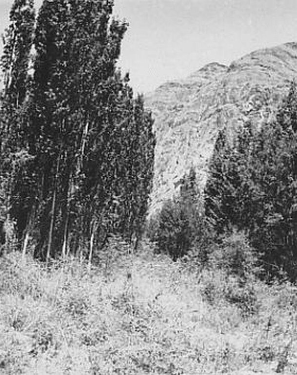
Establishment of an 8-row shelterbelt consisting of different varieties of willow, poplar and sea-buckthorn to protect irrigated cropland with poor quality soil in the high Pamir region from wind erosion.
2.2 การอธิบายแบบละเอียดของเทคโนโลยี
คำอธิบาย:
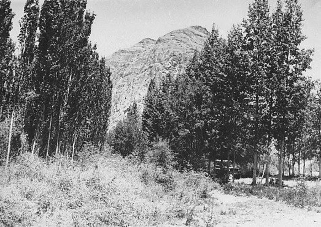
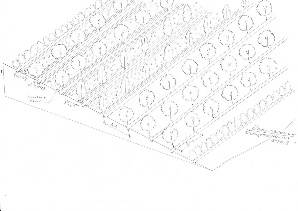
The 24m wide shelterbelt consists of eight rows of trees. Three plots, 50m wide and 350m long were left in-between the trees to intercrop with lucerne and other perennial herbs. Thus, the total area which includes the shelterbelts, meadows and irrigation ditches makes up nearly 10 ha. The shelterbelt was established perpendicular to the direction of the strong winds. Past trials have shown that under the harsh climatic conditions of the Pamir region, shelterbelts in sandy and pebbly areas should include at least eight rows of trees and shrubs.
Purpose of the Technology: The purpose of this technology was to intercrop the shelterbelts with lucerne in order to help protect crops from wind erosion.
Establishment / maintenance activities and inputs: Shelterbelts were planted by hand, not using any machinery. Trees and shrubs were planted in accordance with their physiological characteristics and their tolerance to deflation. The eight rows were planted in the following order: 1st row: sea-buckthorn, 2nd: Shugnan willows, 3rd: Thuran willows, 4th: Pamir poplars, 5th: Bolle's poplars, 6th: Wilhelm’s willows, 7th: Shugnan willows and 8th: Sea Buckthorn. The distance between trees in each row was 4m. Willows and poplars were planted as cuttings, around 1.5–3m in length cut off at the point at which the diameter of the base was around 6cm. Sea buckthorn was planted as seeds at a depth of 4-6cm. Horizontal planting, which increases the growth by 25%, was used instead of vertical planting. The trees were planted between late March and early April. Furrow irrigation ditches were dug before the actual planting of the trees. The irrigation ditches were 0.3m deep and 0.5m wide. The plot was then watered before the actual planting of the trees and the Lucerne, to increase the soil moisture and improve the subsequent growth of the trees. Further watering of the area was carried out every 4-7 days depending on the weather conditions and levels of moisture in the soil. These willow and poplar trees can be pruned 5-6 years after the initial planting. At this stage the branches will be 1-3 m long and can be used by the local population.
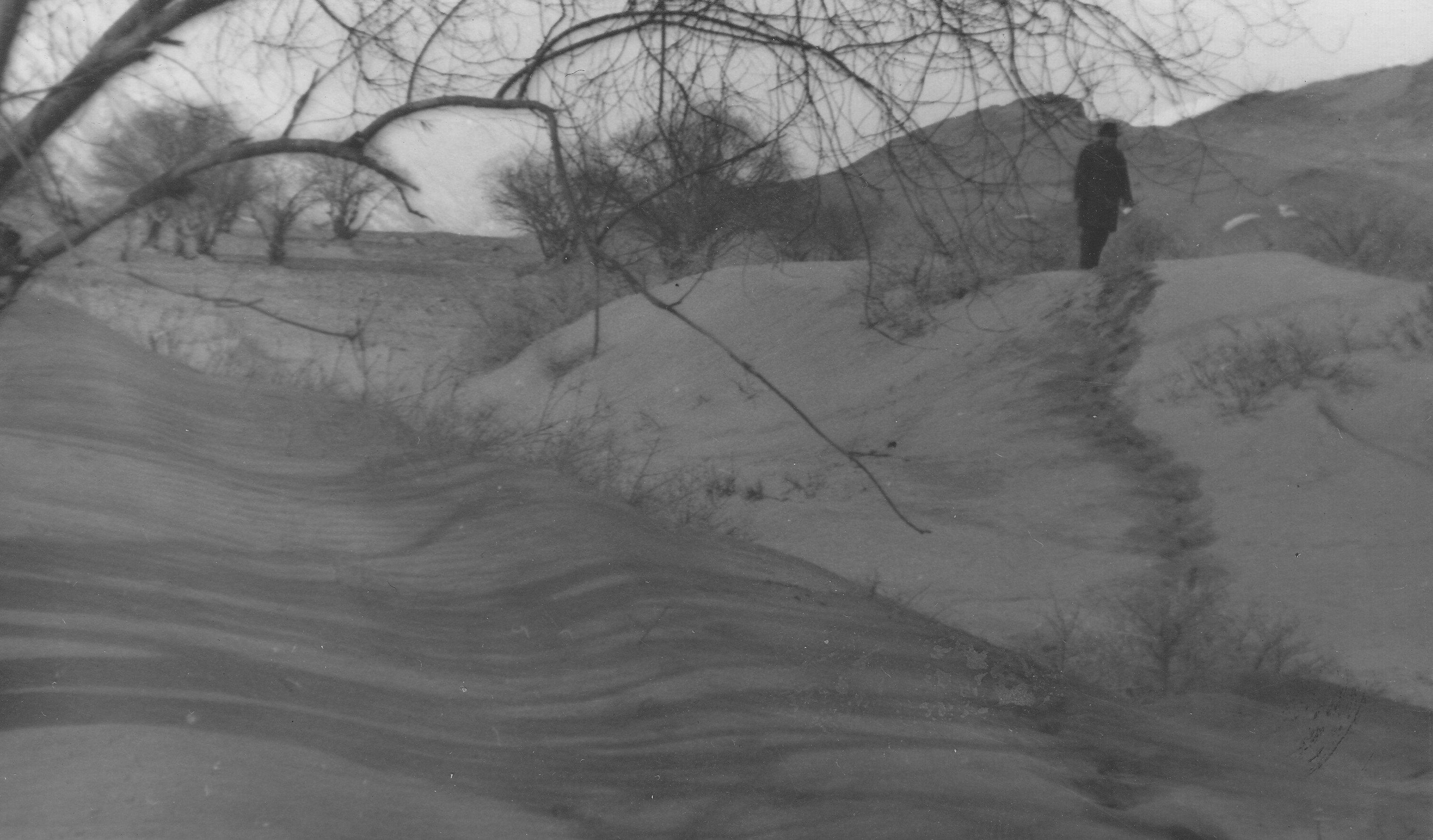
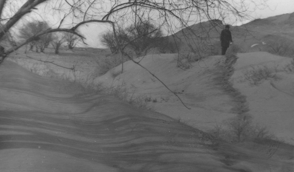
Natural / human environment: The plot is located in an arid zone which has sandy and pebbly soil with low fertility. Initially this area was covered by Tugai forest and used as grazing land as well as for timber production. However, as a result of deforestation, the land in this area has become highly unstable and poses a threat to the irrigated lands upslope. 80% of the soil consists of stones and sand. Vegetation cover is mainly composed of sagebrush deserts. These shelterbelts were established during Soviet times and when the civil war broke out after independence, many of the poplar trees were cut down by the local population for construction- and firewood. Therefore only parts of the original shelterbelts are still in place today.
2.3 รูปภาพของเทคโนโลยี
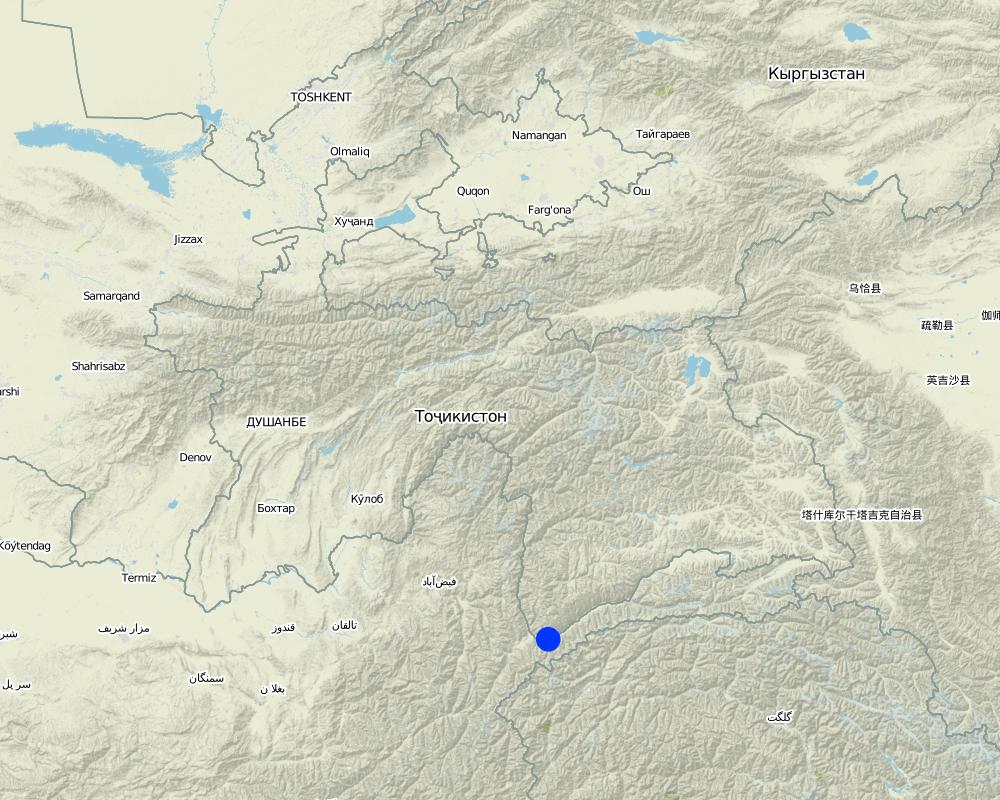
2.5 ประเทศภูมิภาค หรือสถานที่ตั้งที่เทคโนโลยีได้นำไปใช้และได้รับการครอบคลุมโดยการประเมินนี้
ประเทศ:
ทาจิกิสถาน
ภูมิภาค/รัฐ/จังหวัด:
GBAO
ข้อมูลจำเพาะเพิ่มเติมของสถานที่ตั้ง :
Ishkashim
แสดงความคิดเห็น:
Boundary points of the Technology area: 36.40.46 - 71.47.28 36.40.37 - 71.47.26 36.4051 - 71.47.01 36.40.36 - 71.47.02
Total area covered by the SLM Technology is 0.1 km2.
about 10 ha
Map
×2.6 วันที่การดำเนินการ
ถ้าไม่รู้ปีที่แน่นอน ให้ระบุวันที่โดยประมาณ:
- มากกว่า 50 ปี (แบบดั้งเดิม)
2.7 คำแนะนำของเทคโนโลยี
ให้ระบุว่าเทคโนโลยีถูกแนะนำเข้ามาอย่างไร:
- ในช่วงการทดลองหรือการทำวิจัย
ความคิดเห็น (ประเภทของโครงการ เป็นต้น) :
58 years ago
3. การจัดประเภทของเทคโนโลยี SLM
3.1 วัตถุประสงค์หลักของเทคโนโลยี
- ลด ป้องกัน ฟื้นฟู การเสื่อมโทรมของที่ดิน
3.2 ประเภทของการใช้ที่ดินในปัจจุบันที่ได้นำเทคโนโลยีไปใช้

พื้นที่ปลูกพืช
- การปลูกพืชล้มลุกอายุปีเดียว
- การปลูกพืชยืนต้นที่ไม่มีเนื้อไม้
- การปลูกไม้ยืนต้น ไม้พุ่ม
Annual cropping - Specify crops:
- fodder crops - alfalfa
- root/tuber crops - potatoes
- vegetables - root vegetables (carrots, onions, beet, other)
- vegetables - leafy vegetables (salads, cabbage, spinach, other)
- poplar, wilow, sea-buckthorn
จำนวนของฤดูเพาะปลูกต่อปี:
- 1
ระบุ:
Longest growing period in days: 150Longest growing period from month to month: from May to September
Is intercropping practiced?
ใช่
If yes, specify which crops are intercropped:
trees to intercrop with lucerne and other perennial herbs

ป่า/พื้นที่ทำไม้
- ป่า/พื้นที่ทำไม้
ผลิตภัณฑ์และบริการ:
- ไม้ที่นำมาทำเป็นเชื้อเพลิง
- ผลไม้และถั่ว
- การแทะเล็มหญ้า / การเก็บกินหญ้า
- การอนุรักษ์ / ป้องกันธรรมชาติ
- การป้องกันภัยธรรมชาติ

ที่ดินที่ไม่ให้ผลผลิต
ระบุ:
Wastelands, deserts, glaciers, swamps, recreation areas, etc
แสดงความคิดเห็น:
Major land use problems (compiler’s opinion): land loss, soil fertility decrease, desertification of the area, poverty,
Major land use problems (land users’ perception): land degradation, land fertility decrease, deforestation, poverty
Plantation forestry: Yes
Forest products and services: fuelwood, fruits and nuts, grazing / browsing, nature conservation / protection, protection against natural hazards
Future (final) land use (after implementation of SLM Technology): Forests / woodlands: Fp: Plantations, afforestations
Livestock is grazing on crop residues
3.4 การใช้น้ำ
การใช้น้ำของที่ดินที่มีการใช้เทคโนโลยีอยู่:
- การชลประทานแบบเต็มรูปแบบ
3.5 กลุ่ม SLM ที่ตรงกับเทคโนโลยีนี้
- แนวกันลมหรือแนวต้านลม
- การปรับปรุงดิน / พืชคลุมดิน
3.6 มาตรการ SLM ที่ประกอบกันเป็นเทคโนโลยี

มาตรการจัดการพืช
- A1: พืช/สิ่งปกคลุมดิน

มาตรการอนุรักษ์ด้วยวิธีพืช
- V1: ต้นไม้และพุ่มไม้คลุมดิน

มาตรการอนุรักษ์ด้วยโครงสร้าง
- S11: อื่น ๆ

มาตรการอนุรักษ์ด้วยการจัดการ
- M1: การเปลี่ยนรูปแบบของการใช้ประโยชน์ที่ดิน
แสดงความคิดเห็น:
Main measures: vegetative measures
Type of vegetative measures: aligned: -against wind, aligned: -linear
3.7 รูปแบบหลักของการเสื่อมโทรมของที่ดินที่ได้รับการแก้ไขโดยเทคโนโลยี

การกัดกร่อนของดินโดยลม
- Ed (Deflation and deposition): การกัดกร่อนโดยลมและการทับถม
แสดงความคิดเห็น:
Main type of degradation addressed: Ed: deflation and deposition
Main causes of degradation: deforestation / removal of natural vegetation (incl. forest fires) (excessive cutting of natural trees and shrubs), wind storms / dust storms (during the wind storm sand covers the cultivated lands), land tenure (more of the forests destroyed in transition period), poverty / wealth (shortage of electricity was the main reason of forest degradation)
Secondary causes of degradation: over-exploitation of vegetation for domestic use (grass was used for livestock), overgrazing (overgrazing of the natural forests by livestock)
3.8 การป้องกัน การลดลง หรือการฟื้นฟูความเสื่อมโทรมของที่ดิน
ระบุเป้าหมายของเทคโนโลยีกับความเสื่อมโทรมของที่ดิน:
- ลดความเสื่อมโทรมของดิน
- ฟื้นฟูบำบัดที่ดินที่เสื่อมโทรมลงอย่างมาก
แสดงความคิดเห็น:
Main goals: prevention of land degradation
Secondary goals: mitigation / reduction of land degradation, rehabilitation / reclamation of denuded land
4. ข้อมูลจำเพาะด้านเทคนิค กิจกรรมการนำไปปฏิบัติใช้ ปัจจัยนำเข้า และค่าใช้จ่าย
4.1 แบบแปลนทางเทคนิคของเทคโนโลยี
ข้อมูลจำเพาะด้านเทคนิค (แบบแปลนทางเทคนิคของเทคโนโลยี):
Location: GBAO. Ishkashim
Date: 20.04.2011
Technical knowledge required for field staff / advisors: moderate (All the works are simple for implementaton)
Technical knowledge required for land users: moderate (All the works are simple for implementaton)
Main technical functions: improvement of ground cover, improvement of surface structure (crusting, sealing), improvement of topsoil structure (compaction), stabilisation of soil (eg by tree roots against land slides), increase in nutrient availability (supply, recycling,…), reduction in wind speed, increase of biomass (quantity), promotion of vegetation species and varieties (quality, eg palatable fodder), spatial arrangement and diversification of land use
Secondary technical functions: increase of surface roughness, improvement of subsoil structure (hardpan), increase in organic matter, increase of infiltration, increase / maintain water stored in soil, increase of groundwater level / recharge of groundwater
Aligned: -against wind
Vegetative material: T : trees / shrubs
Number of plants per (ha): 390
Vertical interval between rows / strips / blocks (m): 1
Spacing between rows / strips / blocks (m): 6
Vertical interval within rows / strips / blocks (m): 3
Aligned: -linear
Vegetative material: G : grass
Number of plants per (ha): 20 kg seeds
Width within rows / strips / blocks (m): 4
Trees/ shrubs species: sea-buckthorns, willows and poplars
Perennial crops species: alfa alfa
Grass species: alfa alfa
Slope (which determines the spacing indicated above): 0.00%
If the original slope has changed as a result of the Technology, the slope today is (see figure below): 0.00%
Gradient along the rows / strips: 0.20%
ผู้เขียน:
Qadamov Aslam, Gulmamadov St.52/7 apt.11
4.2 ข้อมูลทั่วไปเกี่ยวกับการคำนวณปัจจัยนำเข้าและค่าใช้จ่าย
ระบุสกุลเงินที่ใช้คำนวณค่าใช้จ่าย:
- USD
ระบุค่าเฉลี่ยของค่าจ้างในการจ้างแรงงานต่อวัน:
3.00
4.3 กิจกรรมเพื่อการจัดตั้ง
| กิจกรรม | Timing (season) | |
|---|---|---|
| 1. | digging of pits for tree planting | first year |
| 2. | planting of trees | first year |
| 3. | sowing of the alfa-alfa in drills | every 5 years |
| 4. | construction of irrigation canals |
4.4 ค่าใช้จ่ายของปัจจัยนำเข้าที่จำเป็นสำหรับการจัดตั้ง
| ปัจจัยนำเข้า | หน่วย | ปริมาณ | ค่าใช้จ่ายต่อหน่วย | ค่าใช้จ่ายทั้งหมดต่อปัจจัยนำเข้า | %ของค่าใช้จ่ายที่ก่อให้เกิดขึ้นโดยผู้ใช้ที่ดิน | |
|---|---|---|---|---|---|---|
| แรงงาน | Digging of pits for tree | Persons/day | 10.0 | 18.0 | 180.0 | 100.0 |
| แรงงาน | Planting of trees | Persons/day | 10.0 | 10.0 | 100.0 | 100.0 |
| แรงงาน | Sowing of the alfa-alfa in drills | Persons/day | 8.0 | 3.125 | 25.0 | 100.0 |
| แรงงาน | Construction of irrigation canals | Persons/day | 15.0 | 15.0 | 225.0 | 100.0 |
| อุปกรณ์ | Shovels and other tools | pieces | 30.0 | 1.0 | 30.0 | |
| วัสดุด้านพืช | Seedling | pieces | 400.0 | 0.11 | 44.0 | |
| วัสดุด้านพืช | Alfalfa sees | kg | 20.0 | 0.65 | 13.0 | |
| ปุ๋ยและสารฆ่า/ยับยั้งการเจริญเติบโตของสิ่งมีชีวิต (ไบโอไซด์) | Fertilizer | kg | 45.0 | 2.244444 | 101.0 | |
| ค่าใช้จ่ายทั้งหมดของการจัดตั้งเทคโนโลยี | 718.0 | |||||
| Total costs for establishment of the Technology in USD | 718.0 | |||||
แสดงความคิดเห็น:
Duration of establishment phase: 1 month(s)
4.5 การบำรุงรักษาสภาพหรือกิจกรรมที่เกิดขึ้นเป็นประจำ
| กิจกรรม | ช่วงระยะเวลา/ความถี่ | |
|---|---|---|
| 1. | sanitary cutting and pruning | every year |
| 2. | cutting of alfa alfa | three times per year |
| 3. | maintenance of the irrigation system | every year |
4.6 ค่าใช้จ่ายของปัจจัยนำเข้าและกิจกรรมที่เกิดขึ้นเป็นประจำที่ต้องการการบำรุงรักษา (ต่อปี)
| ปัจจัยนำเข้า | หน่วย | ปริมาณ | ค่าใช้จ่ายต่อหน่วย | ค่าใช้จ่ายทั้งหมดต่อปัจจัยนำเข้า | %ของค่าใช้จ่ายที่ก่อให้เกิดขึ้นโดยผู้ใช้ที่ดิน | |
|---|---|---|---|---|---|---|
| แรงงาน | Sanitary cutting and pruning | Persons/day | 3.0 | 3.333 | 10.0 | 100.0 |
| แรงงาน | Cutting of alfa alfa | Persons/day | 5.0 | 12.0 | 60.0 | 100.0 |
| แรงงาน | Maintenance of the irrigation system | Persons/day | 2.0 | 22.5 | 45.0 | 100.0 |
| อุปกรณ์ | Scissors | pieces | 3.0 | 10.0 | 30.0 | |
| อุปกรณ์ | Tools | pieces | 7.0 | 1.0 | 7.0 | |
| ค่าใช้จ่ายทั้งหมดของการบำรุงรักษาสภาพเทคโนโลยี | 152.0 | |||||
| Total costs for maintenance of the Technology in USD | 152.0 | |||||
แสดงความคิดเห็น:
wind breakes and grass strips
4.7 ปัจจัยสำคัญที่สุดที่มีผลกระทบต่อค่าใช้จ่าย
ปัจจัยสำคัญที่สุดที่มีผลกระทบต่อค่าใช้จ่ายต่างๆ:
seeds and seedlings cost
5. สิ่งแวดล้อมทางธรรมชาติและของมนุษย์
5.1 ภูมิอากาศ
ฝนประจำปี
- < 250 ม.ม.
- 251-500 ม.ม.
- 501-750 ม.ม.
- 751-1,000 ม.ม.
- 1,001-1,500 ม.ม.
- 1,501-2,000 ม.ม.
- 2,001-3,000 ม.ม.
- 3,001-4,000 ม.ม.
- > 4,000 ม.ม.
ข้อมูลจำเพาะ/ความคิดเห็นเรื่องปริมาณน้ำฝน:
average annual rainfall - 110 mm, during winter - spring times, 5 - 6 month of dry time
เขตภูมิอากาศเกษตร
- แห้งแล้ง
Thermal climate class: boreal. 3 months below 5°C and 6 months above 5°C
5.2 สภาพภูมิประเทศ
ค่าเฉลี่ยความลาดชัน:
- ราบเรียบ (0-2%)
- ลาดที่ไม่ชัน (3-5%)
- ปานกลาง (6-10%)
- เป็นลูกคลื่น (11-15%)
- เป็นเนิน (16-30%)
- ชัน (31-60%)
- ชันมาก (>60%)
ธรณีสัณฐาน:
- ที่ราบสูง/ที่ราบ
- สันเขา
- ไหล่เขา
- ไหล่เนินเขา
- ตีนเนิน
- หุบเขา
ระดับความสูง:
- 0-100 เมตร
- 101-500 เมตร
- 501-1,000 เมตร
- 1,001-1,500 เมตร
- 1,501-2,000 เมตร
- 2,001-2,500 เมตร
- 2,501-3,000 เมตร
- 3,001-4,000 เมตร
- > 4,000 เมตร
ความคิดเห็นและข้อมูลจำเพาะเพิ่มเติมเรื่องสภาพภูมิประเทศ:
Altitudinal zone is 2600 m
Slopes on average are 10 - 14°
5.3 ดิน
ค่าเฉลี่ยความลึกของดิน:
- ตื้นมาก (0-20 ซ.ม.)
- ตื้น (21-50 ซ.ม.)
- ลึกปานกลาง (51-80 ซ.ม.)
- ลึก (81-120 ซ.ม.)
- ลึกมาก (>120 ซ.ม.)
เนื้อดิน (ดินชั้นบน):
- ปานกลาง (ดินร่วน ทรายแป้ง)
อินทรียวัตถุในดิน:
- ต่ำ (<1%)
(ถ้ามี) ให้แนบคำอธิบายเรื่องดินแบบเต็มหรือระบุข้อมูลที่มีอยู่ เช่น ชนิดของดิน ค่า pH ของดินหรือความเป็นกรดของดิน ความสามารถในการแลกเปลี่ยนประจุบวก ไนโตรเจน ความเค็ม เป็นต้น:
Soil texture consists of about 70% of sand and 30% of clay
Soil fertility is low, with humus about 0.2 - 0.3 %
Soil drainage / infiltration is medium and during the summer time soil waters rise up to 1m from top soil
Soil water storage capacity is low because of the sandy soil
5.4 ความเป็นประโยชน์และคุณภาพของน้ำ
ระดับน้ำใต้ดิน:
<5 เมตร
น้ำไหลบ่าที่ผิวดิน:
ดี
คุณภาพน้ำ (ที่ยังไม่ได้บำบัด):
เป็นน้ำเพื่อการดื่มที่ดี
ความคิดเห็นและข้อมูลจำเพาะเพิ่มเติมเรื่องคุณภาพและปริมาณน้ำ:
Availability of surface water also medium, but good water availibility during vegetation time
Water quality (untreated) is good because water comes from glaciers
5.5 ความหลากหลายทางชีวภาพ
ความหลากหลายทางชนิดพันธุ์:
- ปานกลาง
5.6 ลักษณะของผู้ใช้ที่ดินที่นำเทคโนโลยีไปปฏิบัติใช้
แนวทางการตลาดของระบบการผลิต:
- mixed (subsistence/ commercial)
รายได้ที่มาจากนอกฟาร์ม:
- < 10% ของรายได้ทั้งหมด
ระดับของความมั่งคั่งโดยเปรียบเทียบ:
- ยากจนมาก
- จน
เป็นรายบุคคล/ครัวเรือน:
- กลุ่ม/ชุมชน
ระดับของการใช้เครื่องจักรกล:
- การใช้กำลังจากสัตว์
- การใช้เครื่องจักรหรือเครื่องยนต์
เพศ:
- หญิง
- ชาย
ระบุลักษณะอื่นๆที่เกี่ยวข้องของผู้ใช้ที่ดิน:
Land users applying the Technology are mainly common / average land users
Population density: < 10 persons/km2
Annual population growth: 0.5% - 1%
10% of the land users are average wealthy and own 5% of the land.
60% of the land users are poor and own 70% of the land.
30% of the land users are poor and own 25% of the land.
Market orientation of production system: Products are for subsistence needs mainly but for sale as well
Level of mechanization: Animal traction is available fro most landusers, but machines only for some landusers.
5.7 Average area of land used by land users applying the Technology
- < 0.5 เฮกตาร์
- 0.5-1 เฮกตาร์
- 1-2 เฮกตาร์
- 2-5 เฮกตาร์
- 5-15 เฮกตาร์
- 15-50 เฮกตาร์
- 50-100 เฮกตาร์
- 100-500 เฮกตาร์
- 500-1,000 เฮกตาร์
- 1,000-10,000 เฮกตาร์
- >10,000 เฮกตาร์
พิจารณาว่าเป็นขนาดเล็ก กลาง หรือขนาดใหญ่ (ซึ่งอ้างอิงถึงบริบทระดับท้องถิ่น):
- ขนาดเล็ก
แสดงความคิดเห็น:
< 0.5 ha for forests.
Average land size is 1.5 ha
5.8 กรรมสิทธิ์ในที่ดิน สิทธิในการใช้ที่ดินและสิทธิในการใช้น้ำ
กรรมสิทธิ์ในที่ดิน:
- รัฐ
สิทธิในการใช้ที่ดิน:
- รายบุคคล
5.9 การเข้าถึงบริการและโครงสร้างพื้นฐาน
สุขภาพ:
- จน
- ปานกลาง
- ดี
การศึกษา:
- จน
- ปานกลาง
- ดี
ความช่วยเหลือทางด้านเทคนิค:
- จน
- ปานกลาง
- ดี
การจ้างงาน (เช่น ภายนอกฟาร์ม):
- จน
- ปานกลาง
- ดี
ตลาด:
- จน
- ปานกลาง
- ดี
พลังงาน:
- จน
- ปานกลาง
- ดี
ถนนและการขนส่ง:
- จน
- ปานกลาง
- ดี
น้ำดื่มและการสุขาภิบาล:
- จน
- ปานกลาง
- ดี
บริการด้านการเงิน:
- จน
- ปานกลาง
- ดี
6. ผลกระทบและสรุปคำบอกกล่าว
6.1 ผลกระทบในพื้นที่ดำเนินการ (On-site) จากการใช้เทคโนโลยี
ผลกระทบทางด้านเศรษฐกิจและสังคม
การผลิต
การผลิตพืชผล
การผลิตพืชที่ใช้เลี้ยงปศุสัตว์
การผลิตไม้
การเสี่ยงต่อความล้มเหลวในการผลิต
ความหลากหลายของผลิตภัณฑ์
พื้นที่สำหรับการผลิต
การจัดการที่ดิน
รายได้และค่าใช้จ่าย
ค่าใช่จ่ายของปัจจัยการผลิตทางการเกษตร
แสดงความคิดเห็น/ระบุ:
irrigation canals are protected and therefore don't have to be cleaned from sediments every year
รายได้จากฟาร์ม
ความหลากหลายของแหล่งผลิตรายได้
ภาระงาน
ผลกระทบด้านสังคมวัฒนธรรมอื่น ๆ
ความมั่นคงด้านอาหาร / พึ่งตนเองได้
จำนวนก่อน SLM:
0%
หลังจาก SLM:
80%
แสดงความคิดเห็น/ระบุ:
technology increases yield from croplands
สถาบันของชุมชน
สถาบันแห่งชาติ
SLM หรือความรู้เรื่องความเสื่อมโทรมของที่ดิน
จำนวนก่อน SLM:
0%
หลังจาก SLM:
50%
แสดงความคิดเห็น/ระบุ:
during field work farmers acquire knowledges about erosion and methods to prevent it
สถานการณ์ของกลุ่มด้อยโอกาส ทางด้านสังคมและเศรษฐกิจ
จำนวนก่อน SLM:
0%
หลังจาก SLM:
50%
แสดงความคิดเห็น/ระบุ:
poor farmers get opportunity to use more croplands
Livelihoods and human well-being
แสดงความคิดเห็น/ระบุ:
Because of increased knowledge of the local farmers about erosion, reduce wind storm related diseases
ผลกระทบด้านนิเวศวิทยา
วัฐจักรน้ำหรือน้ำบ่า
น้ำไหลบ่าที่ผิวดิน
น้ำบาดาลหรือระดับน้ำในแอ่งน้ำบาดาล
การระเหย
จำนวนก่อน SLM:
0%
หลังจาก SLM:
50%
ดิน
ความชื้นในดิน
จำนวนก่อน SLM:
0%
หลังจาก SLM:
20%
แสดงความคิดเห็น/ระบุ:
windbreak rows conserve soil moisture
สิ่งปกคลุมดิน
การสูญเสียดิน
การเกิดแผ่นแข็งที่ผิวดิน /การเกิดชั้นดาน
การอัดแน่นของดิน
การหมุนเวียนและการเติมของธาตุอาหาร
อินทรียวัตถุในดิน/ต่ำกว่าดินชั้น C
ความหลากหลายทางชีวภาพของพืชและสัตว์
มวลชีวภาพ/เหนือดินชั้น C
ความหลากหลายทางชีวภาพของพืช
ความหลากหลายทางชีวภาพของสัตว์
ชนิดพันธุ์ที่ให้ประโยชน์
ความหลากหลายของสัตว์
ลดความเสี่ยงของภัยพิบัติ
การปล่อยคาร์บอนและก๊าซเรือนกระจก
ความเร็วของลม
6.2 ผลกระทบนอกพื้นที่ดำเนินการ (Off-site) จากการใช้เทคโนโลยี
ตะกอนที่ถูกพัดพามาโดยลม
จำนวนก่อน SLM:
100%
หลังจาก SLM:
20%
ความเสียหายต่อโครงสร้างพื้นฐานของรัฐหรือของเอกชน
จำนวนก่อน SLM:
100%
หลังจาก SLM:
20%
6.3 การเผชิญและความตอบสนองของเทคโนโลยีต่อการเปลี่ยนแปลงสภาพภูมิอากาศที่ค่อยเป็นค่อยไป และสภาพรุนแรงของภูมิอากาศ / ภัยพิบัติ (ที่รับรู้ได้โดยผู้ใช้ที่ดิน)
การเปลี่ยนแปลงสภาพภูมิอากาศที่ค่อยเป็นค่อยไป
การเปลี่ยนแปลงสภาพภูมิอากาศที่ค่อยเป็นค่อยไป
| ฤดู | increase or decrease | เทคโนโลยีมีวิธีการรับมืออย่างไร | |
|---|---|---|---|
| อุณหภูมิประจำปี | เพิ่มขึ้น | ดี |
สภาพรุนแรงของภูมิอากาศ (ภัยพิบัติ)
ภัยพิบัติทางอุตุนิยมวิทยา
| เทคโนโลยีมีวิธีการรับมืออย่างไร | |
|---|---|
| พายุฝนประจำท้องถิ่น | ดี |
| พายุลมประจำท้องถิ่น | ดี |
ภัยพิบัติจากสภาพภูมิอากาศ
| เทคโนโลยีมีวิธีการรับมืออย่างไร | |
|---|---|
| ภัยจากฝนแล้ง | ไม่ค่อยดี |
ภัยพิบัติจากน้ำ
| เทคโนโลยีมีวิธีการรับมืออย่างไร | |
|---|---|
| น้ำท่วมตามปกติ (แม่น้ำ) | ไม่ค่อยดี |
ผลลัพธ์ตามมาที่เกี่ยวข้องกับภูมิอากาศอื่น ๆ
ผลลัพธ์ตามมาที่เกี่ยวข้องกับภูมิอากาศอื่น ๆ
| เทคโนโลยีมีวิธีการรับมืออย่างไร | |
|---|---|
| ช่วงการปลูกพืชที่ลดลงมา | ดี |
แสดงความคิดเห็น:
No, drought is only a problem if it lasts longterm (for a year or more)
6.4 การวิเคราะห์ค่าใช้จ่ายและผลประโยชน์ที่ได้รับ
ผลประโยชน์ที่ได้รับเปรียบเทียบกับค่าใช้จ่ายในการจัดตั้งเป็นอย่างไร (จากมุมมองของผู้ใช้ที่ดิน)
ผลตอบแทนระยะสั้น:
ด้านบวกเล็กน้อย
ผลตอบแทนระยะยาว:
ด้านบวกอย่างมาก
ผลประโยชน์ที่ได้รับเปรียบเทียบกับค่าใช้จ่ายในการบำรุงรักษาหรือต้นทุนที่เกิดขึ้นซ้ำอีก เป็นอย่างไร (จากมุมมองของผู้ใช้ที่ดิน)
ผลตอบแทนระยะสั้น:
ด้านบวกเล็กน้อย
ผลตอบแทนระยะยาว:
ด้านบวกอย่างมาก
6.5 การปรับตัวของเทคโนโลยี
- > 50%
ถ้ามีข้อมูลให้บอกปริมาณด้วย (จำนวนของครัวเรือนหรือครอบคลุมพื้นที่):
81 Households
Of all those who have adopted the Technology, how many did so spontaneously, i.e. without receiving any material incentives/ payments?
- 0-10%
แสดงความคิดเห็น:
100% of land user families have adopted the Technology with external material support
81 land user families have adopted the Technology with external material support
There is a little trend towards spontaneous adoption of the Technology
Comments on adoption trend: unfortunately, after the collapse of the Soviet Union and during the civil war people cut down all the shelterbelts for fuelwood, some people have starte to rehabilitate the shelterbelts as they understand their importance, but it is difficult because there is no material support
6.7 จุดแข็ง / ข้อได้เปรียบ / โอกาสของเทคโนโลยี
| จุดแข็ง / ข้อได้เปรียบ / โอกาสในทัศนคติของผู้รวบรวมหรือวิทยากรหลัก |
|---|
| Low cost of the technology as compared to other technologies |
| The use of local sorts of trees and shrubs allows to apply this technology in any climatic zone of the Pamir |
| High tolerance of selected sorts of trees and shrubs to sand storms, which has been confirmed by multiple practical surveys |
6.8 จุดอ่อน / ข้อเสียเปรียบ / ความเสี่ยงของเทคโนโลยีและวิธีการแก้ไข
| จุดอ่อน / ข้อเสียเปรียบ / ความเสี่ยงในทัศนคติของผู้ใช้ที่ดิน | มีวิธีการแก้ไขได้อย่างไร |
|---|---|
| Willows and poplar trees are prone to various diseases | use herbicides |
| จุดอ่อน / ข้อเสียเปรียบ / ความเสี่ยงในทัศนคติของผู้รวบรวมหรือวิทยากรหลัก | มีวิธีการแก้ไขได้อย่างไร |
|---|---|
| Forest strips need irrigation | construction of irrigation system |
| Willows and poplar trees are prone to various diseases | use herbicides |
7. การอ้างอิงและการเชื่อมต่อ
7.1 วิธีการและแหล่งข้อมูล
ลิงก์และโมดูล
ขยายทั้งหมด ย่อทั้งหมดลิงก์
ไม่มีลิงก์
โมดูล
ไม่มีโมดูล


