Vegetated buffer strips [อิตาลี]
- ผู้สร้างสรรค์:
- การอัพเดท:
- ผู้รวบรวม: Nicola Dal Ferro
- ผู้เรียบเรียง: –
- ผู้ตรวจสอบ: Fabian Ottiger, Alexandra Gavilano
Fasce tampone boscate
technologies_1646 - อิตาลี
ดูส่วนย่อย
ขยายทั้งหมด ย่อทั้งหมด1. ข้อมูลทั่วไป
1.2 รายละเอียดที่ติดต่อได้ของผู้รวบรวมและองค์กรที่เกี่ยวข้องในการประเมินและการจัดเตรียมทำเอกสารของเทคโนโลยี
ผู้เชี่ยวชาญ SLM:
Morari Francesco
University of Padova
อิตาลี
ชื่อของโครงการซึ่งอำนวยความสะดวกในการทำเอกสารหรือการประเมินเทคโนโลยี (ถ้าเกี่ยวข้อง)
Preventing and Remediating degradation of soils in Europe through Land Care (EU-RECARE )ชื่อขององค์กรซึ่งอำนวยความสะดวกในการทำเอกสารหรือการประเมินเทคโนโลยี (ถ้าเกี่ยวข้อง)
University of Padova (UNIPD) - อิตาลี1.3 เงื่อนไขการใช้ข้อมูลที่ได้บันทึกผ่านทาง WOCAT
ผู้รวบรวมและวิทยากรหลักยอมรับเงื่อนไขเกี่ยวกับการใช้ข้อมูลที่ถูกบันทึกผ่านทาง WOCAT:
ใช่
1.5 Reference to Questionnaire(s) on SLM Approaches (documented using WOCAT)
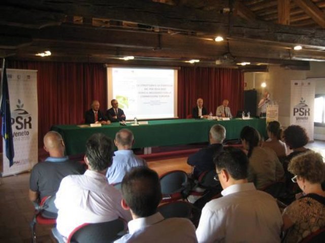
Rural development programme in the Veneto region [อิตาลี]
Developing rural areas in the Veneto region through sustainable land management policies
- ผู้รวบรวม: Nicola Dal Ferro
2. การอธิบายลักษณะของเทคโนโลยี SLM
2.1 การอธิบายแบบสั้น ๆ ของเทคโนโลยี
คำจำกัดความของเทคโนโลยี:
Buffer vegetation of agricultural land bordering to prevent nonpoint surface water pollution and soil erosion
2.2 การอธิบายแบบละเอียดของเทคโนโลยี
คำอธิบาย:
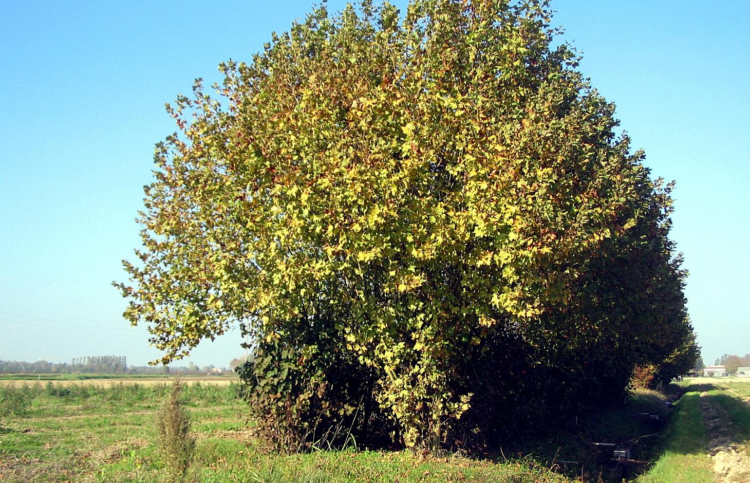
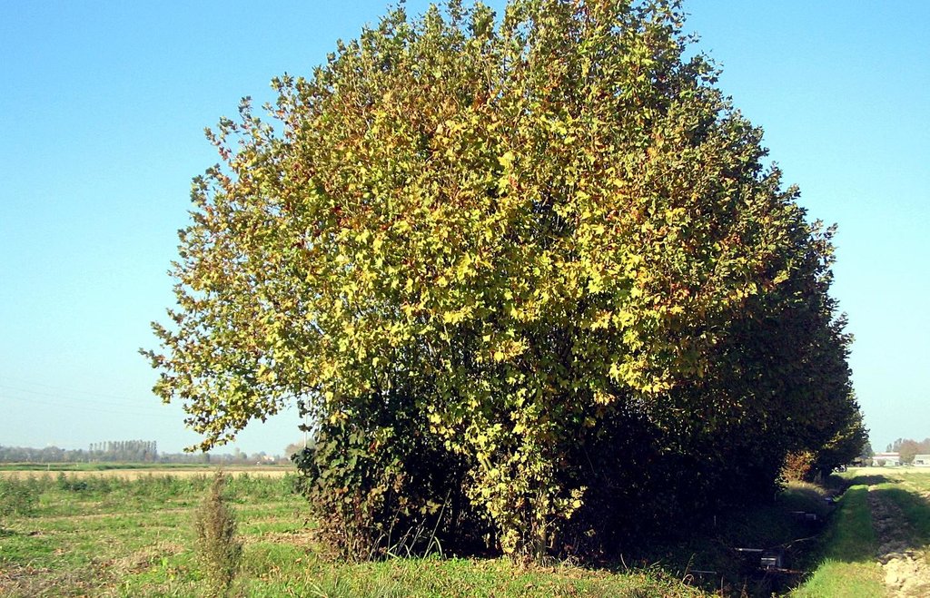
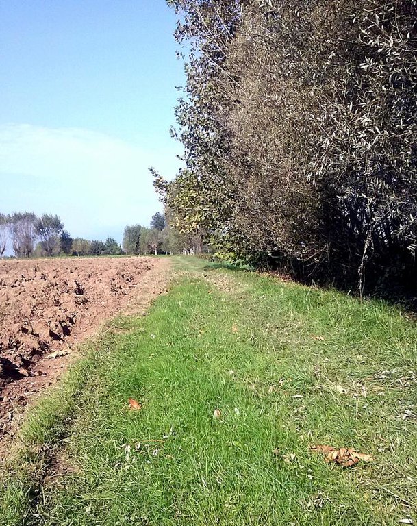
Vegetated buffer strips are agricultural areas with permanent vegetation designed to prevent surface water pollution and minimize soil erosion. In the Veneto region they are generally used along streams, canals and roads and can be composed of grass, hedges, trees or their combination. Buffer strips were a major component of agricultural landscape that has been replaced by intensive monoculture practices by increasing tillable areas. In recent years, the re-introduction of buffer zones in the Venetian plain (and generally in the whole territory of the region) has been supported as an agri-environmental measure for a sustainable land management.
Purpose of the Technology: Vegetated buffer strips, recently promoted by the regional government, are an efficient and economical way to improve surface water quality by agricultural nonpoint source pollution. Farmers take advantage of using buffer strips to help control soil erosion and sediment loss, stabilize riverbanks and reduce flood damage to crops. The continuous soil cover and diversification of habitats improve agroecosystem biodiversity and diversification of farmers income.
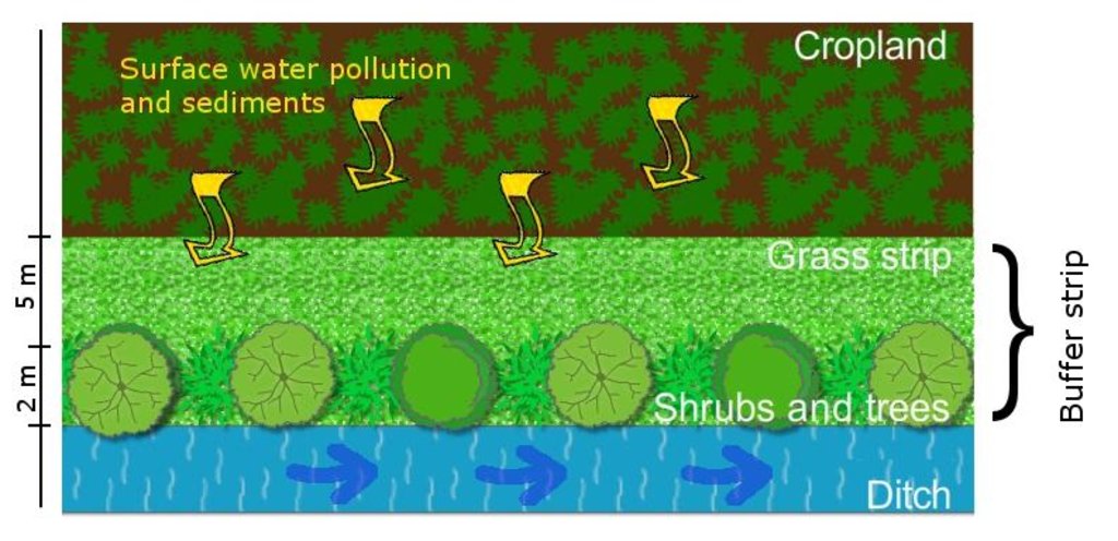
Establishment / maintenance activities and inputs: Vegetated buffer strips are generally composed of a shrub or tree belt of 1 m combined with an herbaceous band of 5 m, usually placed on the sides of cultivated fields in order to maximise their depuration efficacy as well as ensure crop production. Their function to reduce water pollution is optimal if arranged along a water course in order to intercept suspended solids and sediment-bound nutrients.
Natural / human environment: Adopting vegetated buffer strips achieves several environmental benefits with a low initial economic investment. The agroecosystem biodiversity is improved by the creation of continuous buffers that provide food, nesting cover, shaded environment and connecting corridors from one habitat to another to wildlife species, while the continuous soil cover with herbaceous and woody plants enhances soil protection and below-ground biodiversity. Water resources benefit from reduced nutrient supply and sediments that cause excessive growth of algae and diminish oxygen level of the water. Vegetated buffer strips, thanks to the maintenance and differentiation of species in the territory, enhance the quality of life through the improvement of agricultural landscape.
2.3 รูปภาพของเทคโนโลยี
2.5 ประเทศภูมิภาค หรือสถานที่ตั้งที่เทคโนโลยีได้นำไปใช้และได้รับการครอบคลุมโดยการประเมินนี้
ประเทศ:
อิตาลี
ภูมิภาค/รัฐ/จังหวัด:
Italy
ข้อมูลจำเพาะเพิ่มเติมของสถานที่ตั้ง :
Veneto region
ระบุการกระจายตัวของเทคโนโลยี:
- กระจายไปอย่างสม่ำเสมอในพื้นที่
If precise area is not known, indicate approximate area covered:
- 100-1,000 ตร.กม.
2.6 วันที่การดำเนินการ
ถ้าไม่รู้ปีที่แน่นอน ให้ระบุวันที่โดยประมาณ:
- 10-50 ปี
2.7 คำแนะนำของเทคโนโลยี
ให้ระบุว่าเทคโนโลยีถูกแนะนำเข้ามาอย่างไร:
- ในช่วงการทดลองหรือการทำวิจัย
3. การจัดประเภทของเทคโนโลยี SLM
3.1 วัตถุประสงค์หลักของเทคโนโลยี
- ลด ป้องกัน ฟื้นฟู การเสื่อมโทรมของที่ดิน
3.2 ประเภทของการใช้ที่ดินในปัจจุบันที่ได้นำเทคโนโลยีไปใช้
Land use mixed within the same land unit:
ไม่ใช่

พื้นที่ปลูกพืช
- การปลูกพืชล้มลุกอายุปีเดียว
- การปลูกไม้ยืนต้น ไม้พุ่ม
Annual cropping - Specify crops:
- cereals - maize
- legumes and pulses - soya
- wheat, oak, maple, hornbeam, willow
- oak , maple, hornbeam, willow
จำนวนของฤดูเพาะปลูกต่อปี:
- 1
ระบุ:
Longest growing period in days: 210 Longest growing period from month to month: March to OctoberSecond longest growing period in days: 180
แสดงความคิดเห็น:
Major land use problems (compiler’s opinion): Soils in the low Venetian plain of the Veneto region generally suffer from a loss of soil organic matter (SOM) that is strongly affected by their natural texture and climatic conditions. Moreover, in the last 50 years intensive tillage practices contributed to a further SOM decrease, estimated at 0.02-0.58 t/ha/y of carbon. The introduction of monoculture worsened the agro-ecosystem habitats and reduced soil biodiversity.
Major land use problems (land users’ perception): Decrease of productivity and the need of higher inputs of fertiliser.
3.4 การใช้น้ำ
การใช้น้ำของที่ดินที่มีการใช้เทคโนโลยีอยู่:
- น้ำฝนร่วมกับการชลประทาน
แสดงความคิดเห็น:
Water supply: rainfed, full irrigation
3.5 กลุ่ม SLM ที่ตรงกับเทคโนโลยีนี้
- มาตรการปลูกพืชขวางความลาดชัน (cross-slope measure)
3.6 มาตรการ SLM ที่ประกอบกันเป็นเทคโนโลยี

มาตรการอนุรักษ์ด้วยวิธีพืช
- V1: ต้นไม้และพุ่มไม้คลุมดิน
แสดงความคิดเห็น:
Main measures: vegetative measures
Type of vegetative measures: aligned: -linear
3.7 รูปแบบหลักของการเสื่อมโทรมของที่ดินที่ได้รับการแก้ไขโดยเทคโนโลยี

การกัดกร่อนของดินโดยน้ำ
- Wt (Loss of topsoil): การสูญเสียดินชั้นบนหรือการกัดกร่อนที่ผิวดิน
- Wr (Riverbank erosion): การกัดกร่อนริมฝั่งแม่น้ำ

การเสื่อมโทรมของดินทางด้านชีวภาพ
- Bh (Loss of habitat): การสูญเสียแหล่งที่อยู่

การเสื่อมโทรมของน้ำ
- Hp (Decline of surface water quality): การลดลงของคุณภาพน้ำที่ผิวดิน
แสดงความคิดเห็น:
Main type of degradation addressed: Wr: riverbank erosion, Bh: loss of habitats, Hp: decline of surface water quality
Secondary types of degradation addressed: Wt: loss of topsoil / surface erosion
Main causes of degradation: soil management (lack of organic input with fertilizations), population pressure (High demand for agricultural products and competition for land in densely populated area)
Secondary causes of degradation: crop management (annual, perennial, tree/shrub) (crop monoculture instead of crop rotation), deforestation / removal of natural vegetation (incl. forest fires) (mechanisation)
3.8 การป้องกัน การลดลง หรือการฟื้นฟูความเสื่อมโทรมของที่ดิน
ระบุเป้าหมายของเทคโนโลยีกับความเสื่อมโทรมของที่ดิน:
- ป้องกันความเสื่อมโทรมของที่ดิน
- ลดความเสื่อมโทรมของดิน
แสดงความคิดเห็น:
Main goals: prevention of land degradation
Secondary goals: mitigation / reduction of land degradation
4. ข้อมูลจำเพาะด้านเทคนิค กิจกรรมการนำไปปฏิบัติใช้ ปัจจัยนำเข้า และค่าใช้จ่าย
4.1 แบบแปลนทางเทคนิคของเทคโนโลยี
ข้อมูลจำเพาะด้านเทคนิค (แบบแปลนทางเทคนิคของเทคโนโลยี):
An interposed area between the cropland and a water course is designed to intercept runoff and reduce surface water pollution (suspended solids, nutrients etc.).
Location: Veneto region
Technical knowledge required for field staff / advisors: moderate
Technical knowledge required for land users: moderate
Main technical functions: control of dispersed runoff: retain / trap, control of dispersed runoff: impede / retard, stabilisation of soil (eg by tree roots against land slides), improvement of water quality, buffering / filtering water, sediment retention / trapping, sediment harvesting, spatial arrangement and diversification of land use
Secondary technical functions: control of concentrated runoff: retain / trap, control of concentrated runoff: impede / retard, improvement of ground cover, increase of surface roughness, increase in organic matter, increase in nutrient availability (supply, recycling,…)
Aligned: -linear
Vegetative material: T : trees / shrubs
Spacing between rows / strips / blocks (m): 3-5
Vertical interval within rows / strips / blocks (m): 1-3
Trees/ shrubs species: oak, maple, hornbeam, willow, etc.
Grass species: mixed species
ผู้เขียน:
Nicola Dal Ferro
4.2 ข้อมูลทั่วไปเกี่ยวกับการคำนวณปัจจัยนำเข้าและค่าใช้จ่าย
อื่นๆ หรือสกุลเงินประจำชาติ (ระบุ):
Euro €
If relevant, indicate exchange rate from USD to local currency (e.g. 1 USD = 79.9 Brazilian Real): 1 USD =:
0.8
ระบุค่าเฉลี่ยของค่าจ้างในการจ้างแรงงานต่อวัน:
21.00
4.3 กิจกรรมเพื่อการจัดตั้ง
| กิจกรรม | Timing (season) | |
|---|---|---|
| 1. | Planning, mulching, soli preparation, fertilisation | |
| 2. | Purchase of seedlings and planting | |
| 3. | Grass strip establishment | |
| 4. | Machinery for mowing, pruning |
4.4 ค่าใช้จ่ายของปัจจัยนำเข้าที่จำเป็นสำหรับการจัดตั้ง
| ปัจจัยนำเข้า | หน่วย | ปริมาณ | ค่าใช้จ่ายต่อหน่วย | ค่าใช้จ่ายทั้งหมดต่อปัจจัยนำเข้า | %ของค่าใช้จ่ายที่ก่อให้เกิดขึ้นโดยผู้ใช้ที่ดิน | |
|---|---|---|---|---|---|---|
| แรงงาน | Planning, mulching, soli preparation, fertilisation | ha | 1.0 | 306.0 | 306.0 | |
| แรงงาน | Planting | ha | 1.0 | 2.5 | 2.5 | |
| แรงงาน | Grass strip establishment | ha | 1.0 | 152.0 | 152.0 | |
| อุปกรณ์ | Machinery for mowing, pruning | ha | 1.0 | 4000.0 | 4000.0 | |
| วัสดุด้านพืช | Seedlings | ha | 1.0 | 119.0 | 119.0 | |
| ปุ๋ยและสารฆ่า/ยับยั้งการเจริญเติบโตของสิ่งมีชีวิต (ไบโอไซด์) | Fertilizer | ha | 1.0 | 14.0 | 14.0 | |
| ค่าใช้จ่ายทั้งหมดของการจัดตั้งเทคโนโลยี | 4593.5 | |||||
| Total costs for establishment of the Technology in USD | 5741.88 | |||||
4.5 การบำรุงรักษาสภาพหรือกิจกรรมที่เกิดขึ้นเป็นประจำ
| กิจกรรม | ช่วงระยะเวลา/ความถี่ | |
|---|---|---|
| 1. | Pruning, replanting, additional irrigation | |
| 2. | Grass strip maintenance |
4.6 ค่าใช้จ่ายของปัจจัยนำเข้าและกิจกรรมที่เกิดขึ้นเป็นประจำที่ต้องการการบำรุงรักษา (ต่อปี)
| ปัจจัยนำเข้า | หน่วย | ปริมาณ | ค่าใช้จ่ายต่อหน่วย | ค่าใช้จ่ายทั้งหมดต่อปัจจัยนำเข้า | %ของค่าใช้จ่ายที่ก่อให้เกิดขึ้นโดยผู้ใช้ที่ดิน | |
|---|---|---|---|---|---|---|
| แรงงาน | Pruning, replanting, additional irrigation | ha | 1.0 | 127.0 | 127.0 | |
| แรงงาน | Grass strip maintenance | ha | 1.0 | 127.0 | 127.0 | |
| ค่าใช้จ่ายทั้งหมดของการบำรุงรักษาสภาพเทคโนโลยี | 254.0 | |||||
| Total costs for maintenance of the Technology in USD | 317.5 | |||||
4.7 ปัจจัยสำคัญที่สุดที่มีผลกระทบต่อค่าใช้จ่าย
ปัจจัยสำคัญที่สุดที่มีผลกระทบต่อค่าใช้จ่ายต่างๆ:
Establishment costs (purchase of seedlings and planting) are the most important. After the establishment of buffer strip, costs are less relevant due to little work required for maintenance.
5. สิ่งแวดล้อมทางธรรมชาติและของมนุษย์
5.1 ภูมิอากาศ
ฝนประจำปี
- < 250 ม.ม.
- 251-500 ม.ม.
- 501-750 ม.ม.
- 751-1,000 ม.ม.
- 1,001-1,500 ม.ม.
- 1,501-2,000 ม.ม.
- 2,001-3,000 ม.ม.
- 3,001-4,000 ม.ม.
- > 4,000 ม.ม.
เขตภูมิอากาศเกษตร
- กึ่งชุ่มชื้น
Thermal climate class: temperate
5.2 สภาพภูมิประเทศ
ค่าเฉลี่ยความลาดชัน:
- ราบเรียบ (0-2%)
- ลาดที่ไม่ชัน (3-5%)
- ปานกลาง (6-10%)
- เป็นลูกคลื่น (11-15%)
- เป็นเนิน (16-30%)
- ชัน (31-60%)
- ชันมาก (>60%)
ธรณีสัณฐาน:
- ที่ราบสูง/ที่ราบ
- สันเขา
- ไหล่เขา
- ไหล่เนินเขา
- ตีนเนิน
- หุบเขา
ระดับความสูง:
- 0-100 เมตร
- 101-500 เมตร
- 501-1,000 เมตร
- 1,001-1,500 เมตร
- 1,501-2,000 เมตร
- 2,001-2,500 เมตร
- 2,501-3,000 เมตร
- 3,001-4,000 เมตร
- > 4,000 เมตร
5.3 ดิน
ค่าเฉลี่ยความลึกของดิน:
- ตื้นมาก (0-20 ซ.ม.)
- ตื้น (21-50 ซ.ม.)
- ลึกปานกลาง (51-80 ซ.ม.)
- ลึก (81-120 ซ.ม.)
- ลึกมาก (>120 ซ.ม.)
เนื้อดิน (ดินชั้นบน):
- หยาบ/เบา (ดินทราย)
- ปานกลาง (ดินร่วน ทรายแป้ง)
อินทรียวัตถุในดิน:
- ปานกลาง (1-3%)
- ต่ำ (<1%)
(ถ้ามี) ให้แนบคำอธิบายเรื่องดินแบบเต็มหรือระบุข้อมูลที่มีอยู่ เช่น ชนิดของดิน ค่า pH ของดินหรือความเป็นกรดของดิน ความสามารถในการแลกเปลี่ยนประจุบวก ไนโตรเจน ความเค็ม เป็นต้น:
Soil fertility is low-medium
Soil drainage/infiltration is medium
Soil water storage capacity is medium
5.4 ความเป็นประโยชน์และคุณภาพของน้ำ
ระดับน้ำใต้ดิน:
<5 เมตร
น้ำไหลบ่าที่ผิวดิน:
ดี
คุณภาพน้ำ (ที่ยังไม่ได้บำบัด):
เป็นน้ำเพื่อการดื่มที่ดี
ความคิดเห็นและข้อมูลจำเพาะเพิ่มเติมเรื่องคุณภาพและปริมาณน้ำ:
Ground water table: <5m a.s.l. (The area surrounding the Venice lagoon (1240 km2) is even below the sea level (down to -2 m) and currently cultivated due to land reclamation. As a result water table is kept artificially low)
Water quality (untreted): Good drinking water (groundwater) and for agricultural use only (surface water can be used for agricultural purposes but not as drinking water)
5.5 ความหลากหลายทางชีวภาพ
ความหลากหลายทางชนิดพันธุ์:
- ปานกลาง
ความคิดเห็นและข้อมูลจำเพาะเพิ่มเติมของความหลากหลายทางชีวภาพ:
High population density, infrastructures and intensive agriculture practices affect the state of biodiversity.
5.6 ลักษณะของผู้ใช้ที่ดินที่นำเทคโนโลยีไปปฏิบัติใช้
แนวทางการตลาดของระบบการผลิต:
- ทำการค้า/การตลาด
รายได้ที่มาจากนอกฟาร์ม:
- 10-50% ของรายได้ทั้งหมด
ระดับของความมั่งคั่งโดยเปรียบเทียบ:
- พอมีพอกิน
เป็นรายบุคคล/ครัวเรือน:
- เป็นรายบุคคล/ครัวเรือน
ระดับของการใช้เครื่องจักรกล:
- การใช้เครื่องจักรหรือเครื่องยนต์
เพศ:
- ชาย
ระบุลักษณะอื่นๆที่เกี่ยวข้องของผู้ใช้ที่ดิน:
Land users applying the Technology are mainly common / average land users
Difference in the involvement of women and men: Farmers in the Veneto region are traditionally males due to historical and cultural reasons.
Population density: 200-500 persons/km2
Annual population growth: 0.5% - 1%
5.7 Average area of land used by land users applying the Technology
- < 0.5 เฮกตาร์
- 0.5-1 เฮกตาร์
- 1-2 เฮกตาร์
- 2-5 เฮกตาร์
- 5-15 เฮกตาร์
- 15-50 เฮกตาร์
- 50-100 เฮกตาร์
- 100-500 เฮกตาร์
- 500-1,000 เฮกตาร์
- 1,000-10,000 เฮกตาร์
- >10,000 เฮกตาร์
พิจารณาว่าเป็นขนาดเล็ก กลาง หรือขนาดใหญ่ (ซึ่งอ้างอิงถึงบริบทระดับท้องถิ่น):
- ขนาดเล็ก
5.8 กรรมสิทธิ์ในที่ดิน สิทธิในการใช้ที่ดินและสิทธิในการใช้น้ำ
สิทธิในการใช้ที่ดิน:
- รายบุคคล
5.9 การเข้าถึงบริการและโครงสร้างพื้นฐาน
สุขภาพ:
- จน
- ปานกลาง
- ดี
การศึกษา:
- จน
- ปานกลาง
- ดี
ความช่วยเหลือทางด้านเทคนิค:
- จน
- ปานกลาง
- ดี
การจ้างงาน (เช่น ภายนอกฟาร์ม):
- จน
- ปานกลาง
- ดี
ตลาด:
- จน
- ปานกลาง
- ดี
พลังงาน:
- จน
- ปานกลาง
- ดี
ถนนและการขนส่ง:
- จน
- ปานกลาง
- ดี
น้ำดื่มและการสุขาภิบาล:
- จน
- ปานกลาง
- ดี
บริการด้านการเงิน:
- จน
- ปานกลาง
- ดี
6. ผลกระทบและสรุปคำบอกกล่าว
6.1 ผลกระทบในพื้นที่ดำเนินการ (On-site) จากการใช้เทคโนโลยี
ผลกระทบทางด้านเศรษฐกิจและสังคม
การผลิต
การผลิตพืชผล
การผลิตไม้
จำนวนก่อน SLM:
0 t/100 linear metres
หลังจาก SLM:
1-1.5/100 linear metres
ความหลากหลายของผลิตภัณฑ์
ความเป็นประโยชน์และคุณภาพของน้ำ
การมีน้ำดื่มไว้ให้ใช้
รายได้และค่าใช้จ่าย
ความหลากหลายของแหล่งผลิตรายได้
ผลกระทบด้านสังคมวัฒนธรรมอื่น ๆ
โอกาสทางวัฒนธรรม
โอกาสทางด้านสันทนาการ
การบรรเทาความขัดแย้ง
ผลกระทบด้านนิเวศวิทยา
วัฐจักรน้ำหรือน้ำบ่า
คุณภาพน้ำ
น้ำไหลบ่าที่ผิวดิน
ดิน
สิ่งปกคลุมดิน
การสูญเสียดิน
การหมุนเวียนและการเติมของธาตุอาหาร
ความหลากหลายทางชีวภาพของพืชและสัตว์
มวลชีวภาพ/เหนือดินชั้น C
ความหลากหลายทางชีวภาพของพืช
ความหลากหลายของสัตว์
6.2 ผลกระทบนอกพื้นที่ดำเนินการ (Off-site) จากการใช้เทคโนโลยี
น้ำที่ใช้ประโยชน์ได้
น้ำท่วมพื้นที่ท้ายน้ำ
การเกิดมลพิษในน้ำบาดาลหรือแม่น้ำ
ความสามารถต้านทานการเปลี่ยนแปลง / ความสามารถในการคัดกรอง
ความเสียหายต่อพื้นที่เพาะปลูกของเพื่อนบ้าน
6.3 การเผชิญและความตอบสนองของเทคโนโลยีต่อการเปลี่ยนแปลงสภาพภูมิอากาศที่ค่อยเป็นค่อยไป และสภาพรุนแรงของภูมิอากาศ / ภัยพิบัติ (ที่รับรู้ได้โดยผู้ใช้ที่ดิน)
การเปลี่ยนแปลงสภาพภูมิอากาศที่ค่อยเป็นค่อยไป
การเปลี่ยนแปลงสภาพภูมิอากาศที่ค่อยเป็นค่อยไป
| ฤดู | increase or decrease | เทคโนโลยีมีวิธีการรับมืออย่างไร | |
|---|---|---|---|
| อุณหภูมิประจำปี | เพิ่มขึ้น | ดี |
สภาพรุนแรงของภูมิอากาศ (ภัยพิบัติ)
ภัยพิบัติทางอุตุนิยมวิทยา
| เทคโนโลยีมีวิธีการรับมืออย่างไร | |
|---|---|
| พายุฝนประจำท้องถิ่น | ดี |
ภัยพิบัติจากสภาพภูมิอากาศ
| เทคโนโลยีมีวิธีการรับมืออย่างไร | |
|---|---|
| ภัยจากฝนแล้ง | ไม่ค่อยดี |
6.4 การวิเคราะห์ค่าใช้จ่ายและผลประโยชน์ที่ได้รับ
ผลประโยชน์ที่ได้รับเปรียบเทียบกับค่าใช้จ่ายในการจัดตั้งเป็นอย่างไร (จากมุมมองของผู้ใช้ที่ดิน)
ผลตอบแทนระยะสั้น:
ด้านลบเล็กน้อย
ผลตอบแทนระยะยาว:
ด้านบวก
ผลประโยชน์ที่ได้รับเปรียบเทียบกับค่าใช้จ่ายในการบำรุงรักษาหรือต้นทุนที่เกิดขึ้นซ้ำอีก เป็นอย่างไร (จากมุมมองของผู้ใช้ที่ดิน)
ผลตอบแทนระยะสั้น:
ด้านบวก
ผลตอบแทนระยะยาว:
ด้านบวก
6.5 การปรับตัวของเทคโนโลยี
Of all those who have adopted the Technology, how many did so spontaneously, i.e. without receiving any material incentives/ payments?
- 51-90%
แสดงความคิดเห็น:
50% of land user families have adopted the Technology with external material support
Comments on acceptance with external material support: On average it was estimated that, among farmers adopting the technology, ca. half of them benefited of incentives.
50% of land user families have adopted the Technology without any external material support
Comments on spontaneous adoption: On average it was estimated that, among farmers adopting the technology, ca. half of them benefited of incentives.
6.7 จุดแข็ง / ข้อได้เปรียบ / โอกาสของเทคโนโลยี
| จุดแข็ง / ข้อได้เปรียบ / โอกาสในทัศนคติของผู้รวบรวมหรือวิทยากรหลัก |
|---|
|
protects soil from water erosion How can they be sustained / enhanced? long-term maintenance of buffer zones and soil cover |
|
protects surface water quality How can they be sustained / enhanced? combination with other sustainable technologies (e.g. reduction of pesticides). Spread over larger areas |
|
enhances agro-ecosystem biodiversity How can they be sustained / enhanced? improvement of connecting corridors between habitats |
|
diversifies farmer's production How can they be sustained / enhanced? improve farmers' education |
|
little costs compared to environmenmtal benefits How can they be sustained / enhanced? support farmers on decision making |
6.8 จุดอ่อน / ข้อเสียเปรียบ / ความเสี่ยงของเทคโนโลยีและวิธีการแก้ไข
| จุดอ่อน / ข้อเสียเปรียบ / ความเสี่ยงในทัศนคติของผู้ใช้ที่ดิน | มีวิธีการแก้ไขได้อย่างไร |
|---|---|
| sometimes difficult to adjust crop production requirements with buffer strip occupation of space | support farmers on decision making |
| จุดอ่อน / ข้อเสียเปรียบ / ความเสี่ยงในทัศนคติของผู้รวบรวมหรือวิทยากรหลัก | มีวิธีการแก้ไขได้อย่างไร |
|---|---|
| time-dependent buffer performance | Monitoring saturation-effect conditions in the medium, long-term |
| low efficacy if the technology is maintained in the short-term | improve effectiveness of subsidies to keep the technology in the long-term; increase farmers awareness on soil and water benefits |
7. การอ้างอิงและการเชื่อมต่อ
7.1 วิธีการและแหล่งข้อมูล
7.2 การอ้างอิงถึงสิ่งตีพิมพ์
หัวข้อ, ผู้เขียน, ปี, หมายเลข ISBN:
Programma di sviluppo rurale per il veneto 2007-2013, Regione Veneto, 2007. Dipartimento Agricoltura e Sviluppo Rurale.
ลิงก์และโมดูล
ขยายทั้งหมด ย่อทั้งหมดลิงก์

Rural development programme in the Veneto region [อิตาลี]
Developing rural areas in the Veneto region through sustainable land management policies
- ผู้รวบรวม: Nicola Dal Ferro
โมดูล
ไม่มีโมดูล


