Constructed wetland with tile drainage [สาธารณรัฐเช็ก]
- ผู้สร้างสรรค์:
- การอัพเดท:
- ผู้รวบรวม: Petr Fučík
- ผู้เรียบเรียง: –
- ผู้ตรวจสอบ: Rima Mekdaschi Studer, William Critchley
Umělý mokřad na drenáži
technologies_5939 - สาธารณรัฐเช็ก
ดูส่วนย่อย
ขยายทั้งหมด ย่อทั้งหมด1. ข้อมูลทั่วไป
1.2 รายละเอียดที่ติดต่อได้ของผู้รวบรวมและองค์กรที่เกี่ยวข้องในการประเมินและการจัดเตรียมทำเอกสารของเทคโนโลยี
ชื่อของโครงการซึ่งอำนวยความสะดวกในการทำเอกสารหรือการประเมินเทคโนโลยี (ถ้าเกี่ยวข้อง)
OPtimal strategies to retAIN and re-use water and nutrients in small agricultural catchments across different soil-climatic regions in Europe (OPTAIN)ชื่อของโครงการซึ่งอำนวยความสะดวกในการทำเอกสารหรือการประเมินเทคโนโลยี (ถ้าเกี่ยวข้อง)
Constructed wetlands on agricultural drainage systems for enhancement of landscape´s water residence time and improvement of water quality (TH02030376)ชื่อขององค์กรซึ่งอำนวยความสะดวกในการทำเอกสารหรือการประเมินเทคโนโลยี (ถ้าเกี่ยวข้อง)
Research Institute for Soil and Water Conservation (VUMOP) - สาธารณรัฐเช็ก1.3 เงื่อนไขการใช้ข้อมูลที่ได้บันทึกผ่านทาง WOCAT
ผู้รวบรวมและวิทยากรหลักยอมรับเงื่อนไขเกี่ยวกับการใช้ข้อมูลที่ถูกบันทึกผ่านทาง WOCAT:
ใช่
1.4 การเปิดเผยเรื่องความยั่งยืนของเทคโนโลยีที่ได้อธิบายไว้
เทคโนโลยีที่ได้อธิบายไว้นี้เป็นปัญหาของความเสื่อมโทรมโทรมของที่ดินหรือไม่ จึงไม่ได้รับการยอมรับว่าเป็นเทคโนโลยีเพื่อการจัดการที่ดินอย่างยั่งยืน:
ไม่ใช่
แสดงความคิดเห็น:
The described constructed wetland is a sustainable land management technology.
2. การอธิบายลักษณะของเทคโนโลยี SLM
2.1 การอธิบายแบบสั้น ๆ ของเทคโนโลยี
คำจำกัดความของเทคโนโลยี:
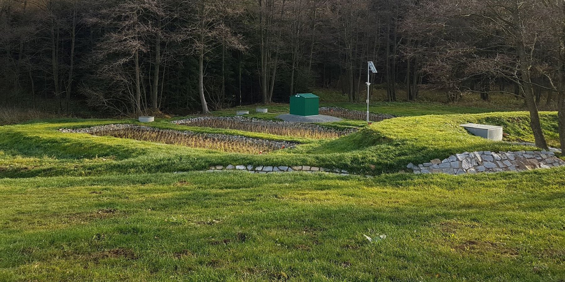
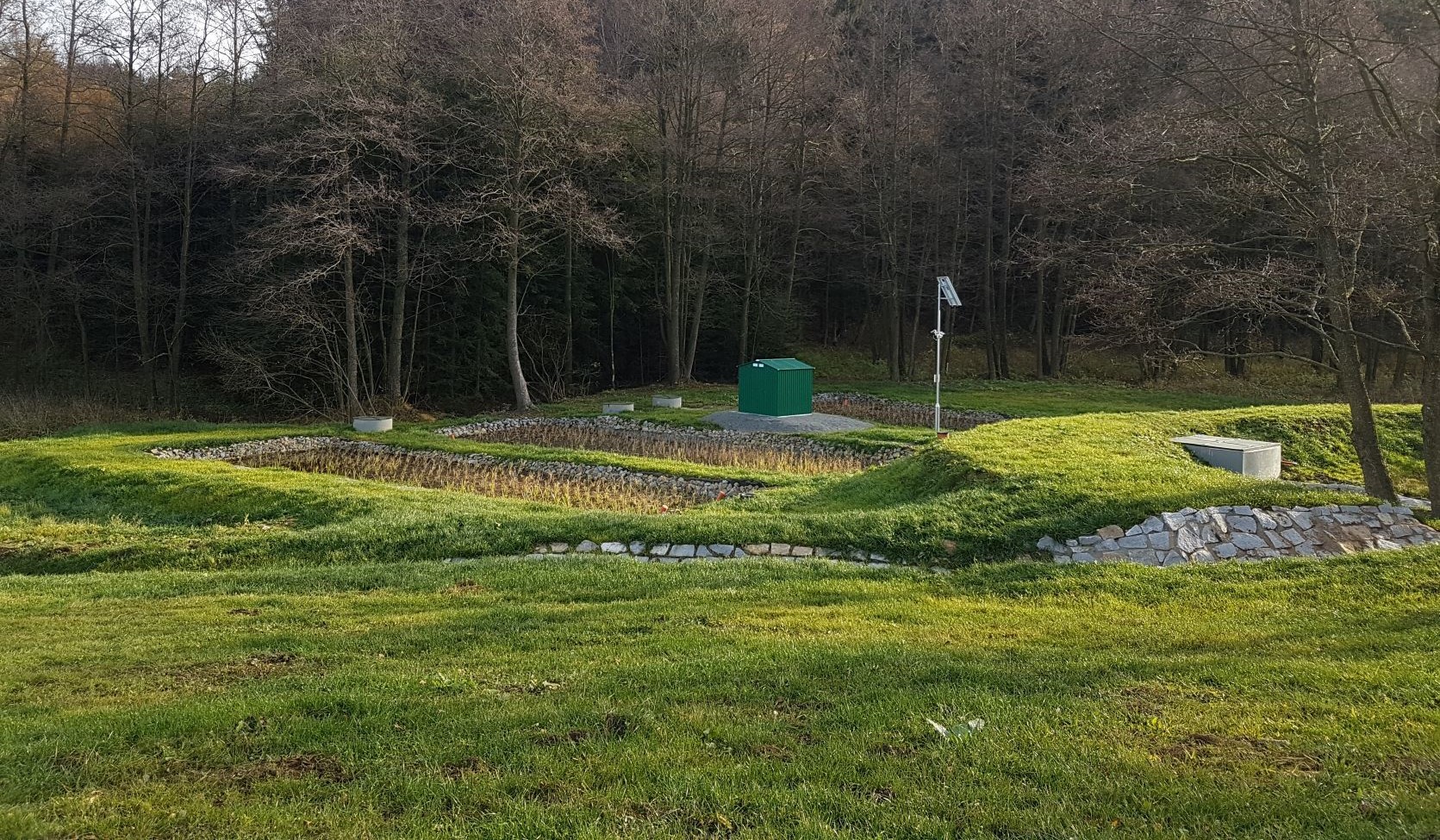
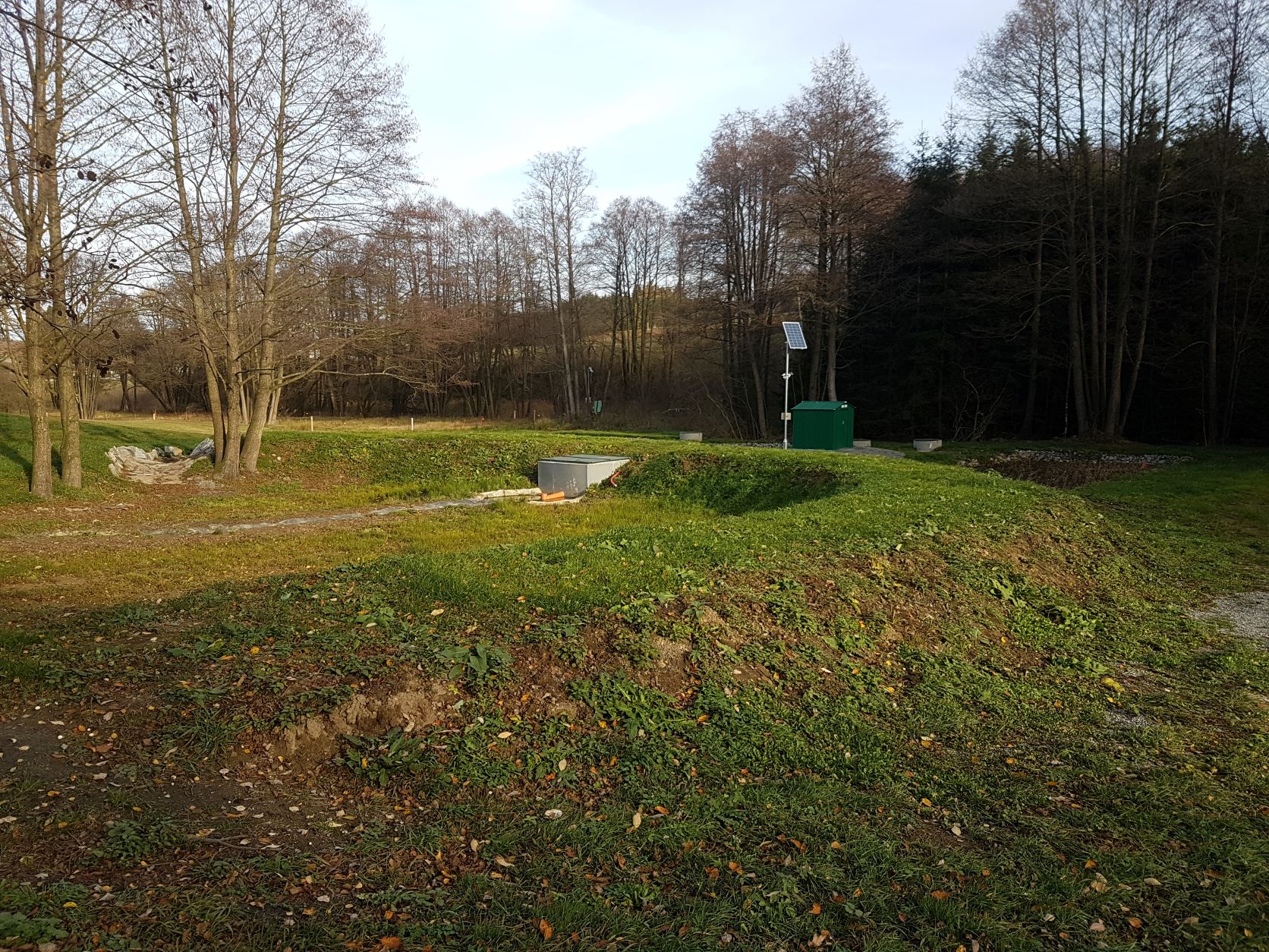
A constructed wetland connected to tile drains that slows drainage flow, removes nitrogen and pesticides from drainage waters, and improves biodiversity. Formed from a substrate of matured birch chips and gravel, and is planted with reeds (Phalaris arundinacea) and reed manna grass (Glyceria maxima).
2.2 การอธิบายแบบละเอียดของเทคโนโลยี
คำอธิบาย:
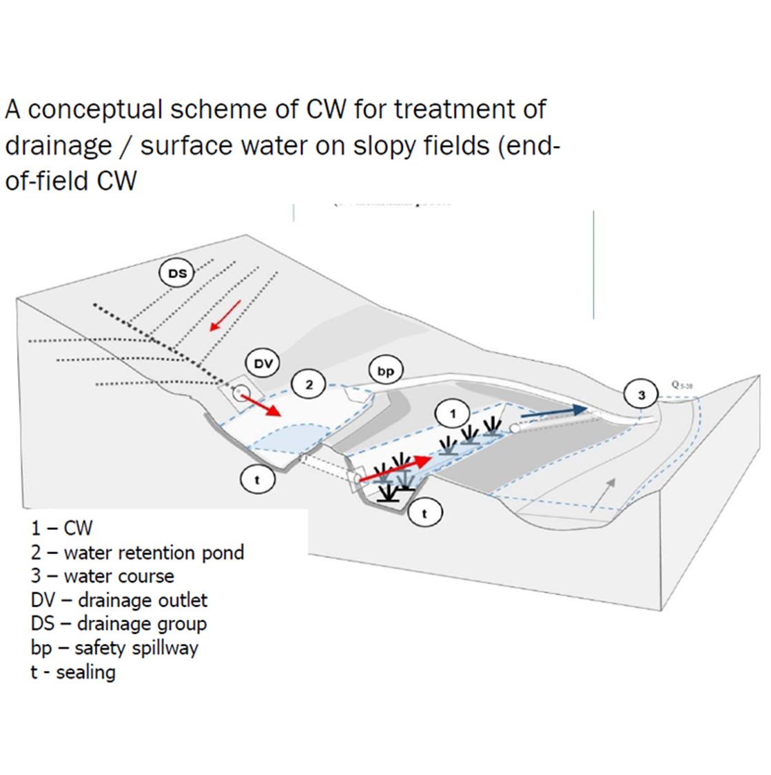
This type of constructed retention wetland is designed to act in a natural way. The objective is to improve water quality, slow down runoff – and support biodiversity. It combines the functions of retaining, and gradually releasing, water while remediating (i.e. cleaning) drainage waters with a focus on pollutant of nitrates and pesticides. The wetland is established in connection with or directly on tile drains and is designed to have both subsurface and surface flow. The substrate used in construction is a mixture of 6-month matured birch chips (4-30 mm length) and gravel (4–8 mm diameter) at a ratio of 1:10. The wetland is planted with reed canary grass (Phalaris arundinacea) and reed manna grass (Glyceria maxima). The wetland to catchment ratio (WCR) is between 2:1000 and 3:1000: thus, for example, a constructed wetland of 200m2 or 300m2 would be required to serve an area of 10 hectares.
The process of establishing such a wetland begins with identifying where this measure is required. The drainage system must be thoroughly located and then the correct site for the wetland identified. The wetland is then designed and planned – including costs and labour requirements and the amount of land taken out of production. Administration includes processing statements and permission from state offices and landowners.
2.3 รูปภาพของเทคโนโลยี
อัลบั้มสื่อบันทึก
คำอธิบายภาพ:
A retention pond is intended to capture high water flows and release it slowly to the wetland.
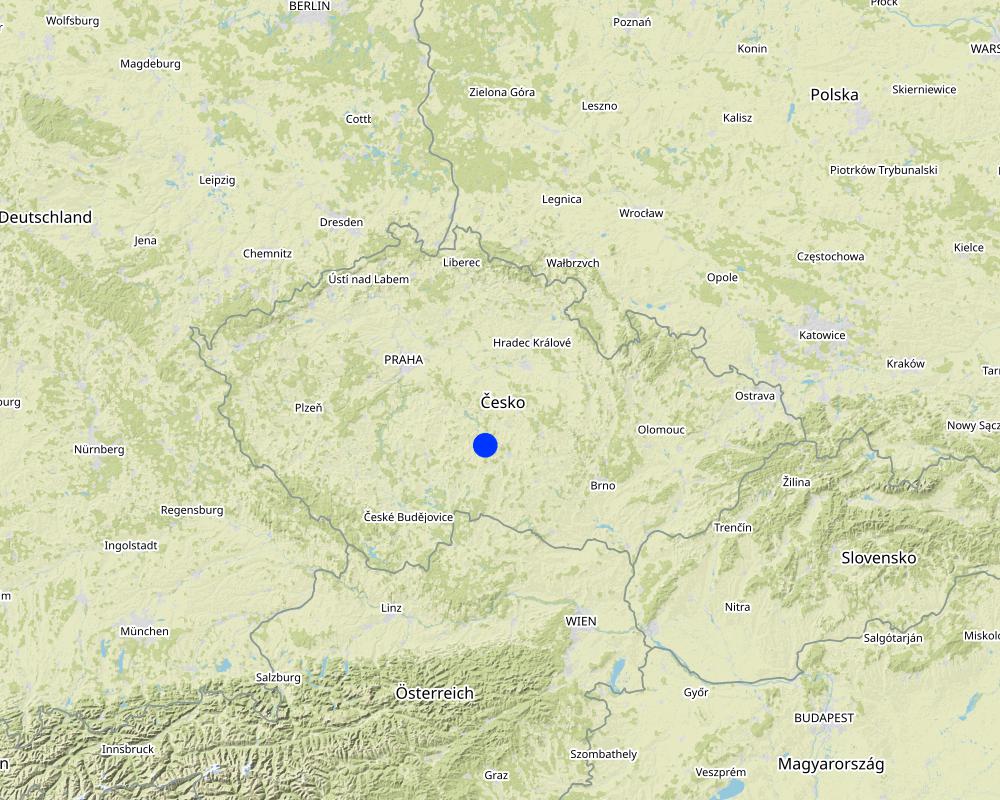
2.5 ประเทศภูมิภาค หรือสถานที่ตั้งที่เทคโนโลยีได้นำไปใช้และได้รับการครอบคลุมโดยการประเมินนี้
ประเทศ:
สาธารณรัฐเช็ก
ภูมิภาค/รัฐ/จังหวัด:
Czech Highlands (Vysočina)
ข้อมูลจำเพาะเพิ่มเติมของสถานที่ตั้ง :
Velký Rybník u Pelhřimova
ระบุการกระจายตัวของเทคโนโลยี:
- ใช้ ณ จุดที่เฉพาะเจาะจงหรือเน้นไปยังบริเวณพื้นที่ขนาดเล็ก
Is/are the technology site(s) located in a permanently protected area?
ไม่ใช่
แสดงความคิดเห็น:
Not in this specific case but it might be in some other cases.
Map
×2.6 วันที่การดำเนินการ
ระบุปีที่ใช้:
2018
ถ้าไม่รู้ปีที่แน่นอน ให้ระบุวันที่โดยประมาณ:
- น้อยกว่า 10 ปี (ไม่นานนี้)
2.7 คำแนะนำของเทคโนโลยี
ให้ระบุว่าเทคโนโลยีถูกแนะนำเข้ามาอย่างไร:
- ในช่วงการทดลองหรือการทำวิจัย
3. การจัดประเภทของเทคโนโลยี SLM
3.1 วัตถุประสงค์หลักของเทคโนโลยี
- อนุรักษ์ระบบนิเวศน์
- ป้องกันพื้นที่ลุ่มน้ำ/บริเวณท้ายน้ำ โดยร่วมกับเทคโนโลยีอื่นๆ
- รักษาสภาพหรือปรับปรุงความหลากหลายทางชีวภาพ
- ลดความเสี่ยงของภัยพิบัติ
- ปรับตัวเข้ากับการเปลี่ยนแปลงภูมิอากาศของโลก สภาพภูมิอากาศที่รุนแรงและผลกระทบ
3.2 ประเภทของการใช้ที่ดินในปัจจุบันที่ได้นำเทคโนโลยีไปใช้
Land use mixed within the same land unit:
ไม่ใช่

ทางน้ำ แหล่งน้ำ พื้นที่ชุ่มน้ำ
- ทางระบายน้ำ ทางน้ำ
- หนองบึง พื้นที่ชุ่มน้ำ
ผลิตภัณฑ์หลักหรือบริการ:
The current land use might change; e.g. if there was a meadow / cropland and after implementation there is a wetland (i.e. water body or other surface)

ที่ดินที่ไม่ให้ผลผลิต
ระบุ:
CW on unproductive land below drained cropland.
ข้อสังเกต:
CW on unproductive land below drained cropland.
3.3 Has land use changed due to the implementation of the Technology?
Has land use changed due to the implementation of the Technology?
- No (Continue with question 3.4)
Land use mixed within the same land unit:
ไม่ใช่
ทางน้ำ แหล่งน้ำ พื้นที่ชุ่มน้ำ
- ทางระบายน้ำ ทางน้ำ
- หนองบึง พื้นที่ชุ่มน้ำ
ผลิตภัณฑ์หลักหรือบริการ:
The current land use might change; e.g. if there was a meadow / cropland and after implementation there is a wetland (i.e. water body or other surface)
ที่ดินที่ไม่ให้ผลผลิต
ระบุ:
CW on unproductive land below drained cropland.
ข้อสังเกต:
CW on unproductive land below drained cropland.
แสดงความคิดเห็น:
The current land use might change; e.g. if there was a meadow / cropland before and after implementation there is a wetland (i.e. water body or other surface)
3.4 การใช้น้ำ
การใช้น้ำของที่ดินที่มีการใช้เทคโนโลยีอยู่:
- จากน้ำฝน
แสดงความคิดเห็น:
Drainage fed wetland
3.5 กลุ่ม SLM ที่ตรงกับเทคโนโลยีนี้
- การผันน้ำและการระบายน้ำ
- การจัดการน้ำผิวดิน (น้ำพุ แม่น้ำทะเลสาบ ทะเล)
- การป้องกัน / การจัดการพื้นที่ชุ่มน้ำ
3.6 มาตรการ SLM ที่ประกอบกันเป็นเทคโนโลยี

มาตรการอนุรักษ์ด้วยโครงสร้าง
- S3: Graded ditches, channels, waterways
- S4: คูน้ำแนวระดับ หลุม
- S11: อื่น ๆ
3.7 รูปแบบหลักของการเสื่อมโทรมของที่ดินที่ได้รับการแก้ไขโดยเทคโนโลยี

การเสื่อมโทรมของน้ำ
- Hs (Change in quantity of surface water): การเปลี่ยนแปลงปริมาณของน้ำที่ผิวดิน
- Hp (Decline of surface water quality): การลดลงของคุณภาพน้ำที่ผิวดิน
แสดงความคิดเห็น:
Worsened drainage water quality (polluted by nitrates and pesticides). Accelerated (undue) subsurface runoff from farmland due to free-drainage.
3.8 การป้องกัน การลดลง หรือการฟื้นฟูความเสื่อมโทรมของที่ดิน
ระบุเป้าหมายของเทคโนโลยีกับความเสื่อมโทรมของที่ดิน:
- ฟื้นฟูบำบัดที่ดินที่เสื่อมโทรมลงอย่างมาก
4. ข้อมูลจำเพาะด้านเทคนิค กิจกรรมการนำไปปฏิบัติใช้ ปัจจัยนำเข้า และค่าใช้จ่าย
4.1 แบบแปลนทางเทคนิคของเทคโนโลยี

ข้อมูลจำเพาะด้านเทคนิค (แบบแปลนทางเทคนิคของเทคโนโลยี):
The retention drainage wetland is designed optionally with subsurface horizontal, vertical or combined flow. For nitrate and soluble pesticides, the horizontal flow is preferred (to support anoxic conditions and the denitrification), whereas for some other pollutants (amonia, phosphorus, sorbing pesticides), the vertical or a combined flow CW is better. Substrate could be various; we used a mixture of matured (6 months) 4-30 mm birch chips and 4–8 mm gravel (1:10), planted with reeds (Phalaris arundinacea) and reed manna grass (Glyceria maxima). The width is between 5–12 m; length 10–20 m; depth 80-120 cm. Water level is kept by the help of below, on or above the substrate surface. The plastic film is 10-20 mm thick.
ผู้เขียน:
Petr Fučík
วันที่:
17/03/2022
4.2 ข้อมูลทั่วไปเกี่ยวกับการคำนวณปัจจัยนำเข้าและค่าใช้จ่าย
ให้ระบุว่าค่าใช้จ่ายและปัจจัยนำเข้าได้รับการคำนวณอย่างไร:
- ต่อหน่วยเทคโนโลยี
โปรดระบุหน่วย:
m2
Specify dimensions of unit (if relevant):
50 - 300
ระบุสกุลเงินที่ใช้คำนวณค่าใช้จ่าย:
- USD
If relevant, indicate exchange rate from USD to local currency (e.g. 1 USD = 79.9 Brazilian Real): 1 USD =:
22.0
ระบุค่าเฉลี่ยของค่าจ้างในการจ้างแรงงานต่อวัน:
Around 1 500 USD per person per month; i.e. 75 USD/person/day
4.3 กิจกรรมเพื่อการจัดตั้ง
| กิจกรรม | Timing (season) | |
|---|---|---|
| 1. | Identification of tile drainage (tiles, outlets). | anytime; project documentation, aerial images, field survey |
| 2. | Water sampling (discharge + water quality) + Curve Number method application. | 3-5x in several months. To get an overview of hydrochemical characteristics of the drainage and the volume of quick runoff |
| 3. | Identification of a proper location for a constructed wetland (CW) | anytime; based on soils, land use, old maps, land owner/user situation, morphology, etc |
| 4. | Assessment of CW hydraulic retention time (HRT) needed. | HRT is computed to enable removal of 50% of pollution load (e.g. NO3); based on average flow (m3/h), designed wetlad volume (m3) and substrate porosity (%) |
| 5. | Design the CW | preparation of the whole documentation |
| 6. | Administration and engineering of the CW | land owner issues, permissions, etc |
| 7. | Construction of the CW | best in drier conditions |
| 8. | Setting the plants | In central Europe - from April to September; at 0,5 - 1 m distance |
| 9. | Finalization of the CW | grassing the banks, ground works, etc |
แสดงความคิดเห็น:
When designing the measures on land drainage at larger areas, there is a paper by Zajíček et al. (2022). How to Select a Location and a Design of Measures on Land Drainage – A Case Study from the Czech Republic. DOI: https://doi.org/10.12911/22998993/146270
4.4 ค่าใช้จ่ายของปัจจัยนำเข้าที่จำเป็นสำหรับการจัดตั้ง
If you are unable to break down the costs in the table above, give an estimation of the total costs of establishing the Technology:
48000.0
ถ้าผู้ใช้ที่ดินรับภาระน้อยกว่า 100% ของค่าใช้จ่าย ให้ระบุว่าใครเป็นผู้รับผิดชอบส่วนที่เหลือ:
Municipality
แสดงความคิดเห็น:
The cost for implementation of a CW is between 18 000 - 85 000 USD (48 000 on average), depending on the size, construction, equipment, etc.
4.5 การบำรุงรักษาสภาพหรือกิจกรรมที่เกิดขึ้นเป็นประจำ
| กิจกรรม | ช่วงระยะเวลา/ความถี่ | |
|---|---|---|
| 1. | General Inspection | 4-6 times per year (every two or three months) |
| 2. | Removal / cleaning of sediment / cloggings | 1-2 times per year (every six or twelve months) |
| 3. | Removal of grass / biomass (if necessary) | 2-6 times per year (every twelve or three months) |
4.6 ค่าใช้จ่ายของปัจจัยนำเข้าและกิจกรรมที่เกิดขึ้นเป็นประจำที่ต้องการการบำรุงรักษา (ต่อปี)
If you are unable to break down the costs in the table above, give an estimation of the total costs of maintaining the Technology:
500.0
ถ้าผู้ใช้ที่ดินรับภาระน้อยกว่า 100% ของค่าใช้จ่าย ให้ระบุว่าใครเป็นผู้รับผิดชอบส่วนที่เหลือ:
In our case research support; in practice could be Munucipality, Regional government, River Basin Management Authority
แสดงความคิดเห็น:
The cost for maintenance/ recurrent activities of a CW is between 300 - 700 EUR per year (500 on average), depending on the size, construction, equipment, etc.
4.7 ปัจจัยสำคัญที่สุดที่มีผลกระทบต่อค่าใช้จ่าย
ปัจจัยสำคัญที่สุดที่มีผลกระทบต่อค่าใช้จ่ายต่างๆ:
CW size, construction, equipment. Design of the whole CW - if designed as a more natural or rather a technical unit.
5. สิ่งแวดล้อมทางธรรมชาติและของมนุษย์
5.1 ภูมิอากาศ
ฝนประจำปี
- < 250 ม.ม.
- 251-500 ม.ม.
- 501-750 ม.ม.
- 751-1,000 ม.ม.
- 1,001-1,500 ม.ม.
- 1,501-2,000 ม.ม.
- 2,001-3,000 ม.ม.
- 3,001-4,000 ม.ม.
- > 4,000 ม.ม.
ระบุปริมาณน้ำฝนเฉลี่ยรายปี (ถ้ารู้) :หน่วย ม.ม.
600.00
ข้อมูลจำเพาะ/ความคิดเห็นเรื่องปริมาณน้ำฝน:
For CW design; it is necessary is to have rainfall amounts with 2, 5,10, 20 and 00 year return periods to calculate direct runoff from adjacent (sloping) farmland to design the retention pond by CN method (or other).
ระบุชื่อของสถานีตรวดวัดอากาศที่ใช้อ้างอิงคือ:
Pelhřimov
เขตภูมิอากาศเกษตร
- กึ่งชุ่มชื้น
The more often torrential rains are anticipated, the more attention is needed to pay the design of the retention pond located prior the CW.
5.2 สภาพภูมิประเทศ
ค่าเฉลี่ยความลาดชัน:
- ราบเรียบ (0-2%)
- ลาดที่ไม่ชัน (3-5%)
- ปานกลาง (6-10%)
- เป็นลูกคลื่น (11-15%)
- เป็นเนิน (16-30%)
- ชัน (31-60%)
- ชันมาก (>60%)
ธรณีสัณฐาน:
- ที่ราบสูง/ที่ราบ
- สันเขา
- ไหล่เขา
- ไหล่เนินเขา
- ตีนเนิน
- หุบเขา
ระดับความสูง:
- 0-100 เมตร
- 101-500 เมตร
- 501-1,000 เมตร
- 1,001-1,500 เมตร
- 1,501-2,000 เมตร
- 2,001-2,500 เมตร
- 2,501-3,000 เมตร
- 3,001-4,000 เมตร
- > 4,000 เมตร
ให้ระบุถ้าเทคโนโลยีได้ถูกนำไปใช้:
- บริเวณแอ่งบนที่ราบ (concave situations)
5.3 ดิน
ค่าเฉลี่ยความลึกของดิน:
- ตื้นมาก (0-20 ซ.ม.)
- ตื้น (21-50 ซ.ม.)
- ลึกปานกลาง (51-80 ซ.ม.)
- ลึก (81-120 ซ.ม.)
- ลึกมาก (>120 ซ.ม.)
เนื้อดิน (ดินชั้นบน):
- ปานกลาง (ดินร่วน ทรายแป้ง)
- ละเอียด/หนัก (ดินเหนียว)
เนื้อดินล่าง (> 20 ซ.ม.ต่ำจากผิวดิน):
- ปานกลาง (ดินร่วน ทรายแป้ง)
- ละเอียด/หนัก (ดินเหนียว)
อินทรียวัตถุในดิน:
- ปานกลาง (1-3%)
- ต่ำ (<1%)
(ถ้ามี) ให้แนบคำอธิบายเรื่องดินแบบเต็มหรือระบุข้อมูลที่มีอยู่ เช่น ชนิดของดิน ค่า pH ของดินหรือความเป็นกรดของดิน ความสามารถในการแลกเปลี่ยนประจุบวก ไนโตรเจน ความเค็ม เป็นต้น:
Soil characteristics are not relevant, with an exception of the retention pond bottom and dam (best clay or low permeable soils).
5.4 ความเป็นประโยชน์และคุณภาพของน้ำ
ระดับน้ำใต้ดิน:
5-50 เมตร
น้ำไหลบ่าที่ผิวดิน:
ปานกลาง
คุณภาพน้ำ (ที่ยังไม่ได้บำบัด):
เป็นน้ำเพื่อการดื่มที่ไม่ดี (จำเป็นต้องได้รับการบำบัด)
Water quality refers to:
both ground and surface water
ความเค็มของน้ำเป็นปัญหาหรือไม่:
ไม่ใช่
กำลังเกิดน้ำท่วมในพื้นที่หรือไม่:
ใช่
บ่อยครั้ง:
เป็นครั้งเป็นคราว
ความคิดเห็นและข้อมูลจำเพาะเพิ่มเติมเรื่องคุณภาพและปริมาณน้ำ:
The more often torrential rains are anticipated, the more attention is needed to pay to the design of the retention pond located prior the CW.
5.5 ความหลากหลายทางชีวภาพ
ความหลากหลายทางชนิดพันธุ์:
- ปานกลาง
ความหลากหลายของแหล่งที่อยู่:
- ปานกลาง
5.6 ลักษณะของผู้ใช้ที่ดินที่นำเทคโนโลยีไปปฏิบัติใช้
อยู่กับที่หรือเร่ร่อน:
- อยู่กับที่
แนวทางการตลาดของระบบการผลิต:
- mixed (subsistence/ commercial)
รายได้ที่มาจากนอกฟาร์ม:
- < 10% ของรายได้ทั้งหมด
ระดับของความมั่งคั่งโดยเปรียบเทียบ:
- พอมีพอกิน
เป็นรายบุคคล/ครัวเรือน:
- สหกรณ์
ระดับของการใช้เครื่องจักรกล:
- การใช้เครื่องจักรหรือเครื่องยนต์
เพศ:
- หญิง
- ชาย
อายุของผู้ใช้ที่ดิน:
- ผู้เยาว์
- วัยกลางคน
- ผู้สูงอายุ
5.7 Average area of land used by land users applying the Technology
- < 0.5 เฮกตาร์
- 0.5-1 เฮกตาร์
- 1-2 เฮกตาร์
- 2-5 เฮกตาร์
- 5-15 เฮกตาร์
- 15-50 เฮกตาร์
- 50-100 เฮกตาร์
- 100-500 เฮกตาร์
- 500-1,000 เฮกตาร์
- 1,000-10,000 เฮกตาร์
- >10,000 เฮกตาร์
พิจารณาว่าเป็นขนาดเล็ก กลาง หรือขนาดใหญ่ (ซึ่งอ้างอิงถึงบริบทระดับท้องถิ่น):
- ขนาดเล็ก
แสดงความคิดเห็น:
One CW area is usually between 50 - 300 m2; 0,2-0,3% of the catchment (s.c. catchment/wetland ratio; CWR). The wetland to catchment ratio (WCR) is between 2:1000 and 3:1000: thus, for example, a constructed wetland of 200m2 or 300m2 would be required to serve an area of 10 hectares.
5.8 กรรมสิทธิ์ในที่ดิน สิทธิในการใช้ที่ดินและสิทธิในการใช้น้ำ
กรรมสิทธิ์ในที่ดิน:
- เป็นแบบชุมชนหรือหมู่บ้าน
- รายบุคคล ไม่ได้รับสิทธิครอบครอง
สิทธิในการใช้ที่ดิน:
- เกี่ยวกับชุมชน (ถูกจัดระเบียบ)
- เช่า
สิทธิในการใช้น้ำ:
- เข้าถึงได้แบบเปิด (ไม่ได้จัดระเบียบ)
- เกี่ยวกับชุมชน (ถูกจัดระเบียบ)
Are land use rights based on a traditional legal system?
ใช่
ระบุ:
land use / land owner might be different and must be taken into account (administrate)
5.9 การเข้าถึงบริการและโครงสร้างพื้นฐาน
สุขภาพ:
- จน
- ปานกลาง
- ดี
การศึกษา:
- จน
- ปานกลาง
- ดี
ความช่วยเหลือทางด้านเทคนิค:
- จน
- ปานกลาง
- ดี
การจ้างงาน (เช่น ภายนอกฟาร์ม):
- จน
- ปานกลาง
- ดี
ตลาด:
- จน
- ปานกลาง
- ดี
พลังงาน:
- จน
- ปานกลาง
- ดี
ถนนและการขนส่ง:
- จน
- ปานกลาง
- ดี
น้ำดื่มและการสุขาภิบาล:
- จน
- ปานกลาง
- ดี
บริการด้านการเงิน:
- จน
- ปานกลาง
- ดี
6. ผลกระทบและสรุปคำบอกกล่าว
6.1 ผลกระทบในพื้นที่ดำเนินการ (On-site) จากการใช้เทคโนโลยี
ผลกระทบทางด้านเศรษฐกิจและสังคม
การผลิต
การจัดการที่ดิน
แสดงความคิดเห็น/ระบุ:
A slightly more demanding land management - after implementation of the CW on land, where just grassland prior to the CW construction.
ความเป็นประโยชน์และคุณภาพของน้ำ
คุณภาพน้ำดื่ม
แสดงความคิดเห็น/ระบุ:
Improvement of water quality due to the implementation of CW; could apply for local drinking water resources.
ผลกระทบด้านนิเวศวิทยา
วัฐจักรน้ำหรือน้ำบ่า
ปริมาณน้ำ
แสดงความคิดเห็น/ระบุ:
Enhancement of water residence time on agricultural land.
คุณภาพน้ำ
แสดงความคิดเห็น/ระบุ:
Improvement of water quality due to the implementation of CW.
การระบายน้ำส่วนเกิน
แสดงความคิดเห็น/ระบุ:
Retention of drainage water runoff from land.
ความหลากหลายทางชีวภาพของพืชและสัตว์
ความหลากหลายทางชีวภาพของพืช
แสดงความคิดเห็น/ระบุ:
Enhancement
6.2 ผลกระทบนอกพื้นที่ดำเนินการ (Off-site) จากการใช้เทคโนโลยี
น้ำที่ใช้ประโยชน์ได้
แสดงความคิดเห็น/ระบุ:
Enhancement of available water in the vicinity of the wetland
การเกิดมลพิษในน้ำบาดาลหรือแม่น้ำ
แสดงความคิดเห็น/ระบุ:
Improvement of water quality in adjacent streams.
6.3 การเผชิญและความตอบสนองของเทคโนโลยีต่อการเปลี่ยนแปลงสภาพภูมิอากาศที่ค่อยเป็นค่อยไป และสภาพรุนแรงของภูมิอากาศ / ภัยพิบัติ (ที่รับรู้ได้โดยผู้ใช้ที่ดิน)
สภาพรุนแรงของภูมิอากาศ (ภัยพิบัติ)
ภัยพิบัติทางอุตุนิยมวิทยา
| เทคโนโลยีมีวิธีการรับมืออย่างไร | |
|---|---|
| พายุฝนประจำท้องถิ่น | ดี |
ภัยพิบัติจากน้ำ
| เทคโนโลยีมีวิธีการรับมืออย่างไร | |
|---|---|
| น้ำท่วมฉับพลัน | ดี |
แสดงความคิดเห็น:
The design of a CW should consider to some extent also these risks - local rainstorms, soil erosion, etc. I.E. the technology must be designed and implemented with a regard to these phenomena; i.e. without loosing its effectiveness in such situations.
6.4 การวิเคราะห์ค่าใช้จ่ายและผลประโยชน์ที่ได้รับ
ผลประโยชน์ที่ได้รับเปรียบเทียบกับค่าใช้จ่ายในการจัดตั้งเป็นอย่างไร (จากมุมมองของผู้ใช้ที่ดิน)
ผลตอบแทนระยะสั้น:
ด้านลบเล็กน้อย
ผลตอบแทนระยะยาว:
ด้านบวกอย่างมาก
ผลประโยชน์ที่ได้รับเปรียบเทียบกับค่าใช้จ่ายในการบำรุงรักษาหรือต้นทุนที่เกิดขึ้นซ้ำอีก เป็นอย่างไร (จากมุมมองของผู้ใช้ที่ดิน)
ผลตอบแทนระยะสั้น:
ด้านลบเล็กน้อย
ผลตอบแทนระยะยาว:
เป็นกลางหรือสมดุล
6.5 การปรับตัวของเทคโนโลยี
- ครั้งเดียวหรือเป็นการทดลอง
ถ้ามีข้อมูลให้บอกปริมาณด้วย (จำนวนของครัวเรือนหรือครอบคลุมพื้นที่):
This particular technology was applied only at several sites. However, there are dozens of intensive constructed wetlands on land drainage around the world (USA, New Zealand, Denmark, etc)
Of all those who have adopted the Technology, how many did so spontaneously, i.e. without receiving any material incentives/ payments?
- 0-10%
6.6 การปรับตัว
เทคโนโลยีได้รับการปรับเปลี่ยนเมื่อเร็วๆนี้ เพื่อให้ปรับตัวเข้ากับสภาพที่กำลังเปลี่ยนแปลงหรือไม่:
ไม่ใช่
6.7 จุดแข็ง / ข้อได้เปรียบ / โอกาสของเทคโนโลยี
| จุดแข็ง / ข้อได้เปรียบ / โอกาสในทัศนคติของผู้ใช้ที่ดิน |
|---|
| Drainage water retention. Slowing down the loss of water from landscape. |
| Improvement water quality. Removal of reactive nitrogen and pesticides from drainage and related surface waters. |
| Enhancement of biodiversity. Promoting suitable sites for wetland flora and fauna. |
6.8 จุดอ่อน / ข้อเสียเปรียบ / ความเสี่ยงของเทคโนโลยีและวิธีการแก้ไข
| จุดอ่อน / ข้อเสียเปรียบ / ความเสี่ยงในทัศนคติของผู้ใช้ที่ดิน | มีวิธีการแก้ไขได้อย่างไร |
|---|---|
| Higher implementation costs. | Use as much local sources as possible. Work with the landscape, use old landsape patterns and experiences. |
7. การอ้างอิงและการเชื่อมต่อ
7.1 วิธีการและแหล่งข้อมูล
- ไปเยี่ยมชมภาคสนาม การสำรวจพื้นที่ภาคสนาม
At least one visit per a month during a four-year project
- การเก็บรวบรวมมาจากรายงานและเอกสารที่มีอยู่
Data and information taken prom project: Constructed wetlands on agricultural drainage systems for enhancement of landscape´s water residence time and improvement of water quality (2017 - 2020); no. TH02030376; provided by Technology Agency of the Czech Republic
วันที่เก็บรวบรวมข้อมูล(ภาคสนาม) :
31/12/2020
แสดงความคิดเห็น:
End of the project
Methodology (in Czech with English abstract) - https://tinyurl.com/yckmn95m
Paper - https://tinyurl.com/yc5wwzsm
7.2 การอ้างอิงถึงสิ่งตีพิมพ์
หัวข้อ, ผู้เขียน, ปี, หมายเลข ISBN:
FUČÍK, P., VYMAZAL, J., HNÁTKOVÁ, T., ŠEREŠ, M. (2018): A trial constructed wetland on agricultural drainage systems for enhancement of landscape´s water residence time and improvement of water quality. In konference 16th IWA International Conference Wetland Systems for Water Pollution Control (http://icws2018.webs.upv.es/conference/about-conference/ ), 29.9. - 4.10.2018, Valencie, Spain.
หัวข้อ, ผู้เขียน, ปี, หมายเลข ISBN:
VYMAZAL, J., SOCHACKI, A., FUČÍK, P., ŠEREŠ, M., KAPLICKÁ, M., HNÁTKOVÁ, T., CHEN, Z. (2020): Constructed wetlands with subsurface flow for nitrogen removal from tile drainage. Ecological Engineering 155 (2020) Article number 105943: 1-10. ISSN 0925-8574. https://doi.org/10.1016/j.ecoleng.2020.105943
หัวข้อ, ผู้เขียน, ปี, หมายเลข ISBN:
Fučík P., Vymazal, J., Šereš, M., Hejduk, T., Hnátková, T., Sochacki, A., Kulhavý, Z., Zajíček, A., Zhen, Z., Duffková, R., Kaplická, M., Sítková, V., Poláková, V., Kukačka, J. 2021. Constructed wetlands on land drainage – principles for design, placement and operation for enhancement of water residence time and improvement of water quality – A certified methodology. Prague. ISBN 978-80-88323-50-1 (print version), ISBN 978-80-88323-51-8 (online pdf). In Czech.
7.3 Links to relevant online information
ชื่อเรื่องหรือคำอธิบาย:
Constructed wetlands on agricultural drainage systems for enhancement of landscape´s water residence time and improvement of water quality
URL:
https://starfos.tacr.cz/en/project/TH02030376
7.4 General comments
This is the end.
ลิงก์และโมดูล
ขยายทั้งหมด ย่อทั้งหมดลิงก์
ไม่มีลิงก์
โมดูล
ไม่มีโมดูล