Water saving through reuse of return flow in paddy fields [Viet Nam]
- Creation:
- Update:
- Compiler: Justyna Sycz
- Editor: –
- Reviewers: David Streiff, Deborah Niggli, Alexandra Gavilano
technologies_1277 - Viet Nam
- Full summary as PDF
- Full summary as PDF for print
- Full summary in the browser
- Full summary (unformatted)
- Water saving through reuse of return flow in paddy fields: Jan. 5, 2017 (inactive)
- Water saving through reuse of return flow in paddy fields: April 29, 2017 (inactive)
- Water saving through reuse of return flow in paddy fields: May 3, 2017 (inactive)
- Water saving through reuse of return flow in paddy fields: Aug. 11, 2019 (public)
View sections
Expand all Collapse all1. General information
1.2 Contact details of resource persons and institutions involved in the assessment and documentation of the Technology
Name of project which facilitated the documentation/ evaluation of the Technology (if relevant)
Book project: Making sense of research for sustainable land management (GLUES)Name of project which facilitated the documentation/ evaluation of the Technology (if relevant)
Land Use and Climate Change Interactions in Central Vietnam (LUCCi / GLUES)Name of the institution(s) which facilitated the documentation/ evaluation of the Technology (if relevant)
Technische Hochschule Köln (TH Köln) - Germany1.3 Conditions regarding the use of data documented through WOCAT
The compiler and key resource person(s) accept the conditions regarding the use of data documented through WOCAT:
Yes
1.4 Declaration on sustainability of the described Technology
Is the Technology described here problematic with regard to land degradation, so that it cannot be declared a sustainable land management technology?
No
1.5 Reference to Questionnaire(s) on SLM Approaches (documented using WOCAT)
Vu Gia Thu Bon River Basin Information Centre [Viet Nam]
The VGTB River Basin Information Centre (RBIC) offers decision support tools for stakeholders and aims at providing comprehensive information and consulting services to the water and land users according to their demands.
- Compiler: Justyna Sycz
2. Description of the SLM Technology
2.1 Short description of the Technology
Definition of the Technology:
Return flow from paddy fields is strategically collected before being lost to rivers and is reused as an effective source of agricultural water.
2.2 Detailed description of the Technology
Description:
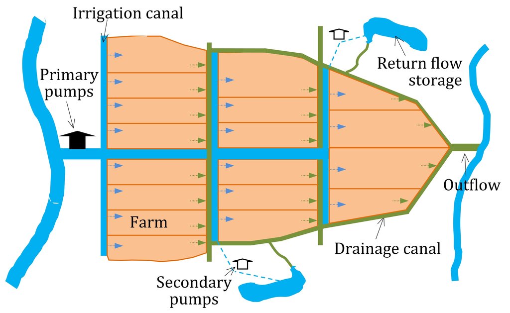
Return flow from paddy fields is defined as applied water that is not lost by evapotranspiration but returns to an aquifer or surface water body (Womach, 2005). The two types of return flow are surface and sub-surface. Surface return flow accounts for the major proportion. If surface return flow is strategically collected before entering rivers, it can be used as an ‘extra’ effective source of agricultural water supply (Phil King, 2008; Simons et al., 2015). Because paddies effectively purify water by absorbing nitrogen and phosphorus, this produces return flow of an acceptable quality for irrigation purposes. Return flow can be collected by drainage canals and stored in ponds and reservoirs, and then returned to pumps for reapplication. This technology offers one solution towards overcoming a deficit of irrigation water.
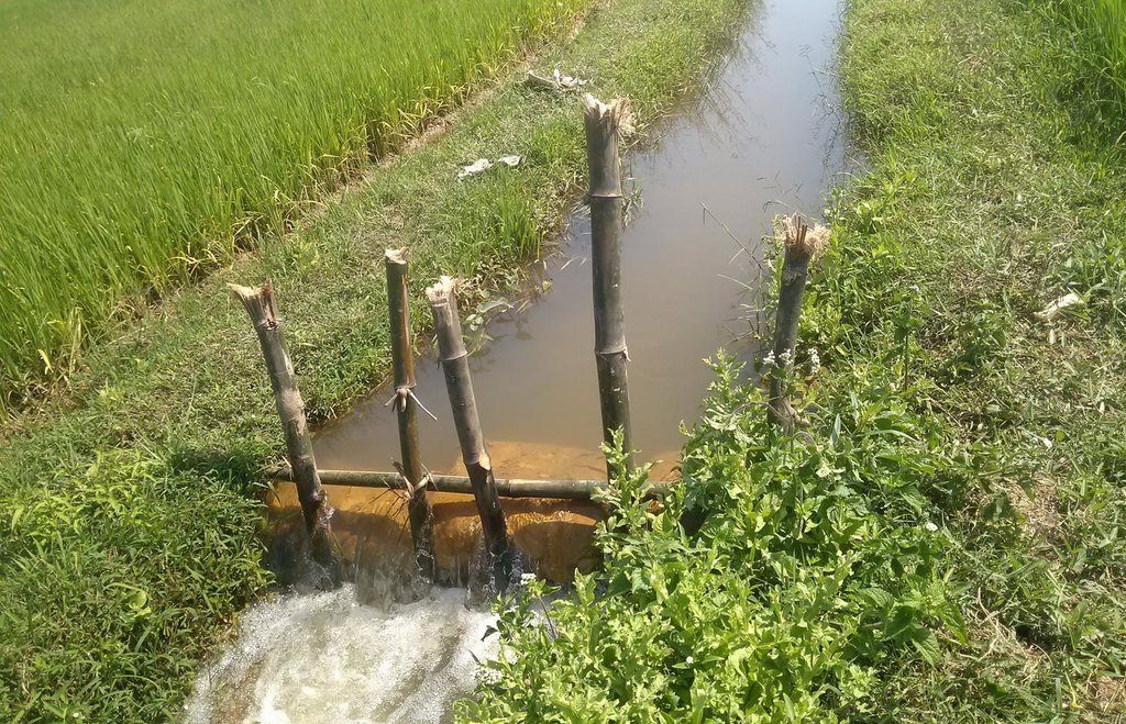
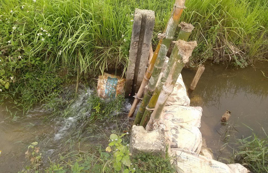
The goal of this technology is to store and reuse surface return flow from paddy farms to enhance irrigation efficiency. The purpose of constructing temporary barriers in drainage canals is to minimise water wastage and optimise the possibility of collecting and recycling surface return flow. Return flow from irrigation system is stored in surrounding ponds and reservoirs Return flow can only be used when it is captured in a storage structure or drain which has a hydraulic link to the irrigation source: thus an integrated framework for the reuse system consisting of both hydraulic, and management, links should be established. Within the scope of this study, the Water Management Unit (WMU) is understood as an integrated irrigation and drainage system consisting of four components: (i) the hydrological catchment which covers both non-irrigated and irrigated area; (ii) the source scheme generating return flow; (iii) the reuse scheme that is hydraulically connected with the source scheme; and (iv) a drainage system functioning as a harvesting as well as a supply structure.
Before implementing such a system it is recommended to analyse the correlation between irrigation efficiency and reuse of return flow, as well as developing a framework for managing and recycling return flow. Investigation aims at identifying the potential of return flow for irrigation; determining its quantity and quality; and developing an efficient and sustainable reuse framework. Water balance calculations, field measurements, water quality sampling and interviewing are all used for this purpose.
In the study area, long dry seasons cause severe water shortages and problems with saline intrusion. The study area is mainly covered by paddy, vegetables and other annual crops such as maize, sweet potatoes, peanuts and sugarcane. Paddy rice, which consumes a high proportion of the freshwater, is the dominant crop. Agricultural land in the downstream area is irrigated through gravity or pump irrigation systems. Here results indicate that the irrigation efficiency can be improved significantly: the irrigation efficiency of Tu Cau and Thanh Quyt irrigation schemes is projected to increase respectively by 1.8 and 1.4 times.
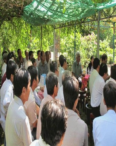
Reuse of return flow can be applied in all WMUs where the drainage canals are connected with storage tanks. Scientific and technical support tools are offered by the Vu Gia Thu Bon River Basin Information Centre. The centre was established in Danang providing a comprehensive information service to farmers and other water users – it includes capacity building and consulting services also.
2.3 Photos of the Technology
General remarks regarding photos:
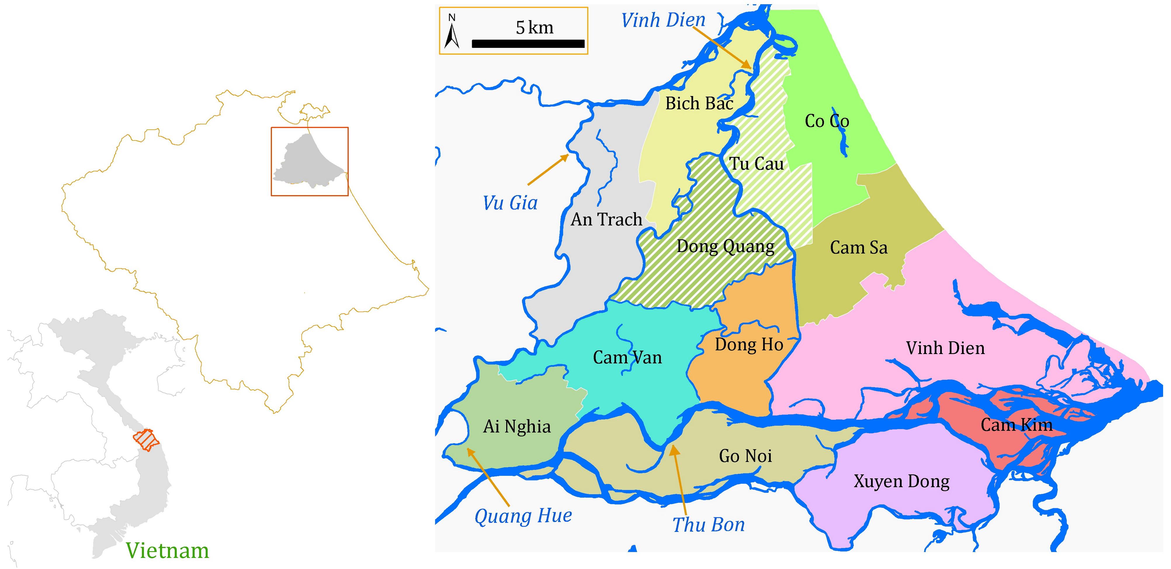
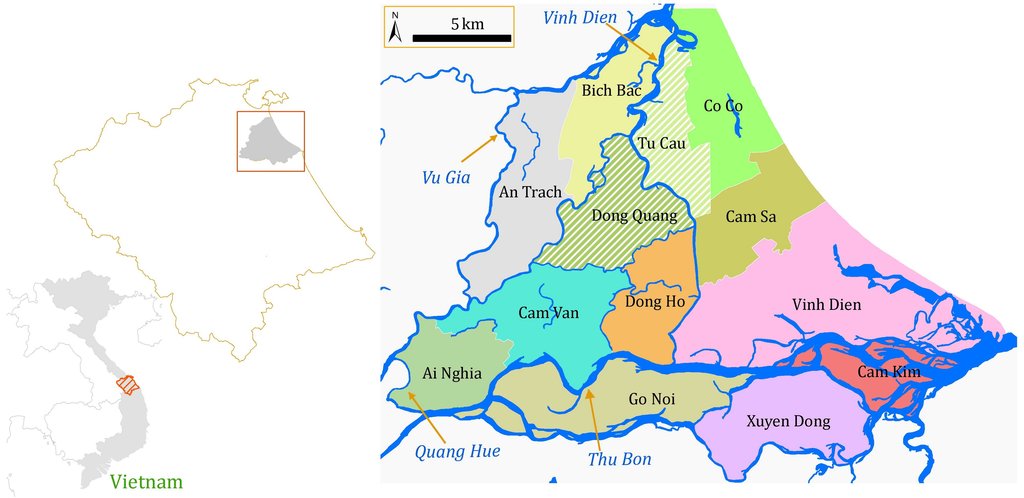
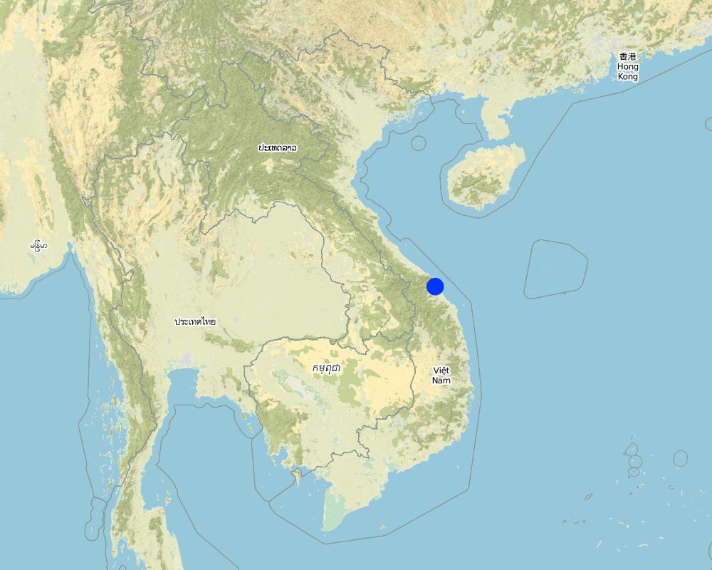
Total area covered by the SLM Technology is 0.916 km2. The research area is located in the downstream of the Vu Gia Thu Bon Basin (VGTB), Central Coast of Vietnam. Based on the hydraulic connectivity, the lowland of the VGTB is divided into 13 Water Management Units (WMU) (Viet, 2014). Of which, the Dong Quang and Tu Cau WMUs are selected to conduct the field survey and water quality sampling.
2.5 Country/ region/ locations where the Technology has been applied and which are covered by this assessment
Country:
Viet Nam
Region/ State/ Province:
Quang Nam
Further specification of location:
Dien Ban
Map
×2.6 Date of implementation
If precise year is not known, indicate approximate date:
- less than 10 years ago (recently)
2.7 Introduction of the Technology
Specify how the Technology was introduced:
- through land users' innovation
- during experiments/ research
3. Classification of the SLM Technology
3.1 Main purpose(s) of the Technology
- improve production
- conserve ecosystem
3.2 Current land use type(s) where the Technology is applied

Cropland
- Annual cropping
- Perennial (non-woody) cropping
- Tree and shrub cropping
Annual cropping - Specify crops:
- cereals - maize
- cereals - rice (wetland)
- root/tuber crops - sweet potatoes, yams, taro/cocoyam, other
- vegetables
Perennial (non-woody) cropping - Specify crops:
- sugar cane
Tree and shrub cropping - Specify crops:
- tree nuts (brazil nuts, pistachio, walnuts, almonds, etc.)
Number of growing seasons per year:
- 2
Specify:
Longest growing period in days: 130, Longest growing period from month to month: 20th December to 28th April; Second longest growing period in days: 110, Second longest growing period from month to month: 20th May to 06th September
Comments:
Major land use problems (compiler’s opinion): The lowland part of Vu Gia Thu Bon is an intensive agricultural area. Rice cultivation, which consumes a high proportion of fresh water, accounts for 70% of total agricultural land (Ribbe et al., 2011). Since 2005, due to the impacts of droughts and saltwater intrusion, water for irrigation during the dry seasons has become an increasing problem in the lowland area of this basin. Simultaneously, the irrigation efficiency of this region is relative low. Various measures are applied to address water scarcity for irrigation. Reusing return flow is regarded as a potentially new measure to reduce the severity of the irrigation deficit in dry periods.
Major land use problems (land users’ perception): Based on the information provided by the Department of Natural Resources and Environment (DONRE) for Quang Nam Province, this basin now faces the problem of temporarily insufficient irrigation water. This situation is caused by droughts, insufficient reservoir capacity, salinity intrusion and ineffective irrigation management.
3.4 Water supply
Water supply for the land on which the Technology is applied:
- full irrigation
3.5 SLM group to which the Technology belongs
- water harvesting
- surface water management (spring, river, lakes, sea)
3.6 SLM measures comprising the Technology

structural measures
- S5: Dams, pans, ponds
- S6: Walls, barriers, palisades, fences

management measures
- M2: Change of management/ intensity level
- M6: Waste management (recycling, re-use or reduce)
3.7 Main types of land degradation addressed by the Technology

water degradation
- Hs: change in quantity of surface water
Comments:
Main causes of degradation: crop management (annual, perennial, tree/shrub) (Paddy rice requires huge amounts of water. Meanwhile, the coefficient of irrigation return flow from paddy field is also quite high.), industrial activities and mining (Hydropower construction reduces water availability for irrigation), over abstraction / excessive withdrawal of water (for irrigation, industry, etc.) (It causes water waste and reduces irrigation efficiency.), change of seasonal rainfall (It affects the paddy water balance and actual irrigation need.), droughts (It causes saltwater intrusion.)
Secondary causes of degradation: change in temperature (It relates to evapotranspiration.), inputs and infrastructure: (roads, markets, distribution of water points, other, …), governance / institutional
3.8 Prevention, reduction, or restoration of land degradation
Specify the goal of the Technology with regard to land degradation:
- reduce land degradation
4. Technical specifications, implementation activities, inputs, and costs
4.1 Technical drawing of the Technology
Technical specifications (related to technical drawing):
Methods of recycling return flow from paddy fields: The surface return flow can be captured by drainage canals and stored in tanks: return water from these reservoirs is pumped back into irrigation canals.
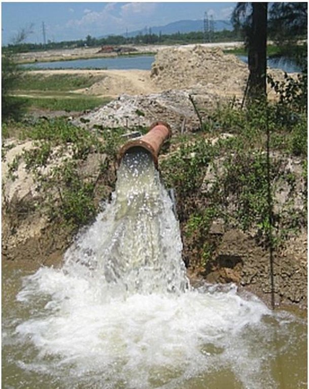
In 2012, the first on-farm irrigation structure was initially implemented in the Tu Cau WMU in order to use return flow for irrigation purposes. The existing Sen Pond was enlarged and a temporary pumping station was installed to pump water into the irrigation canal system.
According to the pumping diary of Tu Cau station (in Winter-Spring crop 2013), there were totally 7 irrigation periods (8-11 days/period). Total input water (including effective rainfall) during the measuring period from 01 March to 10 April was about 28,000 m3. Meanwhile the total volume of return flow of the Tu Cau site was 16,176 m3. This amount of return flow has the potential to irrigate the agricultural area for about 16 days, equivalent to one and a half irrigation periods. The overall efficiency of the irrigation system will be significantly improved.
Location: Lowland area of VGTB Basin. Quang Nam Province
Date: January 2014
Technical knowledge required for field staff / advisors: high
Technical knowledge required for land users: low
Main technical functions: water harvesting / increase water supply
Dam/ pan/ pond
Depth of ditches/pits/dams (m): 2
Width of ditches/pits/dams (m): 194.9
Length of ditches/pits/dams (m): 399.4
Wall/ barrier
Height of bunds/banks/others (m): 0.5
Width of bunds/banks/others (m): 0.25
Length of bunds/banks/others (m): 1.26
Construction material (other): Stone, sandy bags and bamboo sticks
Specification of dams/ pans/ ponds: Capacity 116764.59m3
Catchment area: 77860 m²m2
Beneficial area: 30 ham2
Other type of management: Return flow is the part of drainage flow, it is necessary to enhance the institutional link to develop the reuse framework for the study area. Think about reforming IMC to IDMC with D is drainage.
Author:
Trinh Quoc Viet
4.2 General information regarding the calculation of inputs and costs
other/ national currency (specify):
VND
If relevant, indicate exchange rate from USD to local currency (e.g. 1 USD = 79.9 Brazilian Real): 1 USD =:
20828.0
4.3 Establishment activities
| Activity | Timing (season) | |
|---|---|---|
| 1. | Building temporary barrier in drainage canal | |
| 2. | Dredging and expanding Sen Pond | 12 months |
| 3. | Installing and operating the temporary pump at Sen Pond, P is 15KW (Q=520-600m3/h) |
4.4 Costs and inputs needed for establishment
| Specify input | Unit | Quantity | Costs per Unit | Total costs per input | % of costs borne by land users | |
|---|---|---|---|---|---|---|
| Labour | labour | 1.0 | 3046.52 | 3046.52 | ||
| Equipment | machine use | 1.0 | 5344.09 | 5344.09 | ||
| Equipment | hammer, iron wire | 1.0 | 2.4 | 2.4 | 100.0 | |
| Construction material | Stone,sandy bags,bamboo sticks | 1.0 | 6.45 | 6.45 | 100.0 | |
| Construction material | Earth, concrete | 1.0 | 1335.8 | 1335.8 | ||
| Total costs for establishment of the Technology | 9735.26 | |||||
| Total costs for establishment of the Technology in USD | 0.47 | |||||
Comments:
Duration of establishment phase: 12 month(s)
4.5 Maintenance/ recurrent activities
| Activity | Timing/ frequency | |
|---|---|---|
| 1. | Temporary barrier | each cropping season |
| 2. | Temporary pump | annually |
4.6 Costs and inputs needed for maintenance/ recurrent activities (per year)
| Specify input | Unit | Quantity | Costs per Unit | Total costs per input | % of costs borne by land users | |
|---|---|---|---|---|---|---|
| Labour | labour | 1.0 | 24.0 | 24.0 | 30.0 | |
| Equipment | machine use | 1.0 | 38.41 | 38.41 | ||
| Construction material | Stone,sandy bags,bamboo sticks | 1.0 | 3.22 | 3.22 | 100.0 | |
| Total costs for maintenance of the Technology | 65.63 | |||||
4.7 Most important factors affecting the costs
Describe the most determinate factors affecting the costs:
Prices of the material and equipment; the approval procedure and disbursement process of the project of “Dredging and expanding Sen Pond”; the compensation cost for the farmers; the cost of operating and maintaining temporary pump; the cost of reinforcing the drainage canals.
5. Natural and human environment
5.1 Climate
Annual rainfall
- < 250 mm
- 251-500 mm
- 501-750 mm
- 751-1,000 mm
- 1,001-1,500 mm
- 1,501-2,000 mm
- 2,001-3,000 mm
- 3,001-4,000 mm
- > 4,000 mm
Specifications/ comments on rainfall:
Average annual rainfall in period 1978-2010 of research area is 2105mm. February to April is driest period as rainfall in this period accounts only 3-5% of annual rainfall.
Agro-climatic zone
- sub-humid
Thermal climate class: tropics. humid tropical monsoon climate
5.2 Topography
Slopes on average:
- flat (0-2%)
- gentle (3-5%)
- moderate (6-10%)
- rolling (11-15%)
- hilly (16-30%)
- steep (31-60%)
- very steep (>60%)
Landforms:
- plateau/plains
- ridges
- mountain slopes
- hill slopes
- footslopes
- valley floors
Altitudinal zone:
- 0-100 m a.s.l.
- 101-500 m a.s.l.
- 501-1,000 m a.s.l.
- 1,001-1,500 m a.s.l.
- 1,501-2,000 m a.s.l.
- 2,001-2,500 m a.s.l.
- 2,501-3,000 m a.s.l.
- 3,001-4,000 m a.s.l.
- > 4,000 m a.s.l.
5.3 Soils
Soil depth on average:
- very shallow (0-20 cm)
- shallow (21-50 cm)
- moderately deep (51-80 cm)
- deep (81-120 cm)
- very deep (> 120 cm)
Soil texture (topsoil):
- coarse/ light (sandy)
- medium (loamy, silty)
Topsoil organic matter:
- medium (1-3%)
5.4 Water availability and quality
Ground water table:
< 5 m
Availability of surface water:
medium
Water quality (untreated):
for agricultural use only (irrigation)
5.5 Biodiversity
Species diversity:
- low
5.6 Characteristics of land users applying the Technology
Market orientation of production system:
- subsistence (self-supply)
- mixed (subsistence/ commercial)
Off-farm income:
- > 50% of all income
Relative level of wealth:
- poor
- average
Individuals or groups:
- individual/ household
Level of mechanization:
- manual work
- mechanized/ motorized
Gender:
- women
- men
Indicate other relevant characteristics of the land users:
Land users applying the Technology are mainly common / average land users
Population density: > 500 persons/km2
Annual population growth: 1% - 2%
1% of the land users are very rich and own 3% of the land.
2% of the land users are rich and own 7% of the land.
70% of the land users are average wealthy and own 60% of the land.
25% of the land users are poor and own 20% of the land.
2% of the land users are poor and own 10% of the land.
Off-farm income specification: There is a large industrial park located near the study site and a large part of the working population in the region is earning income by working in the factories.
5.7 Average area of land used by land users applying the Technology
- < 0.5 ha
- 0.5-1 ha
- 1-2 ha
- 2-5 ha
- 5-15 ha
- 15-50 ha
- 50-100 ha
- 100-500 ha
- 500-1,000 ha
- 1,000-10,000 ha
- > 10,000 ha
Is this considered small-, medium- or large-scale (referring to local context)?
- small-scale
5.8 Land ownership, land use rights, and water use rights
Land ownership:
- state
- farmer, individual
Water use rights:
- open access (unorganized)
- farmer, individual
5.9 Access to services and infrastructure
health:
- poor
- moderate
- good
education:
- poor
- moderate
- good
technical assistance:
- poor
- moderate
- good
employment (e.g. off-farm):
- poor
- moderate
- good
markets:
- poor
- moderate
- good
energy:
- poor
- moderate
- good
roads and transport:
- poor
- moderate
- good
drinking water and sanitation:
- poor
- moderate
- good
financial services:
- poor
- moderate
- good
6. Impacts and concluding statements
6.1 On-site impacts the Technology has shown
Socio-economic impacts
Production
crop production
Comments/ specify:
A small farming area within an irrigation scheme will be used to store drained water.
Water availability and quality
irrigation water availability
Comments/ specify:
The technology helps to minimise negative impacts of saltwater intrusion on irrigation
demand for irrigation water
Comments/ specify:
The technology helps to reduce water abstracted from river in dry periods when saltwater intrusion occurring
Other socio-economic impacts
Increased irrigation efficiency
Quantity before SLM:
37%
Quantity after SLM:
68%
Comments/ specify:
The irrigation efficiency is improved significantly (increasing about 1.8 times) in the case of recycling return flow
Socio-cultural impacts
conflict mitigation
contribution to human well-being
Comments/ specify:
This technology helps to minimise the damage to agricultural production caused by excess salt during the dry periods. It brings the benefits for the farmers by increasing the crop yields and helps to improve their livelihoods.
Ecological impacts
Water cycle/ runoff
water quantity
Comments/ specify:
Less freshwater is used for irrigation purposes
surface runoff
groundwater table/ aquifer
Soil
soil moisture
salinity
Comments/ specify:
50/270 ha of the Tu Cau Irrigation scheme is additionally supplied water in the dry periods as rivers are affected by saltwater intrusion
Other ecological impacts
Loss of land for enlarging the Send Pond
contamination of reused water by agro-chemicals
6.3 Exposure and sensitivity of the Technology to gradual climate change and climate-related extremes/ disasters (as perceived by land users)
Gradual climate change
Gradual climate change
| Season | increase or decrease | How does the Technology cope with it? | |
|---|---|---|---|
| annual temperature | increase | not well |
Climate-related extremes (disasters)
Meteorological disasters
| How does the Technology cope with it? | |
|---|---|
| local rainstorm | well |
| local windstorm | not known |
Climatological disasters
| How does the Technology cope with it? | |
|---|---|
| drought | well |
Hydrological disasters
| How does the Technology cope with it? | |
|---|---|
| general (river) flood | not known |
Other climate-related consequences
Other climate-related consequences
| How does the Technology cope with it? | |
|---|---|
| reduced growing period | not well |
6.4 Cost-benefit analysis
How do the benefits compare with the establishment costs (from land users’ perspective)?
Short-term returns:
slightly negative
Long-term returns:
very positive
How do the benefits compare with the maintenance/ recurrent costs (from land users' perspective)?
Short-term returns:
very positive
Long-term returns:
very positive
6.5 Adoption of the Technology
Of all those who have adopted the Technology, how many did so spontaneously, i.e. without receiving any material incentives/ payments?
- 51-90%
Comments:
By applying the technology, the potential reuse area of return flow is estimated about 33% of the study area (30.4ha of agricultural area is potentially irrigated by return flow). However, estimating the number of land user families that have implemented the technology is not the initial aim of the study. Therefore, it requires further detailed investigation and social survey as well.
6.7 Strengths/ advantages/ opportunities of the Technology
| Strengths/ advantages/ opportunities in the land user’s view |
|---|
| Increases the water depth in paddy fields which helps to improve paddy productivity |
| Beneficial/ endangered species might obtain new habitats in the retention area |
| Strengths/ advantages/ opportunities in the compiler’s or other key resource person’s view |
|---|
| Using return flow is helpful to improve irrigation efficiency. The amount of extracting water for irrigation and the cost of operating an irrigation system can be reduced. |
| The measure contributes to mitigating negative impacts of drought and salt intrusion. During the dry season the river water becomes more and more saline due to salt water intrusion. Salinity also builds up from not leaching out salts in the subsoil |
| Take advantages of available drainage canals, ponds, reservoirs to reduce the investment costs |
| Acceptable water quality because of the purification function of paddies which removes nutrients from the water |
| Low costs of conveyance systems because of short distance. More flexibility of allocation because of stable return flow. Less conflict between sectors. |
6.8 Weaknesses/ disadvantages/ risks of the Technology and ways of overcoming them
| Weaknesses/ disadvantages/ risks in the compiler’s or other key resource person’s view | How can they be overcome? |
|---|---|
| Temporal and spatial variation causes difficulty in using return flow. The differences in soil type, terrain, storage capacity of the paddy fields and irrigation method (e.g. irrigation techniques, the amount of input water and pumping intervals) are major factors influencing the quantity of return flow | Constructing temporary barriers in the drainage canal helps to minimise the water wastage and optimise the possibility of collecting and recycling surface return flow. |
| Using return flow might spread diseases, and weed seeds from affected farms to safe farms | Encourage farmers to comply with the principles of prevention and control diseases in agricultural production. It is necessary to implement preliminary tests and analyses the quality of return water before recycling for irrigation purposes. |
7. References and links
7.1 Methods/ sources of information
- field visits, field surveys
- interviews with land users
When were the data compiled (in the field)?
03/08/2015
7.2 References to available publications
Title, author, year, ISBN:
Kim, H. K. et al. (2009) Estimation of irrigation return flow from paddy fields considering the soil moisture
Available from where? Costs?
Agricultural Water Management, 96(5), 875–882.
Title, author, year, ISBN:
Phil King (2008) Return Flow Efficiency
Available from where? Costs?
New Mexico Water Resources Research Institute
Title, author, year, ISBN:
Simons, G.W.H. et al. (2015) Water reuse in river basins with multiple users: A literature review
Available from where? Costs?
Journal of Hydrology. 558–571
Title, author, year, ISBN:
Ribbe et al. (2011) Annex 2 to Milestone Report 2011 - Description of the Study Region including an updated stakeholder analysis,
Available from where? Costs?
LUCCi project. ITT, Cologne University of Applied Sciences
Links and modules
Expand all Collapse allLinks

Vu Gia Thu Bon River Basin Information Centre [Viet Nam]
The VGTB River Basin Information Centre (RBIC) offers decision support tools for stakeholders and aims at providing comprehensive information and consulting services to the water and land users according to their demands.
- Compiler: Justyna Sycz
Modules
No modules


