Trees in the riparian area as a protective and aesthetic advantage at Naro Moru River [Kenya]
- Creation:
- Update:
- Compiler: Manuel Fischer
- Editor: –
- Reviewers: David Streiff, Alexandra Gavilano
technologies_1580 - Kenya
View sections
Expand all Collapse all1. General information
1.2 Contact details of resource persons and institutions involved in the assessment and documentation of the Technology
Key resource person(s)
SLM specialist:
land user:
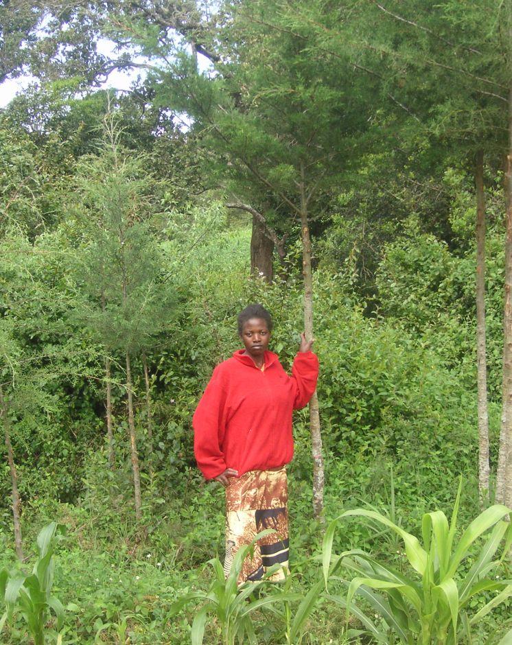
Wanjiru Cecilia
Kenya
1.3 Conditions regarding the use of data documented through WOCAT
The compiler and key resource person(s) accept the conditions regarding the use of data documented through WOCAT:
Yes
2. Description of the SLM Technology
2.1 Short description of the Technology
Definition of the Technology:
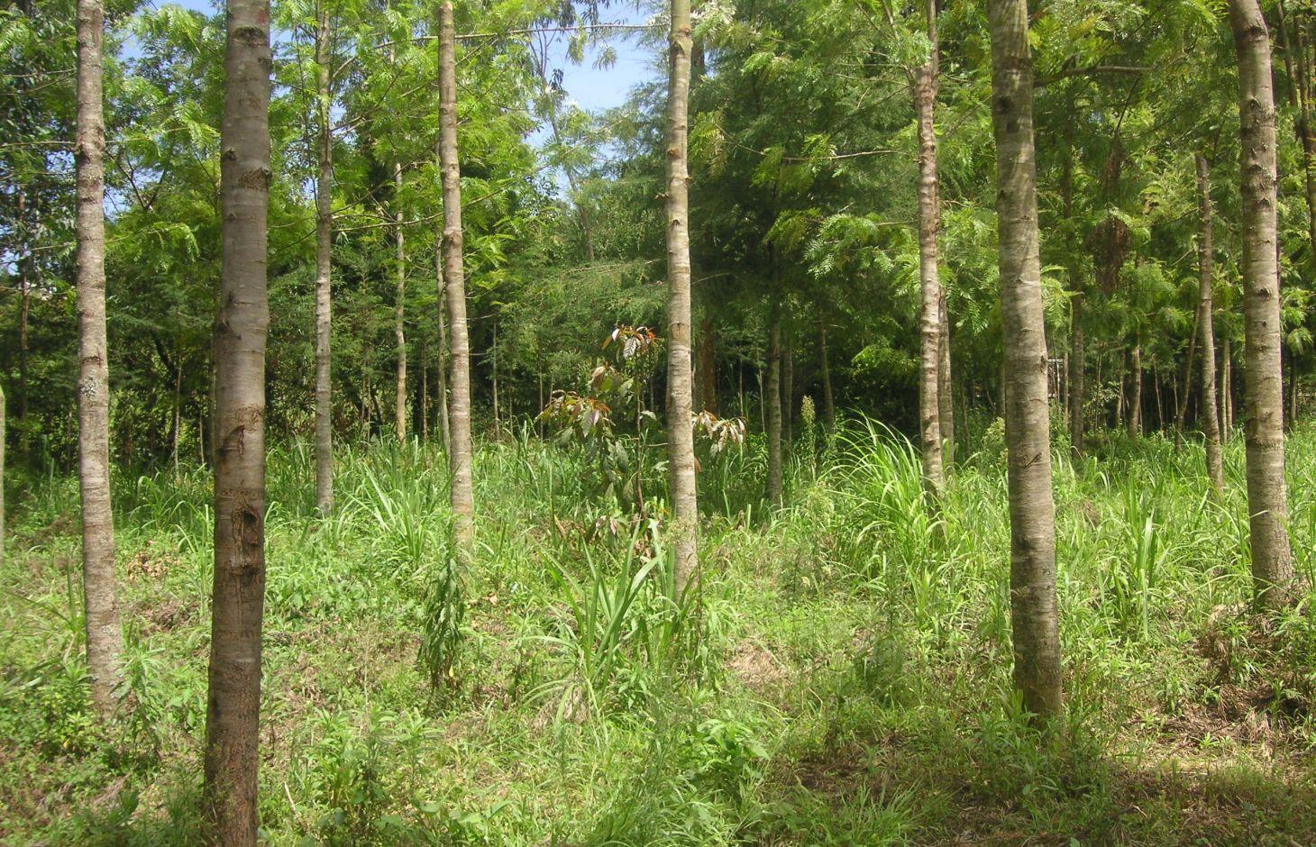
Trees are planted along the riparian zone to stabilize the riverbank and to prevent degradation. The wood can be used to establish a building or to generate income on the market.
2.2 Detailed description of the Technology
Description:
At the foot slopes of Mt. Kenya a farmer has developed a technology to protect the own land plot from riverbank erosion. The technology consists of three main measures: A wall along the riverbed, trees that are aligned on the wall as well as beside it and Napier grass wildly scattered between the trees. The wall was built on a highly exposed spot of the riverbank. Trees along and beside the wall ensure its stability. The combination of the two measures results in an effective protection of the riverbank in terms of erosion. Side effects of the technology are higher runoff during the dry season, better water quality due to less erosion and an improved riparian habitat for animals and plants.
Purpose of the Technology: For a small scale farmer, planting of trees can have advantages in an economic, an ecologic and an aesthetic point of view. The trees stabilize the soil, allow the riparian vegetation to establish, and prevent major damages through flooding. Furthermore, there are several advantages of an intact riparian zone, such as enhanced biodiversity, increased water quality as well as retention of agrochemicals. The trees also work as a kind of bank account, since the prices for wood are quite high. Trees can be cut and sold from time to time to generate an income that can be used for further investments like local entrepreneurship or building houses for family members. Last but not least, the farmer emphasized the beautiful appearance of the trees including the relatively cool micro- climate the trees are able to provide during the hot months of the dry period.
Establishment / maintenance activities and inputs: The trees were planted during the rainy season. Braches are pruned regularly and provide mulch material as well as fire wood. When trees are reaching maturity they will selectively be cut and replanted. The Napier grass is cut regularly for fodder to be feed to animals. At this particular time, there is a regular hay yield (weed). Seedlings for trees and the grasses are produced on site. Occasional pruning ensures fuel wood supply.
Natural / human environment: The plot is situated at the western side of Mt. Kenya in its foot zone, a moderate hilly region. Actually, the foot zone is a transition area between the humid mountain forest above elevations of 2500 m.a.s.l and the semi-arid savannah zone below 2000 m a.s.l. Although the region is located in the rain shadow of Mt. Kenya, there is just enough precipitation (740mm) to sustain rain fed agriculture and the farmers even benefit from a water project. During the last decades, the region has experienced a still continuing population growth which increases population pressure in the area. The good accessibility and the moderate tourism allow even off-farm income-generation.
2.3 Photos of the Technology
Media Gallery
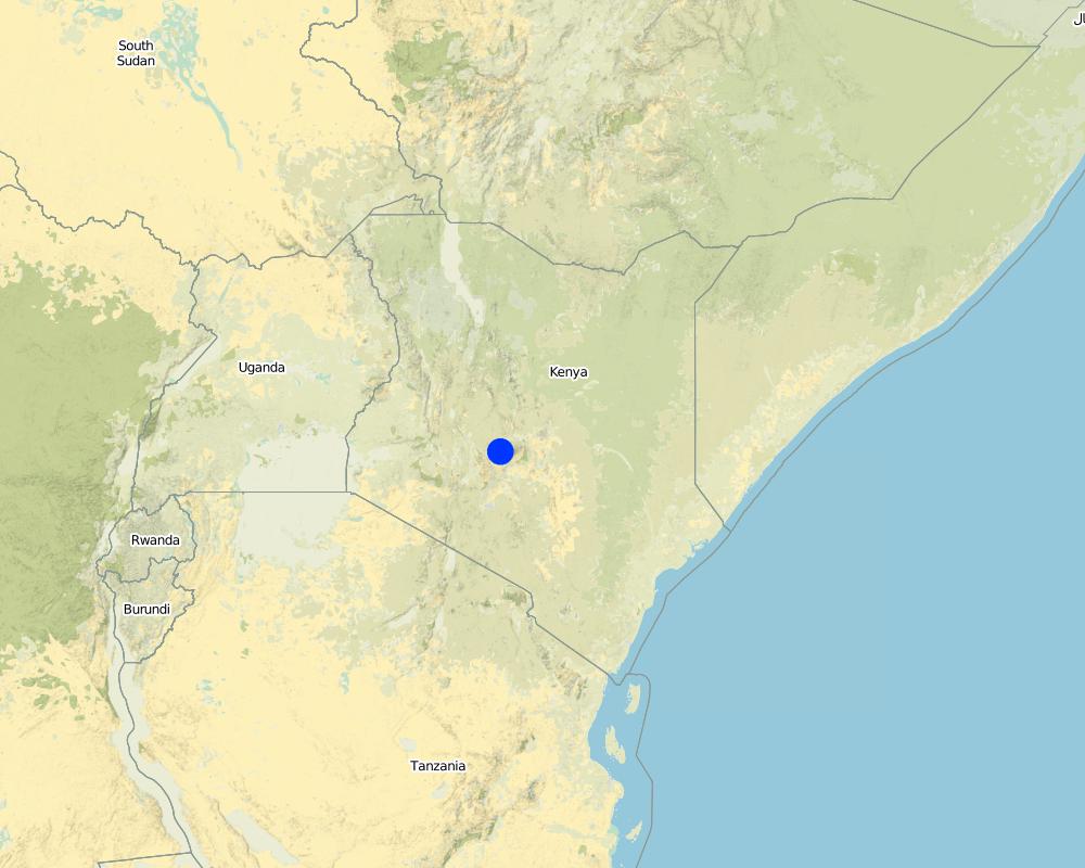
2.5 Country/ region/ locations where the Technology has been applied and which are covered by this assessment
Country:
Kenya
Region/ State/ Province:
Kenya/Central Province
Further specification of location:
Naro Moru
Specify the spread of the Technology:
- evenly spread over an area
If precise area is not known, indicate approximate area covered:
- < 0.1 km2 (10 ha)
Map
×2.6 Date of implementation
If precise year is not known, indicate approximate date:
- less than 10 years ago (recently)
2.7 Introduction of the Technology
Specify how the Technology was introduced:
- through land users' innovation
Comments (type of project, etc.):
The land user has enough space to afforest along the riparian. The main goals are to stabilise the riparian soil and to produce wood for use in the future.
3. Classification of the SLM Technology
3.1 Main purpose(s) of the Technology
- improve production
- reduce, prevent, restore land degradation
3.2 Current land use type(s) where the Technology is applied
Land use mixed within the same land unit:
Yes
Specify mixed land use (crops/ grazing/ trees):
- Agroforestry

Cropland
- Annual cropping
Annual cropping - Specify crops:
- fodder crops - grasses
Number of growing seasons per year:
- 2
Specify:
Longest growing period in days: 90 Longest growing period from month to month: april to may Second longest growing period in days: 90 Second longest growing period from month to month: october to november

Forest/ woodlands
- Tree plantation, afforestation
Type of tree:
- Cupressus species
- Grevillea robusta
Products and services:
- Timber
- Fuelwood
- Nature conservation/ protection
- Recreation/ tourism
Comments:
Trees/ shrubs species: Cypress, Grevillea, indigenous trees
Fruit trees / shrubs species: Napier grass
Major land use problems (compiler’s opinion): Surface water pollution and riverbank degradation as well as a diminished habitat of riparian flora and fauna.
Major land use problems (land users’ perception): An unstable riparian zone being eroded by the river and unattractive aesthetics.
Problems / comments regarding forest use: The purpose of the forest is mainly in a protective way. Later on, as soon as the trees are large enough, selective felling for construction is planned.
Forest products and services: timber, fuelwood, nature conservation / protection, recreation / tourism
Future (final) land use (after implementation of SLM Technology): Forests / woodlands: Fp: Plantations, afforestations
3.3 Has land use changed due to the implementation of the Technology?
Has land use changed due to the implementation of the Technology?
- Yes (Please fill out the questions below with regard to the land use before implementation of the Technology)
Cropland
- Annual cropping
3.5 SLM group to which the Technology belongs
- natural and semi-natural forest management
- improved ground/ vegetation cover
3.6 SLM measures comprising the Technology

vegetative measures
- V1: Tree and shrub cover

structural measures
- S6: Walls, barriers, palisades, fences
Comments:
Main measures: vegetative measures
Secondary measures: structural measures
Type of vegetative measures: aligned: -linear, scattered / dispersed
3.7 Main types of land degradation addressed by the Technology

soil erosion by water
- Wt: loss of topsoil/ surface erosion
- Wr: riverbank erosion

biological degradation
- Bc: reduction of vegetation cover
- Bs: quality and species composition/ diversity decline

water degradation
- Hp: decline of surface water quality
- Hw: reduction of the buffering capacity of wetland areas
Comments:
Main type of degradation addressed: Wr: riverbank erosion, Bs: quality and species composition /diversity decline, Hp: decline of surface water quality
Secondary types of degradation addressed: Wt: loss of topsoil / surface erosion, Bc: reduction of vegetation cover, Hw: reduction of the buffering capacity of wetland areas
Main causes of degradation: deforestation / removal of natural vegetation (incl. forest fires), over-exploitation of vegetation for domestic use, population pressure, education, access to knowledge and support services
Secondary causes of degradation: floods
3.8 Prevention, reduction, or restoration of land degradation
Specify the goal of the Technology with regard to land degradation:
- prevent land degradation
- reduce land degradation
Comments:
Secondary goals: mitigation / reduction of land degradation
4. Technical specifications, implementation activities, inputs, and costs
4.1 Technical drawing of the Technology
Technical specifications (related to technical drawing):
Indigenous trees, a wall and Napier grass are installed between the agricultural land and the river. The wall prevents erosion at a very endangered spot. The trees and the grass provide fodder and wood.
Location: Naro Moru. Nyeri / Central Province
Technical knowledge required for field staff / advisors: moderate
Technical knowledge required for land users: low
Main technical functions: increase of infiltration, improvement of water quality, buffering / filtering water, sediment retention / trapping, sediment harvesting, stabilization of riverbank by trees and grasses
Secondary technical functions: stabilisation of soil (eg by tree roots against land slides)
Aligned: -linear
Vegetative material: T : trees / shrubs
Number of plants per (ha): 200
Vertical interval between rows / strips / blocks (m): 0
Spacing between rows / strips / blocks (m): 1
Vertical interval within rows / strips / blocks (m): 1.5
Width within rows / strips / blocks (m): 2
Scattered / dispersed
Vegetative material: G : grass
Number of plants per (ha): 800
Trees/ shrubs species: Cypress, Grevillea, indigenous trees
Fruit trees / shrubs species: Napier grass
Wall/ barrier
Height of bunds/banks/others (m): 0.5m
Width of bunds/banks/others (m): 2m
Length of bunds/banks/others (m): 10m
Author:
Manuel Fischer
4.2 General information regarding the calculation of inputs and costs
Specify how costs and inputs were calculated:
- per Technology unit
Specify currency used for cost calculations:
- USD
Indicate average wage cost of hired labour per day:
2.70
4.3 Establishment activities
| Activity | Timing (season) | |
|---|---|---|
| 1. | Setting up a tree nursery | |
| 2. | Planting seedlings | during rainy season |
| 3. | Establishment of wall |
4.4 Costs and inputs needed for establishment
| Specify input | Unit | Quantity | Costs per Unit | Total costs per input | % of costs borne by land users | |
|---|---|---|---|---|---|---|
| Labour | Setting up a tree nursery | Persons/day | 5.0 | 3.3333 | 16.67 | 100.0 |
| Labour | Planting seedlings | Persons/day | 25.0 | 3.3333 | 83.33 | 100.0 |
| Labour | Establishment of wall | Persons/day | 5.0 | 3.3333 | 16.67 | 100.0 |
| Total costs for establishment of the Technology | 116.67 | |||||
| Total costs for establishment of the Technology in USD | 116.67 | |||||
4.5 Maintenance/ recurrent activities
| Activity | Timing/ frequency | |
|---|---|---|
| 1. | Replanting trees that dried up | |
| 2. | Cutting the Napier grass and pruning trees | during the rainy seasons = 4 months a year. 3 times a month |
4.6 Costs and inputs needed for maintenance/ recurrent activities (per year)
| Specify input | Unit | Quantity | Costs per Unit | Total costs per input | % of costs borne by land users | |
|---|---|---|---|---|---|---|
| Labour | Replanting trees | Persons/day | 3.0 | 3.3333 | 10.0 | 100.0 |
| Labour | Cutting the Napier grass and pruning trees | Persons/day | 12.0 | 3.33333 | 40.0 | 100.0 |
| Total costs for maintenance of the Technology | 50.0 | |||||
| Total costs for maintenance of the Technology in USD | 50.0 | |||||
Comments:
Establishment has been carried out over a time period of 5 years. Considering this time frame, the establishment costs are smaller than the maintenance costs.
The costs per hectare were calculated for a riparian area with the length of 100 m and a width of 10 m, since hectares are difficult to apply in a riparian context. The determining factor for the costs is labour. In this case, the labour costs are quite high because the seedlings were produced in the own nursery. This explains the high labour costs. Some of the seedlings had to be replanted, because they dried up. The required equipment like a spade is available on nearly every farm or can be borrowed from neighbours and is thus not added to the costs.
5. Natural and human environment
5.1 Climate
Annual rainfall
- < 250 mm
- 251-500 mm
- 501-750 mm
- 751-1,000 mm
- 1,001-1,500 mm
- 1,501-2,000 mm
- 2,001-3,000 mm
- 3,001-4,000 mm
- > 4,000 mm
Indicate the name of the reference meteorological station considered:
NS-Daten Eliza
Agro-climatic zone
- sub-humid
Thermal climate class: subtropics. source: http://en.climate-data.org/location/103473/
5.2 Topography
Slopes on average:
- flat (0-2%)
- gentle (3-5%)
- moderate (6-10%)
- rolling (11-15%)
- hilly (16-30%)
- steep (31-60%)
- very steep (>60%)
Landforms:
- plateau/plains
- ridges
- mountain slopes
- hill slopes
- footslopes
- valley floors
Altitudinal zone:
- 0-100 m a.s.l.
- 101-500 m a.s.l.
- 501-1,000 m a.s.l.
- 1,001-1,500 m a.s.l.
- 1,501-2,000 m a.s.l.
- 2,001-2,500 m a.s.l.
- 2,501-3,000 m a.s.l.
- 3,001-4,000 m a.s.l.
- > 4,000 m a.s.l.
Comments and further specifications on topography:
Altitudinal zone: 2020
Slopes on average: Land plot has a slope between 5% and 9%
5.3 Soils
Soil depth on average:
- very shallow (0-20 cm)
- shallow (21-50 cm)
- moderately deep (51-80 cm)
- deep (81-120 cm)
- very deep (> 120 cm)
Topsoil organic matter:
- medium (1-3%)
If available, attach full soil description or specify the available information, e.g. soil type, soil PH/ acidity, Cation Exchange Capacity, nitrogen, salinity etc.
Soil texture: mixture, because it is not red
Soil fertility is high
Soil drainage / infiltration is good
Soil water storage capacity very low - low
5.4 Water availability and quality
Ground water table:
< 5 m
Availability of surface water:
good
Water quality (untreated):
good drinking water
Comments and further specifications on water quality and quantity:
Ground water table: <5 mjust along the river, deeper ground water level 50-100m
Water quality (untreated): From a water project
5.5 Biodiversity
Species diversity:
- high
Comments and further specifications on biodiversity:
Species diversity: Also medium
5.6 Characteristics of land users applying the Technology
Market orientation of production system:
- subsistence (self-supply)
- mixed (subsistence/ commercial)
Off-farm income:
- less than 10% of all income
Relative level of wealth:
- average
Individuals or groups:
- individual/ household
Level of mechanization:
- manual work
Gender:
- women
- men
Indicate other relevant characteristics of the land users:
Land users applying the Technology are mainly common / average land users
Difference in the involvement of women and men: A clan uses the land commonly. Besides the base family (mother, father, son), the grandmother and an uncle use parts of the land. All of them apply the protective technologies in the riparian.
Population density: 200-500 persons/km2
5.7 Average area of land used by land users applying the Technology
- < 0.5 ha
- 0.5-1 ha
- 1-2 ha
- 2-5 ha
- 5-15 ha
- 15-50 ha
- 50-100 ha
- 100-500 ha
- 500-1,000 ha
- 1,000-10,000 ha
- > 10,000 ha
Is this considered small-, medium- or large-scale (referring to local context)?
- small-scale
Comments:
Average area of land owned or leased by land users applying the Technology: < 0.5 ha for Riparian forest.
5.8 Land ownership, land use rights, and water use rights
Land ownership:
- individual, not titled
Land use rights:
- individual
Water use rights:
- communal (organized)
Comments:
Mostly small scale farmers are using the land.
5.9 Access to services and infrastructure
health:
- poor
- moderate
- good
education:
- poor
- moderate
- good
technical assistance:
- poor
- moderate
- good
employment (e.g. off-farm):
- poor
- moderate
- good
markets:
- poor
- moderate
- good
roads and transport:
- poor
- moderate
- good
drinking water and sanitation:
- poor
- moderate
- good
financial services:
- poor
- moderate
- good
6. Impacts and concluding statements
6.1 On-site impacts the Technology has shown
Socio-economic impacts
Production
crop production
fodder production
Comments/ specify:
Napier grass yield has increased
wood production
Comments/ specify:
Before, there was only little wood production
Socio-cultural impacts
SLM/ land degradation knowledge
Aesthetics
Ecological impacts
Water cycle/ runoff
surface runoff
excess water drainage
Soil
soil cover
soil loss
Biodiversity: vegetation, animals
beneficial species
Climate and disaster risk reduction
flood impacts
Other ecological impacts
Riverbank erosion
6.2 Off-site impacts the Technology has shown
reliable and stable stream flows in dry season
downstream siltation
groundwater/ river pollution
damage on public/ private infrastructure
6.3 Exposure and sensitivity of the Technology to gradual climate change and climate-related extremes/ disasters (as perceived by land users)
Gradual climate change
Gradual climate change
| Season | increase or decrease | How does the Technology cope with it? | |
|---|---|---|---|
| annual temperature | increase | well |
Climate-related extremes (disasters)
Meteorological disasters
| How does the Technology cope with it? | |
|---|---|
| local rainstorm | well |
| local windstorm | well |
Climatological disasters
| How does the Technology cope with it? | |
|---|---|
| drought | well |
Hydrological disasters
| How does the Technology cope with it? | |
|---|---|
| general (river) flood | well |
Other climate-related consequences
Other climate-related consequences
| How does the Technology cope with it? | |
|---|---|
| reduced growing period | well |
6.4 Cost-benefit analysis
How do the benefits compare with the establishment costs (from land users’ perspective)?
Short-term returns:
very negative
Long-term returns:
very positive
How do the benefits compare with the maintenance/ recurrent costs (from land users' perspective)?
Short-term returns:
negative
Long-term returns:
very positive
6.5 Adoption of the Technology
- single cases/ experimental
If available, quantify (no. of households and/ or area covered):
1 household
Of all those who have adopted the Technology, how many did so spontaneously, i.e. without receiving any material incentives/ payments?
- 91-100%
Comments:
Comments on acceptance with external material support: The WRUA has been distributing seedlings among the riparian farmers. Quantification is not possible.
100% of land user families have adopted the Technology without any external material support
6.7 Strengths/ advantages/ opportunities of the Technology
| Strengths/ advantages/ opportunities in the land user’s view |
|---|
|
There is a recreational aspect of the riparian zone. Especially during hot days the farmer is enjoying the slightly colder temperatures because of the canopy and the cooling stream. The aesthetic aspects of the riparian are also enhanced. How can they be sustained / enhanced? If the canopy of the riparian is maintained, it can serve still as recreation area and convince with beautiful looks. |
|
Long term benefits in terms of wood and timber provided by the trees. How can they be sustained / enhanced? If trees are not chopped too early, they will have a good price on the market. |
|
The maintenance of the riparian is not tiring and still gives a good harvest. How can they be sustained / enhanced? Benefits can be sustained by continuing the management practices. |
|
Diversification: Formerly, there was maize at the river, but it died due to cold temperatures. Forests do not die due to frost. How can they be sustained / enhanced? Every plant has its special needs that should be kept in mind. |
| Strengths/ advantages/ opportunities in the compiler’s or other key resource person’s view |
|---|
|
Wood production through selective felling is sustainable. How can they be sustained / enhanced? No widespread felling of trees, only selective intervention. |
|
Fodder production enables the keeping of cattle. How can they be sustained / enhanced? Before dry periods, some fodder should be stored to ensure fodder supplies. |
6.8 Weaknesses/ disadvantages/ risks of the Technology and ways of overcoming them
| Weaknesses/ disadvantages/ risks in the land user’s view | How can they be overcome? |
|---|---|
| There is less crop yield, because an area of the plot was formerly used for maize production and now it is part of the riparian. | The productive and protective benefits of the riparian overcome decreased size of the agricultural plot. |
7. References and links
7.1 Methods/ sources of information
Links and modules
Expand all Collapse allLinks
No links
Modules
No modules