Fascine drainage [Honduras]
- Creation:
- Update:
- Compiler: Helen Gambon
- Editor: Anton Jöhr
- Reviewers: Johanna Jacobi, Alexandra Gavilano
technologies_744 - Honduras
View sections
Expand all Collapse all1. General information
1.2 Contact details of resource persons and institutions involved in the assessment and documentation of the Technology
Key resource person(s)
land user:
Argueta Jorge Alberto
Local Emergency Committe (in Spanish, Comité de Emergencia Local)
Honduras
SLM specialist:
Acosta Granados Nelin Lorena
Honduran Red Cross
Honduras
Montes Lobo Carlos Rolando
Honduran/ Swiss Red Cross, Coordinator of Project Resiliencia in Olancho
Honduras
Name of project which facilitated the documentation/ evaluation of the Technology (if relevant)
Book project: where people and their land are safer - A Compendium of Good Practices in Disaster Risk Reduction (DRR) (where people and their land are safer)Name of the institution(s) which facilitated the documentation/ evaluation of the Technology (if relevant)
Swiss Red Cross (Swiss Red Cross) - Switzerland1.3 Conditions regarding the use of data documented through WOCAT
The compiler and key resource person(s) accept the conditions regarding the use of data documented through WOCAT:
Yes
1.4 Declaration on sustainability of the described Technology
Is the Technology described here problematic with regard to land degradation, so that it cannot be declared a sustainable land management technology?
No
1.5 Reference to Questionnaire(s) on SLM Approaches (documented using WOCAT)
Participative Slope Stabilization [Honduras]
Bioengineering includes a series of techniques based on the use of live vegetation to protect slopes and embankments from erosion and landslides. Bioengineering works are applied according to comprehensive risk assessment; they are multipurpose as a whole, have a low cost of consdtruction and maintenance cost,they enhance the capacities of …
- Compiler: Helen Gambon
2. Description of the SLM Technology
2.1 Short description of the Technology
Definition of the Technology:
Fascine drains are used to drain excess water from elevated lands that might affect plots of land or houses below. They help prevent landslides and gully formation.
2.2 Detailed description of the Technology
Description:
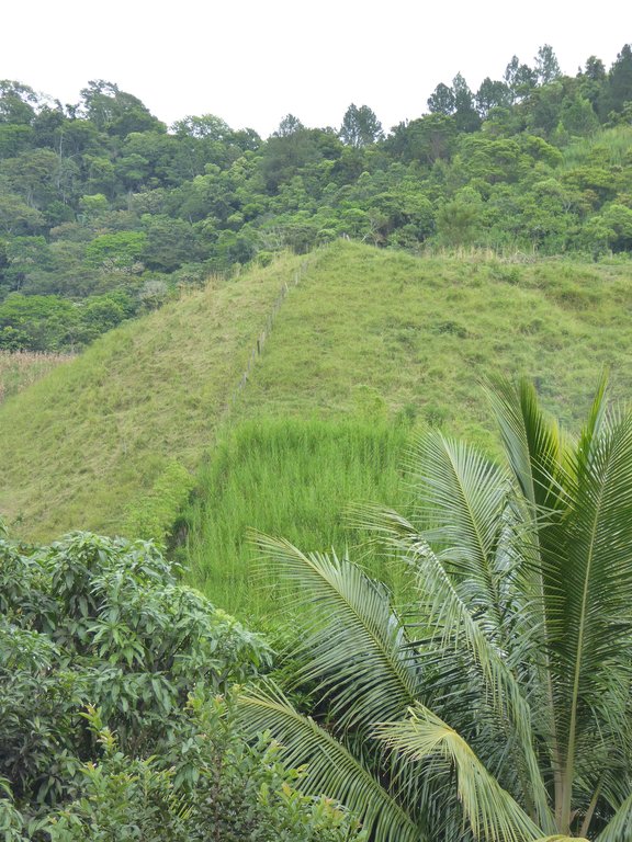
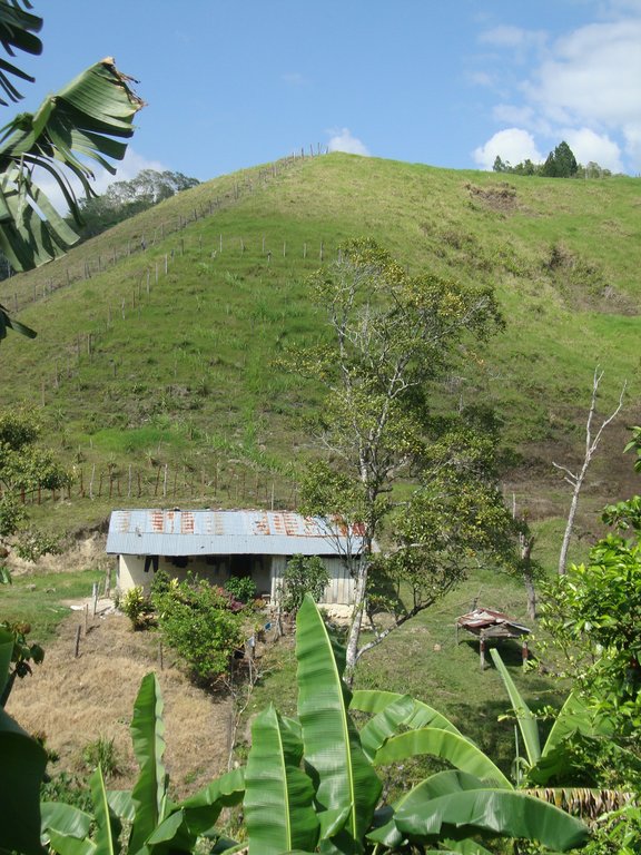
The Department of Olancho is a rainforest area located in the mountain range area of Cordillera Central and Sierra de Agalta, at an average altitude of 1,500 masl. Though most of the area of Olancho is protected as a natural reserve or natural park, there are high levels of deforestation resulting from livestock practices and intense industrial forest management practices. However, small farmers also cause deforestation. These practices result in rampant forest fires, soil degradation and erosion. The Department of Olancho is regularly affected by tropical storms and hurricanes coming in from the Atlantic. This combination of strong natural phenomena, topographic exposure and harmful use of natural resources causes significant material damage and even human deaths.
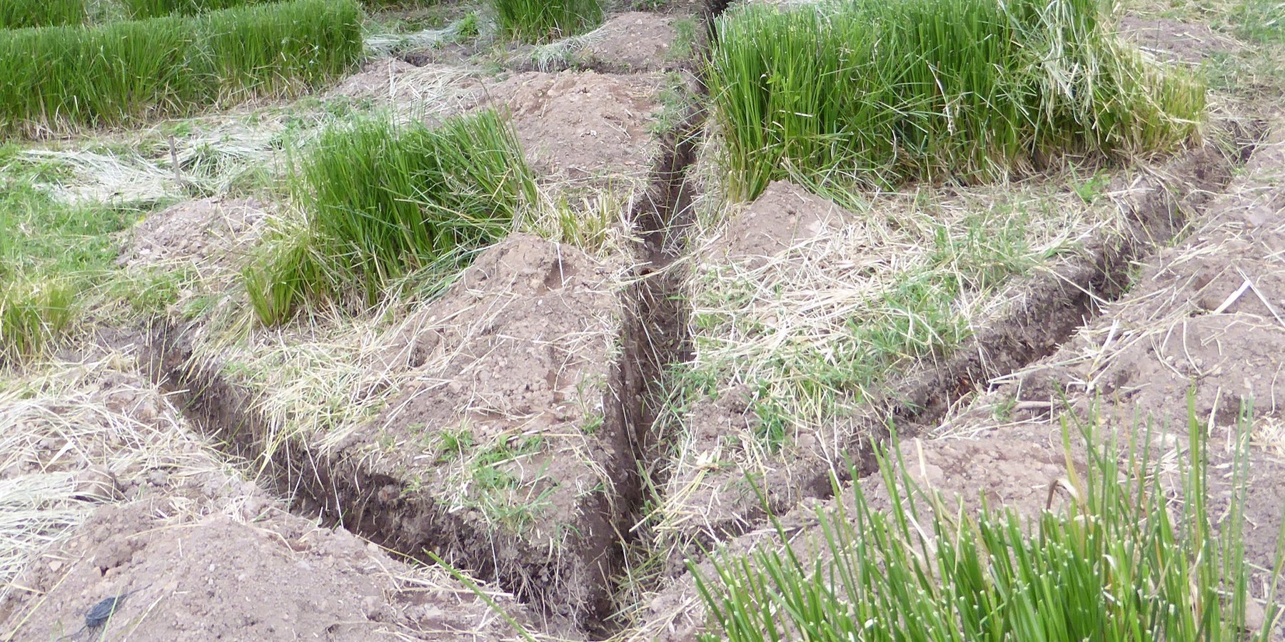
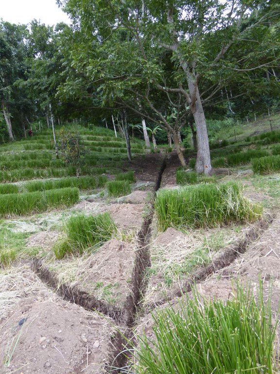
Fascine drains are used to drain excess water from the elevated land that affects lands or houses in lower areas. This Technology is used in sites where counterslopes are present. The technology helps prevent landslides and gullies.
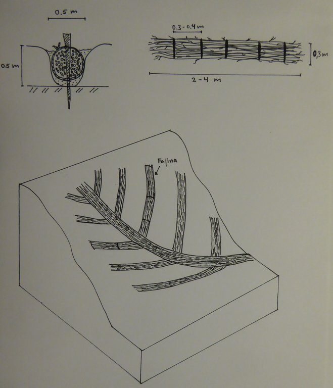
Fascine drains are implemented by digging fishbone shaped trenches with arms connecting to a main trench. The Technology is generally built from the bottom up and the side angles vary between 20º and 45º. The trenches are filled with live grasses, such Pennisetum sp, King Grass (Pennisetum sp) or sugar cane (Saccharum officinarum). These plants are moored with stakes that regenerate easily (such as (Madriado – Gliricidia sepium). Then, the land around the trenches is tightly packed. Since the livestock can damage the fascine bundles, the area must be fenced off. To avoid production losses, grass is sown (maralfalfa or King Grass) on top of the fascines. These grasses can be trimmed three times a year and used as fodder.
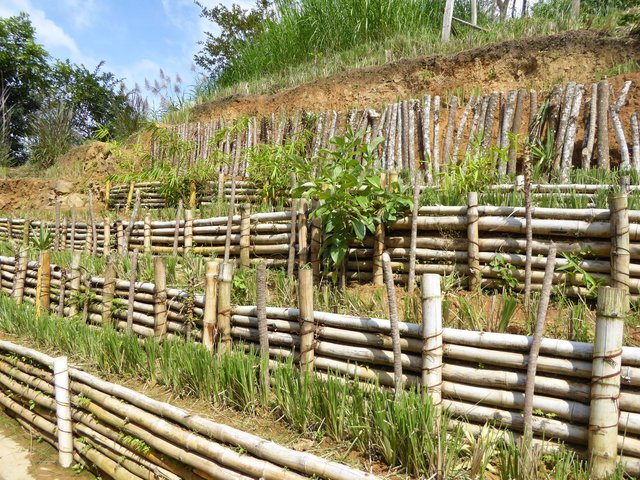
This technology may be combined with others, such as live hedges using Vetiver grass (Vetiveria zizanioides).
In this case study, the fascine drains were implemented by the Project “Resiliencia” undertaken by the Swiss/ Honduran Red Cross. This project aims at helping sustainable development to enhance the resilience of rural areas in Olancho by reducing disaster hazards together and promoting health at every level (home, community, municipality). Bioengineering works are implemented in areas which were identified as being vulnerable by updated risk assessments. The beneficiaries are highly vulnerable and exposed to disasters.
2.3 Photos of the Technology
2.5 Country/ region/ locations where the Technology has been applied and which are covered by this assessment
Country:
Honduras
Region/ State/ Province:
Departament of Olancho
Further specification of location:
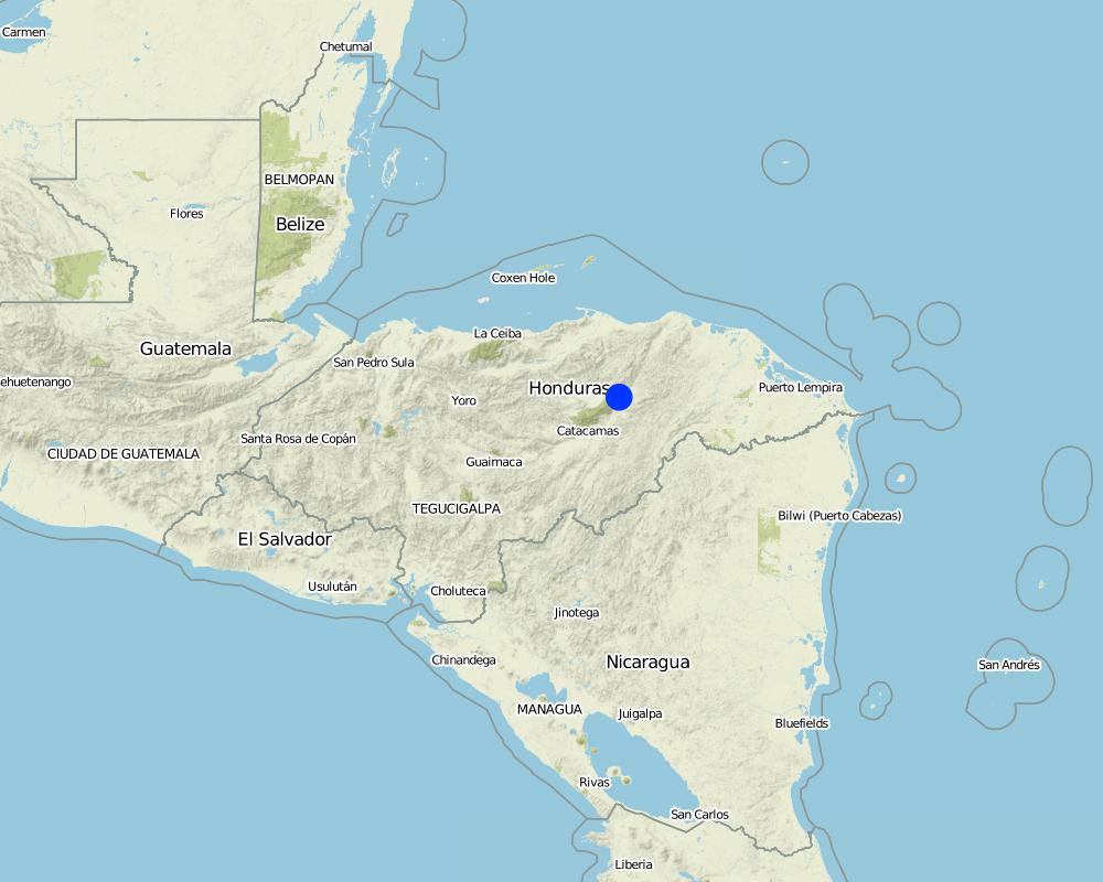
Dulce Nombre de Culmí municipality, Río Blanco community
Specify the spread of the Technology:
- evenly spread over an area
If precise area is not known, indicate approximate area covered:
- < 0.1 km2 (10 ha)
Map
×2.6 Date of implementation
Indicate year of implementation:
2007
2.7 Introduction of the Technology
Specify how the Technology was introduced:
- through projects/ external interventions
3. Classification of the SLM Technology
3.1 Main purpose(s) of the Technology
- reduce, prevent, restore land degradation
- protect a watershed/ downstream areas – in combination with other Technologies
- reduce risk of disasters
3.2 Current land use type(s) where the Technology is applied

Grazing land
Intensive grazing/ fodder production:
- Cut-and-carry/ zero grazing
- cattles
Comments:
The trenches are filled with live grasses, such Pennisetum sp, King Grass (Pennisetum sp) or sugar cane (Saccharum officinarum)
No animals should be allowed into areas where fascine drains are built to prevent them from damaging the Technology. The vegetation (grass) is cut and taken to feed the cattle.
However, the animals can freely roam the farm lands.
Number of growing seasons per year: 3
The grass is cut three times a year to provide additional fodder.
3.3 Has land use changed due to the implementation of the Technology?
Has land use changed due to the implementation of the Technology?
- Yes (Please fill out the questions below with regard to the land use before implementation of the Technology)

Grazing land
- Extensive grazing
Comments:
Before implementing the technology, the area was used as grazing grounds (extensive, hacienda type grazing).
3.4 Water supply
Water supply for the land on which the Technology is applied:
- rainfed
3.5 SLM group to which the Technology belongs
- water diversion and drainage
3.6 SLM measures comprising the Technology

vegetative measures
- V2: Grasses and perennial herbaceous plants

structural measures
- S3: Graded ditches, channels, waterways

management measures
- M2: Change of management/ intensity level
3.7 Main types of land degradation addressed by the Technology

soil erosion by water
- Wm: mass movements/ landslides
- Wo: offsite degradation effects
3.8 Prevention, reduction, or restoration of land degradation
Specify the goal of the Technology with regard to land degradation:
- prevent land degradation
4. Technical specifications, implementation activities, inputs, and costs
4.1 Technical drawing of the Technology
Technical specifications (related to technical drawing):
The system involves digging fishbone shaped trenches connected to a main trench. Central drains generally are 50 cm deep and lateral drains are 30 cm deep. These are generally built from the bottom up and the side angles vary between 20º and 45º. Side trenches are generally 1.0 to 2.5 meters apart, built in parallel lines, with lengths varying between 3 and 8 meters. Trenches are filled with plant stems with a high regeneration rate, such as Maralfalfa grass (Pennisetum sp), King Grass (Pennisetum sp) or sugar cane (Saccharum officinarum). These are then moored with 70 cm stakes made of trees that regenerate easily (eg. Madriado – Gliricidia Sepium) which are used toi anchorthe surrounding soil. The area must be fenced off to avoid livestock from damaging the stakes, since the latter sprout leaves.
In this case study, fascine drains were implemented by the "Resiliencia" project undertaken by the Honduran/Swiss Red Cross in order to provide sustainable support to enhance resiliency in rural areas of Olancho, by working on reducing disaster hazards and promoting health at all levels (home, community, municipality). Bioengineering works are implemented in critical sites based on risk analyses. beneficiaries are highly vulnerable and exposed to disasters.
Once fionished, the fascine drains and the live vetiver hedges will protect a school house from landslides.
Author:
Helen Gambon, Swiss Red Cross
Date:
01/12/2016
4.2 General information regarding the calculation of inputs and costs
Specify how costs and inputs were calculated:
- per Technology unit
Specify unit:
one fascine drainage system
Specify dimensions of unit (if relevant):
40m x 40m
other/ national currency (specify):
Lempiras
If relevant, indicate exchange rate from USD to local currency (e.g. 1 USD = 79.9 Brazilian Real): 1 USD =:
21.0
Indicate average wage cost of hired labour per day:
150 Lempiras
4.3 Establishment activities
| Activity | Timing (season) | |
|---|---|---|
| 1. | Clear land | winter |
| 2. | Prepare stakes and transport them to site | winter |
| 3. | Place stakes and wire | winter |
| 4. | Prepare plant material (king grass or maralfalfa) and tie them in bunches | winter |
| 5. | Dig 50 cm deep trenches (center) and 30 cm (branches) | winter |
| 6. | Place bundles in trenches and moor with stakes | winter |
| 7. | Cover with soil | winter |
| 8. | Plant vegetation to cover | winter |
4.4 Costs and inputs needed for establishment
| Specify input | Unit | Quantity | Costs per Unit | Total costs per input | % of costs borne by land users | |
|---|---|---|---|---|---|---|
| Labour | Trained labor | person per day | 1.0 | 500.0 | 500.0 | |
| Labour | Untrained labor | person per day | 18.0 | 150.0 | 2700.0 | 30.0 |
| Equipment | shovel, pike, gloves, machete | pieces | 3.0 | 2.0 | 6.0 | 100.0 |
| Equipment | Cord | pound | 5.0 | 25.0 | 125.0 | 100.0 |
| Plant material | maralfalfa, king grass, sugar cane or bamboo | pounds | 200.0 | 2.0 | 400.0 | |
| Plant material | wood for stakes | piece | 60.0 | 3.0 | 180.0 | 100.0 |
| Construction material | posts | post | 100.0 | 25.0 | 2500.0 | 100.0 |
| Construction material | barbed wire | roll | 1.0 | 450.0 | 450.0 | |
| Other | Transportation for plants | trip | 1.0 | 500.0 | 500.0 | 100.0 |
| Total costs for establishment of the Technology | 7361.0 | |||||
| Total costs for establishment of the Technology in USD | 350.52 | |||||
If land user bore less than 100% of costs, indicate who covered the remaining costs:
Honduran/ Swiss Red Cross
4.5 Maintenance/ recurrent activities
| Activity | Timing/ frequency | |
|---|---|---|
| 1. | Cut grass with machete | every 4 months |
| 2. | Keep watch on the fence | Continuously |
4.6 Costs and inputs needed for maintenance/ recurrent activities (per year)
| Specify input | Unit | Quantity | Costs per Unit | Total costs per input | % of costs borne by land users | |
|---|---|---|---|---|---|---|
| Labour | Untrained labor | person-days | 6.0 | 150.0 | 900.0 | 100.0 |
| Total costs for maintenance of the Technology | 900.0 | |||||
| Total costs for maintenance of the Technology in USD | 42.86 | |||||
4.7 Most important factors affecting the costs
Describe the most determinate factors affecting the costs:
Purchase and transportation of plants not available on site
5. Natural and human environment
5.1 Climate
Annual rainfall
- < 250 mm
- 251-500 mm
- 501-750 mm
- 751-1,000 mm
- 1,001-1,500 mm
- 1,501-2,000 mm
- 2,001-3,000 mm
- 3,001-4,000 mm
- > 4,000 mm
Specify average annual rainfall (if known), in mm:
1400.00
Specifications/ comments on rainfall:
Dry season from January to June, Rainy Season between June and October, with a heatwave in August.
Agro-climatic zone
- sub-humid
5.2 Topography
Slopes on average:
- flat (0-2%)
- gentle (3-5%)
- moderate (6-10%)
- rolling (11-15%)
- hilly (16-30%)
- steep (31-60%)
- very steep (>60%)
Landforms:
- plateau/plains
- ridges
- mountain slopes
- hill slopes
- footslopes
- valley floors
Altitudinal zone:
- 0-100 m a.s.l.
- 101-500 m a.s.l.
- 501-1,000 m a.s.l.
- 1,001-1,500 m a.s.l.
- 1,501-2,000 m a.s.l.
- 2,001-2,500 m a.s.l.
- 2,501-3,000 m a.s.l.
- 3,001-4,000 m a.s.l.
- > 4,000 m a.s.l.
Indicate if the Technology is specifically applied in:
- concave situations
5.3 Soils
Soil depth on average:
- very shallow (0-20 cm)
- shallow (21-50 cm)
- moderately deep (51-80 cm)
- deep (81-120 cm)
- very deep (> 120 cm)
Soil texture (topsoil):
- fine/ heavy (clay)
Soil texture (> 20 cm below surface):
- fine/ heavy (clay)
Topsoil organic matter:
- high (>3%)
5.4 Water availability and quality
Ground water table:
< 5 m
Availability of surface water:
good
Water quality (untreated):
poor drinking water (treatment required)
Is water salinity a problem?
No
Is flooding of the area occurring?
No
5.5 Biodiversity
Species diversity:
- medium
Habitat diversity:
- medium
5.6 Characteristics of land users applying the Technology
Sedentary or nomadic:
- Sedentary
Market orientation of production system:
- mixed (subsistence/ commercial)
Off-farm income:
- 10-50% of all income
Relative level of wealth:
- average
Individuals or groups:
- individual/ household
Level of mechanization:
- manual work
Gender:
- men
Age of land users:
- middle-aged
Indicate other relevant characteristics of the land users:
Many men living in the areas where the Technology is applied have migrated to USA. Women do not work on their own land but rather look for jobs in other farms or coffee plantations in the region. Men who remain behind have a greater work load. Many families receive remittances.
5.7 Average area of land used by land users applying the Technology
- < 0.5 ha
- 0.5-1 ha
- 1-2 ha
- 2-5 ha
- 5-15 ha
- 15-50 ha
- 50-100 ha
- 100-500 ha
- 500-1,000 ha
- 1,000-10,000 ha
- > 10,000 ha
Is this considered small-, medium- or large-scale (referring to local context)?
- small-scale
- medium-scale
Comments:
Most land users are small scale farmers, though some have large lands. The latter also own livestock.
5.8 Land ownership, land use rights, and water use rights
Land ownership:
- individual, not titled
Land use rights:
- individual
Water use rights:
- communal (organized)
5.9 Access to services and infrastructure
health:
- poor
- moderate
- good
education:
- poor
- moderate
- good
technical assistance:
- poor
- moderate
- good
employment (e.g. off-farm):
- poor
- moderate
- good
markets:
- poor
- moderate
- good
energy:
- poor
- moderate
- good
roads and transport:
- poor
- moderate
- good
drinking water and sanitation:
- poor
- moderate
- good
financial services:
- poor
- moderate
- good
others (specify):
- poor
- moderate
- good
6. Impacts and concluding statements
6.1 On-site impacts the Technology has shown
Socio-economic impacts
Production
fodder production
Quantity before SLM:
Amount before SLM
Quantity after SLM:
Amount after SLM
Comments/ specify:
100% increase
animal production
Quantity before SLM:
Amount before SLM
Quantity after SLM:
Amount after SLM
Comments/ specify:
Land user did not need to reduce livestock to implement the technology nor increase its numbers
Income and costs
workload
Quantity before SLM:
Amount before SLM
Quantity after SLM:
Amount after SLM
Comments/ specify:
Maintenance
Socio-cultural impacts
SLM/ land degradation knowledge
Quantity before SLM:
Amount before SLM
Quantity after SLM:
Amount after SLM
Ecological impacts
Water cycle/ runoff
surface runoff
Quantity before SLM:
Amount before SLM
Quantity after SLM:
Amount after SLM
excess water drainage
Quantity before SLM:
Amount before SLM
Quantity after SLM:
Amount after SLM
Soil
soil loss
Quantity before SLM:
Amount before SLM
Quantity after SLM:
Amount after SLM
nutrient cycling/ recharge
Quantity before SLM:
Amount before SLM
Quantity after SLM:
Amount after SLM
Biodiversity: vegetation, animals
biomass/ above ground C
Quantity before SLM:
Amount before SLM
Quantity after SLM:
Amount after SLM
Climate and disaster risk reduction
landslides/ debris flows
Quantity before SLM:
Amount before SLM
Quantity after SLM:
Amount after SLM
impacts of cyclones, rain storms
Quantity before SLM:
Amount before SLM
Quantity after SLM:
Amount after SLM
6.2 Off-site impacts the Technology has shown
damage on neighbours' fields
Quantity before SLM:
0
Quantity after SLM:
2
Comments/ specify:
Before implementation, the speed of water flow damaged the land plots in the lower areas of the site of intervention. Once the fascine drains were set in place, water now filters into the ground at a higher rate, thus its flow speed has decreased and the water flowing towards the stream.
6.3 Exposure and sensitivity of the Technology to gradual climate change and climate-related extremes/ disasters (as perceived by land users)
Gradual climate change
Gradual climate change
| Season | increase or decrease | How does the Technology cope with it? | |
|---|---|---|---|
| annual temperature | increase | very well | |
| seasonal temperature | summer | increase | very well |
| seasonal rainfall | summer | decrease | moderately |
Climate-related extremes (disasters)
Meteorological disasters
| How does the Technology cope with it? | |
|---|---|
| tropical storm | well |
| extra-tropical cyclone | well |
Hydrological disasters
| How does the Technology cope with it? | |
|---|---|
| landslide | well |
6.4 Cost-benefit analysis
How do the benefits compare with the establishment costs (from land users’ perspective)?
Short-term returns:
very positive
Long-term returns:
very positive
How do the benefits compare with the maintenance/ recurrent costs (from land users' perspective)?
Short-term returns:
very positive
Long-term returns:
very positive
6.5 Adoption of the Technology
- single cases/ experimental
Of all those who have adopted the Technology, how many did so spontaneously, i.e. without receiving any material incentives/ payments?
- 0-10%
6.6 Adaptation
Has the Technology been modified recently to adapt to changing conditions?
No
6.7 Strengths/ advantages/ opportunities of the Technology
| Strengths/ advantages/ opportunities in the land user’s view |
|---|
| The Technology protects houses against running surface water and landslides |
| Food is produced for livestock |
| Strengths/ advantages/ opportunities in the compiler’s or other key resource person’s view |
|---|
| The Technology prevents soil loss and gully formation. |
6.8 Weaknesses/ disadvantages/ risks of the Technology and ways of overcoming them
| Weaknesses/ disadvantages/ risks in the land user’s view | How can they be overcome? |
|---|---|
| The livestock can destroy the fascine drains | Area must be fenced off and monitored |
| Weaknesses/ disadvantages/ risks in the compiler’s or other key resource person’s view | How can they be overcome? |
|---|---|
| Land users abandon the land due to migration. | Though migration is common, a part of the family usually stays behind and they can sustain the SLM Technology. |
7. References and links
7.1 Methods/ sources of information
- field visits, field surveys
1
- interviews with land users
1
- interviews with SLM specialists/ experts
2
When were the data compiled (in the field)?
23/11/2016
7.2 References to available publications
Title, author, year, ISBN:
Local responses to global challenges - community based disaster risk reduction. Experiences from Honduras. Case Study. Swiss Red Cross, May 2016
Available from where? Costs?
info@redcross.ch (gratis)
Links and modules
Expand all Collapse allLinks

Participative Slope Stabilization [Honduras]
Bioengineering includes a series of techniques based on the use of live vegetation to protect slopes and embankments from erosion and landslides. Bioengineering works are applied according to comprehensive risk assessment; they are multipurpose as a whole, have a low cost of consdtruction and maintenance cost,they enhance the capacities of …
- Compiler: Helen Gambon
Modules
No modules


