Trenches combined with living hedges or grass lines [رواندا]
- تاريخ الإنشاء:
- تحديث:
- جامع المعلومات: Desire Kagabo
- المحرر: –
- المُراجع: David Streiff
Imiringoti
technologies_1550 - رواندا
عرض الأقسام
توسيع الكل طي الكل1. معلومات عامة
1.2 تفاصيل الاتصال بالأشخاص الرئيسيين لمصدر المعلومات والمؤسسات المشاركة في تقييم وتوثيق التقنية
متخصص في الإدارة المستدامة للأراضي:
متخصص في الإدارة المستدامة للأراضي:
اسم المشروع الذي سهّل توثيق/تقييم التقنية (إذا كان ذلك على صلة)
The Transboundary Agro-ecosystem Management Project for the Kagera River Basin (GEF-FAO / Kagera TAMP )اسم المؤسسة (المؤسسات) التي سهلت توثيق/تقييم التقنية (إذا كان ذلك على صلة)
Food and Agriculture Organization of the United Nations (FAO) - إيطاليااسم المؤسسة (المؤسسات) التي سهلت توثيق/تقييم التقنية (إذا كان ذلك على صلة)
Rwanda Agriculture Board (Rwanda Agriculture Board) - رواندا1.3 الشروط المتعلقة باستخدام البيانات الموثقة من خلال WOCAT
يوافق جامع المعلومات والشخص (لاشخاص) الرئيسي لمصدر المعلومات على الشروط المتعلقة باستخدام البيانات الموثقة من خلال WOCAT:
نعم
2. وصف تقنيةالإدارة المستدامي للأراضي
2.1 وصف مختصر للتقنية
تعريف التقنية:
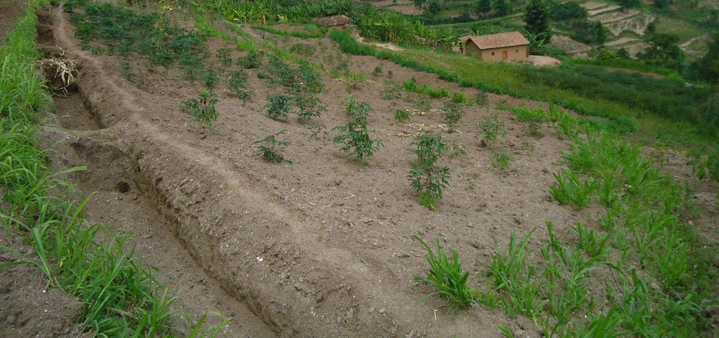
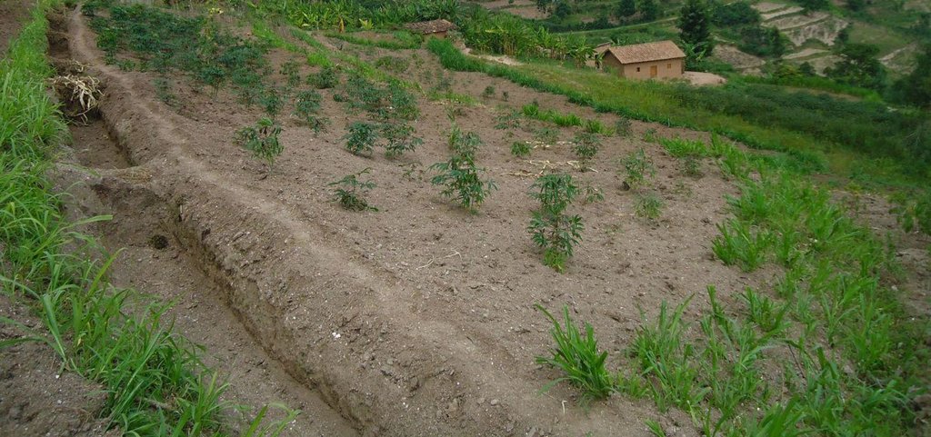
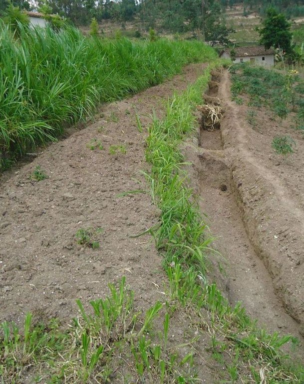
Trenches combined with living hedges or grass lines are slow-forming terraces to control soil erosion by changing the length of the slope and progressively reducing the slope gradient; he slope steepness decreases progressively by hydric and tillage erosion.
2.2 وصف تفصيلي للتقنية
الوصف:
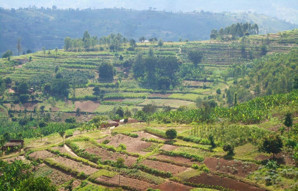
Trenches combined with living hedges or grassed lines are less labour-intensive method that is practiced in the highlands of Rwanda. The method involves digging trenches which have grass-stabilized banks, or simply planting grass strips and vegetative barriers across the slope to reduce runoff. This method, locally referred to as ‘progressive terracing’, is more adaptable by individual farmers across the country. In the study conducted by Kagabo et al. (2013) in the highlands of Buberuka Region of Rwanda, it was noted that net increment in yields and returns on investment increased with the age of terraces, since the capital costs of terracing were easily recovered. These terraces also showed more resilience, some being over 30 years old and still effective. Along the contour band, soil from the upper parts of the slope is removed and deposited above by creating a series of discontinuous trenches in order to extend the flat terrain. Over 5-10 years, the terraces become enlarged and form a terrace along the contour, such that the slopes are transformed over time into level bench terraces (but never %).
Purpose of the Technology: The main purpose of this technology is to reduce runoff and soil erosion on the slope and to improve soil quality and soil moisture retention. Grass strips or living hedgerows are intended to both trap sediments and facilitate the slow formation of terraces.
Establishment / maintenance activities and inputs: The establishment of trenches combined with living hedges or grassed lines is less labor intensive and requires less skilled labor. Regular maintenance banks on which living hedges are planted, to seasonally stream living hedges to minimize the competition of nutrients and water with plants. To efficiently use these terraces it is advisable to introduce intensive and rentable cropping systems or agroforestry with fruits and forage trees.
Natural / human environment: This technology was reported to be very resilient as trenches combined with living hedges or grassed lines of 20+ year old are still effective in controlling soil erosion. However, the soil quality on these formed terraces between alleys does not homogenize 100% over the course of time. Large soil fertility gradients with marked spatial difference in both soil quality and crop yield from their upper parts downwards of the terraces is observed. The soil in the lower parts of the terraces showed as much as 57% more organic carbon content and 31% more available phosphorous than the soil in the upper parts of the terraces (Kagabo et al. 2013).
2.3 صور التقنية
2.5 البلد/المنطقة/المواقع التي تم تنفيذ التقنية فيها والتي يغطيها هذا التقييم
البلد:
رواندا
المنطقة/الولاية/المحافظة:
Rwanda
مزيد من التفاصيل حول الموقع:
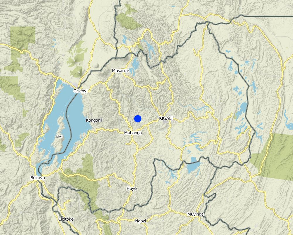
Kamonyi District (Southern Province)
Map
×2.6 تاريخ التنفيذ
في حالة عدم معرفة السنة بالتحديد، يرجى الإشارة إلى التاريخ التقريبي:
- منذ 10-50 سنة
2.7 إدخال التقنية
- Government
3. تصنيف تقنية الإدارة المستدامي للأراضي
3.1 الغرض الرئيسي ( الأغراض الرئيسية) للتقنية
- الحد من تدهور الأراضي ومنعه وعكسه
3.2 نوع (أنواع) استخدام الأراضي الحالية حيث يتم تطبيق التقنية

الأراضي الزراعية
- زراعة سنوية
- زراعة الأشجار والشجيرات
المحاصيل الرئيسية (المحاصيل النقدية والغذائية):
major cash crop: Coffee and cassava
major food crop: Banana and beans
other: Maize
التعليقات:
Major land use problems (compiler’s opinion): Soil erosion, water contamination due to sediment loads, decrease of soil fertility and soil depth, loss of vegetation cover
Major land use problems (land users’ perception): Soil erosion, contamination of water (the turbidity of water is high) therefore the domestic use of water is a problem.
Future (final) land use (after implementation of SLM Technology): Cropland: Ca: Annual cropping
إذا تغير استخدام الأراضي بسبب التقنية، قم بالإشارة إلى استخدام الأرض قبل تنفيذ التقنية:
Grazing land: Ge: Extensive grazing land
3.3 مزيد من المعلومات حول استخدام الأراضي
إمدادات المياه للأرض التي يتم تنفيذ التقنية عليها:
- بعلية
حدد:
Longest growing period in days: 150; Longest growing period from month to month: September – February; Second longest growing period in days: 120; Second longest growing period from month to month: March – July
كثافة الثروة الحيوانية (إذا كانت ذات صلة):
10-25 LU /km2
3.4 مجموعةالإدارة المستدامة للأراضي التي تنتمي إليها هذه التقنية
- تحسين الغطاء الأرضي/النباتي
- التدابير المتقاطعة للمنحدرات
3.5 انتشار التقنية
حدد انتشار التقنية:
- منتشرة بالتساوي على مساحة
إذا كانت التقنية منتشرة بالتساوي على منطقة ما، فحدد المنطقة التقريبية المغطاة:
- 100-10 كم2
التعليقات:
The area covered by this technology has been estimated
3.6 التدابير التقنية في مجال إلادارة المستدامة للأراضي

التدابير النباتية
- V1: غطاء من الأشجار والشجيرات
- V2: الأعشاب والنباتات العشبية المعمرة

التدابير البنيوية
- S3: الخنادق المتدرجة ،والقنوات، والممرات المائية
التعليقات:
Type of vegetative measures: aligned: -contour, aligned: -along boundary
3.7 الأنواع الرئيسية من تدهور الأراضي التي تناولتها التقنية

تآكل التربة بالمياه
- الوزن(Wt): فقدان التربة السطحية/تآكل السطح
- (Wg):الانجراف الخلجاني/ الخلجان
- (Wo:) تأثيرات التدهور من مواقع أخرى
التعليقات:
Secondary types of degradation addressed: Wg: gully erosion / gullying, Wo: offsite degradation effects
Main causes of degradation: deforestation / removal of natural vegetation (incl. forest fires) (Used as energy (fire wood)), other natural causes (avalanches, volcanic eruptions, mud flows, highly susceptible natural resources, extreme topography, etc.) specify (Steep slopes in many cases are over 60%), population pressure (High density (in rural area over 400 inhabitant per ha))
Secondary causes of degradation: soil management (Less use of organic manure), crop management (annual, perennial, tree/shrub) (No proper crop rotation and all crop residues are exported), over-exploitation of vegetation for domestic use (Fodder), poverty / wealth (Farmers have low income and have less access to off farm income or remittances), education, access to knowledge and support services (High rate of irriteracy)
3.8 منع أو حد أو عكس تدهور الأراضي
تحديد هدف التقنية فيما يتعلق بتدهور الأراضي:
- منع تدهور الأراضي
- الحد من تدهور الأراضي
التعليقات:
Secondary goals: prevention of land degradation
4. المواصفات الفنية، وأنشطة التنفيذ، والمدخلات، والتكاليف
4.1 الرسم الفني للتقنية
المؤلف:
Kagabo Desire and Guy Ngenzi, RAB, 5016 Kigali
4.2 المواصفات الفنية/شروحات الرسم الفني
Trenches are dug in trapezoidal shape with 40 cm of height, 30 cm of base length and 50 cm of top lengths. An empty space of 40 cm is left between two consecutive trenches along a contour line.
Location: Kamonyi/Giko. Southern province
Date: 2012
Technical knowledge required for field staff / advisors: high (Special training should be provided to field staff to be able to make an adequate design and teach land users)
Technical knowledge required for land users: low (Land users are required to only implement the technology under the supervision of field staff)
Technical knowledge required for Farmer representive: high (These farmers need to be trained so that the can easily supervise the work)
Main technical functions: control of concentrated runoff: retain / trap, reduction of slope length, improvement of topsoil structure (compaction), increase of infiltration, sediment retention / trapping, sediment harvesting
Secondary technical functions: control of concentrated runoff: impede / retard, reduction of slope angle
Aligned: -contour
Vegetative material: G : grass
Number of plants per (ha): 11114
Vertical interval between rows / strips / blocks (m): 1
Spacing between rows / strips / blocks (m): 6
Vertical interval within rows / strips / blocks (m): 0.3
Width within rows / strips / blocks (m): 0.2
Aligned: -along boundary
Vegetative material: T : trees / shrubs, F : fruit trees / shrubs, G : grass
Number of plants per (ha): 84
Vertical interval between rows / strips / blocks (m): NA
Spacing between rows / strips / blocks (m): NA
Vertical interval within rows / strips / blocks (m): 20
Width within rows / strips / blocks (m): NA
Trees/ shrubs species: Grevelea/planted
Fruit trees / shrubs species: Avocado/Planted
Grass species: Napier grass/planted
Slope (which determines the spacing indicated above): 20%
If the original slope has changed as a result of the Technology, the slope today is (see figure below): 45%
Gradient along the rows / strips: 0%
Bund/ bank: level
Vertical interval between structures (m): 1.2
Spacing between structures (m): 6
Depth of ditches/pits/dams (m): 0.4
Width of ditches/pits/dams (m): 0.5
Length of ditches/pits/dams (m): 5
Height of bunds/banks/others (m): 0.4
Width of bunds/banks/others (m): 0.4
Length of bunds/banks/others (m): 5
Bund/ bank: graded
Vertical interval between structures (m): 1.2
Spacing between structures (m): 6
Depth of ditches/pits/dams (m): 0.4
Width of ditches/pits/dams (m): 0.5
Length of ditches/pits/dams (m): 5
Height of bunds/banks/others (m): 0.4
Width of bunds/banks/others (m): 0.4
Length of bunds/banks/others (m): 5
Construction material (earth): Soil excavation in farmers land along the contour
Slope (which determines the spacing indicated above): 30%
If the original slope has changed as a result of the Technology, the slope today is: 10%
Lateral gradient along the structure: 0%
Vegetation is used for stabilisation of structures.
4.3 معلومات عامة بخصوص حساب المدخلات والتكاليف
عملة أخرى/ عملة وطنية (حدد):
Rwandan Francs
أشر إلى سعر الصرف من الدولار الأمريكي إلى العملة المحلية (إذا كان ذا صلة): 1 دولار أمريكي =:
640,0
اذكر متوسط تكلفة أجر العمالة المستأجرة في اليوم الواحد:
1000
4.4 أنشطة التأسيس
| النشاط | نوع التدبير | التوقيت | |
|---|---|---|---|
| 1. | Cuttings | نباتية | Rainy season |
| 2. | Transport | نباتية | Rainy season |
| 3. | Planting | نباتية | Rainy season |
| 4. | Identification of contour lines, digging of trenches and grass planting on risers | بنيوية أو هيكلية | dry season |
4.5 التكاليف والمدخلات اللازمة للتأسيس
| تحديد المدخلات | الوحدة | الكمية | التكاليف لكل وحدة | إجمالي التكاليف لكل مدخل | % من التكاليف التي يتحملها مستخدمو الأراضي | |
|---|---|---|---|---|---|---|
| العمالة | Planting | persons/day/ha | 20,0 | 1000,0 | 20000,0 | 100,0 |
| العمالة | Identification of contour lines, digging and planting | persons/day/ha | 100,0 | 1000,0 | 100000,0 | 100,0 |
| معدات | Transport | ha | 10,0 | 1000,0 | 10000,0 | 100,0 |
| معدات | Tools | pieces/ha | 100,0 | 1200,0 | 120000,0 | 100,0 |
| المواد النباتية | Cuttings | ha | 2,0 | 1000,0 | 2000,0 | 100,0 |
| إجمالي تكاليف إنشاء التقنية | 252000,0 | |||||
التعليقات:
Duration of establishment phase: 1 month(s)
4.6 الصيانة/الأنشطة المتكررة
| النشاط | نوع التدبير | التوقيت/الوتيرة | |
|---|---|---|---|
| 1. | Weeding | نباتية | Before crop planting/each cropping season |
| 2. | Manure application and transportation | نباتية | Before crop planting/annually |
| 3. | Grass streaming | نباتية | Throughout the year |
| 4. | Clearing the ditches by removing piled up sediments. | بنيوية أو هيكلية | Rainy season |
4.7 التكاليف والمدخلات اللازمة للصيانة/للأنشطة المتكررة (سنويًا)
| تحديد المدخلات | الوحدة | الكمية | التكاليف لكل وحدة | إجمالي التكاليف لكل مدخل | % من التكاليف التي يتحملها مستخدمو الأراضي | |
|---|---|---|---|---|---|---|
| العمالة | Weeding | persons/day/ha | 5,0 | 1000,0 | 5000,0 | 100,0 |
| العمالة | Manure application and transportation | persons/day/ha | 10,0 | 1000,0 | 10000,0 | 100,0 |
| العمالة | Grass streaming | persons/day/ha | 2,0 | 1000,0 | 2000,0 | 100,0 |
| العمالة | Clearing the ditches | persons/day/ha | 30,0 | 1000,0 | 30000,0 | 100,0 |
| معدات | Tools | pieces/ha | 30,0 | 800,0 | 24000,0 | 100,0 |
| إجمالي تكاليف صيانة التقنية | 71000,0 | |||||
التعليقات:
Machinery/ tools: Not applicable
The cost of labor is estimated based on land steepness, soil structure (deep, gravel or shallow soils). Land steepness defines the spacing between anti-erosion ditches hence affecting the cost of labor. Similarly, the soil structure (deep, gravel or shallow soils) defines the size of labor to be used per hectare.
4.8 أهم العوامل المؤثرة على التكاليف
قدم وصفا لأهم العوامل التي تؤثر على التكاليف:
The most determining factor affecting the cost is labor (the cost of labor increases with the nature of the soil structure as well as with the land steepness.
5. البيئة الطبيعية والبشرية
5.1 المناخ
هطول الأمطار السنوي
- < 250 مم
- 251- 500 ملم
- 501 - 750ملم
- 1,000-751 ملم
- 1,500-1,100 ملم
- 2,000-1,500 ملم
- 3,000-2,001 ملم
- 4,000-3,100 ملم
- > 4000 ملم
المنطقة المناخية الزراعية
- شبه رطبة
Thermal climate class: tropics
5.2 طوبوغرافيا
متوسط الانحدارات:
- مسطح (0-2%)
- بسيط (3-5%)
- معتدل (6-10%)
- متدحرج (11-15%)
- تلال (16-30%)
- شديدة الانحدار(31-60%)
- فائقة الانحدار (>60%)
التضاريس:
- هضاب/سهول
- أثلام مرتفعة
- المنحدرات الجبلية
- منحدرات التلال
- منحدرات في السفوح
- قاع الوادي
المنطقة الارتفاعية:
- 100-0 متر فوق سطح البحر
- 500-101 متر فوق سطح البحر
- 1,000-501 متر فوق سطح البحر
- 1,500-1,001 متر فوق سطح البحر
- 2,000-1,501 متر فوق سطح البحر
- 2,500-2,100 متر فوق سطح البحر
- 3,000-2,501 متر فوق سطح البحر
- 4,000-3,001 متر فوق سطح البحر
- > 4000 متر فوق سطح البحر
5.3 التربة
متوسط عمق التربة:
- ضحل جدًا (0-20 سم)
- ضحلة (21-50 سم)
- متوسطة العمق (51-80 سم)
- عميقة (81-120 سم)
- عميقة جدًا (> 120 سم)
قوام التربة (التربة السطحية):
- متوسط ( طميي، سلتي)
- ناعم/ثقيل (طيني)
المواد العضوية في التربة السطحية:
- متوسطة (1-3%)
- منخفضة (<1%)
إذا كان متاحًا، قم بإرفاق وصف كامل للتربة أو تحديد المعلومات المتوفرة، على سبيل المثال نوع التربة، الرقم الهيدروجيني/ درجة حموضة التربة، قدرة التبادل الكاتيوني، النيتروجين، الملوحة وما إلى ذلك.
Soil fertility is medium
Soil drainage / infiltration is good
Soil water storage capacity is medium
5.4 توافر المياه ونوعيتها
منسوب المياه الجوفية:
50-5 م
توافر المياه السطحية:
ضعيف/ غير متوافر
نوعية المياه (غير المعالجة):
مياه الشرب سيئة (تتطلب معالجة)
5.5 التنوع البيولوجي
تنوع الأنواع:
- متوسط
5.6 خصائص مستخدمي الأراضي الذين يطبقون التقنية
التوجه السوقي لنظام الإنتاج:
- الكفاف (الإمداد الذاتي)
الدخل من خارج المزرعة:
- أقل من % 10من كامل الدخل
المستوى النسبي للثروة:
- ضعيف جدا
- ضعيف
أفراداً أو مجموعات:
- فرد/أسرة معيشية
مستوى المكننة:
- عمل يدوي
الجنس:
- نساء
- رجال
اذكر الخصائص الأخرى ذات الصلة لمستخدمي الأراضي:
Land users applying the Technology are mainly common / average land users
Population density: 50-100 persons/km2
Annual population growth: 2% - 3%; 3%
75% of the land users are poor and own 75% of the land.
30% of the land users are poor and own 25% of the land.
5.7 متوسط مساحة الأرض المملوكة أو المستأجرة من قبل مستخدمي الأراضي الذين يطبقون التقنية
- < 0.5 هكتارا
- 0.5 - 1 هكتار
- 1 -2 هكتار
- 2 - 5 هكتار
- 5 - 15 هكتار
- 15 - 50 هكتار
- 50 - 100هكتار
- 500-100 هكتار
- 1,000-500 هكتار
- 10,000-1,000 هكتار
- > 10,000 هكتار
هل يعتبر هذا نطاقًا صغيرًا أو متوسطًا أو واسعا (في إشارة إلى السياق المحلي)؟:
- على نطاق صغير
5.8 ملكية الأراضي، وحقوق استخدام الأراضي، وحقوق استخدام المياه
ملكية الارض:
- فردية، يوجد سند ملكية
حقوق استخدام الأراضي:
- فردي
حقوق استخدام المياه:
- وصول مفتوح (غير منظم)
5.9 الوصول إلى الخدمات والبنية التحتية
الصحة:
- ضعيف
- معتدل
- جيد
التعليم:
- ضعيف
- معتدل
- جيد
المساعدة التقنية:
- ضعيف
- معتدل
- جيد
العمل (على سبيل المثال خارج المزرعة):
- ضعيف
- معتدل
- جيد
الأسواق:
- ضعيف
- معتدل
- جيد
الطاقة:
- ضعيف
- معتدل
- جيد
الطرق والنقل:
- ضعيف
- معتدل
- جيد
مياه الشرب وخدمات الصرف الصحي:
- ضعيف
- معتدل
- جيد
الخدمات المالية:
- ضعيف
- معتدل
- جيد
6. الآثار والتصريحات الختامية
6.1 الآثار التي أظهرتها التقنية في الموقع
الآثار الاجتماعية والاقتصادية
الإنتاج
إنتاج المحاصيل
الكمية قبل الإدارة المستدامة للأراضي:
3472
الكمية بعد الإدارة المستدامة للأراضي:
10416
التعليقات/ حدد:
Yield of beans increased
إنتاج الأعلاف
الكمية قبل الإدارة المستدامة للأراضي:
40
الكمية بعد الإدارة المستدامة للأراضي:
160
التعليقات/ حدد:
Grasses availability increases because grasses are growing along the contours
منطقة الإنتاج
الدخل والتكاليف
عبء العمل
الآثار الاجتماعية والثقافية
المعرفة بالإدارة المستدامة للأراضي/تدهور الأراضي
الكمية قبل الإدارة المستدامة للأراضي:
1
الكمية بعد الإدارة المستدامة للأراضي:
30
التعليقات/ حدد:
The technology improved awareness regarding soil erosion control
التخفيف من حدة الصراع
الكمية قبل الإدارة المستدامة للأراضي:
20
الكمية بعد الإدارة المستدامة للأراضي:
80
التعليقات/ حدد:
Production per unit area increased considerably thus theft between farmers have been reduced
livelihood and human well-being
التعليقات/ حدد:
Increase in agricultural production has contributed to income generation and provide needed school fees
الآثار الايكولوجية
دورة المياه / الجريان السطحي
حصاد / جمع المياه
الجريان السطحي
التربة
رطوبة التربة
غطاء التربة
فقدان التربة
الآثار الايكولوجية الأخرى
hazard towards adverse events
6.2 الآثار التي أظهرتها التقنية خارج الموقع
تراكم الطمي باتجاه مصب النهر
الأضرار التي لحقت بحقول الجيران
التعليقات/ حدد:
Each farmer use his land without causing damage in the down neighbor's land
6.3 تعرض التقنية وحساسيتها لتغير المناخ التدريجي والظواهر المتطرفة/الكوارث المرتبطة بالمناخ (كما يراها مستخدمو الأراضي)
تغير مناخ تدريجي
تغير مناخ تدريجي
| الموسم | نوع التغير المناخي/ المتطرف | كيف تتعامل التقنية مع ذلك؟ | |
|---|---|---|---|
| درجة الحرارة السنوية | زيادة | جيدا |
الظواهر المتطرفة / الكوارث المرتبطة بالمناخ
الكوارث الجوية
| كيف تتعامل التقنية مع ذلك؟ | |
|---|---|
| عاصفة ممطرة محلية | ليس جيدا |
| عاصفة هوائية محلية | جيدا |
الكوارث المناخية
| كيف تتعامل التقنية مع ذلك؟ | |
|---|---|
| جفاف | جيدا |
الكوارث الهيدرولوجية
| كيف تتعامل التقنية مع ذلك؟ | |
|---|---|
| فيضان عام (نهر) | ليس جيدا |
العواقب الأخرى المتعلقة بالمناخ
العواقب الأخرى المتعلقة بالمناخ
| كيف تتعامل التقنية مع ذلك؟ | |
|---|---|
| انخفاض فترة النمو | جيدا |
6.4 تحليل التكلفة والعائد
كيف يمكن مقارنة العوائد نسبة لتكاليف الإنشاء (من وجهة نظر مستخدمي الأراضي)؟
عوائد قصيرة الأجل:
محايد/متوازن
عوائد طويلة الأجل:
ايجابي جدا
كيف تتم مقارنة العوائدمع كلفة الصيانة/التكاليف المتكررة (من وجهة نظر مستخدمي الأراضي)؟
عوائد قصيرة الأجل:
سلبي قليلا
عوائد طويلة الأجل:
ايجابي جدا
6.5 اعتماد التقنية
- أكثر من 50%
إذا كان متاحًا، قم بتحديد الكمية (عدد الأسر المعيشية و/أو المساحةالمغطاة):
207 households covering 100 percent of the stated area
من بين جميع الذين تبنوا التقنية، كم عدد الذين فعلوا ذلك بشكل تلقائي، أي دون تلقي أي حوافز مادية/مدفوعات؟:
- 100-90%
التعليقات:
207 land user families have adopted the Technology without any external material support
There is a strong trend towards spontaneous adoption of the Technology
Comments on adoption trend: 100% of farmers has adopted the technology
6.7 نقاط القوة / المزايا / الفرص التي توفرها التقنية
| نقاط القوة/ المزايا/ الفرص من وجهة نظر مستخدمي الأراضي |
|---|
|
To prevent soil erosion How can they be sustained / enhanced? Maintenance of contour lines |
|
Grasses provide mulching How can they be sustained / enhanced? Proper maintenance of grasses on contour lines |
| نقاط القوة/ المزايا/ الفرص من وجهة نظر جامع المعلومات أو غيره من الاشخاص الرئيسيين لمصدر المعلومات |
|---|
|
Mitigation of land degradation due to soil erosion How can they be sustained / enhanced? Continuous sensitization and enforcement by government to land users to stabilize the technology. |
|
Increased crop productivity How can they be sustained / enhanced? Continuous training from government and give all basic necessary support services to land users |
|
Increased fodder production How can they be sustained / enhanced? Proper maintenance of the technology by land users |
6.8 نقاط ضعف / مساوىء / مخاطر التقنية وسبل التغلب عليها
| نقاط الضعف/ المساوىء/ المخاطر من وجهة نظر مستخدم الأراضي | كيف يمكن التغلب عليها؟ |
|---|---|
| It is hard to implement mainly by older and poor land users | It is required to offer communal support or financial support from development partners |
| نقاط الضعف/ المساوىء/ المخاطر من وجهة نظر جامع المعلومات أو غيره من الاشخاص الرئيسيين لمصدر المعلومات | كيف يمكن التغلب عليها؟ |
|---|---|
| It requires a lot of physical energy, elderly people can't afford | Help each other through communal work (umuganda) |
| Labor costs | Land users with less financial means should join their efforts by working together |
7. المراجع والروابط
7.2 المراجع للمنشورات المتاحة
العنوان، المؤلف، السنة، النظام القياسي الدولي لترقيم الكتب ISBN:
Kagera TAMP project website
متاح من أين؟كم التكلفة؟:
http://www.fao.org/nr/kagera/en/
العنوان، المؤلف، السنة، النظام القياسي الدولي لترقيم الكتب ISBN:
Participatory Integrated Watershed Managementin the north-western highlands of RwandaMbarushimana Désiré2013
متاح من أين؟كم التكلفة؟:
http://www.wageningenur.nl/nl/show/Desire-Kagabo-Participatory-Integrated-Watershed-Management-in-the-northwestern-highlands-of-Rwanda.htm
الروابط والوحدات المواضيعية
توسيع الكل طي الكلالروابط
لا يوجد روابط
الوحدات المواضيعية
لا يوجد وحدات مواضيعية


