Check dams from stem cuttings [نيكاراغوا]
- تاريخ الإنشاء:
- تحديث:
- جامع المعلومات: Mathias Gurtner
- المحرر: –
- المراجعون: Deborah Niggli, Alexandra Gavilano
Diques de postes prendedizos (Spanish)
technologies_1719 - نيكاراغوا
عرض الأقسام
توسيع الكل طي الكل1. معلومات عامة
1.2 تفاصيل الاتصال بالأشخاص الرئيسيين لمصدر المعلومات والمؤسسات المشاركة في تقييم وتوثيق التقنية
متخصص في الإدارة المستدامة للأراضي:
Rodriguez Roger
PASOLAC
نيكاراغوا
متخصص في الإدارة المستدامة للأراضي:
Mongalo Reinerio
Sociación Tierra y Vida (AT&V)
نيكاراغوا
اسم المشروع الذي سهّل توثيق/تقييم التقنية (إذا كان ذلك على صلة)
Book project: where the land is greener - Case Studies and Analysis of Soil and Water Conservation Initiatives Worldwide (where the land is greener)1.3 الشروط المتعلقة باستخدام البيانات الموثقة من خلال WOCAT
يوافق جامع المعلومات والشخص (لاشخاص) الرئيسي لمصدر المعلومات على الشروط المتعلقة باستخدام البيانات الموثقة من خلال WOCAT:
نعم
1.4 إعلان بشأن استدامة التقنية الموصوفة
هل التقنية الموصوفة هنا تمثل مشكلة فيما يتعلق بتدهور الأراضي، بحيث لا يمكن إعلانها تقنية مستدامة لإدارة الأراضي؟:
كلا
2. وصف تقنيةالإدارة المستدامي للأراضي
2.1 وصف مختصر للتقنية
تعريف التقنية:
Gully rehabilitation by check dams made of stem cuttings from trees. These living barriers retard concentrated runoff and fill up the gullies gradually with sediment.
2.2 وصف تفصيلي للتقنية
الوصف:
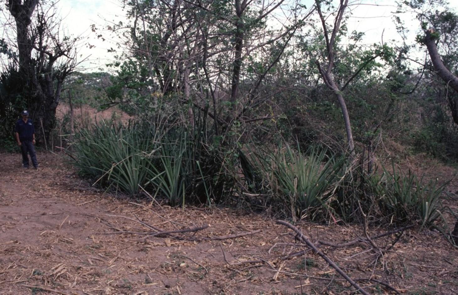
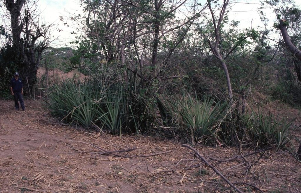
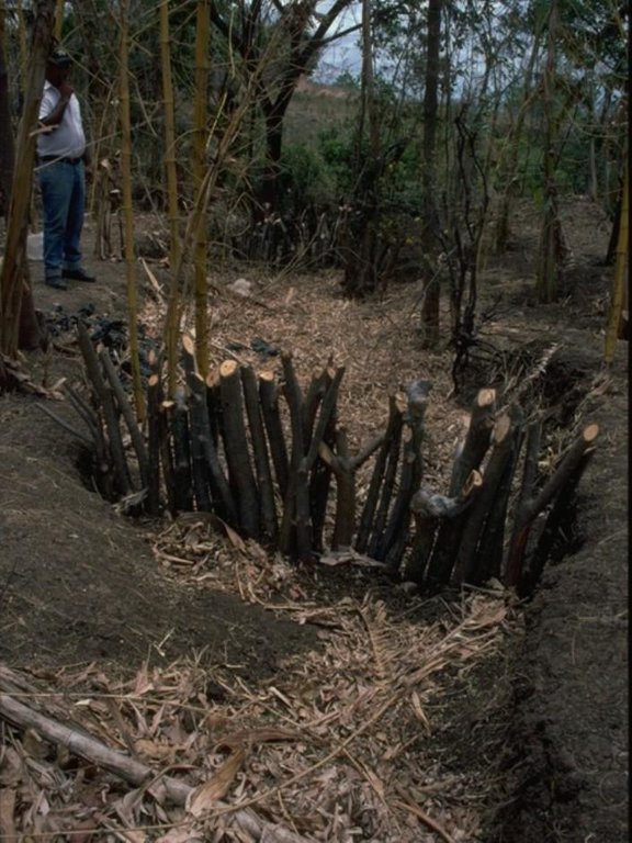
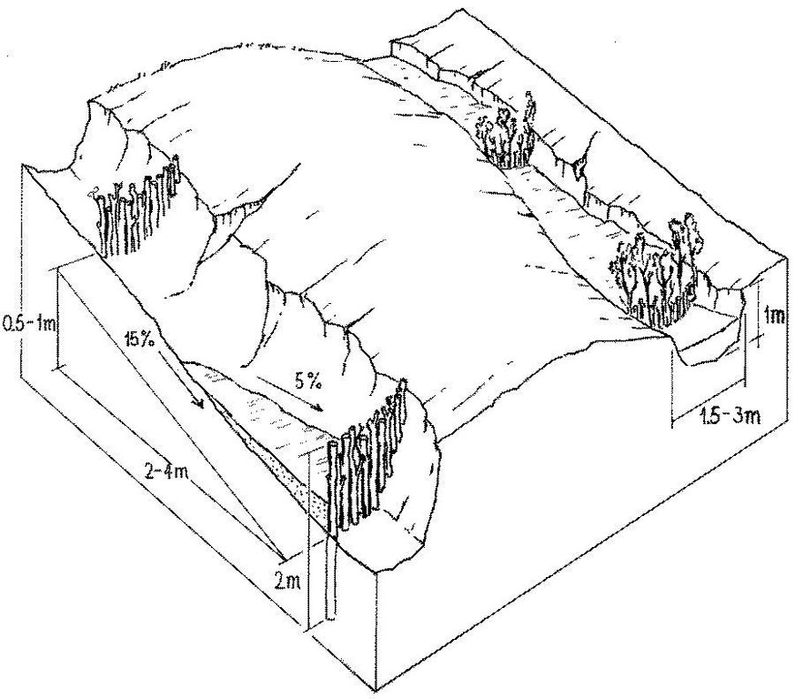
Stem cuttings from specific tree species have the ability to strike roots and continue growing after being planted into the earth. In this case study local species have been used to create check dams in gullies: these include jinocuebo (Simaroubaceaes bombacaceaes, and also jobo, tiguilote, pochote from the same family). Other suitable species are jocote (Spondias purpurea) and madero negro (Gliricidia sepium). As an option the pinapple-like piñuela (Bromelia pinguin) can be planted in association with the stem cuttings to further reinforce the system. Tree stems are cut into pieces 5-15 cm thick and 1.5-2.5 m long, depending on the depth of the gully. The cuttings are planted to half of their length, and formed into semi-circular barriers (see diagram). The dams retard runoff and thus retain eroded sediment. Spacing between dams depends on the gradient of the gully bed. For example on a 15% slope it is recommended to build a dam every 4 meters (see spacing under establishment activities). Between dams, the gully gradually fills up with eroded soil, the speed of the runoff is further reduced and agricultural land that has been divided by the gully is reconnected. Large and deep gullies may change over time into a sequence of narrow fertile terraces where crops can be grown.
However, the check dams should be seen as part of an integrated catchment management and protection plan, and thus be supported by other SWC measures on the lateral slopes, such as retention ditches and/or live barriers laid out along the contour. Erosion and runoff control on the sides of each gully is an essential part of the rehabilitation process. These check dams of rooted poles are more robust and durable than stone dams in soils of sandy/ loamy texture. On moderate and steep slopes a combination of stem cutting and stone dams is recommended.
After two to three years the barriers should be pruned - yielding wood and fodder. Dead poles should be replaced and the dam widened if necessary.
In this case study the dams are constructed in a semi-arid region with erratic rainfall where gullies are common on agricultural land, be it cropland or grazing land. The land users are mainly peasant farmers, growing crops for subsistence on smallholdings, and living in very poor conditions. This system of gully rehabilitation is promoted by an NGO entitled ‘Asociación Tierra y Vida’ through farmerto-farmer (campesino a campesino) extension.
2.3 صور التقنية
2.5 البلد/المنطقة/المواقع التي تم تنفيذ التقنية فيها والتي يغطيها هذا التقييم
البلد:
نيكاراغوا
المنطقة/الولاية/المحافظة:
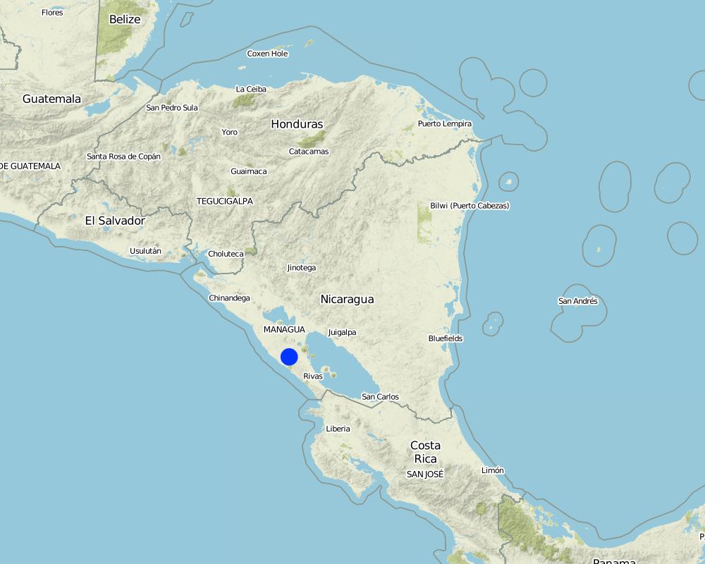
Santa Teresa, Paso de la Solera
مزيد من التفاصيل حول الموقع:
Carazo, Nicaragua
التعليقات:
Total area covered by the SLM Technology is 5 km2.
Map
×2.6 تاريخ التنفيذ
في حالة عدم معرفة السنة بالتحديد، يرجى الإشارة إلى التاريخ التقريبي:
- منذ أقل من 10 سنوات (مؤخرًا)
2.7 إدخال التقنية
حدد كيف تم إدخال التقنية:
- من خلال المشاريع/ التدخلات الخارجية
3. تصنيف تقنية الإدارة المستدامي للأراضي
3.1 الغرض الرئيسي ( الأغراض الرئيسية) للتقنية
- الحد من تدهور الأراضي ومنعه وعكسه
- الحد من مخاطر الكوارث
3.2 نوع (أنواع) استخدام الأراضي الحالية حيث يتم تطبيق التقنية

الأراضي الزراعية
- زراعة سنوية
حدد:
Longest growing period in days: 100, Longest growing period from month to month: May to August; Second longest growing period in days: 90, Second longest growing period from month to month: September to November

أراضي الرعي
التعليقات:
Major land use problems (compiler’s opinion): There is a range of factors that limit agricultural production in the area: soil degradation, extensive gully formation on crop land, low soil fertility, lack of inputs for crop production, erratic precipitation. Also, lack of interest/knowledge and lack of resources hinder the implementation of SWC measures.
3.4 إمدادات المياه
إمدادات المياه للأرض التي يتم تنفيذ التقنية عليها:
- بعلية
3.5 مجموعةالإدارة المستدامة للأراضي التي تنتمي إليها هذه التقنية
- التدابير المتقاطعة للمنحدرات
3.6 التدابير التقنية في مجال إلادارة المستدامة للأراضي

التدابير النباتية
- V5: أخرى

التدابير البنيوية
- S4: تسوية الخنادق والحفر
- S5: السدود، الأحواض الصغيرة، البرك
التعليقات:
Specification of other vegetative measures: stem cuttings; live barriers along contour (supp.)
Specification of other structural measures: check dams; retention ditches
3.7 الأنواع الرئيسية من تدهور الأراضي التي تناولتها التقنية

تآكل التربة بالمياه
- (Wg):الانجراف الخلجاني/ الخلجان
3.8 منع أو حد أو عكس تدهور الأراضي
تحديد هدف التقنية فيما يتعلق بتدهور الأراضي:
- اصلاح/إعادة تأهيل الأراضي المتدهورة بشدة
4. المواصفات الفنية، وأنشطة التنفيذ، والمدخلات، والتكاليف
4.1 الرسم الفني للتقنية
المواصفات الفنية (المتعلقة بالرسم الفني):
Stem cuttings planted in gullies to form living check dams: recently planted (left) and cuttings that have begun to take root and sprout, resulting in the gully becoming filled with trapped sediment (right).
Technical knowledge required for field staff / advisors: low
Technical knowledge required for land users: moderate
Main technical functions: control of concentrated runoff: retain / trap, levelling of land
Secondary technical functions: reduction of slope angle, reduction of slope length
Construction material (wood): jinocuebo (Simaroubaceaes bombacaceaes, and also jobo, tiguilote, pochote from the same family), j
Slope (which determines the spacing indicated above): 15%
المؤلف:
Mats Gurtner
4.3 أنشطة التأسيس
| النشاط | التوقيت (الموسم) | |
|---|---|---|
| 1. | Calculate and mark spacing between structures. | efore rainy season (April/May) |
| 2. | Cut poles out of selected local trees (diameter: 5–15 cm,length: 1.5–2.5 m depending on gully depth). | before rainy season (April/May) |
| 3. | Dig small semi-circular ditches at the gully bottom (the depth of theditch is half the length of the cuttings). | before rainy season (April/May) |
| 4. | Plant the cuttings vertically into the ditch; put the thicker cuttingsin the middle of the gully where runoff velocity is higher. | efore rainy season (April/May) |
| 5. | Fill ditch with excavated earth to fix the cuttings. | before rainy season (April/May) |
| 6. | Water to encourage rooting. | before rainy season (April/May) |
4.4 التكاليف والمدخلات اللازمة للتأسيس
| تحديد المدخلات | الوحدة | الكمية | التكاليف لكل وحدة | إجمالي التكاليف لكل مدخل | % من التكاليف التي يتحملها مستخدمو الأراضي | |
|---|---|---|---|---|---|---|
| العمالة | labour | ha | 1,0 | 100,0 | 100,0 | 100,0 |
| معدات | tools | ha | 1,0 | 20,0 | 20,0 | |
| معدات | wheelbarrow | ha | 1,0 | 10,0 | 10,0 | 100,0 |
| مواد البناء | wood | ha | 1,0 | 60,0 | 60,0 | 100,0 |
| إجمالي تكاليف إنشاء التقنية | 190,0 | |||||
| إجمالي تكاليف إنشاء التقنية بالدولار الأمريكي | 190,0 | |||||
التعليقات:
Duration of establishment phase: 2 month(s)
4.5 الصيانة/الأنشطة المتكررة
| النشاط | التوقيت/الوتيرة | |
|---|---|---|
| 1. | Biotrampas: pruning the trees | every three years. |
| 2. | Cut-off drains: clearing of sediment, cutting bushes and grasses. | |
| 3. | Stone check dams: pruning trees and bushes every three years. After fullsedimentation, the dam may be increased in height. | |
| 4. | Wooden check dams: pruning trees and bushes | every three years. |
4.6 التكاليف والمدخلات اللازمة للصيانة/للأنشطة المتكررة (سنويًا)
| تحديد المدخلات | الوحدة | الكمية | التكاليف لكل وحدة | إجمالي التكاليف لكل مدخل | % من التكاليف التي يتحملها مستخدمو الأراضي | |
|---|---|---|---|---|---|---|
| العمالة | labour | ha | 1,0 | 30,0 | 30,0 | 100,0 |
| مواد البناء | wood | ha | 1,0 | 5,0 | 5,0 | 100,0 |
| إجمالي تكاليف صيانة التقنية | 35,0 | |||||
| إجمالي تكاليف صيانة التقنية بالدولار الأمريكي | 35,0 | |||||
التعليقات:
Costs are calculated for a 100 m long, 2 m wide and 1 m deep gully with check dams every 4 m, on the basis of one gully per hectare.
4.7 أهم العوامل المؤثرة على التكاليف
قدم وصفا لأهم العوامل التي تؤثر على التكاليف:
The wood (for poles) belongs to the land users themselves, thus the ‘cost’ does not involve purchase.
5. البيئة الطبيعية والبشرية
5.1 المناخ
هطول الأمطار السنوي
- < 250 مم
- 251- 500 ملم
- 501 - 750ملم
- 1,000-751 ملم
- 1,500-1,100 ملم
- 2,000-1,500 ملم
- 3,000-2,001 ملم
- 4,000-3,100 ملم
- > 4000 ملم
المنطقة المناخية الزراعية
- شبه قاحلة
5.2 طوبوغرافيا
متوسط الانحدارات:
- مسطح (0-2%)
- بسيط (3-5%)
- معتدل (6-10%)
- متدحرج (11-15%)
- تلال (16-30%)
- شديدة الانحدار(31-60%)
- فائقة الانحدار (>60%)
التضاريس:
- هضاب/سهول
- أثلام مرتفعة
- المنحدرات الجبلية
- منحدرات التلال
- منحدرات في السفوح
- قاع الوادي
المنطقة الارتفاعية:
- 100-0 متر فوق سطح البحر
- 500-101 متر فوق سطح البحر
- 1,000-501 متر فوق سطح البحر
- 1,500-1,001 متر فوق سطح البحر
- 2,000-1,501 متر فوق سطح البحر
- 2,500-2,100 متر فوق سطح البحر
- 3,000-2,501 متر فوق سطح البحر
- 4,000-3,001 متر فوق سطح البحر
- > 4000 متر فوق سطح البحر
5.3 التربة
متوسط عمق التربة:
- ضحل جدًا (0-20 سم)
- ضحلة (21-50 سم)
- متوسطة العمق (51-80 سم)
- عميقة (81-120 سم)
- عميقة جدًا (> 120 سم)
قوام التربة (التربة السطحية):
- متوسط ( طميي، سلتي)
- ناعم/ثقيل (طيني)
المواد العضوية في التربة السطحية:
- منخفضة (<1%)
5.6 خصائص مستخدمي الأراضي الذين يطبقون التقنية
التوجه السوقي لنظام الإنتاج:
- الكفاف (الإمداد الذاتي)
- مختلط (كفاف/ تجاري)
الدخل من خارج المزرعة:
- 10-50% من جميع الإيرادات
أفراداً أو مجموعات:
- فرد/أسرة معيشية
اذكر الخصائص الأخرى ذات الصلة لمستخدمي الأراضي:
Off-farm income specification: temporary or permanent migration, particularly young people
5.7 متوسط مساحة الأرض التي يستخدمها مستخدمو الأراضي الذين يطبقون التقنية
- < 0.5 هكتارا
- 0.5 - 1 هكتار
- 1 -2 هكتار
- 2 - 5 هكتار
- 5 - 15 هكتار
- 15 - 50 هكتار
- 50 - 100هكتار
- 500-100 هكتار
- 1,000-500 هكتار
- 10,000-1,000 هكتار
- > 10,000 هكتار
هل يعتبر هذا نطاقًا صغيرًا أو متوسطًا أو واسعا (في إشارة إلى السياق المحلي)؟:
- على نطاق صغير
5.8 ملكية الأراضي، وحقوق استخدام الأراضي، وحقوق استخدام المياه
ملكية الارض:
- فردية، لا يوجد سند ملكية
- فردية، يوجد سند ملكية
حقوق استخدام الأراضي:
- مؤجر
- فردي
6. الآثار والتصريحات الختامية
6.1 الآثار التي أظهرتها التقنية في الموقع
الآثار الاجتماعية والاقتصادية
الإنتاج
إنتاج المحاصيل
التعليقات/ حدد:
where gullies planted
إنتاج الأعلاف
التعليقات/ حدد:
eg madero negro=Gliricidium sepium
إنتاج الخشب
التعليقات/ حدد:
medium term
الدخل والتكاليف
دخل المزرعة
عبء العمل
التعليقات/ حدد:
during establishment phase
الآثار الاجتماعية والثقافية
المؤسسات المجتمعية
التخفيف من حدة الصراع
improves relationships between land users
الآثار الايكولوجية
التربة
رطوبة التربة
فقدان التربة
دورة المغذيات/إعادة الشحن
6.2 الآثار التي أظهرتها التقنية خارج الموقع
الفيضان في اتجاه مجرى النهر
تراكم الطمي باتجاه مصب النهر
تلوث المياه الجوفية/الأنهار
6.4 تحليل التكلفة والعائد
كيف يمكن مقارنة العوائد نسبة لتكاليف الإنشاء (من وجهة نظر مستخدمي الأراضي)؟
عوائد قصيرة الأجل:
سلبي
عوائد طويلة الأجل:
إيجابي
كيف تتم مقارنة العوائدمع كلفة الصيانة/التكاليف المتكررة (من وجهة نظر مستخدمي الأراضي)؟
عوائد قصيرة الأجل:
محايد/متوازن
عوائد طويلة الأجل:
ايجابي جدا
6.5 اعتماد التقنية
- > 50%
التعليقات:
66% of land user families have adopted the Technology with external material support
30% of all farmers approached by the project (about 400 out of 1,200 land users) have built these check dams. Seeds, tools and credits were provided as incentives; the reasons for implementation included both the attraction of the incentives and perceived ecological benefits in terms of rehabilitation of degraded areas.
34% of land user families have adopted the Technology without any external material support
There is a strong trend towards spontaneous adoption of the Technology
6.7 نقاط القوة / المزايا / الفرص التي توفرها التقنية
| نقاط القوة/ المزايا/ الفرص من وجهة نظر جامع المعلومات أو غيره من الاشخاص الرئيسيين لمصدر المعلومات |
|---|
| Facilitated land management: area is no longer divided by gullies |
| Retards runoff speed: decreases erosion |
| Accumulation of fertile earth above the check dams, possibility of growing crops on ‘terraces’ between the structures |
| Increased soil moisture |
6.8 نقاط ضعف / مساوىء / مخاطر التقنية وسبل التغلب عليها
| نقاط الضعف/ المساوىء/ المخاطر من وجهة نظر جامع المعلومات أو غيره من الاشخاص الرئيسيين لمصدر المعلومات | كيف يمكن التغلب عليها؟ |
|---|---|
| The check dams used alone as SWC measure may not be adequate to withstand concentrated runoff | It is important to combine this technology with other SWC practices (e.g. retention ditches on slopes at both sides of gully, live fences, etc). |
| Only likely to be applied where land use rights are guaranteed. | |
| Labour intensive. |
7. المراجع والروابط
7.1 طرق جمع/مصادر المعلومات
- زيارات ميدانية، مسوحات ميدانية
- مقابلات مع مستخدمي الأراضي
متى تم تجميع البيانات (ميدانيا)؟:
01/02/2004
7.2 المراجع للمنشورات المتاحة
العنوان، المؤلف، السنة، النظام القياسي الدولي لترقيم الكتب ISBN:
Gurdiel G . La construcción de diques. Tierra Fresca, Simas-Enlace, Managua. 1993.
العنوان، المؤلف، السنة، النظام القياسي الدولي لترقيم الكتب ISBN:
Guía Técnica de Conservación de Suelos y Agua. PASOLAC, Managua. 2000.
العنوان، المؤلف، السنة، النظام القياسي الدولي لترقيم الكتب ISBN:
LUPE . Manual Práctico de Manejo de Suelos en Laderas. Secretaría de Recursos Naturales, Tegucigalpa, Honduras. 1994.
الروابط والوحدات المواضيعية
توسيع الكل طي الكلالروابط
لا يوجد روابط
الوحدات المواضيعية
لا يوجد وحدات مواضيعية


