Environmentally-Friendly Community Practices [جمهورية مولدوفا]
- تاريخ الإنشاء:
- تحديث:
- جامع المعلومات: Valentin Ciubotaru
- المحررون: Valentin Ciubotaru, UNCCD PRAIS
- المراجعون: Farrukh Nazarmavloev, William Critchley, Rima Mekdaschi Studer
Practicile comunitare prietenoase mediului
technologies_1816 - جمهورية مولدوفا
عرض الأقسام
توسيع الكل طي الكل1. معلومات عامة
1.2 تفاصيل الاتصال بالأشخاص الرئيسيين لمصدر المعلومات والمؤسسات المشاركة في تقييم وتوثيق التقنية
الشخص (الأشخاص) الرئيسي لمصدر المعلومات
متخصص في الإدارة المستدامة للأراضي:
Ciubotaru Valentin
+37322 545733 / +37322 69134294
ngobios@yahoo.com / valentin.ciubotaru@yahoo.com
NGO BIOS
72/3 Columna str., office nr. 3. Chisinau- MD-2012
جمهورية مولدوفا
اسم المؤسسة (المؤسسات) التي سهلت توثيق/تقييم التقنية (إذا كان ذلك على صلة)
NGO BIOS (.) - جمهورية مولدوفا1.3 الشروط المتعلقة باستخدام البيانات الموثقة من خلال WOCAT
متى تم تجميع البيانات (ميدانيا)؟:
02/06/2014
يوافق جامع المعلومات والشخص (لاشخاص) الرئيسي لمصدر المعلومات على الشروط المتعلقة باستخدام البيانات الموثقة من خلال WOCAT:
نعم
1.4 إعلان بشأن استدامة التقنية الموصوفة
هل التقنية الموصوفة هنا تمثل مشكلة فيما يتعلق بتدهور الأراضي، بحيث لا يمكن إعلانها تقنية مستدامة لإدارة الأراضي؟:
كلا
2. وصف تقنيةالإدارة المستدامي للأراضي
2.1 وصف مختصر للتقنية
تعريف التقنية:
Community area development plans were developed taking into consideration the main problems, opportunities, necessities and wishes of the local population. All communities included afforestation of severely eroded land, re-establishing degraded forest belts and planting new forest lines, creating protection shields for aquatic areas, and an ecological education community program.
2.2 وصف تفصيلي للتقنية
الوصف:
Community area development plans were developed for six communities for the period of 2008-2028, taking into consideration the main problems, opportunities, requirements and wishes of the local population. Special attention was paid to environmental impact assessment to harmonize economic and social development with environmental protection. All communities included afforestation of severely eroded land, re-establishing degraded forest belts and planting new forest lines, creating protection shields for aquatic areas, and elaborating and implementing a ecological education community program.
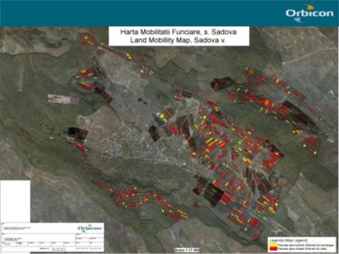
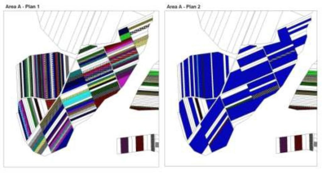
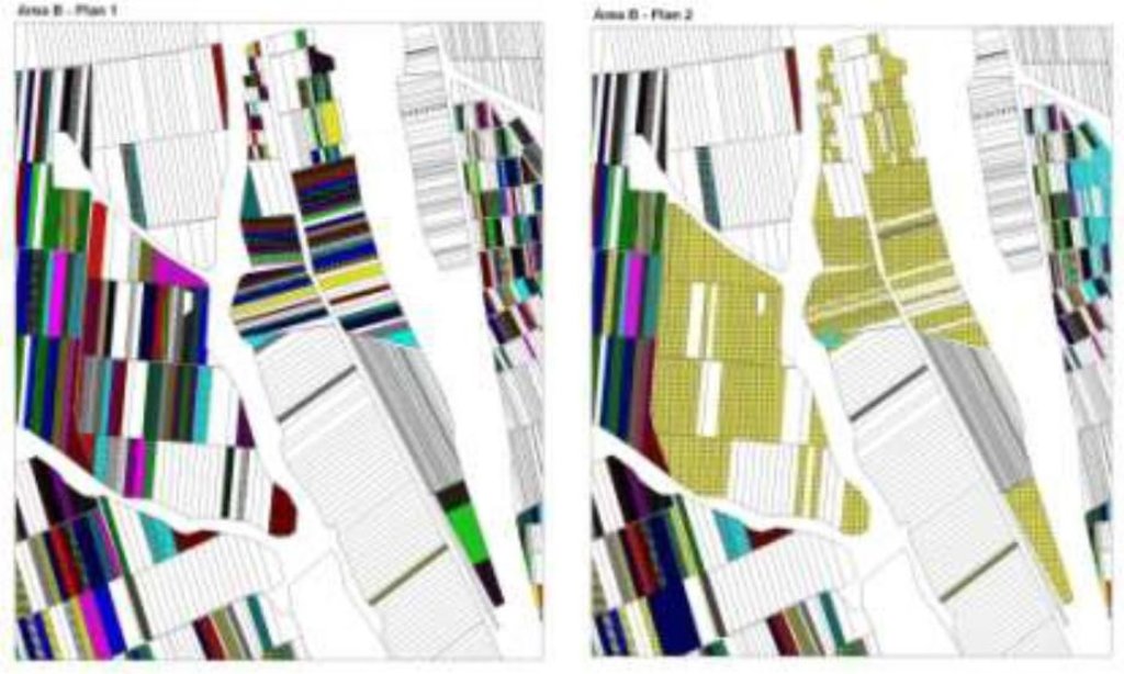
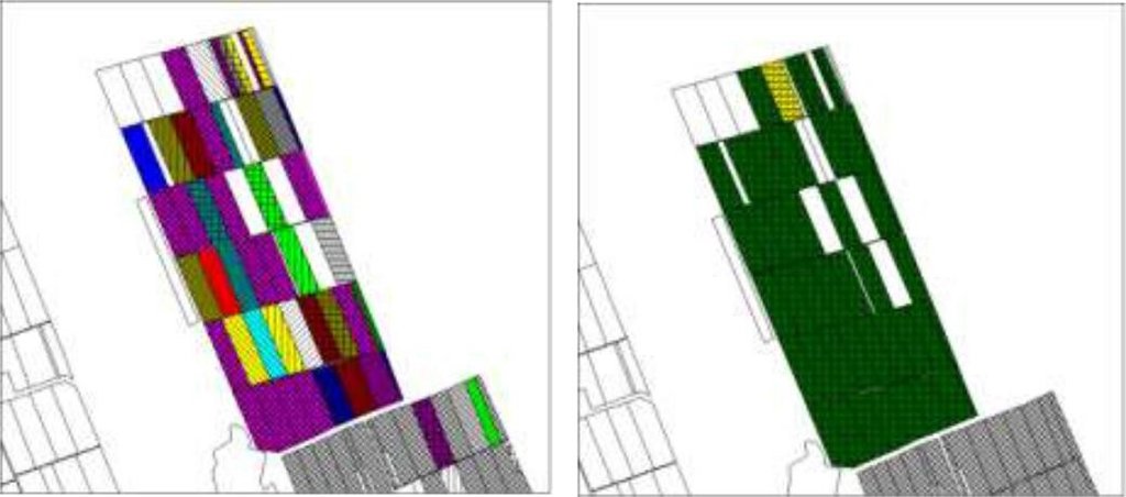
The first action implemented was agricultural land re-parcelling, based on FAO guidelines. Training programs were conducted for project staff and beneficiaries. Following land planning, discussions and individual negotiations with each land owner, the project promoted the application of the following land parcels operations: sale, exchange and long term lease. The costs incurred during land transactions were fully covered by the project. The Land Use Scheme implies changes in some categories of use and especially expanding the area of vineyards and orchards as well as using agricultural land for community development according to the needs and wishes of the population. Land re-parcelling offers farmers the possibility of rearranging agricultural land according to ecological principles and potential.
The overall goal of land re-parcelling component was to respond to the concerns of the Government and others about the fragmentation of agricultural land: it focussed on small peasant farms as its primary target group. The specific objectives of the pilot action were:
- to test the demand for and feasibility of land re-parcelling with small landowners as the primary target group;
- to facilitate development of 6 community area development plans, taking into account environmental impact assessment.
- to use the pilot experience as the basis for designing a potential national-level approach, including techniques, resource requirements and legislative framework;
- to assess the impact of re-parcelling at the local level, including on land markets, agricultural production, and equity.
The re-parcelling activities were extended to 40 villages on the proviso that the concept and the experience of the implemented re-parcelling pilots would be precisely followed. Based on this experience, the Ministry of Agriculture is in active partnership with National Agency for Rural Development and NGO BIOS, supported by the FAO-developed National Strategy for Land Consolidation.
2.3 صور التقنية
2.5 البلد/المنطقة/المواقع التي تم تنفيذ التقنية فيها والتي يغطيها هذا التقييم
البلد:
جمهورية مولدوفا
مزيد من التفاصيل حول الموقع:
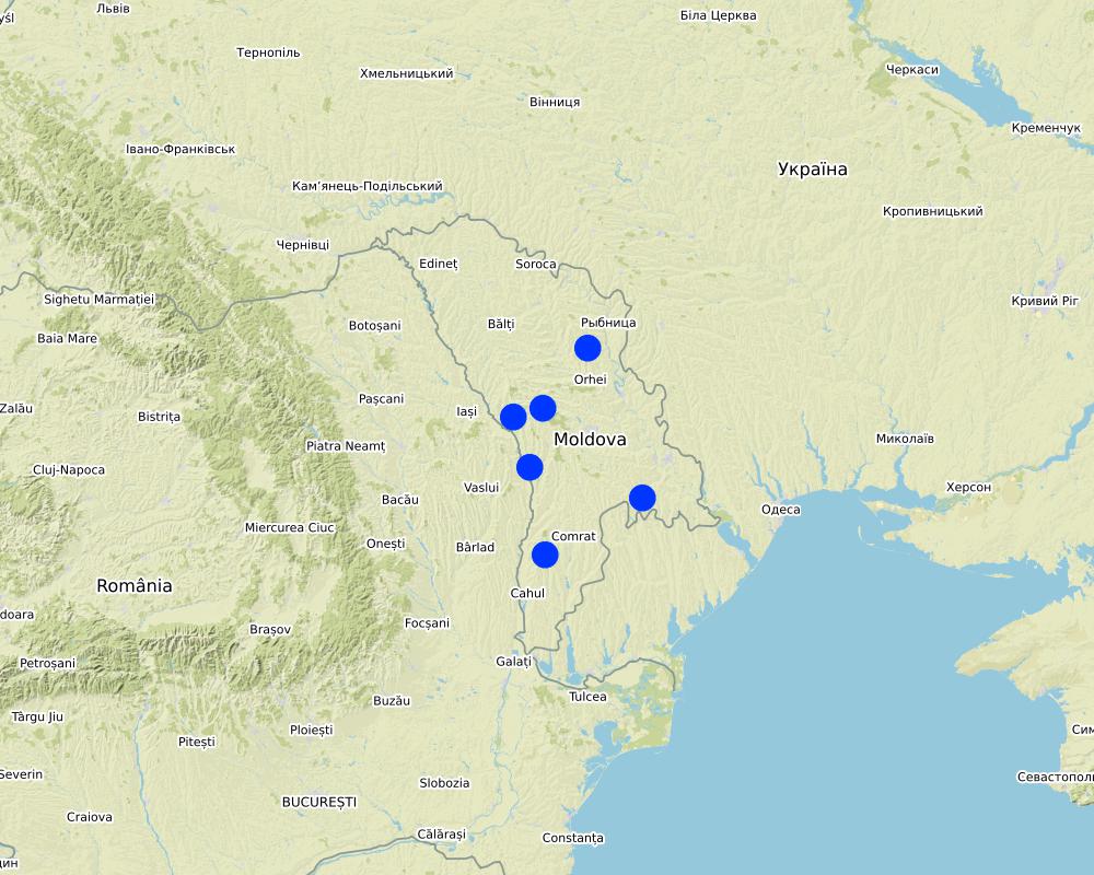
The six communes which form the pilot area, namely Basauca village Rezina district, Sadova village Calarasi district, Calmatui village Hincesti district, Bolduresti community of Cantemir district, Baimaclia community Cantemir district, Opaci village Causeni district, Republic of Moldova. The experience was replicated in 40 villages.
التعليقات:
The six communes which form the pilot area, namely Basauca village Rezina district, Sadova village Calarasi district, Calmatui village Hincesti district, Bolduresti community of Cantemir district, Baimaclia community Cantemir district, Opaci village Causeni district, Republic of Moldova.
Map
×2.6 تاريخ التنفيذ
في حالة عدم معرفة السنة بالتحديد، يرجى الإشارة إلى التاريخ التقريبي:
- منذ أقل من 10 سنوات (مؤخرًا)
2.7 إدخال التقنية
حدد كيف تم إدخال التقنية:
- أثناء التجارب/الأبحاث
- من خلال المشاريع/ التدخلات الخارجية
3. تصنيف تقنية الإدارة المستدامي للأراضي
3.1 الغرض الرئيسي ( الأغراض الرئيسية) للتقنية
- تحسين الإنتاج
- الحد من تدهور الأراضي ومنعه وعكسه
- الحفاظ على النظام البيئي
- حماية مستجمعات المياه / المناطق الواقعة في اتجاه مجرى النهر - مع تقنيات أخرى
- خلق أثر اقتصادي مفيد
3.2 نوع (أنواع) استخدام الأراضي الحالية حيث يتم تطبيق التقنية

الأراضي الزراعية
- زراعة سنوية
- زراعة معمرة (غير خشبية)

غير ذلك
حدد:
- Land fragmentation; - Environmentally unsustainable land management practices; - Illegal cutting of forests, leading to the destruction of forest belts and buffer strips; - Point and non-point sources of pollution, - Over-grazing..
3.3 مزيد من المعلومات حول استخدام الأراضي
إمدادات المياه للأرض التي يتم تنفيذ التقنية عليها:
- مختلط بعلي-مروي
عدد مواسم الزراعة في السنة:
- 1
3.4 مجموعةالإدارة المستدامة للأراضي التي تنتمي إليها هذه التقنية
- أنظمة التناوب (تعاقب المحاصيل، البور، الزراعة المتنقلة)
- الإدارة المتكاملة للمحاصيل والثروة الحيوانية
- التدابير المتقاطعة للمنحدرات
3.5 انتشار التقنية
حدد انتشار التقنية:
- منتشرة بالتساوي على مساحة
إذا كانت التقنية منتشرة بالتساوي على منطقة ما، فحدد المنطقة التقريبية المغطاة:
- > 10,000 كم2
التعليقات:
The Technology was replicated to 40 villages in South, Center and North regions of Moldova
3.6 التدابير التقنية في مجال إلادارة المستدامة للأراضي

التدابير الزراعية
- A1: الغطاء النباتي/التربة
- A2: المادة العضوية/خصوبة التربة

التدابير النباتية
- V1: غطاء من الأشجار والشجيرات
- V2: الأعشاب والنباتات العشبية المعمرة

التدابير البنيوية
- S5: السدود، الأحواض الصغيرة، البرك
- S6: الجدران والحواجز وسياجات القش، والسياجات
- S9: إنشاءات حماية النباتات وملاجىء الحيوانات

التدابير الإدارية
- M1: التغيير في نوع استخدام الأراضي
- M2: تغيير في مستوى الإدارة/الكثافة
التعليقات:
- Implementing activities of protection, maintenance and improving of degraded soil fertility;
- Agroforestry consisted of planting of tree rows on cultivated lands, primarily of windbreaks and anti-erosion protective belts.
- Improving the quality of pastures and implementing controlled pasturing.|
- Regeneration of degraded commune forest as well as existing forest protective belts.
- Planting of tree rows on cultivated lands, primarily of windbreaks and anti-erosion protective belts. |
Facilitate the development of farms by reducing the fragmentation and expanding the area of agricultural lands. The project provides assistance to land owners and farmers to undertake voluntarily land transactions based on market economy principles, elaborating the land ownership maps (GIS MapInfo|
The elaboration of the Community Area Development Plans was effected together with the local public administration, professors, legal persons, non-governmental organizations, and the population of communities with active involvement of Zonal Ecologic Agencies, Preventive Medicine Centers, |Agriculture and Economy Departments of district Executive Committees.
3.7 الأنواع الرئيسية من تدهور الأراضي التي تناولتها التقنية

تآكل التربة بالمياه
- الوزن(Wt): فقدان التربة السطحية/تآكل السطح
- (Wr):انجراف ضفة النهر
- (Wo:) تأثيرات التدهور من مواقع أخرى

تآكل التربة الناتج عن الرياح
- (Et): فقدان التربة السطحية
- (Ed): الانكماش والترسب

التدهور المادي أو الفيزيائي للتربة
- (Pc) : تراص التربة
- (Pu): فقدان الوظيفة الإنتاجية الحيوية بسبب أنشطة أخرى

التدهور البيولوجي
- (Bc): تناقص الغطاء النباتي
- (Bh): فقدان الموائل
- (Bq): انخفاض الكمية/الكتلة الحيوية
- (Bs): انخفاض جودة وتركيبة الأنواع/التنوع
- (Bl): فقدان الحياة بالتربة
3.8 منع أو حد أو عكس تدهور الأراضي
تحديد هدف التقنية فيما يتعلق بتدهور الأراضي:
- منع تدهور الأراضي
- الحد من تدهور الأراضي
4. المواصفات الفنية، وأنشطة التنفيذ، والمدخلات، والتكاليف
4.4 أنشطة التأسيس
| النشاط | نوع التدبير | التوقيت | |
|---|---|---|---|
| 1. | Implementing activities of protection, maintenance and improving of degraded soil fertility | ||
| 2. | Agroforestry consisting of planting of tree rows on cultivated lands, primarily of windbreaks and anti-erosion protective belts. | ||
| 3. | Improving the quality of pastures and implementing controlled pasturing| | ||
| 4. | Regeneration of degraded commune forest as well as existing forest protective belts | ||
| 5. | Planting of tree rows on cultivated lands, primarily of windbreaks and anti-erosion protective belts |
4.5 التكاليف والمدخلات اللازمة للتأسيس
إذا تحمل مستخدم الأرض أقل من 100% من التكاليف، حدد من قام بتغطية التكاليف المتبقية:
The Project
5. البيئة الطبيعية والبشرية
5.1 المناخ
هطول الأمطار السنوي
- < 250 مم
- 251- 500 ملم
- 501 - 750ملم
- 1,000-751 ملم
- 1,500-1,100 ملم
- 2,000-1,500 ملم
- 3,000-2,001 ملم
- 4,000-3,100 ملم
- > 4000 ملم
الإشارة إلى اسم محطة الأرصاد الجوية المرجعية المعنية:
Chisinau, Nisporeni, Calarasi, Cahul, Leova, Hincesti, Rezina
المنطقة المناخية الزراعية
- شبه قاحلة
Moldova's climate is moderately continental: the summers are warm and long, with temperatures averaging 20 °C, and the winters are relatively mild and dry, with January temperatures averaging −4 °C. Annual rainfall, which ranges from around 600 millimeters in the north to 400 millimeters in the south, can vary greatly. The heaviest rainfall occurs in summer; heavy showers and thunderstorms are common. Because of the irregular terrain, heavy summer rains often cause erosion and river silting.|
5.2 طوبوغرافيا
متوسط الانحدارات:
- مسطح (0-2%)
- بسيط (3-5%)
- معتدل (6-10%)
- متدحرج (11-15%)
- تلال (16-30%)
- شديدة الانحدار(31-60%)
- فائقة الانحدار (>60%)
التضاريس:
- هضاب/سهول
- أثلام مرتفعة
- المنحدرات الجبلية
- منحدرات التلال
- منحدرات في السفوح
- قاع الوادي
المنطقة الارتفاعية:
- 100-0 متر فوق سطح البحر
- 500-101 متر فوق سطح البحر
- 1,000-501 متر فوق سطح البحر
- 1,500-1,001 متر فوق سطح البحر
- 2,000-1,501 متر فوق سطح البحر
- 2,500-2,100 متر فوق سطح البحر
- 3,000-2,501 متر فوق سطح البحر
- 4,000-3,001 متر فوق سطح البحر
- > 4000 متر فوق سطح البحر
وضح ما إذا كانت التقنية مطبقة على وجه التحديد في:
- غير ذات صلة
التعليقات والمواصفات الإضافية بشأن التضاريس:
Most of Moldova's territory is a moderate hilly plateau cut deeply by many streams and rivers. Geologically, Moldova lies primarily on deep sedimentary rock that gives way to harder crystalline outcroppings only in the north. Moldova's hills are part of the Moldavian Plateau, which geologically originate from the Carpathian Mountains. |
5.3 التربة
متوسط عمق التربة:
- ضحل جدًا (0-20 سم)
- ضحلة (21-50 سم)
- متوسطة العمق (51-80 سم)
- عميقة (81-120 سم)
- عميقة جدًا (> 120 سم)
قوام التربة (التربة السطحية):
- متوسط ( طميي، سلتي)
قوام التربة (> 20 سم تحت السطح):
- متوسط ( طميي، سلتي)
المواد العضوية في التربة السطحية:
- عالية (>3%)
- متوسطة (1-3%)
إذا كان متاحًا، قم بإرفاق وصف كامل للتربة أو تحديد المعلومات المتوفرة، على سبيل المثال نوع التربة، الرقم الهيدروجيني/ درجة حموضة التربة، قدرة التبادل الكاتيوني، النيتروجين، الملوحة وما إلى ذلك.
About 75% of Moldova is covered by black earth or chernozem. In the northern hills, more clay textured soils are found; in the south, red-earth soil is predominant. The soil becomes less fertile toward the south but can still support grape and sunflower production. The hills have forest soils, while a small portion in southern Moldova is in the steppe zone, although most steppe areas today are cultivated. The lower reaches of the Prut and Dniester rivers and the southern river valleys are saline
5.4 توافر المياه ونوعيتها
منسوب المياه الجوفية:
50-5 م
توافر المياه السطحية:
متوسط
نوعية المياه (غير المعالجة):
مياه الشرب سيئة (تتطلب معالجة)
هل تعتبر ملوحة الماء مشكلة؟:
نعم
حدد:
high water mineralisation
هل تحدث فيضانات في المنطقة؟:
نعم
الإنتظام:
بشكل عرضي
5.5 التنوع البيولوجي
تنوع الأنواع:
- متوسط
تنوع الموائل:
- منخفض
5.6 خصائص مستخدمي الأراضي الذين يطبقون التقنية
مستقر أو مرتحل:
- غير المترحل
التوجه السوقي لنظام الإنتاج:
- مختلط (كفاف/ تجاري)
الدخل من خارج المزرعة:
- 10-50% من جميع الإيرادات
المستوى النسبي للثروة:
- ضعيف
أفراداً أو مجموعات:
- فرد/أسرة معيشية
- المجموعات/ المجتمع المحلي
مستوى المكننة:
- ميكانيكية/ مزودة بمحرك
الجنس:
- نساء
- رجال
عمر مستخدمي الأرضي:
- متوسط العمر
- كبار السن
5.7 متوسط مساحة الأرض المملوكة أو المستأجرة من قبل مستخدمي الأراضي الذين يطبقون التقنية
- < 0.5 هكتارا
- 0.5 - 1 هكتار
- 1 -2 هكتار
- 2 - 5 هكتار
- 5 - 15 هكتار
- 15 - 50 هكتار
- 50 - 100هكتار
- 500-100 هكتار
- 1,000-500 هكتار
- 10,000-1,000 هكتار
- > 10,000 هكتار
هل يعتبر هذا نطاقًا صغيرًا أو متوسطًا أو واسعا (في إشارة إلى السياق المحلي)؟:
- على نطاق صغير
التعليقات:
After independence (1991), land was privatized. The average family was entitled to plots of between 1.5 and 2.5 ha. Four categories of farms emerged: (i) small individual farmers; (ii) individual commercial farmers; (iii) farmers in associations with close relatives; and (iv) farmers in groups (from less than 10 farmers to large, joint-stock companies). The small size of many farms precludes the use of agricultural machinery and advanced technology. |
5.8 ملكية الأراضي، وحقوق استخدام الأراضي، وحقوق استخدام المياه
ملكية الارض:
- مجتمعي/قروي
- فردية، يوجد سند ملكية
حقوق استخدام الأراضي:
- مؤجر
- فردي
حقوق استخدام المياه:
- وصول مفتوح (غير منظم)
- فردي
التعليقات:
The principal activity of local farmers is crop farming; main arable crops are maize and wheat. The cultivation of grapes and fruits is another traditional element of agriculture in this area. Vineyards and orchards take a significant share of cropped land. Income is derived from sale of agricultural produce, including milk and eggs, from forest products, but also from seasonal work at the small workshops in their own and surrounding communities.|
Income depends much on weather conditions and agricultural policies. Estimated average income per person is 50 US dollars per month for the last three years (no including this year).
5.9 الوصول إلى الخدمات والبنية التحتية
الصحة:
- ضعيف
- معتدل
- جيد
التعليم:
- ضعيف
- معتدل
- جيد
المساعدة التقنية:
- ضعيف
- معتدل
- جيد
العمل (على سبيل المثال خارج المزرعة):
- ضعيف
- معتدل
- جيد
الأسواق:
- ضعيف
- معتدل
- جيد
الطاقة:
- ضعيف
- معتدل
- جيد
الطرق والنقل:
- ضعيف
- معتدل
- جيد
مياه الشرب وخدمات الصرف الصحي:
- ضعيف
- معتدل
- جيد
الخدمات المالية:
- ضعيف
- معتدل
- جيد
6. الآثار والتصريحات الختامية
6.1 الآثار التي أظهرتها التقنية في الموقع
الآثار الاجتماعية والاقتصادية
الإنتاج
إنتاج المحاصيل
إنتاج حيواني
جودة الغابات/الأراضي الحرجية
تنوع المنتج
منطقة الإنتاج
إدارة الأراضي
توافر المياه ونوعيتها
توافر مياه الشرب
نوعية مياه الشرب
توافر المياه للماشية
الدخل والتكاليف
دخل المزرعة
تنوع مصادر الدخل
الآثار الايكولوجية
دورة المياه / الجريان السطحي
حصاد / جمع المياه
الجريان السطحي
التربة
رطوبة التربة
غطاء التربة
فقدان التربة
تكون قشرة التربة السطحية/انسداد مسام التربة
تراص التربة
المادة العضوية في التربة/تحت الطبقة c
التنوع البيولوجي: الغطاء النباتي، الحيوانات
الغطاء النباتي
الكتلة الحيوية/ طبقة الكربون فوق التربة
التنوع النباتي
التنوع الحيواني
تنوع الموائل
6.2 الآثار التي أظهرتها التقنية خارج الموقع
الفيضان في اتجاه مجرى النهر
تراكم الطمي باتجاه مصب النهر
تلوث المياه الجوفية/الأنهار
القدرة على التخفيف / الترشيح
الأضرار التي لحقت بحقول الجيران
6.3 تعرض التقنية وحساسيتها لتغير المناخ التدريجي والظواهر المتطرفة/الكوارث المرتبطة بالمناخ (كما يراها مستخدمو الأراضي)
التعليقات:
Expected changes include utilization of local resources, change in existing land use management, change in landscape, changes in erosion rates, etc. These in their turn are expected to lead to social and economic impacts on people.
• The main environmental indicators are largely the same. • The expected environmental impact of re-parcelling and initiated actions are significant, especially in the long run. |
People learn to live with the new approach, new land structure, alternative solutions of solving their own problems, etc. |
Implementation of the land re-parcelling project contributes to improving the structure of the agricultural land, efficient use of technology, increase the possibility of arranging the community territory with a consolidated network of roads; |
The economic levels stayed practically unchanged, while social cohesion and culture has somewhat improved from exposure to new things, common work. The expected social impact of re-parcelling and initiated actions are significant, especially in the long run.|
Expected changes include increased jobs for people, there will be favourable conditions for the young population to stay in the rural area and those who left abroad could return back and start various businesses in their village.|
Improving the community infrastructure by water and natural gas supply, etc. It offers farmers a possibility to start processing enterprises so that they can sell the final product at a higher price than the raw products.
6.4 تحليل التكلفة والعائد
كيف يمكن مقارنة العوائد نسبة لتكاليف الإنشاء (من وجهة نظر مستخدمي الأراضي)؟
عوائد قصيرة الأجل:
إيجابي قليلا
عوائد طويلة الأجل:
إيجابي
كيف تتم مقارنة العوائدمع كلفة الصيانة/التكاليف المتكررة (من وجهة نظر مستخدمي الأراضي)؟
عوائد قصيرة الأجل:
إيجابي قليلا
عوائد طويلة الأجل:
إيجابي
6.5 اعتماد التقنية
- 50-10%
من بين جميع الذين تبنوا التقنية، كم عدد الذين فعلوا ذلك بشكل تلقائي، أي دون تلقي أي حوافز مادية/مدفوعات؟:
- 50-10%
6.6 التكيف
هل تم تعديل التقنية مؤخرًا لتتكيف مع الظروف المتغيرة؟:
كلا
6.7 نقاط القوة / المزايا / الفرص التي توفرها التقنية
| نقاط القوة/ المزايا/ الفرص من وجهة نظر جامع المعلومات أو غيره من الاشخاص الرئيسيين لمصدر المعلومات |
|---|
|
Business opportunities related to community development, etc. | Highly motivated local governments Highly motivated farmers |
7. المراجع والروابط
7.1 طرق جمع/مصادر المعلومات
- مقابلات مع مستخدمي الأراضي
6000
7.3 روابط للمعلومات ذات الصلة المتوفرة على الإنترنت
العنوان/الوصف:
Assessment Study on Land Re-parceling Pilot Project in 6 Villages in Moldova
عنوان الرابط URL:
http://www.capmu.md/wp-content/uploads/images/docs/Impact_Assessment/Final%20report%20IA%20land%20rep.pdf
العنوان/الوصف:
Experiences with land reform and land consolidation in Moldova
عنوان الرابط URL:
file:///C:/Users/USER/Downloads/59-357-1-PB.pdf
الروابط والوحدات المواضيعية
توسيع الكل طي الكلالروابط
لا يوجد روابط
الوحدات المواضيعية
لا يوجد وحدات مواضيعية


