Community supported pasture and rangeland rehabilitation works [أنغولا]
- تاريخ الإنشاء:
- تحديث:
- جامع المعلومات: Nicholas Euan Sharpe
- المحرر: Txaran Basterrechea
- المراجعون: Alexandra Gavilano, Rima Mekdaschi Studer, Joana Eichenberger
technologies_3141 - أنغولا
- Community supported pasture and rangeland rehabilitation works: 31 يناير، 2018 (inactive)
- Community supported pasture and rangeland rehabilitation works: 16 فبراير، 2018 (inactive)
- Community supported pasture and rangeland rehabilitation works: 6 مارس، 2019 (inactive)
- Community supported pasture and rangeland rehabilitation works: 2 نوفمبر، 2021 (public)
عرض الأقسام
توسيع الكل طي الكل1. معلومات عامة
1.2 تفاصيل الاتصال بالأشخاص الرئيسيين لمصدر المعلومات والمؤسسات المشاركة في تقييم وتوثيق التقنية
متخصص في الإدارة المستدامة للأراضي:
اسم المشروع الذي سهّل توثيق/تقييم التقنية (إذا كان ذلك على صلة)
Reabilitação de terras e gestão das áreas de pastagem nos sistemas de produção agro-pastoris dos pequenos produtores no sudoeste de Angola (RETESA)اسم المشروع الذي سهّل توثيق/تقييم التقنية (إذا كان ذلك على صلة)
Book project: Guidelines to Rangeland Management in Sub-Saharan Africa (Rangeland Management)اسم المؤسسة (المؤسسات) التي سهلت توثيق/تقييم التقنية (إذا كان ذلك على صلة)
FAO Angola (FAO Angola) - أنغولا1.3 الشروط المتعلقة باستخدام البيانات الموثقة من خلال WOCAT
يوافق جامع المعلومات والشخص (لاشخاص) الرئيسي لمصدر المعلومات على الشروط المتعلقة باستخدام البيانات الموثقة من خلال WOCAT:
نعم
1.4 إعلان بشأن استدامة التقنية الموصوفة
هل التقنية الموصوفة هنا تمثل مشكلة فيما يتعلق بتدهور الأراضي، بحيث لا يمكن إعلانها تقنية مستدامة لإدارة الأراضي؟:
كلا
2. وصف تقنيةالإدارة المستدامي للأراضي
2.1 وصف مختصر للتقنية
تعريف التقنية:
Rehabilitation of rangelands involves selection of key pasture and fodder species, and their reintroduction into strategic areas through stakeholder participation. The technology is also supported by communal management plans, which were created to address the root causes of land degradation.
2.2 وصف تفصيلي للتقنية
الوصف:
This technology was developed and implemented through the RETESA Project “Land rehabilitation and rangelands management in smallholder agropastoral production systems in south-western Angola”. RETESA is a project owned and implemented by the Ministry of Environment of the Government of Angola, with technical and methodological assistance from The Food and Agriculture Organization of the United Nations (FAO), and financed by the Global Environment Facility (GEF).
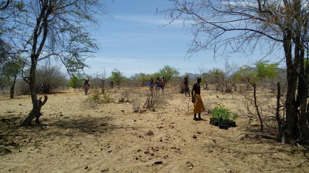
Inappropriate grazing regimes and poor livestock management by pastoral communities in SW Angola have led to degradation of rangeland and pastoral resources, with perennial grassland species and shrubs having been effectively eliminated. This is despite the fact that the pastoral communities of the area know their environment extremely well and are aware of the land degradation happening around them. Under the project they identified crucial areas for rehabilitation works, selecting mostly areas around water points that have been in use both by local and transhumant herders. Through these works, the local community sought to (a) increase ground cover to reduce sediment loads entering waterways (erosion control), (b) provide shade for livestock, (c) increase forage production and (d) introduce legumes and multipurpose forage trees in areas of high animal traffic. A total of four areas in the Bibala and Virei Municipalities were identified for the activities.
The communities were closely involved in the selection and propagation of plant species for the rehabilitation works. The project field staff also ran field palatability trials with them to confirm that the plants selected met their expectations. These participatory trials were also aimed at enhancing their understanding of livestock nutrition and how it related to animal health. Once the species were chosen, seed was collected by the communities and the Project Technicians, and was multiplied in 32 Agro-Pastoral Field School Nurseries and 2 Government funded Veterinary Research Stations. A total of 15 species were identified, with the grasses Eragrostis superba, Urochloa mosambicensis, and the trees Acacia nilotica, Faidherbia albida, Leucaena leucocephala and Moringa oleifera being the most valued by the communities as forage and multipurpose species. The trees were germinated from seed with success. However, native grass species failed to germinate by standard methods - early field trials having ruled out direct seeding methods. Thus they were multiplied by root division of plants collected from cultivated fields. This avoided removal of grass from natural areas.
As the majority of the areas selected for the rehabilitation works were focused around water points and waterways, the soils were generally alluvial, sandy loams. Precipitation is highest in the areas to the north: it ranges from 600 mm in the upper areas of the Bibala Municipality to 200 mm in the areas to the south in Virei. In general, the vegetation communities could be described as dry sclerophyll woodlands with Colophospermum mopane being the dominant tree species, with forest cover decreasing in height and density as one moves south toward drier areas.
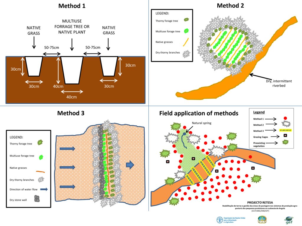
Through close collaboration with the participant communities, three rehabilitation methods were designed and improved upon throughout the Project's duration. Method 1 was used to plant open areas within the rehabilitation zone, Method 2 was employed to introduce and protect concentrated plantings of the selected species in strategic locations within the landscape, and Method 3 was preferred for the recuperation of riparian vegetation and to reduce sediment loads in waterways. The three methods used are described in more detail in the Technical Drawings. To increase the sense of ownership and thus the sustained effectiveness of the rehabilitation works, land management plans and other supporting activities were also carried out.
2.3 صور التقنية
2.5 البلد/المنطقة/المواقع التي تم تنفيذ التقنية فيها والتي يغطيها هذا التقييم
البلد:
أنغولا
المنطقة/الولاية/المحافظة:
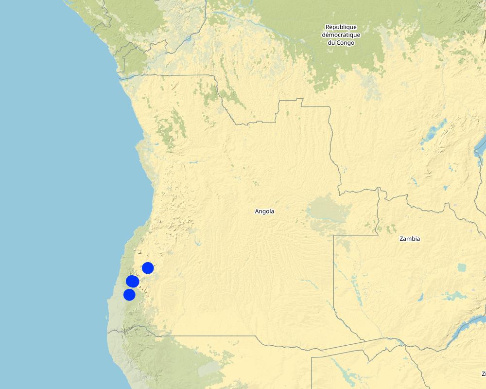
Province of Namibe
مزيد من التفاصيل حول الموقع:
Municipalities of Bibala and Virei
حدد انتشار التقنية:
- يتم تطبيقها في نقاط محددة/ تتركز على مساحة صغيرة
التعليقات:
There are 3 main rehabilitation areas, all within the Namibe Province in Southern Angola.
Planting areas are selected due to their importance and relevance to the local communities. For the most part, the plantings have been centred around key water points. In order to increase impact and scale up the process of rangeland rehabilitation and improvement, management plans are negotiated and agreed upon by the communities through the Green Negotiated Territorial Development Approach (GreeNTD) processes.
Map
×2.6 تاريخ التنفيذ
في حالة عدم معرفة السنة بالتحديد، يرجى الإشارة إلى التاريخ التقريبي:
- منذ أقل من 10 سنوات (مؤخرًا)
2.7 إدخال التقنية
حدد كيف تم إدخال التقنية:
- من خلال المشاريع/ التدخلات الخارجية
التعليقات (نوع المشروع، الخ):
The proposed project: “Land rehabilitation and rangelands management in smallholders’ agropastoral production systems in southwestern Angola” (RETESA) is a joint effort by the Ministério do Ambiente (MA), Ministério da Agricultura e do Desenvolvimento Rural e das Pescas (MINANDER), Governo Provincial do Namibe, Governo Provincial do Huila, and Governo Provincial de Benguela, together with FAO and GEF. In line with the GEF-5 Land Degradation strategy, the project’s goal is to create an enhanced enabling environment in the agricultural sector and a sustained flow of agro-ecosystem services.
3. تصنيف تقنية الإدارة المستدامي للأراضي
3.1 الغرض الرئيسي ( الأغراض الرئيسية) للتقنية
- تحسين الإنتاج
- الحد من تدهور الأراضي ومنعه وعكسه
- الحفاظ على النظام البيئي
- الحفاظ على/تحسين التنوع البيولوجي
- الحد من مخاطر الكوارث
- التكيف مع تغير المناخ/الظواهر المتطرفة وآثارها
- التخفيف من تغير المناخ وآثاره
- خلق أثر اقتصادي مفيد
3.2 نوع (أنواع) استخدام الأراضي الحالية حيث يتم تطبيق التقنية

أراضي الرعي
الرعي الواسع النطاق:
- رعي شبه مرتحل
- Transhumance movements
نوع الحيوان:
- ماشية - الألبان
- الماشية -لإنتاج اللحوم وليس للألبان
- الماعز
المنتجات والخدمات:
- اللحوم
- الحليب

المجاري المائية، المسطحات المائية، الأراضي الرطبة
- خطوط الصرف، الممرات المائية
- البرك والسدود
- Natural springs
التعليقات:
Number of growing seasons per year: 1
Livestock density: Official data is not available and true livestock numbers are unknown.
3.3 هل تغير استخدام الأراضي نتيجة لتنفيذ التقنية؟
هل تغير استخدام الأراضي نتيجة لتنفيذ التقنية؟:
- نعم (يرجى ملء الأسئلة أدناه فيما يتعلق باستخدام الأراضي قبل تنفيذ التقنية)
التعليقات:
Crop land is increasing in the area as population increases and people move towards more sedimentary livelihoods.
3.4 إمدادات المياه
إمدادات المياه للأرض التي يتم تنفيذ التقنية عليها:
- بعلية
3.5 مجموعةالإدارة المستدامة للأراضي التي تنتمي إليها هذه التقنية
- الرعي وإدارة المراعي
- تحسين الغطاء الأرضي/النباتي
3.6 التدابير التقنية في مجال إلادارة المستدامة للأراضي

التدابير النباتية
- V1: غطاء من الأشجار والشجيرات
- V2: الأعشاب والنباتات العشبية المعمرة

التدابير الإدارية
- M2: تغيير في مستوى الإدارة/الكثافة
التعليقات:
The management plans created at the community and administrative level identify a number of large areas which are to serve as 'Grazing Reverses' for the dry season. Therefore, the agreements call for all livestock to abandon the area at the onset of the first rains and not return until the Pastoral Management Forum agrees to open the area for grazing. Once open, the range is available to all pastoralists, those that live in the immediate area and those moving through on their transhumance migration.
3.7 الأنواع الرئيسية من تدهور الأراضي التي تناولتها التقنية

تآكل التربة بالمياه
- الوزن(Wt): فقدان التربة السطحية/تآكل السطح
- (Wr):انجراف ضفة النهر

التدهور البيولوجي
- (Bc): تناقص الغطاء النباتي
- (Bh): فقدان الموائل
- (Bq): انخفاض الكمية/الكتلة الحيوية
- (Bs): انخفاض جودة وتركيبة الأنواع/التنوع
- (Bl): فقدان الحياة بالتربة
3.8 منع أو حد أو عكس تدهور الأراضي
تحديد هدف التقنية فيما يتعلق بتدهور الأراضي:
- الحد من تدهور الأراضي
- اصلاح/إعادة تأهيل الأراضي المتدهورة بشدة
4. المواصفات الفنية، وأنشطة التنفيذ، والمدخلات، والتكاليف
4.1 الرسم الفني للتقنية
المواصفات الفنية (المتعلقة بالرسم الفني):
Planting is typically based on three different methods, as seen in the figure above.
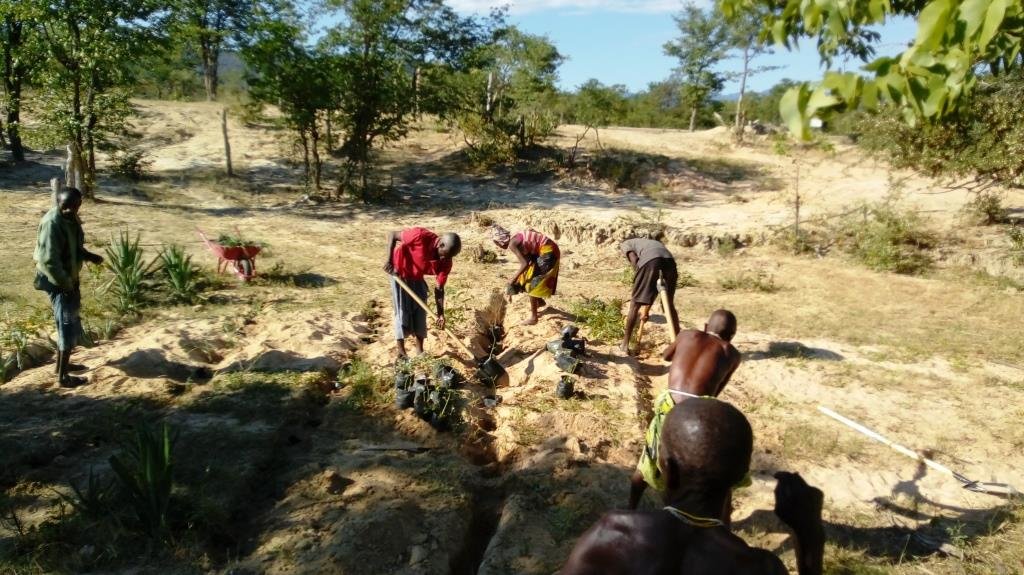
- Method 1 relies on placing a leguminous, multipurpose tree species in the ground with two native grass species to each side of the tree. The holes are dug and a small amount of manure is placed in the bottom of the hole, adding some water if it is readily available. Then the trees and grasses are planted and well-watered. Finally, a branch or two of thorny shrubs or trees are placed over the plants to protect them from being grazed (where possible, dead branches should be used, rather than cutting living plants).
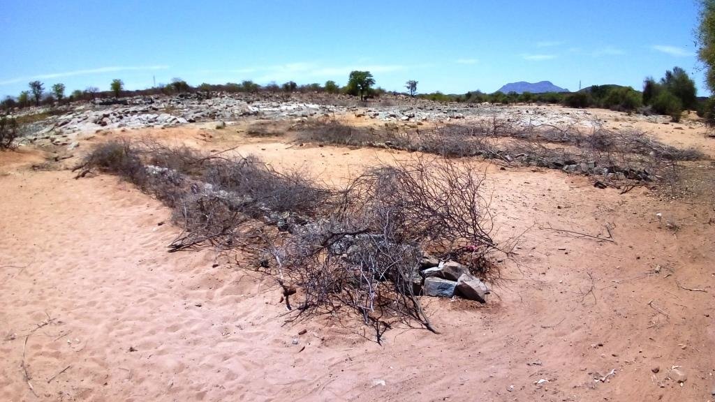
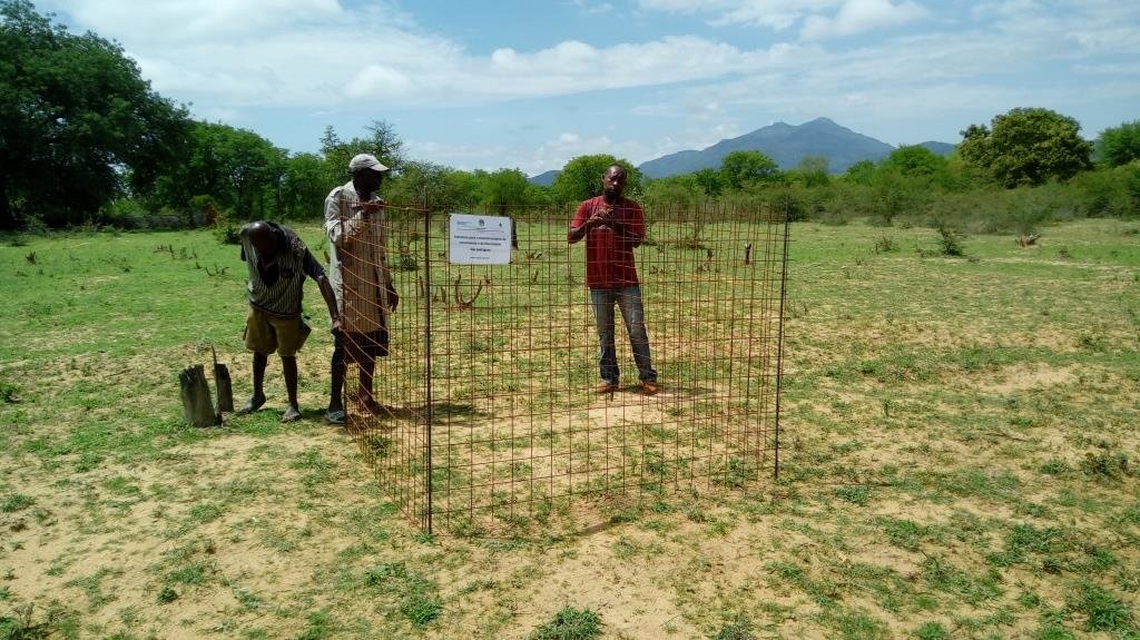
- Method 2 requires the creation of an enclosed, protected area which is then planted at high densities, preferably in low-lying areas where adequate soil moisture is available. Dry, dead branches from thorny trees and shrubs are used to create the enclosures and provide protection to these plantings.
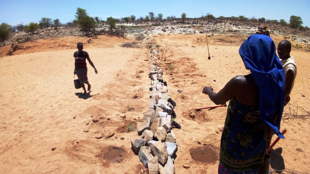
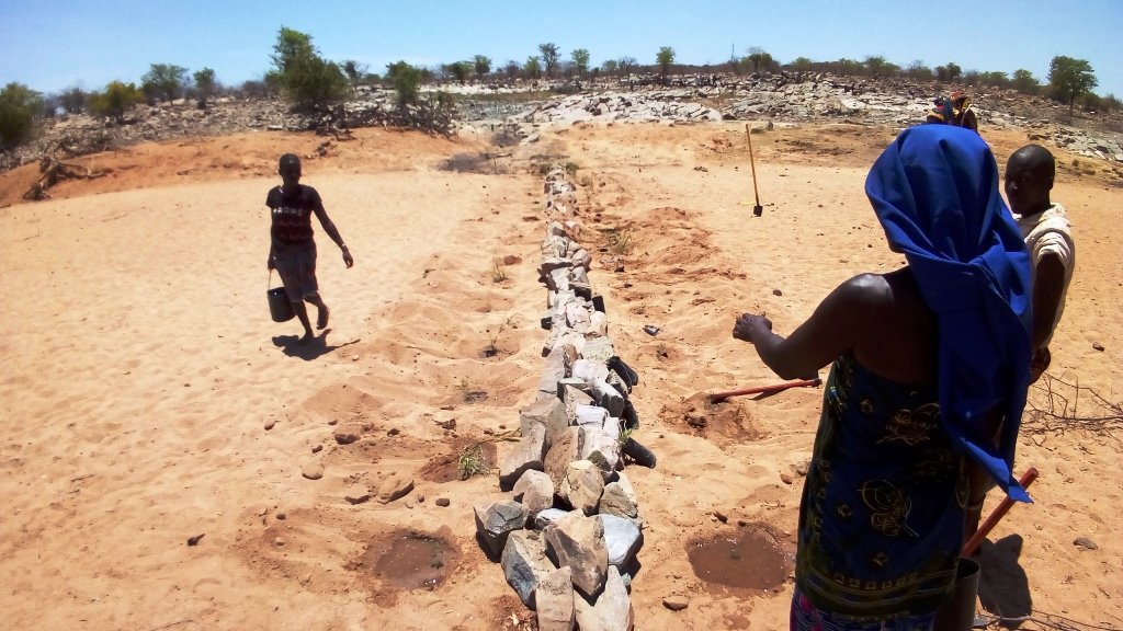
- Method 3 is based on the creation of a 'leaky weir', which is a small stone barrier, horizontal to the flow of water (on the contour) planted with a mixture of native riparian species. This is intended to slow the flow of water and stimulate the recovery of riparian vegetation. The plants are also protected with dry, dead branches from thorny trees and shrubs in this method.
To increase their effectiveness, it is recommended that the three methods be combined within the landscape, as seen in the 4th slide 'Field application of methods'.
المؤلف:
Projecto RETESA
التاريخ:
10/01/2018
4.2 معلومات عامة بخصوص حساب المدخلات والتكاليف
حدد كيفية احتساب التكاليف والمدخلات:
- لكل وحدة تقنية
حدد الوحدة:
3345 seedlings produced, delivered and planted
حدد أبعاد الوحدة (إذا كانت ذات صلة):
3345 units
حدد العملة المستخدمة لحساب التكاليف:
- دولار أمريكي USD
اذكر متوسط تكلفة أجر العمالة المستأجرة في اليوم الواحد:
6 Dollars
4.3 أنشطة التأسيس
| النشاط | التوقيت (الموسم) | |
|---|---|---|
| 1. | Meetings and field visits with participant communities to identify plant species and their uses | Best during growing season |
| 2. | Further meetings to decide on which species are to be multiplied and arrange seed collection | Near end of growing season |
| 3. | Seed collection and transportation | When seed is available (varies with species) |
| 4. | Instalation of irrigation systems | Most communiites need a water extraction and distribution system to create nurseries |
| 5. | Delivery of nursery supplies and instalation of shade cloth | Nurseries should have water access and shade |
| 6. | Planting of seeds and care for seedlings at nursery | Formed part of Agro-Pastoral Farmer Field School activities |
| 7. | Identification of planting areas and timing | Should be at beginning of rainy season, or when soil moisture permits |
| 8. | Organisation of materials and tools | At least 1 week before the planting |
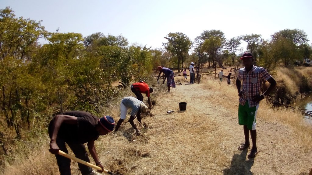
| 9. | Planting day (preparation of planting holes and transplanting of seedlings) | 2 days maximum was seen to be optimal |
| 10. | Watering until the plants are established | Usually a maximum of 3 watering over 1 week after the plantings |
| 11. | Follow up visits to make sure management agreements are being respected and plants are not being eaten by stock until they are ready | Plants should not be grazed for at least 6 months from planting time until they are well established |
التعليقات:
The activities and costs given were those needed to produce and plant 3,345 trees and grasses in the 4 rehabilitation areas. Given that 3,345 plants were produced at a cost of $3284.75, the cost per plant produced and planted in the field is $0.98. Seedlings available through local, government nurseries were $2.00 per unit, but only exotic ornamentals were available. However, it can be expected that in other contexts and locations, it would be cheaper to buy seedlings, instead of training communities and creating numerous small-scale nurseries, though clearly these communities will not ‘own’ the process as well as if they were involved from the beginning.
4.4 التكاليف والمدخلات اللازمة للتأسيس
| تحديد المدخلات | الوحدة | الكمية | التكاليف لكل وحدة | إجمالي التكاليف لكل مدخل | % من التكاليف التي يتحملها مستخدمو الأراضي | |
|---|---|---|---|---|---|---|
| العمالة | Project Technicians/Drivers/Consultants, etc | Person-days | 30,0 | 20,0 | 600,0 | |
| العمالة | Plant identification activities and seed collection | Person-days | 10,0 | 6,0 | 60,0 | 100,0 |
| العمالة | Plant nursery creation and plant production | Person-days | 16,0 | 6,0 | 96,0 | 100,0 |
| العمالة | Participation during planting days | Person-days | 25,0 | 10,0 | 250,0 | 90,0 |
| معدات | Vehicle | Trips | 10,0 | 40,0 | 400,0 | |
| معدات | Nursery supplies (including water system which also supplies water to Farmer Field School) | Materials | 1,0 | 800,0 | 800,0 | 10,0 |
| معدات | Planting supplies (shovels, hoes, wheelbarrows, etc.) | Materials | 1,0 | 120,0 | 120,0 | |
| معدات | Other improvements to water point (fencing, cement blocks, cement, hoses, etc.) | Materials | 1,0 | 250,0 | 250,0 | |
| معدات | Maps (traced onto paper from projected images for management purposes) | Materials | 1,0 | 10,0 | 10,0 | |
| معدات | Food and Refreshments | Per person | 25,0 | 2,5 | 62,5 | |
| الأسمدة والمبيدات الحيوية | Manure (50 grams per sack, 12.500 sacks) | Kilos | 625,0 | 0,25 | 156,25 | 100,0 |
| مواد البناء | Shade-cloth | m2 | 320,0 | 1,5 | 480,0 | |
| إجمالي تكاليف إنشاء التقنية | 3284,75 | |||||
| إجمالي تكاليف إنشاء التقنية بالدولار الأمريكي | 3284,75 | |||||
إذا تحمل مستخدم الأرض أقل من 100% من التكاليف، حدد من قام بتغطية التكاليف المتبقية:
Remaining costs were provided by the RETESA Project.
التعليقات:
Production depends on the ability of the pastoral communities to produce viable plants. If they are unable to do so, then plants can be bought from Government funded nurseries, though costs per plant will most rise though it can substitute the need for having to purchase a water supply system. The total shown here reflects a percentage (16%) of the costs of installing a water system that supplied water to the whole of the Agro-Pastoral Farmer Field School. These systems usually included a 10,000 litre water tank, a gasoline water pump, extraction pipe and parts, 100 to 200 mts of 1.5" hoses and parts and 3 kms of drip irrigation hose.
4.5 الصيانة/الأنشطة المتكررة
| النشاط | التوقيت/الوتيرة | |
|---|---|---|
| 1. | Meetings to ensure management agreements are being respected. | Once every 3 to 6 months, especially before and after rainy season. |
| 2. | Repairs and replacement of nursery supplies. | Once a year. |
| 3. | Replanting of dead seedlings | Just before and during rainy season. |
4.6 التكاليف والمدخلات اللازمة للصيانة/للأنشطة المتكررة (سنويًا)
| تحديد المدخلات | الوحدة | الكمية | التكاليف لكل وحدة | إجمالي التكاليف لكل مدخل | % من التكاليف التي يتحملها مستخدمو الأراضي | |
|---|---|---|---|---|---|---|
| العمالة | Visits to sites and tour of planting areas. | Person-days | 4,0 | 20,0 | 80,0 | 50,0 |
| العمالة | Driver. | Person-days | 1,0 | 20,0 | 20,0 | |
| العمالة | Replanting of dead seedlings | Person-days | 2,0 | 6,0 | 12,0 | 100,0 |
| العمالة | Watering | Person-days | 14,0 | 6,0 | 84,0 | 100,0 |
| معدات | Vehicle | Trips | 1,0 | 40,0 | 40,0 | |
| معدات | Watering cans and buckets | Materials | 4,0 | 5,0 | 20,0 | |
| إجمالي تكاليف صيانة التقنية | 256,0 | |||||
| إجمالي تكاليف صيانة التقنية بالدولار الأمريكي | 256,0 | |||||
إذا تحمل مستخدم الأرض أقل من 100% من التكاليف، حدد من قام بتغطية التكاليف المتبقية:
The RETESA Project provided an important part of both material and technical support to the communities, though the communities also contributed substantially.
4.7 أهم العوامل المؤثرة على التكاليف
قدم وصفا لأهم العوامل التي تؤثر على التكاليف:
The activities and costs given were those needed to produce and plant 3,345 trees and grasses in the 4 rehabilitation areas. Given that 3.345 plants were produced at a cost of $3284.75, the cost per plant produced and planted in the field is $0.98. Seedlings avaliable through local, government nurseries were $2.00 per unit, but only exotic ornamentals were avaliable. However, it can be expected that in other contexts and locations, it would be cheaper to buy seedlings instead of training communities and creating numerous small scale nurseries, though clearly these communities will not appropriate the process as well as if they were involved from the beginning.
5. البيئة الطبيعية والبشرية
5.1 المناخ
هطول الأمطار السنوي
- < 250 مم
- 251- 500 ملم
- 501 - 750ملم
- 1,000-751 ملم
- 1,500-1,100 ملم
- 2,000-1,500 ملم
- 3,000-2,001 ملم
- 4,000-3,100 ملم
- > 4000 ملم
المواصفات/التعليقات على هطول الأمطار:
In the past, the rainy season started in October or November and ran until May. However, the rains in the last few years have fallen in January to April.
الإشارة إلى اسم محطة الأرصاد الجوية المرجعية المعنية:
None in the area.
المنطقة المناخية الزراعية
- شبه قاحلة
5.2 طوبوغرافيا
متوسط الانحدارات:
- مسطح (0-2%)
- بسيط (3-5%)
- معتدل (6-10%)
- متدحرج (11-15%)
- تلال (16-30%)
- شديدة الانحدار(31-60%)
- فائقة الانحدار (>60%)
التضاريس:
- هضاب/سهول
- أثلام مرتفعة
- المنحدرات الجبلية
- منحدرات التلال
- منحدرات في السفوح
- قاع الوادي
المنطقة الارتفاعية:
- 100-0 متر فوق سطح البحر
- 500-101 متر فوق سطح البحر
- 1,000-501 متر فوق سطح البحر
- 1,500-1,001 متر فوق سطح البحر
- 2,000-1,501 متر فوق سطح البحر
- 2,500-2,100 متر فوق سطح البحر
- 3,000-2,501 متر فوق سطح البحر
- 4,000-3,001 متر فوق سطح البحر
- > 4000 متر فوق سطح البحر
وضح ما إذا كانت التقنية مطبقة على وجه التحديد في:
- غير ذات صلة
التعليقات والمواصفات الإضافية بشأن التضاريس:
Usually the planting are undertaken along river plains and river banks, as they are the only areas that have the necessary soil moisture to ensure survival of the seedlings.
5.3 التربة
متوسط عمق التربة:
- ضحل جدًا (0-20 سم)
- ضحلة (21-50 سم)
- متوسطة العمق (51-80 سم)
- عميقة (81-120 سم)
- عميقة جدًا (> 120 سم)
قوام التربة (التربة السطحية):
- خشن / خفيف (رملي)
قوام التربة (> 20 سم تحت السطح):
- خشن / خفيف (رملي)
المواد العضوية في التربة السطحية:
- منخفضة (<1%)
5.4 توافر المياه ونوعيتها
منسوب المياه الجوفية:
< 5 م
توافر المياه السطحية:
ضعيف/ غير متوافر
نوعية المياه (غير المعالجة):
مياه الشرب سيئة (تتطلب معالجة)
هل تعتبر ملوحة الماء مشكلة؟:
نعم
حدد:
Many bores and wells cannot be used due to Salinity problems. Before planting, it is wise to make sure soil salinity is not problematic in areas identified.
هل تحدث فيضانات في المنطقة؟:
نعم
الإنتظام:
بشكل عرضي
تعليقات ومواصفات أخرى بشأن نوعية المياه وكميتها:
Water quality and quantity are major issues for the area. There are few if any reliable water sources in the area and most communities depend on wells dug in the river bottoms to supply their water.
5.5 التنوع البيولوجي
تنوع الأنواع:
- متوسط
تنوع الموائل:
- منخفض
التعليقات والمواصفات الإضافية بشأن التنوع البيولوجي:
The area is devoid of most wild animals due to the years of war the country experienced during the second half of the 20th century.
5.6 خصائص مستخدمي الأراضي الذين يطبقون التقنية
مستقر أو مرتحل:
- شبه مرتحل
التوجه السوقي لنظام الإنتاج:
- الكفاف (الإمداد الذاتي)
الدخل من خارج المزرعة:
- 10-50% من جميع الإيرادات
المستوى النسبي للثروة:
- ضعيف جدا
أفراداً أو مجموعات:
- فرد/أسرة معيشية
مستوى المكننة:
- عمل يدوي
الجنس:
- نساء
- رجال
عمر مستخدمي الأرضي:
- شباب
- متوسط العمر
اذكر الخصائص الأخرى ذات الصلة لمستخدمي الأراضي:
The communities are still traditional though are currently being influenced by the globalisation process.
5.7 متوسط مساحة الأرض التي يستخدمها مستخدمو الأراضي الذين يطبقون التقنية
- < 0.5 هكتارا
- 0.5 - 1 هكتار
- 1 -2 هكتار
- 2 - 5 هكتار
- 5 - 15 هكتار
- 15 - 50 هكتار
- 50 - 100هكتار
- 500-100 هكتار
- 1,000-500 هكتار
- 10,000-1,000 هكتار
- > 10,000 هكتار
هل يعتبر هذا نطاقًا صغيرًا أو متوسطًا أو واسعا (في إشارة إلى السياق المحلي)؟:
- على نطاق واسع
التعليقات:
Agricultural plots are considered private and are usually between 1 to 2 hectares, though grazing land, which makes up the majority of the area, is still commonly owned and covers vast areas.
5.8 ملكية الأراضي، وحقوق استخدام الأراضي، وحقوق استخدام المياه
ملكية الارض:
- مجتمعي/قروي
حقوق استخدام الأراضي:
- وصول مفتوح (غير منظم)
حقوق استخدام المياه:
- وصول مفتوح (غير منظم)
5.9 الوصول إلى الخدمات والبنية التحتية
الصحة:
- ضعيف
- معتدل
- جيد
التعليم:
- ضعيف
- معتدل
- جيد
المساعدة التقنية:
- ضعيف
- معتدل
- جيد
العمل (على سبيل المثال خارج المزرعة):
- ضعيف
- معتدل
- جيد
الأسواق:
- ضعيف
- معتدل
- جيد
الطاقة:
- ضعيف
- معتدل
- جيد
الطرق والنقل:
- ضعيف
- معتدل
- جيد
مياه الشرب وخدمات الصرف الصحي:
- ضعيف
- معتدل
- جيد
الخدمات المالية:
- ضعيف
- معتدل
- جيد
6. الآثار والتصريحات الختامية
6.1 الآثار التي أظهرتها التقنية في الموقع
الآثار الاجتماعية والاقتصادية
الإنتاج
إنتاج الأعلاف
الكمية قبل الإدارة المستدامة للأراضي:
Low rangeland production
الكمية بعد الإدارة المستدامة للأراضي:
Slight improvement
التعليقات/ حدد:
Difficult to measure. Rehabilitation works and the management plans for the rangeland areas have led to some improvement, though the droughts affecting the area during the interventions significantly affected rangeland fodder production.
جودة العلف
الكمية قبل الإدارة المستدامة للأراضي:
No crop residues or fodder plantings used
الكمية بعد الإدارة المستدامة للأراضي:
Crop residues and fodder plantings incorporated in cropping areas
التعليقات/ حدد:
The process allowed Project Technicians to educate communities on the use of crop residues as fodder and the planting of multiuse trees within cropping areas to provide green fodder in the dry season. The reintroduction of drought tolerant, quality indigenous grasses should also lead an increase in fodder production over the coming year.
إنتاج حيواني
الكمية قبل الإدارة المستدامة للأراضي:
No planning for dry season grazing, apart from transhumance movements
الكمية بعد الإدارة المستدامة للأراضي:
Crop residues and other cultivated forages produced for those animals that stay
التعليقات/ حدد:
The transhumance movements of livestock are still seen as the most adequate solution to changes in natural rangeland production, though most families leave behind some animals with the main family unit. These animals are now receiving the quality feed they need to remain productive and healthy.
إدارة الأراضي
الكمية قبل الإدارة المستدامة للأراضي:
No management plans in place for commonly managed natural resources
الكمية بعد الإدارة المستدامة للأراضي:
Participatory land management plans have been negociated and agreed
التعليقات/ حدد:
Simplified land management plans based on traditional livestock movements and cropping seasons have been negotiated and agreed by local stakeholders and municipal Administrators.
توافر المياه ونوعيتها
نوعية مياه الشرب
الكمية قبل الإدارة المستدامة للأراضي:
Livestock and communities drink from same water
الكمية بعد الإدارة المستدامة للأراضي:
Separate water drinking points for livestock and community
التعليقات/ حدد:
Unrestricted access of livestock to community domestic water points led to waterborne diseases and poor water quality. Separating livestock and domestic use has improved community health.
توافر المياه للماشية
التعليقات/ حدد:
In addition to restricting livestock access to main water bodies, new drinking troughs have been built with community support.
نوعية المياه للماشية
التعليقات/ حدد:
By separating livestock drinking points and domestic water points, waterborne illnesses have been reduced. In at least one area a water tank and new drinking trough have been built with community support.
الآثار الاجتماعية والثقافية
المعرفة بالإدارة المستدامة للأراضي/تدهور الأراضي
الكمية قبل الإدارة المستدامة للأراضي:
No education or training on land degradation
الكمية بعد الإدارة المستدامة للأراضي:
Education and training on land degradation issues and rehabilitation methods
التعليقات/ حدد:
The majority of communities that have gone through the process now understand how poor land management leads to land degradation and steps they can take to reduce it.
الآثار الايكولوجية
دورة المياه / الجريان السطحي
كمية المياه
التعليقات/ حدد:
Improved ground cover and the return of riparian vegetation would increase infiltration rates and decrease evapotranspiration rates and restore the micro water cycle. But this is also a long term process.
جودة المياه
الكمية قبل الإدارة المستدامة للأراضي:
Low
الكمية بعد الإدارة المستدامة للأراضي:
Low in short term, improved in long term
التعليقات/ حدد:
Revegetation of river plains and river banks should lead to improved water quality though it will be a long term effect if the rehabilitation areas are respected.
الجريان السطحي
الكمية قبل الإدارة المستدامة للأراضي:
No method to deal with the high surface runoff rates in the area
الكمية بعد الإدارة المستدامة للأراضي:
A method has been devised for reducing surface runoff rates.
التعليقات/ حدد:
The 'leaky weir' method (Rehabilitation method 3) has shown promise over the duration of the Project and could be applied at other landscape levels to reduce surface runoff.
التربة
غطاء التربة
التعليقات/ حدد:
The reintroduction of native grasses in the area should lead to improved ground cover, binding the soil and reducing erosion rates.
فقدان التربة
التعليقات/ حدد:
The reintroduction of native grasses in the area should lead to improved ground cover ratios, binding the soil and reducing erosion rates.
دورة المغذيات/إعادة الشحن
التعليقات/ حدد:
Proper livestock management also ensures that manure is properly and evenly distributed in the field.
التنوع البيولوجي: الغطاء النباتي، الحيوانات
الغطاء النباتي
الكمية قبل الإدارة المستدامة للأراضي:
Reduced number of poor quality grass species
الكمية بعد الإدارة المستدامة للأراضي:
Communities capacitated in plant multiplication methods
التعليقات/ حدد:
Apart from the rehabilitation works themselves, the local communities have been capacitated with methods to approach and deal with land degradation.
الكتلة الحيوية/ طبقة الكربون فوق التربة
التنوع النباتي
التعليقات/ حدد:
The reintroduction of native and leguminous plants has improved plant diversity both within rehabilitation areas and cultivated lands.
الحد من مخاطر المناخ والكوارث
آثار الجفاف
المناخ الموضعي (مايكرو)
التعليقات/ حدد:
The works around the water points over time should lead to increase in vegetative cover, shade, habitat and reduced temperatures.
6.2 الآثار التي أظهرتها التقنية خارج الموقع
القدرة على التخفيف / الترشيح
6.3 تعرض التقنية وحساسيتها لتغير المناخ التدريجي والظواهر المتطرفة/الكوارث المرتبطة بالمناخ (كما يراها مستخدمو الأراضي)
تغير مناخ تدريجي
تغير مناخ تدريجي
| الموسم | زيادة أو نقصان | كيف تتعامل التقنية مع ذلك؟ | |
|---|---|---|---|
| هطول الأمطار السنوي | انخفاض | جيدا | |
| هطول الأمطار الموسمية | الربيع | انخفاض | جيدا |
6.4 تحليل التكلفة والعائد
كيف يمكن مقارنة العوائد نسبة لتكاليف الإنشاء (من وجهة نظر مستخدمي الأراضي)؟
عوائد قصيرة الأجل:
محايد/متوازن
عوائد طويلة الأجل:
إيجابي
كيف تتم مقارنة العوائدمع كلفة الصيانة/التكاليف المتكررة (من وجهة نظر مستخدمي الأراضي)؟
عوائد قصيرة الأجل:
محايد/متوازن
عوائد طويلة الأجل:
إيجابي
6.5 اعتماد التقنية
- حالات فردية/تجريبية
من بين جميع الذين تبنوا التقنية، كم عدد الذين فعلوا ذلك بشكل تلقائي، أي دون تلقي أي حوافز مادية/مدفوعات؟:
- 10-0%
6.6 التكيف
هل تم تعديل التقنية مؤخرًا لتتكيف مع الظروف المتغيرة؟:
كلا
6.7 نقاط القوة / المزايا / الفرص التي توفرها التقنية
| نقاط القوة/ المزايا/ الفرص من وجهة نظر مستخدمي الأراضي |
|---|
| Communities learn about plants' role in the wider ecosystem, how to select and multiply key fruit, fodder or timber species and should see an increase in their horticultural and livestock production, leading to improved nutrition or income. |
| Done properly, it can be a cost-effective and reliable way to produce the plants needed within family units. |
| نقاط القوة/ المزايا/ الفرص من وجهة نظر جامع المعلومات أو غيره من الاشخاص الرئيسيين لمصدر المعلومات |
|---|
| When the plants are produced in collaboration with the local pastoral communities, the benefits are wide ranging, promoting everything from environmental awareness to technical and practical knowledge. |
| It remains a cost-effective way of improving key productive species and increasing community resilience. |
| Increasing biomass and introducing better management cycles contribute to reducing land degradation and improve nutrient and energy cycling. |
6.8 نقاط ضعف / مساوىء / مخاطر التقنية وسبل التغلب عليها
| نقاط الضعف/ المساوىء/ المخاطر من وجهة نظر مستخدم الأراضي | كيف يمكن التغلب عليها؟ |
|---|---|
| Can require stable supply of water, and labour costs can increase if water sources are not easily accessible. | Locate nurseries near reliable and accessible water sources. |
| Can require permanent residence, so as to be able to care for plants until they are developed and placed in the ground at the proper date in the calendar (before or during rainy season). | Not easy in nomadic cultures. |
| Early attempts often fail to produce lasting results. | Concentrate early efforts on small experimental plots so as to fine-tune planting methods and timing. |
| نقاط الضعف/ المساوىء/ المخاطر من وجهة نظر جامع المعلومات أو غيره من الاشخاص الرئيسيين لمصدر المعلومات | كيف يمكن التغلب عليها؟ |
|---|---|
| The technology is usually not suitable for large areas of land (>1,000 hectares). | Compliment any rehabilitation efforts with improved management plans which are developed with stakeholder input and approval. |
| Plant losses are typically high, especially if rains fail to arrive, or if the year is abnormally dry. | Watch weather forecast to try and focus planting campaigns on those days with a high probability of rain. |
| Local species are often not valued by local officials and technicians, leading to a predominance of exotic species in rehabilitation works. | Undertake awareness and training sessions which highlight the value and uses of native species with local land users and administrative officials. |
7. المراجع والروابط
7.1 طرق جمع/مصادر المعلومات
- زيارات ميدانية، مسوحات ميدانية
The Project has a number of activities in the communities where the technology was used so there were numerous visits and interviews.
- مقابلات مع مستخدمي الأراضي
Various information and survey methods were used throughout the RETESA Project, providing a solid basis from which to involve landusers and SLM specialists in decisionmaking processes.
- مقابلات مع المتخصصين/الخبراء في الإدارة المستدامة للأراضي
3 SLM specialists.
متى تم تجميع البيانات (ميدانيا)؟:
15/05/2017
7.3 روابط للمعلومات ذات الصلة على الإنترنت
العنوان/الوصف:
FAO in Action: Using indigenous knowledge to reverse land degradation in Angola.
عنوان الرابط URL:
http://www.fao.org/in-action/using-indigenous-knowledge-to-reverse-land-degradation-in-angola/en/
الروابط والوحدات المواضيعية
توسيع الكل طي الكلالروابط
لا يوجد روابط
الوحدات المواضيعية
لا يوجد وحدات مواضيعية


