Mainstreaming river water to facilitate irrigation in Barind [Bangladesh]
- Creation:
- Update:
- Compiler: Jalal Uddin Md. Shoaib
- Editor: –
- Reviewers: Udo Höggel, William Critchley, Rima Mekdaschi Studer
Sharmongla Sech Prokolpo.
technologies_5171 - Bangladesh
View sections
Expand all Collapse all1. General information
1.2 Contact details of resource persons and institutions involved in the assessment and documentation of the Technology
SLM specialist:
SLM specialist:
SLM specialist:
Name of project which facilitated the documentation/ evaluation of the Technology (if relevant)
Establishing National Land Use and Land Degradation Profile toward Mainstreaming SLM Practices in Sector Policies (ENALULDEP/SLM)Name of the institution(s) which facilitated the documentation/ evaluation of the Technology (if relevant)
Department of Environment (DoE) - Bangladesh1.3 Conditions regarding the use of data documented through WOCAT
The compiler and key resource person(s) accept the conditions regarding the use of data documented through WOCAT:
Yes
1.4 Declaration on sustainability of the described Technology
Is the Technology described here problematic with regard to land degradation, so that it cannot be declared a sustainable land management technology?
No
2. Description of the SLM Technology
2.1 Short description of the Technology
Definition of the Technology:
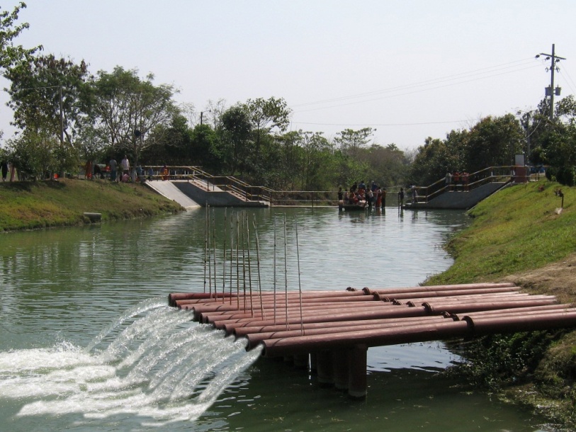
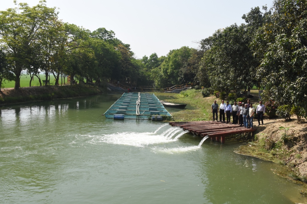
The technology promotes the lifting of river water by pump sets and conveys the water through buried pipelines to a canal. The conserved canal water is used for irrigation delivered by low lift pumps (LLP). Because water is held in the canal it revitalises the ecosystem along its length. Furthermore, using river water for irrigation avoids dangers associated with groundwater depletion.
2.2 Detailed description of the Technology
Description:
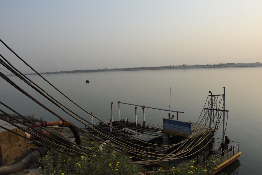
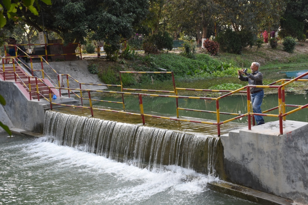
The project is sited at Sharmongla under Godagari Upazilla of Rajshahi district. The Sharmongla canal is located about 3.5 km away from the Padma river. Its total length is 29.0 km. Under this technology, water is lifted from the Padma river by pumps set on a pontoon. The lifted water is then discharged to a canal through underground pipelines. The water so discharged is lifted to the crop fields (delivery points) for irrigation. The elevation difference between the delivery points and the sourcing river is about 21 m. There are numbers of submerged weirs/dams constructed across the canal at different locations for conserving water: the water then helps regenerate the ecosystem along its banks and enriches the habitat.
Pontoon at a glance:
•Year of construction: 2004
•No. of centrifugal pumps at pontoon: 12
•Pump capacity: 50 m lifting height.
•Power of each pump: 60 HP
•Capacity of each pump: 2.5 cusec
•Total capacity of pump sets: 30 cusec
•Capacity of electric sub-station: 750 KW
•No. of discharge pipelines: 12
Sharmongla canal at a glance:
•Length of the canal: 29 km
•Average width of the canal: 15 m
•Average depth from ground level: 5 m
•No. of submerged weirs and dams within the canal: 14
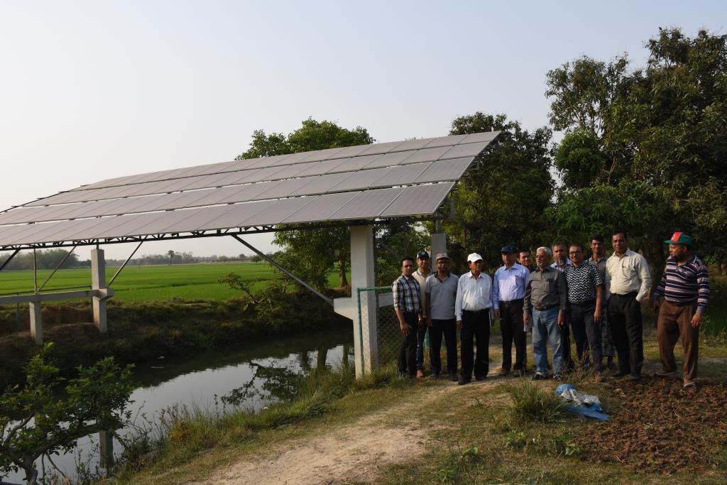
•No. of LLP (low lift pump): 27 electrified and 6 solar pumps
•Total irrigated area: 1850 ha
•Benefiting farmers: 5330
•Harvest yield of rice per year: 20,500 metric tonnes (approx.)
•Afforestation on the canal bank: 65,500 trees
Purposes/objectives of the technology:
•The main purpose of the said technology is to provide water for irrigation. This prevents abstracting of groundwater, which has adverse effects on the environment: therefore this system is environment friendly.
• Enhancing groundwater recharge thereby supports ecosystem function.
•The storing of river water in irrigation canals supports the enrichment of the habitat.
Approach for implementing the technology:
There was no irrigation facility for crop production in this drought-prone area. Government officials came to the locality, discussed with the local community, elites, as well as the farmers. Finally, the local community was convinced about the technology. Then the irrigation system could be implemented in the area. On seeing the success of the technology, the same has been replicated on approx. 9400 ha. in Barind area, benefitting approx. 32,200 farmers.
Maintenance of the technology:
In case of problems, the respective mechanic of that area informs the Assistant Engineer through the Sub-Assistant Engineer. Thus the problem is solved by their own initiative. It is also monitored by the Executive Engineer of the respective District, and finally by the Executive Director from the headquarters if needed.
Crop cultivation:
Due to the application of the technology, previously fallow land has come under cultivation/irrigation facilities, mono-cropped land has been converted into multi-cropped land. Different crops, like rice, wheat, maize, mustard, pulses, potato, tomato, spices and other vegetables are cultivated.
Farmers’ acceptance:
The technology has been well accepted by the farmers, as uncultivated land has been brought under cultivation and different crops are now being cultivated year-round.
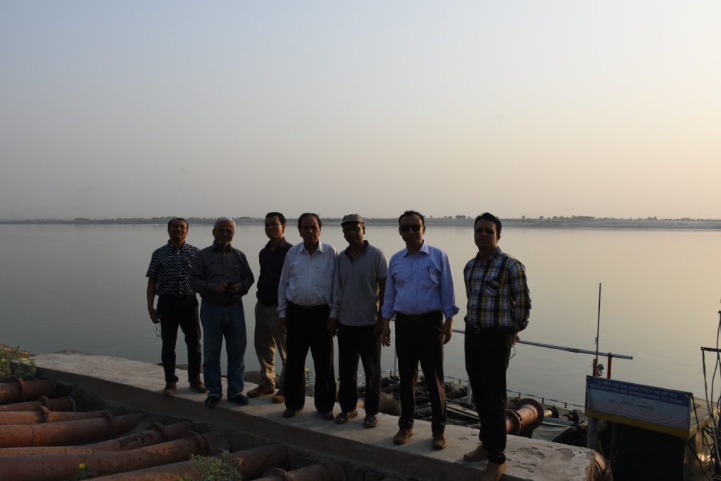
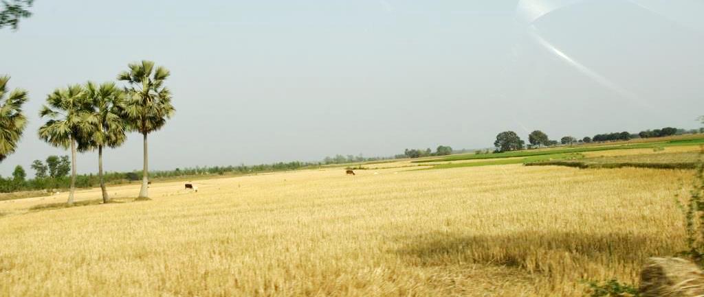
2.3 Photos of the Technology
Media Gallery
2.4 Videos of the Technology
Date:
25/03/2019
2.5 Country/ region/ locations where the Technology has been applied and which are covered by this assessment
Country:
Bangladesh
Specify the spread of the Technology:
- applied at specific points/ concentrated on a small area
Is/are the technology site(s) located in a permanently protected area?
No
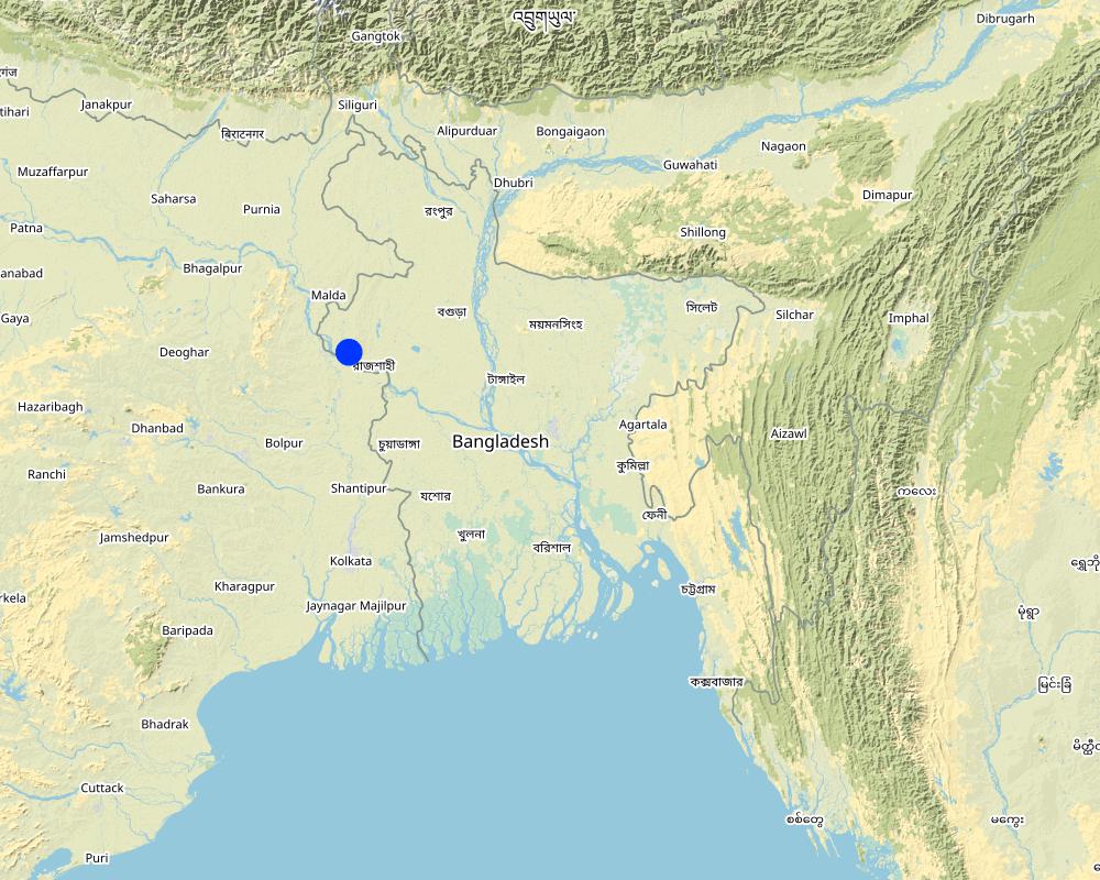
Map
×2.6 Date of implementation
If precise year is not known, indicate approximate date:
- 10-50 years ago
2.7 Introduction of the Technology
Specify how the Technology was introduced:
- through projects/ external interventions
Comments (type of project, etc.):
The following project were providing the irrigation facilities in Barind region:
i) SEMP - Sustainable Environment Mgt. Project
ii) RWCP - Rain Water Conservation Project
iii) EIBA – Extension of Irrigation in Barind area through conservation water in canal
3. Classification of the SLM Technology
3.1 Main purpose(s) of the Technology
- improve production
- reduce, prevent, restore land degradation
- conserve ecosystem
- preserve/ improve biodiversity
- create beneficial economic impact
3.2 Current land use type(s) where the Technology is applied
Land use mixed within the same land unit:
Yes
Specify mixed land use (crops/ grazing/ trees):
- Agroforestry

Cropland
- Annual cropping
- Tree and shrub cropping
- Irrigated rice (Paddy
Tree and shrub cropping - Specify crops:
- mango, mangosteen, guava
Number of growing seasons per year:
- 3
Specify:
Rabi-Pre-Kharif- Kharif
Is intercropping practiced?
Yes
If yes, specify which crops are intercropped:
Mango with rice,
Is crop rotation practiced?
Yes
If yes, specify:
Major crop rotation is Boro (winter rice) - Transplanted Aman, Minor crop rotations are Potato-Boro- Tasplanted Aman, Rabi crops (mainly vegetables)- Boro- Transplanted Aman
3.3 Has land use changed due to the implementation of the Technology?
Has land use changed due to the implementation of the Technology?
- Yes (Please fill out the questions below with regard to the land use before implementation of the Technology)
Land use mixed within the same land unit:
Yes
Specify mixed land use (crops/ grazing/ trees):
- Agroforestry
Cropland
- Annual cropping
- Tree and shrub cropping
Is intercropping practiced?
Yes
If yes, specify which crops are intercropped:
Mango and rice
Is crop rotation practiced?
No
3.4 Water supply
Water supply for the land on which the Technology is applied:
- mixed rainfed-irrigated
3.5 SLM group to which the Technology belongs
- agroforestry
- irrigation management (incl. water supply, drainage)
- surface water management (spring, river, lakes, sea)
3.6 SLM measures comprising the Technology

structural measures
- S3: Graded ditches, channels, waterways
- S5: Dams, pans, ponds
- S7: Water harvesting/ supply/ irrigation equipment
- S10: Energy saving measures

management measures
- M2: Change of management/ intensity level
- M3: Layout according to natural and human environment
Comments:
There are two stages of harvesting water.
1 - from river water, which is not going directly to the field
2- water reserved in canals and supplied to the field
Para S10 - refers to saving conventional electricity by using solar power for distribution of water to fields
3.7 Main types of land degradation addressed by the Technology

water degradation
- Ha: aridification
- Hq: decline of groundwater quality
Comments:
Barind was driest part of Bangladesh. It was enhanced when groundwater abstraction increased to support cropping by irrigation. The reduction of the groundwater table enhanced the dry out of dug wells, which supported domestic consumption. Hence, aridification was prominent in the area. It is reported that after the application of this technology, there are indications of recharging of the groundwater. Due to the increase in vegetation, the local temperature tends to be cooler than before.
3.8 Prevention, reduction, or restoration of land degradation
Specify the goal of the Technology with regard to land degradation:
- prevent land degradation
- reduce land degradation
Comments:
This technology helps reducing land degradation through using river water rather than groundwater for irrigation, thereby
preventing land degradation through increasing the vegetation cover on land.
4. Technical specifications, implementation activities, inputs, and costs
4.1 Technical drawing of the Technology

Technical specifications (related to technical drawing):
1. Pontoon: Length 55 ft, Width: 25 ft, Height: 4.50 ft
2. Centrifugal pump (12 nos)—each pump 60 HP,capacity-2.5 cusec, pump head: 50m
3. Electric power station capacity: 750 KW
4. Underground water distribution line (12 nos): Length of each line is 3.50 km
5. Length of water storage canal (Sharmangla canal): 29.0 km (average width 15.0 m and depth 5.0 m)
6. Nos of submerged weir/dam to reserve water in the canal: 14 nos
7. Nos of LLP (electrified) to lift water from the canal to crop field through buried pipeline : 27 nos
8. Nos of solar pump to lift water from the canal to crop field through buried pipeline: 06 nos
9. Nos of Prepaid meter for collecting irrigation charges (Revenue): 33 nos
10. Irrigated area: 1850 ha
11. Construction materials:
-Pontoon: A kind of platform that float on water made of Mild steel sheet, Stainless steel etc.
- Power station: Transformer, electric pole, wire etc.
- Distribution line: mild steel and PVC pipe
- Dam/Submerged weir: steel bar, cement, sand, brick, stone etc.
Author:
Sayed Zillul Bari
Date:
25/03/2019
4.2 General information regarding the calculation of inputs and costs
Specify how costs and inputs were calculated:
- per Technology unit
Specify unit:
1 Pontoon, Pumps, Pipes, weir construction etc
Specify dimensions of unit (if relevant):
Pontoon (Length 55 ft, Width: 25 ft, Height: 4.50 ft) is a platform build on iron sheets, that can float on river, where pumps were set. The pipes for water delivery were of PVC. Water canal in this case compiler referred to canals of Barind which were ephemeral. Now water reserve for year round use.Piping system includes PVC pipe to convey water to the field, where a valve was set to control water disposal. There is a pipe of 12 inch dia to maintain water head through out the system.
other/ national currency (specify):
BDT
If relevant, indicate exchange rate from USD to local currency (e.g. 1 USD = 79.9 Brazilian Real): 1 USD =:
85.0
Indicate average wage cost of hired labour per day:
800 BDT
4.3 Establishment activities
| Activity | Timing (season) | |
|---|---|---|
| 1. | Pontoon construction and installation on the river | 60 days |
| 2. | Pumps installation on the pontoon | 30 days |
| 3. | Construction of underground water distribution line | 70 days |
| 4. | Re-excavation of derelict canal | 120 days |
| 5. | Construction of submerged weir / dam | 180 days |
| 6. | LLP installation at the canal bank (27 nos) | 150 days |
| 7. | Solar pump installation (06 nos) | 45 days |
| 8. | Pre-paid meter installation at pump sites to collect irrigation charges (33 nos) | 30 days |
| 9. | Buried pipe line construction for irrigation at crop land sites | 120 days |
4.4 Costs and inputs needed for establishment
| Specify input | Unit | Quantity | Costs per Unit | Total costs per input | % of costs borne by land users | |
|---|---|---|---|---|---|---|
| Construction material | Pontoon construction and installation on the river | 1 | 1.0 | 5000000.0 | 5000000.0 | |
| Construction material | Construction of underground water distribution line | 1 | 1.0 | 27800000.0 | 27800000.0 | |
| Construction material | Construction of submerged weir / dam | 1 | 14.0 | 1600000.0 | 22400000.0 | |
| Construction material | Re-excavation of derelict canal | 1 | 1.0 | 29000000.0 | 29000000.0 | |
| Other | Pre-paid meter installation at pump sites to collect irrigation charges | 1 | 33.0 | 243000.0 | 8019000.0 | |
| Other | Solar pump installation | 1 | 6.0 | 2000000.0 | 12000000.0 | |
| Other | LLP installation at the canal bank (27 nos) | 1 | 8.0 | 2700000.0 | 21600000.0 | |
| Other | Pumps installation on the pontoon | 1 | 12.0 | 1833000.0 | 21996000.0 | |
| Other | Buried pipe line construction for irrigation at crop land sites | 1 | 1.0 | 23100000.0 | 23100000.0 | |
| Total costs for establishment of the Technology | 170915000.0 | |||||
| Total costs for establishment of the Technology in USD | 2010764.71 | |||||
If you are unable to break down the costs in the table above, give an estimation of the total costs of establishing the Technology:
1439.02
If land user bore less than 100% of costs, indicate who covered the remaining costs:
none
Comments:
Labor costs etc all included in construction, pipeline installation etc.
4.5 Maintenance/ recurrent activities
| Activity | Timing/ frequency | |
|---|---|---|
| 1. | Pontoon repair and maintenance | 1/5years |
| 2. | Pump repair and maintenance | As per requirement, 1/yr |
| 3. | Distribution line maintenance | As per requirement, 1/yr |
| 4. | Power station repair and maintenance | As per requirement, 1/yr |
| 5. | Submerged weir / dam repair and maintenance | 1/5yrs |
| 6. | LLP repair and maintenance | 2/yr or as and when necessary |
| 7. | Buried pipe line repair and maintenance | 1/6yrs, as and when necessary |
| 8. | Prepaid meter repair | 2-3/yr |
4.6 Costs and inputs needed for maintenance/ recurrent activities (per year)
| Specify input | Unit | Quantity | Costs per Unit | Total costs per input | % of costs borne by land users | |
|---|---|---|---|---|---|---|
| Equipment | Prepaid meter repair | 1 | 0.2 | 100000.0 | 20000.0 | |
| Construction material | Buried pipe line repair and maintenance | 1 | 1.0 | 0.05 | 0.05 | |
| Other | Pontoon repair and maintenance | 1 | 1.0 | 500000.0 | 500000.0 | |
| Other | Pump repair and maintenance (each) | 1 | 1.0 | 20000.0 | 20000.0 | |
| Other | Distribution line maintenance | 1 | 1.0 | 75000.0 | 75000.0 | |
| Other | Power station repair and maintenance | 1 | 1.0 | 50000.0 | 50000.0 | |
| Other | Submerged weir / dam repair and maintenance (each) | 1 | 1.0 | 200000.0 | 200000.0 | |
| Other | LLP repair and maintenance (each) | 1 | 1.0 | 50000.0 | 50000.0 | |
| Total costs for maintenance of the Technology | 915000.05 | |||||
| Total costs for maintenance of the Technology in USD | 10764.71 | |||||
If you are unable to break down the costs in the table above, give an estimation of the total costs of maintaining the Technology:
11.0
If land user bore less than 100% of costs, indicate who covered the remaining costs:
Land users share their participation in kinds and allowing installation of pipelines and other infrastructure
Comments:
Land users were trained and they provided land for infrastructures. For example space for outlets and underground pipe installation. Practically they did not contribute any cash.
4.7 Most important factors affecting the costs
Describe the most determinate factors affecting the costs:
Pontoon construction, power supply and lining of the underground piping system.
5. Natural and human environment
5.1 Climate
Annual rainfall
- < 250 mm
- 251-500 mm
- 501-750 mm
- 751-1,000 mm
- 1,001-1,500 mm
- 1,501-2,000 mm
- 2,001-3,000 mm
- 3,001-4,000 mm
- > 4,000 mm
Specify average annual rainfall (if known), in mm:
1600.00
Specifications/ comments on rainfall:
Most of the rainfall events happen during May to October
Indicate the name of the reference meteorological station considered:
Agroecological region 26
Agro-climatic zone
- sub-humid
5.2 Topography
Slopes on average:
- flat (0-2%)
- gentle (3-5%)
- moderate (6-10%)
- rolling (11-15%)
- hilly (16-30%)
- steep (31-60%)
- very steep (>60%)
Landforms:
- plateau/plains
- ridges
- mountain slopes
- hill slopes
- footslopes
- valley floors
Altitudinal zone:
- 0-100 m a.s.l.
- 101-500 m a.s.l.
- 501-1,000 m a.s.l.
- 1,001-1,500 m a.s.l.
- 1,501-2,000 m a.s.l.
- 2,001-2,500 m a.s.l.
- 2,501-3,000 m a.s.l.
- 3,001-4,000 m a.s.l.
- > 4,000 m a.s.l.
Indicate if the Technology is specifically applied in:
- not relevant
5.3 Soils
Soil depth on average:
- very shallow (0-20 cm)
- shallow (21-50 cm)
- moderately deep (51-80 cm)
- deep (81-120 cm)
- very deep (> 120 cm)
Soil texture (topsoil):
- medium (loamy, silty)
Soil texture (> 20 cm below surface):
- fine/ heavy (clay)
Topsoil organic matter:
- low (<1%)
If available, attach full soil description or specify the available information, e.g. soil type, soil PH/ acidity, Cation Exchange Capacity, nitrogen, salinity etc.
High Barind tract, mainly dissected (Closely & Broadly) terrace, soil pH is acidic, low in Nitrogen content, low CEC
5.4 Water availability and quality
Ground water table:
5-50 m
Availability of surface water:
poor/ none
Water quality (untreated):
good drinking water
Water quality refers to:
both ground and surface water
Is water salinity a problem?
No
Is flooding of the area occurring?
No
Comments and further specifications on water quality and quantity:
Area is above flood level
5.5 Biodiversity
Species diversity:
- low
Habitat diversity:
- low
5.6 Characteristics of land users applying the Technology
Sedentary or nomadic:
- Sedentary
Market orientation of production system:
- mixed (subsistence/ commercial)
Off-farm income:
- 10-50% of all income
Relative level of wealth:
- average
Individuals or groups:
- individual/ household
Level of mechanization:
- manual work
- mechanized/ motorized
Gender:
- women
- men
Age of land users:
- youth
- middle-aged
- elderly
5.7 Average area of land used by land users applying the Technology
- < 0.5 ha
- 0.5-1 ha
- 1-2 ha
- 2-5 ha
- 5-15 ha
- 15-50 ha
- 50-100 ha
- 100-500 ha
- 500-1,000 ha
- 1,000-10,000 ha
- > 10,000 ha
Is this considered small-, medium- or large-scale (referring to local context)?
- large-scale
Comments:
Yes. The farmers of Barind are of wide range. The large farmers are basically absentee. Medium range farmers engage themselves in their land and in addition they rent land from large farmers. So there is complex ownership.
This was from field feedback.
5.8 Land ownership, land use rights, and water use rights
Land ownership:
- individual, titled
Land use rights:
- leased
- individual
Water use rights:
- open access (unorganized)
- leased
Are land use rights based on a traditional legal system?
Yes
5.9 Access to services and infrastructure
health:
- poor
- moderate
- good
education:
- poor
- moderate
- good
technical assistance:
- poor
- moderate
- good
employment (e.g. off-farm):
- poor
- moderate
- good
markets:
- poor
- moderate
- good
energy:
- poor
- moderate
- good
roads and transport:
- poor
- moderate
- good
drinking water and sanitation:
- poor
- moderate
- good
financial services:
- poor
- moderate
- good
6. Impacts and concluding statements
6.1 On-site impacts the Technology has shown
Socio-economic impacts
Production
crop production
crop quality
fodder production
fodder quality
animal production
risk of production failure
product diversity
production area
land management
Water availability and quality
drinking water availability
drinking water quality
water availability for livestock
water quality for livestock
irrigation water availability
irrigation water quality
demand for irrigation water
Comments/ specify:
At present land users are used to grow high water demanding crops. For example Boro paddy and potato both crops require large volume of water and the irrigated area slowly increasing, that situation demand of irrigation water increasing.
Income and costs
expenses on agricultural inputs
Comments/ specify:
The supply of agricultural inputs increased and channelized through deploying dealers etc. Hence expenses relatively decreased
farm income
diversity of income sources
economic disparities
Comments/ specify:
Basically in this area could be grouped in to two. One group has almost no land and previously they have to migrate beyond barind area as labor and they were poor. At present they have job (agri-labor or otherwise) in their area and become more solvent then past 90's. On other hand the second group cultivate the land of their own or leased, which they could not in 90's. They also in handicap because of poor crop and no option to cultivate in two seasons. Hence apparently both groups as of their status are in well shape. The peoples those who have no land for cultivation now can engage them in many other entrepreneurship (e.g. farm product marketing, livestock/poultry raring, carpentering, grocery, etc etc) emerged.
workload
Socio-cultural impacts
food security/ self-sufficiency
health situation
land use/ water rights
cultural opportunities
recreational opportunities
community institutions
national institutions
Comments/ specify:
Along with the Barind Multipurpose Development Authority (BMDA) other national institutions like Department of Agricultural Extension, Livestock, Fisheries, Bangladesh Rural Development Board (BRDB), Financial institutions- Rajshahi Agricultural Development Bank and others (NGO) are operating more effectively in the Barind in multiple dimensions. In addition students from Rajshahi University also engaged in their research on various issues. BMDA also improving its capacity and skill to develop more effective approach for Barind area.
SLM/ land degradation knowledge
conflict mitigation
Ecological impacts
Water cycle/ runoff
water quantity
water quality
harvesting/ collection of water
surface runoff
Comments/ specify:
This comment was done comparing between conveying water by open drainage and through pipeline. Definitely there are almost no run-off from pipe line distribution. On the hand land users have to confirm their field bunds to protect run-off. Prepaid metering system also restricted land users not to allow excess water to over flow from their field. In-spite of that there may be small amount run-off, but the detachment of top soils is within tolerable limit and accumulate within field bunds.
excess water drainage
groundwater table/ aquifer
Comments/ specify:
It is reported that ground water slowly recharged, As a results shallow tube wells are also working , which were about to abandoned before.
evaporation
Comments/ specify:
Vegetation coverage increased,
Soil
soil cover
Comments/ specify:
Increased land cover-Reduced drought
soil loss
Comments/ specify:
In 90's the lands were bare and in monsoon after heavy downpour a large amount of water going to downstream as run-off with detached top soil. At present land is covered, field bunds are strengthen, restrict run-off as a result soil loss decreased.
soil accumulation
Comments/ specify:
Field bunds enhance soil accumulation by limiting run-off water by field bunds/dykes.
soil compaction
Comments/ specify:
Mechanized cultivation and usage of farm machinery however enhance soil compaction.
Climate and disaster risk reduction
flood impacts
Comments/ specify:
The area is above flood level
drought impacts
emission of carbon and greenhouse gases
Comments/ specify:
Emission of carbon decreased as vegetation cover round the year increased.
micro-climate
Comments/ specify:
Reduced dusty wind, temperature cooler then before.
Other ecological impacts
The Barind was almost desert like before 90's. Its natural vegetation were almost extinct. Biodiversity both Species and habitat were low. At present it is improving spectacularly.
Specify assessment of on-site impacts (measurements):
In all a desert like Barind tract become green now.
6.2 Off-site impacts the Technology has shown
water availability
Comments/ specify:
Usage of surface water reduces groundwater abstraction and improves groundwater (GW) recharge
groundwater/ river pollution
Comments/ specify:
As the land cover has increased, that has a substantial impact on limiting polluted surface water to flow up to river.
6.3 Exposure and sensitivity of the Technology to gradual climate change and climate-related extremes/ disasters (as perceived by land users)
Gradual climate change
Gradual climate change
| Season | increase or decrease | How does the Technology cope with it? | |
|---|---|---|---|
| annual temperature | decrease | very well | |
| seasonal temperature | summer | decrease | very well |
| annual rainfall | increase | well | |
| seasonal rainfall | summer | increase | not known |
6.4 Cost-benefit analysis
How do the benefits compare with the establishment costs (from land users’ perspective)?
Short-term returns:
slightly negative
Long-term returns:
very positive
How do the benefits compare with the maintenance/ recurrent costs (from land users' perspective)?
Short-term returns:
negative
Long-term returns:
positive
6.5 Adoption of the Technology
- > 50%
If available, quantify (no. of households and/ or area covered):
It could rather to explain as the beneficiaries of the technology. Truly a single land user or a group of land user will not able to install this type of system for multiple reasons. There are two components of this technology, one is the government institution who provided the scope of using surface water for irrigation and the second one are the land user who use the scope or facilities of irrigation system Here about 1800 farmers are involved to use surface water as their irrigation source.
Of all those who have adopted the Technology, how many did so spontaneously, i.e. without receiving any material incentives/ payments?
- 91-100%
Comments:
Most of the farmers of the area who has land adopted surface water for irrigation instead of ground water abstraction.
6.6 Adaptation
Has the Technology been modified recently to adapt to changing conditions?
Yes
If yes, indicate to which changing conditions it was adapted:
- labour availability (e.g. due to migration)
Specify adaptation of the Technology (design, material/ species, etc.):
where there are no canal for water storage , local ponds are used to reserve the surface water to irrigate land surrounding the pods and obviously where river water could not be reached.
6.7 Strengths/ advantages/ opportunities of the Technology
| Strengths/ advantages/ opportunities in the land user’s view |
|---|
| Ensured crop production through irrigation |
| Reduced ground water irrigation and decrease ground water depletion. |
| Increased work facility at project area |
| Strengths/ advantages/ opportunities in the compiler’s or other key resource person’s view |
|---|
| Improved socio-economic condition of beneficiaries |
| Increased ground water recharge |
| Increased fish cultivation and duck farming at the canal |
6.8 Weaknesses/ disadvantages/ risks of the Technology and ways of overcoming them
| Weaknesses/ disadvantages/ risks in the land user’s view | How can they be overcome? |
|---|---|
| Scope of individual level implementation is very limited | Community approach will facilitate the SLM implementation etc. |
| Maintenance, distribution and regulation of water etc have no control of the beneficiaries | Capacity of the beneficiaries to be developed |
| Weaknesses/ disadvantages/ risks in the compiler’s or other key resource person’s view | How can they be overcome? |
|---|---|
| Source of lifting water points may be shifted in the long run | Efficiencies of irrigation water supply need more attention with demand and supply. |
| Weak linkage with beneficiaries | Integrated approach needed to include community and implementing agencies. |
| Crops with high water demand may not sustain in the long run | Appropriate crop and cropping patterns are to be adopted with crop zoning |
| Increasing cropping intensity leads to deficiency of soil nutrients | Monitoring of soil health essential for this region. |
7. References and links
7.1 Methods/ sources of information
- field visits, field surveys
Three times with experts of this area
- interviews with land users
20
- interviews with SLM specialists/ experts
10
- compilation from reports and other existing documentation
Consulted relevant project documents
When were the data compiled (in the field)?
25/03/2019
Comments:
A long process was maintained from building capacity of the professionals to handle WOCAT tools, initial inventory with core experts and screening with local professionals, documentation in field and compiling data in the WOCAT format, which was again validated with large local groups of scientists, extension officials, local government, NGO, lead farmers etc.
7.2 References to available publications
Title, author, year, ISBN:
Project documents
Available from where? Costs?
Available in BMDA
7.3 Links to relevant online information
Title/ description:
Questionnaires on Tecnologies (QT)
URL:
www.wocat.net
Title/ description:
Sustainable land management (SLM)
URL:
https://knowledge.unccd.int/topics/sustainable-land-management-slm
Title/ description:
Achieving Land Degradation Neutrality at the country level
URL:
https://knowledge.unccd.int/topics/land-degradation-neutrality
7.4 General comments
Excellent
Links and modules
Expand all Collapse allLinks
No links
Modules
No modules