Mainstreaming river water to facilitate irrigation in Barind [ບັງລາເດດ]
- ການສ້າງ:
- ປັບປູງ:
- ຜູ້ສັງລວມຂໍ້ມູນ: Jalal Uddin Md. Shoaib
- ບັນນາທິການ: –
- ຜູ້ທົບທວນຄືນ: Udo Höggel, William Critchley, Rima Mekdaschi Studer
Sharmongla Sech Prokolpo.
technologies_5171 - ບັງລາເດດ
ເບິ່ງພາກສ່ວນ
ຂະຫຍາຍທັງໝົດ ຍຸບທັງໝົດ1. ຂໍ້ມູນທົ່ວໄປ
1.2 ຂໍ້ມູນ ການຕິດຕໍ່ພົວພັນ ຂອງບຸກຄົນທີ່ສໍາຄັນ ແລະ ສະຖາບັນ ທີ່ມີສ່ວນຮ່ວມ ໃນການປະເມີນເອກກະສານ ເຕັກໂນໂລຢີ
ຜຸ້ຊ່ຽວຊານ ດ້ານການຄຸ້ມຄອງ ທີ່ດິນແບບຍືນຍົງ:
ຜຸ້ຊ່ຽວຊານ ດ້ານການຄຸ້ມຄອງ ທີ່ດິນແບບຍືນຍົງ:
ຜຸ້ຊ່ຽວຊານ ດ້ານການຄຸ້ມຄອງ ທີ່ດິນແບບຍືນຍົງ:
ຊື່ໂຄງການ ທີ່ອໍານວຍຄວາມສະດວກ ໃນການສ້າງເອກກະສານ/ປະເມີນ ເຕັກໂນໂລຢີ (ຖ້າກ່ຽວຂ້ອງ)
Establishing National Land Use and Land Degradation Profile toward Mainstreaming SLM Practices in Sector Policies (ENALULDEP/SLM)ຊື່ສະຖາບັນ (ຫຼາຍສະຖາບັນ) ທີ່ອໍານວຍຄວາມສະດວກ ໃນການສ້າງເອກກະສານ / ປະເມີນ ເຕັກໂນໂລຢີ (ຖ້າກ່ຽວຂ້ອງ)
Department of Environment (DoE) - ບັງລາເດດ1.3 ເງື່ອນໄຂ ກ່ຽວກັບ ການນໍາໃຊ້ຂໍ້ມູນເອກະສານ ທີ່ສ້າງຂື້ນ ໂດຍຜ່ານ ອົງການພາບລວມຂອງໂລກ ທາງດ້ານແນວທາງ ແລະ ເຕັກໂນໂລຢີ ຂອງການອານຸລັກ ທໍາມະຊາດ (WOCAT)
ຜູ້ປ້ອນຂໍ້ມູນ ແລະ ບຸກຄົນສຳຄັນ ທີ່ໃຫ້ຂໍ້ມູນ (ຫຼາຍ) ຍິນຍອມ ຕາມເງື່ອນໄຂ ໃນການນຳໃຊ້ຂໍ້ມູນ ເພື່ອສ້າງເປັນເອກກະສານຂອງ WOCAT:
ແມ່ນ
1.4 ແຈ້ງການວ່າ ດ້ວຍຄວາມຍືນຍົງຂອງ ເຕັກໂນໂລຢີ
ການນໍາໃຊ້ ເຕັກໂນໂລຢີ ດັ່ງກ່າວໄດ້ອະທິບາຍ ເຖິງບັນຫາ ກ່ຽວກັບ ການເຊື່ອມໂຊມຂອງດິນບໍ? ຖ້າບໍ່ດັ່ງນັ້ນ ມັນບໍ່ສາມາດ ຢັ້ງຢືນໄດ້ວ່າ ເປັນເຕັກໂນໂລຊີ ໃນການຄຸ້ມຄອງ ທີ່ດິນແບບຍືນຍົງ? :
ບໍ່ແມ່ນ
2. ການອະທິບາຍ ເຕັກໂນໂລຢີ ຂອງການຄຸ້ມຄອງ ທີ່ດິນແບບຍືນຍົງ
2.1 ຄໍາອະທິບາຍສັ້ນຂອງ ເຕັກໂນໂລຢີ
ການກຳໜົດຄວາມໝາຍ ຂອງເຕັກໂນໂລຢີ:
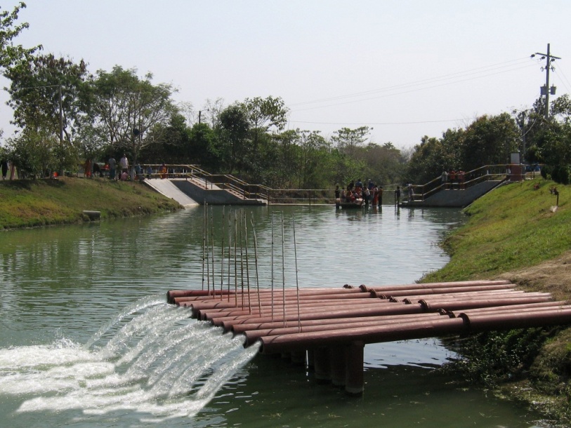
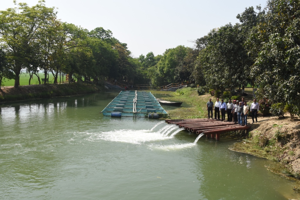
The technology promotes the lifting of river water by pump sets and conveys the water through buried pipelines to a canal. The conserved canal water is used for irrigation delivered by low lift pumps (LLP). Because water is held in the canal it revitalises the ecosystem along its length. Furthermore, using river water for irrigation avoids dangers associated with groundwater depletion.
2.2 ການອະທິບາຍ ລາຍລະອຽດ ຂອງເຕັກໂນໂລຢີ
ການພັນລະນາ:
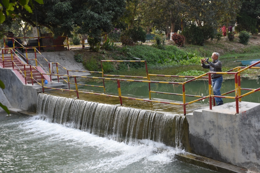
The project is sited at Sharmongla under Godagari Upazilla of Rajshahi district. The Sharmongla canal is located about 3.5 km away from the Padma river. Its total length is 29.0 km. Under this technology, water is lifted from the Padma river by pumps set on a pontoon. The lifted water is then discharged to a canal through underground pipelines. The water so discharged is lifted to the crop fields (delivery points) for irrigation. The elevation difference between the delivery points and the sourcing river is about 21 m. There are numbers of submerged weirs/dams constructed across the canal at different locations for conserving water: the water then helps regenerate the ecosystem along its banks and enriches the habitat.
Pontoon at a glance:
•Year of construction: 2004
•No. of centrifugal pumps at pontoon: 12
•Pump capacity: 50 m lifting height.
•Power of each pump: 60 HP
•Capacity of each pump: 2.5 cusec
•Total capacity of pump sets: 30 cusec
•Capacity of electric sub-station: 750 KW
•No. of discharge pipelines: 12
Sharmongla canal at a glance:
•Length of the canal: 29 km
•Average width of the canal: 15 m
•Average depth from ground level: 5 m
•No. of submerged weirs and dams within the canal: 14
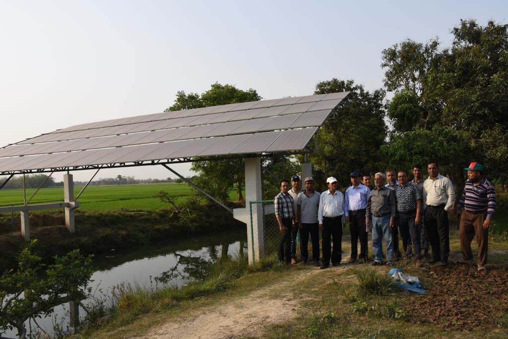
•No. of LLP (low lift pump): 27 electrified and 6 solar pumps
•Total irrigated area: 1850 ha
•Benefiting farmers: 5330
•Harvest yield of rice per year: 20,500 metric tonnes (approx.)
•Afforestation on the canal bank: 65,500 trees
Purposes/objectives of the technology:
•The main purpose of the said technology is to provide water for irrigation. This prevents abstracting of groundwater, which has adverse effects on the environment: therefore this system is environment friendly.
• Enhancing groundwater recharge thereby supports ecosystem function.
•The storing of river water in irrigation canals supports the enrichment of the habitat.
Approach for implementing the technology:
There was no irrigation facility for crop production in this drought-prone area. Government officials came to the locality, discussed with the local community, elites, as well as the farmers. Finally, the local community was convinced about the technology. Then the irrigation system could be implemented in the area. On seeing the success of the technology, the same has been replicated on approx. 9400 ha. in Barind area, benefitting approx. 32,200 farmers.
Maintenance of the technology:
In case of problems, the respective mechanic of that area informs the Assistant Engineer through the Sub-Assistant Engineer. Thus the problem is solved by their own initiative. It is also monitored by the Executive Engineer of the respective District, and finally by the Executive Director from the headquarters if needed.
Crop cultivation:
Due to the application of the technology, previously fallow land has come under cultivation/irrigation facilities, mono-cropped land has been converted into multi-cropped land. Different crops, like rice, wheat, maize, mustard, pulses, potato, tomato, spices and other vegetables are cultivated.
Farmers’ acceptance:
The technology has been well accepted by the farmers, as uncultivated land has been brought under cultivation and different crops are now being cultivated year-round.
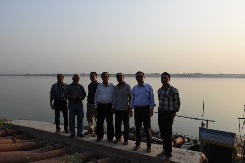
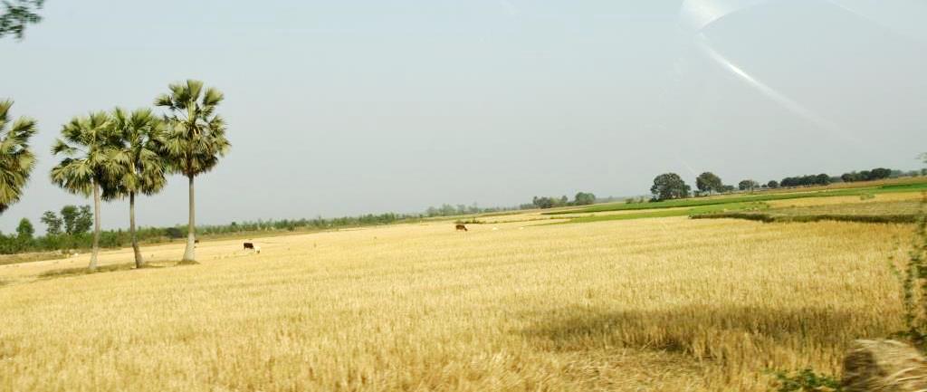
2.3 ຮູບພາບຂອງເຕັກໂນໂລຢີ
ສື່ຮູບພາບ
2.4 ວິດີໂອ ເຕັກໂນໂລຢີ
ວັນທີ:
25/03/2019
2.5 ປະເທດ / ເຂດ / ສະຖານທີ່ບ່ອນທີ່ ເຕັກໂນໂລຢີ ໄດ້ຮັບການນໍາໃຊ້ ແລະ ທີ່ຖືກປົກຄຸມດ້ວຍການປະເມີນຜົນ
ປະເທດ:
ບັງລາເດດ
ໃຫ້ລະບຸ ການແຜ່ຂະຫຍາຍ ເຕັກໂນໂລຢີ:
- ນໍາໃຊ້ໃນຈຸດສະເພາະ / ແນໃສ່ນໍາໃຊ້ໃນພື້ນທີ່ຂະໜາດນ້ອຍ
ສ່ວນຫຼາຍສະຖານທີ່ຕັ້ງຂອງເຕັກໂນໂລຢີ ແມ່ນ ຢູ່ໃນເຂດພື້ນທີ່ສະຫງວນບໍ?
ບໍ່ແມ່ນ
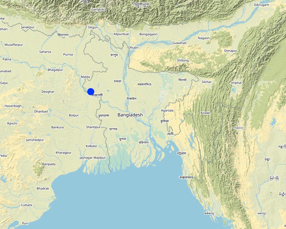
Map
×2.6 ວັນທີໃນການຈັດຕັ້ງປະຕິບັດ
ຖ້າຫາກວ່າ ບໍ່ຮູ້ຈັກ ປີທີ່ຊັດເຈນ ແມ່ນໃຫ້ປະມານ ວັນທີເອົາ:
- 10-50 ປີ ຜ່ານມາ
2.7 ການນໍາສະເໜີ ເຕັກໂນໂລຢີ
ໃຫ້ລະບຸ ເຕັກໂນໂລຢີ ໄດ້ຖືກຈັດຕັ້ງປະຕິບັດຄືແນວໃດ?
- ໂດຍຜ່ານໂຄງການ / ການຊ່ວຍເຫຼືອຈາກພາຍນອກ
ຄວາມຄິດເຫັນ (ປະເພດ ໂຄງການ ແລະ ອື່ນໆ):
The following project were providing the irrigation facilities in Barind region:
i) SEMP - Sustainable Environment Mgt. Project
ii) RWCP - Rain Water Conservation Project
iii) EIBA – Extension of Irrigation in Barind area through conservation water in canal
3. ການໃຈ້ແຍກ ເຕັກໂນໂລຢີ ໃນການຄຸ້ມຄອງ ດິນແບບຍືນຍົງ
3.1 ຈຸດປະສົງຫຼັກ (ຫຼາຍ) ຂອງເຕັກໂນໂລຢີ
- ປັບປຸງ ການຜະລິດ
- ຫຼຸດຜ່ອນ, ປ້ອງກັນ, ຟື້ນຟູ ການເຊື່ອມໂຊມຂອງດິນ
- ການອະນຸລັກ ລະບົບນິເວດ
- ປົກປັກຮັກສາ / ການປັບປຸງຊີວະນາໆພັນ
- ສ້າງຜົນກະທົບ ທາງເສດຖະກິດ ທີ່ເປັນປະໂຫຍດ
3.2 ປະເພດການນໍາໃຊ້ທີ່ດິນ ໃນປະຈຸບັນ() ທີ່ເຕັກໂນໂລຢີ ໄດ້ຖືກນໍາໃຊ້
ການນຳໃຊ້ທີ່ດິນ ປະສົມພາຍໃນພື້ນທີ່ດຽວກັນ:
ແມ່ນ
ລະບຸການນຳໃຊ້ທີ່ດິນແບບປະສົມ (ຜົນລະປູກ / ທົ່ງຫຍ້າລ້ຽງສັດ / ຕົ້ນໄມ້):
- ກະສິກໍາ-ປ່າໄມ້ ແບບປະສົມປະສານ

ດິນທີ່ປູກພືດ
- ການປູກພືດປະຈໍາປີ
- ເປັນໄມ້ຢືນຕົ້ນ ແລະ ໄມ້ພຸ່ມ ຈາກການປູກພືດ
- Irrigated rice (Paddy
ການປູກພືດທີ່ເປັນຕົ້ນໄມ້ ແລະ ໄມ້ພຸ່ມ - ລະບຸປະເພດພືດ:
- ໝາກມ່ວງ, ໝາກມັງຄຸດ, ໝາກສີດາ
ຈໍານວນ ລະດູການ ປູກໃນປີໜຶ່ງ:
- 3
ລະບຸ ຊະນິດ:
Rabi-Pre-Kharif- Kharif
ມີການເຝືກປູກພືດແບບສັບຫວ່າງບໍ່?
ແມ່ນ
ຖ້າມີ, ໃຫ້ລະບຸວ່າປູກພືດຊະນິດໃດທີ່ປູກສັບຫວ່າງ:
Mango with rice,
ມີການເຝືກປູກພືດແບບໝູນວຽນບໍ່?
ແມ່ນ
ຖ້າແມ່ນ, ໃຫ້ລະບຸແຈ້ງ:
Major crop rotation is Boro (winter rice) - Transplanted Aman, Minor crop rotations are Potato-Boro- Tasplanted Aman, Rabi crops (mainly vegetables)- Boro- Transplanted Aman
3.3 ການນຳໃຊ້ທີ່ດິນ ມີການປ່ຽນແປງຍ້ອນການຈັດຕັ້ງທົດລອງເຕັກໂນໂລຢີ ແມ່ນບໍ່?
ການນຳໃຊ້ທີ່ດິນ ມີການປ່ຽນແປງຍ້ອນການຈັດຕັ້ງທົດລອງເຕັກໂນໂລຢີ ແມ່ນບໍ່?
- ແມ່ນ (ກະລຸນາຕື່ມໃສ່ ຄຳຖາມຂ້າງລຸ່ມນີ້ກ່ຽວກັບການນຳໃຊ້ທີ່ດິນ ກ່ອນການທົດລອງເຕັກໂນໂລຢີ)
ການນຳໃຊ້ທີ່ດິນ ປະສົມພາຍໃນພື້ນທີ່ດຽວກັນ:
ແມ່ນ
ລະບຸການນຳໃຊ້ທີ່ດິນແບບປະສົມ (ຜົນລະປູກ / ທົ່ງຫຍ້າລ້ຽງສັດ / ຕົ້ນໄມ້):
- ກະສິກໍາ-ປ່າໄມ້ ແບບປະສົມປະສານ
ດິນທີ່ປູກພືດ
- ການປູກພືດປະຈໍາປີ
- ເປັນໄມ້ຢືນຕົ້ນ ແລະ ໄມ້ພຸ່ມ ຈາກການປູກພືດ
ມີການເຝືກປູກພືດແບບສັບຫວ່າງບໍ່?
ແມ່ນ
ຖ້າມີ, ໃຫ້ລະບຸວ່າປູກພືດຊະນິດໃດທີ່ປູກສັບຫວ່າງ:
Mango and rice
ມີການເຝືກປູກພືດແບບໝູນວຽນບໍ່?
ບໍ່ແມ່ນ
3.4 ການສະໜອງນ້ຳ
ການສະໜອງນໍ້າ ໃນພື້ນທີ່ ທີ່ໄດ້ນໍາໃຊ້ ເຕັກໂນໂລຢີ:
- ປະສົມປະສານ ກັນລະຫວ່າງ ນໍ້າຝົນ ແລະ ນໍ້າຊົນລະປະທານ
3.5 ການນໍາໃຊ້ເຕັກໂນໂລຢີ ທີ່ຢູ່ໃນກຸ່ມການຄຸ້ມຄອງ ທີ່ດິນແບບຍືນຍົງ
- ກະສິກໍາ-ປ່າໄມ້ ແບບປະສົມປະສານ
- ການຄຸ້ມຄອງຊົນລະປະທານ (ການສະໜອງນໍ້າ, ລະບາຍ)
- ການຄຸ້ມຄອງນໍ້າໜ້າດິນ (ນ້ຳຈາກພຸ, ແມ່ນໍ້າ, ທະເລສາບ, ທະເລ)
3.6 ມາດຕະການ ການຄຸ້ມຄອງ ທີ່ດິນແບບຍືນຍົງ ປະກອບດ້ວຍ ເຕັກໂນໂລຢີ

ມາດຕະການໂຄງສ້າງ
- S3: ຮ່ອງ, ຄອງນໍ້າ, ທາງໄຫຼນໍ້າ
- S5: ເຂື່ອນໄຟຟ້າ, ຝາຍເກັບນໍ້າ, ອ່າງ, ໜອງ
- S7: ອຸປະກອນເກັບຮັກສາ, ສະໜອງນ້ຳ, ຊົນລະປະທານ
- S10: ມາດຕະການ ປະຢັດພະລັງງານ

ມາດຕະການ ທາງດ້ານການຄຸ້ມຄອງ
- M2: ການປ່ຽນແປງ ການຈັດການຄຸ້ມຄອງ / ລະດັບຄວາມໜາແໜ້ນ
- M3: ອີງຕາມສະພາບແວດລ້ອມ ທາງທຳມະຊາດ ແລະ ມະນຸດ
ຄວາມຄິດເຫັນ:
There are two stages of harvesting water.
1 - from river water, which is not going directly to the field
2- water reserved in canals and supplied to the field
Para S10 - refers to saving conventional electricity by using solar power for distribution of water to fields
3.7 ປະເພດດິນເຊື່ອມໂຊມ ຫຼັກທີ່ໄດ້ນໍາໃຊ້ ເຕັກໂນໂລຢີ

ການເຊື່ອມໂຊມ ຂອງນໍ້າ
- Ha: ສະພາບແຫ້ງແລ້ງ
- Hq: ຄຸນນະພາບ ຂອງນ້ຳໃຕ້ດິນຫຼຸດລົງ
ຄວາມຄິດເຫັນ:
Barind was driest part of Bangladesh. It was enhanced when groundwater abstraction increased to support cropping by irrigation. The reduction of the groundwater table enhanced the dry out of dug wells, which supported domestic consumption. Hence, aridification was prominent in the area. It is reported that after the application of this technology, there are indications of recharging of the groundwater. Due to the increase in vegetation, the local temperature tends to be cooler than before.
3.8 ການປ້ອງກັນ, ການຫຼຸດຜ່ອນ, ຫຼືການຟື້ນຟູຂອງການເຊື່ອມໂຊມຂອງດິນ
ໃຫ້ລະບຸ ເປົ້າໝາຍ ເຕັກໂນໂລຢີ ທີ່ພົວພັນ ກັບຄວາມເຊື່ອມໂຊມຂອງດິນ:
- ປ້ອງກັນການເຊື່ອມໂຊມຂອງດິນ
- ຫຼຸດຜ່ອນການເຊື່ອມໂຊມຂອງດິນ
ຄວາມຄິດເຫັນ:
This technology helps reducing land degradation through using river water rather than groundwater for irrigation, thereby
preventing land degradation through increasing the vegetation cover on land.
4. ຂໍ້ກໍາໜົດ, ກິດຈະກໍາການປະຕິບັດ, ວັດຖຸດິບ, ແລະຄ່າໃຊ້ຈ່າຍ
4.1 ເຕັກນິກ ໃນການແຕ້ມແຜນວາດ ເຕັກໂນໂລຢີ

ຄຸນລັກສະນະ ຂອງເຕັກນິກ (ທີ່ກ່ຽວຂ້ອງ ກັບການແຕ້ມແຜນວາດ ທາງດ້ານເຕັກນີກ):
1. Pontoon: Length 55 ft, Width: 25 ft, Height: 4.50 ft
2. Centrifugal pump (12 nos)—each pump 60 HP,capacity-2.5 cusec, pump head: 50m
3. Electric power station capacity: 750 KW
4. Underground water distribution line (12 nos): Length of each line is 3.50 km
5. Length of water storage canal (Sharmangla canal): 29.0 km (average width 15.0 m and depth 5.0 m)
6. Nos of submerged weir/dam to reserve water in the canal: 14 nos
7. Nos of LLP (electrified) to lift water from the canal to crop field through buried pipeline : 27 nos
8. Nos of solar pump to lift water from the canal to crop field through buried pipeline: 06 nos
9. Nos of Prepaid meter for collecting irrigation charges (Revenue): 33 nos
10. Irrigated area: 1850 ha
11. Construction materials:
-Pontoon: A kind of platform that float on water made of Mild steel sheet, Stainless steel etc.
- Power station: Transformer, electric pole, wire etc.
- Distribution line: mild steel and PVC pipe
- Dam/Submerged weir: steel bar, cement, sand, brick, stone etc.
ຜູ້ຂຽນ:
Sayed Zillul Bari
ວັນທີ:
25/03/2019
4.2 ຂໍ້ມູນທົ່ວໄປກ່ຽວກັບການຄິດໄລ່ປັດໃຈຂາເຂົ້າໃນການຜະລິດ ແລະ ມູນຄ່າອື່ນໆ
ລະບຸ ວິທີການ ຄຳໃຊ້ຈ່າຍ ແລະ ປັດໄຈນໍາເຂົ້າ ທີ່ໄດ້ຄິດໄລ່:
- ຕໍ່ຫົວໜ່ວຍ ທີ່ໄດ້ຈັດຕັ້ງປະຕິບັດ ເຕັກໂນໂລຢີ
ໃຫ້ລະບຸຫົວໜ່ວຍ:
1 Pontoon, Pumps, Pipes, weir construction etc
ກໍານົດຂະຫນາດຂອງຫົວນ໋ວຍ (ຖ້າກ່ຽວຂ້ອງ):
Pontoon (Length 55 ft, Width: 25 ft, Height: 4.50 ft) is a platform build on iron sheets, that can float on river, where pumps were set. The pipes for water delivery were of PVC. Water canal in this case compiler referred to canals of Barind which were ephemeral. Now water reserve for year round use.Piping system includes PVC pipe to convey water to the field, where a valve was set to control water disposal. There is a pipe of 12 inch dia to maintain water head through out the system.
ສະກຸນເງິນອື່ນໆ / ປະເທດອື່ນໆ (ລະບຸ):
BDT
ຖ້າກ່ຽວຂ້ອງ, ໃຫ້ລະບຸອັດຕາແລກປ່ຽນຈາກ USD ເປັນສະກຸນເງິນທ້ອງຖິ່ນ (ເຊັ່ນ: 1 USD = 79.9 Brazilian Real): 1 USD =:
85.0
ລະບຸ ຄ່າຈ້າງ ຄ່າແຮງງານສະເລ່ຍ ຕໍ່ ວັນ:
800 BDT
4.3 ການສ້າງຕັ້ງກິດຈະກໍາ
| ກິດຈະກໍາ | Timing (season) | |
|---|---|---|
| 1. | Pontoon construction and installation on the river | 60 days |
| 2. | Pumps installation on the pontoon | 30 days |
| 3. | Construction of underground water distribution line | 70 days |
| 4. | Re-excavation of derelict canal | 120 days |
| 5. | Construction of submerged weir / dam | 180 days |
| 6. | LLP installation at the canal bank (27 nos) | 150 days |
| 7. | Solar pump installation (06 nos) | 45 days |
| 8. | Pre-paid meter installation at pump sites to collect irrigation charges (33 nos) | 30 days |
| 9. | Buried pipe line construction for irrigation at crop land sites | 120 days |
4.4 ຕົ້ນທຶນ ແລະ ປັດໄຈຂາເຂົ້າທີ່ຈໍາເປັນໃນຈັດຕັ້ງປະຕິບັດ
| ລະບຸ ປັດໃຈ ນໍາເຂົ້າ ໃນການຜະລີດ | ຫົວໜ່ວຍ | ປະລິມານ | ຕົ້ນທຶນ ຕໍ່ຫົວໜ່ວຍ | ຕົ້ນທຶນທັງໝົດ ຂອງປັດໃຈຂາເຂົ້າ ໃນການຜະລິດ | % ຂອງຕົ້ນທຶນທັງໝົດ ທີ່ຜູ້ນໍາໃຊ້ທີ່ດິນ ໃຊ້ຈ່າຍເອງ | |
|---|---|---|---|---|---|---|
| ວັດສະດຸກໍ່ສ້າງ | Pontoon construction and installation on the river | 1 | 1.0 | 5000000.0 | 5000000.0 | |
| ວັດສະດຸກໍ່ສ້າງ | Construction of underground water distribution line | 1 | 1.0 | 27800000.0 | 27800000.0 | |
| ວັດສະດຸກໍ່ສ້າງ | Construction of submerged weir / dam | 1 | 14.0 | 1600000.0 | 22400000.0 | |
| ວັດສະດຸກໍ່ສ້າງ | Re-excavation of derelict canal | 1 | 1.0 | 29000000.0 | 29000000.0 | |
| ອື່ນໆ | Pre-paid meter installation at pump sites to collect irrigation charges | 1 | 33.0 | 243000.0 | 8019000.0 | |
| ອື່ນໆ | Solar pump installation | 1 | 6.0 | 2000000.0 | 12000000.0 | |
| ອື່ນໆ | LLP installation at the canal bank (27 nos) | 1 | 8.0 | 2700000.0 | 21600000.0 | |
| ອື່ນໆ | Pumps installation on the pontoon | 1 | 12.0 | 1833000.0 | 21996000.0 | |
| ອື່ນໆ | Buried pipe line construction for irrigation at crop land sites | 1 | 1.0 | 23100000.0 | 23100000.0 | |
| ຕົ້ນທຶນທັງໝົດ ໃນການຈັດຕັ້ງປະຕິບັດ ເຕັກໂນໂລຢີ | 170915000.0 | |||||
| ຄ່າໃຊ້ຈ່າຍທັງໝົດ ສຳລັບການສ້າງຕັ້ງເຕັກໂນໂລຢີ ເປັນສະກຸນເງີນໂດລາ | 2010764.71 | |||||
ຖ້າທ່ານບໍ່ສາມາດ ໄຈ້ແຍກຄ່າໃຊ້ຈ່າຍໃນຕາຕະລາງຂ້າງເທິງ, ໃຫ້ຄາດຄະເນຂອງຄ່າໃຊ້ຈ່າຍທັງຫມົດ ຂອງການສ້າງເຕັກໂນໂລຢີ:
1439.02
ຖ້າຫາກຜູ້ນຳໃຊ້ທີ່ດິນ ນຳໃຊ້ມູນຄ່າຕ່ຳກວ່າ 100% ໃຫ້ລະບຸ ແມ່ນໃຜເປັນຜູ້ຊ່ວຍ ໃນລາຍຈ່າຍທີ່ເຫຼືອ:
none
ຄວາມຄິດເຫັນ:
Labor costs etc all included in construction, pipeline installation etc.
4.5 ບໍາລຸງຮັກສາ / ແຜນຈັດຕັ້ງປະຕິບັດ ກິດຈະກໍາ
| ກິດຈະກໍາ | ໄລຍະເວລາ / ຄວາມຖີ່ | |
|---|---|---|
| 1. | Pontoon repair and maintenance | 1/5years |
| 2. | Pump repair and maintenance | As per requirement, 1/yr |
| 3. | Distribution line maintenance | As per requirement, 1/yr |
| 4. | Power station repair and maintenance | As per requirement, 1/yr |
| 5. | Submerged weir / dam repair and maintenance | 1/5yrs |
| 6. | LLP repair and maintenance | 2/yr or as and when necessary |
| 7. | Buried pipe line repair and maintenance | 1/6yrs, as and when necessary |
| 8. | Prepaid meter repair | 2-3/yr |
4.6 ຄ່າໃຊ້ຈ່າຍ ແລະ ປັດໄຈນໍາເຂົ້າທີ່ຈໍາເປັນສໍາລັບການບໍາລຸງຮັກສາກິດຈະກໍາ / ແຜນປະຕິບັດ (ຕໍ່ປີ)
| ລະບຸ ປັດໃຈ ນໍາເຂົ້າ ໃນການຜະລີດ | ຫົວໜ່ວຍ | ປະລິມານ | ຕົ້ນທຶນ ຕໍ່ຫົວໜ່ວຍ | ຕົ້ນທຶນທັງໝົດ ຂອງປັດໃຈຂາເຂົ້າ ໃນການຜະລິດ | % ຂອງຕົ້ນທຶນທັງໝົດ ທີ່ຜູ້ນໍາໃຊ້ທີ່ດິນ ໃຊ້ຈ່າຍເອງ | |
|---|---|---|---|---|---|---|
| ອຸປະກອນ | Prepaid meter repair | 1 | 0.2 | 100000.0 | 20000.0 | |
| ວັດສະດຸກໍ່ສ້າງ | Buried pipe line repair and maintenance | 1 | 1.0 | 0.05 | 0.05 | |
| ອື່ນໆ | Pontoon repair and maintenance | 1 | 1.0 | 500000.0 | 500000.0 | |
| ອື່ນໆ | Pump repair and maintenance (each) | 1 | 1.0 | 20000.0 | 20000.0 | |
| ອື່ນໆ | Distribution line maintenance | 1 | 1.0 | 75000.0 | 75000.0 | |
| ອື່ນໆ | Power station repair and maintenance | 1 | 1.0 | 50000.0 | 50000.0 | |
| ອື່ນໆ | Submerged weir / dam repair and maintenance (each) | 1 | 1.0 | 200000.0 | 200000.0 | |
| ອື່ນໆ | LLP repair and maintenance (each) | 1 | 1.0 | 50000.0 | 50000.0 | |
| ຕົ້ນທຶນທັງໝົດ ທີ່ໃຊ້ໃນການບໍາລຸງຮັກສາ ເຕັກໂນໂລຢີ | 915000.05 | |||||
| ຄ່າໃຊ້ຈ່າຍທັງໝົດ ສຳລັບການບົວລະບັດຮກສາເຕັກໂນໂລຢີ ເປັນສະກຸນເງີນໂດລາ | 10764.71 | |||||
ຖ້າທ່ານບໍ່ສາມາດ ໄຈ້ແຍກຄ່າໃຊ້ຈ່າຍໃນຕາຕະລາງຂ້າງເທິງ, ໃຫ້ຄາດຄະເນຂອງຄ່າໃຊ້ຈ່າຍທັງຫມົດ ຂອງການບຳລຸງຮັກສາ ເຕັກໂນໂລຢີ:
11.0
ຖ້າຫາກຜູ້ນຳໃຊ້ທີ່ດິນ ນຳໃຊ້ມູນຄ່າຕ່ຳກວ່າ 100% ໃຫ້ລະບຸ ແມ່ນໃຜເປັນຜູ້ຊ່ວຍ ໃນລາຍຈ່າຍທີ່ເຫຼືອ:
Land users share their participation in kinds and allowing installation of pipelines and other infrastructure
ຄວາມຄິດເຫັນ:
Land users were trained and they provided land for infrastructures. For example space for outlets and underground pipe installation. Practically they did not contribute any cash.
4.7 ປັດໄຈ ທີ່ສໍາຄັນ ທີ່ສົ່ງຜົນກະທົບ ຕໍ່ຄ່າໃຊ້ຈ່າຍ
ໃຫ້ອະທິບາຍ ປັດໃຈ ທີ່ສົ່ງຜົນກະທົບ ຕໍ່ຕົ້ນທຶນ ໃນການຈັດຕັ້ງປະຕິບັດ:
Pontoon construction, power supply and lining of the underground piping system.
5. ສະພາບແວດລ້ອມທໍາມະຊາດ ແລະ ມະນຸດ
5.1 ອາກາດ
ປະລິມານນໍ້າຝົນປະຈໍາປີ
- < 250 ມີລິແມັດ
- 251-500 ມີລິແມັດ
- 501-750 ມີລິແມັດ
- 751-1,000 ມີລິແມັດ
- 1,001-1,500 ມີລິແມັດ
- 1,501-2,000 ມີລິແມັດ
- 2,001-3,000 ມີລິແມັດ
- 3,001-4,000 ມີລິແມັດ
- > 4,000 ມີລິແມັດ
ໃຫ້ລະບຸສະເລ່ຍ ປະລິມານນໍ້າຝົນຕົກປະຈໍາປີ ເປັນມິນລິແມັດ (ຖ້າຫາກຮູ້ຈັກ):
1600.00
ຂໍ້ມູນສະເພາະ / ຄວາມເຫັນກ່ຽວກັບ ປະລິມານນໍ້າຝົນ:
Most of the rainfall events happen during May to October
ໃຫ້ລະບຸ ຊື່ສະຖານີ ອຸຕຸນິຍົມ ເພື່ອເປັນຂໍ້ມູນອ້າງອີງ:
Agroecological region 26
ເຂດສະພາບອາກາດກະສິກໍາ
- ເຄີ່ງຄວາມຊຸ່ມ
5.2 ພູມິປະເທດ
ຄ່າສະເລ່ຍ ຄວາມຄ້ອຍຊັນ:
- ພື້ນທີ່ຮາບພຽງ (0-2%)
- ອ່ອນ (3-5 %)
- ປານກາງ (6-10 %)
- ມ້ວນ (11-15 %)
- ເນີນ(16-30%)
- ໍຊັນ (31-60%)
- ຊັນຫຼາຍ (>60%)
ຮູບແບບຂອງດິນ:
- ພູພຽງ / ທົ່ງພຽງ
- ສັນພູ
- ເປີ້ນພູ
- ເນີນພູ
- ຕີນພູ
- ຮ່ອມພູ
ເຂດລະດັບສູງ:
- 0-100 ແມັດ a.s.l.
- 101-500 ແມັດ a.s.l.
- 501-1,000 ແມັດ a.s.l.
- 1,001-1,500 ແມັດ a.s.l.
- 1,501-2,000 ແມັດ a.s.l.
- 2,001-2,500 ແມັດ a.s.l.
- 2,501-3,000 ແມັດ a.s.l.
- 3,001-4,000 ແມັດ a.s.l.
- > 4,000 ແມັດ a.s.l.
ໃຫ້ລະບຸ ເຕັກໂນໂລຢີ ທີ່ໄດ້ຖືກນຳໃຊ້:
- ບໍ່ກ່ຽວຂ້ອງ
5.3 ດິນ
ຄວາມເລິກ ຂອງດິນສະເລ່ຍ:
- ຕື້ນຫຼາຍ (0-20 ຊັງຕີແມັດ)
- ຕື້ນ (21-50 ຊຕມ)
- ເລີກປານກາງ (51-80 ຊຕມ)
- ເລິກ (81-120 ຊມ)
- ເລິກຫຼາຍ (> 120 cm)
ເນື້ອດິນ (ໜ້າດິນ):
- ປານກາງ (ດິນໜຽວ, ດິນໂຄນ)
ເນື້ອດິນ (ເລິກຈາກໜ້າດິນ ລົງໄປຫຼາຍກວ່າ 20 ຊັງຕິແມັດ):
- ບາງລະອຽດ / ໜັກ (ໜຽວ)
ຊັ້ນອິນຊີວັດຖຸ ເທິງໜ້າດິນ:
- ຕໍາ່ (<1 %)
ຖ້າເປັນໄປໄດ້ ແມ່ນໃຫ້ຕິດຄັດ ການພັນລະນາດິນ ຫຼື ຂໍ້ມູນສະເພາະຂອງດິນ, ຕົວຢ່າງ, ຄຸນລັກສະນະ ປະເພດຂອງດິນ, ຄ່າຄວາມເປັນກົດ / ເປັນດ່າງຂອງດິນ, ສານອາຫານ, ດິນເຄັມ ແລະ ອື່ນໆ.
High Barind tract, mainly dissected (Closely & Broadly) terrace, soil pH is acidic, low in Nitrogen content, low CEC
5.4 ມີນໍ້າ ແລະ ຄຸນນະພາບ
ລະດັບ ນໍ້າໃຕ້ດິນ:
5-50 ແມັດ
ການມີນໍ້າ ເທິງໜ້າດິນ:
ທຸກຍາກ / ບໍ່ມີ
ຄຸນນະພາບນໍ້າ (ບໍ່ມີການບໍາບັດ):
ມີນໍ້າດື່ມ
ຄຸນນະພາບນ້ຳ ໝາຍເຖີງ:
ທັງນ້ຳໃຕ້ດິນ ແລະ ນ້ຳໜ້າດິນ
ມີບັນຫາ ກ່ຽວກັບນໍ້າເຄັມບໍ່?
ບໍ່ແມ່ນ
ເກີດມີນໍ້າຖ້ວມ ໃນພື້ນທີ່ບໍ່?
ບໍ່ແມ່ນ
ຄວາມຄິດເຫັນ ແລະ ຂໍ້ກໍານົດ ເພີ່ມເຕີມ ກ່ຽວກັບ ຄຸນນະພາບ ແລະ ປະລິມານ ຂອງນ້ຳ:
Area is above flood level
5.5 ຊີວະນາໆພັນ
ຄວາມຫຼາກຫຼາຍ ທາງສາຍພັນ:
- ຕໍ່າ
ຄວາມຫຼາກຫຼາຍ ທາງດ້ານ ທີ່ຢູ່ອາໃສ ຂອງສິ່ງທີ່ມີຊີວິດ:
- ຕໍ່າ
5.6 ຄຸນລັກສະນະ ຂອງຜູ້ນໍາໃຊ້ທີ່ດິນ ທີ່ໄດ້ນໍາໃຊ້ເຕັກໂນໂລຢີ
ຢູ່ປະຈຳ ຫຼື ເຄື່ອນຍ້າຍຕະຫຼອດ:
- ບໍ່ເຄື່ອນໄຫວ
ລະບົບ ການຕະຫຼາດ ແລະ ຜົນຜະລິດ:
- ປະສົມປົນເປ( ກຸ້ມຕົນເອງ/ເປັນສິນຄ້າ)
ລາຍຮັບ ທີ່ບໍ່ໄດ້ມາຈາກ ການຜະລິດ ກະສິກໍາ:
- 10-50 % ຂອງລາຍຮັບທັງໝົດ
ລະດັບຄວາມຮັ່ງມີ:
- ສະເລ່ຍ
ບຸກຄົນ ຫຼື ກຸ່ມ:
- ບຸກຄົນ / ຄົວເຮືອນ
ລະດັບ ການຫັນເປັນກົນຈັກ:
- ການໃຊ້ແຮງງານຄົນ
- ເຄື່ອງກົນຈັກ
ເພດ:
- ຜູ້ຍິງ
- ຜູ້ຊາຍ
ອາຍຸ ຂອງຜູ້ນໍາໃຊ້ທີ່ດິນ:
- ຊາວໜຸ່ມ
- ໄວກາງຄົນ
- ຜູ້ສູງອາຍຸ
5.7 ເນື້ອທີ່ສະເລ່ຍຂອງດິນ ທີ່ຜູ້ນຳໃຊ້ທີ່ດິນ ໃຊ້ເຮັດເຕັກໂນໂລຢີ
- <0.5 ເຮັກຕາ
- 0.5-1 ເຮັກຕາ
- 1-2 ເຮັກຕາ
- 2-5 ເຮັກຕາ
- 5-15 ເຮັກຕາ
- 15-50 ເຮັກຕາ
- 50-100 ເຮັກຕາ
- 100-500 ເຮັກຕາ
- 500-1,000 ເຮັກຕາ
- 1,000-10,000 ເຮັກຕາ
- > 10,000 ເຮັກຕາ
ຖືໄດ້ວ່າ ເປັນຂະໜາດນ້ອຍ, ກາງ ຫຼື ໃຫຍ່ (ອີງຕາມເງື່ອນໄຂ ສະພາບຄວາມເປັນຈິງ ຂອງທ້ອງຖີ່ນ)? :
- ຂະໜາດໃຫຍ່
ຄວາມຄິດເຫັນ:
Yes. The farmers of Barind are of wide range. The large farmers are basically absentee. Medium range farmers engage themselves in their land and in addition they rent land from large farmers. So there is complex ownership.
This was from field feedback.
5.8 ເຈົ້າຂອງທີ່ດິນ, ສິດໃຊ້ທີ່ດິນ, ແລະ ສິດທິການນໍາໃຊ້ນໍ້າ
ເຈົ້າຂອງດິນ:
- ບຸກຄົນ, ທີ່ມີຕໍາແໜ່ງ
ສິດທິ ໃນການນໍາໃຊ້ທີ່ດິນ:
- ເຊົ່າ
- ບຸກຄົນ
ສິດທິ ໃນການນໍາໃຊ້ນໍ້າ:
- ເປີດກວ້າງ (ບໍ່ມີການຈັດຕັ້ງ)
- ເຊົ່າ
ສິດນຳໃຊ້ທີ່ດິນ ແມ່ນ ອີງໃສ່ລະບົບກົດໝາຍແບບດັ້ງເດີມບໍ?
ແມ່ນ
5.9 ການເຂົ້າເຖິງການບໍລິການ ແລະ ພື້ນຖານໂຄງລ່າງ
ສຸຂະພາບ:
- ທຸກຍາກ
- ປານກາງ
- ດີ
ການສຶກສາ:
- ທຸກຍາກ
- ປານກາງ
- ດີ
ການຊ່ວຍເຫຼືອ ດ້ານວິຊາການ:
- ທຸກຍາກ
- ປານກາງ
- ດີ
ການຈ້າງງານ (ຕົວຢ່າງ, ການເຮັດກິດຈະກໍາອື່ນ ທີ່ບໍ່ແມ່ນ ການຜະລິດກະສິກໍາ):
- ທຸກຍາກ
- ປານກາງ
- ດີ
ຕະຫຼາດ:
- ທຸກຍາກ
- ປານກາງ
- ດີ
ພະລັງງານ:
- ທຸກຍາກ
- ປານກາງ
- ດີ
ຖະໜົນຫົນທາງ ແລະ ການຂົນສົ່ງ:
- ທຸກຍາກ
- ປານກາງ
- ດີ
ການດື່ມນໍ້າ ແລະ ສຸຂາພິບານ:
- ທຸກຍາກ
- ປານກາງ
- ດີ
ການບໍລິການ ທາງດ້ານການເງິນ:
- ທຸກຍາກ
- ປານກາງ
- ດີ
6. ຜົນກະທົບ ແລະ ລາຍງານສະຫຼຸບ
6.1 ການສະແດງຜົນກະທົບ ພາຍໃນພື້ນທີ່ ທີ່ໄດ້ຈັດຕັ້ງປະຕິບັດ ເຕັກໂນໂລຢີ
ຜົນກະທົບທາງເສດຖະກິດສັງຄົມ
ການຜະລິດ
ການຜະລິດພືດ
ຄຸນນະພາບຂອງພືດ
ການຜະລິດອາຫານສັດ
ຄຸນນະພາບຂອງອາຫານສັດ
ຜົນຜະລິດຂອງສັດ
ຄວາມສ່ຽງ ຕໍ່ຜົນຜະລິດ
ຄວາມໜາແໜ້ນ ຂອງຜົນຜະລິດ
ເນື້ອທີ່ການຜະລິດ
ການຈັດການຄຸ້ມຄອງທີ່ດິນ
ມີນໍ້າ ແລະ ຄຸນນະພາບ
ມີນໍ້າດື່ມ
ນໍ້າດື່ມ ມີຄຸນນະພາບ
ມີນໍ້າ ໃຫ້ສັດລ້ຽງ
ຄຸນນະພາບ ຂອງນໍ້າ ສໍາລັບລ້ຽງສັດ
ມີນໍ້າຊົນລະປະທານ
ຄຸນນະພາບ ຂອງນໍ້າຊົນລະປະທານ
ຄວາມຕ້ອງການ ນໍ້າຊົນລະປະທານ
ຄວາມຄິດເຫັນ / ລະບຸແຈ້ງ:
At present land users are used to grow high water demanding crops. For example Boro paddy and potato both crops require large volume of water and the irrigated area slowly increasing, that situation demand of irrigation water increasing.
ລາຍໄດ້ ແລະ ຄ່າໃຊ້ຈ່າຍ
ຄ່າໃຊ້ຈ່າຍ ປັດໄຈນໍາເຂົ້າ ໃນການຜະລິດກະສິກໍາ
ຄວາມຄິດເຫັນ / ລະບຸແຈ້ງ:
The supply of agricultural inputs increased and channelized through deploying dealers etc. Hence expenses relatively decreased
ລາຍຮັບ ຈາກການຜະລີດ
ຄວາມຫຼາກຫຼາຍ ຂອງແຫຼ່ງລາຍຮັບ
ຄວາມແຕກຕ່າງ ທາງດ້ານເສດຖະກິດ
ຄວາມຄິດເຫັນ / ລະບຸແຈ້ງ:
Basically in this area could be grouped in to two. One group has almost no land and previously they have to migrate beyond barind area as labor and they were poor. At present they have job (agri-labor or otherwise) in their area and become more solvent then past 90's. On other hand the second group cultivate the land of their own or leased, which they could not in 90's. They also in handicap because of poor crop and no option to cultivate in two seasons. Hence apparently both groups as of their status are in well shape. The peoples those who have no land for cultivation now can engage them in many other entrepreneurship (e.g. farm product marketing, livestock/poultry raring, carpentering, grocery, etc etc) emerged.
ມີວຽກໜັກ
ຜົນກະທົບດ້ານວັດທະນາທໍາສັງຄົມ
ການຄໍ້າປະກັນ ສະບຽງອາຫານ / ກຸ້ມຢູ່ກຸ້ມກິນ
ສະພາບທາງດ້ານສຸຂະພາບ
ສິດທິ ໃນການນໍາໃຊ້ທີ່ດິນ ຫຼື ນໍ້າ
ກາລະໂອກາດ ທາງດ້ານວັດທະນະທໍາ
ໂອກາດ ໃນການພັກຜ່ອນຢ່ອນໃຈ
ສະຖາບັນ ການຈັດຕັ້ງຊຸມຊົນ
ສະຖາບັນແຫ່ງຊາດ
ຄວາມຄິດເຫັນ / ລະບຸແຈ້ງ:
Along with the Barind Multipurpose Development Authority (BMDA) other national institutions like Department of Agricultural Extension, Livestock, Fisheries, Bangladesh Rural Development Board (BRDB), Financial institutions- Rajshahi Agricultural Development Bank and others (NGO) are operating more effectively in the Barind in multiple dimensions. In addition students from Rajshahi University also engaged in their research on various issues. BMDA also improving its capacity and skill to develop more effective approach for Barind area.
ຄວາມຮູ້ກ່ຽວກັບ ການຄຸ້ມຄອງ ທີ່ດິນແບບຍືນຍົງ / ການເຊື່ອມໂຊມຂອງດິນ
ການຫຼຸດຜ່ອນ ຂໍ້ຂັດແຍ່ງ
ຜົນກະທົບຕໍ່ລະບົບນິເວດ
ວົງຈອນນໍ້າ / ນໍ້າ
ປະລິມານນໍ້າ
ຄຸນນະພາບນໍ້າ
ການຂຸດຄົ້ນ / ການເກັບກັກນໍ້າ
ການໄຫຼ ຂອງນໍ້າໜ້າດິນ
ຄວາມຄິດເຫັນ / ລະບຸແຈ້ງ:
This comment was done comparing between conveying water by open drainage and through pipeline. Definitely there are almost no run-off from pipe line distribution. On the hand land users have to confirm their field bunds to protect run-off. Prepaid metering system also restricted land users not to allow excess water to over flow from their field. In-spite of that there may be small amount run-off, but the detachment of top soils is within tolerable limit and accumulate within field bunds.
ການລະບາຍນໍ້າ
ຊັ້ນນໍ້າໄຕ້ດິນ / ນໍ້າ
ຄວາມຄິດເຫັນ / ລະບຸແຈ້ງ:
It is reported that ground water slowly recharged, As a results shallow tube wells are also working , which were about to abandoned before.
ການລະເຫີຍອາຍ
ຄວາມຄິດເຫັນ / ລະບຸແຈ້ງ:
Vegetation coverage increased,
ດິນ
ການປົກຄຸມຂອງດິນ
ຄວາມຄິດເຫັນ / ລະບຸແຈ້ງ:
Increased land cover-Reduced drought
ການສູນເສຍດິນ
ຄວາມຄິດເຫັນ / ລະບຸແຈ້ງ:
In 90's the lands were bare and in monsoon after heavy downpour a large amount of water going to downstream as run-off with detached top soil. At present land is covered, field bunds are strengthen, restrict run-off as a result soil loss decreased.
ການທັບຖົມຂອງດິນ
ຄວາມຄິດເຫັນ / ລະບຸແຈ້ງ:
Field bunds enhance soil accumulation by limiting run-off water by field bunds/dykes.
ການອັດແໜ້ນຂອງດິນ
ຄວາມຄິດເຫັນ / ລະບຸແຈ້ງ:
Mechanized cultivation and usage of farm machinery however enhance soil compaction.
ການຫຼຸດຜ່ອນ ຄວາມສ່ຽງ ຈາກໄພພິບັດ ແລະ ອາກາດປ່ຽນແປງ
ຜົນກະທົບ ຂອງນໍ້າຖ້ວມ
ຄວາມຄິດເຫັນ / ລະບຸແຈ້ງ:
The area is above flood level
ຜົນກະທົບ ຂອງໄພແຫ້ງແລ້ງ
ການລະເຫີຍອາຍກາກບອນ ແລະ ອາຍຜິດເຮືອນແກ້ວ
ຄວາມຄິດເຫັນ / ລະບຸແຈ້ງ:
Emission of carbon decreased as vegetation cover round the year increased.
ການປ່ຽນແປງ ອາກາດ ໃນວົງແຄບ
ຄວາມຄິດເຫັນ / ລະບຸແຈ້ງ:
Reduced dusty wind, temperature cooler then before.
ຜົນກະທົບຕໍ່ລະບົບນິເວດອື່ນໆ
The Barind was almost desert like before 90's. Its natural vegetation were almost extinct. Biodiversity both Species and habitat were low. At present it is improving spectacularly.
ລະບຸ ການປະເມີນຜົນກະທົບ ຕໍ່ສະຖານທີ່ (ການວັດແທກ):
In all a desert like Barind tract become green now.
6.2 ຜົນກະທົບທາງອ້ອມ ຈາກການນໍາໃຊ້ເຕັກໂນໂລຢີ
ສາມາດເຂົ້າເຖິງແຫຼ່ງນໍ້າ
ຄວາມຄິດເຫັນ / ລະບຸແຈ້ງ:
Usage of surface water reduces groundwater abstraction and improves groundwater (GW) recharge
ມົນລະພິດ ທາງນໍ້າ / ນໍ້າໄຕ້ດິນ
ຄວາມຄິດເຫັນ / ລະບຸແຈ້ງ:
As the land cover has increased, that has a substantial impact on limiting polluted surface water to flow up to river.
6.3 ການປ້ອງກັນ ແລະ ຄວາມບອບບາງ ຂອງເຕັກໂນໂລຢິ ໃນການປ່ຽນແປງສະພາບດິນຟ້າອາກາດ ແລະ ກ່ຽວຂ້ອງກັບອາກາດທີ່ມີການປ່ຽນແປງທີ່ຮຸນແຮງ / ໄພພິບັດທາງທໍາມະຊາດ (ຮັບຮູ້ໄດ້ໂດຍຜູ້ນໍາໃຊ້ທີ່ດິນ)
ການປ່ຽນແປງດິນຟ້າອາກາດ ເທື່ອລະກ້າວ
ການປ່ຽນແປງດິນຟ້າອາກາດ ເທື່ອລະກ້າວ
| ລະດູການ | ເພີ່ມຂື້ນ ຫຼື ຫຼຸດລົງ | ການນໍາໃຊ້ ເຕັກໂນໂລຢີ ສາມາດ ຮັບມື ໄດ້ຄືແນວໃດ? | |
|---|---|---|---|
| ອຸນຫະພູມປະຈໍາປີ | ຫຼຸດລົງ | ດີຫຼາຍ | |
| ອຸນຫະພູມລະດູການ | ລະດູຮ້ອນ | ຫຼຸດລົງ | ດີຫຼາຍ |
| ປະລິມານນໍ້າຝົນປະຈໍາປີ | ເພີ່ມຂື້ນ | ດີ | |
| ປະລິມານນໍ້າຝົນຕາມລະດູການ | ລະດູຮ້ອນ | ເພີ່ມຂື້ນ | ບໍ່ຮູ້ |
6.4 ການວິເຄາະຕົ້ນທຶນ ແລະ ຜົນປະໂຫຍດ
ຈະເຮັດປະໂຫຍດເພື່ອປຽບທຽບກັບຄ່າໃຊ້ຈ່າຍກັບສິ່ງກໍ່ສ້າງ (ຈາກທັດສະນະຂອງຜູ້ນຳໃຊ້ທີ່ດິນ) ໄດ້ແນວໃດ?
ຜົນຕອບແທນ ໃນໄລຍະສັ້ນ:
ຜົນກະທົບທາງລົບເລັກນ້ອຍ
ຜົນຕອບແທນ ໃນໄລຍະຍາວ:
ຜົນກະທົບທາງບວກຫຼາຍ
ຈະໄດ້ຮັບຜົນປະໂຫຍດເມື່ອປຽບທຽບກັບ / ຄ່າໃຊ້ຈ່າຍໃນການບຳລຸງຮັກສາທີເ່ກີດຂື້ນອິກ (ຈາກທັດສະນະຄະຕິຂອງຜູ້ນຳໃຊ້ທີ່ດິນ) ໄດ້ແນວໃດ?
ຜົນຕອບແທນ ໃນໄລຍະສັ້ນ:
ຜົນກະທົບທາງລົບ
ຜົນຕອບແທນ ໃນໄລຍະຍາວ:
ຜົນກະທົບທາງບວກ
6.5 ການປັບຕົວຮັບເອົາເຕັກໂນໂລຢີ
- > 50%
ຖ້າຫາກວ່າມີ, ປະລິມານ (ຈໍານວນຂອງຄົວເຮືອນ / ເນື້ອທີ່ການຄຸ້ມຄອງ):
It could rather to explain as the beneficiaries of the technology. Truly a single land user or a group of land user will not able to install this type of system for multiple reasons. There are two components of this technology, one is the government institution who provided the scope of using surface water for irrigation and the second one are the land user who use the scope or facilities of irrigation system Here about 1800 farmers are involved to use surface water as their irrigation source.
ທັງໝົດນັ້ນ ແມ່ນໃຜ ໄດ້ປັບຕົວເຂົ້າ ໃນການນໍາໃຊ້ ເຕັກໂນໂລຢີ, ມີຈັກຄົນ ທີ່ສາມາດເຮັດເອງໄດ້, ຕົວຢ່າງ, ປາດສະຈາກ ການຊ່ວຍເຫຼືອ ທາງດ້ານອຸປະກອນ / ການຈ່າຍເປັນເງິນ?
- 91-100%
ຄວາມຄິດເຫັນ:
Most of the farmers of the area who has land adopted surface water for irrigation instead of ground water abstraction.
6.6 ການປັບຕົວ
ໄດ້ມີການດັດປັບ ເຕັກໂນໂລຢີ ເພື່ອໃຫ້ແທດເໝາະກັບເງື່ອນໄຂ ການປ່ຽນແປງບໍ?
ແມ່ນ
ຖ້າແມ່ນ, ລະບຸແມ່ນເງື່ອນໄຂ ໃດທີ່ໄດ້ປ່ຽນແປງ ທີ່ເຮັດໃຫ້ເກີດມີການປັບຕົວ:
- ມີແຮງງານ (ຕົວຢ່າງ, ເນື່ອງຈາກການເຄື່ອນຍ້າຍແຮງງານ)
ລະບຸການຮັບຮອງເອົາ ເຕັກໂນໂລຢີ (ການອອກແບບ, ອຸປະກອນການ / ຊະນິດພັນ ແລະ ອື່ນໆ):
where there are no canal for water storage , local ponds are used to reserve the surface water to irrigate land surrounding the pods and obviously where river water could not be reached.
6.7 ຈຸດແຂງ / ຂໍ້ດີ / ໂອກາດ ໃນການນໍາໃຊ້ ເຕັກໂນໂລຢີ
| ຈຸດແຂງ / ຂໍ້ດີ / ໂອກາດໃນການນໍາໃຊ້ທີ່ດິນ |
|---|
| Ensured crop production through irrigation |
| Reduced ground water irrigation and decrease ground water depletion. |
| Increased work facility at project area |
| ຈຸດແຂງ / ຈຸດດີ / ໂອກາດ ຈາກທັດສະນະຂອງຜູ້ປ້ອນຂໍ້ມູນ ຫຼື ບຸກຄົນສຳຄັນ |
|---|
| Improved socio-economic condition of beneficiaries |
| Increased ground water recharge |
| Increased fish cultivation and duck farming at the canal |
6.8 ຈຸດອ່ອນ / ຂໍ້ເສຍ / ຄວາມສ່ຽງ ໃນການນໍາໃຊ້ ເຕັກໂນໂລຢີ ແລະ ວິທີການແກ້ໄຂບັນຫາ
| ຈຸດອ່ອນ / ຂໍ້ເສຍ / ຄວາມສ່ຽງໃນມຸມມອງຂອງຜູ້ນໍາໃຊ້ທີ່ດິນ | ມີວິທີການແກ້ໄຂຄືແນວໃດ? |
|---|---|
| Scope of individual level implementation is very limited | Community approach will facilitate the SLM implementation etc. |
| Maintenance, distribution and regulation of water etc have no control of the beneficiaries | Capacity of the beneficiaries to be developed |
| ຈຸດອ່ອນ/ຂໍ້ບົກຜ່ອງ/ຄວາມສ່ຽງ ຈາກທັດສະນະຂອງຜູ້ປ້ອນຂໍ້ມູນ ຫຼື ບຸກຄົນສຳຄັນ | ມີວິທີການແກ້ໄຂຄືແນວໃດ? |
|---|---|
| Source of lifting water points may be shifted in the long run | Efficiencies of irrigation water supply need more attention with demand and supply. |
| Weak linkage with beneficiaries | Integrated approach needed to include community and implementing agencies. |
| Crops with high water demand may not sustain in the long run | Appropriate crop and cropping patterns are to be adopted with crop zoning |
| Increasing cropping intensity leads to deficiency of soil nutrients | Monitoring of soil health essential for this region. |
7. ເອກະສານອ້າງອີງ ແລະ ການເຊື່ອມຕໍ່
7.1 ວິທີການ / ແຫຼ່ງຂໍ້ມູນ
- ການໄປຢ້ຽມຢາມພາກສະໜາມ, ການສໍາຫຼວດພາກສະໜາມ
Three times with experts of this area
- ການສໍາພາດ ຜູ້ນໍາໃຊ້ທີ່ດິນ
20
- ສໍາພາດ ຊ່ຽວຊານ ການຄຸ້ມຄອງ ດິນແບບຍືນຍົງ
10
- ການລວບລວມ ບົດລາຍງານ ແລະ ເອກະສານ ອື່ນໆ ທີ່ມີຢູ່ແລ້ວ
Consulted relevant project documents
ເມື່ອໃດທີ່ໄດ້ສັງລວມຂໍ້ມູນ (ຢູ່ພາກສະໜາມ)?
25/03/2019
ຄວາມຄິດເຫັນ:
A long process was maintained from building capacity of the professionals to handle WOCAT tools, initial inventory with core experts and screening with local professionals, documentation in field and compiling data in the WOCAT format, which was again validated with large local groups of scientists, extension officials, local government, NGO, lead farmers etc.
7.2 ເອກກະສານອ້າງອີງທີ່ເປັນບົດລາຍງານ
ຫົວຂໍ້, ຜູ້ຂຽນ, ປີ, ISBN:
Project documents
ມີຢູ່ໃສ?ມູນຄ່າເທົ່າໃດ?
Available in BMDA
7.3 ເຊື່ອມຕໍ່ກັບຂໍ້ມູນທີ່ກ່ຽວຂ້ອງໂດຍກົງ
ຫົວຂໍ້ / ພັນລະນາ:
Questionnaires on Tecnologies (QT)
URL:
www.wocat.net
ຫົວຂໍ້ / ພັນລະນາ:
Sustainable land management (SLM)
URL:
https://knowledge.unccd.int/topics/sustainable-land-management-slm
ຫົວຂໍ້ / ພັນລະນາ:
Achieving Land Degradation Neutrality at the country level
URL:
https://knowledge.unccd.int/topics/land-degradation-neutrality
7.4 ຄຳຄິດຄຳເຫັນທົ່ວໄປ
Excellent
ຂໍ້ມູນການເຊື່ອມຕໍ່ ແລະ ເນື້ອໃນ
ຂະຫຍາຍທັງໝົດ ຍຸບທັງໝົດການເຊື່ອມຕໍ່
ບໍ່ມີຂໍ້ມູນການເຊື່ອມຕໍ່
ເນື້ອໃນ
ບໍ່ມີເນື້ອໃນ