Individual Dry-Stone Basins [Tunisia]
- Creation:
- Update:
- Compiler: Wafa Saidi
- Editors: Siagbé Golli, Faouzi Harrouchi, faouzi BATTI, Fatma Maaloul, Tabitha Nekesa, Ahmadou Gaye
- Reviewers: William Critchley, Rima Mekdaschi Studer
الأحواض الفردية الحجرية
technologies_6601 - Tunisia
View sections
Expand all Collapse all1. General information
1.2 Contact details of resource persons and institutions involved in the assessment and documentation of the Technology
Key resource person(s)
SLM specialist:
Jabnouni Hamda
Cellule Territoriale de Vulgarisation Oueslatia, Arrondissement Conservation des Eaux et des Sols, Commissariats Régionaux au Développement Agricole Kairouan
Tunisia
Name of project which facilitated the documentation/ evaluation of the Technology (if relevant)
Soil protection and rehabilitation for food security (ProSo(i)l)Name of the institution(s) which facilitated the documentation/ evaluation of the Technology (if relevant)
Direction Générale de l’Amenagement et de Conservation des Terres Agricoles (DG/ACTA) - TunisiaName of the institution(s) which facilitated the documentation/ evaluation of the Technology (if relevant)
GIZ Tunisia (GIZ Tunisia) - Tunisia1.3 Conditions regarding the use of data documented through WOCAT
The compiler and key resource person(s) accept the conditions regarding the use of data documented through WOCAT:
Yes
1.4 Declaration on sustainability of the described Technology
Is the Technology described here problematic with regard to land degradation, so that it cannot be declared a sustainable land management technology?
No
1.5 Reference to Questionnaire(s) on SLM Approaches (documented using WOCAT)
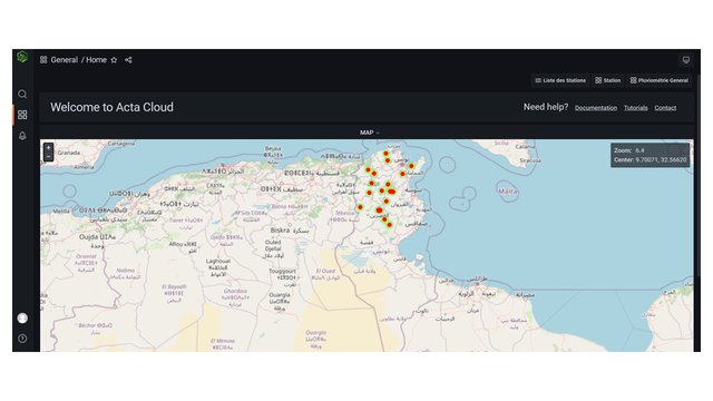
Territorial Natural Resource Management Observatory [Tunisia]
A territorial natural resources management observatory is a scientific, technical and institutional system set up in a given area to observe, monitor and improve knowledge.
- Compiler: Wafa Saidi
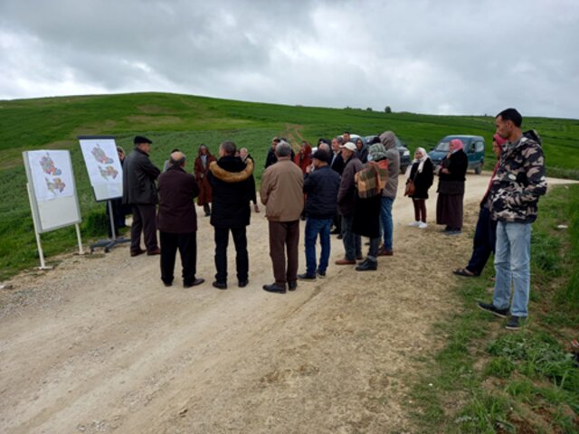
Integrated Territorial Planning and Development Project (PADIT) [Tunisia]
The PADIT approach comprises a cross-cutting participatory methodology to rural development, rallying various stakeholders around a project, within a location, to identify the main economic areas of the rural community concerned, and draw up a prioritized list of actions to strengthen and support development efforts in their location.
- Compiler: Wafa Saidi
2. Description of the SLM Technology
2.1 Short description of the Technology
Definition of the Technology:
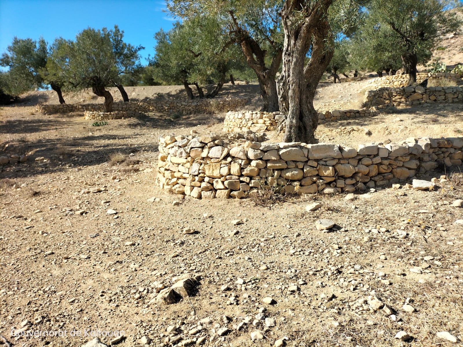
Individual dry-stone basins are a traditional runoff water collection technique built in dry stone around the trunk of trees, mainly olive trees.
2.2 Detailed description of the Technology
Description:
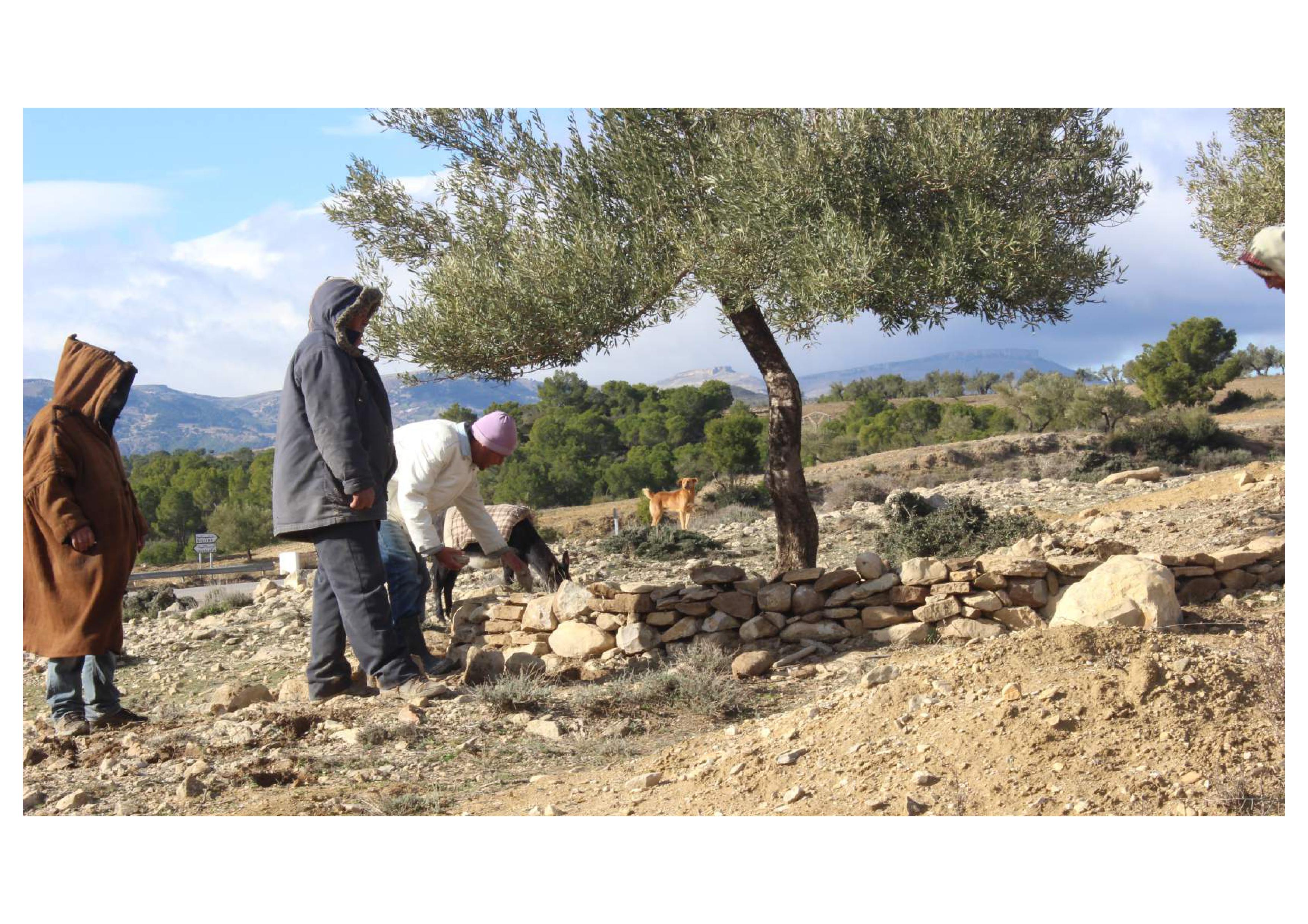
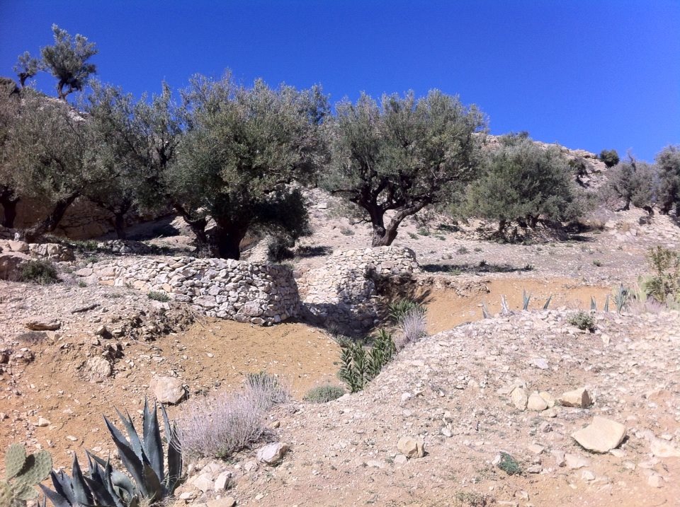
The individual dry-stone basin is a semi-circular arrangement of stones placed around the base of a tree. This technique is applied in arid or semi-arid regions facing water scarcity, especially in hilly or mountainous areas characterized by rocky or shallow soils with poor water retention.
The aim of this practice is to collect rainwater and allow it to capture rainwater and facilitate its gradual infiltration into the soil, thereby fostering plant growth. It helps prevent soil erosion, enhances soil fertility, and reduces water runoff.
The dimensions of individual dry-stone basins vary according to tree size, soil type and slope. The basin construction process involves the following steps:
-Attach a cord to the olive tree's trunk to create a semicircle with the same radius as the tree's canopy;
-Dig a concave semicircular trench, 10-20 cm deep, around the plant in the upstream direction.
-Place large stones in the trench.
-Crush the stones (1 to 2 cm)
After placing the two staggered rows of stones, a second row must be added on top to provide volume to the dike and lock the stones together. This process is iterated to achieve a height ranging from 0.40 to 1 m, depending on the slope, ensuring a level dike surface that effectively negates runoff velocity.
Stones are used to block plant debris, while crushing prevents water from infiltrating and causing the dike to collapse. It is crucial to lay the levelling stones flat, as this is pivotal to the success of the method. The irregular texture of the crushed stones plays a vital role in filtering water during the initial rains and retaining it once it has settled (typically by the 3rd to 4th rain). In just a few rains, the space between the bunds is leveled.
After each plowing or fertilizer application, the troughs must be reshaped. Maintenance of the outlet, with the removal of weeds from the basin platform, is essential.
Land users hold varying perspectives on the use of this technology, shaped by their experiences. While these structures help prevent soil erosion, enhance soil quality and water retention, boost water availability for trees, and stimulate growth and fruit production, the construction of individual dry-stone basins is labor-intensive and costly, which some land users perceive as a drawback.
2.3 Photos of the Technology
Media Gallery
2.4 Videos of the Technology
Comments, short description:
Technique d’installation d’une cuvette individuelle en pierres sèches au site pilote Oueslatia - Kairouan dans le cadre du projet "PAPS-Eau Valorisation", Projet pilote: “Renforcement de l’agriculture pluviale au travers les techniques et les ouvrages de CES”/Installing an individual dry stone basin at the Oueslatia - Kairouan pilot site as part of the "PAPS-Eau Valorisation" project, Pilot project: "Strengthening rain-fed agriculture through WSC techniques and structures"
Location:
Oueslatia - Kairouan
2.5 Country/ region/ locations where the Technology has been applied and which are covered by this assessment
Country:
Tunisia
Region/ State/ Province:
Oueslatia, Kairouan
Specify the spread of the Technology:
- evenly spread over an area
If precise area is not known, indicate approximate area covered:
- 1,000-10,000 km2
Is/are the technology site(s) located in a permanently protected area?
No
Comments:
This technology is being introduced in a dry-crop-dominated agricultural region. The area has also witnessed the expansion of olive cultivation, which remains well-suited to the agro-ecological conditions, especially due to its significance in the utilization of sloped terrain. Olive orchards in this region tend to be relatively small, typically not exceeding 0.5 hectares in size.
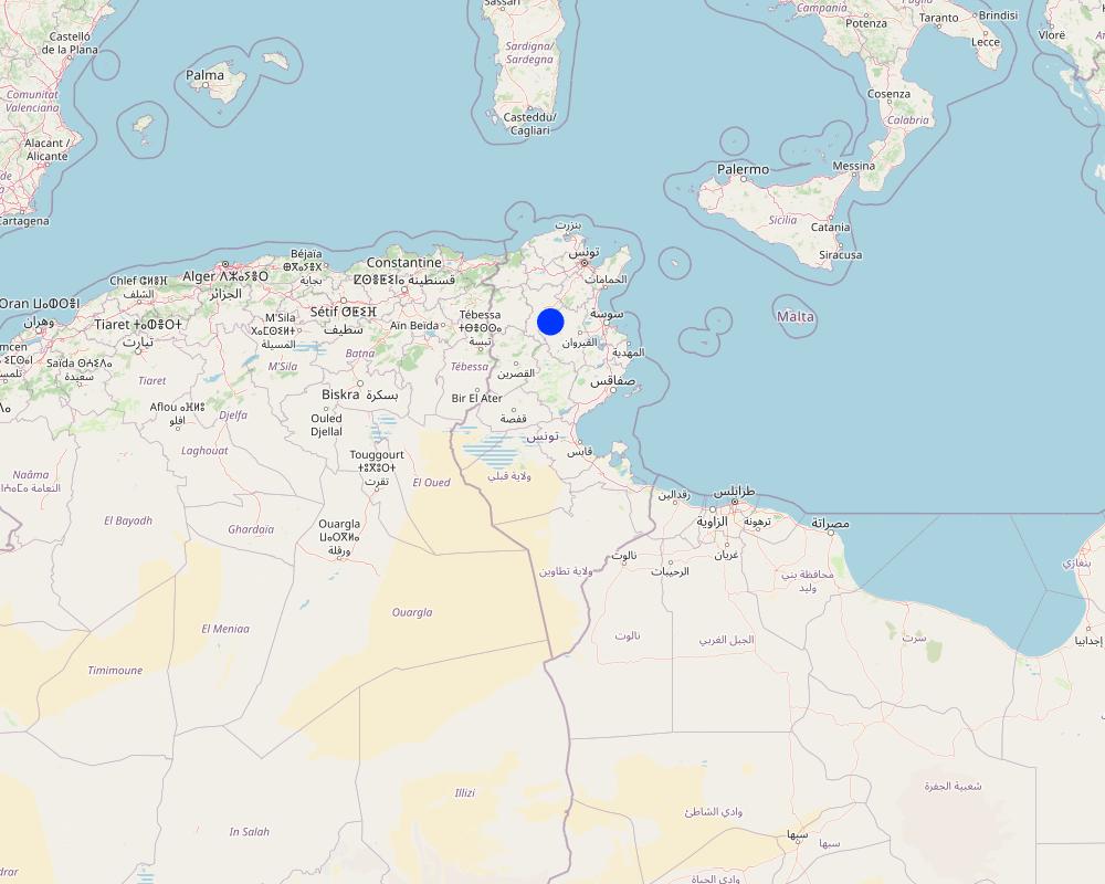
Map
×2.6 Date of implementation
If precise year is not known, indicate approximate date:
- more than 50 years ago (traditional)
2.7 Introduction of the Technology
Specify how the Technology was introduced:
- as part of a traditional system (> 50 years)
Comments (type of project, etc.):
Individual dry-stone basins are a traditional technique devised for cultivating trees in arid and semi-arid regions characterized by light, moderately deep soil, and gentle relief.
3. Classification of the SLM Technology
3.1 Main purpose(s) of the Technology
- improve production
- reduce, prevent, restore land degradation
- protect a watershed/ downstream areas – in combination with other Technologies
- adapt to climate change/ extremes and its impacts
- create beneficial economic impact
3.2 Current land use type(s) where the Technology is applied
Land use mixed within the same land unit:
No

Cropland
- Tree and shrub cropping
Tree and shrub cropping - Specify crops:
- olive
Number of growing seasons per year:
- 1
3.3 Has land use changed due to the implementation of the Technology?
Has land use changed due to the implementation of the Technology?
- No (Continue with question 3.4)
3.4 Water supply
Water supply for the land on which the Technology is applied:
- rainfed
3.5 SLM group to which the Technology belongs
- integrated soil fertility management
- cross-slope measure
- water harvesting
3.6 SLM measures comprising the Technology

structural measures
- S2: Bunds, banks
3.7 Main types of land degradation addressed by the Technology

soil erosion by water
- Wt: loss of topsoil/ surface erosion

chemical soil deterioration
- Cn: fertility decline and reduced organic matter content (not caused by erosion)

water degradation
- Ha: aridification
- Hs: change in quantity of surface water
3.8 Prevention, reduction, or restoration of land degradation
Specify the goal of the Technology with regard to land degradation:
- prevent land degradation
- reduce land degradation
4. Technical specifications, implementation activities, inputs, and costs
4.1 Technical drawing of the Technology
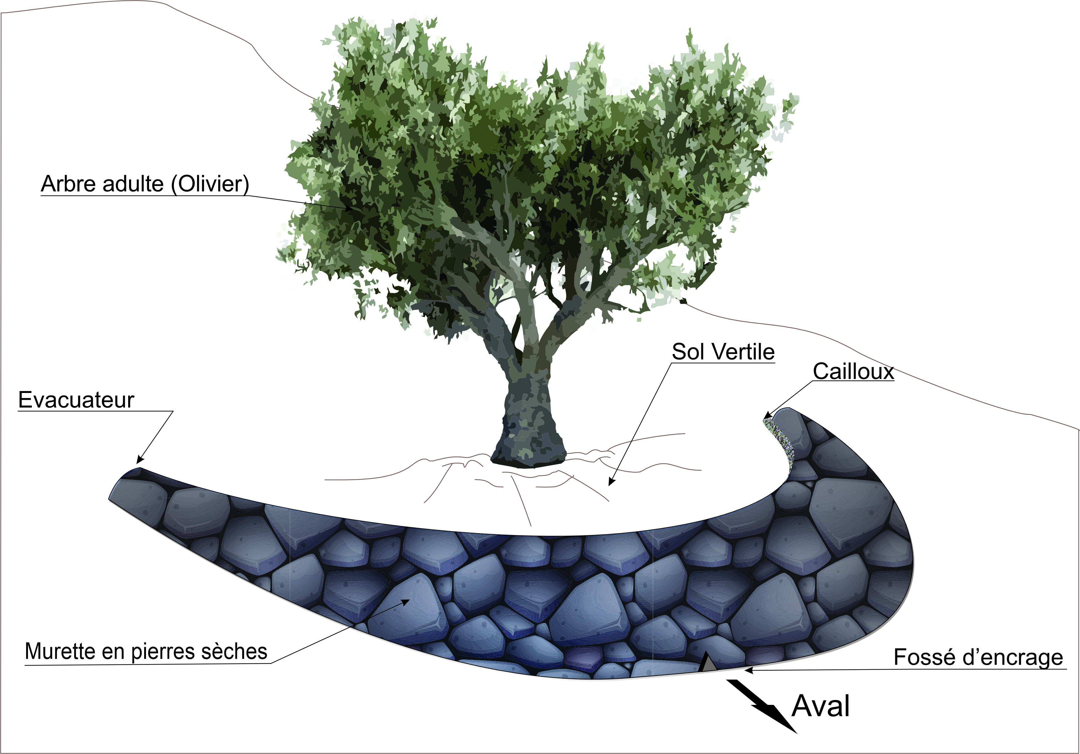
Technical specifications (related to technical drawing):
The individual basin is merely a structure that requires an impluvium and an evacuator with a precise slope.
Basin specifications are as follows
- the slope must be no steeper than 35°;
- the spacing varies according to the type of tree planting (the number of trees varies from one hectare to the next);
- the basin requires a 20 cm trench in the form of an arch placed against the direction of flow;
- construction of a 50-70 cm-high dry-stone wall;
- backfill with pebbles and sand inside the basin.
Author:
Hamda Jabnouni
Date:
03/2023
4.2 General information regarding the calculation of inputs and costs
Specify how costs and inputs were calculated:
- per Technology unit
Specify unit:
Individual dry-stone basin
other/ national currency (specify):
Tunisian dinars
If relevant, indicate exchange rate from USD to local currency (e.g. 1 USD = 79.9 Brazilian Real): 1 USD =:
3.1
Indicate average wage cost of hired labour per day:
17.664
4.3 Establishment activities
| Activity | Timing (season) | |
|---|---|---|
| 1. | Stone picking | |
| 2. | Digging a 30 cm-deep trench | |
| 3. | Construction of the basin | |
| 4. | Backfilling with pebbles and sand |
Comments:
Basins are built all year round.
4.4 Costs and inputs needed for establishment
| Specify input | Unit | Quantity | Costs per Unit | Total costs per input | % of costs borne by land users | |
|---|---|---|---|---|---|---|
| Labour | Workers | Individual | 1.0 | 17.0 | 17.0 | |
| Equipment | Pickaxe | 1.0 | 30.0 | 30.0 | ||
| Equipment | Shovel | 1.0 | 24.0 | 24.0 | ||
| Equipment | Large hammer | 1.0 | 60.0 | 60.0 | ||
| Construction material | Purchase and transportation of dry stones | Basin | 1.0 | 40.0 | 40.0 | |
| Total costs for establishment of the Technology | 171.0 | |||||
| Total costs for establishment of the Technology in USD | 55.16 | |||||
If land user bore less than 100% of costs, indicate who covered the remaining costs:
Directorate-General for Agricultural Land Planning and Conservation
Comments:
The Directorate-General for the Development and Conservation of Agricultural Land and its regional representatives are responsible for implementing this technology based on a request submitted by the land users.
4.5 Maintenance/ recurrent activities
| Activity | Timing/ frequency | |
|---|---|---|
| 1. | Elevation of the wall | |
| 2. | Weed clearance | |
| 3. | Prunning |
4.6 Costs and inputs needed for maintenance/ recurrent activities (per year)
| Specify input | Unit | Quantity | Costs per Unit | Total costs per input | % of costs borne by land users | |
|---|---|---|---|---|---|---|
| Labour | Workers employed in raising the wall | Basin | 17.0 | 100.0 | ||
| Labour | Workers for prunning operations | Basin | 5.0 | 100.0 | ||
| Labour | Workers for weed clearance activities | Basin | 1.5 | 100.0 |
4.7 Most important factors affecting the costs
Describe the most determinate factors affecting the costs:
The key cost determinants in this process are the availability of labor and stones in the field.
5. Natural and human environment
5.1 Climate
Annual rainfall
- < 250 mm
- 251-500 mm
- 501-750 mm
- 751-1,000 mm
- 1,001-1,500 mm
- 1,501-2,000 mm
- 2,001-3,000 mm
- 3,001-4,000 mm
- > 4,000 mm
Specify average annual rainfall (if known), in mm:
350.00
Specifications/ comments on rainfall:
In the study area, the annual rainfall ranges from 200 mm to 400 mm. The region follows a Mediterranean rainfall pattern, which is marked by winter runoff and experiences nearly complete drying out during the summer season
Indicate the name of the reference meteorological station considered:
Oueslatia Forest
Agro-climatic zone
- semi-arid
The study area is located in an intermediate climatic class: semi-arid, characterized by a highly variable rainfall pattern with hot, dry summers and cool, wet winters.
5.2 Topography
Slopes on average:
- flat (0-2%)
- gentle (3-5%)
- moderate (6-10%)
- rolling (11-15%)
- hilly (16-30%)
- steep (31-60%)
- very steep (>60%)
Landforms:
- plateau/plains
- ridges
- mountain slopes
- hill slopes
- footslopes
- valley floors
Altitudinal zone:
- 0-100 m a.s.l.
- 101-500 m a.s.l.
- 501-1,000 m a.s.l.
- 1,001-1,500 m a.s.l.
- 1,501-2,000 m a.s.l.
- 2,001-2,500 m a.s.l.
- 2,501-3,000 m a.s.l.
- 3,001-4,000 m a.s.l.
- > 4,000 m a.s.l.
5.3 Soils
Soil depth on average:
- very shallow (0-20 cm)
- shallow (21-50 cm)
- moderately deep (51-80 cm)
- deep (81-120 cm)
- very deep (> 120 cm)
Soil texture (topsoil):
- medium (loamy, silty)
Soil texture (> 20 cm below surface):
- medium (loamy, silty)
Topsoil organic matter:
- medium (1-3%)
If available, attach full soil description or specify the available information, e.g. soil type, soil PH/ acidity, Cation Exchange Capacity, nitrogen, salinity etc.
- Poorly developed soils
- Healthy soil
- Gypsum crusts
5.4 Water availability and quality
Ground water table:
> 50 m
Availability of surface water:
poor/ none
Water quality (untreated):
for agricultural use only (irrigation)
Water quality refers to:
both ground and surface water
Is water salinity a problem?
No
Is flooding of the area occurring?
No
5.5 Biodiversity
Species diversity:
- low
Habitat diversity:
- medium
5.6 Characteristics of land users applying the Technology
Sedentary or nomadic:
- Sedentary
Market orientation of production system:
- subsistence (self-supply)
Off-farm income:
- > 50% of all income
Relative level of wealth:
- poor
- average
Individuals or groups:
- individual/ household
- employee (company, government)
Level of mechanization:
- manual work
- animal traction
Gender:
- men
Age of land users:
- youth
- middle-aged
- elderly
Indicate other relevant characteristics of the land users:
- Off-farm activities exhibit significant diversity but are predominantly centered on sporadic day labor, employment as civil servants, and involvement in small businesses such as shops.
- The surveyed farmers had an average age of 53.5, with the youngest being 21 and the oldest 86.
5.7 Average area of land used by land users applying the Technology
- < 0.5 ha
- 0.5-1 ha
- 1-2 ha
- 2-5 ha
- 5-15 ha
- 15-50 ha
- 50-100 ha
- 100-500 ha
- 500-1,000 ha
- 1,000-10,000 ha
- > 10,000 ha
Is this considered small-, medium- or large-scale (referring to local context)?
- small-scale
5.8 Land ownership, land use rights, and water use rights
Land ownership:
- individual, not titled
Land use rights:
- individual
Water use rights:
- individual
Are land use rights based on a traditional legal system?
Yes
Specify:
Heritage
5.9 Access to services and infrastructure
health:
- poor
- moderate
- good
education:
- poor
- moderate
- good
technical assistance:
- poor
- moderate
- good
employment (e.g. off-farm):
- poor
- moderate
- good
markets:
- poor
- moderate
- good
energy:
- poor
- moderate
- good
roads and transport:
- poor
- moderate
- good
drinking water and sanitation:
- poor
- moderate
- good
financial services:
- poor
- moderate
- good
6. Impacts and concluding statements
6.1 On-site impacts the Technology has shown
Socio-economic impacts
Production
crop production
Comments/ specify:
The installation of the basins results in an average yield improvement of 150%.
crop quality
Comments/ specify:
The growth of olive trees is enhanced by the presence of dissolved minerals in the water
Income and costs
expenses on agricultural inputs
Comments/ specify:
Individual dry-stone basins provide manure carried away by run-off water, minimizing input costs.
farm income
workload
Comments/ specify:
The olive trees do not require the addition of manure, which reduces working hours.
Socio-cultural impacts
food security/ self-sufficiency
SLM/ land degradation knowledge
Ecological impacts
Water cycle/ runoff
water quantity
harvesting/ collection of water
surface runoff
excess water drainage
Soil
soil moisture
Comments/ specify:
A comparison between soils treated with individual dry stone basins and other untreated soils showed that the basins increased soil moisture by around 28%.
soil loss
soil organic matter/ below ground C
Comments/ specify:
The individual dry-stone basins increased organic matter levels by around 8%.
Climate and disaster risk reduction
drought impacts
micro-climate
Specify assessment of on-site impacts (measurements):
On-site impacts were assessed by means of exhaustive surveys in the Oueslatia area and field measurements carried out as part of research projects.
6.2 Off-site impacts the Technology has shown
downstream siltation
Comments/ specify:
This technology works to decelerate runoff by capturing sediment, thus safeguarding downstream dams from siltation.
Specify assessment of off-site impacts (measurements):
Research results have highlighted the external impacts of this technology.
6.3 Exposure and sensitivity of the Technology to gradual climate change and climate-related extremes/ disasters (as perceived by land users)
Gradual climate change
Gradual climate change
| Season | increase or decrease | How does the Technology cope with it? | |
|---|---|---|---|
| annual rainfall | decrease | well |
Climate-related extremes (disasters)
Meteorological disasters
| How does the Technology cope with it? | |
|---|---|
| local hailstorm | very well |
6.4 Cost-benefit analysis
How do the benefits compare with the establishment costs (from land users’ perspective)?
Short-term returns:
positive
Long-term returns:
very positive
How do the benefits compare with the maintenance/ recurrent costs (from land users' perspective)?
Short-term returns:
positive
Long-term returns:
very positive
6.5 Adoption of the Technology
- > 50%
If available, quantify (no. of households and/ or area covered):
150 ha
Of all those who have adopted the Technology, how many did so spontaneously, i.e. without receiving any material incentives/ payments?
- 11-50%
Comments:
Following a request from the landowner, the Directorate-General for the Development and Conservation of Agricultural Lands (DGACTA) is involved in the installation of individual dry-stone basins.
6.6 Adaptation
Has the Technology been modified recently to adapt to changing conditions?
No
6.7 Strengths/ advantages/ opportunities of the Technology
| Strengths/ advantages/ opportunities in the land user’s view |
|---|
| This technology enriches the soil. |
| This technology boosts agricultural production. |
| Strengths/ advantages/ opportunities in the compiler’s or other key resource person’s view |
|---|
| Individual dry-stone basins are small water collection structures. |
| Individual dry-stone basins are recognized as anti-erosion techniques. |
| It plays an important role in recharging the water table. |
6.8 Weaknesses/ disadvantages/ risks of the Technology and ways of overcoming them
| Weaknesses/ disadvantages/ risks in the land user’s view | How can they be overcome? |
|---|---|
| Cost | Incentivization through subsidies |
| Weaknesses/ disadvantages/ risks in the compiler’s or other key resource person’s view | How can they be overcome? |
|---|---|
| Elevation of the wall is the only maintenance method. |
7. References and links
7.1 Methods/ sources of information
- field visits, field surveys
A field survey
- interviews with land users
A farmer was interviewed
- interviews with SLM specialists/ experts
- compilation from reports and other existing documentation
When were the data compiled (in the field)?
23/01/2023
7.2 References to available publications
Title, author, year, ISBN:
Guide de conservation des eaux et du Sol, Ministère de l’agriculture, Direction Générale de l'Aménagement et de la Conservations des Terres Agricoles, 1995
Available from where? Costs?
Ministry of Agriculture, Directorat-General for the Development and Conservation of Agricultural Lands
7.3 Links to relevant online information
Title/ description:
Chapitre 6. Les techniques traditionnelles de gestion de l’eau, de la biomasse et de la fertilité des sols In : Gestion durable des eaux et des sols au Maroc : Valorisation des techniques traditionnelles méditerranéennes, SABIR, Mohamed ; ROOSE, Éric ; et AL KARKOURI, Jamal, 2010, ISBN : 9782709917902.
URL:
https://books.openedition.org/irdeditions/327
Title/ description:
Guide technique pour la lutte contre la désertification, Abdessalem Kallala, OSS, 2017.
URL:
http://projet.oss-online.org/LCD/images/BP/Techniques_LCD.pdf
Title/ description:
Guide technique pour la lutte contre la désertification, Abdessalem Kallala, OSS, 2017.
URL:
http://projet.oss-online.org/LCD/images/BP/Techniques_LCD.pdf
Title/ description:
Guide technique pour la lutte contre la désertification, Abdessalem Kallala, OSS, 2017.
URL:
http://projet.oss-online.org/LCD/images/BP/Techniques_LCD.pdf
Title/ description:
Guide technique pour la lutte contre la désertification, Abdessalem Kallala, OSS, 2017.
URL:
http://projet.oss-online.org/LCD/images/BP/Techniques_LCD.pdf
Links and modules
Expand all Collapse allLinks
Territorial Natural Resource Management Observatory [Tunisia]
A territorial natural resources management observatory is a scientific, technical and institutional system set up in a given area to observe, monitor and improve knowledge.
- Compiler: Wafa Saidi
Integrated Territorial Planning and Development Project (PADIT) [Tunisia]
The PADIT approach comprises a cross-cutting participatory methodology to rural development, rallying various stakeholders around a project, within a location, to identify the main economic areas of the rural community concerned, and draw up a prioritized list of actions to strengthen and support development efforts in their location.
- Compiler: Wafa Saidi
Modules
No modules