Soil bund & Fanya Juu combined & vegetated [Ethiopie]
- Création :
- Mise à jour :
- Compilateur : Daniel Danano
- Rédacteur : –
- Examinateurs : Fabian Ottiger, Alexandra Gavilano
technologies_1078 - Ethiopie
Voir les sections
Développer tout Réduire tout1. Informations générales
1.2 Coordonnées des personnes-ressources et des institutions impliquées dans l'évaluation et la documentation de la Technologie
Spécialiste GDT:
Dibaba Israel
Rural land administration and natural resources management
Ethiopie
Nom du ou des institutions qui ont facilité la documentation/ l'évaluation de la Technologie (si pertinent)
FAO Food and Agriculture Organization (FAO Food and Agriculture Organization) - Italie1.3 Conditions relatives à l'utilisation par WOCAT des données documentées
Le compilateur et la(les) personne(s) ressource(s) acceptent les conditions relatives à l'utilisation par WOCAT des données documentées:
Oui
2. Description de la Technologie de GDT
2.1 Courte description de la Technologie
Définition de la Technologie:
Soil bund and Fanya Juu constructed along the contour lines in microwatershed to conserve soil moisture and control erosion.
2.2 Description détaillée de la Technologie
Description:
Soil bund and Fanya Juu constructed in combination in a microwatershed for retaining maximum possible rain water in the soil by obstructing runoff water. Soil bunds are suitable for steeper slopes compared to fanya juu terraces which are more effective in gentle and flatter slopes.Land users in the SWC area prefer to combine the two physical structures for many reasons.One important factor is the cost of establishment, which is a function of labour needed for the construction. Fanya juu which means throwing soil upslope in Kiswahili intails throwing soil upslope which is more labours than throwing soil to downslope in the case of soil bunds. The other reason is that cultivated lands with fanya juu terraces are not easily accessed by free grazing livestock. The ditches placed in the downslope side of the embankment (fanya juu) is not easily vrossable but in soil bund although not that easy livestock are seen to trample over the embankment and jump the ditch which is placed in the upslope side. The other advantage farmers consider is that Fanya juu is more efficient in controlling runoff because the water that overtops the embankment is trapped by the ditch. Fanya Juu despite its high cost is preferred to be applied in combination with bunds because of the other advantage that it forms bench terrace rapidly.
Purpose of the Technology: The major purpose is to trap as much rain water as possible and also control soil erosion. Cultivated lands with with Soil bund and Fanya Juu have shown remarkable improvement in soil moistureavailability to crops compared to fields with no measures.
Establishment / maintenance activities and inputs: Soil bund and Fanya Juu are established in the same way by digging soil from and embanking it on a contour line. A contour line is laid out by following zero gradient. Once the soil is dug and embanked it is lightly compacted to avoid colapse. To further ensure bund stabilityuseful trees/shrubs are planted.The planted tree/shrub species are those offering multiuses such as fodder, fertility improving and fuelwood. Maintenance: It is done by repairing breaks and managing planted trees on the structure or by upgrading the structure by increasing its height and plant improved tree and fruit tree species.
Natural / human environment: The technology is suitable to semiarid climatic condition which have erratic rains and where crop production is limited by soil moisture stress. Soils in the technology area are susceptable to erosion and therefore the structure should be stablized by planting trees or grass species.
2.5 Pays/ région/ lieux où la Technologie a été appliquée et qui sont couverts par cette évaluation
Pays:
Ethiopie
Région/ Etat/ Province:
Oromia
Autres spécifications du lieu:
Oromia
Commentaires:
Total area covered by the SLM Technology is 15 km2.
Soil and water conservation activities started in the area about 30 years ago by the extension program of the Ministry of Agriculture. Systematically planned SWC measures, however, came into picture recently as Integrated microwatersheds planning & implementation approach was introduced.
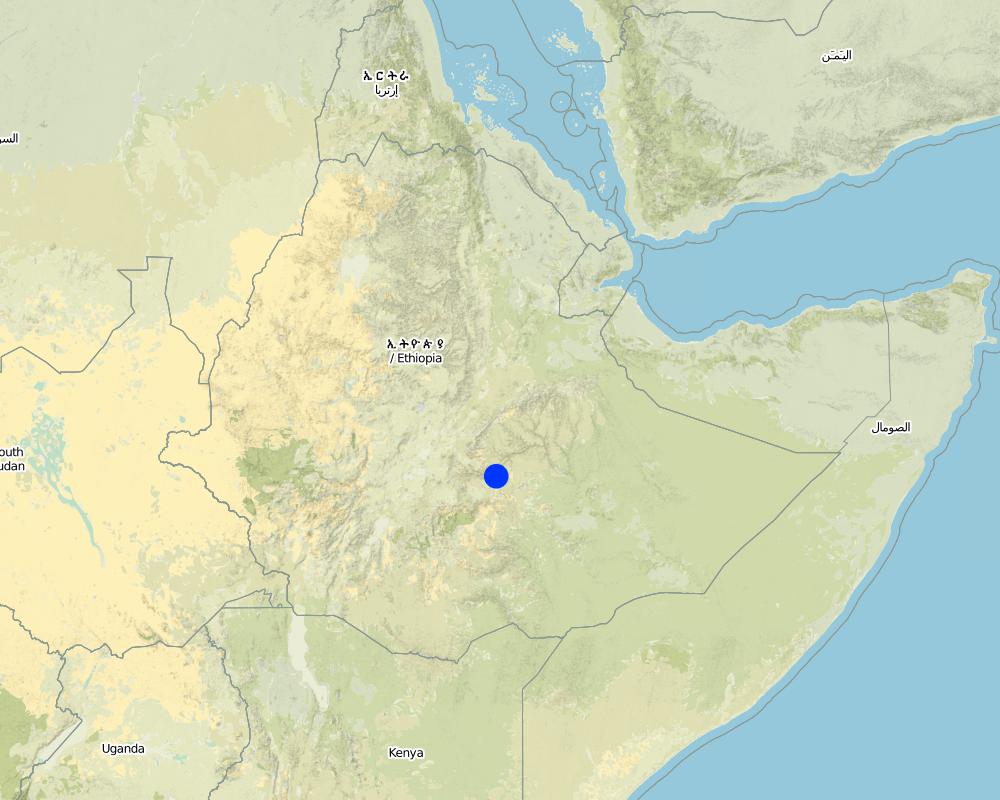
Map
×2.6 Date de mise en œuvre de la Technologie
Si l'année précise est inconnue, indiquez la date approximative: :
- il y a moins de 10 ans (récemment)
2.7 Introduction de la Technologie
Spécifiez comment la Technologie a été introduite: :
- par le biais de projets/ d'interventions extérieures
Commentaires (type de projet, etc.) :
Fanya juu is first practiced in Kenya and soil bunds are also exotic but experienced widely in Ethiopia over the past 30 years.
3. Classification de la Technologie de GDT
3.1 Principal(aux) objectif(s) de la Technologie
- réduire, prévenir, restaurer les terres dégradées
- préserver l'écosystème
3.2 Type(s) actuel(s) d'utilisation des terres, là où la Technologie est appliquée

Terres cultivées
- Cultures annuelles
- Cultures pérennes (non ligneuses)
- Plantations d’arbres ou de buissons
Cultures annuelles - Précisez les cultures:
- céréales - maïs
- céréales - autres
- céréales - sorgho
- légumineuses et légumes secs - fèves
- cultures oléagineuses - tournesol, colza, autres
- teff, wheat
- local, elephant grass
- casea seame, leucanea, sesbania
Précisez:
Longest growing period in days: 210 Longest growing period from month to month: Apr - Nov
Est-ce que les cultures intercalaires sont pratiquées?
Oui
Si oui, précisez quelles cultures sont produites en culture intercalaire:
sorghum-teff-beans

Pâturages

Forêts/ bois
Commentaires:
Major land use problems (compiler’s opinion): Soil erosion, productivity decline, degraded grazing and forest lands, soil moisture stress.
Major land use problems (land users’ perception): Poor crop production, high fertilizer cost, lack of grazing land.
3.3 Est-ce que l’utilisation des terres a changé en raison de la mise en œuvre de la Technologie ?
Est-ce que l’utilisation des terres a changé en raison de la mise en œuvre de la Technologie ?
- Oui (Veuillez remplir les questions ci-après au regard de l’utilisation des terres avant la mise en œuvre de la Technologie)
Pâturages
Pâturage intensif/ production fourragère :
- Affouragement en vert/ zéro-pâturage
Forêts/ bois
- Plantations d'arbres, boisements
Produits et services:
- Bois de chauffage
- Fruits et noix
- Pâturage/ broutage
Commentaires:
cut and carry, weeding and cultivation and proper management.
3.4 Approvisionnement en eau
Approvisionnement en eau des terres sur lesquelles est appliquée la Technologie:
- pluvial
3.5 Groupe de GDT auquel appartient la Technologie
- mesures en travers de la pente
- gestion des eaux de surface (sources, rivières, lacs, mers)
3.6 Mesures de GDT constituant la Technologie

pratiques agronomiques
- A3: Traitement de la couche superficielle du sol
A3: Différenciez les systèmes de travail du sol:
A 3.2: Reduced tillage (> 30% soil cover)
Commentaires:
Main measures: structural measures
Secondary measures: vegetative measures, management measures
Type of agronomic measures: early planting, mixed cropping / intercropping, contour planting / strip cropping, legume inter-planting, manure / compost / residues, mineral (inorganic) fertilizers, minimum tillage, contour tillage
Type of vegetative measures: aligned: -contour, scattered / dispersed
3.7 Principaux types de dégradation des terres traités par la Technologie

érosion hydrique des sols
- Wt: perte de la couche superficielle des sols (couche arable)/ érosion de surface
- Wg: ravinement/ érosion en ravines

dégradation chimique des sols
- Cn: baisse de la fertilité des sols et réduction du niveau de matière organique (non causée par l’érosion)

dégradation physique des sols
- Pk: scellage et encroûtement
Commentaires:
Main type of degradation addressed: Wt: loss of topsoil / surface erosion
Secondary types of degradation addressed: Wg: gully erosion / gullying, Cn: fertility decline and reduced organic matter content, Pk: sealing and crusting
3.8 Prévention, réduction de la dégradation ou réhabilitation des terres dégradées
Spécifiez l'objectif de la Technologie au regard de la dégradation des terres:
- réduire la dégradation des terres
- restaurer/ réhabiliter des terres sévèrement dégradées
Commentaires:
Secondary goals: rehabilitation / reclamation of denuded land
4. Spécifications techniques, activités, intrants et coûts de mise en œuvre
4.1 Dessin technique de la Technologie
Spécifications techniques (associées au dessin technique):
Technical knowledge required for field staff / advisors: high
Technical knowledge required for land users: moderate
Main technical functions: control of dispersed runoff: impede / retard
Secondary technical functions: control of dispersed runoff: retain / trap, reduction of slope angle, reduction of slope length
Early planting
Material/ species: sorghum and maize
Quantity/ density: 80-100000
Remarks: broadcasting
Mixed cropping / intercropping
Material/ species: sorghum-teff-beans
Remarks: broadcasting
Contour planting / strip cropping
Material/ species: maize, sunflower
Agronomic measure: mixed cropping / intercropping
Material/ species: wheat-safflower
Remarks: broadcasting
Legume inter-planting
Remarks: field crops (safflower sunflower)
Manure / compost / residues
Remarks: at homesteads
Mineral (inorganic) fertilizers
Material/ species: Dap, Urea
Quantity/ density: 1.5 q/ha
Minimum tillage
Remarks: at pilot level for maize planting
Contour tillage
Remarks: For cereal crops on terraced cultivated lands
Aligned: -contour
Vegetative material: T : trees / shrubs
Number of plants per (ha): 400
Vertical interval between rows / strips / blocks (m): 1
Scattered / dispersed
Vegetative material: T : trees / shrubs
Number of plants per (ha): 50-100
Trees/ shrubs species: casea seame, leucanea, sesbania
Grass species: local, elephant grass
Slope (which determines the spacing indicated above): 5.00%
If the original slope has changed as a result of the Technology, the slope today is (see figure below): 2.00%
Gradient along the rows / strips: 1.00%
Waterway
Depth of ditches/pits/dams (m): 1.5m
Width of ditches/pits/dams (m): 3m
Length of ditches/pits/dams (m): 500m
Height of bunds/banks/others (m): 1.5m
Width of bunds/banks/others (m): 3m
Length of bunds/banks/others (m): 3m
Bund/ bank: level
Spacing between structures (m): 1.5m
Depth of ditches/pits/dams (m): 0.5m
Width of ditches/pits/dams (m): 1m
Length of ditches/pits/dams (m): 150m
Height of bunds/banks/others (m): 0.65m
Width of bunds/banks/others (m): 1.5m
Length of bunds/banks/others (m): 150m
Structural measure: diversion ditch / cut-off drain
Spacing between structures (m): 200m
Depth of ditches/pits/dams (m): 0.75m
Width of ditches/pits/dams (m): 120m
Length of ditches/pits/dams (m): 150m
Height of bunds/banks/others (m): 0.75m
Width of bunds/banks/others (m): 1.2m
Length of bunds/banks/others (m): 150m
Construction material (earth): soil bund and fanya juu
Construction material (stone): waterways and diversions
Slope (which determines the spacing indicated above): 5%
If the original slope has changed as a result of the Technology, the slope today is: 2%
Lateral gradient along the structure: 0%
For water harvesting: the ratio between the area where the harvested water is applied and the total area from which water is collected is: 1:1
Vegetation is used for stabilisation of structures.
Change of land use type: cut and carry, weeding and cultivation and proper management.
Other type of management: site guarding - 0vergrazed lands are closed for establishing vegetation.
4.2 Informations générales sur le calcul des intrants et des coûts
autre/ monnaie nationale (précisez):
Birr
Indiquez le taux de change des USD en devise locale, le cas échéant (p.ex. 1 USD = 79.9 réal brésilien): 1 USD = :
8,6
Indiquez le coût salarial moyen de la main d'œuvre par jour:
0.80
4.3 Activités de mise en place/ d'établissement
| Activité | Calendrier des activités (saisonnier) | |
|---|---|---|
| 1. | collecting seeds | dry season |
| 2. | seedling production | dry season |
| 3. | seedling planting | rainy season |
| 4. | direct sowing of seeds | rainy season |
| 5. | contour marking | dry season |
| 6. | embanking soils | dry season |
| 7. | light compaction | dry season |
| 8. | fencing | dry season |
4.4 Coûts et intrants nécessaires à la mise en place
| Spécifiez les intrants | Unité | Quantité | Coûts par unité | Coût total par intrant | % du coût supporté par les exploitants des terres | |
|---|---|---|---|---|---|---|
| Main d'œuvre | Labour | ha | 1,0 | 199,0 | 199,0 | 20,0 |
| Equipements | Tools | ha | 63,0 | 5,0 | ||
| Matériel végétal | Seeds | ha | 1,0 | 8,0 | 8,0 | 100,0 |
| Coût total de mise en place de la Technologie | 207,0 | |||||
| Coût total de mise en place de la Technologie en dollars américains (USD) | 24,07 | |||||
Commentaires:
Duration of establishment phase: 84 month(s)
4.5 Activités d'entretien/ récurrentes
| Activité | Calendrier/ fréquence | |
|---|---|---|
| 1. | tillage /primary) | |
| 2. | tillage/secondary/ | |
| 3. | seedbed preartaion | |
| 4. | planting/sowing | |
| 5. | Weeding | |
| 6. | cultivation | |
| 7. | weeding and cultivation | after rains /annual |
| 8. | replanting | during rains /annual |
| 9. | repair breaks | after rains/as required |
| 10. | upgrading | dry season/annual |
| 11. | upgrading and repairing of breaks | before rains / annual |
4.6 Coûts et intrants nécessaires aux activités d'entretien/ récurrentes (par an)
| Spécifiez les intrants | Unité | Quantité | Coûts par unité | Coût total par intrant | % du coût supporté par les exploitants des terres | |
|---|---|---|---|---|---|---|
| Main d'œuvre | Labour | ha | 1,0 | 13,0 | 13,0 | 100,0 |
| Coût total d'entretien de la Technologie | 13,0 | |||||
| Coût total d'entretien de la Technologie en dollars américains (USD) | 1,51 | |||||
Commentaires:
length of terrace, number of trees planted
4.7 Facteurs les plus importants affectant les coûts
Décrivez les facteurs les plus importants affectant les coûts :
slope, soil condition labour availability
5. Environnement naturel et humain
5.1 Climat
Précipitations annuelles
- < 250 mm
- 251-500 mm
- 501-750 mm
- 751-1000 mm
- 1001-1500 mm
- 1501-2000 mm
- 2001-3000 mm
- 3001-4000 mm
- > 4000 mm
Spécifiez la pluviométrie moyenne annuelle (si connue), en mm:
800,00
Zone agro-climatique
- semi-aride
Charachterized by high tempretures, windy and soil moisture stress
5.2 Topographie
Pentes moyennes:
- plat (0-2 %)
- faible (3-5%)
- modéré (6-10%)
- onduleux (11-15%)
- vallonné (16-30%)
- raide (31-60%)
- très raide (>60%)
Reliefs:
- plateaux/ plaines
- crêtes
- flancs/ pentes de montagne
- flancs/ pentes de colline
- piémonts/ glacis (bas de pente)
- fonds de vallée/bas-fonds
Zones altitudinales:
- 0-100 m
- 101-500 m
- 501-1000 m
- 1001-1500 m
- 1501-2000 m
- 2001-2500 m
- 2501-3000 m
- 3001-4000 m
- > 4000 m
Commentaires et précisions supplémentaires sur la topographie:
Landforms: Hill slopes (are largley cultivated and some grazing lands, ranked 1), valley floors (are totally cultivated lands and have potentials if suffiecent rains are received, ranked 2) and mountain slopes (are grazing and shrub lands. Valley floors depend for runoff water from this, ranked 3)
Slopes on average: Flat (bunds were built before but silted up due to soil burial, ranked 1), rolling (ranked 2) as well as gentle and moderate (both ranked 3)
5.3 Sols
Profondeur moyenne du sol:
- très superficiel (0-20 cm)
- superficiel (21-50 cm)
- modérément profond (51-80 cm)
- profond (81-120 cm)
- très profond (>120 cm)
Texture du sol (de la couche arable):
- moyen (limoneux)
Matière organique de la couche arable:
- moyen (1-3%)
- faible (<1%)
Si disponible, joignez une description complète du sol ou précisez les informations disponibles, par ex., type de sol, pH/ acidité du sol, capacité d'échange cationique, azote, salinité, etc.
Soil depth on average: Moderately deep (soils on gentle slopes where the technology is dominantly practiced, ranked 1), shallow (soils on hillslopes are predominantly , ranked 2) and deep (soils in the valley floors are moderately deep to deep, ranked 3)
Soil texture is medium (on gentle slopes and valley floors, ranked 1) and coarse/light (on hilly slopes and gentle slopes, ranked 2) and fine/heavy (ranked 3)
Soil fertility is very low (soils that are continuously cropped on gentle slopes, ranked 1), low (soils on steep slopes because of erosion, ranked 2) and medium (soils on valley floors because of deposited soils, ranked 3)
Topsoil organic matter is low (soils of shallow depth on hillslopes, ranked 1) and medium (soils on valley floors, ranked 2)
Soil drainage/infiltration is good
Soil water storage capacity is low (shallow soils on the hillslopes, ranked 1) and medium (soils in the valley floors, ranked 2)
5.6 Caractéristiques des exploitants des terres appliquant la Technologie
Orientation du système de production:
- subsistance (auto-approvisionnement)
- exploitation mixte (de subsistance/ commerciale)
Revenus hors exploitation:
- 10-50% de tous les revenus
Niveau relatif de richesse:
- moyen
- riche
Niveau de mécanisation:
- travail manuel
Indiquez toute autre caractéristique pertinente des exploitants des terres:
Population density: 100-200 persons/km2
Annual population growth: 2% - 3%
5% of the land users are rich (have means to pay labour).
35% of the land users are average wealthy (get organized in groups for labour share).
60% of the land users are poor (are beneficiaries of food for work).
Off-farm income specification: land users who have implemented SWC measures have better income compared with those who have not implemented SWC.
Level of mechanization: Manual labour (land is tilled by oxen plough)
Market orientation cropland: Subsistence (poor and average farmers produced for themselves, ranked 1) and mixed (better of and rich produce food for own consumption and also market, ranked 2)
5.7 Superficie moyenne des terres utilisées par les exploitants des terres appliquant la Technologie
- < 0,5 ha
- 0,5-1 ha
- 1-2 ha
- 2-5 ha
- 5-15 ha
- 15-50 ha
- 50-100 ha
- 100-500 ha
- 500-1 000 ha
- 1 000-10 000 ha
- > 10 000 ha
Commentaires:
Most land users have land holding less than 1 hectar and fragmented
5.8 Propriété foncière, droits d’utilisation des terres et de l'eau
Propriété foncière:
- état
Droits d’utilisation des terres:
- accès libre (non organisé)
- individuel
6. Impacts et conclusions
6.1 Impacts sur site que la Technologie a montrés
Impacts socio-économiques
Production
production agricole
Commentaires/ spécifiez:
due to soil moisture improvement
production fourragère
Commentaires/ spécifiez:
bund stablization and area enclosure
qualité des fourrages
Commentaires/ spécifiez:
bund stablization and area enclosure
Revenus et coûts
revenus agricoles
Commentaires/ spécifiez:
homesteads intensification
Impacts socioculturels
institutions communautaires
Commentaires/ spécifiez:
farmers' groups for development work getting strengthened
connaissances sur la GDT/ dégradation des terres
Commentaires/ spécifiez:
land users have developed skills in marking contours and constructing bunds.
Impacts écologiques
Cycle de l'eau/ ruissellement
ruissellement de surface
Quantité avant la GDT:
50
Quantité après la GDT:
0
Sols
humidité du sol
Commentaires/ spécifiez:
because of structural measures
perte en sol
Commentaires/ spécifiez:
integrated measures
Autres impacts écologiques
Soil fertility
Commentaires/ spécifiez:
leguminous plants and compost application
6.2 Impacts hors site que la Technologie a montrés
inondations en aval
Commentaires/ spécifiez:
because of reduced runoff on uphills
envasement en aval
Commentaires/ spécifiez:
reduce soil erosion
6.4 Analyse coûts-bénéfices
Quels sont les bénéfices comparativement aux coûts de mise en place (du point de vue des exploitants des terres)?
Rentabilité à court terme:
légèrement négative
Rentabilité à long terme:
positive
Quels sont les bénéfices comparativement aux coûts d'entretien récurrents (du point de vue des exploitants des terres)?
Rentabilité à court terme:
légèrement positive
Rentabilité à long terme:
positive
6.5 Adoption de la Technologie
De tous ceux qui ont adopté la Technologie, combien d'entre eux l'ont fait spontanément, à savoir sans recevoir aucune incitation matérielle, ou aucune rémunération? :
- 0-10%
Commentaires:
95% of land user families have adopted the Technology with external material support
Comments on acceptance with external material support: estimates
5% of land user families have adopted the Technology without any external material support
Comments on spontaneous adoption: estimates
There is a moderate trend towards spontaneous adoption of the Technology
Comments on adoption trend: Spontaneous adoption is being observed who are average in wealth in particular and in families who have adequate awarness of SWC measures in general.
6.7 Points forts/ avantages/ possibilités de la Technologie
| Points forts/ avantages/ possibilités du point de vue du compilateur ou d'une autre personne ressource clé |
|---|
|
Structures do not hinder farm operations because they are widely spaced. How can they be sustained / enhanced? Practice inter bund measures that trap runoff efficiently. |
|
Fodder is grown on bunds and there is no area lost How can they be sustained / enhanced? Strengthening the introduction of high yielding fodder species. |
|
Homestead intensification activities are integrated with the SWC technology. How can they be sustained / enhanced? Embrace more land in the program |
|
Crop, fodder and wood production increased because of plantation, structures and area enclosures. How can they be sustained / enhanced? Use more efficient techniques and inputs that enhance soil fertility. |
| Crop production has increased because of improved soil moisture avalability. |
6.8 Faiblesses/ inconvénients/ risques de la Technologie et moyens de les surmonter
| Faiblesses/ inconvénients/ risques du point de vue de l’exploitant des terres | Comment peuvent-ils être surmontés? |
|---|---|
| are labour consuming | organize farmers in groups and undertake repairs before the damage gets more serious |
| require frequent maintenance |
| Faiblesses/ inconvénients/ risques du point de vue du compilateur ou d'une autre personne ressource clé | Comment peuvent-ils être surmontés? |
|---|---|
| require regular maintenance | make quality structures and avoid livestock interference |
| require closer protection and guarding | practice more cut and carry |
7. Références et liens
7.1 Méthodes/ sources d'information
Liens et modules
Développer tout Réduire toutLiens
Aucun lien
Modules
Aucun module trouvé