Soil bund & Fanya Juu combined & vegetated [เอธิโอเปีย]
- ผู้สร้างสรรค์:
- การอัพเดท:
- ผู้รวบรวม: Daniel Danano
- ผู้เรียบเรียง: –
- ผู้ตรวจสอบ: Fabian Ottiger, Alexandra Gavilano
technologies_1078 - เอธิโอเปีย
ดูส่วนย่อย
ขยายทั้งหมด ย่อทั้งหมด1. ข้อมูลทั่วไป
1.2 รายละเอียดที่ติดต่อได้ของผู้รวบรวมและองค์กรที่เกี่ยวข้องในการประเมินและการจัดเตรียมทำเอกสารของเทคโนโลยี
ผู้เชี่ยวชาญ SLM:
Dibaba Israel
Rural land administration and natural resources management
เอธิโอเปีย
ชื่อขององค์กรซึ่งอำนวยความสะดวกในการทำเอกสารหรือการประเมินเทคโนโลยี (ถ้าเกี่ยวข้อง)
FAO Food and Agriculture Organization (FAO Food and Agriculture Organization) - อิตาลี1.3 เงื่อนไขการใช้ข้อมูลที่ได้บันทึกผ่านทาง WOCAT
ผู้รวบรวมและวิทยากรหลักยอมรับเงื่อนไขเกี่ยวกับการใช้ข้อมูลที่ถูกบันทึกผ่านทาง WOCAT:
ใช่
2. การอธิบายลักษณะของเทคโนโลยี SLM
2.1 การอธิบายแบบสั้น ๆ ของเทคโนโลยี
คำจำกัดความของเทคโนโลยี:
Soil bund and Fanya Juu constructed along the contour lines in microwatershed to conserve soil moisture and control erosion.
2.2 การอธิบายแบบละเอียดของเทคโนโลยี
คำอธิบาย:
Soil bund and Fanya Juu constructed in combination in a microwatershed for retaining maximum possible rain water in the soil by obstructing runoff water. Soil bunds are suitable for steeper slopes compared to fanya juu terraces which are more effective in gentle and flatter slopes.Land users in the SWC area prefer to combine the two physical structures for many reasons.One important factor is the cost of establishment, which is a function of labour needed for the construction. Fanya juu which means throwing soil upslope in Kiswahili intails throwing soil upslope which is more labours than throwing soil to downslope in the case of soil bunds. The other reason is that cultivated lands with fanya juu terraces are not easily accessed by free grazing livestock. The ditches placed in the downslope side of the embankment (fanya juu) is not easily vrossable but in soil bund although not that easy livestock are seen to trample over the embankment and jump the ditch which is placed in the upslope side. The other advantage farmers consider is that Fanya juu is more efficient in controlling runoff because the water that overtops the embankment is trapped by the ditch. Fanya Juu despite its high cost is preferred to be applied in combination with bunds because of the other advantage that it forms bench terrace rapidly.
Purpose of the Technology: The major purpose is to trap as much rain water as possible and also control soil erosion. Cultivated lands with with Soil bund and Fanya Juu have shown remarkable improvement in soil moistureavailability to crops compared to fields with no measures.
Establishment / maintenance activities and inputs: Soil bund and Fanya Juu are established in the same way by digging soil from and embanking it on a contour line. A contour line is laid out by following zero gradient. Once the soil is dug and embanked it is lightly compacted to avoid colapse. To further ensure bund stabilityuseful trees/shrubs are planted.The planted tree/shrub species are those offering multiuses such as fodder, fertility improving and fuelwood. Maintenance: It is done by repairing breaks and managing planted trees on the structure or by upgrading the structure by increasing its height and plant improved tree and fruit tree species.
Natural / human environment: The technology is suitable to semiarid climatic condition which have erratic rains and where crop production is limited by soil moisture stress. Soils in the technology area are susceptable to erosion and therefore the structure should be stablized by planting trees or grass species.
2.5 ประเทศภูมิภาค หรือสถานที่ตั้งที่เทคโนโลยีได้นำไปใช้และได้รับการครอบคลุมโดยการประเมินนี้
ประเทศ:
เอธิโอเปีย
ภูมิภาค/รัฐ/จังหวัด:
Oromia
ข้อมูลจำเพาะเพิ่มเติมของสถานที่ตั้ง :
Oromia
แสดงความคิดเห็น:
Total area covered by the SLM Technology is 15 km2.
Soil and water conservation activities started in the area about 30 years ago by the extension program of the Ministry of Agriculture. Systematically planned SWC measures, however, came into picture recently as Integrated microwatersheds planning & implementation approach was introduced.
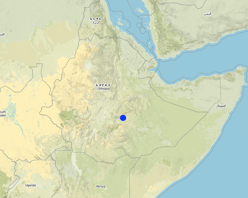
Map
×2.6 วันที่การดำเนินการ
ถ้าไม่รู้ปีที่แน่นอน ให้ระบุวันที่โดยประมาณ:
- น้อยกว่า 10 ปี (ไม่นานนี้)
2.7 คำแนะนำของเทคโนโลยี
ให้ระบุว่าเทคโนโลยีถูกแนะนำเข้ามาอย่างไร:
- ทางโครงการหรือจากภายนอก
ความคิดเห็น (ประเภทของโครงการ เป็นต้น) :
Fanya juu is first practiced in Kenya and soil bunds are also exotic but experienced widely in Ethiopia over the past 30 years.
3. การจัดประเภทของเทคโนโลยี SLM
3.1 วัตถุประสงค์หลักของเทคโนโลยี
- ลด ป้องกัน ฟื้นฟู การเสื่อมโทรมของที่ดิน
- อนุรักษ์ระบบนิเวศน์
3.2 ประเภทของการใช้ที่ดินในปัจจุบันที่ได้นำเทคโนโลยีไปใช้

พื้นที่ปลูกพืช
- การปลูกพืชล้มลุกอายุปีเดียว
- การปลูกพืชยืนต้นที่ไม่มีเนื้อไม้
- การปลูกไม้ยืนต้น ไม้พุ่ม
Annual cropping - Specify crops:
- cereals - maize
- cereals - other
- cereals - sorghum
- legumes and pulses - beans
- oilseed crops - sunflower, rapeseed, other
- teff, wheat
- local, elephant grass
- casea seame, leucanea, sesbania
ระบุ:
Longest growing period in days: 210 Longest growing period from month to month: Apr - Nov
Is intercropping practiced?
ใช่
If yes, specify which crops are intercropped:
sorghum-teff-beans

ทุ่งหญ้าเลี้ยงสัตว์

ป่า/พื้นที่ทำไม้
แสดงความคิดเห็น:
Major land use problems (compiler’s opinion): Soil erosion, productivity decline, degraded grazing and forest lands, soil moisture stress.
Major land use problems (land users’ perception): Poor crop production, high fertilizer cost, lack of grazing land.
3.3 Has land use changed due to the implementation of the Technology?
Has land use changed due to the implementation of the Technology?
- Yes (Please fill out the questions below with regard to the land use before implementation of the Technology)
ทุ่งหญ้าเลี้ยงสัตว์
ทุ่งหญ้าเลี้ยงสัตว์ที่มีการจัดการแบบเข้มข้นหรือการผลิตอาหารสัตว์:
- ตัดแล้วขนไป / ไม่มีการปล่อยแทะเล็มเอง (Cut-and-carry / zero grazing)
ป่า/พื้นที่ทำไม้
- ป่า/พื้นที่ทำไม้
ผลิตภัณฑ์และบริการ:
- ไม้ที่นำมาทำเป็นเชื้อเพลิง
- ผลไม้และถั่ว
- การแทะเล็มหญ้า / การเก็บกินหญ้า
แสดงความคิดเห็น:
cut and carry, weeding and cultivation and proper management.
3.4 การใช้น้ำ
การใช้น้ำของที่ดินที่มีการใช้เทคโนโลยีอยู่:
- จากน้ำฝน
3.5 กลุ่ม SLM ที่ตรงกับเทคโนโลยีนี้
- มาตรการปลูกพืชขวางความลาดชัน (cross-slope measure)
- การจัดการน้ำผิวดิน (น้ำพุ แม่น้ำทะเลสาบ ทะเล)
3.6 มาตรการ SLM ที่ประกอบกันเป็นเทคโนโลยี

มาตรการจัดการพืช
- A3: การรักษาหน้าดิน
A3: Differentiate tillage systems:
A 3.2: Reduced tillage (> 30% soil cover)
แสดงความคิดเห็น:
Main measures: structural measures
Secondary measures: vegetative measures, management measures
Type of agronomic measures: early planting, mixed cropping / intercropping, contour planting / strip cropping, legume inter-planting, manure / compost / residues, mineral (inorganic) fertilizers, minimum tillage, contour tillage
Type of vegetative measures: aligned: -contour, scattered / dispersed
3.7 รูปแบบหลักของการเสื่อมโทรมของที่ดินที่ได้รับการแก้ไขโดยเทคโนโลยี

การกัดกร่อนของดินโดยน้ำ
- Wt (Loss of topsoil): การสูญเสียดินชั้นบนหรือการกัดกร่อนที่ผิวดิน
- Wg (Gully erosion): การกัดกร่อนแบบร่องธารหรือการทำให้เกิดร่องน้ำเซาะ

การเสื่อมโทรมของดินทางด้านเคมี
- Cn (Fertility decline): ความอุดมสมบูรณ์และปริมาณอินทรียวัตถุในดินถูกทำให้ลดลงไป (ไม่ได้เกิดจากสาเหตุการกัดกร่อน)

การเสื่อมโทรมของดินทางด้านกายภาพ
- Pk (Slaking and crusting): การอุดตันของช่องว่างในดินหรือรูพรุน
แสดงความคิดเห็น:
Main type of degradation addressed: Wt: loss of topsoil / surface erosion
Secondary types of degradation addressed: Wg: gully erosion / gullying, Cn: fertility decline and reduced organic matter content, Pk: sealing and crusting
3.8 การป้องกัน การลดลง หรือการฟื้นฟูความเสื่อมโทรมของที่ดิน
ระบุเป้าหมายของเทคโนโลยีกับความเสื่อมโทรมของที่ดิน:
- ลดความเสื่อมโทรมของดิน
- ฟื้นฟูบำบัดที่ดินที่เสื่อมโทรมลงอย่างมาก
แสดงความคิดเห็น:
Secondary goals: rehabilitation / reclamation of denuded land
4. ข้อมูลจำเพาะด้านเทคนิค กิจกรรมการนำไปปฏิบัติใช้ ปัจจัยนำเข้า และค่าใช้จ่าย
4.1 แบบแปลนทางเทคนิคของเทคโนโลยี
ข้อมูลจำเพาะด้านเทคนิค (แบบแปลนทางเทคนิคของเทคโนโลยี):
Technical knowledge required for field staff / advisors: high
Technical knowledge required for land users: moderate
Main technical functions: control of dispersed runoff: impede / retard
Secondary technical functions: control of dispersed runoff: retain / trap, reduction of slope angle, reduction of slope length
Early planting
Material/ species: sorghum and maize
Quantity/ density: 80-100000
Remarks: broadcasting
Mixed cropping / intercropping
Material/ species: sorghum-teff-beans
Remarks: broadcasting
Contour planting / strip cropping
Material/ species: maize, sunflower
Agronomic measure: mixed cropping / intercropping
Material/ species: wheat-safflower
Remarks: broadcasting
Legume inter-planting
Remarks: field crops (safflower sunflower)
Manure / compost / residues
Remarks: at homesteads
Mineral (inorganic) fertilizers
Material/ species: Dap, Urea
Quantity/ density: 1.5 q/ha
Minimum tillage
Remarks: at pilot level for maize planting
Contour tillage
Remarks: For cereal crops on terraced cultivated lands
Aligned: -contour
Vegetative material: T : trees / shrubs
Number of plants per (ha): 400
Vertical interval between rows / strips / blocks (m): 1
Scattered / dispersed
Vegetative material: T : trees / shrubs
Number of plants per (ha): 50-100
Trees/ shrubs species: casea seame, leucanea, sesbania
Grass species: local, elephant grass
Slope (which determines the spacing indicated above): 5.00%
If the original slope has changed as a result of the Technology, the slope today is (see figure below): 2.00%
Gradient along the rows / strips: 1.00%
Waterway
Depth of ditches/pits/dams (m): 1.5m
Width of ditches/pits/dams (m): 3m
Length of ditches/pits/dams (m): 500m
Height of bunds/banks/others (m): 1.5m
Width of bunds/banks/others (m): 3m
Length of bunds/banks/others (m): 3m
Bund/ bank: level
Spacing between structures (m): 1.5m
Depth of ditches/pits/dams (m): 0.5m
Width of ditches/pits/dams (m): 1m
Length of ditches/pits/dams (m): 150m
Height of bunds/banks/others (m): 0.65m
Width of bunds/banks/others (m): 1.5m
Length of bunds/banks/others (m): 150m
Structural measure: diversion ditch / cut-off drain
Spacing between structures (m): 200m
Depth of ditches/pits/dams (m): 0.75m
Width of ditches/pits/dams (m): 120m
Length of ditches/pits/dams (m): 150m
Height of bunds/banks/others (m): 0.75m
Width of bunds/banks/others (m): 1.2m
Length of bunds/banks/others (m): 150m
Construction material (earth): soil bund and fanya juu
Construction material (stone): waterways and diversions
Slope (which determines the spacing indicated above): 5%
If the original slope has changed as a result of the Technology, the slope today is: 2%
Lateral gradient along the structure: 0%
For water harvesting: the ratio between the area where the harvested water is applied and the total area from which water is collected is: 1:1
Vegetation is used for stabilisation of structures.
Change of land use type: cut and carry, weeding and cultivation and proper management.
Other type of management: site guarding - 0vergrazed lands are closed for establishing vegetation.
4.2 ข้อมูลทั่วไปเกี่ยวกับการคำนวณปัจจัยนำเข้าและค่าใช้จ่าย
อื่นๆ หรือสกุลเงินประจำชาติ (ระบุ):
Birr
If relevant, indicate exchange rate from USD to local currency (e.g. 1 USD = 79.9 Brazilian Real): 1 USD =:
8.6
ระบุค่าเฉลี่ยของค่าจ้างในการจ้างแรงงานต่อวัน:
0.80
4.3 กิจกรรมเพื่อการจัดตั้ง
| กิจกรรม | Timing (season) | |
|---|---|---|
| 1. | collecting seeds | dry season |
| 2. | seedling production | dry season |
| 3. | seedling planting | rainy season |
| 4. | direct sowing of seeds | rainy season |
| 5. | contour marking | dry season |
| 6. | embanking soils | dry season |
| 7. | light compaction | dry season |
| 8. | fencing | dry season |
4.4 ค่าใช้จ่ายของปัจจัยนำเข้าที่จำเป็นสำหรับการจัดตั้ง
| ปัจจัยนำเข้า | หน่วย | ปริมาณ | ค่าใช้จ่ายต่อหน่วย | ค่าใช้จ่ายทั้งหมดต่อปัจจัยนำเข้า | %ของค่าใช้จ่ายที่ก่อให้เกิดขึ้นโดยผู้ใช้ที่ดิน | |
|---|---|---|---|---|---|---|
| แรงงาน | Labour | ha | 1.0 | 199.0 | 199.0 | 20.0 |
| อุปกรณ์ | Tools | ha | 63.0 | 5.0 | ||
| วัสดุด้านพืช | Seeds | ha | 1.0 | 8.0 | 8.0 | 100.0 |
| ค่าใช้จ่ายทั้งหมดของการจัดตั้งเทคโนโลยี | 207.0 | |||||
| Total costs for establishment of the Technology in USD | 24.07 | |||||
แสดงความคิดเห็น:
Duration of establishment phase: 84 month(s)
4.5 การบำรุงรักษาสภาพหรือกิจกรรมที่เกิดขึ้นเป็นประจำ
| กิจกรรม | ช่วงระยะเวลา/ความถี่ | |
|---|---|---|
| 1. | tillage /primary) | |
| 2. | tillage/secondary/ | |
| 3. | seedbed preartaion | |
| 4. | planting/sowing | |
| 5. | Weeding | |
| 6. | cultivation | |
| 7. | weeding and cultivation | after rains /annual |
| 8. | replanting | during rains /annual |
| 9. | repair breaks | after rains/as required |
| 10. | upgrading | dry season/annual |
| 11. | upgrading and repairing of breaks | before rains / annual |
4.6 ค่าใช้จ่ายของปัจจัยนำเข้าและกิจกรรมที่เกิดขึ้นเป็นประจำที่ต้องการการบำรุงรักษา (ต่อปี)
| ปัจจัยนำเข้า | หน่วย | ปริมาณ | ค่าใช้จ่ายต่อหน่วย | ค่าใช้จ่ายทั้งหมดต่อปัจจัยนำเข้า | %ของค่าใช้จ่ายที่ก่อให้เกิดขึ้นโดยผู้ใช้ที่ดิน | |
|---|---|---|---|---|---|---|
| แรงงาน | Labour | ha | 1.0 | 13.0 | 13.0 | 100.0 |
| ค่าใช้จ่ายทั้งหมดของการบำรุงรักษาสภาพเทคโนโลยี | 13.0 | |||||
| Total costs for maintenance of the Technology in USD | 1.51 | |||||
แสดงความคิดเห็น:
length of terrace, number of trees planted
4.7 ปัจจัยสำคัญที่สุดที่มีผลกระทบต่อค่าใช้จ่าย
ปัจจัยสำคัญที่สุดที่มีผลกระทบต่อค่าใช้จ่ายต่างๆ:
slope, soil condition labour availability
5. สิ่งแวดล้อมทางธรรมชาติและของมนุษย์
5.1 ภูมิอากาศ
ฝนประจำปี
- < 250 ม.ม.
- 251-500 ม.ม.
- 501-750 ม.ม.
- 751-1,000 ม.ม.
- 1,001-1,500 ม.ม.
- 1,501-2,000 ม.ม.
- 2,001-3,000 ม.ม.
- 3,001-4,000 ม.ม.
- > 4,000 ม.ม.
ระบุปริมาณน้ำฝนเฉลี่ยรายปี (ถ้ารู้) :หน่วย ม.ม.
800.00
เขตภูมิอากาศเกษตร
- กึ่งแห้งแล้ง
Charachterized by high tempretures, windy and soil moisture stress
5.2 สภาพภูมิประเทศ
ค่าเฉลี่ยความลาดชัน:
- ราบเรียบ (0-2%)
- ลาดที่ไม่ชัน (3-5%)
- ปานกลาง (6-10%)
- เป็นลูกคลื่น (11-15%)
- เป็นเนิน (16-30%)
- ชัน (31-60%)
- ชันมาก (>60%)
ธรณีสัณฐาน:
- ที่ราบสูง/ที่ราบ
- สันเขา
- ไหล่เขา
- ไหล่เนินเขา
- ตีนเนิน
- หุบเขา
ระดับความสูง:
- 0-100 เมตร
- 101-500 เมตร
- 501-1,000 เมตร
- 1,001-1,500 เมตร
- 1,501-2,000 เมตร
- 2,001-2,500 เมตร
- 2,501-3,000 เมตร
- 3,001-4,000 เมตร
- > 4,000 เมตร
ความคิดเห็นและข้อมูลจำเพาะเพิ่มเติมเรื่องสภาพภูมิประเทศ:
Landforms: Hill slopes (are largley cultivated and some grazing lands, ranked 1), valley floors (are totally cultivated lands and have potentials if suffiecent rains are received, ranked 2) and mountain slopes (are grazing and shrub lands. Valley floors depend for runoff water from this, ranked 3)
Slopes on average: Flat (bunds were built before but silted up due to soil burial, ranked 1), rolling (ranked 2) as well as gentle and moderate (both ranked 3)
5.3 ดิน
ค่าเฉลี่ยความลึกของดิน:
- ตื้นมาก (0-20 ซ.ม.)
- ตื้น (21-50 ซ.ม.)
- ลึกปานกลาง (51-80 ซ.ม.)
- ลึก (81-120 ซ.ม.)
- ลึกมาก (>120 ซ.ม.)
เนื้อดิน (ดินชั้นบน):
- ปานกลาง (ดินร่วน ทรายแป้ง)
อินทรียวัตถุในดิน:
- ปานกลาง (1-3%)
- ต่ำ (<1%)
(ถ้ามี) ให้แนบคำอธิบายเรื่องดินแบบเต็มหรือระบุข้อมูลที่มีอยู่ เช่น ชนิดของดิน ค่า pH ของดินหรือความเป็นกรดของดิน ความสามารถในการแลกเปลี่ยนประจุบวก ไนโตรเจน ความเค็ม เป็นต้น:
Soil depth on average: Moderately deep (soils on gentle slopes where the technology is dominantly practiced, ranked 1), shallow (soils on hillslopes are predominantly , ranked 2) and deep (soils in the valley floors are moderately deep to deep, ranked 3)
Soil texture is medium (on gentle slopes and valley floors, ranked 1) and coarse/light (on hilly slopes and gentle slopes, ranked 2) and fine/heavy (ranked 3)
Soil fertility is very low (soils that are continuously cropped on gentle slopes, ranked 1), low (soils on steep slopes because of erosion, ranked 2) and medium (soils on valley floors because of deposited soils, ranked 3)
Topsoil organic matter is low (soils of shallow depth on hillslopes, ranked 1) and medium (soils on valley floors, ranked 2)
Soil drainage/infiltration is good
Soil water storage capacity is low (shallow soils on the hillslopes, ranked 1) and medium (soils in the valley floors, ranked 2)
5.6 ลักษณะของผู้ใช้ที่ดินที่นำเทคโนโลยีไปปฏิบัติใช้
แนวทางการตลาดของระบบการผลิต:
- เพื่อการยังชีพ (หาเลี้ยงตนเอง)
- mixed (subsistence/ commercial)
รายได้ที่มาจากนอกฟาร์ม:
- 10-50% ของรายได้ทั้งหมด
ระดับของความมั่งคั่งโดยเปรียบเทียบ:
- พอมีพอกิน
- รวย
ระดับของการใช้เครื่องจักรกล:
- งานที่ใช้แรงกาย
ระบุลักษณะอื่นๆที่เกี่ยวข้องของผู้ใช้ที่ดิน:
Population density: 100-200 persons/km2
Annual population growth: 2% - 3%
5% of the land users are rich (have means to pay labour).
35% of the land users are average wealthy (get organized in groups for labour share).
60% of the land users are poor (are beneficiaries of food for work).
Off-farm income specification: land users who have implemented SWC measures have better income compared with those who have not implemented SWC.
Level of mechanization: Manual labour (land is tilled by oxen plough)
Market orientation cropland: Subsistence (poor and average farmers produced for themselves, ranked 1) and mixed (better of and rich produce food for own consumption and also market, ranked 2)
5.7 Average area of land used by land users applying the Technology
- < 0.5 เฮกตาร์
- 0.5-1 เฮกตาร์
- 1-2 เฮกตาร์
- 2-5 เฮกตาร์
- 5-15 เฮกตาร์
- 15-50 เฮกตาร์
- 50-100 เฮกตาร์
- 100-500 เฮกตาร์
- 500-1,000 เฮกตาร์
- 1,000-10,000 เฮกตาร์
- >10,000 เฮกตาร์
แสดงความคิดเห็น:
Most land users have land holding less than 1 hectar and fragmented
5.8 กรรมสิทธิ์ในที่ดิน สิทธิในการใช้ที่ดินและสิทธิในการใช้น้ำ
กรรมสิทธิ์ในที่ดิน:
- รัฐ
สิทธิในการใช้ที่ดิน:
- เข้าถึงได้แบบเปิด (ไม่ได้จัดระเบียบ)
- รายบุคคล
6. ผลกระทบและสรุปคำบอกกล่าว
6.1 ผลกระทบในพื้นที่ดำเนินการ (On-site) จากการใช้เทคโนโลยี
ผลกระทบทางด้านเศรษฐกิจและสังคม
การผลิต
การผลิตพืชผล
แสดงความคิดเห็น/ระบุ:
due to soil moisture improvement
การผลิตพืชที่ใช้เลี้ยงปศุสัตว์
แสดงความคิดเห็น/ระบุ:
bund stablization and area enclosure
คุณภาพพืชที่ใช้เลี้ยงปศุสัตว์
แสดงความคิดเห็น/ระบุ:
bund stablization and area enclosure
รายได้และค่าใช้จ่าย
รายได้จากฟาร์ม
แสดงความคิดเห็น/ระบุ:
homesteads intensification
ผลกระทบด้านสังคมวัฒนธรรมอื่น ๆ
สถาบันของชุมชน
แสดงความคิดเห็น/ระบุ:
farmers' groups for development work getting strengthened
SLM หรือความรู้เรื่องความเสื่อมโทรมของที่ดิน
แสดงความคิดเห็น/ระบุ:
land users have developed skills in marking contours and constructing bunds.
ผลกระทบด้านนิเวศวิทยา
วัฐจักรน้ำหรือน้ำบ่า
น้ำไหลบ่าที่ผิวดิน
จำนวนก่อน SLM:
50
หลังจาก SLM:
0
ดิน
ความชื้นในดิน
แสดงความคิดเห็น/ระบุ:
because of structural measures
การสูญเสียดิน
แสดงความคิดเห็น/ระบุ:
integrated measures
ผลกระทบด้านนิเวศวิทยาอื่น ๆ
Soil fertility
แสดงความคิดเห็น/ระบุ:
leguminous plants and compost application
6.2 ผลกระทบนอกพื้นที่ดำเนินการ (Off-site) จากการใช้เทคโนโลยี
น้ำท่วมพื้นที่ท้ายน้ำ
แสดงความคิดเห็น/ระบุ:
because of reduced runoff on uphills
การทับถมของดินตะกอนพื้นที่ท้ายน้ำ
แสดงความคิดเห็น/ระบุ:
reduce soil erosion
6.4 การวิเคราะห์ค่าใช้จ่ายและผลประโยชน์ที่ได้รับ
ผลประโยชน์ที่ได้รับเปรียบเทียบกับค่าใช้จ่ายในการจัดตั้งเป็นอย่างไร (จากมุมมองของผู้ใช้ที่ดิน)
ผลตอบแทนระยะสั้น:
ด้านลบเล็กน้อย
ผลตอบแทนระยะยาว:
ด้านบวก
ผลประโยชน์ที่ได้รับเปรียบเทียบกับค่าใช้จ่ายในการบำรุงรักษาหรือต้นทุนที่เกิดขึ้นซ้ำอีก เป็นอย่างไร (จากมุมมองของผู้ใช้ที่ดิน)
ผลตอบแทนระยะสั้น:
ด้านบวกเล็กน้อย
ผลตอบแทนระยะยาว:
ด้านบวก
6.5 การปรับตัวของเทคโนโลยี
Of all those who have adopted the Technology, how many did so spontaneously, i.e. without receiving any material incentives/ payments?
- 0-10%
แสดงความคิดเห็น:
95% of land user families have adopted the Technology with external material support
Comments on acceptance with external material support: estimates
5% of land user families have adopted the Technology without any external material support
Comments on spontaneous adoption: estimates
There is a moderate trend towards spontaneous adoption of the Technology
Comments on adoption trend: Spontaneous adoption is being observed who are average in wealth in particular and in families who have adequate awarness of SWC measures in general.
6.7 จุดแข็ง / ข้อได้เปรียบ / โอกาสของเทคโนโลยี
| จุดแข็ง / ข้อได้เปรียบ / โอกาสในทัศนคติของผู้รวบรวมหรือวิทยากรหลัก |
|---|
|
Structures do not hinder farm operations because they are widely spaced. How can they be sustained / enhanced? Practice inter bund measures that trap runoff efficiently. |
|
Fodder is grown on bunds and there is no area lost How can they be sustained / enhanced? Strengthening the introduction of high yielding fodder species. |
|
Homestead intensification activities are integrated with the SWC technology. How can they be sustained / enhanced? Embrace more land in the program |
|
Crop, fodder and wood production increased because of plantation, structures and area enclosures. How can they be sustained / enhanced? Use more efficient techniques and inputs that enhance soil fertility. |
| Crop production has increased because of improved soil moisture avalability. |
6.8 จุดอ่อน / ข้อเสียเปรียบ / ความเสี่ยงของเทคโนโลยีและวิธีการแก้ไข
| จุดอ่อน / ข้อเสียเปรียบ / ความเสี่ยงในทัศนคติของผู้ใช้ที่ดิน | มีวิธีการแก้ไขได้อย่างไร |
|---|---|
| are labour consuming | organize farmers in groups and undertake repairs before the damage gets more serious |
| require frequent maintenance |
| จุดอ่อน / ข้อเสียเปรียบ / ความเสี่ยงในทัศนคติของผู้รวบรวมหรือวิทยากรหลัก | มีวิธีการแก้ไขได้อย่างไร |
|---|---|
| require regular maintenance | make quality structures and avoid livestock interference |
| require closer protection and guarding | practice more cut and carry |
7. การอ้างอิงและการเชื่อมต่อ
7.1 วิธีการและแหล่งข้อมูล
ลิงก์และโมดูล
ขยายทั้งหมด ย่อทั้งหมดลิงก์
ไม่มีลิงก์
โมดูล
ไม่มีโมดูล