Boundary Trees-Windbreakers [ប្រទេសកេនយ៉ា]
- ការបង្កើត៖
- បច្ចុប្បន្នភាព
- អ្នកចងក្រង៖ Paul Kahiga
- អ្នកកែសម្រួល៖ –
- អ្នកត្រួតពិនិត្យ Deborah Niggli
Windbreaker
technologies_1738 - ប្រទេសកេនយ៉ា
ពិនិត្យមើលគ្រប់ផ្នែក
ពង្រីកមើលទាំងអស់ បង្រួមទាំងអស់1. ព័ត៌មានទូទៅ
1.2 ព័ត៌មានលម្អិតពីបុគ្គលសំខាន់ៗ និងស្ថាប័នដែលចូលរួមក្នុងការវាយតម្លៃ និងចងក្រងឯកសារនៃបច្ចេកទេស
Gathenya Mwangi
Jomo Kenyatta University of Agriculture and Technology
PO Box: 62000-00200, Nairobi, Juja, Kenya
ប្រទេសកេនយ៉ា
អ្នកជំនាញឯកទេស SLM:
Home Patrick
Jomo Kenyatta University of Agriculture and Technology
PO Box: 62000-00200, Nairobi, Juja, Kenya
ប្រទេសកេនយ៉ា
អ្នកជំនាញឯកទេស SLM:
Chege Timothy
Jomo Kenyatta University of Agriculture and Technology
PO Box: 62000-00200, Nairobi, Juja, Kenya
ប្រទេសកេនយ៉ា
អ្នកជំនាញឯកទេស SLM:
Abamba Omwange
Jomo Kenyatta University of Agriculture and Technology
PO Box: 62000-00200, Nairobi, Juja, Kenya
ប្រទេសកេនយ៉ា
អ្នកជំនាញឯកទេស SLM:
Baobab Kimengich
Jomo Kenyatta University of Agriculture and Technology
PO Box: 62000-00200, Nairobi, Juja, Kenya
ប្រទេសកេនយ៉ា
អ្នកជំនាញឯកទេស SLM:
Wamuongo Jane
+254 729 054547
Kenya Agricultural Research Institute
Nairobi
ប្រទេសកេនយ៉ា
អ្នកជំនាញឯកទេស SLM:
Karanja Andrew
+254 729 054547
Kenya Agricultural Research Institute
Nairobi
ប្រទេសកេនយ៉ា
អ្នកជំនាញឯកទេស SLM:
Namirembe Sarah
+254 20 7224000
World Agroforestry Centre - ICRAF
United Nations Avenue, P. O. Box 30677, Nairobi, Kenya
ប្រទេសកេនយ៉ា
ឈ្មោះអង្គភាពមួយ (ច្រើន) ដែលបានចងក្រងឯកសារ/ វាយតម្លៃបច្ចេកទេស (បើទាក់ទង)
Jomo Kenyatta University (Jomo Kenyatta University) - ប្រទេសកេនយ៉ាឈ្មោះអង្គភាពមួយ (ច្រើន) ដែលបានចងក្រងឯកសារ/ វាយតម្លៃបច្ចេកទេស (បើទាក់ទង)
KARI Headquarters (KARI Headquarters) - ប្រទេសកេនយ៉ាឈ្មោះអង្គភាពមួយ (ច្រើន) ដែលបានចងក្រងឯកសារ/ វាយតម្លៃបច្ចេកទេស (បើទាក់ទង)
International Centre for Research in Agroforestry (ICRAF) - ប្រទេសកេនយ៉ា1.3 លក្ខខណ្ឌទាក់ទងទៅនឹងការប្រើប្រាស់ទិន្នន័យដែលបានចងក្រងតាមរយៈ វ៉ូខេត
តើពេលណាដែលទិន្នន័យបានចងក្រង (នៅទីវាល)?
18/09/2012
អ្នកចងក្រង និង(បុគ្គលសំខាន់ៗ)យល់ព្រមទទួលយកនូវលក្ខខណ្ឌនានាទាក់ទងទៅនឹងការប្រើប្រាស់ទិន្នន័យដែលបានចងក្រងតាមរយៈវ៉ូខេត:
បាទ/ចា៎
1.4 សេចក្តីប្រកាសស្តីពីចីរភាពនៃការពណ៌នាពីបច្ចេកទេស
តើបច្ចេកទេសដែលបានពណ៌នានេះមានបញ្ហាដែលផ្តោតលើការធ្លាក់ចុះគុណភាពដី, បើដូច្នេះវាមិនអាចត្រូវបានប្រកាសថាជាបច្ចេកទេសនៃការគ្រប់គ្រងប្រកបដោយចីរភាពទេ?
ទេ
2. ការពណ៌នាពីបច្ចេកទេស SLM
2.1 ការពណ៌នាដោយសង្ខេបពីបច្ចេកទេស
និយមន័យបច្ចេកទេស:
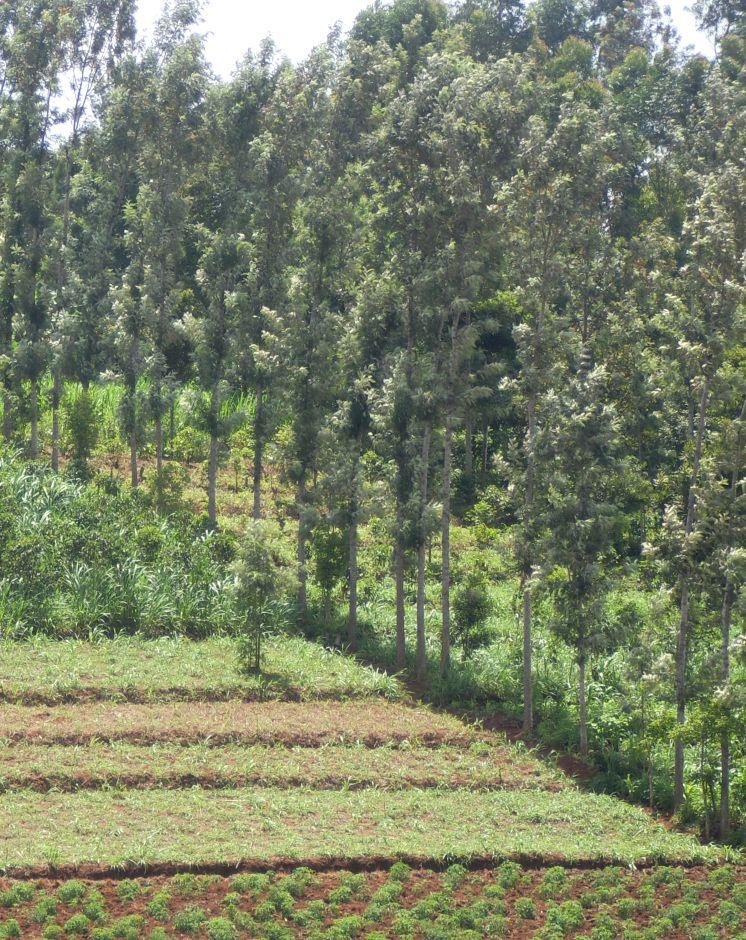
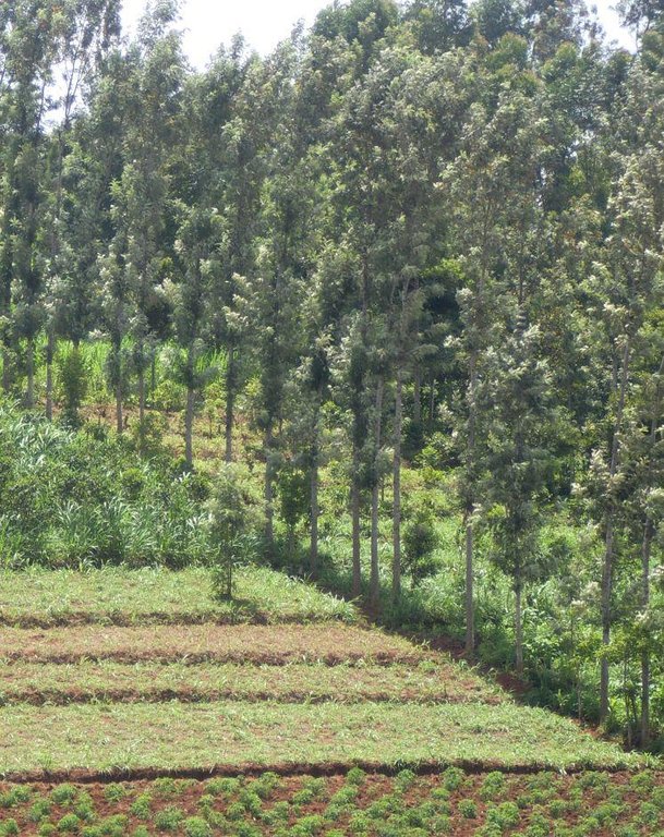
Windbreaks are narrow strips of trees, shrubs and/or grasses planted to protect fields, homes, canals, and other areas from the wind and blowing sand.
2.2 ការពណ៌នាលម្អិតពីបច្ចេកទេស
ការពណ៌នា:
Where wind is a major cause of soil erosion and moisture loss, windbreaks can make a significant contribution to sustainable production. They also be used to act as shelter-belts, a type of windbreak, are long, multiple rows of trees and shrubs, usually along sea coasts, to protect agricultural fields from inundation by tidal waves.
Purpose of the Technology: Windbreaks can make a significant contribution to sustainable production
Where wind is a major cause of soil erosion and moisture loss
It improves the microclimate in a given protected area by decreasing water evaporation from the soil and plants
Establishment / maintenance activities and inputs: Trees ( mainly Grivelia robusta) are planted in rows. They are maintained by regular pruning from the tender age to old age. Also, regular replacement of old trees. The trees are closely planted, about 1m apart and a maximum height of about 10m. The trees are always planted along the edges of the fields to protect the effects of mainly wind and the tidal waves. Surveying of the planting lines should be done to ensure they are linear
Natural / human environment: The trees are used as boundaries, firewood, timber and fence posts, they should be environmental friendly.
2.3 រូបភាពនៃបច្ចេកទេស
2.5 ប្រទេស/តំបន់/ទីតាំងកន្លែង ដែលបច្ចេកទេសត្រូវបានអនុវត្ត និងបានគ្រប់ដណ្តប់ដោយការវាយតម្លៃនេះ
ប្រទេស:
ប្រទេសកេនយ៉ា
តំបន់/រដ្ឋ/ខេត្ត:
Eastern Province
បញ្ជាក់បន្ថែមពីលក្ខណៈនៃទីតាំង:
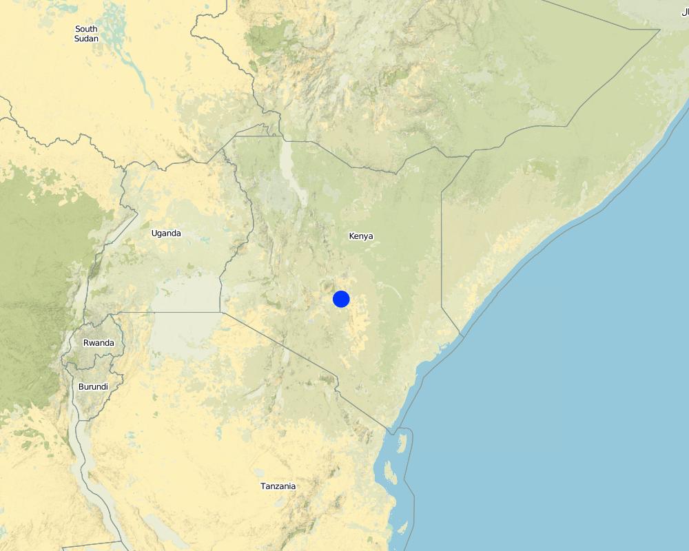
Mbeere South District
Map
×2.6 កាលបរិច្ឆេទនៃការអនុវត្ត
ប្រសិនបើមិនច្បាស់ឆ្នាំ សូមបញ្ជាក់កាលបរិច្ឆេទដែលប្រហាក់ប្រហែល:
- 10-50 ឆ្នាំ
2.7 ការណែនាំពីបច្ចេកទេស
សូមបញ្ជាក់តើបច្ចេកទេសត្រូវបានណែនាំឱ្យអនុវត្តដោយរបៀបណា:
- តាមរយៈការបង្កើតថ្មីរបស់អ្នកប្រើប្រាស់ដី
3. ចំណាត់ថ្នាក់នៃបច្ចេកទេស SLM
3.1 គោលបំណងចម្បង (១ ឬច្រើន) នៃបច្ចេកទេសនេះ
- ធ្វើឱ្យប្រសើរឡើងនូវផលិតកម្ម
- កាត់បន្ថយ, បង្ការ, ស្តារឡើងវិញនូវការធ្លាក់ចុះគុណភាពដី
- បន្ស៊ាំទៅនឹងការប្រែប្រួលអាកាសធាតុ/គ្រោះមហន្តរាយ និងផលប៉ះពាល់របស់វា
- បង្កើតផលប្រយោជន៍សេដ្ឋកិច្ច
3.2 ប្រភេទដីប្រើប្រាស់មួយប្រភេទ (ច្រើនប្រភេទ) ដែលបានអនុវត្តបច្ចេកទេស

ដីដាំដំណាំ
- ដំណាំប្រចាំឆ្នាំ
មតិយោបល់:
Major land use problems (compiler’s opinion): There is a lot of wind erosion that leads to low land productivity.
Major land use problems (land users’ perception): Soil erosion of the top soil.
Future (final) land use (after implementation of SLM Technology): Cropland: Ca: Annual cropping
ប្រសិនបើដីមានការប្រែប្រួលបន្ទាប់ពីការអនុវត្តបច្ចេកទេស សូមបញ្ជាក់ពីការប្រើប្រាស់ដីមុនពេលអនុវត្តន៍បច្ចេកទេស:
Cropland: Ca: Annual cropping
3.3 ព័ត៌មានបន្ថែមអំពីអ្នកប្រើប្រាស់ដី
ការផ្គត់ផ្គង់ទឹកនៅកន្លែងអនុវត្តបច្ចេកទេស:
- ទឹកភ្លៀង និងប្រព័ន្ធស្រោចស្រព
ចំនួនសារដែលដាំដំណាំក្នុងមួយឆ្នាំ:
- 2
3.4 ក្រុម SLM ដែលបច្ចេកទេសស្ថិតនៅក្នុង
- របាំងខ្យល់
3.5 ការសាយភាយនៃបច្ចេកទេស
បញ្ជាក់ពីការសាយភាយនៃបច្ចេកទេស:
- ត្រូវបានផ្សព្វផ្សាយត្រឹមតំបន់មួយ
ប្រសិនបើបច្ចេកទេសត្រូវបានសាយភាយពាសពេញតំបន់ណាមួយ សូមកំណត់ទំហំផ្ទៃដីអនុវត្តន៍:
- 0.1-1 គម2
3.6 វិធានការ SLM ដែលបញ្ចូលនូវបច្ចេកទេស

វិធានការរុក្ខជាតិ
- V1: ឈើធំៗ និងដើមឈើតូចៗ
មតិយោបល់:
Type of vegetative measures: aligned: -along boundary
3.7 កំណត់ប្រភេទនៃការធ្លាក់ចុះគុណភាពដីសំខាន់ៗដែលបច្ចេកទេសនេះបានដោះស្រាយ

ការបាត់ដីដោយសារខ្យល់
- Et: ការបាត់បង់ដីស្រទាប់លើ
មតិយោបល់:
Main causes of degradation: wind storms / dust storms
Secondary causes of degradation: soil management, crop management (annual, perennial, tree/shrub), droughts, land tenure
3.8 ការពារ កាត់បន្ថយ ឬស្តារឡើងវិញនៃការធ្លាក់ចុះគុណភាពដី
បញ្ជាក់ពីគោលដៅរបស់បច្ចេកទេស ដែលផ្តោតទៅការធ្លាក់ចុះគុណភាពដី:
- ការការពារការធ្លាក់ចុះគុណភាពដី
- ការជួសជុល/ ស្តារឡើងវិញនៃឱនភាពដីធ្ងន់ធ្ងរ
4. បច្ចេកទេសជាក់លាក់ សកម្មភាពអនុវត្ត ធាតុចូល និងថ្លៃដើម
4.1 គំនូសបច្ចេកទេសនៃបច្ចេកទេសនេះ
4.2 លក្ខណៈពិសេសនៃបច្ចេកទេស/ ពណ៌នាពីគំនូរបច្ចេកទេស
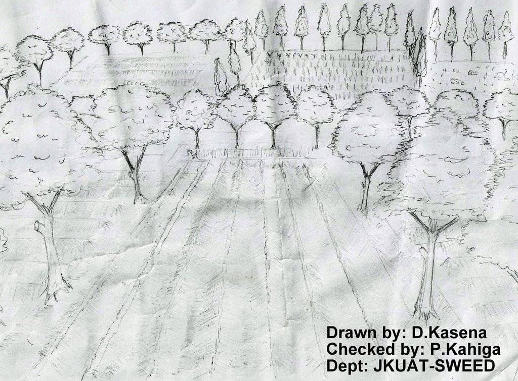
The technical drawing on the left hand shows boundary trees planted either along boundaries between farmers or between different portions of two crop stands. The spacing between the crops depend on the type of particular tree. The most common boundary trees used in Embu County is gravellia trees that have multiple uses (firewood, timber, animal feeds - leaves during the dry spells and mulch to some extent)
Location: Embu. Central Province
Date: 13.02.2013
Technical knowledge required for field staff / advisors: moderate (The technology does not require a lot of skills to demonstrate to the farmers. Just basic skills on spacing and vertical interval)
Technical knowledge required for land users: low (The basic skills of the farmer required to effect the technology)
Main technical functions: stabilisation of soil (eg by tree roots against land slides), reduction in wind speed
Aligned: -contour
Vegetative material: T : trees / shrubs
Aligned: -along boundary
Vegetative material: T : trees / shrubs
Number of plants per (ha): 400
Vertical interval between rows / strips / blocks (m): 20
Spacing between rows / strips / blocks (m): 5
Vertical interval within rows / strips / blocks (m): 0.3
Width within rows / strips / blocks (m): 0.5
Trees/ shrubs species: Grivelia robusta
Grass species: Napier grass
Slope (which determines the spacing indicated above): 5%%
If the original slope has changed as a result of the Technology, the slope today is (see figure below): 5%%
4.3 ព័ត៌មានទូទៅដែលពាក់ព័ន្ធនឹងការគណនាធាតុចូល និងថ្លៃដើម
ផ្សេងៗ/ រូបិយប័ណ្ណជាតិ (បញ្ជាក់):
KSh
កំណត់អត្រាប្តូរប្រាក់ពីដុល្លាទៅរូបិយប័ណ្ណតំបន់ (បើទាក់ទង)៖ 1 ដុល្លារ =:
85,0
កំណត់ថ្លៃឈ្នួលជាមធ្យមនៃការជួលកម្លាំងពលកម្មក្នុងមួយថ្ងៃ:
4.70
4.4 សកម្មភាពបង្កើត
| សកម្មភាព | ប្រភេទវិធានការ | ពេលវេលា | |
|---|---|---|---|
| 1. | Establishing contours | សារពើរុក្ខជាតិ | Each cropping season |
| 2. | Digging of holes | សារពើរុក្ខជាតិ | Before the cropping season |
| 3. | Planting of trees | សារពើរុក្ខជាតិ | After the digging of holes |
4.5 ថ្លៃដើម និងធាតុចូលដែលត្រូវការសម្រាប់ការបង្កើតបច្ចេកទេស
| បញ្ជាក់ពីធាតុចូល | ឯកតា | បរិមាណ | ថ្លៃដើមក្នុងមួយឯកតា | ថ្លៃធាតុចូលសរុប | % នៃថ្លៃដើមដែលចំណាយដោយអ្នកប្រើប្រាស់ដី | |
|---|---|---|---|---|---|---|
| កម្លាំងពលកម្ម | Labour | ha | 1,0 | 470,0 | 470,0 | 100,0 |
| សម្ភារៈ | Tools | ha | 1,0 | 5,3 | 5,3 | 100,0 |
| សម្ភារៈដាំដុះ | Seedlings | ha | 1,0 | 480,0 | 480,0 | 100,0 |
| ជី និងសារធាតុពុល | Compost/manure | ha | 1,0 | 3,5 | 3,5 | 100,0 |
| ថ្លៃដើមសរុបក្នុងការបង្កើតបច្ចេកទេស | 958,8 | |||||
មតិយោបល់:
Duration of establishment phase: 24 month(s)
4.6 សកម្មភាពថែទាំ
| សកម្មភាព | ប្រភេទវិធានការ | ពេលវេលា/ ភាពញឹកញាប់ | |
|---|---|---|---|
| 1. | Prunning | ក្សេត្រសាស្ត្រ | Each cropping season |
| 2. | Pruning | សារពើរុក្ខជាតិ | Onset of planting season |
4.7 កំណត់ថ្លៃដើមសម្រាប់ការថែទាំ/ សកម្មភាពរបស់បច្ចេកទេស (ក្នុងរយៈពេលមួយឆ្នាំ)
| បញ្ជាក់ពីធាតុចូល | ឯកតា | បរិមាណ | ថ្លៃដើមក្នុងមួយឯកតា | ថ្លៃធាតុចូលសរុប | % នៃថ្លៃដើមដែលចំណាយដោយអ្នកប្រើប្រាស់ដី | |
|---|---|---|---|---|---|---|
| កម្លាំងពលកម្ម | Labour | ha | 1,0 | 470,0 | 470,0 | 100,0 |
| ថ្លៃដើមសរុបសម្រាប់ការថែទាំដំណាំតាមបច្ចេកទេស | 470,0 | |||||
4.8 កត្តាសំខាន់បំផុតដែលមានឥទ្ធិពលដល់ការចំណាយ
ពណ៌នាពីកត្តាប៉ះពាល់ចម្បងៗទៅលើថ្លៃដើម:
If the land has a gentle sloping gradient, the trees need to be closely planted o reduce the effects of the winds and storms to the crops.
5. លក្ខណៈបរិស្ថានធម្មជាតិ និងមនុស្ស
5.1 អាកាសធាតុ
បរិមាណទឹកភ្លៀងប្រចាំឆ្នាំ
- < 250 មម
- 251-500 មម
- 501-750 មម
- 751-1,000 មម
- 1,001-1,500 មម
- 1,501-2,000 មម
- 2,001-3,000 មម
- 3,001-4,000 មម
- > 4,000 មម
លក្ខណៈពិសេស/ មតិយោបល់លើរដូវភ្លៀង:
The area receives relatively good amount of rainfall
តំបន់កសិអាកាសធាតុ
- មានភ្លៀងមធ្យម
- មានភ្លៀងតិចតួច
5.2 សណ្ឋានដី
ជម្រាលជាមធ្យម:
- រាបស្មើ (0-2%)
- ជម្រាលតិចតួច (3-5%)
- មធ្យម (6-10%)
- ជម្រាលខ្ពស់បន្តិច (11-15%)
- ទីទួល (16-30%)
- ទីទួលចោត (31-60%)
- ទីទួលចោតខ្លាំង (>60%)
ទម្រង់ដី:
- ខ្ពង់រាប
- កំពូលភ្នំ
- ជម្រាលភ្នំ
- ជម្រាលទួល
- ជម្រាលជើងភ្នំ
- បាតជ្រលងភ្នំ
តំបន់តាមរយៈកម្ពស់ :
- 0-100 ម
- 101-500 ម
- 501-1,000 ម
- 1,001-1,500 ម
- 1,501-2,000 ម
- 2,001-2,500 ម
- 2,501-3,000 ម
- 3,001-4,000 ម
- > 4,000 ម
5.3 ដី
ជម្រៅដីជាមធ្យម:
- រាក់ខ្លាំង (0-20 សម)
- រាក់ (21-50 សម)
- មធ្យម (51-80 សម)
- ជ្រៅ (81-120 សម)
- ជ្រៅខ្លាំង (> 120 សម)
វាយនភាពដី (ស្រទាប់លើ):
- មធ្យម (ល្បាយ, ល្បាប់)
សារធាតុសរីរាង្គនៅស្រទាប់ដីខាងលើ:
- មធ្យម (1-3%)
បើអាចសូមភ្ជាប់ការពណ៌នាពីដីឱ្យបានច្បាស់ ឬព័ត៌មានដែលអាចទទួលបាន ឧ. ប្រភេទដី, pH ដី/ ជាតិអាស៊ីត, សមត្ថភាពផ្លាស់ប្តូរកាចុង, វត្តមាននីត្រូសែន, ភាពប្រៃ ។ល។:
Soil texture: Medium (the soils are relatively friable)
Soil fertility: Medium (limited crops for productivity)
Topsoil organic matter: Medium (gently sloping lands)
Soil drainage/infiltration: Medium (the soils are relatively good drained)
Soil water storage capacity: Medium (soils have medium water holding capacity due to high intensities of sun rays)
5.4 ទឹកដែលអាចទាញមកប្រើប្រាស់បាន និងគុណភាពទឹក
នីវ៉ូទឹកក្រោមដី:
> 50 ម
ទឹកលើដីដែលអាចទាញយកប្រើប្រាស់បាន:
កម្រិតមធ្យម
គុណភាពទឹក (មិនបានធ្វើប្រត្តិកម្ម):
ទឹកពិសារដែលគ្មានគុណភាព (តម្រូវឱ្យមានការសំអាត)
5.5 ជីវៈចម្រុះ
ភាពសម្បូរបែបនៃប្រភេទ:
- ទាប
5.6 លក្ខណៈនៃអ្នកប្រើប្រាស់ដីដែលអនុវត្តបច្ចេកទេស
ទីផ្សារនៃប្រព័ន្ធផលិតកម្ម:
- ពាក់កណ្តាលពាណិជ្ជកម្ម (ផ្គត់ផ្គង់ខ្លួនឯង/ ពាណិជ្ជកម្ម
ចំណូលក្រៅកសិកម្ម:
- 10-50% នៃចំណូល
កម្រិតជីវភាព:
- មធ្យម
ឯកជន ឬក្រុម:
- ធ្វើខ្លួនឯង/ គ្រួសារ
កម្រិតប្រើប្រាស់គ្រឿងយន្ត:
- ប្រើកម្លាំងពលកម្ម
យេនឌ័រ:
- ស្ត្រី
- បុរស
សូមបញ្ជាក់ពីលក្ខណៈពាក់ព័ន្ធផ្សេងទៀតអំពីអ្នកប្រើប្រាស់ដី:
Land users applying the Technology are mainly common / average land users
Difference in the involvement of women and men: Men ensure establishment and women ensure good maintenance of the technology
Population density: > 500 persons/km2
Annual population growth: 1% - 2%
(Most people have avaragely living standards).
Off-farm income specification: There is increased production since the trees once grown big can be cut and provide timber
5.7 ទំហំផ្ទៃដីជាមធ្យមនៃដីផ្ទាល់ខ្លួន ឬជួលគេដែលបានអនុវត្តបច្ចេកទេស
- < 0.5 ហិកតា
- 0.5-1 ហិកតា
- 1-2 ហិកតា
- 2-5 ហិកតា
- 5-15 ហិកតា
- 15-50 ហិកតា
- 50-100 ហិកតា
- 100-500 ហិកតា
- 500-1,000 ហិកតា
- 1,000-10,000 ហិកតា
- > 10,000 ហិកតា
តើផ្ទៃដីនេះចាត់ទុកជាទំហំកម្រិតណាដែរ ខ្នាតតូច មធ្យម ឬខ្នាតធំ (ធៀបនឹងបរិបទតំបន់)?
- ខ្នាតតូច
5.8 ភាពជាម្ចាស់ដី កម្មសិទ្ធប្រើប្រាស់ដី និងកម្មសិទ្ធប្រើប្រាស់ទឹក
ភាពជាម្ចាស់ដី:
- ឯកជន មិនមានកម្មសិទ្ធ
កម្មសិទ្ធិប្រើប្រាស់ដី:
- ឯកជន
5.9 ការប្រើប្រាស់សេវាកម្ម និងហេដ្ឋារចនាសម្ព័ន្ធ
សុខភាព:
- មិនល្អ
- មធ្យម
- ល្អ
ការអប់រំ:
- មិនល្អ
- មធ្យម
- ល្អ
6. ផលប៉ះពាល់ និងការសន្និដ្ឋាន
6.1 ផលប៉ះពាល់ក្នុងបរិវេណអនុវត្តបច្ចេកទេសដែលកើតមាន
ផលប៉ះពាល់លើសេដ្ឋកិច្ចសង្គម
ផលិតផល
ផលិតកម្មឈើ
ភាពសម្បូរបែបនៃផលិតផល
ការគ្រប់គ្រងដី
ចំណូល និងថ្លៃដើម
ចំណូលក្នុងកសិដ្ឋាន
ផលប៉ះពាល់ទៅលើវប្បធម៌សង្គម
ចំណេះដឹង SLM / ការធ្លាក់ចុះគុណភាពដី
ការកាត់បន្ថយជម្លោះ
Improved livelihoods and human well-being
ផលប៉ះពាល់ទៅលើអេកូឡូស៊ី
ជីវចម្រុះ៖ ដំណាំ, សត្វ
ភាពសម្បូរបែបនៃទីជំរក
ការកាត់បន្ថយហានិភ័យនៃគ្រោះមហន្តរាយ និងគ្រោះអាកាសធាតុ
ល្បឿនខ្យល់
6.2 ផលប៉ះពាល់ក្រៅបរិវេណអនុវត្តបច្ចេកទេសដែលកើតមាន
ខ្យល់នាំយកនូវធូរលី
6.3 ភាពប្រឈម និងភាពរួសនៃបច្ចេកទេសទៅនឹងការប្រែប្រួលអាកាសធាតុ និងគ្រោះអាកាសធាតុ/ គ្រោះមហន្តរាយ (ដែលដឹងដោយអ្នកប្រើប្រាស់ដី)
គ្រោះអាកាសធាតុ (មហន្តរាយ)
គ្រោះមហន្តរាយធម្មជាតិ
| លក្ខណៈឆ្លើយតបនៃបច្ចេកទេសទៅនឹងការប្រែប្រួលអាកាសធាតុ | |
|---|---|
| ព្យុះកំបុតត្បូងតាមតំបន់ | ល្អ |
6.4 ការវិភាគថ្លៃដើម និងអត្ថប្រយោជន៍
តើផលចំណេញ និងថ្លៃដើមត្រូវបានប្រៀបធៀបគ្នាយ៉ាងដូចម្តេច (ទស្សនៈរបស់អ្នកប្រើប្រាស់ដី)?
រយៈពេលខ្លី:
វិជ្ជមាន
រយៈពេលវែង:
វិជ្ជមាន
តើផលចំណេញ និងការថែទាំ/ ជួសជុលត្រូវបានប្រៀបធៀបគ្នាយ៉ាងដូចម្តេច (ទស្សនៈរបស់អ្នកប្រើប្រាស់ដី)?
រយៈពេលខ្លី:
វិជ្ជមាន
រយៈពេលវែង:
វិជ្ជមាន
6.5 ការទទួលយកបច្ចេកទេស
មតិយោបល់:
There is a strong trend towards spontaneous adoption of the Technology
6.7 ភាពខ្លាំង/ គុណសម្បត្តិ/ ឱកាសនៃបច្ចេកទេស
| ភាពខ្លាំង/ គុណសម្បត្តិ/ ឱកាស ទស្សនៈរបស់បុគ្គលសំខាន់ៗ |
|---|
| Reduce wind speed |
| They produce fruit, nuts, maple syrup, firewood, posts, poles and veneer |
| They provide nectar and pollen for bees |
| Wind breaks protect a variety of wind-sensitive crops |
| Acts as sound barriers and mitigate odors from neighboring properties |
6.8 ភាពខ្សោយ/ គុណវិបត្តិ/ ហានិភ័យនៃបច្ចេកទេស និងវិធីសាស្ត្រដោះស្រាយ
| ភាពខ្សោយ/ គុណវិបត្តិ/ ហានិភ័យ ទស្សនៈរបស់អ្នកប្រើប្រាស់ដី | តើបច្ចេកទេសទាំងនោះបានដោះស្រាយបញ្ហាដូចម្តេច? |
|---|---|
| complicates equipment movement | Proper spacing to allow movement of equipment |
| Establishment and maintenance costs | The establishment and maintenance cost cant be equaled with the overall benefits |
| ភាពខ្សោយ/ គុណវិបត្តិ/ ហានិភ័យ ទស្សនៈរបស់អ្នកចងក្រងឬបុគ្គលសំខាន់ៗ | តើបច្ចេកទេសទាំងនោះបានដោះស្រាយបញ្ហាដូចម្តេច? |
|---|---|
| Loss of space that could otherwise be utilized by food crops | Appropriate spacing even though the effect has less magnitude because it is established along the boundaries |
| Shading effects, effects on micro-climate and harbors pests. | Avoid very tall windbreaks which shades excessively and are susceptible to breakages. Use of appropriate chemicals for spraying the pests. |
| Competition for water and nutrients | Supplemental irrigation in times of droughts |
7. ឯកសារយោង និងវេបសាយ
7.1 វិធីសាស្ត្រ/ ប្រភពនៃព័ត៌មាន
- តាមការចុះទីវាល ការស្រាវជ្រាវនៅទីវាល
- ការសម្ភាសន៍ជាមួយអ្នកប្រើប្រាស់ដី
ការតភ្ជាប់ និងម៉ូឌុល
ពង្រីកមើលទាំងអស់ បង្រួមទាំងអស់ការតភ្ជាប់
គ្មានការតភ្ជាប់
ម៉ូឌុល
គ្មានម៉ូឌុល


