Sunken streambed structure [ប្រទេសឥណ្ឌា]
- ការបង្កើត៖
- បច្ចុប្បន្នភាព
- អ្នកចងក្រង៖ David Gandhi
- អ្នកកែសម្រួល៖ –
- អ្នកត្រួតពិនិត្យច្រើនទៀត៖ Fabian Ottiger, Alexandra Gavilano
DOH
technologies_1471 - ប្រទេសឥណ្ឌា
ពិនិត្យមើលគ្រប់ផ្នែក
ពង្រីកមើលទាំងអស់ បង្រួមទាំងអស់1. ព័ត៌មានទូទៅ
1.2 ព័ត៌មានលម្អិតពីបុគ្គលសំខាន់ៗ និងស្ថាប័នដែលចូលរួមក្នុងការវាយតម្លៃ និងចងក្រងឯកសារនៃបច្ចេកទេស
អ្នកជំនាញឯកទេស SLM:
Agrawal VK
Comprehensive Watershed Development Project
ប្រទេសឥណ្ឌា
អ្នកជំនាញឯកទេស SLM:
ឈ្មោះគម្រោងដែលបានចងក្រងឯកសារ/ វាយតម្លៃលើបច្ចេកទេស (បើទាក់ទង)
Book project: Water Harvesting – Guidelines to Good Practice (Water Harvesting)ឈ្មោះគម្រោងដែលបានចងក្រងឯកសារ/ វាយតម្លៃលើបច្ចេកទេស (បើទាក់ទង)
Book project: where the land is greener - Case Studies and Analysis of Soil and Water Conservation Initiatives Worldwide (where the land is greener)1.3 លក្ខខណ្ឌទាក់ទងទៅនឹងការប្រើប្រាស់ទិន្នន័យដែលបានចងក្រងតាមរយៈ វ៉ូខេត
អ្នកចងក្រង និង(បុគ្គលសំខាន់ៗ)យល់ព្រមទទួលយកនូវលក្ខខណ្ឌនានាទាក់ទងទៅនឹងការប្រើប្រាស់ទិន្នន័យដែលបានចងក្រងតាមរយៈវ៉ូខេត:
បាទ/ចា៎
1.5 ការយោងទៅលើកម្រងបញ្ជីសំណួរ (មួយ ឬច្រើន) នៃវិធីសាស្ត្រផ្សព្វផ្សាយ SLM (ដែលបានចងក្រងដោយទស្សនៈពិភពលោកស្តីពីវិធីសាស្ត្រ និងបច្ចេកទេសងអភិរក្ស WOCAT)
Comprehensive watershed development [ប្រទេសឥណ្ឌា]
Participatory approach that includes a package of measures leading to empowerment of communities to implement and sustain watershed development.
- អ្នកចងក្រង៖ David Gandhi
2. ការពណ៌នាពីបច្ចេកទេស SLM
2.1 ការពណ៌នាដោយសង្ខេបពីបច្ចេកទេស
និយមន័យបច្ចេកទេស:
Excavations in streambeds to provide temporary storage of runoff, increasing water yields from shallow wells for supplementary irrigation.
2.2 ការពណ៌នាលម្អិតពីបច្ចេកទេស
ការពណ៌នា:
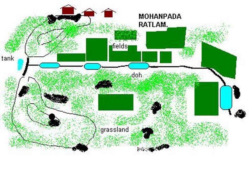
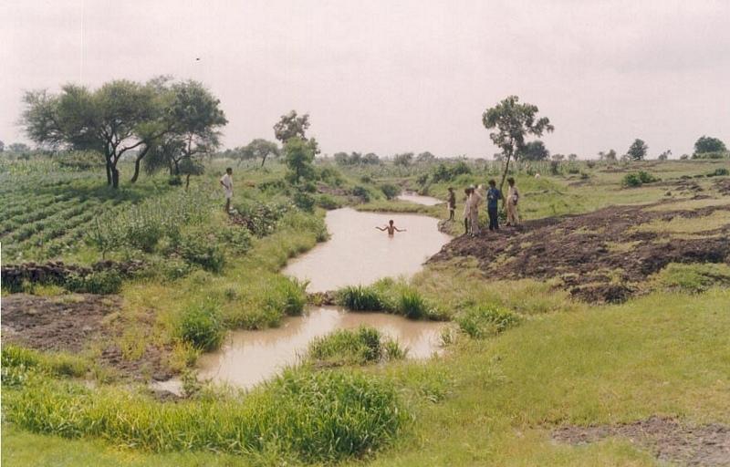
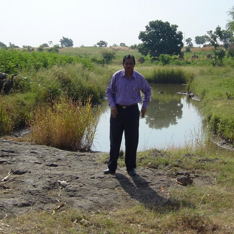
Dohs are rectangular excavations in seasonal streambeds, which are intended to capture and hold runoff to enhance groundwater recharge, thus increasing water for irrigation from nearby shallow wells. They also collect and impound subsurface flow. Dohs are built in semi-arid areas where rainfall is low and seasonal. The dimension of a typical doh is 1.0-1.5 m deep with variable length (up to 40 m) and width (up to 10 m) depending on streambed section, with an average capacity of 400 m3.
Purpose of the Technology: The excavated material is deposited along the stream banks as a barrier against siltation from surrounding areas. The slopes of the excavation are gentle (an upstream slope of 1:6 or 17% and a downstream slope of 1:8 or 12%) so that water flows into it, and excess water out again, carrying silt rather than depositing it. The sides however are steep, to increase capacity - and would benefit from stone pitching to stabilise them. A silt trap comprising a line of loose boulders is constructed upstream across the streambed. Dohs are generally built in sequence. They may be as close as a few metres apart. Bends in the stream are avoided as these are susceptible to bank erosion.
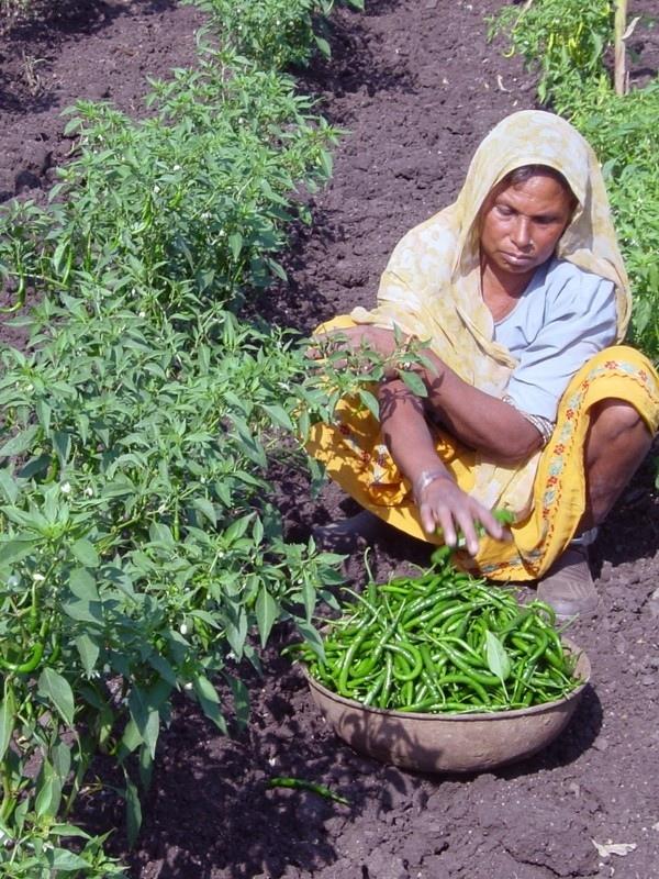
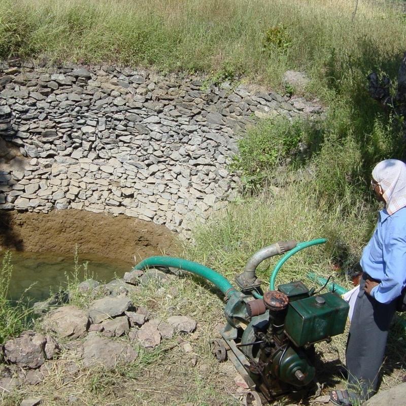
Establishment / maintenance activities and inputs: The technology is used in conjunction with shallow wells (odees), which enable farmers to harvest the increased groundwater for supplementary irrigation of annual crops- including vegetables such as chilli peppers. Water is pumped out of the wells. In the case study village, Mohanpada, each doh basically supplies an underground source of extra water to one well. Communities together with project staff carry out site selection, and then detailed design/estimates/layout is done with project technical assistance. As a supportive measure the catchment area is treated with gully plugs (small stone checks in gullies). A water harvesting tank (small reservoir or dam) may be excavated above the series of dohs where this is justified by a sufficiently large catchment area/suitable site. The capacity of the tank at Mohanpada is around 600 m3 and thus also has a positive impact on groundwater recharge.
Natural / human environment: Maintenance is agreed through meetings of user groups: manual desilting is planned and repairs of gully plugs also. In summary, dohs are low cost water recharge alternatives for poorer communities, and in this case study, the extra area brought under production has meant that all families that require it, now have access to some water for irrigation.
2.3 រូបភាពនៃបច្ចេកទេស
វិចិត្រសាលប្រព័ន្ធផ្សព្វផ្សាយ
2.5 ប្រទេស/តំបន់/ទីតាំងកន្លែង ដែលបច្ចេកទេសត្រូវបានអនុវត្ត និងបានគ្រប់ដណ្តប់ដោយការវាយតម្លៃនេះ
ប្រទេស:
ប្រទេសឥណ្ឌា
តំបន់/រដ្ឋ/ខេត្ត:
Madhya Pradesh
បញ្ជាក់បន្ថែមពីលក្ខណៈនៃទីតាំង:
Ratlam, Mohanpada
មតិយោបល់:
Total area covered by the SLM Technology is 0.1 km2.
The project area for phase 1 comprises 18 villages (3314 Households) mainly tribal. A significant portion of the area is barren and used for open grazing. The sunken wter harvesting technology was initially demonstrated in few villages as an alternative to the high cost heading type approach to water harvesting bieng implemented on a large scale by main line programmes.
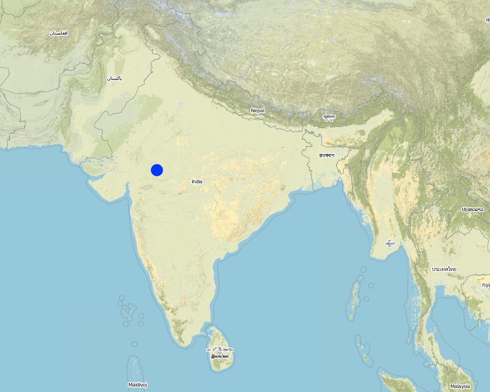
Map
×2.6 កាលបរិច្ឆេទនៃការអនុវត្ត
ប្រសិនបើមិនច្បាស់ឆ្នាំ សូមបញ្ជាក់កាលបរិច្ឆេទដែលប្រហាក់ប្រហែល:
- ច្រើនជាង 50 ឆ្នាំមុន (ប្រពៃណី)
2.7 ការណែនាំពីបច្ចេកទេស
សូមបញ្ជាក់តើបច្ចេកទេសត្រូវបានណែនាំឱ្យអនុវត្តដោយរបៀបណា:
- តាមរយៈគម្រោង / អន្តរាគមន៍ពីខាងក្រៅ
មតិយោបល់ (ប្រភេទនៃគម្រោង ។ល។):
The technology which is a modification of the traditional 'DOH' observed in river beds was implemented on an experimental basis in village Ambaohondan Tehsil 0 Mau, Dist. Indore under NWDPRA by Mr. V.K.Agrawal & Mr.V.V.Karmarkar.
3. ចំណាត់ថ្នាក់នៃបច្ចេកទេស SLM
3.1 គោលបំណងចម្បង (១ ឬច្រើន) នៃបច្ចេកទេសនេះ
- ធ្វើឱ្យប្រសើរឡើងនូវផលិតកម្ម
3.2 ប្រភេទដីប្រើប្រាស់មួយប្រភេទ (ច្រើនប្រភេទ) ដែលបានអនុវត្តបច្ចេកទេស
ដីប្រើប្រាស់ចម្រុះនៅលើដីតែមួយ:
បាទ/ចា៎
បញ្ជាក់ពីប្រភេទដីច្រើនប្រភេទ (ដីដាំដំណាំ/ដីចិញ្ចឹមសត្វ/ដីព្រៃឈើ):
- Agro-pastoralism ( រួមបញ្ចូលទាំងដំណាំ និងចិញ្ចឹមសត្វ)

ដីដាំដំណាំ
- ដំណាំប្រចាំឆ្នាំ
ដំណាំប្រចាំឆ្នាំ - បញ្ជាក់ប្រភេទដំណាំ:
- ដំណាំសរសៃ - កម្បាស ឬសំឡី
- ពពួកសណ្តែក - គ្រាប់ហោឡាំងតាវ
- បន្លែ - ផ្សេងៗ
- wheat, chili peppers
ចំនួនសារដែលដាំដំណាំក្នុងមួយឆ្នាំ:
- 2
សូមបញ្ជាក់:
Longest growing period in days: 120 Longest growing period from month to month: Jul - Oct

ដីសម្រាប់ចិញ្ចឹមសត្វ
- Extensive grazing
មតិយោបល់:
Major land use problems (compiler’s opinion): There are regular poor yields of agricultural crops on the degraded, rainfed fields. A further constraint is the limited amount of water in wells, restricting both the extent of irrigation, and the number of people with access to irrigation. There is an underlying problem of poverty, which in turn leads to seasonal out-migration to find work.
Major land use problems (land users’ perception): Agricultural lands: sloping fields, soil loss, poor yields. Common lands:competition from surrounding villages for grazing resulting in low yields. Private pastures (bir): small patches which are not sufficient to meet the fodder needs. Settlement area: 28 huts already erected. Additional space not available.
Other grazingland: extensive grazing: on patches of waste lands within fields
Type of cropping system and major crops comments: During monsoon (kharif) season the main crop is cotton + maize. In addition minor pulses are taken. If water is available for irrigation, this is followed by wheat+gram in winter. Major area is fallow in winter except for the cotton crop which is of longer duration. No cultivation was observed in summer.
3.4 ការផ្គត់ផ្គង់ទឹក
ការផ្គត់ផ្គង់ទឹកនៅកន្លែងអនុវត្តបច្ចេកទេស:
- ទឹកភ្លៀង
មតិយោបល់:
Water supply: Also mixed rainfed - irrigated
3.5 ក្រុម SLM ដែលបច្ចេកទេសស្ថិតនៅក្នុង
- ការស្តុកទុកទឹក
- ការគ្រប់គ្រងប្រព័ន្ធស្រោចស្រព (រួមទាំងការផ្គត់ផ្គង់ទឹក ប្រព័ន្ធបង្ហូរ)
- ការគ្រប់គ្រងទឹកលើដី (ទឹកធ្លាក់ ទន្លេ បឹង សមុទ្រ)
3.6 វិធានការ SLM ដែលបញ្ចូលនូវបច្ចេកទេស

វិធានការរចនាស័ម្ពន្ធ
មតិយោបល់:
Main measures: structural measures
3.7 កំណត់ប្រភេទនៃការធ្លាក់ចុះគុណភាពដីសំខាន់ៗដែលបច្ចេកទេសនេះបានដោះស្រាយ

ការហូរច្រោះដីដោយសារទឹក
- Wg: ការកកើតឡើងនូវកំទេចកំទីដីស្រទាប់ក្រោម

ការបាត់បង់ទឹក
- Ha: ការថយចុះសំណើមដី
មតិយោបល់:
Main type of degradation addressed: Wg: gully erosion / gullying, Ha: aridification
Main causes of degradation: other human induced causes (specify) (Social causes = Lack of awareness and mobilisation amongst the communities.), Top down approach (Macro planning rather than micro (village level) planning.)
3.8 ការពារ កាត់បន្ថយ ឬស្តារឡើងវិញនៃការធ្លាក់ចុះគុណភាពដី
បញ្ជាក់ពីគោលដៅរបស់បច្ចេកទេស ដែលផ្តោតទៅការធ្លាក់ចុះគុណភាពដី:
- ការកាត់បន្ថយការធ្លាក់ចុះគុណភាពដី
4. បច្ចេកទេសជាក់លាក់ សកម្មភាពអនុវត្ត ធាតុចូល និងថ្លៃដើម
4.1 គំនូសបច្ចេកទេសនៃបច្ចេកទេសនេះ
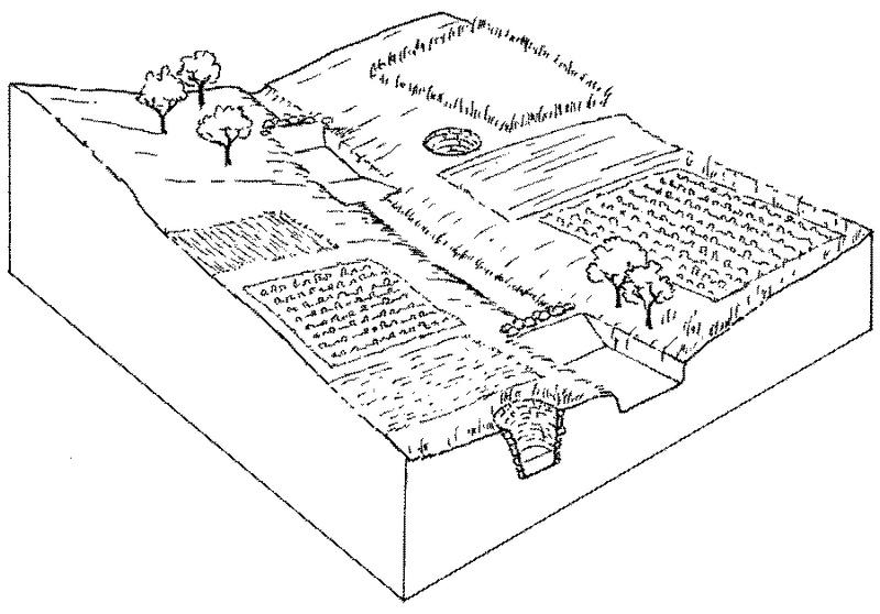
លក្ខណៈពិសេសនៃបច្ចេកទេស (ទាក់ទងនឺងគំនូរបច្ចេកទេស):
Overview of sunken streambed structures (doh) with associated wells and irrigated plots. Note that several dohs are applied in series along the waterway.
Technical knowledge required for field staff / advisors: moderate
Technical knowledge required for land users: low
Main technical functions: increase of infiltration, water harvesting / increase water supply
Secondary technical functions: control of concentrated runoff: retain / trap
Structural measure: doh (sunken streambed structure)
Structural measure: dam, gully plugs (supp.)
Construction material (stone): used for silt trap on the upstream side
Construction material (other): weathered section is excavated manually, while hard rock beds may be excavated by machine, dynamite.
ឈ្មោះអ្នកនិពន្ធ:
Mats Gurtner
4.2 ព័ត៌មានទូទៅដែលពាក់ព័ន្ធនឹងការគណនាធាតុចូល និងថ្លៃដើម
ផ្សេងៗ/ រូបិយប័ណ្ណជាតិ (បញ្ជាក់):
Rupees
បើពាក់ព័ន្ធសូមកំណត់អត្រាប្តូរប្រាក់ពីដុល្លាទៅរូបិយប័ណ្ណតំបន់ (ឧ. 1 ដុល្លារ = 79.9 រៀលនៃរូបិយប័ណ្ណប្រេស៊ីល) ៖ 1 ដុល្លារ =:
48,85
កំណត់ថ្លៃឈ្នួលជាមធ្យមនៃការជួលកម្លាំងពលកម្មក្នុងមួយថ្ងៃ:
1.00
4.3 សកម្មភាពបង្កើត
| សកម្មភាព | រយៈពេល (រដូវកាល) | |
|---|---|---|
| 1. | Site selection with community by eye | Dry season |
| 2. | Identification of beneficiaries and user groups | Dry season |
| 3. | Design & estimation by project staff | Dry season |
| 4. | Agreement of village committee. | Dry season |
| 5. | Treatment of catchment with gully plug | Dry season |
| 6. | Excavation of Dohs (200–400 m3) as last action with silt traps upstreamof each made from loose stone. | Dry season |
| 7. | Wells (odees) may be deepened and pumps bought | Dry season |
4.4 ថ្លៃដើម និងធាតុចូលដែលត្រូវការសម្រាប់ការបង្កើតបច្ចេកទេស
| បញ្ជាក់ពីធាតុចូល | ឯកតា | បរិមាណ | ថ្លៃដើមក្នុងមួយឯកតា | ថ្លៃធាតុចូលសរុប | % នៃថ្លៃដើមដែលចំណាយដោយអ្នកប្រើប្រាស់ដី | |
|---|---|---|---|---|---|---|
| កម្លាំងពលកម្ម | Labour | ha | 1,0 | 225,0 | 225,0 | 25,0 |
| សម្ភារៈ | Tools | ha | 1,0 | 15,0 | 15,0 | 100,0 |
| ថ្លៃដើមសរុបក្នុងការបង្កើតបច្ចេកទេស | 240,0 | |||||
| ថ្លៃដើមសរុបក្នុងការបង្កើតបច្ចេកទេសគិតជាដុល្លារ | 4,91 | |||||
មតិយោបល់:
Duration of establishment phase: 12 month(s)
4.5 សកម្មភាពថែទាំ
| សកម្មភាព | ពេលវេលា/ ភាពញឹកញាប់ | |
|---|---|---|
| 1. | Maintenance of catchment treatments (desilting of gully plugs etc) | Dry Season/if required |
| 2. | Meeting of User Group | Monsoon/After heavy Showars |
| 3. | Repairs to Silt-trap | During monsoon/After heavy shower |
| 4. | Desilting of DOH | Dry Season/annual |
4.6 កំណត់ថ្លៃដើមសម្រាប់ការថែទាំ/ សកម្មភាពរបស់បច្ចេកទេស (ក្នុងរយៈពេលមួយឆ្នាំ)
| បញ្ជាក់ពីធាតុចូល | ឯកតា | បរិមាណ | ថ្លៃដើមក្នុងមួយឯកតា | ថ្លៃធាតុចូលសរុប | % នៃថ្លៃដើមដែលចំណាយដោយអ្នកប្រើប្រាស់ដី | |
|---|---|---|---|---|---|---|
| កម្លាំងពលកម្ម | Labour | ha | 1,0 | 5,0 | 5,0 | 100,0 |
| ថ្លៃដើមសរុបសម្រាប់ការថែទាំដំណាំតាមបច្ចេកទេស | 5,0 | |||||
| ថ្លៃដើមសរុបសម្រាប់ការថែទាំដំណាំតាមបច្ចេកទេសគិតជាដុល្លារ | 0,1 | |||||
មតិយោបល់:
The construction of one doh costs between US$ 200-400, depending on the size of the doh (approximately one cubic metre can be excavated per person day at a cost of one US dollar). On a per hectare basis the costs are very variable, since they are related to the extra area brought under irrigation. In this case study there are four dohs within a total village area of 50 ha. Ten of the 50 ha have been brought into irrigated production (extra to the 5 ha already irrigated) due to the four dohs and the ‘tank’ and the costs outlined above are spread over those 10 ha. In this case half of the costs are directly attributable to dohs (average capacity 400 m3 each), and half to catchment treatment where the water-harvesting tank (a reservoir of approximately 600 m3) is the main cost. Where there is underlying rock, mechanical drills and blasting by dynamite may be required, which increases the costs. That was not the case in this village. The cost of deepening/widening the five wells (odees) has not been included here: that is carried out by the villagers themselves. While the project normally pays around 85% of labour costs, here at Mohanpada village the project only needs to pay 75%, due to a high level of commitment by the villagers.
The total of 4 doh structure were constructed along a stream length of 451 m having gradient of 1.2%. Total storage capacity is 1646qm. It is observed that during past year (2002) the structures were completely filled & subsequently emptied (percolated) 5 times.
4.7 កត្តាសំខាន់បំផុតដែលមានឥទ្ធិពលដល់ការចំណាយ
ពណ៌នាពីកត្តាប៉ះពាល់ចម្បងៗទៅលើថ្លៃដើម:
Presence of hard stata (bed rock) increases cost of excavation
5. លក្ខណៈបរិស្ថានធម្មជាតិ និងមនុស្ស
5.1 អាកាសធាតុ
បរិមាណទឹកភ្លៀងប្រចាំឆ្នាំ
- < 250 មម
- 251-500 មម
- 501-750 មម
- 751-1,000 មម
- 1,001-1,500 មម
- 1,501-2,000 មម
- 2,001-3,000 មម
- 3,001-4,000 មម
- > 4,000 មម
កំណត់បរិមាណទឹកភ្លៀង (បើដឹង) ជា មីលីម៉ែត្រ:
800,00
លក្ខណៈពិសេស/ មតិយោបល់លើរដូវភ្លៀង:
However since past 4 years rainfall has been below average
តំបន់កសិអាកាសធាតុ
- មានភ្លៀងតិចតួច
Located on the tropic of cancer, characterised by hot dry summers (max 46 deg C) and cold dry winters. Monsoon (July-Sept) is characterised by high intensity showers followed by prolonged dry spells.
5.2 សណ្ឋានដី
ជម្រាលជាមធ្យម:
- រាបស្មើ (0-2%)
- ជម្រាលតិចតួច (3-5%)
- មធ្យម (6-10%)
- ជម្រាលខ្ពស់បន្តិច (11-15%)
- ទីទួល (16-30%)
- ទីទួលចោត (31-60%)
- ទីទួលចោតខ្លាំង (>60%)
ទម្រង់ដី:
- ខ្ពង់រាប
- កំពូលភ្នំ
- ជម្រាលភ្នំ
- ជម្រាលទួល
- ជម្រាលជើងភ្នំ
- បាតជ្រលងភ្នំ
តំបន់តាមរយៈកម្ពស់ :
- 0-100 ម
- 101-500 ម
- 501-1,000 ម
- 1,001-1,500 ម
- 1,501-2,000 ម
- 2,001-2,500 ម
- 2,501-3,000 ម
- 3,001-4,000 ម
- > 4,000 ម
មតិយោបល់ និងបញ្ចាក់បន្ថែមអំពីសណ្ឋានដី :
Slopes on average: Also gentle (ranked 2) and moderate (ranked 3)
5.3 ដី
ជម្រៅដីជាមធ្យម:
- រាក់ខ្លាំង (0-20 សម)
- រាក់ (21-50 សម)
- មធ្យម (51-80 សម)
- ជ្រៅ (81-120 សម)
- ជ្រៅខ្លាំង (> 120 សម)
វាយនភាពដី (ស្រទាប់លើ):
- គ្រើម/ មានពន្លឺ (ខ្សាច់)
- មធ្យម (ល្បាយ, ល្បាប់)
សារធាតុសរីរាង្គនៅស្រទាប់ដីខាងលើ:
- ខ្ពស់ (>3%)
- មធ្យម (1-3%)
បើអាចសូមភ្ជាប់ការពណ៌នាពីដីឱ្យបានច្បាស់ ឬព័ត៌មានដែលអាចទទួលបាន ឧ. ប្រភេទដី, pH ដី/ ជាតិអាស៊ីត, សមត្ថភាពផ្លាស់ប្តូរកាចុង, វត្តមាននីត្រូសែន, ភាពប្រៃ ។ល។:
Soil depth on average: Very shallow (ranked 1, eroded wastelands, fields on slopes) and shallow (ranked 2, fields in valley portion)
Soil texture: Medium (ranked 1, present in valley sections) and coarse/light (ranked 2, present along slopes)
Soil fertility: Low (ranked 1, fields along slopes,waste lands) and medium (ranked 2, fields in valley section)
Topsoil organic matter: High (ranked 1, fields along slopes, waste lands) and medium (ranked 2, fields in valley sections)
Soil drainage/infiltration: Medium
Soil water storage capacity: Low
5.6 លក្ខណៈនៃអ្នកប្រើប្រាស់ដីដែលអនុវត្តបច្ចេកទេស
ទីផ្សារនៃប្រព័ន្ធផលិតកម្ម:
- ពាក់កណ្តាលពាណិជ្ជកម្ម (ផ្គត់ផ្គង់ខ្លួនឯង/ ពាណិជ្ជកម្ម)
ចំណូលក្រៅកសិកម្ម:
- 10-50% នៃចំណូល
កម្រិតជីវភាព:
- មិនល្អខ្លាំង
- មិនល្អ
កម្រិតប្រើប្រាស់គ្រឿងយន្ត:
- ប្រើកម្លាំងពលកម្ម
- ប្រើកម្លាំងសត្វ
សូមបញ្ជាក់ពីលក្ខណៈពាក់ព័ន្ធផ្សេងទៀតអំពីអ្នកប្រើប្រាស់ដី:
Population density: > 500 persons/km2
Annual population growth: > 4%
1% of the land users are average wealthy (One family has bore-well).
19% of the land users are poor (Few farmers have access to shallow wells.).
80% of the land users are poor (Majority are small/marginal farmers without access to irrigation).
Off-farm income specification: some migratory work in nearby towns and in large scale mechanised farms during peak periods (note: now there is less migration as a result of increased irrigation)
5.7 ទំហំផ្ទៃដីជាមធ្យមនៃដីប្រើប្រាស់ដោយអ្នកប្រើប្រាស់ដី ក្នុងការអនុវត្តបច្ចេកទេស
- < 0.5 ហិកតា
- 0.5-1 ហិកតា
- 1-2 ហិកតា
- 2-5 ហិកតា
- 5-15 ហិកតា
- 15-50 ហិកតា
- 50-100 ហិកតា
- 100-500 ហិកតា
- 500-1,000 ហិកតា
- 1,000-10,000 ហិកតា
- > 10,000 ហិកតា
5.8 ភាពជាម្ចាស់ដី កម្មសិទ្ធប្រើប្រាស់ដី និងកម្មសិទ្ធប្រើប្រាស់ទឹក
ភាពជាម្ចាស់ដី:
- ភូមិ
- ឯកជន មានកម្មសិទ្ធ
កម្មសិទ្ធិប្រើប្រាស់ដី:
- អាស្រ័យផលសេរី (មិនមានការកំណត់)
- ឯកជន
6. ផលប៉ះពាល់ និងការសន្និដ្ឋាន
6.1 ផលប៉ះពាល់ក្នុងបរិវេណអនុវត្តបច្ចេកទេសដែលកើតមាន
ផលប៉ះពាល់លើសេដ្ឋកិច្ចសង្គម
ផលិតផល
ផលិតកម្មដំណាំ
ចំណូល និងថ្លៃដើម
ចំណូលក្នុងកសិដ្ឋាន
ភាពខុសគ្នាផ្នែកសេដ្ឋកិច្ច
មតិយោបល់/ ការបញ្ជាក់:
Increased economic inequity in some villages, between those with wells and those without
ផលប៉ះពាល់ទៅលើវប្បធម៌សង្គម
ស្ថាប័នសហគមន៍
ចំណេះដឹង SLM / ការធ្លាក់ចុះគុណភាពដី
ការកាត់បន្ថយជម្លោះ
មតិយោបល់/ ការបញ្ជាក់:
Increased economic inequity in some villages, between those with wells and those without
ផលប៉ះពាល់ទៅលើអេកូឡូស៊ី
វដ្តទឹក/លំហូរ
នីវ៉ូទឹកក្រោមដី/ ដង្ហើមទឹក
ដី
សំណើមដី
គម្របដី
មតិយោបល់/ ការបញ្ជាក់:
Where cultivated
ការបាត់បង់ដី
មតិយោបល់/ ការបញ្ជាក់:
In catchment
6.2 ផលប៉ះពាល់ក្រៅបរិវេណអនុវត្តបច្ចេកទេសដែលកើតមាន
លំហូរទឹកដែលអាចប្រើប្រាស់បាននៅរដូវប្រាំង
ទឹកជំនន់ខ្សែទឹកខាងក្រោម
កំណកល្បាប់ខ្សែទឹកខាងក្រោម
ទឹកក្រោមដី/ ការបំពុលទឹកទន្លេ
Amount of water to downstream users
6.4 ការវិភាគថ្លៃដើម និងអត្ថប្រយោជន៍
តើផលចំណេញ និងថ្លៃដើមត្រូវបានប្រៀបធៀបគ្នាយ៉ាងដូចម្តេច (ទស្សនៈរបស់អ្នកប្រើប្រាស់ដី)?
រយៈពេលខ្លី:
វិជ្ជមាន
រយៈពេលវែង:
វិជ្ជមានខ្លាំង
តើផលចំណេញ និងការថែទាំ/ ជួសជុលត្រូវបានប្រៀបធៀបគ្នាយ៉ាងដូចម្តេច (ទស្សនៈរបស់អ្នកប្រើប្រាស់ដី)?
រយៈពេលខ្លី:
វិជ្ជមាន
រយៈពេលវែង:
វិជ្ជមានខ្លាំង
6.5 ការទទួលយកបច្ចេកទេស
មតិយោបល់:
100% of land user families have adopted the Technology with external material support
1600 land user families have adopted the Technology with external material support
Comments on acceptance with external material support: estimates
There is a little trend towards spontaneous adoption of the Technology
Comments on adoption trend: Farmers in Mohanpada have constructed one doh with only 10 % subsidy on the total cost.
Spontaneous adoption is growing in neighbouring villages.
6.7 ភាពខ្លាំង/ គុណសម្បត្តិ/ ឱកាសនៃបច្ចេកទេស
| ភាពខ្លាំង/ គុណសម្បត្តិ/ ឱកាស ទស្សនៈរបស់បុគ្គលសំខាន់ៗ |
|---|
|
Dohs are a low cost alternative method of increasing groundwater in a semi-arid area where production of high value legumes depends on irrigation – and dohs represent the best way in this situation of expanding the extent of irrigated land, and bringing irrigation to more families. |
|
Small, multiple recharge points for replenishing groundwater for irrigation from wells How can they be sustained / enhanced? Breaking hard pan in stream bed mechanically by drills or blasting to deepen dohs and thereby make them more effective. |
| No risk of breaches of bunds as the structures are sunken below ground. |
6.8 ភាពខ្សោយ/ គុណវិបត្តិ/ ហានិភ័យនៃបច្ចេកទេស និងវិធីសាស្ត្រដោះស្រាយ
| ភាពខ្សោយ/ គុណវិបត្តិ/ ហានិភ័យ ទស្សនៈរបស់អ្នកចងក្រងឬបុគ្គលសំខាន់ៗ | តើបច្ចេកទេសទាំងនោះបានដោះស្រាយបញ្ហាដូចម្តេច? |
|---|---|
| Group maintenance is required | Form user groups. |
| Villagers are more used to (and may prefer) larger and deeper ‘tanks’ | Establish more dohs to create more impact. |
| Dohs are limited in capacity and thus dry up quickly, as do the wells | Establish more dohs to create more impact. |
7. ឯកសារយោង និងវេបសាយ
7.1 វិធីសាស្ត្រ/ ប្រភពនៃព័ត៌មាន
ការតភ្ជាប់ និងម៉ូឌុល
ពង្រីកមើលទាំងអស់ បង្រួមទាំងអស់ការតភ្ជាប់
Comprehensive watershed development [ប្រទេសឥណ្ឌា]
Participatory approach that includes a package of measures leading to empowerment of communities to implement and sustain watershed development.
- អ្នកចងក្រង៖ David Gandhi
ម៉ូឌុល
គ្មានម៉ូឌុល