Regional Environmental program [ນໍເວ]
- ການສ້າງ:
- ປັບປູງ:
- ຜູ້ສັງລວມຂໍ້ມູນ: Kamilla Skaalsveen
- ບັນນາທິການ: –
- ຜູ້ທົບທວນຄືນ: Fabian Ottiger
Regionalt miljøprogram
approaches_2596 - ນໍເວ
ເບິ່ງພາກສ່ວນ
ຂະຫຍາຍທັງໝົດ ຍຸບທັງໝົດ1. ຂໍ້ມູນທົ່ວໄປ
1.2 ລາຍລະອຽດ ການຕິດຕໍ່ ຂອງບຸກຄົນທີ່ຊັບພະຍາກອນ ແລະ ສະຖາບັນ ການມີສ່ວນຮ່ວມ ໃນການປະເມີນຜົນ ແລະ ເອກະສານ ຂອງວິທີທາງ
ຊື່ຂອງ ສະຖາບັນການຈັດຕັ້ງ ທີ່ອໍານວຍຄວາມສະດວກ ໃນການສ້າງເອກກະສານ ຫຼື ປະເມີນແນວທາງ (ຖ້າກ່ຽວຂ້ອງ)
Norwegian Institute for Agricultural and Environme (Norwegian Institute for Agricultural and Environme) - ນໍເວ1.3 ເງື່ອນໄຂ ຂອງການນໍາໃຊ້ເອກກະສານຂໍ້ມູນ ຂອງ WOCAT
ເມື່ອໃດທີ່ໄດ້ສັງລວມຂໍ້ມູນ (ຢູ່ພາກສະໜາມ)?
25/02/2015
ຜູ້ສັງລວມ ແລະ ບັນດາຜູ້ຕອບແບບສອບຖາມ ຍອມຮັບໃນເງື່ອນໄຂ ການນໍາໃຊ້ຂໍ້ມູນເອກະສານ ທີ່ສ້າງຂື້ນ ໂດຍຜ່ານ ອົງການ WOCAT:
ແມ່ນ
1.4 ເອກະສານອ້າງອີງ (ຫຼາຍ) ກັບແບບສອບຖາມ (ຫຼາຍ) ເຕັກໂນໂລຢີ ຂອງດ້ານການຄຸ້ມຄອງ ດິນແບບຍືນຍົງ
Small constructed wetland [ນໍເວ]
A small constructed wetland is a combination of ponds and vegetation filters, designed mainly to remove sediment and nutrients from streams. It is usually located in first and second order streams in agricultural landscapes.
- ຜູ້ສັງລວມຂໍ້ມູນ: Dominika Krzeminska
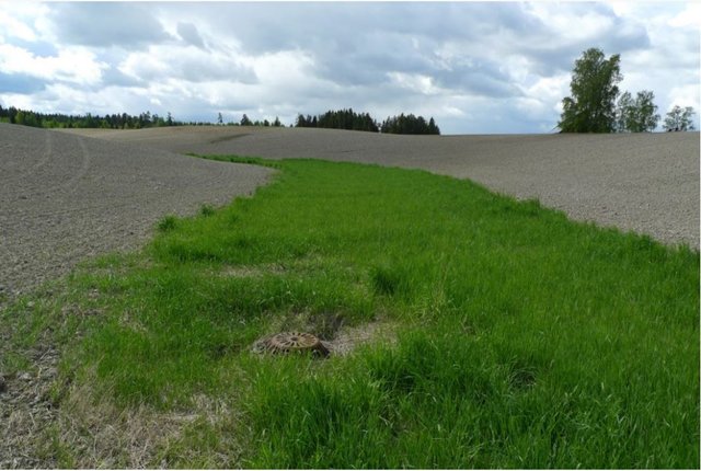
Grassed waterways [ນໍເວ]
Grassed waterways are shallow channels (natural or constructed) with grass cover, used to drain surface runoff from cropland and prevent erosion.
- ຜູ້ສັງລວມຂໍ້ມູນ: Dominika Krzeminska
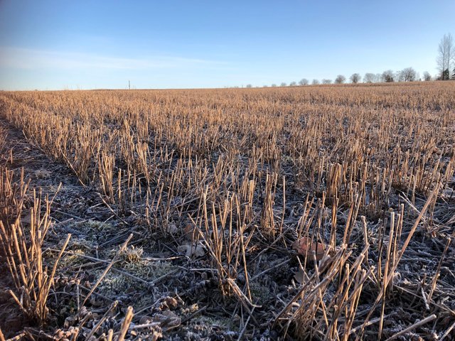
Reduced tillage: no tillage in autumn [ນໍເວ]
Reduced tillage, involving no plowing in the autumn, preserves stubble or plant cover during the autumn and winter to prevent soil erosion, and particle and nutrient loss from cropland to watercourses.
- ຜູ້ສັງລວມຂໍ້ມູນ: Kamilla Skaalsveen
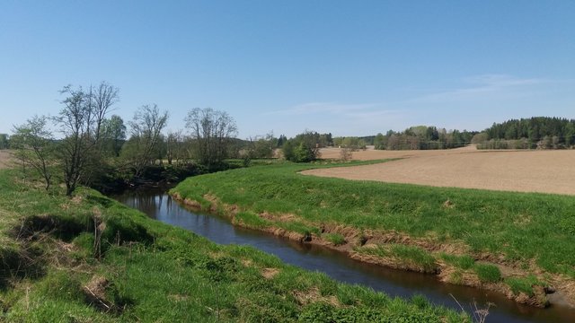
Grass buffer zones alongside waterways in cropland [ນໍເວ]
Grass buffer zones are established along waterways in cropland to reduce the surface runoff rate, and the amounts of sediment, nutrients and pesticides in the runoff.
- ຜູ້ສັງລວມຂໍ້ມູນ: Kamilla Skaalsveen
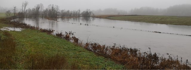
Grass or stubble in areas prone to flooding … [ນໍເວ]
Establishment of grass - or retaining stubble - on arable land that is prone to erosion and flooding to reduce the risk of soil and nutrient losses.
- ຜູ້ສັງລວມຂໍ້ມູນ: Dominika Krzeminska
Small retention ponds in the forest [ນໍເວ]
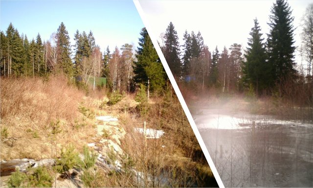
Small retention ponds, located in the forest, are ponds or pools with sufficient storage capacity to store the surface runoff to prevent flooding during heavy rainfall events. Ponds contain limited or no water during dry weather, but are designed to retain water during rain events.
- ຜູ້ສັງລວມຂໍ້ມູນ: Dominika Krzeminska
2. ພັນລະນາ ແນວທາງການຄຸ້ມຄອງນໍາໃຊ້ດິນແບບຍືນຍົງ
2.1 ການອະທິບາຍ ໂດຍຫຍໍ້ ຂອງວິທີທາງ
Regulations and financial grants for reduction of pollution and promotion of the cultural landscape.
2.2 ການອະທິບາຍ ລາຍລະອຽດ ຂອງວິທີທາງ
ການອະທິບາຍ ລາຍລະອຽດ ຂອງວິທີທາງ:
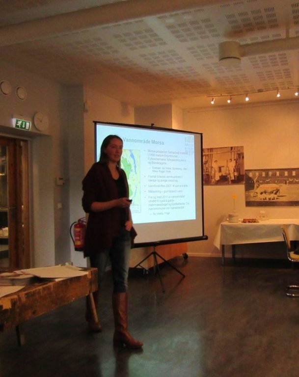
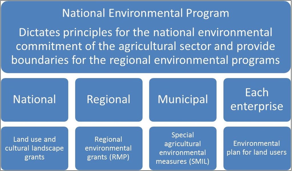
Aims / objectives: The Regional Environmental Program (RMP) is a part of the Regional Rural Development Program provided by County Governors, in this case the County Governors of Østfold and Akershus. The programs differ somewhat between counties and the one for Østfold is used as an example here. The program aims to target environmental efforts in the agricultural sector, mainly focusing on
agricultural runoff, reduced usage of pesticides, cultural landscapes, biological diversity, cultural monuments and environments, outdoor recreation and availability. Measures related to reduction of runoff from agricultural land to waterbodies has resent years been given the highest priority, and the greatest part of the financial grants. Improvement of soil structure to maintain soil functions and prevention of soil loss and nutrient leaching, are some of the main goals of the approach.
Methods: Management plans and local regulations for different catchments are implemented through the Regional Environmental Program. Funds to finance measures are provided from both this program and other sources, such as the Grant Scheme for Special Agricultural Environmental Measures (SMIL). The latter is allocated by the County Governor and managed by local municipalities. In order to receive production subsidies the land users have to carry out the regulation measures. In areas of
prioritized watercourses the soil tillage regulations are stricter, and the financial support higher. Around especially vulnerable waterbodies the measures are compulsory. Agricultural areas are classified by their susceptibility to water erosion (four erosion risk classes), with different soil management requirements. High erosion risk classes normally provide higher grant rates.
Stages of implementation: The Regional Environmental Program was first introduced in 2005, followed by a rollover in 2009. It
was at the agricultural settlement in 2012 decided to continue the program in the same path as settled in 2004/2005, with improvements from the evaluation in 2007/2008 and 2011. The County Governor continues the ongoing work of targeting the economical funds to measures of high environmental benefit. The Regional Environmental Program is also influenced by guidelines from the National Environmental Program of 2013-2016. Random controls are carried out and falsely reported measures lead to reduction and repayment of production grants.
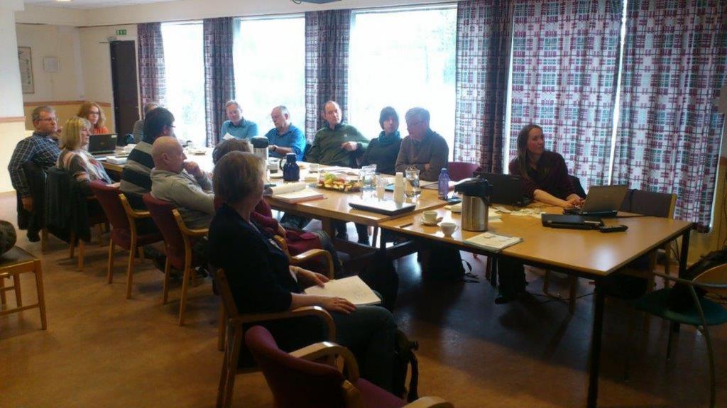
Role of stakeholders: The farmers are mainly conducting the measures by changing their land use practices, but the Regional
Environmental Program is developed in collaboration between municipalities, the county, the Farmers’ Organization, industry, and the County Governor. The measures are revised annually, mainly based on inputs from the Farmers’ Organization and the municipality. Other measures are included by the Regional Environmental Program than shown in the QT (Grass Covered Riparian Buffer Strips and Reduced Tillage), but these were evaluated to be less relevant for the prevention of soil loss.
Other important information: Other measures are included by the Regional Environmental Program than shown in the QT (Grass Covered Riparian Buffer Strips and Reduced Tillage), but these were evaluated to be less relevant for the prevention of soil loss.
For more information: http://www.fylkesmannen.no/en/Ostfold/Agriculture-and-food/Environmental-measures/Tilskudd-til-regionale-miljotiltak-RMP-2014/ (In Norwegian only)
Regional regulations: https://lovdata.no/dokument/JB/forskrift/2011-06-01-716?q=morsa
2.3 ຮູບພາບຂອງແນວທາງ
2.5 ປະເທດ / ເຂດ / ສະຖານທີ່ບ່ອນທີ່ແນວທາງໄດ້ຖືກນໍາໃຊ້
ປະເທດ:
ນໍເວ
ພາກພື້ນ / ລັດ / ແຂວງ:
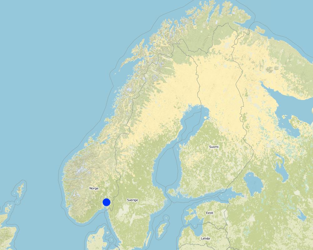
Østfold
ຂໍ້ມູນເພີ່ມເຕີມຂອງສະຖານທີ່:
The Morsa Catchment
Map
×2.6 ວັນທີເລີ່ມຕົ້ນ ແລະ ສິ້ນສຸດ ການຈັດຕັ້ງປະຕີບັດ ວິທີທາງ
ສະແດງປີຂອງການເລີ່ມຕົ້ນ:
2004
2.7 ປະເພດຂອງແນວທາງ
- ພາຍໃຕ້ໂຄງການ / ແຜນງານ
2.8 ເປົ້າໝາຍ / ຈຸດປະສົງຫຼັກ ຂອງການຈັດຕັ້ງປະຕິບັດ ວິທີທາງ
The Approach focused on SLM only
Target the environmental initiatives and provide increased visibility.
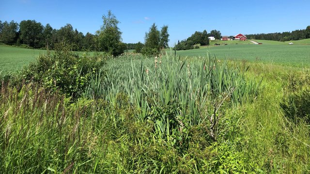
The SLM Approach addressed the following problems: Agricultural runoff and erosion, usage of pesticides, degradation of cultural landscapes, loss of biological diversity, degradation of cultural monuments and environments, decreased availability to outdoor recreational areas.
2.9 ເງື່ອນໄຂອໍານວຍ ຫຼື ຂັດຂວາງການປະຕິບັດຂອງເຕັກໂນໂລຢີ / ເຕັກໂນໂລຢີການນໍາໃຊ້ຕາມແນວທາງ
ມີຄວາມສາມາດ / ເຂັ້າເຖິງຊັບພະຍາກອນດ້ານການເງິນ ແລະ ການບໍລິການ
- ເຊື່ອງຊ້ອນ
Measures may lead to income loss for land users.
Treatment through the SLM Approach: Financial grants.
ກ່ຽວກັບກົດໝາຍ (ສິດນໍາໃຊ້ດິນ, ສິດນໍາໃຊ້ນໍ້າ)
- ເຊື່ອງຊ້ອນ
The existing land ownership, land use rights / water rights hindered a little the approach implementation Not all land users implemented the technologies.
ວຽກ, ມີກໍາລັງຄົນ
- ເຊື່ອງຊ້ອນ
The workload may increase with land use changes and implementation of erosion risk classes and regulations.
Treatment through the SLM Approach: Higher financial grants for high risk areas.
3. ການມີສ່ວນຮ່ວມ ແລະ ບົດບາດຂອງພາກສ່ວນທີ່ກ່ຽວຂ້ອງທີ່ໄດ້ມີສ່ວນຮ່ວມ
3.1 ຜູ້ມີສ່ວນຮ່ວມ ໃນວິທີທາງ ແລະ ພາລະບົດບາດ ຂອງເຂົາເຈົ້າ
- ຜູ້ນໍາໃຊ້ດິນໃນທ້ອງຖິ່ນ / ຊຸມຊົນທ້ອງຖິ່ນ
- ຜູ້ຊ່ຽວຊານ ການນຄຸ້ມຄອງ ທີ່ດິນແບບຍືນຍົງ / ທີ່ປຶກສາດ້ານກະສິກໍາ
- ອໍານາດ ການປົກຄອງທ້ອງຖິ່ນ
- ພະນັກງານຂັ້ນສູນກາງ (ຜູ້ວາງແຜນ, ຜູ້ສ້າງນະໂຍບາຍ)
3.2 ການມີສ່ວນຮ່ວມຂອງຜູ້ນໍາໃຊ້ທີ່ດິນໃນທ້ອງຖິ່ນ / ຊຸມຊົນທ້ອງຖິ່ນໃນໄລຍະທີ່ແຕກຕ່າງກັນຂອງແນວທາງ
ການລວບລວມ ເອົາຜູ້ນໍາໃຊ້ດິນ ໃນທ້ອງຖິ່ນ / ຊຸມຊົນທ້ອງຖິ່ນ | ໃຫ້ລະບຸ ຜູ້ໃດທີ່ມີສ່ວນຮ່ວມ ໃນແຕ່ລະກິດຈະກໍາ? | |
---|---|---|
ການເລີ່ມຕົ້ນ / ແຮງຈູງໃຈ | ການບໍ່ປະຕິບັດ | Regulations initiated by politicians and management, governed by the Agricultural Authority |
ການວາງແຜນ | ການບໍ່ປະຕິບັດ | Involvement of specialists |
ການປະຕິບັດ | ການຊ່ວຍເຫຼືອຈາກພາຍນອກ | Changes in land use practices implemented by land users |
ຕິດຕາມກວດກາ / ການປະເມີນຜົນ | ການບໍ່ປະຕິບັດ | Monitoring and evaluation of measures by specialists and management |
Research | ການບໍ່ປະຕິບັດ | Results evaluated and reported by specialists |
3.3 ແຜນວາດ (ຖ້າມີ)
3.4 ການຕັດສິນໃຈກ່ຽວກັບການຄັດເລືອກເຕັກໂນໂລຢີຂອງການຄຸ້ມຄອງທີ່ດິນແບບຍືນຍົງ / ເຕັກໂນໂລຢີ
ລະບຸ ຄົນທີ່ຕັດສິນໃຈ ກ່ຽວກັບການຄັດເລືອກຂອງ ເຕັກໂນໂລຢີ / ເຕັກໂນໂລຢີ ຈະໄດ້ຮັບການປະຕິບັດ:
- ຊຽ່ວຊານ ສະເພາະດ້ານການຄຸ້ມຄອງ ດິນແບບຍືນຍົງຜູ້ດຽວ
ອະທິບາຍ:
The choice of SLM Technology was made on the basis of recommendations from specialists.
Decisions on the method of implementing the SLM Technology were made by by politicians / leaders. Decisions on the method were made on county and management level.
4. ການສະໜັບສະໜູນທາງດ້ານວິຊາການ, ການສ້າງຄວາມສາມາດ, ແລະ ການຈັດການຄວາມຮູ້.
4.1 ການສ້າງຄວາມສາມາດ / ການຝຶກອົບຮົມ
ຜູ້ນໍາໃຊ້ທີ່ດິນ ຫຼື ພາກສ່ວນກ່ຽວຂ້ອງອື່ນໆ ໄດ້ຮັບການຝຶກອົບຮົມບໍ່?
ແມ່ນ
ໃຫ້ລະບຸ ຜູ້ໃດທີ່ໄດ້ຮັບການຝຶກອົບຮົມ:
- ຜູ້ນໍາໃຊ້ດິນ
- ພະນັກງານພາກສະໜາມ / ທີ່ປຶກສາ
ຮູບແບບຂອງການຝຶກອົບຮົມ:
- ການເຮັດຕົວຈິງ
4.2 ການບໍລິການໃຫ້ຄໍາປຶກສາ
ເຮັດຜູ້ໃຊ້ທີ່ດິນມີການເຂົ້າເຖິງການບໍລິການໃຫ້ຄໍາປຶກສາ?
ແມ່ນ
- Through information
ອະທິບາຍ / ຄວາມຄິດເຫັນ:
Name of method used for advisory service: Guidelines and circulars from the County Governor; Key elements: Information, Guidance, Environmental standards
Advisory service is quite adequate to ensure the continuation of land conservation activities; Requires land conservation measures for disbursement of subsidies.
4.3 ສະຖາບັນການສ້າງຄວາມເຂັ້ມແຂງ (ການພັດທະນາອົງການຈັດຕັ້ງ)
ສະຖາບັນ ໄດ້ຮັບການສ້າງຕັ້ງຂື້ນ ຫຼື ໄດ້ຮັບການສ້າງຄວາມເຂັ້ມແຂງ ໂດຍການຈັດຕັ້ງປະຕິບັດ ວິທີທາງບໍ່?
- ບໍ່ມີ
4.4 ຕິດຕາມກວດກາ ແລະ ປະເມີນຜົນ
ການຈັດຕັ້ງປະຕິບັດ ວິທີທາງ ໄດ້ມີການປະເມີນຜົນ ແລະ ຕິດຕາມບໍ?
ແມ່ນ
ຄວາມຄິດເຫັນ:
bio-physical aspects were ad hoc monitored by project staff through observations; indicators: Landslides
bio-physical aspects were regular monitored by other through measurements; indicators: P content in soil, water quality, runoff
technical aspects were ad hoc monitored by project staff through measurements; indicators: Infiltration rate/soil compaction
economic / production aspects were regular monitored by government, land users through observations; indicators: Production rate, increase/decrease in income
area treated aspects were regular monitored by government through observations; indicators: Evaluation of measures
no. of land users involved aspects were regular monitored by government through observations; indicators: None
management of Approach aspects were ad hoc monitored by project staff, government, land users through observations; indicators: None
There were several changes in the Approach as a result of monitoring and evaluation: Annual revision
There were few changes in the Technology as a result of monitoring and evaluation: Evaluation and modification proposals in progress
4.5 ການຄົ້ນຄວ້າ
ນີ້້ແມ່ນສ່ວນໜຶ່ງ ການຄົ້ນຄວ້າ ຂອງວິທີທາງບໍ່?
ແມ່ນ
ລະບຸ ຫົວຂໍ້:
- ເຕັກໂນໂລຢີ
ໃຫ້ຂໍ້ມູນ ເພີ່ມເຕີມ ແລະ ກໍານົດ ຜູ້ໃດເຮັດການຄົ້ນຄວ້າ:
Research of the effectiveness of the technologies have been carried out and discussed with land users and management.
Research was carried out on-farm
5. ການສະໜັບສະໜູນທາງດ້ານການເງິນ ແລະ ອຸປະກອນຈາກພາຍນອກ
5.1 ງົບປະມານປະຈໍາປີ ສໍາລັບວິທີທາງ ຂອງການຄຸ້ມຄອງ ທີ່ດິນແບບຍືນຍົງ
ຖ້າຫາກບໍ່ຮູ້ຈັດງົບປະມານທີ່ແນ່ນອນ ແມ່ນໃຫ້ປະມານເອົາ:
- > 1,000,000
ຄໍາເຫັນ (ຕົວຢ່າງ: ແຫຼ່ງຂໍ້ມູນຫຼັກ ຂອງການສະໜອງທຶນ / ຜູ້ໃຫ້ທຶນທີ່ສໍາຄັນ):
Approach costs were met by the following donors: local government (district, county, municipality, village etc) (Regional level): 100.0%
5.2 ການສະໜັບສະໜູນ ທາງດ້ານການເງິນ / ອຸປະກອນ ສະໜອງໃຫ້ແກ່ຜູ້ນໍາທີ່ດິນ
ຜູ້ນໍາໃຊ້ດິນ ໄດ້ຮັບການສະໜັບສະໜູນ ທາງດ້ານ ການເງິນ / ອຸປະກອນ ໃນການຈັດຕັ້ງປະຕິບັດ ເຕັກໂນໂລຢີບໍ?
ແມ່ນ
ຖ້າແມ່ນ, ໃຫ້ລະບຸປະເພດ (ຫຼາຍ) ຂອງການສະໜັບສະໜູນ, ເງື່ອນໄຂ ແລະ ຜູູ້ສະໜອງ (ຫຼາຍ):
Contributions were provided by the state from the Regional Environmental Program and other sources as the Grant Scheme for Special Agricultural Environmental Measures (SMIL).
5.3 ເງິນສົມທົບສໍາລັບການນໍາໃຊ້ສະເພາະປັດໃຈຂາເຂົ້າໃນການຜະລີດກະສິກໍາ (ລວມທັງແຮງງານ)
ຖ້າແຮງງານ ຂອງຜູ້ນໍາໃຊ້ດິນ ໄດ້ຮັບການສະໜັບສະໜູນ ປັດໃຈຂາເຂົ້າ, ແມ່ນບໍ່:
- ຈ່າຍເປັນເງິນສົດ
ຄວາມຄິດເຫັນ:
Economical benefits for the land user to implement measures and loss if they reject, according to local regulations.
5.4 ສິນເຊື່ອ
ໄດ້ປ່ອຍສິນເຊື່ອ ສະໜອງໃຫ້ພາຍໃຕ້ ວິທີການສໍາລັບກິດຈະກໍາ ການຄຸ້ມຄອງ ທີ່ດິນແບບຍືນນຍົງບໍ່?
ບໍ່ແມ່ນ
6. ວິເຄາະຜົນກະທົບ ແລະ ສັງລວມບັນຫາ
6.1 ຜົນກະທົບຂອງແນວທາງ
ການຈັດຕັ້ງປະຕິບັດ ວິທີທາງ ສາມາດຊ່ວຍຜູ້ນໍາໃຊ້ທີ່ດິນ ໃນການຈັດຕັ້ງປະຕິບັດ ແລະ ບໍາລຸງຮັກສາ ເຕັກໂນໂລຢີ ການຄຸ້ມຄອງ ທີ່ດິນແບບຍືນຍົງໄດ້ບໍ?
- ບໍ່
- ມີ, ໜ້ອຍໜຶ່ງ
- ມີ, ພໍສົມຄວນ
- ມີ, ຫຼາຍ
Regulations to prevent soil and water degradation.
ການຈັດຕັ້ງປະຕິບັດ ວິທີທາງ ສາມາດສ້າງຄວາມເຂັ້ມແຂງ ທາງສັງຄົມ ແລະ ເສດຖະກິດບໍ່?
- ບໍ່
- ມີ, ໜ້ອຍໜຶ່ງ
- ມີ, ພໍສົມຄວນ
- ມີ, ຫຼາຍ
ການຈັດຕັ້ງປະຕິບັດ ວິທີທາງ ສາມາດປັບປຸງ ປະເດັນການຖືຄອງທີ່ດິນ / ສິດທິໃນການນໍາໃຊ້ທີ່ດິນ ທີ່ເຊື່ອງຊ້ອນໃນການຈັດຕັ້ງປະຕິບັດ ເຕັກໂນໂລຢີ ການຄຸ້ມຄອງ ທີ່ດິນແບບຍືນຍົງໄດ້ບໍ?
- ບໍ່
- ມີ, ໜ້ອຍໜຶ່ງ
- ມີ, ພໍສົມຄວນ
- ມີ, ຫຼາຍ
Did other land users / projects adopt the Approach?
- ບໍ່
- ມີ, ໜ້ອຍໜຶ່ງ
- ມີ, ພໍສົມຄວນ
- ມີ, ຫຼາຍ
Similar approaches are applied on watercourses in other counties, but regulations and financial support varies.
Did the Approach lead to improved livelihoods / human well-being?
- ບໍ່
- ມີ, ໜ້ອຍໜຶ່ງ
- ມີ, ພໍສົມຄວນ
- ມີ, ຫຼາຍ
Somewhat better water quality in drinking water recipients.
Did the Approach help to alleviate poverty?
- ບໍ່
- ມີ, ໜ້ອຍໜຶ່ງ
- ມີ, ພໍສົມຄວນ
- ມີ, ຫຼາຍ
6.2 ແຮງຈູງໃຈຫຼັກຂອງຜູ້ນໍາໃຊ້ທີ່ດິນໃນການປະຕິບັດການຄຸ້ມຄອງທີ່ດິນແບບຍືນຍົງ
- ການຊໍາລະເງິນ / ເງິນອຸດໜູນ
Subsidies
- ກົດລະບຽບແລະລະບຽບການ (ລະອຽດ) / ການບັງຄັບໃຊ້
Regulations
- ລວມເຂົ້ານໍາກັນກັບການເຄື່ອນໄຫວ / ໂຄງການ / ກຸ່ມ / ເຄືອຂ່າຍ
Cooperation between farmers
- ຄວາມຮັບຮູ້ ທາງສີ່ງແວດລ້ອມ
Pollution awareness
6.3 ຄວາມຍືນຍົງຂອງກິດຈະກໍາວິທີທາງ
ຜູ້ນໍາໃຊ້ ທີ່ດິນ ສາມາດສືບຕໍ່ ການຈັດຕັ້ງປະຕິບັດ ຜ່ານວິທີທາງໄດ້ບໍ່ (ໂດຍປາດສະຈາກ ການຊ່ວຍເຫຼືອ ຈາກພາກສ່ວນພາຍນອກ)?
- ບໍ່ມີ
ຖ້າ ບໍ່ ຫຼື ບໍ່ແນ່ໃຈ, ໃຫ້ອະທິບາຍ ແລະ ຄໍາເຫັນ:
Production and income loss.
6.4 ຈຸດແຂງ / ຂໍ້ດີ ຂອງວິທີທາງ
ຈຸດແຂງ / ຈຸດດີ / ໂອກາດ ຈາກທັດສະນະຂອງຜູ້ປ້ອນຂໍ້ມູນ ຫຼື ບຸກຄົນສຳຄັນ |
---|
Good guidance and free maps for land users available on the internet |
Annual repport (both strength and weekness) |
Financial grants graded by erosion risk classes |
Regular evaluation through agricultural negotiations (How to sustain/ enhance this strength: A management committee has recently suggested simplifications to the program, but this has not yet been evaluated by the Ministry of Food and Agriculture) |
6.5 ຈຸດອ່ອນ / ຂໍ້ເສຍຂອງແນວທາງ ແລະ ວິທີການແກ້ໄຂໃຫ້ເຂົາເຈົ້າ
ຈຸດອ່ອນ ຫຼື ຂໍ້ເສຍ ຫຼື ຄວາມສ່ຽງ ໃນມຸມມອງຂອງ ຜູ້ສັງລວມຂໍ້ມູນ ຫຼື ບັນດາຜູ້ຕອບແບບສອບຖາມ | ມີວິທີການແກ້ໄຂຄືແນວໃດ? |
---|---|
Complicated system with a variety of details | There is a group who is working on a report to the ministry on how to simplify the program |
7. ເອກກະສານອ້າງອີງ ແລະ ຂໍ້ມູນການເຊື່ອມໂຍງ
7.1 ວິທີການ / ແຫຼ່ງຂໍ້ມູນ
- ການໄປຢ້ຽມຢາມພາກສະໜາມ, ການສໍາຫຼວດພາກສະໜາມ
- ການສໍາພາດ ຜູ້ນໍາໃຊ້ທີ່ດິນ
ຂໍ້ມູນການເຊື່ອມຕໍ່ ແລະ ເນື້ອໃນ
ຂະຫຍາຍທັງໝົດ ຍຸບທັງໝົດການເຊື່ອມຕໍ່
Small constructed wetland [ນໍເວ]
A small constructed wetland is a combination of ponds and vegetation filters, designed mainly to remove sediment and nutrients from streams. It is usually located in first and second order streams in agricultural landscapes.
- ຜູ້ສັງລວມຂໍ້ມູນ: Dominika Krzeminska
Grassed waterways [ນໍເວ]
Grassed waterways are shallow channels (natural or constructed) with grass cover, used to drain surface runoff from cropland and prevent erosion.
- ຜູ້ສັງລວມຂໍ້ມູນ: Dominika Krzeminska
Reduced tillage: no tillage in autumn [ນໍເວ]
Reduced tillage, involving no plowing in the autumn, preserves stubble or plant cover during the autumn and winter to prevent soil erosion, and particle and nutrient loss from cropland to watercourses.
- ຜູ້ສັງລວມຂໍ້ມູນ: Kamilla Skaalsveen
Grass buffer zones alongside waterways in cropland [ນໍເວ]
Grass buffer zones are established along waterways in cropland to reduce the surface runoff rate, and the amounts of sediment, nutrients and pesticides in the runoff.
- ຜູ້ສັງລວມຂໍ້ມູນ: Kamilla Skaalsveen
Grass or stubble in areas prone to flooding … [ນໍເວ]
Establishment of grass - or retaining stubble - on arable land that is prone to erosion and flooding to reduce the risk of soil and nutrient losses.
- ຜູ້ສັງລວມຂໍ້ມູນ: Dominika Krzeminska
Small retention ponds in the forest [ນໍເວ]
Small retention ponds, located in the forest, are ponds or pools with sufficient storage capacity to store the surface runoff to prevent flooding during heavy rainfall events. Ponds contain limited or no water during dry weather, but are designed to retain water during rain events.
- ຜູ້ສັງລວມຂໍ້ມູນ: Dominika Krzeminska
ເນື້ອໃນ
ບໍ່ມີເນື້ອໃນ