Stakeholder participation in integrated assessment and planning of vulnerable coastal regions [ເຢຍລະມັນ]
- ການສ້າງ:
- ປັບປູງ:
- ຜູ້ສັງລວມຂໍ້ມູນ: Martin Maier
- ບັນນາທິການ: –
- ຜູ້ທົບທວນຄືນ: Fabian Ottiger
Stakeholder Partizipation und integrative Entscheidungshilfen für gefährdete Küstenregionen (deutsch)
approaches_2597 - ເຢຍລະມັນ
ເບິ່ງພາກສ່ວນ
ຂະຫຍາຍທັງໝົດ ຍຸບທັງໝົດ1. ຂໍ້ມູນທົ່ວໄປ
1.2 ລາຍລະອຽດ ການຕິດຕໍ່ ຂອງບຸກຄົນທີ່ຊັບພະຍາກອນ ແລະ ສະຖາບັນ ການມີສ່ວນຮ່ວມ ໃນການປະເມີນຜົນ ແລະ ເອກະສານ ຂອງວິທີທາງ
ຜູ້ຊ່ຽວຊານ ດ້ານການຄຸ້ມຄອງ ທີ່ດິນແບບຍືນຍົງ:
Karrasch Lena
leena.karrasch@uni-oldenburg.de
University of Oldenburg
D-26111, Oldenburg
ເຢຍລະມັນ
ຊື່ຂອງໂຄງການ ທີ່ອໍານວຍຄວາມສະດວກ ໃນການສ້າງເອກກະສານ ຫຼື ປະເມີນດ້ານແນວທາງ (ຖ້າກ່ຽວຂ້ອງ)
Sustainable Coastal Land Management (COMTESS / GLUES)ຊື່ຂອງ ສະຖາບັນການຈັດຕັ້ງ ທີ່ອໍານວຍຄວາມສະດວກ ໃນການສ້າງເອກກະສານ ຫຼື ປະເມີນແນວທາງ (ຖ້າກ່ຽວຂ້ອງ)
University of Oldenburg (University of Oldenburg) - ເຢຍລະມັນ1.3 ເງື່ອນໄຂ ຂອງການນໍາໃຊ້ເອກກະສານຂໍ້ມູນ ຂອງ WOCAT
ເມື່ອໃດທີ່ໄດ້ສັງລວມຂໍ້ມູນ (ຢູ່ພາກສະໜາມ)?
10/03/2015
ຜູ້ສັງລວມ ແລະ ບັນດາຜູ້ຕອບແບບສອບຖາມ ຍອມຮັບໃນເງື່ອນໄຂ ການນໍາໃຊ້ຂໍ້ມູນເອກະສານ ທີ່ສ້າງຂື້ນ ໂດຍຜ່ານ ອົງການ WOCAT:
ແມ່ນ
1.4 ເອກະສານອ້າງອີງ (ຫຼາຍ) ກັບແບບສອບຖາມ (ຫຼາຍ) ເຕັກໂນໂລຢີ ຂອງດ້ານການຄຸ້ມຄອງ ດິນແບບຍືນຍົງ
2. ພັນລະນາ ແນວທາງການຄຸ້ມຄອງນໍາໃຊ້ດິນແບບຍືນຍົງ
2.1 ການອະທິບາຍ ໂດຍຫຍໍ້ ຂອງວິທີທາງ
Stakeholders have been involved in integrated assessment to develop action-oriented land use options addressing possible climate change adaptation measures as alternatives to traditional coastal protection strategies.
2.2 ການອະທິບາຍ ລາຍລະອຽດ ຂອງວິທີທາງ
ການອະທິບາຍ ລາຍລະອຽດ ຂອງວິທີທາງ:
Aims / objectives: The SLM approach described here comprises knowledge transfer between the scientific community and practitioners through a “stakeholder-scientist partnership”. The exchange of individual positions, interests and needs concerning spatial planning activities and sustainable land use management was very important. This was also true for the investigation of relationships and interactions between the different stakeholders. Furthermore, a stakeholder-based definition of land use elements and ecosystem services enabled the stakeholders to work with scientific concepts. Land use elements are delineated spatial areas related to one specific use of land, such as arable fields, infrastructure or aquatic areas. Ecosystem services, by definition the benefits people obtain from ecosystems, include provisioning, regulation, cultural and supporting services. The assessment of stakeholder preferences concerning each land use element and ecosystem service allowed an evaluation by scientists and researchers. All suggestions made by the stakeholders are included in the project results.
Methods: In total, there were 38 qualitative interviews carried out about the stakeholders opinion concerning sustainable and adaptive land use management (with one representative from each sector), 14 quantitative interviews to determine the relationship between land use elements and ecosystem services, several telephone and email conversations, 7 focus groups (interviews with more than one representative of each sector), and 4 regional forums (attended by representatives of all sectors). Each participatory process addressed a specific issue, such as determining preferences, relationships or scenario development. These plenaries provided a platform for stakeholder discussions, group assessments and consensus-building processes on the different issues. The focus groups were built to discuss sector-specific issues in greater depth and to support the joint decision-making process. All the results were triangulated and validated.
Role of stakeholders: A heterogeneous expert group including all relevant actors (incl. land users) in the case study region was convened. Fourteen local and regional stakeholders acted as representatives of the various sectors: water management, nature conservation, agriculture, regional and local governmental bodies, and tourism. They covered all relevant fields and levels (from administrative to policy) of decision-making in the community of Krummhörn. The role of the researcher during the participatory governance process is characterised as the “knowledge-broker”. The knowledge-broker acted at the interface between research and the stakeholders. The tasks were to provide the context (land use) and detailed information (ecosystem services) and determine decision-alternatives (land management scenarios) enabling and clarifying the freedom of choice. Additionally, the knowledge-broker translated research results to facilitate the dialogue between the different sectors and strengthen collaboration.
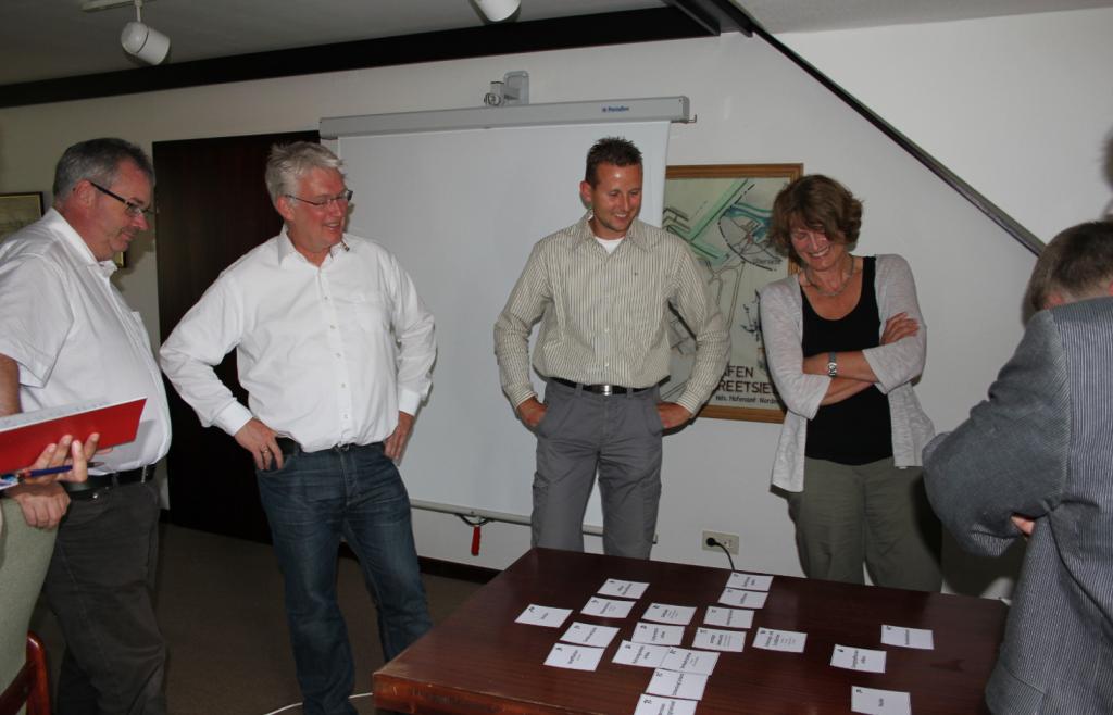
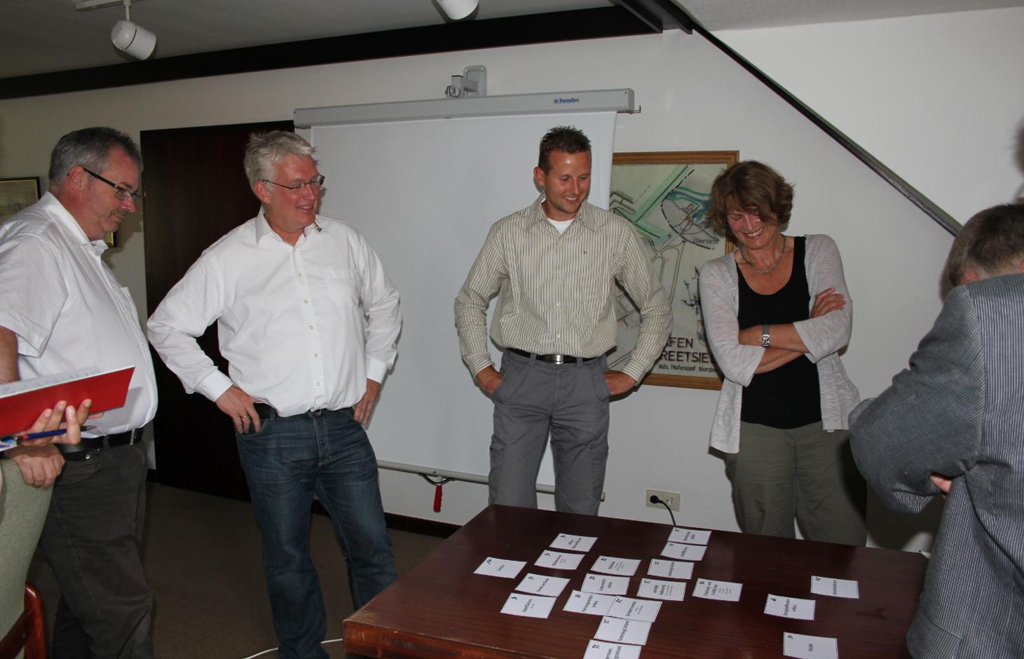
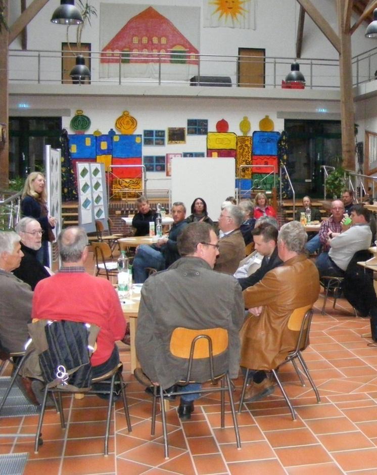
2.3 ຮູບພາບຂອງແນວທາງ
ສື່ຮູບພາບ
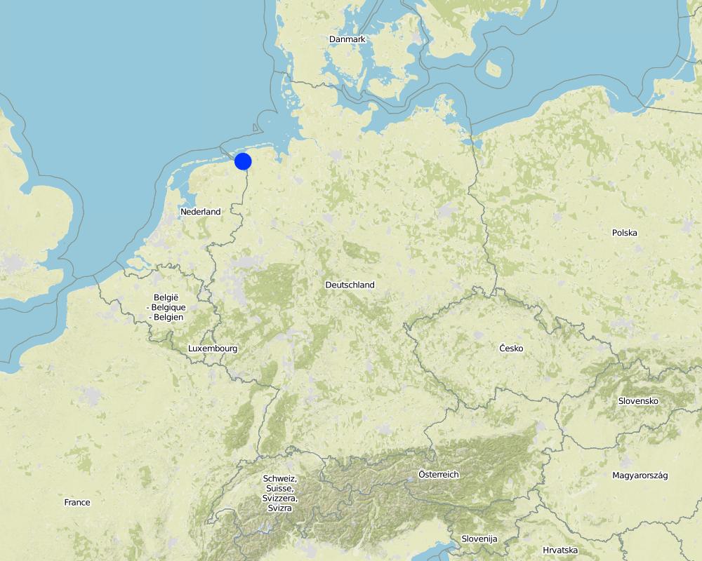
2.5 ປະເທດ / ເຂດ / ສະຖານທີ່ບ່ອນທີ່ແນວທາງໄດ້ຖືກນໍາໃຊ້
ປະເທດ:
ເຢຍລະມັນ
ພາກພື້ນ / ລັດ / ແຂວງ:
Germany, Lower Saxony
ຂໍ້ມູນເພີ່ມເຕີມຂອງສະຖານທີ່:
County of Aurich, community of Krummhörn
Map
×2.6 ວັນທີເລີ່ມຕົ້ນ ແລະ ສິ້ນສຸດ ການຈັດຕັ້ງປະຕີບັດ ວິທີທາງ
ສະແດງປີຂອງການເລີ່ມຕົ້ນ:
2011
ປີທີ່ສີ້ນສູດ (ຖ້າຢຸດບໍ່ໄດ້ນໍາໃຊ້ ວິທີທາງ):
2015
2.7 ປະເພດຂອງແນວທາງ
- ພາຍໃຕ້ໂຄງການ / ແຜນງານ
2.8 ເປົ້າໝາຍ / ຈຸດປະສົງຫຼັກ ຂອງການຈັດຕັ້ງປະຕິບັດ ວິທີທາງ
The Approach focused mainly on other activities than SLM (Disaster risk reduction, stakeholder engagement)
The aim of the approach is to foster a more sustainable and adaptive future land use management process by including social, ecological and economic impacts of possible developments in the decision-making processes.
The SLM Approach addressed the following problems: Coastal zones with their natural and societal sub-systems are exposed to rapid changes and pressures on resources. Scarcity of space and impacts of climate change are dominant drivers of land use and adaptation management today. The population of vulnerable coastal regions has to deal with these complex problems, and to develop suitable options for land use and adaptation management considering socio-economic and environmental changes and their impacts on the land management, and vice-versa the impact of land management on the socio-economy and the environment. Future land use management needs to focus on the interactions of the entire human-nature system, aiming at more sustainable development while focusing on the benefits that ecosystems provide for people.
2.9 ເງື່ອນໄຂອໍານວຍ ຫຼື ຂັດຂວາງການປະຕິບັດຂອງເຕັກໂນໂລຢີ / ເຕັກໂນໂລຢີການນໍາໃຊ້ຕາມແນວທາງ
ສັງຄົມ / ວັດທະນະທໍາ / ມາດຕະຖານ ແລະ ຄຸນຄ່າທາງສາສະໜາ
- ເຊື່ອງຊ້ອນ
The stakeholders are concerned that the land their ancestors reclaimed from the sea might be taken back again. Furthermore, the stakeholders feared that current flood protection structures would be endangered by new developments such as water retention areas.
Treatment through the SLM Approach: Provide a platform for direct knowledge exchange between different stakeholders and scientists and joint development of land management options, ensuring active participation in transparent decision-making, and providing positive outcomes for all participants.
ມີຄວາມສາມາດ / ເຂັ້າເຖິງຊັບພະຍາກອນດ້ານການເງິນ ແລະ ການບໍລິການ
- ເຊື່ອງຊ້ອນ
The land used as a retention area is partially available for other land use. High costs for construction and development of retention area.
Treatment through the SLM Approach: Explanation of benefits provided by nature (ecosystem services). Calculation of expected
costs without changes in land management such as increased pumping costs.
ການກໍ່ຕັ້ງສະຖາບັນ
- ເຊື່ອງຊ້ອນ
Disagreement between different sectors.
Treatment through the SLM Approach: Consensus finding through a participatory process.
ກ່ຽວກັບກົດໝາຍ (ສິດນໍາໃຊ້ດິນ, ສິດນໍາໃຊ້ນໍ້າ)
- ອໍານວຍ
No effect of land ownership or water rights on the approach.
3. ການມີສ່ວນຮ່ວມ ແລະ ບົດບາດຂອງພາກສ່ວນທີ່ກ່ຽວຂ້ອງທີ່ໄດ້ມີສ່ວນຮ່ວມ
3.1 ຜູ້ມີສ່ວນຮ່ວມ ໃນວິທີທາງ ແລະ ພາລະບົດບາດ ຂອງເຂົາເຈົ້າ
- ຜູ້ນໍາໃຊ້ດິນໃນທ້ອງຖິ່ນ / ຊຸມຊົນທ້ອງຖິ່ນ
County of Aurich and community of Krummhörn
Agriculture, water management, tourism, nature conservation. There has been no discrimination inside the communities up to now.
- ຜູ້ຊ່ຽວຊານ ການນຄຸ້ມຄອງ ທີ່ດິນແບບຍືນຍົງ / ທີ່ປຶກສາດ້ານກະສິກໍາ
Project members (scientists)
- ນັກຄົ້ນຄວ້າ
- ອໍານາດ ການປົກຄອງທ້ອງຖິ່ນ
Waterboard and Dike authorities
Regional planning (county)
- ພະນັກງານຂັ້ນສູນກາງ (ຜູ້ວາງແຜນ, ຜູ້ສ້າງນະໂຍບາຍ)
Major. Most decision makers are male
3.2 ການມີສ່ວນຮ່ວມຂອງຜູ້ນໍາໃຊ້ທີ່ດິນໃນທ້ອງຖິ່ນ / ຊຸມຊົນທ້ອງຖິ່ນໃນໄລຍະທີ່ແຕກຕ່າງກັນຂອງແນວທາງ
| ການລວບລວມ ເອົາຜູ້ນໍາໃຊ້ດິນ ໃນທ້ອງຖິ່ນ / ຊຸມຊົນທ້ອງຖິ່ນ | ໃຫ້ລະບຸ ຜູ້ໃດທີ່ມີສ່ວນຮ່ວມ ໃນແຕ່ລະກິດຈະກໍາ? | |
|---|---|---|
| ການເລີ່ມຕົ້ນ / ແຮງຈູງໃຈ | ການຮ່ວມມື | Stakeholder analysis (snowball-principle) to include all interest groups |
| ການວາງແຜນ | ການຮ່ວມມື | Local and regional decision-makers designed an actor-based scenario. They defined relevant land use elements and ecosystem services. The stakeholders ranked the land use elements and ecosystem services according to their preferences. Furthermore, they determined how important one land use element for a certain ecosystem service is. |
| ການປະຕິບັດ | ການຮ່ວມມື | The regional spatial planning authority implements the results from the approach. |
| ຕິດຕາມກວດກາ / ການປະເມີນຜົນ | ບໍ່ມີ | Not yet |
| Research | ການບໍ່ປະຕິບັດ | The stakeholders have been informed about the research results. |
3.3 ແຜນວາດ (ຖ້າມີ)
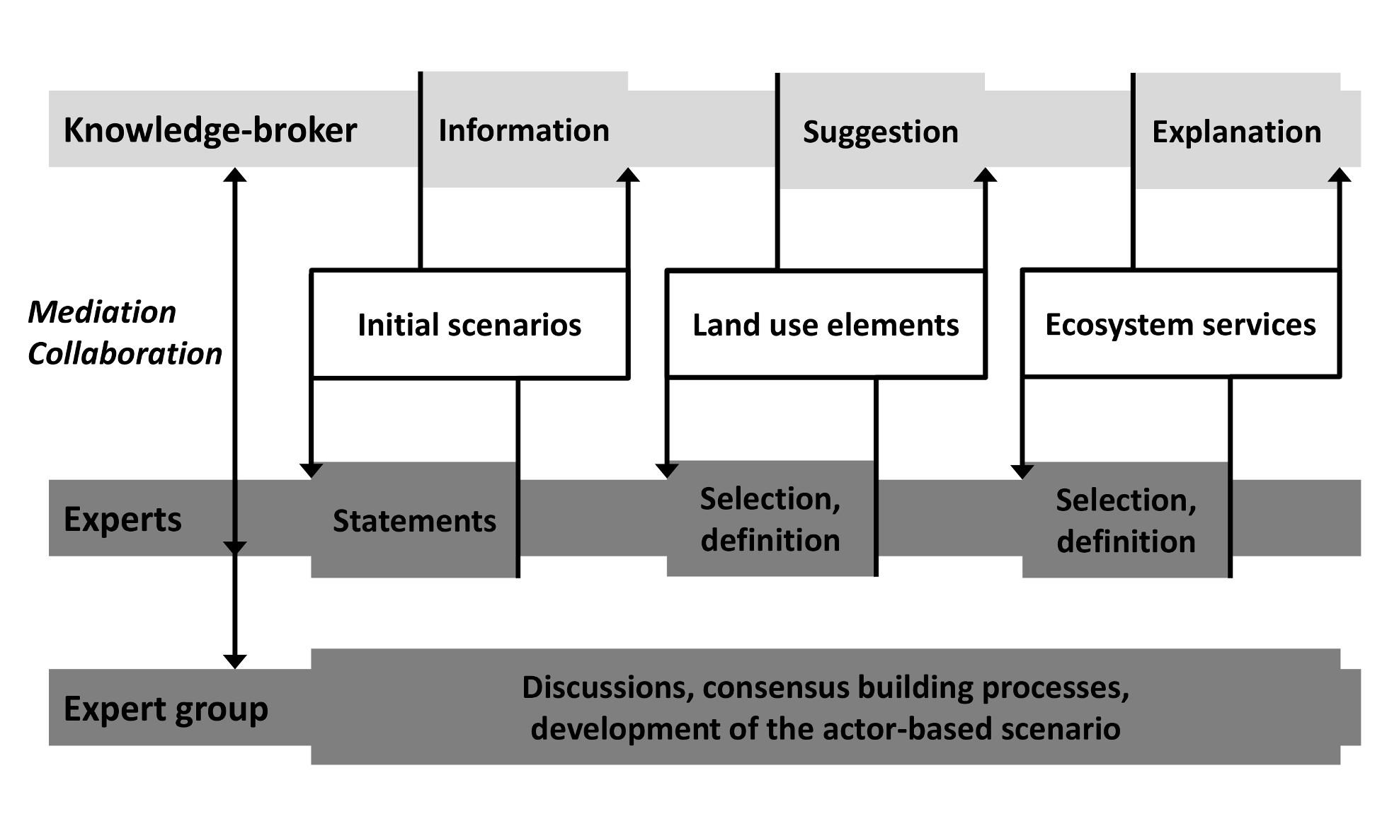
ການອະທິບາຍ:
Description of the interactions between knowledge-broker (scientist), individual experts (local and regional decision-makers) and the expert group. The initial scenarios prepared by researchers informed the expert about different land use options. The experts gave statements judging the initial scenarios. Based on this feedback the researcher suggested land use elements and explained ecosystem services which have been selected and defined by the experts. These information were used by the expert group to discuss and develop the actor based scenario.
ຜູ້ຂຽນ:
Leena Karrasch (COAST – University of Oldenburg)
3.4 ການຕັດສິນໃຈກ່ຽວກັບການຄັດເລືອກເຕັກໂນໂລຢີຂອງການຄຸ້ມຄອງທີ່ດິນແບບຍືນຍົງ / ເຕັກໂນໂລຢີ
ລະບຸ ຄົນທີ່ຕັດສິນໃຈ ກ່ຽວກັບການຄັດເລືອກຂອງ ເຕັກໂນໂລຢີ / ເຕັກໂນໂລຢີ ຈະໄດ້ຮັບການປະຕິບັດ:
- ຜູ້ຊ່ຽວຊານ ຫຼັກດ້ານການຄຸ້ມຄອງ ທີ່ດິນແບບຍືນຍົງ, ມີການຕິດຕາມປຶກສາຫາລືກັບຜູ້ນໍາໃຊ້ທີ່ດິນ
ອະທິບາຍ:
Decisions were made by the stakeholder group. Guided consensus building processes on different land management topics.
Decisions on the method of implementing the SLM Technology were made by mainly by land users supported by SLM specialists. Decisions were made by the stakeholder group. Guided consensus building processes on different land management topics.
4. ການສະໜັບສະໜູນທາງດ້ານວິຊາການ, ການສ້າງຄວາມສາມາດ, ແລະ ການຈັດການຄວາມຮູ້.
4.1 ການສ້າງຄວາມສາມາດ / ການຝຶກອົບຮົມ
ຜູ້ນໍາໃຊ້ທີ່ດິນ ຫຼື ພາກສ່ວນກ່ຽວຂ້ອງອື່ນໆ ໄດ້ຮັບການຝຶກອົບຮົມບໍ່?
ແມ່ນ
ໃຫ້ລະບຸ ຜູ້ໃດທີ່ໄດ້ຮັບການຝຶກອົບຮົມ:
- ຜູ້ນໍາໃຊ້ດິນ
- ພະນັກງານພາກສະໜາມ / ທີ່ປຶກສາ
- decision maker
ຮູບແບບຂອງການຝຶກອົບຮົມ:
- ຕົວຕໍ່ຕົວ
- ເນື້ອທີ່ສວນທົດລອງ
- ກອງປະຊຸມ
- ຫຼັກສູດ
ຮູບແບບຂອງການຝຶກອົບຮົມ:
- knowledge brokerage
ໃນຫົວຂໍ້:
Training focused on possible consequences of climate change.
4.2 ການບໍລິການໃຫ້ຄໍາປຶກສາ
ເຮັດຜູ້ໃຊ້ທີ່ດິນມີການເຂົ້າເຖິງການບໍລິການໃຫ້ຄໍາປຶກສາ?
ແມ່ນ
ອະທິບາຍ / ຄວາມຄິດເຫັນ:
Advisory service is very adequate to ensure the continuation of land conservation activities; They are aware of possible adaptation measures, based on scientific information and group consensus building.
4.3 ສະຖາບັນການສ້າງຄວາມເຂັ້ມແຂງ (ການພັດທະນາອົງການຈັດຕັ້ງ)
ສະຖາບັນ ໄດ້ຮັບການສ້າງຕັ້ງຂື້ນ ຫຼື ໄດ້ຮັບການສ້າງຄວາມເຂັ້ມແຂງ ໂດຍການຈັດຕັ້ງປະຕິບັດ ວິທີທາງບໍ່?
- ບໍ່ມີ
4.4 ຕິດຕາມກວດກາ ແລະ ປະເມີນຜົນ
ຄວາມຄິດເຫັນ:
There were no changes in the Approach as a result of monitoring and evaluation: Not relevant
There were no changes in the Technology as a result of monitoring and evaluation
4.5 ການຄົ້ນຄວ້າ
ນີ້້ແມ່ນສ່ວນໜຶ່ງ ການຄົ້ນຄວ້າ ຂອງວິທີທາງບໍ່?
ແມ່ນ
ລະບຸ ຫົວຂໍ້:
- ສັງຄົມ
- ເສດຖະສາດ / ການຕະຫຼາດ
- ລະບົບນິເວດ
- ເຕັກໂນໂລຢີ
ໃຫ້ຂໍ້ມູນ ເພີ່ມເຕີມ ແລະ ກໍານົດ ຜູ້ໃດເຮັດການຄົ້ນຄວ້າ:
A transdisciplinary research project worked on providing information and collecting data concerning sociology, economics, ecology and technology. This information was used for the work with the stakeholders, to illustrate possible future scenarios and available land management options with their consequences. The results are shown in technology T_GER003en. Furthermore these results were fed in to models based on climate change and sea level rise scenarios. These models show the effects of the proposed land management on the ecosystem services provided in the region.
Research was carried out both on station and on-farm
5. ການສະໜັບສະໜູນທາງດ້ານການເງິນ ແລະ ອຸປະກອນຈາກພາຍນອກ
5.1 ງົບປະມານປະຈໍາປີ ສໍາລັບວິທີທາງ ຂອງການຄຸ້ມຄອງ ທີ່ດິນແບບຍືນຍົງ
ຖ້າຫາກບໍ່ຮູ້ຈັດງົບປະມານທີ່ແນ່ນອນ ແມ່ນໃຫ້ປະມານເອົາ:
- 10,000-100,000
ຄໍາເຫັນ (ຕົວຢ່າງ: ແຫຼ່ງຂໍ້ມູນຫຼັກ ຂອງການສະໜອງທຶນ / ຜູ້ໃຫ້ທຶນທີ່ສໍາຄັນ):
Approach costs were met by the following donors: government (Federal Ministry of Education and Research BMBF): 100.0%
5.2 ການສະໜັບສະໜູນ ທາງດ້ານການເງິນ / ອຸປະກອນ ສະໜອງໃຫ້ແກ່ຜູ້ນໍາທີ່ດິນ
ຜູ້ນໍາໃຊ້ດິນ ໄດ້ຮັບການສະໜັບສະໜູນ ທາງດ້ານ ການເງິນ / ອຸປະກອນ ໃນການຈັດຕັ້ງປະຕິບັດ ເຕັກໂນໂລຢີບໍ?
ບໍ່ແມ່ນ
5.3 ເງິນສົມທົບສໍາລັບການນໍາໃຊ້ສະເພາະປັດໃຈຂາເຂົ້າໃນການຜະລີດກະສິກໍາ (ລວມທັງແຮງງານ)
- ບໍ່ມີ
ຄວາມຄິດເຫັນ:
Labour was not rewarded
5.4 ສິນເຊື່ອ
ໄດ້ປ່ອຍສິນເຊື່ອ ສະໜອງໃຫ້ພາຍໃຕ້ ວິທີການສໍາລັບກິດຈະກໍາ ການຄຸ້ມຄອງ ທີ່ດິນແບບຍືນນຍົງບໍ່?
ບໍ່ແມ່ນ
6. ວິເຄາະຜົນກະທົບ ແລະ ສັງລວມບັນຫາ
6.1 ຜົນກະທົບຂອງແນວທາງ
ການຈັດຕັ້ງປະຕິບັດ ວິທີທາງ ສາມາດຊ່ວຍຜູ້ນໍາໃຊ້ທີ່ດິນ ໃນການຈັດຕັ້ງປະຕິບັດ ແລະ ບໍາລຸງຮັກສາ ເຕັກໂນໂລຢີ ການຄຸ້ມຄອງ ທີ່ດິນແບບຍືນຍົງໄດ້ບໍ?
- ບໍ່
- ມີ, ໜ້ອຍໜຶ່ງ
- ມີ, ພໍສົມຄວນ
- ມີ, ຫຼາຍ
Awareness of challenges and understanding related to land use due to climate change was increased and support to design desired future land management was provided. Ideas for more sustainable land management have been spatially implemented in the regional plan.
ການຈັດຕັ້ງປະຕິບັດ ວິທີທາງ ສາມາດສ້າງຄວາມເຂັ້ມແຂງ ທາງສັງຄົມ ແລະ ເສດຖະກິດບໍ່?
- ບໍ່
- ມີ, ໜ້ອຍໜຶ່ງ
- ມີ, ພໍສົມຄວນ
- ມີ, ຫຼາຍ
It may improve the situation of socially and economically disadvantaged groups in future.
Did other land users / projects adopt the Approach?
- ບໍ່
- ມີ, ໜ້ອຍໜຶ່ງ
- ມີ, ພໍສົມຄວນ
- ມີ, ຫຼາຍ
Regional plan ('Regionales Raumordnungsprogramm') for the county of Aurich adopted the approach to tackle the impact of climate change.
Did the Approach lead to improved livelihoods / human well-being?
- ບໍ່
- ມີ, ໜ້ອຍໜຶ່ງ
- ມີ, ພໍສົມຄວນ
- ມີ, ຫຼາຍ
It may improve livelihoods in future.
Did the Approach help to alleviate poverty?
- ບໍ່
- ມີ, ໜ້ອຍໜຶ່ງ
- ມີ, ພໍສົມຄວນ
- ມີ, ຫຼາຍ
Poverty is not the issue addressed by this approach.
6.2 ແຮງຈູງໃຈຫຼັກຂອງຜູ້ນໍາໃຊ້ທີ່ດິນໃນການປະຕິບັດການຄຸ້ມຄອງທີ່ດິນແບບຍືນຍົງ
- ການຜະລິດເພີ່ມຂຶ້ນ
- ກໍາໄລເພີ່ມຂຶ້ນ (ຄວາມສາມາດ), ການປັບປຸງຄ່າໃຊ້ຈ່າຍ, ຜົນປະໂຫຍດ, ອັດຕາສ່ວນ
indirect via adapted land use
- ຄວາມຮັບຮູ້ ທາງສີ່ງແວດລ້ອມ
only environmental consciousness
- ການປັບປຸງຄວາມງົດງາມ
- well-being and livelihoods improvement
including prevention of damage during extreme events.
- decision support
decision support for decision makers
6.3 ຄວາມຍືນຍົງຂອງກິດຈະກໍາວິທີທາງ
ຜູ້ນໍາໃຊ້ ທີ່ດິນ ສາມາດສືບຕໍ່ ການຈັດຕັ້ງປະຕິບັດ ຜ່ານວິທີທາງໄດ້ບໍ່ (ໂດຍປາດສະຈາກ ການຊ່ວຍເຫຼືອ ຈາກພາກສ່ວນພາຍນອກ)?
- ແມ່ນ
ຖ້າ ໄດ້, ອະທິບາຍເຫດຜົນ:
It is very likely, that the involved stakeholder meet in future for continuation of the participatory process.
6.4 ຈຸດແຂງ / ຂໍ້ດີ ຂອງວິທີທາງ
| ຈຸດແຂງ / ຂໍ້ດີ / ໂອກາດໃນການນໍາໃຊ້ທີ່ດິນ |
|---|
| The work on a common goal improves decision-making processes. |
| Research and scientists provide evidence and scenarios. They translated research results to facilitate the dialogue between the different sectors and strengthen the collaboration. |
| Active participation in transparent decision-making lead to positive outcomes for all participants. Participation is a positive and practical way to overcome controversial issues. |
| ຈຸດແຂງ / ຈຸດດີ / ໂອກາດ ຈາກທັດສະນະຂອງຜູ້ປ້ອນຂໍ້ມູນ ຫຼື ບຸກຄົນສຳຄັນ |
|---|
| Together with stakeholders of the region, concrete and action oriented adaptive strategies will be developed. |
|
Stakeholder collaboration promotes social learning processes, consideration of different world-views and cooperation and agreements. |
| Stakeholder engagement as important tool for implementing sustainable development and link cross-sectoral interests. |
|
Stakeholders help to identify risks, impacts and values. |
| Stakeholders provide input to planning processes, they are meaningful partners and provide local knowledge. |
6.5 ຈຸດອ່ອນ / ຂໍ້ເສຍຂອງແນວທາງ ແລະ ວິທີການແກ້ໄຂໃຫ້ເຂົາເຈົ້າ
| ຈຸດອ່ອນ / ຂໍ້ເສຍ / ຄວາມສ່ຽງໃນມູມມອງຂອງຜູ້ນໍາໃຊ້ທີ່ດິນ | ມີວິທີການແກ້ໄຂຄືແນວໃດ? |
|---|---|
| Different world-views of different participants. | Sufficient time for interaction and exchange. Be open minded. |
| Time consuming meetings. | Motivation, give feedback, ongoing information process (learning and knowledge exchange). |
|
Scientific concepts are not easy understandable. |
Use of simple language and avoidance of scientific jargon. |
| ຈຸດອ່ອນ ຫຼື ຂໍ້ເສຍ ຫຼື ຄວາມສ່ຽງ ໃນມຸມມອງຂອງ ຜູ້ສັງລວມຂໍ້ມູນ ຫຼື ບັນດາຜູ້ຕອບແບບສອບຖາມ | ມີວິທີການແກ້ໄຂຄືແນວໃດ? |
|---|---|
|
The work with stakeholders is time intensive and challenging. |
Highling the benefits and the time and commitment gained compared to approaches which do not include the stakeholders and what the consequences are. |
| It is difficult to include all different interests. | Make the project interesting for everyone. Elaborate different options depending on the different interest and discuss the output (benefits and trade-offs). |
| Keep all stakeholders together. | Give feedback, ongoing information process. |
| “Subjective” character of research. | Trying to be as objective as possible. |
7. ເອກກະສານອ້າງອີງ ແລະ ຂໍ້ມູນການເຊື່ອມໂຍງ
7.1 ວິທີການ / ແຫຼ່ງຂໍ້ມູນ
- ການໄປຢ້ຽມຢາມພາກສະໜາມ, ການສໍາຫຼວດພາກສະໜາມ
- ການສໍາພາດ ຜູ້ນໍາໃຊ້ທີ່ດິນ
7.2 ເອກະສານທົ່ວໄປທີ່ສາມາດໃຊ້ໄດ້
ຫົວຂໍ້, ຜູ້ຂຽນ, ປີ, ISBN:
Linking the ecosystem services approach to social preferences and needs in integrated coastal land use management – A planning approach, Leena Karrasch, Thomas Klenke, Johan Woltjer, 2014
ມີຢູ່ໃສ?ມູນຄ່າເທົ່າໃດ?
Land Use Policy 38, 522-532; http://www.sciencedirect.com/science/article/pii/S0264837713002718
ຂໍ້ມູນການເຊື່ອມຕໍ່ ແລະ ເນື້ອໃນ
ຂະຫຍາຍທັງໝົດ ຍຸບທັງໝົດການເຊື່ອມຕໍ່
ບໍ່ມີຂໍ້ມູນການເຊື່ອມຕໍ່
ເນື້ອໃນ
ບໍ່ມີເນື້ອໃນ