Jessour [Tunísia]
- Criação:
- Atualização:
- Compilador/a: Mongi Ben Zaied
- Editor: –
- Revisor: Deborah Niggli
Jesser, Katra, Tabias (Arabic)
technologies_1013 - Tunísia
Veja as seções
Expandir tudo Recolher tudo1. Informação geral
1.2 Detalhes do contato das pessoas capacitadas e instituições envolvidas na avaliação e documentação da tecnologia
Pessoa(s) capacitada(s)
Especialista em GST:
Mongi Sghaier
+216 75 633 005
Institut des Régions Arides IRA
4119 Medenine - Tunisia
Tunísia
Especialista em GST:
Mongi Chniter
+21671 564 939
Commissariats Régionaux au Développement Agricole CRDA
Cité Bouchoucha - le Bardo 2000
Tunísia
Especialista em GST:
Ouessar Mohammed
+216 75 633 005
Institut des Régions Arides IRA
4119 Medenine - Tunisia
Tunísia
Nome do projeto que facilitou a documentação/avaliação da Tecnologia (se relevante)
DESIRE (EU-DES!RE)Nome do projeto que facilitou a documentação/avaliação da Tecnologia (se relevante)
Book project: Water Harvesting – Guidelines to Good Practice (Water Harvesting)Nome da(s) instituição(ões) que facilitou(ram) a documentação/ avaliação da Tecnologia (se relevante)
Institut des Régions Arides de Médenine (Institut des Régions Arides de Médenine) - TunísiaNome da(s) instituição(ões) que facilitou(ram) a documentação/ avaliação da Tecnologia (se relevante)
Commissariats Régionaux au Développement Agricole (CRDA) - Tunísia1.3 Condições em relação ao uso da informação documentada através de WOCAT
Quando os dados foram compilados (no campo)?
22/09/2008
O/a compilador/a e a(s) pessoa(s) capacitada(s) aceitam as condições relativas ao uso de dados documentados através da WOCAT:
Sim
1.5 Referência ao(s) questionário(s) sobre as abordagens da GST
Collecte des eaux pluviales dans des citernes [Tunísia]
Les citernes sont construites soit par l’état dans les zones enclavées où l’approvisionnement en eaux potables et difficile voire impossible par le réseau de la Société Nationale d’Exploitation et de Distribution des Eaux (SONEDE) soit par des particuliers pour collecter les eaux de pluies. Ces ouvrages sont destinés à l’abreuvement …
- Compilador/a: Donia Mühlematter
Conservation des eaux et des sols suivant la … [Tunísia]
Les « jessour » sont développés dans les zones montagneuses de Gabès, Mede-nine et Tataouine où l’altitude varie entre 400 et 600 m et une pluviométrie an-nuelle variant entre 100 et 150 mm. Dans cette zone, on compte aux alentours de 35 000 jisr qui reçoit chacun annuellement un supplément …
- Compilador/a: Donia Mühlematter
Dryland watershed management approach [Tunísia]
Integrated land and water management approach, including vegetative, management, and agronomic measure
- Compilador/a: Naceur Mahdi
2. Descrição da tecnologia de GST
2.1 Descrição curta da tecnologia
Definição da tecnologia:
Jessour is an ancient runoff water harvesting technique widely practiced in the arid highlands
2.2 Descrição detalhada da tecnologia
Descrição:
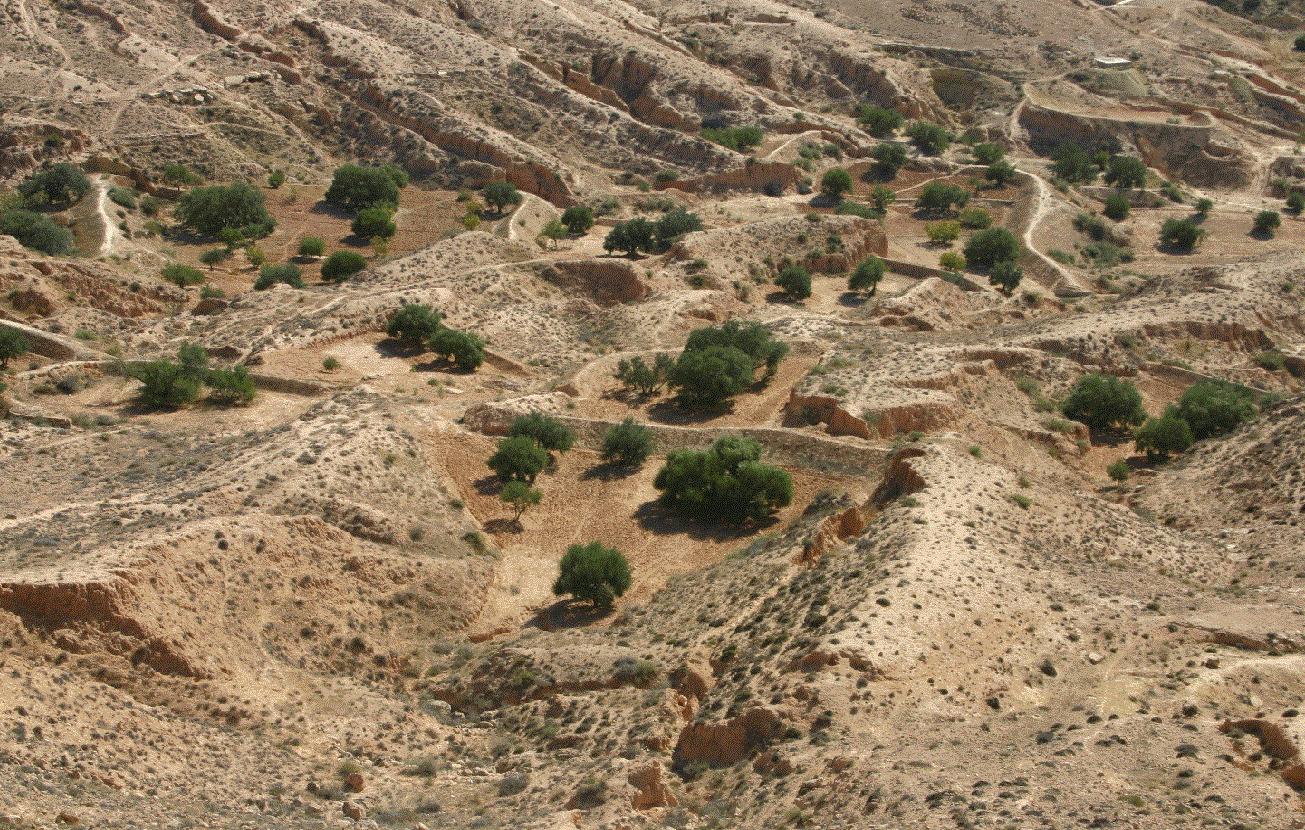
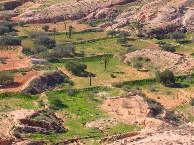
Jessour technology is generally practised in mountain dry regions (less than 200 mm annually) with medium to high slopes. This technology was behind the installation of very old olive orchards based on rainfed agriculture in rugged landscapes which allowed the local population not only to ensure self-sufficiency but also to provide neighbouring areas many agricultural produces (olive oil, dried figs, palm dates, etc.).
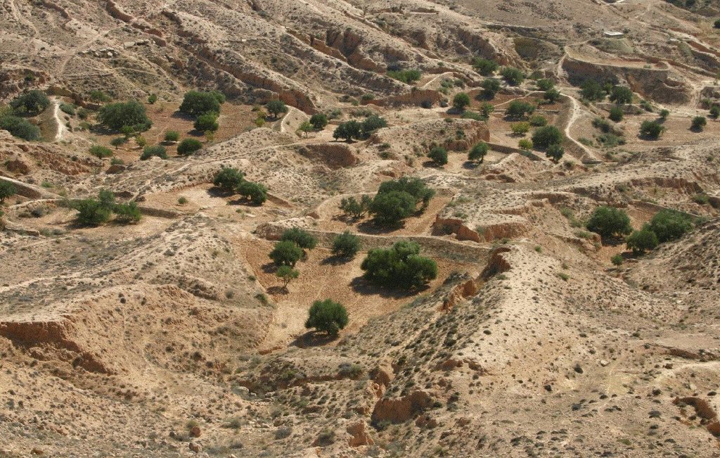
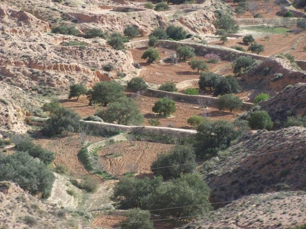
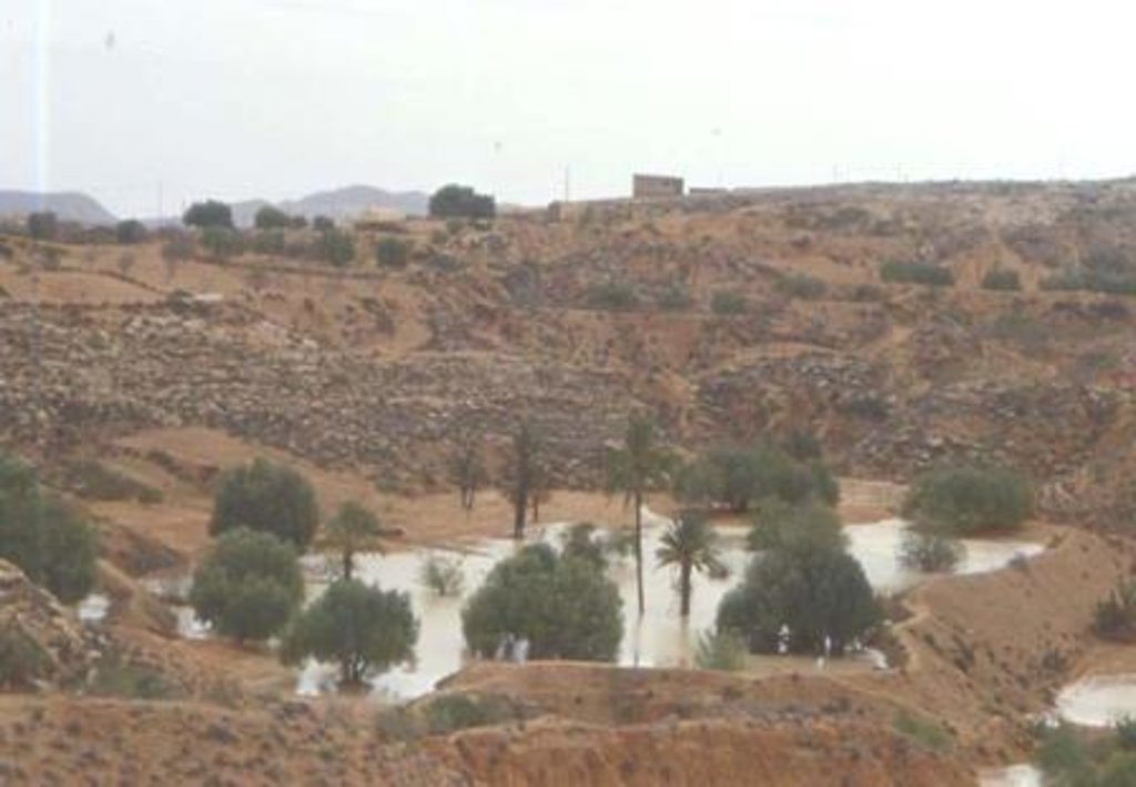
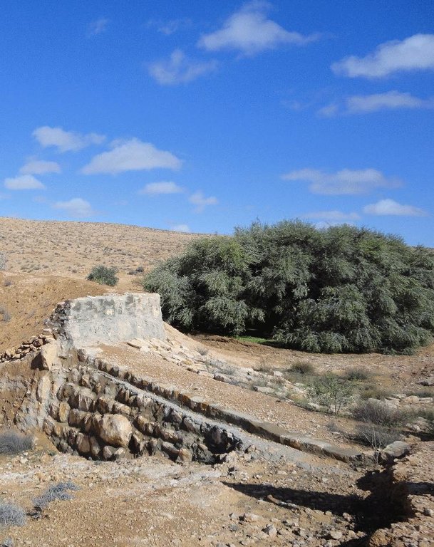
Jessour is the plural of jessr, which is a hydraulic unit made of three components: the impluvium, the terrace and the dyke. The impluvium or the catchment is the area which collects and conveys runoff water. It is bordered by a natural water divide line (a line that demarcates the boundary of a natural area or catchment, so that all the rain that falls on this area is concentrated and drained towards the same outlet). Each unit has its own impluvium, but can also receive excess water from upstream units. The terrace or cropping zone is the area in which farming is practised. It is formed progressively by the deposition of sediment. An artificial soil will then be created, which can be up to 5 m deep close to the dyke. Generally, fruit trees (e.g. olive, fig, almond, and date palm), legumes (e.g. pea, chickpeas, lentil, and faba bean) and barley and wheat are cultivated on these terraces.
Purpose of the Technology: Although the jessour technique was developed for the production of various agricultural crops, it now also plays three additional roles: (1) aquifer recharge, via runoff water infiltration into the terraces, (2) flood control and therefore the protection of infrastructure and towns built downstream, and (3) wind erosion control, by preventing sediment from reaching the downstream plains, where windspeeds can be particularly high.
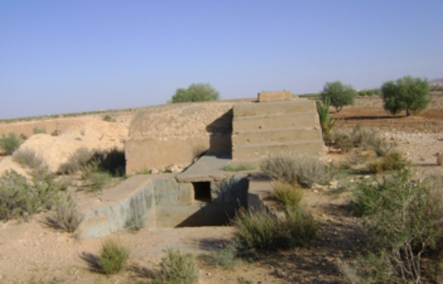
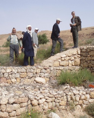
Establishment / maintenance activities and inputs: In the Jessour, a dyke (tabia, sed, katra) acts as a barrier used to hold back sediment and runoff water. Such dykes are made of earth, and are equipped with a central and/or lateral spillway (masref and/or manfes) and one or two abutments (ktef), assuring the evacuation of excess water. They are trapezoidal and measure 15-50 m in length, 1-4 m in width and 2-5 m in height. In old units, the dyke is stabilised with a covering of dry stones to overcome the erosive effects of water wave action on the front and back of the dyke. The spillway is made of stones arranged in the form of stairs, in order to dissipate the kinetic energy of the overflow.
This technology is currently encountered in the mountain ranges of Matmata of South Eastern Tunisia where the local agricultural activities are based mainly on rainfed agriculture and livestock breeding. However, high rates of migration to cities may threaten the long-term maintenance of those structures.
2.3 Fotos da tecnologia
2.5 País/região/locais onde a tecnologia foi aplicada e que estão cobertos nesta avaliação
País:
Tunísia
Região/Estado/Província:
Medenine
Especificação adicional de localização:
Beni Khedache
Comentários:
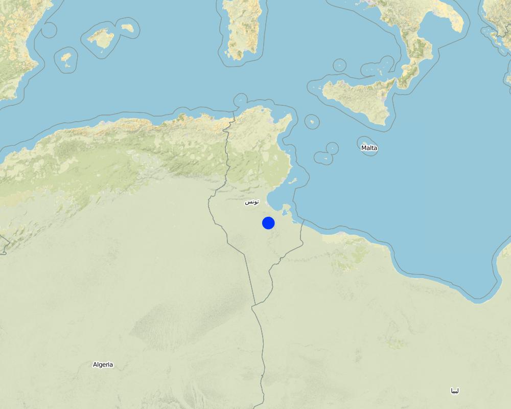
This technology is developed mainly in the upstream areas of the study watershed (mountainous zone of Béni Khédache).
Map
×2.6 Data da implementação
Caso o ano exato seja desconhecido, indique a data aproximada:
- mais de 50 anos atrás (tradicional)
2.7 Introdução da tecnologia
Especifique como a tecnologia foi introduzida:
- Como parte do sistema tradicional (>50 anos)
Comentários (tipos de projeto, etc.):
Jessour is an ancient runoff water harvesting technique widely practiced in the arid highlands, which are dominated by outcroppings of calcareous formations and depositions of quaternary calcareous silt.
3. Classificação da tecnologia de GST
3.2 Tipo(s) atualizado(s) de uso da terra onde a tecnologia foi aplicada

Terra de cultivo
- Cultura anual
- Cultura de árvores e arbustos
Principais plantações (colheitas para venda e consumo próprio):
Major cash crops: Olive oil, fig, cereals
Major food crops: Olive oil, legumes, fig, other fruits
Comentários:
Major land use problems (compiler’s opinion): Loss of surface water (runoff), problems of flooding, water erosion, soil degradation, drought
Future (final) land use (after implementation of SLM Technology): Cropland: Ct: Tree and shrub cropping
Livestock is grazing on crop residues
Caso o uso da terra tenha mudado devido a implementação da tecnologia, indique seu uso anterior à implementação da tecnologia:
Grazing land: Ge: Extensive grazing land
3.3 Mais informações sobre o uso da terra
Abastecimento de água para a terra na qual a tecnologia é aplicada:
- Precipitação natural
Comentários:
Water supply: rainfed, mixed rainfed - irrigated
Número de estações de cultivo por ano:
- 1
Especifique:
Longest growing period in days: 180Longest growing period from month to month: Oct - Mar
3.4 Grupo de GST ao qual pertence a tecnologia
- Quebra-vento/cerca de árvores
- Coleta de água
- Gestão de irrigação (inclusive abastecimento de água, drenagem)
3.5 Difusão da tecnologia
Especifique a difusão da tecnologia:
- Uniformemente difundida numa área
Caso a tecnologia seja uniformemente difundida numa área, indique a área coberta aproximada:
- 100-1.000 km2
Comentários:
This technology is developed mainly in the upstream areas of the study watershed (mountainous zone of Béni Khédache). This system is based on runoff water harvesting for fruit trees cropping (mainly olives). The cropping areas are relatively small and rarely exceed 0.25 ha.
3.6 Medidas de GST contendo a tecnologia

Medidas estruturais
- S2: Barragens, bancos
Comentários:
Main measures: structural measures
3.7 Principais tipos de degradação da terra abordados pela tecnologia

Erosão do solo pela água
- Wt: Perda do solo superficial/erosão de superfície
- Wg: Erosão por ravinas/ravinamento
Comentários:
Main type of degradation addressed: Wt: loss of topsoil / surface erosion
Secondary types of degradation addressed: Wg: gully erosion / gullying
Main causes of degradation: crop management (annual, perennial, tree/shrub), change of seasonal rainfall, Heavy / extreme rainfall (intensity/amounts), poverty / wealth
Secondary causes of degradation: soil management, overgrazing, land tenure
3.8 Redução, prevenção ou recuperação da degradação do solo
Especifique o objetivo da tecnologia em relação a degradação da terra:
- Prevenir degradação do solo
- Reduzir a degradação do solo
Comentários:
Main goals: mitigation / reduction of land degradation
Secondary goals: prevention of land degradation
4. Especificações técnicas, implementação de atividades, entradas e custos
4.1 Desenho técnico da tecnologia
4.2 Especificações técnicas/ explicações do desenho técnico
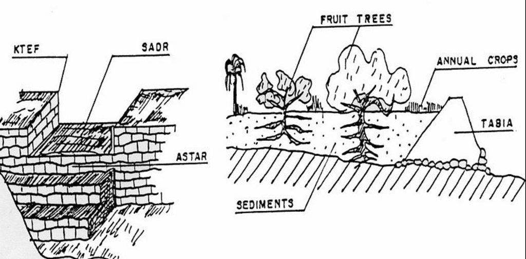
Left: Cross-section of dyke (locally called tabia) and terrace (cropping area).
The Jessour ensure the collection of both runoff water and sediments allowing creating very deep ‘artificial’ soils (terrace) which form a very good reservoir for water and nutrients to be used by fruit trees and annual crops.
Right: The spillway allows the overflow to the other Jessour downstream. It also represents the symbol of water sharing equity between different farmers in the same watershed. (Drawing adapted from El Amami (1984))
Location: Mountainous zone near Beni Khedache. Medenine
Date: 1984
Technical knowledge required for field staff / advisors: moderate
Technical knowledge required for land users: moderate
Main technical functions: increase of infiltration, sediment retention / trapping, sediment harvesting, harvesting of runoff water / water trapping
Secondary technical functions: control of concentrated runoff: retain / trap, improvement of ground cover, increase / maintain water stored in soil, increase of groundwater level / recharge of groundwater, increase of biomass (quantity)
Spillway
Height of bunds/banks/others (m): 2-5
Width of bunds/banks/others (m): 0.4-0.6
Length of bunds/banks/others (m): 2-6
Dam/ pan/ pond
Vertical interval between structures (m): 2-3
Spacing between structures (m): 30-70
Height of bunds/banks/others (m): 2-6
Width of bunds/banks/others (m): 1-5
Length of bunds/banks/others (m): 10-40
Construction material (earth): Main dyke
Construction material (stone): Spillway and in some cases the dyke (external coating)
Construction material (concrete): Occasionally for consolidation of the spillway.
Lateral gradient along the structure: <1%
Specification of dams/ pans/ ponds: Capacity 300-1000m3
Catchment area: 1-10ham2
Beneficial area: 0.01-1ham2
For water harvesting: the ratio between the area where the harvested water is applied and the total area from which water is collected is: 1:5
4.3 Informação geral em relação ao cálculo de entradas e custos
Outro/moeda nacional (especifique):
TD
Indique a taxa cambial do dólar norte americano para a moeda local (se relevante): 1 USD =:
1,3
Indique a média salarial da mão-de-obra contratada por dia:
10.00
4.4 Atividades de implantação
| Atividade | Tipo de medida | Periodicidade | |
|---|---|---|---|
| 1. | Dyke construction | Estrutural | |
| 2. | Plantations | Estrutural | |
| 3. | Spillway construction | Estrutural |
4.5 Custos e entradas necessárias para a implantação
| Especifique a entrada | Unidade | Quantidade | Custos por unidade | Custos totais por entrada | % dos custos arcados pelos usuários da terra | |
|---|---|---|---|---|---|---|
| Mão-de-obra | Labour | ha | 1,0 | 1200,0 | 1200,0 | 100,0 |
| Material vegetal | ha | 1,0 | 800,0 | 800,0 | 100,0 | |
| Material de construção | ha | 1,0 | 1000,0 | 1000,0 | 100,0 | |
| Custos totais para a implantação da tecnologia | 3000,0 | |||||
Comentários:
Duration of establishment phase: 6 month(s)
4.6 Atividades recorrentes/manutenção
| Atividade | Tipo de medida | Periodicidade/frequência | |
|---|---|---|---|
| 1. | Crop and trees maintenance | Estrutural | Annually |
| 2. | Dyke and spillway maintenance | Estrutural | |
| 3. | Repairs | Estrutural | |
| 4. | Tillage (against soil sealing) | Estrutural | |
| 5. | Tillage (against soil sealing) | Estrutural | Annually and after rainy events |
4.7 Custos e entradas necessárias pata a manutenção/atividades recorrentes (por ano)
| Especifique a entrada | Unidade | Quantidade | Custos por unidade | Custos totais por entrada | % dos custos arcados pelos usuários da terra | |
|---|---|---|---|---|---|---|
| Mão-de-obra | Labour | ha | 1,0 | 400,0 | 400,0 | 100,0 |
| Material vegetal | ha | 1,0 | 200,0 | 200,0 | 100,0 | |
| Material de construção | ha | 1,0 | 300,0 | 300,0 | 100,0 | |
| Custos totais para a manutenção da tecnologia | 900,0 | |||||
Comentários:
Machinery/ tools: Tractor, animals and manual works.
The technology establishment and maintenance costs met by the land users are 100% if executed on a private basis, but it can range from 10 to 50% when the site is subject to a publicly-funded programme.
4.8 Fatores mais importantes que afetam os custos
Descreva os fatores mais determinantes que afetam os custos:
Found in inaccessible and even remote areas, labour is the most determining factors affecting the costs of this system.
5. Ambiente natural e humano
5.1 Clima
Precipitação pluviométrica anual
- <250 mm
- 251-500 mm
- 501-750 mm
- 751-1.000 mm
- 1.001-1.500 mm
- 1.501-2.000 mm
- 2.001-3.000 mm
- 3.001-4.000 mm
- > 4.000 mm
Zona agroclimática
- Árido
Thermal climate class: subtropics
5.2 Topografia
Declividade média:
- Plano (0-2%)
- Suave ondulado (3-5%)
- Ondulado (6-10%)
- Moderadamente ondulado (11-15%)
- Forte ondulado (16-30%)
- Montanhoso (31-60%)
- Escarpado (>60%)
Formas de relevo:
- Planalto/planície
- Cumes
- Encosta de serra
- Encosta de morro
- Sopés
- Fundos de vale
Zona de altitude:
- 0-100 m s.n.m.
- 101-500 m s.n.m.
- 501-1.000 m s.n.m.
- 1.001-1.500 m s.n.m.
- 1.501-2.000 m s.n.m.
- 2.001-2.500 m s.n.m.
- 2.501-3.000 m s.n.m.
- 3.001-4.000 m s.n.m.
- > 4.000 m s.n.m.
Comentários e outras especificações sobre a topografia:
Altitudinal zone: 101-500 m a.s.l. (This is the most appropriate location)
Landforms: Mountain slopes (This is the most appropriate location)
5.3 Solos
Profundidade do solo em média:
- Muito raso (0-20 cm)
- Raso (21-50 cm)
- Moderadamente profundo (51-80 cm)
- Profundo (81-120 cm)
- Muito profundo (>120 cm)
Textura do solo (solo superficial):
- Grosso/fino (arenoso)
- Médio (limoso, siltoso)
Matéria orgânica do solo superficial:
- Baixo (<1%)
Caso disponível anexe a descrição completa do solo ou especifique as informações disponíveis, p. ex. tipo de solo, PH/acidez do solo, nitrogênio, capacidade de troca catiônica, salinidade, etc.
Soil depth: Very shallow-shallow. Very deep in particular case of loess deposits.
Soil fertility is: Very low
Soil drainage/infiltration is: Medium
Soil water storage: Medium
5.4 Disponibilidade e qualidade de água
Lençol freático:
5-50 m
Disponibilidade de água de superfície:
Médio
Qualidade da água (não tratada):
Água potável precária (tratamento necessário)
Comentários e outras especificações sobre a qualidade e a quantidade da água:
Water quality untreated: Poor drinking water (treatement required) (ground water better than surface water (cisterns))
5.5 Biodiversidade
Diversidade de espécies:
- Médio
5.6 Características dos usuários da terra que utilizam a tecnologia
Orientação de mercado do sistema de produção:
- Subsistência (autoabastecimento)
- Misto (subsistência/comercial)
Rendimento não agrícola:
- >50% de toda renda
Nível relativo de riqueza:
- Pobre
- Média
Indivíduos ou grupos:
- Indivíduo/unidade familiar
Nível de mecanização:
- Trabalho manual
- Tração animal
Gênero:
- Homens
Indique outras características relevantes dos usuários da terra:
Land users applying the Technology are mainly common / average land users
Difference in the involvement of women and men: Historically, the hard work is done by men.
Population density: 10-50 persons/km2
Annual population growth: < 0.5%
10% of the land users are rich and own 20% of the land.
80% of the land users are average wealthy and own 75% of the land.
10% of the land users are poor and own 5% of the land.
Off-farm income specification: The technique is very ancient and, therefore, ALL the farmers apply this technology. The only difference is the number of the owned units.
Off-farm incomes come from migration, construction works, commerce, tourism sector, administration or informal activities.
Level of mechanization: Manual work and animal traction (Especially in remote areas with difficult access)
5.7 Média da área de terra própria ou arrendada por usuários da terra que utilizam a tecnologia
- < 0,5 ha
- 0,5-1 ha
- 1-2 ha
- 2-5 ha
- 5-15 ha
- 15-50 ha
- 50-100 ha
- 100-500 ha
- 500-1.000 ha
- 1.000-10.000 ha
- > 10.000 ha
É considerado pequena, média ou grande escala (referente ao contexto local)?
- Pequena escala
5.8 Propriedade de terra, direitos de uso da terra e de uso da água
Propriedade da terra:
- Indivíduo, não intitulado
Direitos do uso da terra:
- Indivíduo
Direitos do uso da água:
- Indivíduo
Comentários:
The communal rule applies in this region: the farmer owns the terrace (the cropping area) and its impluvium from which the runoff is harvested.
5.9 Acesso a serviços e infraestrutura
Saúde:
- Pobre
- Moderado
- Bom
Educação:
- Pobre
- Moderado
- Bom
Assistência técnica:
- Pobre
- Moderado
- Bom
Emprego (p. ex. não agrícola):
- Pobre
- Moderado
- Bom
Mercados:
- Pobre
- Moderado
- Bom
Energia:
- Pobre
- Moderado
- Bom
Vias e transporte:
- Pobre
- Moderado
- Bom
Água potável e saneamento:
- Pobre
- Moderado
- Bom
Serviços financeiros:
- Pobre
- Moderado
- Bom
6. Impactos e declarações finais
6.1 Impactos no local mostrados pela tecnologia
Impactos socioeconômicos
Produção
Produção agrícola
Risco de falha de produção
Diversidade de produtos
Área de produção
Comentários/especificar:
Reduced grazing lands
Renda e custos
Rendimento agrícola
Diversidade de fontes de rendimento
Impactos socioculturais
Segurança alimentar/auto-suficiência
Conhecimento de GST/ degradação da terra
Atenuação de conflitos
Situação de grupos social e economicamente desfavorecidos
Impactos ecológicos
Ciclo hídrico/escoamento
Colheita/recolhimento de água
Escoamento superficial
Lençol freático/aquífero
Solo
Perda de solo
6.2 Impactos externos mostrados pela tecnologia
Disponibilidade de água
Caudal confiável e estável em período seco
Cheias de jusante
Sedimentação a jusante
Danos na infraestrutura pública/privada
Runoff
Comentários/especificar:
Reduced available runoff for downstream users
6.3 Exposição e sensibilidade da tecnologia às mudanças climáticas graduais e extremos/desastres relacionados ao clima (conforme o ponto de vista dos usuários da terra)
Mudança climática gradual
Mudança climática gradual
| Estação do ano | Tipo de mudança climática/extremo | Como a tecnologia lida com isso? | |
|---|---|---|---|
| Temperatura anual | aumento | bem |
Extremos (desastres) relacionados ao clima
Desastres meteorológicos
| Como a tecnologia lida com isso? | |
|---|---|
| Temporal local | bem |
| Tempestade de vento local | bem |
Desastres climatológicos
| Como a tecnologia lida com isso? | |
|---|---|
| Seca | bem |
Desastres hidrológicos
| Como a tecnologia lida com isso? | |
|---|---|
| Inundação geral (rio) | não bem |
Outras consequências relacionadas ao clima
Outras consequências relacionadas ao clima
| Como a tecnologia lida com isso? | |
|---|---|
| Período de crescimento reduzido | bem |
6.4 Análise do custo-benefício
Como os benefícios se comparam aos custos de implantação (do ponto de vista dos usuários da terra)?
Retornos a curto prazo:
muito negativo
Retornos a longo prazo:
muito positivo
Como os benefícios se comparam aos custos recorrentes/de manutenção(do ponto de vista dos usuários da terra)?
Retornos a curto prazo:
neutro/balanceado
Retornos a longo prazo:
positivo
6.5 Adoção da tecnologia
Entre todos aqueles que adotaram a tecnologia, quantos adotaram espontaneamente, ou seja, sem receber nenhum incentivo material/pagamentos?
- 90-100%
Comentários:
10% of land user families have adopted the Technology with external material support
90% of land user families have adopted the Technology without any external material support
Comments on spontaneous adoption: This technique is very ancient and it is therefore already fully adopted/used in the region.
There is a moderate trend towards spontaneous adoption of the Technology
6.7 Pontos fortes/vantagens/oportunidades da tecnologia
| Pontos fortes/vantagens/oportunidades na visão do usuário da terra |
|---|
|
Well known technique by the local population How can they be sustained / enhanced? training of new generations |
| Pontos fortes/vantagens/oportunidades na visão do/a compilador/a ou de outra pessoa capacitada |
|---|
|
This technique allowed a expansion of cropping lands in the mountain area How can they be sustained / enhanced? encourage maintenance of existing structure |
|
Allows crop production in very dry environments (with less than 200 mm of rainfall) How can they be sustained / enhanced? encourage maintenance of existing structure |
|
Collects and accumulates water, soil and nutrients behind the tabia and makes it available to crops How can they be sustained / enhanced? encourage maintenance of existing structure |
|
Reduced damage by flooding How can they be sustained / enhanced? encourage maintenance of existing structure |
|
Well adapted technology for the ecological environment How can they be sustained / enhanced? ensure maintenance works |
6.8 Pontos fracos, desvantagens/riscos da tecnologia e formas de superá-los
| Pontos fracos/desvantagens/riscos na visão do usuário da terra | Como eles podem ser superados? |
|---|---|
| Productivity of the land is very low | Development of alternative income generation activities. |
| Land ownership fragmentation | New land access |
| Pontos fracos/vantagens/riscos na visão do/a compilador/a ou de outra pessoa capacitada | Como eles podem ser superados? |
|---|---|
| Risks related to the climatic changes | It needs to be combined with supplemental irrigation |
| Risk of local know how disappearence | Trainig of new generations |
| Land ownership fragmentation | Agrarian reform |
7. Referências e links
7.2 Referências às publicações disponíveis
Título, autor, ano, ISBN:
El Amami, S. 1984. Les aménagements hydrauliques traditionnels en Tunisie. Centre de Recherche en Génie Rural (CRGR), Tunis, Tunisia. 69 pp.
Disponível de onde? Custos?
ENGREF - Tunis
Título, autor, ano, ISBN:
Ennabli, N. 1993. Les aménagements hydrauliques et hydro-agricoles en Tunisie. Imprimerie Officielle de la République Tunisienne, Tunis, 255 pp.
Disponível de onde? Custos?
INAT - Tunis
Título, autor, ano, ISBN:
Ben Mechlia, N., Ouessar, M. 2004. Water harvesting systems in Tunisia. In: Oweis, T., Hachum, A., Bruggeman, A. (eds). Indigenous water harvesting in West Asia and North Africa, , ICARDA, Aleppo, Syria, pp: 21-41.
Disponível de onde? Custos?
ICARDA
Título, autor, ano, ISBN:
Genin, D., Guillaume, H., Ouessar, M., Ouled Belgacem, A., Romagny, B., Sghaier, M., Taamallah, H. (eds) 2006. Entre la désertification et le développement : la Jeffara tunisienne. CERES, Tunis, 351 pp.
Disponível de onde? Custos?
IRA; IRD
Título, autor, ano, ISBN:
Ouessar M. 2007. Hydrological impacts of rainwater harvesting in wadi Oum Zessar watershed (Southern Tunisia). Ph.D. thesis, Faculty of Bioscience Engineering, Ghent University, Ghent, Belgium, 154 pp.
Disponível de onde? Custos?
IRA
Título, autor, ano, ISBN:
Sghaier, M., Mahdhi, N., De Graaff, J., Ouessar, M. 2002. Economic assessment of soil and water conservation works: case of the wadi Oum Zessar watershed in south-eastern Tunisia.TRMP paper n° 40, Wageningen University, The Netherlands, pp: 101-113.
Disponível de onde? Custos?
IRA
Links e módulos
Expandir tudo Recolher tudoLinks

Collecte des eaux pluviales dans des citernes [Tunísia]
Les citernes sont construites soit par l’état dans les zones enclavées où l’approvisionnement en eaux potables et difficile voire impossible par le réseau de la Société Nationale d’Exploitation et de Distribution des Eaux (SONEDE) soit par des particuliers pour collecter les eaux de pluies. Ces ouvrages sont destinés à l’abreuvement …
- Compilador/a: Donia Mühlematter

Conservation des eaux et des sols suivant la … [Tunísia]
Les « jessour » sont développés dans les zones montagneuses de Gabès, Mede-nine et Tataouine où l’altitude varie entre 400 et 600 m et une pluviométrie an-nuelle variant entre 100 et 150 mm. Dans cette zone, on compte aux alentours de 35 000 jisr qui reçoit chacun annuellement un supplément …
- Compilador/a: Donia Mühlematter

Dryland watershed management approach [Tunísia]
Integrated land and water management approach, including vegetative, management, and agronomic measure
- Compilador/a: Naceur Mahdi
Módulos
Não há módulos


