
The programme of landscape revitalization and integrated river basin management in the Slovak republic for the year 2011 - retention measures in the Sobotište village. [Словакия]
- Создание:
- Обновить:
- Составитель: Zuzana Studvova
- Редактор: –
- Рецензент: David Streiff
Program revitalizácie krajiny a integrovaného manažmentu povodí v Slovenskej republike pre rok 2011 - vodozádržné opatrenia v obci Sobotište. (Slovak language)
approaches_2680 - Словакия
- Полная аннотация в формате PDF
- Полная аннотация в формате PDF для вывода на печать
- Полная аннотация в формате интернет-страницы
- Полная аннотация (неотформатированно)
- The programme of landscape revitalization and integrated river basin management in the Slovak republic for the year 2011 - retention measures in the Sobotište village.: 2 августа 2017 г. (inactive)
- The programme of landscape revitalization and integrated river basin management in the Slovak republic for the year 2011 - retention measures in the Sobotište village.: 2 августа 2017 г. (public)
Просмотреть разделы
Развернуть все Свернуть все1. Общая информация
1.2 Контактные данные специалистов и организаций, участвующих в описании и оценке Подхода
Название проекта, содействовавшего документированию/оценке Подхода (если применимо)
Sustainable Hill Cultivation Programme1.3 Условия, регламентирующие использование собранных ВОКАТ данных
Когда были собраны данные (на местах)?
01/01/2015
Составитель и ответственный/-ые специалист(-ы) согласны с условиями, регламентирующими использование собранных ВОКАТ данных:
Да
1.4 Ссылка (-и) на Анкету (-ы) по Технологиям УЗП
Level ditches in cropland [Словакия]
Conservation measures for eroded cropland. The technology contains level ditches of various lengths, which are digged along a contour.
- Составитель: Zuzana Studvova
Wooden check dams [Словакия]
Small wooden check dams built in erosion rills, grooves or gorges to reduce flood risk.
- Составитель: Zuzana Studvova
2. Описание Подхода УЗП
2.1 Краткое описание Подхода
This approach is devoted to the implementation of 'The Landscape Revitalisation Programme and integrated river basins management of the Slovak Republic' in the Sobotište village.
2.2 Подробное описание Подхода
Подробное описание Подхода:
Aims / objectives: The objective of the first implementation project for 2011 was to create, activate and systematically implement a minimum of 6 million m³ of water retention elements in mountain and foothill areas of forest-agricultural landscape in Slovakia. A particular aim was to create and build landscape water retention systems, terrain elements, facilities and technical solutions in forest, agricultural and urban areas in selected village locations, with the abovementioned cyclical rainwater retention capacity, which will then be operated and
maintained. Another project objective was to force and socially support the creation of employment at community and regional level. The creation of water retention elements and the implementation of revitalisation measures required the creation of a minimum of 2,500 jobs of a seasonal and temporary nature in 2011, including extending existing specialist capacities. This whould also extend the work skills and knowledge necessary for revitalisation of the landscape.
833 municipalities showed interest to participate in this project/approach, while 200 municipalities met the criteria. The project created about 3,500 seasonal jobs in 2011, particularly in regions with high unemployment.
Methods: Criteria and their significance for including villages into the first implementation project are
as follows:
1. 45% - historic or regularly repeated occurrence of flash flooding,
2. 35 % - village is situated in a location with a high potential risk of flooding, in accordance
with modelled potential for the occurrence of flooding. A map of regional and local
potential for flooding in the area of Slovakia1
is at Appendix No. 1,
3. 10% - location of a village in the upper part of river basins, so the implemented measures
will positively decrease the risk of flooding for highest possible number of villages in the
given river basins,
4. 10% - the ratio of documented unemployment is taking into account so citizens of villages
with a high ratio of documented unemployment could contribute towards revitalisation
works.
The submitted methodology of the whole flood potential of Slovakia was prepared on the basis of the work of J. Minár and Co. (2005). The mentioned work focuses upon the
presentation of methodology and results for evaluating the flood creation potential within the whole of Slovakia. It also includes a general description of the modelling of hydrological
processes. The method presented in this work is a good alternative for fast, effective and relatively financially undemanding but still sufficiently reliable analysis of flood risks of
larger areas. The actual calculation of total potential for flooding took place in the technological environment of Geographic Information Systems (GIS) in the following steps
with the stated data:
- calculation of the morphometric potential (incline, horizontal articulation of the
topography, slope length, speed of surface run-off),
- partial synthetic geological potential (infiltration and drainage properties of the soil,
retention properties of the land cover, breaking effect of land cover, size of river basin,
shape of river basin),
- overall potential of the land for the creation of flood situations (climatic and
hydrological characteristics and data).
Stages of implementation: Management of the first implementation project was carried out by the Executive Manager of the Programme of Landscape Revitalization and Integrated River Basin Management in SR in cooperation with the Government Representative for Local Government and for Integrated River Basin and Landscape Management and other interested departments of the Government Office SR.
2.3 Фотографии, иллюстрирующие Подход
Медиа-галерея
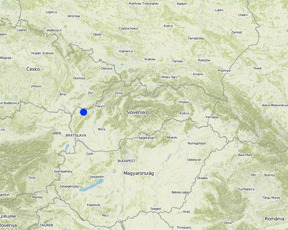
2.5 Страна/ регион/ место, где применялся Подход
Страна:
Словакия
Административная единица (Район/Область):
Slovakia
Более точная привязка места:
Senica / Sobotište
Map
×2.6 Даты начала и окончания реализации Подхода
Год начала реализации:
2011
Год окончания (Если Подход больше не применяется):
2012
2.7 Тип Подхода
- в рамках проекта/ программы
2.8 Каковы цели/ задачи Подхода
The Approach focused mainly on SLM with other activities
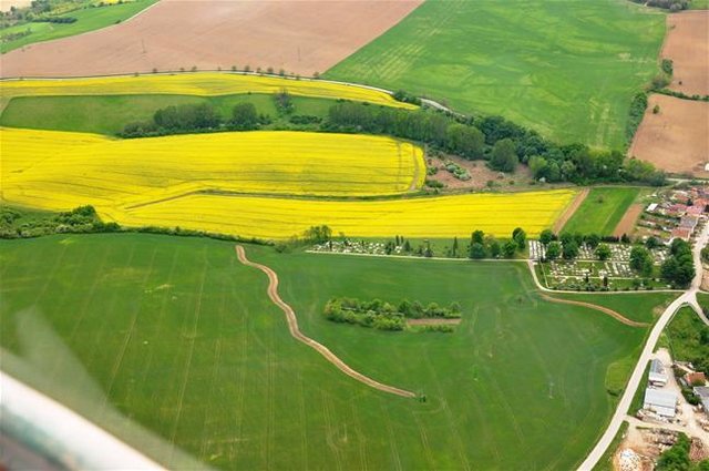
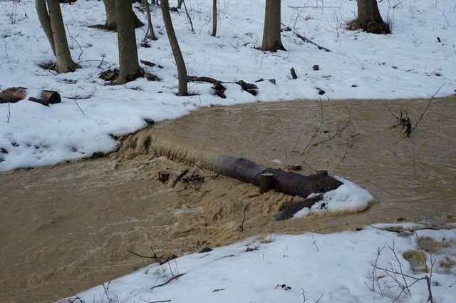
The Sobotište of village was greatly affected in 2011 by floods from storm rainfall. Problems with floods, however, occur regularly, especially at the Teplica and the Sobotišský stream. Some problems have been recorded in farmland and meadows, in places of concentrated runoff during the storm rainfalls, long lasting rainfalls, and snow melting. Floods endanger villages and make severe damage. The goal of the approach is to eliminate damage to healt and properties.
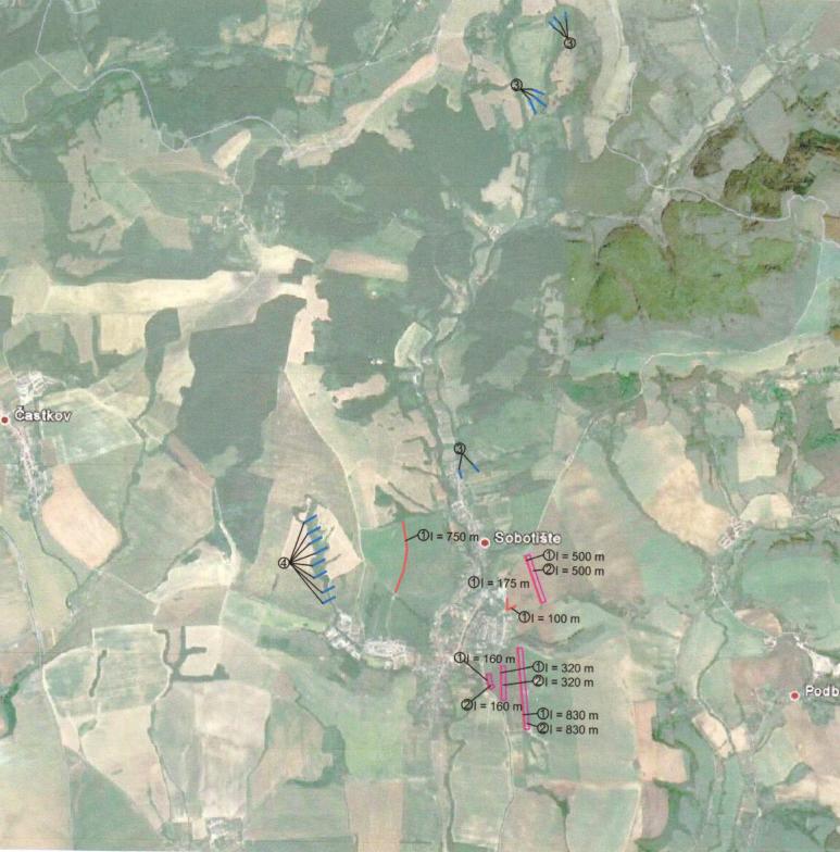
Water retention measures are proposed in the territory of Sobotište, localities of Kubiny, Staré Hory, Javorec, Kaničkov Jarok and Padelky. It is expected that the proposed water retention measures will support the accumulation and infiltration of water into the soil and retard runoff from farmland, meadows, and pastures. With the proper function of measures the surface runoff in farmland will decrease and slow down, and community will not endanger as much as previously.
The SLM Approach addressed the following problems: In general, the main problems within the implementation of projects are mostly legislative regulations that hamper the SLM and the implementation of technologies. The big problem is protection zone of particular rivers connected to administrative and legislative laws and regulations. Some difficulties detected were the execution of permissions for the implementations of methods and technologies that would help to achieve the sustainable land management.
Second problem is land consolidation. The process of the land consolidation is too long to be achieved and accomplished in time. Especially if the public call of the application submission for subsidies needs the consolidation of land to be already solved.
Third, the measures cannot be more expensive than the protected object.
Four, there is lack of money for the purchasing the land in municipalities.
Five, there is very poor law enforcement and recovery of law and claims.
2.9 Условия содействующие применению Технологии/ Технологий в рамках Подхода или затрудняющие его
Наличие/ доступность финансовых ресурсов и услуг
- затрудняют
Treatment through the SLM Approach:
Нормативно-правовая база (землевладение, права на земле- и водопользование)
- затрудняют
ownership of the land
Treatment through the SLM Approach:
3. Участие и распределение ролей заинтересованных сторон
3.1 Заинтересованные стороны, участвующие в реализации Подхода и их роли
- местные землепользователи/ местные сообщества
The approach involved socially and economically disadvantaged ethnicities
- эксперты по УЗП/ сельскому хозяйству
- государственные власти (отвечающие за планирование или принятие решений)
3.2 Участие местных землепользователей/ местных сообществ на разных стадиях реализации Подхода
| Участие местных землепользователей/ местных сообществ | Перечислите участников и опишите их вовлеченность | |
|---|---|---|
| инициирование/ мотивация | самоорганизация | Government |
| планирование | самоорганизация | Government, SLM specialist |
| выполнение | самоорганизация | Municipalities, land users |
| мониторинг/ оценка | самоорганизация | Municipalities, land users |
| Research | пассивное |
3.4 Принятие решений по выбору Технологии/ Технологий УЗП
Укажите, кто принимал решение по выбору применяемой Технологии/ Технологий:
- в основном землепользователи при поддержке специалистов по УЗП
Поясните:
Decisions on the method of implementing the SLM Technology were made by mainly by land users supported by SLM specialists
4. Техническая поддержка, повышение компетенций и управление знаниями
4.1 Повышение компетенций/ обучение
Проводилось ли обучение землепользователей/ других заинтересованных лиц?
Нет
4.2 Консультационные услуги
Есть ли у землепользователей возможность получать консультации?
Нет
4.3 Институциональная (организационная) поддержка
В ходе реализации Подхода были ли организованы новые институциональные структуры или поддержаны уже существующие?
- нет
4.4 Мониторинг и оценка
Являются ли мониторинг и оценка частью Подхода?
Нет
4.5 Научные исследования
Были ли научные исследования частью Подхода?
Да
Укажите темы исследований:
- технология
Напишите подробнее и назовите тех, кто выполнял исследования:
Research was carried out on-farm
5. Финансирование и внешняя материальная поддержка
5.1 Годовой бюджет мероприятий по УЗП в рамках Подхода
Если точный годовой бюжет неизвестен, укажите примерный диапазон затрат:
- 10000-100000
Комментарий (например, основные источники финансирования/ ключевые доноры):
Approach costs were met by the following donors: government: 100.0%
5.2 Финансирование и внешняя материальная поддержка, предоставляемая землепользователям
Предоставлялась ли землепользователям финансовая/ материальная поддержка для применения Технологии /Технологий?
Да
Если да, укажите тип(-ы) поддержки, кто ее предоставил и условия предоставления:
Government funds and subsidies
5.3 Субсидии на отдельные затраты (включая оплату труда)
- оборудование
| Укажите, какие ресурсы были субсидированы | В какой степени | Опишите субсидии подробнее |
|---|---|---|
| техника | профинансированы полностью | |
| инвентарь/ инструменты | профинансированы полностью | |
- сельскохозяйственные
| Укажите, какие ресурсы были субсидированы | В какой степени | Опишите субсидии подробнее |
|---|---|---|
| семена | профинансированы полностью | |
| удобрения | профинансированы полностью | |
- строительные материалы
| Укажите, какие ресурсы были субсидированы | В какой степени | Опишите субсидии подробнее |
|---|---|---|
| камень | профинансированы полностью | |
| древесина | профинансированы полностью | |
5.4 Кредитование
Предоставлялись ли в рамках Подхода кредиты на мероприятия УЗП?
Нет
7. Справочные материалы и ссылки
7.1 Методы сбора/источники информации
- выезды на места, полевые обследования
- опросы землепользователей
Ссылки и модули
Развернуть все Свернуть всеСсылки
Level ditches in cropland [Словакия]
Conservation measures for eroded cropland. The technology contains level ditches of various lengths, which are digged along a contour.
- Составитель: Zuzana Studvova
Wooden check dams [Словакия]
Small wooden check dams built in erosion rills, grooves or gorges to reduce flood risk.
- Составитель: Zuzana Studvova
Модули
Нет модулей