
The programme of landscape revitalization and integrated river basin management in the Slovak republic for the year 2011 - retention measures in the Sobotište village. [Eslováquia]
- Criação:
- Atualização:
- Compilador/a: Zuzana Studvova
- Editor: –
- Revisor: David Streiff
Program revitalizácie krajiny a integrovaného manažmentu povodí v Slovenskej republike pre rok 2011 - vodozádržné opatrenia v obci Sobotište. (Slovak language)
approaches_2680 - Eslováquia
- Resumo completo em PDF
- Resumo completo em PDF para impressão
- Resumo completo no navegador
- Resumo completo (sem formatação)
- The programme of landscape revitalization and integrated river basin management in the Slovak republic for the year 2011 - retention measures in the Sobotište village.: 2 de Agosto de 2017 (inactive)
- The programme of landscape revitalization and integrated river basin management in the Slovak republic for the year 2011 - retention measures in the Sobotište village.: 2 de Agosto de 2017 (public)
Veja as seções
Expandir tudo Recolher tudo1. Informação geral
1.2 Detalhes do contato das pessoas capacitadas e instituições envolvidas na avaliação e documentação da abordagem
Nome do projeto que facilitou a documentação/avaliação da Abordagem (se relevante)
Sustainable Hill Cultivation Programme1.3 Condições em relação ao uso da informação documentada através de WOCAT
Quando os dados foram compilados (no campo)?
01/01/2015
O compilador e a(s) pessoa(s) capacitada(s) aceitam as condições relativas ao uso de dados documentados através do WOCAT:
Sim
1.4 Referência ao(s) questionário(s) sobre tecnologias da GST
Level ditches in cropland [Eslováquia]
Conservation measures for eroded cropland. The technology contains level ditches of various lengths, which are digged along a contour.
- Compilador/a: Zuzana Studvova
Wooden check dams [Eslováquia]
Small wooden check dams built in erosion rills, grooves or gorges to reduce flood risk.
- Compilador/a: Zuzana Studvova
2. Descrição da abordagem de GST
2.1 Descrição curta da abordagem
This approach is devoted to the implementation of 'The Landscape Revitalisation Programme and integrated river basins management of the Slovak Republic' in the Sobotište village.
2.2 Descrição detalhada da abordagem
Descrição detalhada da abordagem:
Aims / objectives: The objective of the first implementation project for 2011 was to create, activate and systematically implement a minimum of 6 million m³ of water retention elements in mountain and foothill areas of forest-agricultural landscape in Slovakia. A particular aim was to create and build landscape water retention systems, terrain elements, facilities and technical solutions in forest, agricultural and urban areas in selected village locations, with the abovementioned cyclical rainwater retention capacity, which will then be operated and
maintained. Another project objective was to force and socially support the creation of employment at community and regional level. The creation of water retention elements and the implementation of revitalisation measures required the creation of a minimum of 2,500 jobs of a seasonal and temporary nature in 2011, including extending existing specialist capacities. This whould also extend the work skills and knowledge necessary for revitalisation of the landscape.
833 municipalities showed interest to participate in this project/approach, while 200 municipalities met the criteria. The project created about 3,500 seasonal jobs in 2011, particularly in regions with high unemployment.
Methods: Criteria and their significance for including villages into the first implementation project are
as follows:
1. 45% - historic or regularly repeated occurrence of flash flooding,
2. 35 % - village is situated in a location with a high potential risk of flooding, in accordance
with modelled potential for the occurrence of flooding. A map of regional and local
potential for flooding in the area of Slovakia1
is at Appendix No. 1,
3. 10% - location of a village in the upper part of river basins, so the implemented measures
will positively decrease the risk of flooding for highest possible number of villages in the
given river basins,
4. 10% - the ratio of documented unemployment is taking into account so citizens of villages
with a high ratio of documented unemployment could contribute towards revitalisation
works.
The submitted methodology of the whole flood potential of Slovakia was prepared on the basis of the work of J. Minár and Co. (2005). The mentioned work focuses upon the
presentation of methodology and results for evaluating the flood creation potential within the whole of Slovakia. It also includes a general description of the modelling of hydrological
processes. The method presented in this work is a good alternative for fast, effective and relatively financially undemanding but still sufficiently reliable analysis of flood risks of
larger areas. The actual calculation of total potential for flooding took place in the technological environment of Geographic Information Systems (GIS) in the following steps
with the stated data:
- calculation of the morphometric potential (incline, horizontal articulation of the
topography, slope length, speed of surface run-off),
- partial synthetic geological potential (infiltration and drainage properties of the soil,
retention properties of the land cover, breaking effect of land cover, size of river basin,
shape of river basin),
- overall potential of the land for the creation of flood situations (climatic and
hydrological characteristics and data).
Stages of implementation: Management of the first implementation project was carried out by the Executive Manager of the Programme of Landscape Revitalization and Integrated River Basin Management in SR in cooperation with the Government Representative for Local Government and for Integrated River Basin and Landscape Management and other interested departments of the Government Office SR.
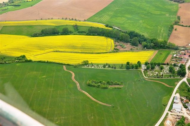
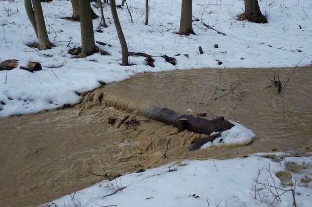
2.3 Fotos da abordagem
Galeria de Mídias
2.5 País/região/locais onde a abordagem foi aplicada
País:
Eslováquia
Região/Estado/Província:
Slovakia
Especificação adicional de localização:
Senica / Sobotište
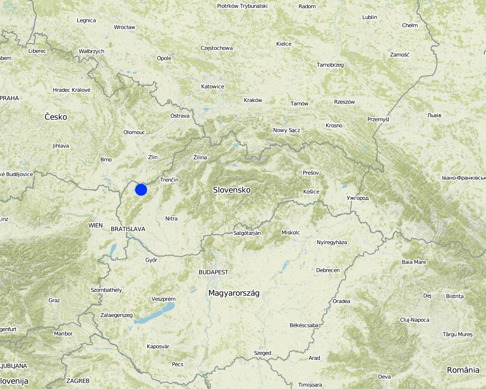
Map
×2.6 Datas de início e término da abordagem
Indique o ano de início:
2011
Ano de término (caso a abordagem não seja mais aplicada):
2012
2.7 Tipo de abordagem
- Baseado em projeto/programa
2.8 Principais metas/objetivos da abordagem
The Approach focused mainly on SLM with other activities
The Sobotište of village was greatly affected in 2011 by floods from storm rainfall. Problems with floods, however, occur regularly, especially at the Teplica and the Sobotišský stream. Some problems have been recorded in farmland and meadows, in places of concentrated runoff during the storm rainfalls, long lasting rainfalls, and snow melting. Floods endanger villages and make severe damage. The goal of the approach is to eliminate damage to healt and properties.
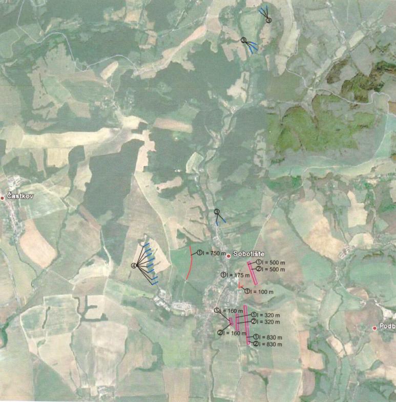
Water retention measures are proposed in the territory of Sobotište, localities of Kubiny, Staré Hory, Javorec, Kaničkov Jarok and Padelky. It is expected that the proposed water retention measures will support the accumulation and infiltration of water into the soil and retard runoff from farmland, meadows, and pastures. With the proper function of measures the surface runoff in farmland will decrease and slow down, and community will not endanger as much as previously.
The SLM Approach addressed the following problems: In general, the main problems within the implementation of projects are mostly legislative regulations that hamper the SLM and the implementation of technologies. The big problem is protection zone of particular rivers connected to administrative and legislative laws and regulations. Some difficulties detected were the execution of permissions for the implementations of methods and technologies that would help to achieve the sustainable land management.
Second problem is land consolidation. The process of the land consolidation is too long to be achieved and accomplished in time. Especially if the public call of the application submission for subsidies needs the consolidation of land to be already solved.
Third, the measures cannot be more expensive than the protected object.
Four, there is lack of money for the purchasing the land in municipalities.
Five, there is very poor law enforcement and recovery of law and claims.
2.9 Condição que propiciam ou inibem a implementação de tecnologia/tecnologias aplicada(s) segundo a abordagem
Disponibilidade/acesso a recursos e serviços financeiros
- Inibitivo
Treatment through the SLM Approach:
Quadro jurídico (posse de terra, direitos de uso da terra e da água)
- Inibitivo
ownership of the land
Treatment through the SLM Approach:
3. Participação e papel das partes interessadas envolvidas
3.1 Partes interessadas envolvidas na abordagem e seus papéis
- Usuários de terra/comunidades locais
The approach involved socially and economically disadvantaged ethnicities
- Especialistas em GST/ consultor agrícola
- Governo nacional (planejadores, responsáveis pelas decisões)
3.2 Envolvimento do usuários de terra/comunidades locais nas diferentes fases da abordagem
| Envolvimento do usuários de terra/comunidades locais | Especifique quem estava envolvido e descreva as atividades | |
|---|---|---|
| Iniciação/motivação | Automobilização | Government |
| Planejamento | Automobilização | Government, SLM specialist |
| Implementação | Automobilização | Municipalities, land users |
| Monitoramento/avaliação | Automobilização | Municipalities, land users |
| Research | Passivo |
3.4 Decisão sobre a seleção de tecnologia/tecnologias de GST
Especifique quem decidiu sobre a seleção de tecnologia/tecnologias a serem implementadas:
- Principalmente usuários da terra, apoiados por especialistas em GST
Explique:
Decisions on the method of implementing the SLM Technology were made by mainly by land users supported by SLM specialists
4. Suporte técnico, reforço das capacidades e gestão do conhecimento
4.1 Reforço das capacidades/formação
Foi oferecida formação aos usuários da terra/outras partes interessadas?
Não
4.2 Serviço de consultoria
Os usuários de terra têm acesso a um serviço de consultoria?
Não
4.3 Fortalecimento da instituição (desenvolvimento organizacional)
As instituições foram fortalecidas ou estabelecidas através da abordagem?
- Não
4.4 Monitoramento e avaliação
Monitoramento e avaliação são partes da abordagem?
Não
4.5 Pesquisa
A pesquisa foi parte da abordagem?
Sim
Especifique os tópicos:
- Tecnologia
Dê mais detalhes e indique quem realizou a pesquisa:
Research was carried out on-farm
5. Financiamento e apoio material externo
5.1 Orçamento anual para o componente de GST da abordagem
Caso o orçamento exato seja desconhecido, indique a faixa:
- 10.000-100.000
Comentários (p. ex. principais fontes de recursos/principais doadores):
Approach costs were met by the following donors: government: 100.0%
5.2 Apoio financeiro/material concedido aos usuários da terra
Os usuários da terra receberam apoio financeiro/material para a implementação de tecnologia/tecnologias?
Sim
Caso afirmativo, especifique tipo(s) de apoio, condições e fornecedor(es):
Government funds and subsidies
5.3 Subsídios para entradas específicas (incluindo mão-de-obra)
- Equipamento
| Especifique quais entradas foram subsidiadas | Em que medida | Especifique os subsídios |
|---|---|---|
| Maquinário | Totalmente financiado | |
| Ferramentas | Totalmente financiado | |
- Agrícola
| Especifique quais entradas foram subsidiadas | Em que medida | Especifique os subsídios |
|---|---|---|
| Sementes | Totalmente financiado | |
| Fertilizantes | Totalmente financiado | |
- Construção
| Especifique quais entradas foram subsidiadas | Em que medida | Especifique os subsídios |
|---|---|---|
| Pedra | Totalmente financiado | |
| Madeira | Totalmente financiado | |
5.4 Crédito
Foi concedido crédito segundo a abordagem para atividades de GST?
Não
7. Referências e links
7.1 Métodos/fontes de informação
- visitas de campo, pesquisas de campo
- entrevistas com usuários de terras
Links e módulos
Expandir tudo Recolher tudoLinks
Level ditches in cropland [Eslováquia]
Conservation measures for eroded cropland. The technology contains level ditches of various lengths, which are digged along a contour.
- Compilador/a: Zuzana Studvova
Wooden check dams [Eslováquia]
Small wooden check dams built in erosion rills, grooves or gorges to reduce flood risk.
- Compilador/a: Zuzana Studvova
Módulos
Não há módulos