Afforestation [กาบูเวร์ดี]
- ผู้สร้างสรรค์:
- การอัพเดท:
- ผู้รวบรวม: Jacques Tavares
- ผู้เรียบเรียง: –
- ผู้ตรวจสอบ: David Streiff
Arborização / floresta (Portuguese)
technologies_1523 - กาบูเวร์ดี
ดูส่วนย่อย
ขยายทั้งหมด ย่อทั้งหมด1. ข้อมูลทั่วไป
1.2 รายละเอียดที่ติดต่อได้ของผู้รวบรวมและองค์กรที่เกี่ยวข้องในการประเมินและการจัดเตรียมทำเอกสารของเทคโนโลยี
ผู้เชี่ยวชาญ SLM:
Varela Larissa
INIDA
กาบูเวร์ดี
ผู้เชี่ยวชาญ SLM:
Amarós Regla
INIDA
กาบูเวร์ดี
ผู้เชี่ยวชาญ SLM:
Bentub Jailson
INIDA
กาบูเวร์ดี
ชื่อขององค์กรซึ่งอำนวยความสะดวกในการทำเอกสารหรือการประเมินเทคโนโลยี (ถ้าเกี่ยวข้อง)
INIDA (INIDA) - กาบูเวร์ดี1.3 เงื่อนไขการใช้ข้อมูลที่ได้บันทึกผ่านทาง WOCAT
วันที่เก็บรวบรวมข้อมูล(ภาคสนาม) :
03/04/2009
ผู้รวบรวมและวิทยากรหลักยอมรับเงื่อนไขเกี่ยวกับการใช้ข้อมูลที่ถูกบันทึกผ่านทาง WOCAT:
ใช่
1.5 อ้างอิงไปที่แบบสอบถามเรื่องแนวทาง SLM

Protection des versants [กาบูเวร์ดี]
Cette approche consiste à mettre à profit les eaux d'écoulement superficiel
- ผู้รวบรวม: Jacques Tavares
2. การอธิบายลักษณะของเทคโนโลยี SLM
2.1 การอธิบายแบบสั้น ๆ ของเทคโนโลยี
คำจำกัดความของเทคโนโลยี:
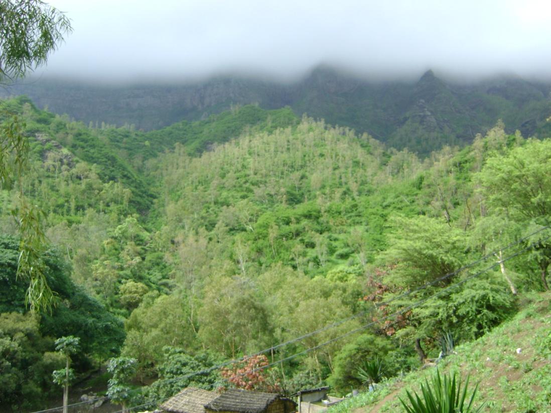
Afforestation is one of the key technologies to address the fragility of ecosystems: it provides better protection against erosion and makes better use of rainfall in order to maintain the sustainability of agricultural systems.
2.2 การอธิบายแบบละเอียดของเทคโนโลยี
คำอธิบาย:
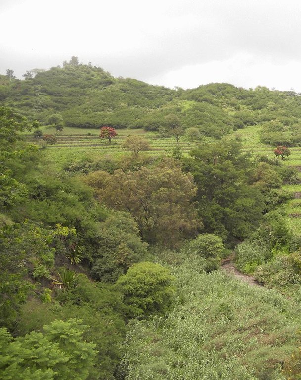
Mountain forest areas are considered protective due to their role in regulating water (infiltration of storm water, regulation of surface runoff, and ground water recharge) within the watershed. The main species used are Prosopis juliflora, Parkinsonia aculeata, Jatropha curcas, Atriplex spp, Acacia holosericea, Acacia victoriae, Lantana camara and others, in arid areas and Eucalyptus camaldulensis, Grevillea robusta, Pinus and Cupressus ssp. in highland and humid areas.
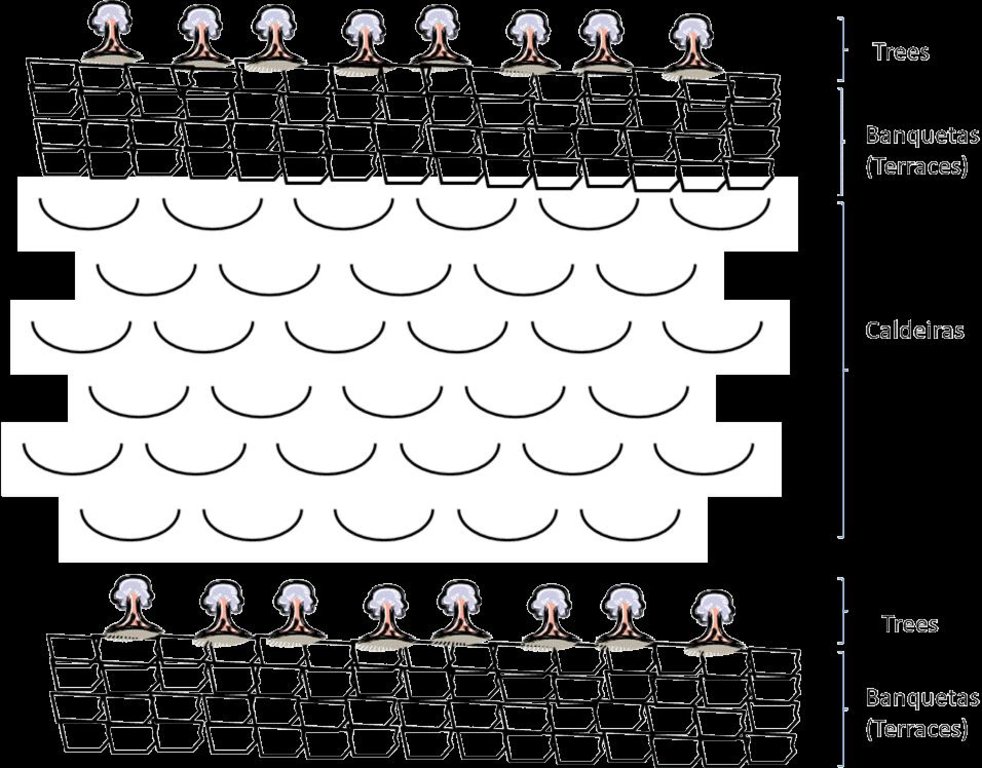
Purpose of the Technology: The climatic conditions are characterized by high spatial and temporal variability of the rainfall. The rains are concentrated in two or three months (August and September or October); the highlands and the N-NE parts are wetter compared to the low lands or coastal areas, which are very dry. The average annual rainfall is about 225 mm over the whole island; it has declined since the 1960s, with negative effects on farming conditions, and water supply. However, in areas located more than 500 m above sea level and exposed to trade winds, rainfall can exceed 700 mm. About 20% of the precipitation is lost through runoff, 13% infiltrates the soil and recharges aquifers and 67% evaporates. The evaporation loss is a limiting factor for any agriculture or forestry. Therefore, it is necessary to adapt the afforestation implementation to the specific local conditions (slope, stone cover, climate, etc). To overcome and minimize the problem of water scarcity, several measures are applied: (a) caldeira or half-moon structures achieved with earth or stone; (b) contour furrows or level bench terraces with stone walls arranged along the contour; (c). small dams to protect gullies. The aim is to maximize retention of water and control surface runoff. This not only allows better infiltration of water for the tree plantations, but also protects against soil erosion and facilitates groundwater recharge.
Establishment / maintenance activities and inputs: The success of the reforestation may be indicated not only by the area covered but also by the number of introduced plants. In 1975, there were about 3,000 ha of afforested land. By 2011, there are over 90,000 ha of afforested land with almost 50 million trees. Afforestation has focused mainly on the island of Santiago and Santo Antão, (13% of the total area reforested). Nowadays, more than 20% of the country is afforested. The forest has had a great importance in the context of combating desertification, rehabilitation of vegetation cover, in meeting energy needs and forage production and in developing agrosilvopastoral systems, as well as having undoubtedly contributed to a significant modification of the landscape in Cape Verde. The afforestation activities also contributed to increase biodiversity of some species of birds, including “Galinha di mato” (Numida meleagris), “Codorniz” (Coturnix coturnix), “Passarinha” (Halcyon leucocephala) and others.
Natural / human environment: The forest species are mainly used for land protection and for production of fuel wood and coal. Because of the poor growing conditions, the forest species are not well suited to the construction industry or wood processing.
2.3 รูปภาพของเทคโนโลยี
2.5 ประเทศภูมิภาค หรือสถานที่ตั้งที่เทคโนโลยีได้นำไปใช้และได้รับการครอบคลุมโดยการประเมินนี้
ประเทศ:
กาบูเวร์ดี
ภูมิภาค/รัฐ/จังหวัด:
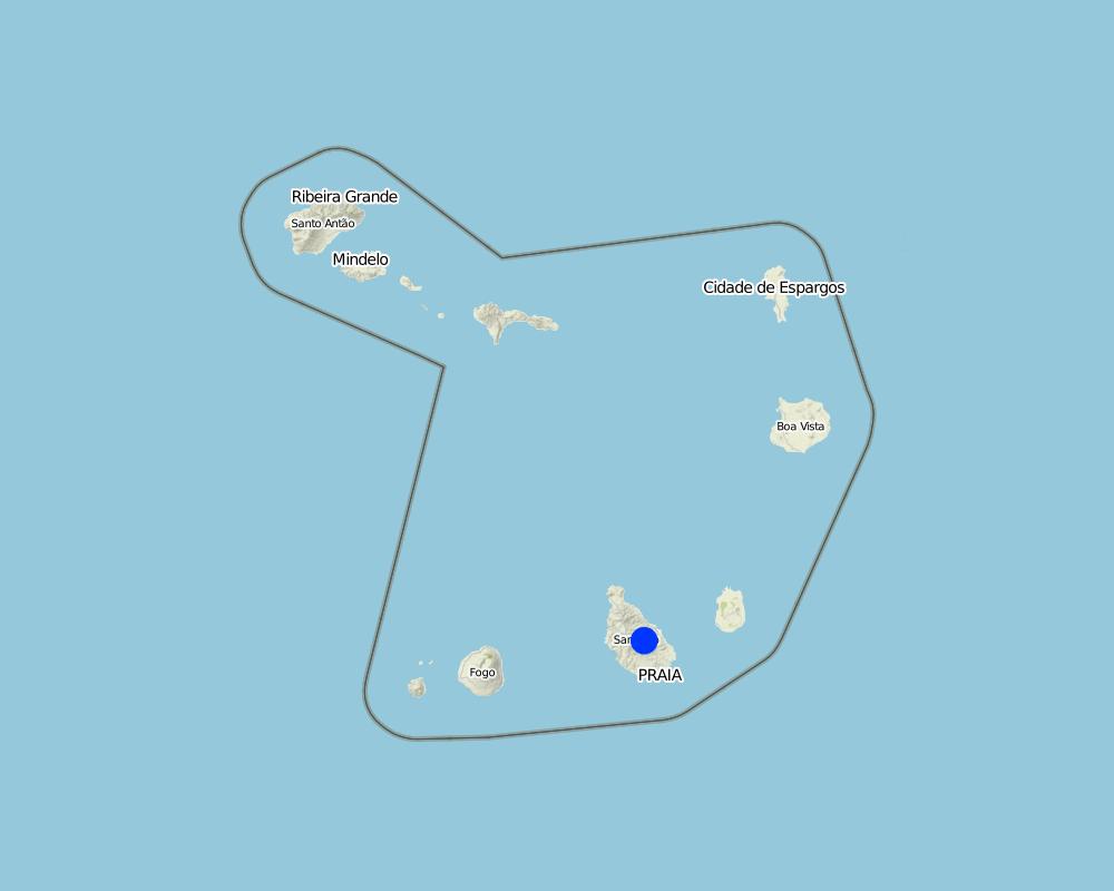
Santiago Island, Cape Verde
ข้อมูลจำเพาะเพิ่มเติมของสถานที่ตั้ง :
Ribeira Seca
Map
×2.6 วันที่การดำเนินการ
ถ้าไม่รู้ปีที่แน่นอน ให้ระบุวันที่โดยประมาณ:
- 10-50 ปี
2.7 คำแนะนำของเทคโนโลยี
ให้ระบุว่าเทคโนโลยีถูกแนะนำเข้ามาอย่างไร:
- ทางโครงการหรือจากภายนอก
ความคิดเห็น (ประเภทของโครงการ เป็นต้น) :
Before 1975, the forestry production was directed to the market of wood, after 1975 began to stock in order to protect the environment
3. การจัดประเภทของเทคโนโลยี SLM
3.1 วัตถุประสงค์หลักของเทคโนโลยี
- ลด ป้องกัน ฟื้นฟู การเสื่อมโทรมของที่ดิน
- อนุรักษ์ระบบนิเวศน์
3.2 ประเภทของการใช้ที่ดินในปัจจุบันที่ได้นำเทคโนโลยีไปใช้

ทุ่งหญ้าเลี้ยงสัตว์
ทุ่งหญ้าเลี้ยงสัตว์ที่มีการจัดการแบบเข้มข้นหรือการผลิตอาหารสัตว์:
- ตัดแล้วขนไป / ไม่มีการปล่อยแทะเล็มเอง (Cut-and-carry / zero grazing)
ชนิดพันธุ์สัตว์และผลิตภัณฑ์หลัก:
goats and cows

ป่า/พื้นที่ทำไม้
ป่า/พื้นที่ทำไม้:
- การปลูกหลายพันธุ์รวมกัน
ผลิตภัณฑ์และบริการ:
- การอนุรักษ์ / ป้องกันธรรมชาติ
แสดงความคิดเห็น:
Major land use problems (compiler’s opinion): The loss of soil by runoff, influenced by its low coverage, reducing their fertility and their thickness
Major land use problems (land users’ perception): Soil erosion by runoff, low productive soils, low organic matter, low soil cover, fertility and depth particularly in the agro-systems with rainfed agriculture.
Cut-and-carry/ zero grazing: goats/ cows
Grazingland comments: production is characterized as extensive, although made in a closed expaço
Plantation forestry: Few trees are cut, since the main objective of which is the forest canopy. The dead are removed, make's some clean and plant new trees every year.
Problems / comments regarding forest use: Before 1975, date of independence of Cape Verde, began to stock the areas discovered. The forest is more dense at high altitudes but also introduced
Forest products and services: nature conservation / protection
Future (final) land use (after implementation of SLM Technology): Mixed: Ms: Silvo-pastoralism
Type of grazing system comments: production is characterized as extensive, although made in a closed expaço
ถ้าการใช้ที่ดินมีการเปลี่ยนแปลงเนื่องมาจากการนำเทคโนโลยีไปปฏิบัติใช้ ให้ระบุการใช้ที่ดินก่อนนำเทคโนโลยีไปปฏิบัติใช้:
Mixed: Mo: Other
3.3 ข้อมูลเพิ่มเติมเกี่ยวกับการใช้ที่ดิน
การใช้น้ำของที่ดินที่มีการใช้เทคโนโลยีอยู่:
- จากน้ำฝน
จำนวนของฤดูเพาะปลูกต่อปี:
- 1
ระบุ:
Longest growing period in days: 90; Longest growing period from month to month: August untill October
ความหนาแน่นของปศุสัตว์ (ถ้าเกี่ยวข้อง):
25-50 LU /km2
3.4 กลุ่ม SLM ที่ตรงกับเทคโนโลยีนี้
- การจัดการป่าธรรมชาติและกึ่งธรรมชาติ
- การจัดการด้านชลประทาน (รวมถึงการลำเลียงส่งน้ำ การระบายน้ำ)
3.5 กระจายตัวของเทคโนโลยี
แสดงความคิดเห็น:
Total area covered by the SLM Technology is 71.5 km2.
The forest with the greatest density of trees occupies an area of 2.51 km2 and is located in the area of higher altitude. The density decreases with decrease in altitude
3.6 มาตรการ SLM ที่ประกอบกันเป็นเทคโนโลยี

มาตรการอนุรักษ์ด้วยวิธีพืช
- V1: ต้นไม้และพุ่มไม้คลุมดิน

มาตรการอนุรักษ์ด้วยโครงสร้าง
- S2: ทำนบ เขื่อนดิน
แสดงความคิดเห็น:
Secondary measures: structural measures
3.7 รูปแบบหลักของการเสื่อมโทรมของที่ดินที่ได้รับการแก้ไขโดยเทคโนโลยี

การกัดกร่อนของดินโดยน้ำ
- Wt (Loss of topsoil): การสูญเสียดินชั้นบนหรือการกัดกร่อนที่ผิวดิน
- Wg (Gully erosion): การกัดกร่อนแบบร่องธารหรือการทำให้เกิดร่องน้ำเซาะ

การเสื่อมโทรมของดินทางด้านชีวภาพ
- Bc (Reduction of vegetation cover): การลดลงของจำนวนพืชที่ปกคลุมดิน
- Bh (Loss of habitat): การสูญเสียแหล่งที่อยู่

การเสื่อมโทรมของน้ำ
- Hg (Change in groundwater): การเปลี่ยนแปลงของน้ำบาดาลหรือระดับน้ำในแอ่งน้ำบาดาล
แสดงความคิดเห็น:
Secondary types of degradation addressed: Hg: change in groundwater / aquifer level
Main causes of degradation: soil management (It is cultivated maize and peanuts on land slopes very pronounced and boot up the plants by the root in end of the cycle), crop management (annual, perennial, tree/shrub) (The cleaning of the crop residues of corn is done pulling them by the root, negatively affecting soil stability), poverty / wealth (Leads sensitized peoples to advocate action against the landscape for survival of the family), education, access to knowledge and support services (Knowledge and technical training increase the options for means of survival of the community that acts on the forest, the degree of attending school is low and the illiteracy rate is 17%)
Secondary causes of degradation: overgrazing (Creation of the wild animals compact the soil, destroying the structures for the conservation of soil and water exists, and creates conflict), disturbance of water cycle (infiltration / runoff), Heavy / extreme rainfall (intensity/amounts) (Sometimes occur heavy rains intensity that associated with poor vegetation cover, increase soil erosion), governance / institutional (Lack of applicability of the laws that manage the land)
3.8 การป้องกัน การลดลง หรือการฟื้นฟูความเสื่อมโทรมของที่ดิน
ระบุเป้าหมายของเทคโนโลยีกับความเสื่อมโทรมของที่ดิน:
- ฟื้นฟูบำบัดที่ดินที่เสื่อมโทรมลงอย่างมาก
4. ข้อมูลจำเพาะด้านเทคนิค กิจกรรมการนำไปปฏิบัติใช้ ปัจจัยนำเข้า และค่าใช้จ่าย
4.1 แบบแปลนทางเทคนิคของเทคโนโลยี
4.2 ข้อมูลจำเพาะด้านเทคนิคและการอธิบายแบบแปลนทางเทคนิค
Treatment of slope before afforestation
Technical knowledge required for field staff / advisors: moderate (It's needed sufficient knowledge to choice species according to their suitability to the natural and human environment)
Technical knowledge required for land users: low
Main technical functions: control of raindrop splash, improvement of ground cover, stabilisation of soil (eg by tree roots against land slides), increase of infiltration, increase of groundwater level / recharge of groundwater
Secondary technical functions: increase in organic matter, increase / maintain water stored in soil, reduction in wind speed
Retention/infiltration ditch/pit, sediment/sand trap
Vertical interval between structures (m): 2
Spacing between structures (m): 5
Depth of ditches/pits/dams (m): 0.2
Width of ditches/pits/dams (m): 0.8
Length of ditches/pits/dams (m): 100
Height of bunds/banks/others (m): 0.4
Width of bunds/banks/others (m): 0.4
Length of bunds/banks/others (m): 100
Construction material (earth): land from the local construction of the ditch is used in the construction of banks, that can be rein
Slope (which determines the spacing indicated above): 30 - 60%
Lateral gradient along the structure: 0%
For water harvesting: the ratio between the area where the harvested water is applied and the total area from which water is collected is: 1:3
Vegetation is used for stabilisation of structures.
4.4 กิจกรรมเพื่อการจัดตั้ง
| กิจกรรม | ประเภทของมาตรการ | ช่วงเวลาดำเนินการ | |
|---|---|---|---|
| 1. | Quantification of the area to be afforested | ด้วยวิธีพืช | |
| 2. | Production of plants in nursery ( 500 - 1300 plants) | ด้วยวิธีพืช | |
| 3. | Treatment of area (slope) with building terraces (15 m / person / day) | ด้วยวิธีพืช | |
| 4. | Treatment of area (slope) with: Making half-moons “Caldeiras” (3 / person / day) | ด้วยวิธีพืช | |
| 5. | 4. Excavating the pits (10 / person / day): 60x60x60 cm | ด้วยวิธีพืช | |
| 6. | Planting (50 /person / day): 5 to 5 metres | ด้วยวิธีพืช | |
| 7. | Initial maintenance (8 /persons / day) | ด้วยวิธีพืช | |
| 8. | Cleaning and marking on curves level | ด้วยโครงสร้าง | In April |
| 9. | Construction of the retention / infiltration ditch and opening of the surface of culture | ด้วยโครงสร้าง | April to June |
4.5 ค่าใช้จ่ายของปัจจัยนำเข้าที่จำเป็นสำหรับการจัดตั้ง
| ปัจจัยนำเข้า | หน่วย | ปริมาณ | ค่าใช้จ่ายต่อหน่วย | ค่าใช้จ่ายทั้งหมดต่อปัจจัยนำเข้า | %ของค่าใช้จ่ายที่ก่อให้เกิดขึ้นโดยผู้ใช้ที่ดิน | |
|---|---|---|---|---|---|---|
| แรงงาน | Labour | ha | 1.0 | 28218.0 | 28218.0 | |
| อุปกรณ์ | Tools | ha | 1.0 | 410.0 | 410.0 | 10.0 |
| วัสดุด้านพืช | Seeds | ha | 1.0 | 942.0 | 942.0 | |
| ค่าใช้จ่ายทั้งหมดของการจัดตั้งเทคโนโลยี | 29570.0 | |||||
แสดงความคิดเห็น:
Duration of establishment phase: 1 month(s)
4.6 การบำรุงรักษาสภาพหรือกิจกรรมที่เกิดขึ้นเป็นประจำ
| กิจกรรม | ประเภทของมาตรการ | ช่วงระยะเวลา/ความถี่ | |
|---|---|---|---|
| 1. | forest cleaning | ด้วยวิธีพืช | |
| 2. | forest cleaning | ด้วยโครงสร้าง | In the dry session |
4.7 ค่าใช้จ่ายของปัจจัยนำเข้าและกิจกรรมที่เกิดขึ้นเป็นประจำที่ต้องการการบำรุงรักษา (ต่อปี)
| ปัจจัยนำเข้า | หน่วย | ปริมาณ | ค่าใช้จ่ายต่อหน่วย | ค่าใช้จ่ายทั้งหมดต่อปัจจัยนำเข้า | %ของค่าใช้จ่ายที่ก่อให้เกิดขึ้นโดยผู้ใช้ที่ดิน | |
|---|---|---|---|---|---|---|
| แรงงาน | Forest cleaning | ha | 1.0 | 142.0 | 142.0 | 52.0 |
| ค่าใช้จ่ายทั้งหมดของการบำรุงรักษาสภาพเทคโนโลยี | 142.0 | |||||
แสดงความคิดเห็น:
Machinery/ tools: Hoe, machete
Costs are estimated according to the time required for afforestation and the entity contracted for the implementation of the activities.
4.8 ปัจจัยสำคัญที่สุดที่มีผลกระทบต่อค่าใช้จ่าย
ปัจจัยสำคัญที่สุดที่มีผลกระทบต่อค่าใช้จ่ายต่างๆ:
The labour affects the costs more than other factors. Paid labour is a way to achieve additional income for many people in this area. The employer (Directorate General of Agriculture, Sylviculture and Livestock of the Ministry of Rural Development) provides 90% of the cost of the equipment. The lifetime of the equipment is 10-15 years.
5. สิ่งแวดล้อมทางธรรมชาติและของมนุษย์
5.1 ภูมิอากาศ
ฝนประจำปี
- < 250 ม.ม.
- 251-500 ม.ม.
- 501-750 ม.ม.
- 751-1,000 ม.ม.
- 1,001-1,500 ม.ม.
- 1,501-2,000 ม.ม.
- 2,001-3,000 ม.ม.
- 3,001-4,000 ม.ม.
- > 4,000 ม.ม.
ระบุปริมาณน้ำฝนเฉลี่ยรายปี (ถ้ารู้) :หน่วย ม.ม.
800.00
เขตภูมิอากาศเกษตร
- ชื้น
- กึ่งชุ่มชื้น
- กึ่งแห้งแล้ง
- แห้งแล้ง
Thermal climate class: tropics. average temperature equal to 26 º C
The exposure and altitude are factors diterminantes for agroclimatic estratização. the higher areas and targeted to the SE are more humid.
5.2 สภาพภูมิประเทศ
ค่าเฉลี่ยความลาดชัน:
- ราบเรียบ (0-2%)
- ลาดที่ไม่ชัน (3-5%)
- ปานกลาง (6-10%)
- เป็นลูกคลื่น (11-15%)
- เป็นเนิน (16-30%)
- ชัน (31-60%)
- ชันมาก (>60%)
ธรณีสัณฐาน:
- ที่ราบสูง/ที่ราบ
- สันเขา
- ไหล่เขา
- ไหล่เนินเขา
- ตีนเนิน
- หุบเขา
ระดับความสูง:
- 0-100 เมตร
- 101-500 เมตร
- 501-1,000 เมตร
- 1,001-1,500 เมตร
- 1,501-2,000 เมตร
- 2,001-2,500 เมตร
- 2,501-3,000 เมตร
- 3,001-4,000 เมตร
- > 4,000 เมตร
ให้ระบุถ้าเทคโนโลยีได้ถูกนำไปใช้:
- ไม่เกี่ยวข้อง
ความคิดเห็นและข้อมูลจำเพาะเพิ่มเติมเรื่องสภาพภูมิประเทศ:
Altitudinal zone: 100-500 m a.s.l. belongs to the stratum semi-arid sub-humid. Is part of the stratum the highest percentage of the area of the basin. 1000-1500 m a.s.l. includes mainly the cliffs and ridges.
Landforms: Also ridges and footslopes. The hazards of a convex situations does not allow its application in mountain slopes.
5.3 ดิน
ค่าเฉลี่ยความลึกของดิน:
- ตื้นมาก (0-20 ซ.ม.)
- ตื้น (21-50 ซ.ม.)
- ลึกปานกลาง (51-80 ซ.ม.)
- ลึก (81-120 ซ.ม.)
- ลึกมาก (>120 ซ.ม.)
เนื้อดิน (ดินชั้นบน):
- หยาบ/เบา (ดินทราย)
- ปานกลาง (ดินร่วน ทรายแป้ง)
อินทรียวัตถุในดิน:
- ปานกลาง (1-3%)
- ต่ำ (<1%)
(ถ้ามี) ให้แนบคำอธิบายเรื่องดินแบบเต็มหรือระบุข้อมูลที่มีอยู่ เช่น ชนิดของดิน ค่า pH ของดินหรือความเป็นกรดของดิน ความสามารถในการแลกเปลี่ยนประจุบวก ไนโตรเจน ความเค็ม เป็นต้น:
Soil depth on average: Very shallow is associated with the sloping hillsides used for rainfull agriculture and shaloow is found mainly in the valley bottoms of the downstream.
Soil texture (topsoil): The soil overlay mainly basaltic rocks, piroclastic, conglomerates and aluvial deposits
Soil fertility is medium - low
Soil drainage / infiltration is good - medium
Soil water storage capacity is medium - low
5.4 ความเป็นประโยชน์และคุณภาพของน้ำ
ระดับน้ำใต้ดิน:
5-50 เมตร
น้ำไหลบ่าที่ผิวดิน:
ไม่ดีหรือไม่มีเลย
คุณภาพน้ำ (ที่ยังไม่ได้บำบัด):
เป็นน้ำเพื่อการดื่มที่ไม่ดี (จำเป็นต้องได้รับการบำบัด)
ความคิดเห็นและข้อมูลจำเพาะเพิ่มเติมเรื่องคุณภาพและปริมาณน้ำ:
Ground water table: In rain months, it is more superficial than in the dry months
Availability of surface water: There is some just when it rains.
Water quality (untreated): Salinization of water due to over exploitation of wells and boreholes
5.5 ความหลากหลายทางชีวภาพ
ความหลากหลายทางชนิดพันธุ์:
- ปานกลาง
5.6 ลักษณะของผู้ใช้ที่ดินที่นำเทคโนโลยีไปปฏิบัติใช้
รายได้ที่มาจากนอกฟาร์ม:
- < 10% ของรายได้ทั้งหมด
ระดับของความมั่งคั่งโดยเปรียบเทียบ:
- จน
เป็นรายบุคคล/ครัวเรือน:
- ลูกจ้าง (บริษัท รัฐบาล)
ระบุลักษณะอื่นๆที่เกี่ยวข้องของผู้ใช้ที่ดิน:
Population density: 100-200 persons/km2
Annual population growth: > 4%
and own 1% of the land (the tecnology is applyed by the state, and the state of that country is poor).
Off-farm income specification: forest production (mainly grass and wood) generate an annual income of approximately $2,500
Market orientation of production system: Mixed:Forest products are quite limited: lumber, firewood, charcoal and fodder from the pods. Firewood is the most important product but marketing is quite limited in time and space and subsistence are families who enter the forest for collection of grass and firewood. It is necessary for their survival. The state sells these products in order to finance other development projects.
5.7 พื้นที่เฉลี่ยของที่ดินที่เป็นเจ้าของหรือเช่าโดยผู้ใช้ที่ดินที่นำเทคโนโลยีไปปฏิบัติใช้
- < 0.5 เฮกตาร์
- 0.5-1 เฮกตาร์
- 1-2 เฮกตาร์
- 2-5 เฮกตาร์
- 5-15 เฮกตาร์
- 15-50 เฮกตาร์
- 50-100 เฮกตาร์
- 100-500 เฮกตาร์
- 500-1,000 เฮกตาร์
- 1,000-10,000 เฮกตาร์
- >10,000 เฮกตาร์
พิจารณาว่าเป็นขนาดเล็ก กลาง หรือขนาดใหญ่ (ซึ่งอ้างอิงถึงบริบทระดับท้องถิ่น):
- ขนาดใหญ่
แสดงความคิดเห็น:
Also 50-100 ha, 100-500 ha and 100-500 ha,
The forest covers all the household
The grass production is made between the trees across the forest area if it's possible
5.8 กรรมสิทธิ์ในที่ดิน สิทธิในการใช้ที่ดินและสิทธิในการใช้น้ำ
กรรมสิทธิ์ในที่ดิน:
- รัฐ
- รายบุคคล ได้รับสิทธิครอบครอง
- Diocese
สิทธิในการใช้ที่ดิน:
- เกี่ยวกับชุมชน (ถูกจัดระเบียบ)
- รายบุคคล
สิทธิในการใช้น้ำ:
- เกี่ยวกับชุมชน (ถูกจัดระเบียบ)
5.9 การเข้าถึงบริการและโครงสร้างพื้นฐาน
การศึกษา:
- จน
- ปานกลาง
- ดี
ความช่วยเหลือทางด้านเทคนิค:
- จน
- ปานกลาง
- ดี
การจ้างงาน (เช่น ภายนอกฟาร์ม):
- จน
- ปานกลาง
- ดี
ตลาด:
- จน
- ปานกลาง
- ดี
พลังงาน:
- จน
- ปานกลาง
- ดี
ถนนและการขนส่ง:
- จน
- ปานกลาง
- ดี
น้ำดื่มและการสุขาภิบาล:
- จน
- ปานกลาง
- ดี
บริการด้านการเงิน:
- จน
- ปานกลาง
- ดี
6. ผลกระทบและสรุปคำบอกกล่าว
6.1 ผลกระทบในพื้นที่ดำเนินการ (On-site) จากการใช้เทคโนโลยี
ผลกระทบทางด้านเศรษฐกิจและสังคม
การผลิต
การผลิตพืชที่ใช้เลี้ยงปศุสัตว์
คุณภาพพืชที่ใช้เลี้ยงปศุสัตว์
การผลิตพลังงาน
แสดงความคิดเห็น/ระบุ:
Firewood to the community
ความเป็นประโยชน์และคุณภาพของน้ำ
การมีน้ำดื่มไว้ให้ใช้
รายได้และค่าใช้จ่าย
ค่าใช่จ่ายของปัจจัยการผลิตทางการเกษตร
ความเหลื่อมล้ำทางเศรษฐกิจ
ผลกระทบด้านสังคมวัฒนธรรมอื่น ๆ
ความมั่นคงด้านอาหาร / พึ่งตนเองได้
แสดงความคิดเห็น/ระบุ:
It reduces the options of land use
โอกาสทางวัฒนธรรม
การบรรเทาความขัดแย้ง
สถานการณ์ของกลุ่มด้อยโอกาส ทางด้านสังคมและเศรษฐกิจ
แสดงความคิดเห็น/ระบุ:
Any sex has the same opportunity on the assets of the forest
livelihood and human well-being
แสดงความคิดเห็น/ระบุ:
It improves air quality, promotes the production of endemic species and its use as medicine
ผลกระทบด้านนิเวศวิทยา
วัฐจักรน้ำหรือน้ำบ่า
น้ำบาดาลหรือระดับน้ำในแอ่งน้ำบาดาล
การระเหย
ดิน
ความชื้นในดิน
สิ่งปกคลุมดิน
การสูญเสียดิน
อินทรียวัตถุในดิน/ต่ำกว่าดินชั้น C
ลดความเสี่ยงของภัยพิบัติ
การปล่อยคาร์บอนและก๊าซเรือนกระจก
ความเร็วของลม
ผลกระทบด้านนิเวศวิทยาอื่น ๆ
Invasive species
competition
6.2 ผลกระทบนอกพื้นที่ดำเนินการ (Off-site) จากการใช้เทคโนโลยี
น้ำที่ใช้ประโยชน์ได้
การไหลของน้ำคงที่และสม่ำเสมอในช่วงฤดูแล้ง
น้ำท่วมพื้นที่ท้ายน้ำ
การทับถมของดินตะกอนพื้นที่ท้ายน้ำ
ความสามารถต้านทานการเปลี่ยนแปลง / ความสามารถในการคัดกรอง
ตะกอนที่ถูกพัดพามาโดยลม
ความเสียหายต่อพื้นที่เพาะปลูกของเพื่อนบ้าน
6.3 การเผชิญและความตอบสนองของเทคโนโลยีต่อการเปลี่ยนแปลงสภาพภูมิอากาศที่ค่อยเป็นค่อยไป และสภาพรุนแรงของภูมิอากาศ / ภัยพิบัติ (ที่รับรู้ได้โดยผู้ใช้ที่ดิน)
การเปลี่ยนแปลงสภาพภูมิอากาศที่ค่อยเป็นค่อยไป
การเปลี่ยนแปลงสภาพภูมิอากาศที่ค่อยเป็นค่อยไป
| ฤดู | ประเภทของการเปลี่ยนแปลงสภาพภูมิอากาศที่ค่อยเป็นค่อยไป และสภาพรุนแรงของภูมิอากาศ | เทคโนโลยีมีวิธีการรับมืออย่างไร | |
|---|---|---|---|
| อุณหภูมิประจำปี | เพิ่มขึ้น | ดี |
สภาพรุนแรงของภูมิอากาศ (ภัยพิบัติ)
ภัยพิบัติทางอุตุนิยมวิทยา
| เทคโนโลยีมีวิธีการรับมืออย่างไร | |
|---|---|
| พายุฝนประจำท้องถิ่น | ไม่ทราบ |
| พายุลมประจำท้องถิ่น | ไม่ค่อยดี |
ภัยพิบัติจากสภาพภูมิอากาศ
| เทคโนโลยีมีวิธีการรับมืออย่างไร | |
|---|---|
| ภัยจากฝนแล้ง | ไม่ค่อยดี |
ภัยพิบัติจากน้ำ
| เทคโนโลยีมีวิธีการรับมืออย่างไร | |
|---|---|
| น้ำท่วมตามปกติ (แม่น้ำ) | ไม่ทราบ |
ผลลัพธ์ตามมาที่เกี่ยวข้องกับภูมิอากาศอื่น ๆ
ผลลัพธ์ตามมาที่เกี่ยวข้องกับภูมิอากาศอื่น ๆ
| เทคโนโลยีมีวิธีการรับมืออย่างไร | |
|---|---|
| ช่วงการปลูกพืชที่ลดลงมา | ดี |
แสดงความคิดเห็น:
Tree species more tolerant of the climatic factors can be used, whilst retaining all the benefits that the existing species provide
6.4 การวิเคราะห์ค่าใช้จ่ายและผลประโยชน์ที่ได้รับ
ผลประโยชน์ที่ได้รับเปรียบเทียบกับค่าใช้จ่ายในการจัดตั้งเป็นอย่างไร (จากมุมมองของผู้ใช้ที่ดิน)
ผลตอบแทนระยะสั้น:
ด้านลบ
ผลตอบแทนระยะยาว:
ด้านบวก
ผลประโยชน์ที่ได้รับเปรียบเทียบกับค่าใช้จ่ายในการบำรุงรักษาหรือต้นทุนที่เกิดขึ้นซ้ำอีก เป็นอย่างไร (จากมุมมองของผู้ใช้ที่ดิน)
ผลตอบแทนระยะสั้น:
เป็นกลางหรือสมดุล
ผลตอบแทนระยะยาว:
ด้านบวกอย่างมาก
แสดงความคิดเห็น:
The high costs are associated with its implementation; afterwards they are significantly reduced and the technology builds up the benefits.
6.5 การปรับตัวของเทคโนโลยี
ถ้ามีข้อมูลให้บอกปริมาณด้วย (จำนวนของครัวเรือนหรือครอบคลุมพื้นที่):
None. It's a project of the government
แสดงความคิดเห็น:
Comments on acceptance with external material support: Only the state has implemented this technology, because it changes the use of land and, without any subsidies, other land users are not encouraged to agree to it.
There is a moderate trend towards spontaneous adoption of the Technology
Comments on adoption trend: there is a continuing campaign of afforestation of state land. There are voluntary associations working in this technology for a better environment
6.7 จุดแข็ง / ข้อได้เปรียบ / โอกาสของเทคโนโลยี
| จุดแข็ง / ข้อได้เปรียบ / โอกาสในทัศนคติของผู้ใช้ที่ดิน |
|---|
|
Production of firewood and grass How can they be sustained / enhanced? make more forest operations such as pruning or cutting of new seedlings |
|
Protection of soil How can they be sustained / enhanced? strengthen maintenance operations |
| จุดแข็ง / ข้อได้เปรียบ / โอกาสในทัศนคติของผู้รวบรวมหรือวิทยากรหลัก |
|---|
|
Increases the quality of the landscape and reduces the loss of soil by runoff How can they be sustained / enhanced? increasing the tree cover in areas with low coverage |
|
Encourages the production of livestock, and fuel wood How can they be sustained / enhanced? integrate the community in managing the forest, and manage it in a sustainable way. |
6.8 จุดอ่อน / ข้อเสียเปรียบ / ความเสี่ยงของเทคโนโลยีและวิธีการแก้ไข
| จุดอ่อน / ข้อเสียเปรียบ / ความเสี่ยงในทัศนคติของผู้ใช้ที่ดิน | มีวิธีการแก้ไขได้อย่างไร |
|---|---|
| impossibility of farming in the forest lands | off-farm income creation to compensate |
| Lack of involvement of farmers in the management of forest areas | capacity building of land users in forest management strategies, elaboration of contracts between State and land users for the management of forest perimeters |
| จุดอ่อน / ข้อเสียเปรียบ / ความเสี่ยงในทัศนคติของผู้รวบรวมหรือวิทยากรหลัก | มีวิธีการแก้ไขได้อย่างไร |
|---|---|
| Reduces the percentage of land for agricultural production | increase productivity in cultivated land and reduce the need for the use of forest land, and implement new production technologies such as greenhouses |
7. การอ้างอิงและการเชื่อมต่อ
7.2 การอ้างอิงถึงสิ่งตีพิมพ์
หัวข้อ, ผู้เขียน, ปี, หมายเลข ISBN:
Desertification at the Santiago Island, DESIRE, 2008
หัวข้อ, ผู้เขียน, ปี, หมายเลข ISBN:
Relatório de avaliação inicial do impacto das realizações de conservação de solos e água em 1993 do projecto WDP, WDP project, 1995
หัวข้อ, ผู้เขียน, ปี, หมายเลข ISBN:
www.ine.cv: Survey of family income and expenditure, INE, 2002
หัวข้อ, ผู้เขียน, ปี, หมายเลข ISBN:
OCDE, CILSS, 1982. Análise do Sector Florestal e Propostas para Cabo Verde. Sahel D (82) 179
ชื่อเรื่อง ผู้เขียน ปี ISBN:
Club do Sahel, pp 203.
หัวข้อ, ผู้เขียน, ปี, หมายเลข ISBN:
MAAA/DGASP, 1996. Rapport de pays pour la Conférence Technique Internationale de la FAO sur les Ressources Phytogénétiques, Leipzig, 1996, pp 38.
ชื่อเรื่อง ผู้เขียน ปี ISBN:
Leipzig, 1996, pp 38.
ลิงก์และโมดูล
ขยายทั้งหมด ย่อทั้งหมดลิงก์

Protection des versants [กาบูเวร์ดี]
Cette approche consiste à mettre à profit les eaux d'écoulement superficiel
- ผู้รวบรวม: Jacques Tavares
โมดูล
ไม่มีโมดูล


