Water-spreading weirs for the development of degraded dry river valleys [ชาด]
- ผู้สร้างสรรค์:
- การอัพเดท:
- ผู้รวบรวม: Unknown User
- ผู้เรียบเรียง: –
- ผู้ตรวจสอบ: Fabian Ottiger
Seuils d’épandage pour la valorisation des vallées d'oued dégradées
technologies_1536 - ชาด
ดูส่วนย่อย
ขยายทั้งหมด ย่อทั้งหมด1. ข้อมูลทั่วไป
1.2 รายละเอียดที่ติดต่อได้ของผู้รวบรวมและองค์กรที่เกี่ยวข้องในการประเมินและการจัดเตรียมทำเอกสารของเทคโนโลยี
วิทยากรหลัก
ผู้เชี่ยวชาญ SLM:
Bender Heinz
ชื่อของโครงการซึ่งอำนวยความสะดวกในการทำเอกสารหรือการประเมินเทคโนโลยี (ถ้าเกี่ยวข้อง)
Book project: Water Harvesting – Guidelines to Good Practice (Water Harvesting)1.3 เงื่อนไขการใช้ข้อมูลที่ได้บันทึกผ่านทาง WOCAT
วันที่เก็บรวบรวมข้อมูล(ภาคสนาม) :
08/03/2012
ผู้รวบรวมและวิทยากรหลักยอมรับเงื่อนไขเกี่ยวกับการใช้ข้อมูลที่ถูกบันทึกผ่านทาง WOCAT:
ใช่
2. การอธิบายลักษณะของเทคโนโลยี SLM
2.1 การอธิบายแบบสั้น ๆ ของเทคโนโลยี
คำจำกัดความของเทคโนโลยี:
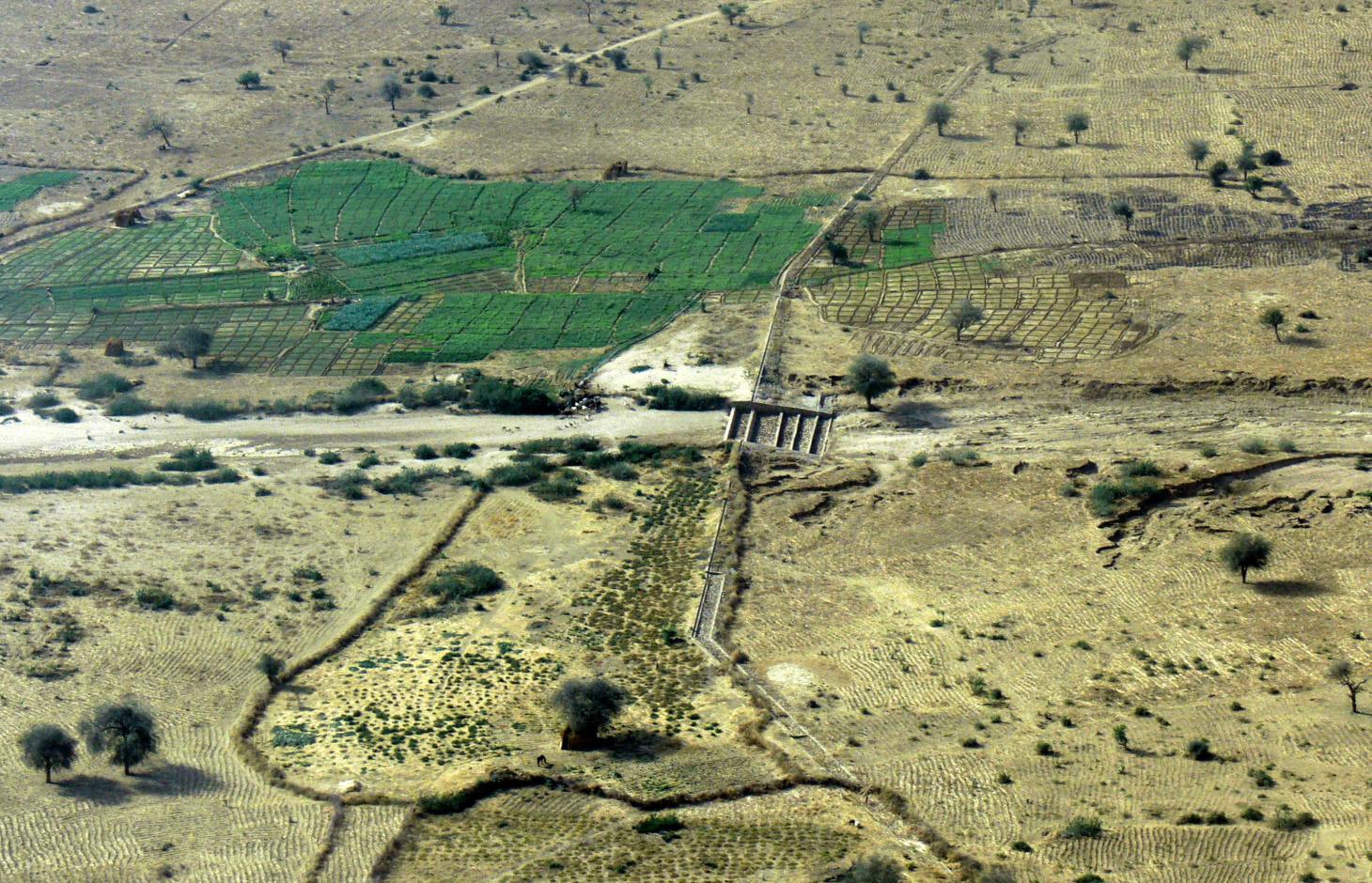
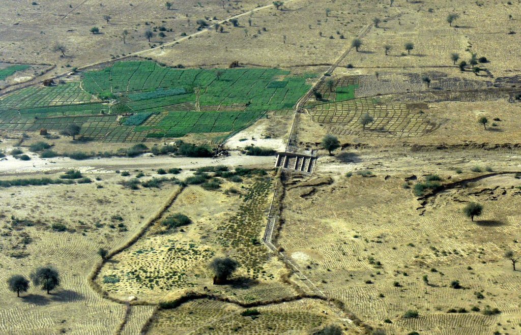
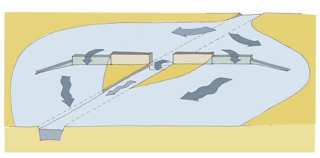
Water-spreading weirs are structures that span the entire width of a valley to spread floodwater over the adjacent land area.
2.2 การอธิบายแบบละเอียดของเทคโนโลยี
คำอธิบาย:
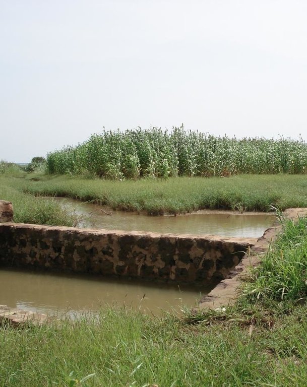
Over the last 12 years water-spreading weirs have been introduced and improved as a new rehabilitation technique for degraded dry valleys in Burkina Faso, Niger and Chad. In Chad 104 water-spreading weirs were constructed in the scope of the two development projects, initiated by the German Technical Cooperation (GIZ) and the Swiss Development Cooperation (SDC) in the 1990s. Water-spreading weirs are made of natural stones and cement, and consist of a spillway in the actual riverbed and lateral abutments and wings. Floodwaters are spread over the adjacent land area above the structure, where they eventually overflow the lateral wings and then slowly flow back towards the riverbed below the structure. As a result the land area below the weir is flooded. The lateral spreading of the water causes the land area above and below the structure to be flooded and supplies it with sediment. Water infiltrates, gullies in the valley are filled and the riverbed is raised. Thanks to the infiltration, the groundwater table also rises in a few years.
Purpose of the Technology: In dry valleys in which water flows in the rivers for only a few days a year, the weirs serve to distribute the incoming runoff over the valley floor and allow as much water as possible to infiltrate the soil. The aquifer is thus replenished and is then available for agricultural use. In contrast to the various types of dams, the goal of water-spreading weirs is not to create reservoirs for later use. What water-spreading weirs do is cause a temporary flooding of the adjacent land area above and below the weir. Depending on user preferences, the primary goal may be 1) agricultural use, 2) sylvo-pastoral use or 3) the replenishment and rising of the water table.
Establishment / maintenance activities and inputs: Water-spreading weirs require detailed technical planning and experienced engineering and construction firms. The bulk of the work is performed using local materials and by village craftsmen and helpers.
Natural / human environment: Compared to small impoundment dams, retention basins and microweirs, water-spreading weirs are especially well-suited for shallow, wide valleys that, due to severe gully erosion, are no longer inundated by small and medium
volume floodwaters. The flooding no longer takes place because the actual riverbed has been deeply eroded and enlarged. However, water-spreading weirs are also suitable for improving agricultural productivity in more or less intact valley floors. Water-spreading weirs are successful in regions where precipitation during the growing season is erratic and where the weirs ensure a more evenly distributed water supply for crops, as well as in zones in which water enrichment makes one or two additional growing seasons possible. At the present time they are in use in a broad area where annual rainfall ranges from 50 to 1,200 mm/year.
2.3 รูปภาพของเทคโนโลยี
2.5 ประเทศภูมิภาค หรือสถานที่ตั้งที่เทคโนโลยีได้นำไปใช้และได้รับการครอบคลุมโดยการประเมินนี้
ประเทศ:
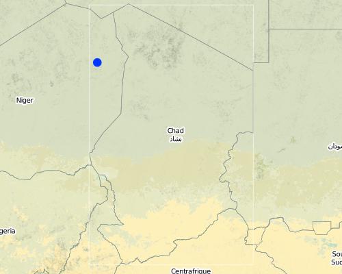
ชาด
ภูมิภาค/รัฐ/จังหวัด:
Eastern Chad
Map
×2.6 วันที่การดำเนินการ
ถ้าไม่รู้ปีที่แน่นอน ให้ระบุวันที่โดยประมาณ:
- 10-50 ปี
2.7 คำแนะนำของเทคโนโลยี
ให้ระบุว่าเทคโนโลยีถูกแนะนำเข้ามาอย่างไร:
- ทางโครงการหรือจากภายนอก
ความคิดเห็น (ประเภทของโครงการ เป็นต้น) :
The first water-spreading weirs were introduced during the 1990s in Chad through Swiss cooperation
3. การจัดประเภทของเทคโนโลยี SLM
3.1 วัตถุประสงค์หลักของเทคโนโลยี
- ปรับปรุงการผลิตให้ดีขึ้น
- ลด ป้องกัน ฟื้นฟู การเสื่อมโทรมของที่ดิน
3.2 ประเภทของการใช้ที่ดินในปัจจุบันที่ได้นำเทคโนโลยีไปใช้

พื้นที่ปลูกพืช
- การปลูกพืชล้มลุกอายุปีเดียว
พืชหลัก (พืชเศรษฐกิจและพืชอาหาร):
Major cash crop: Onions, tomatoes, garlic
Major food crop: Millet, sorghum and cowpea
Other crops: Watermelon, okra, sesame

ทุ่งหญ้าเลี้ยงสัตว์
ทุ่งหญ้าเลี้ยงสัตว์ที่ใช้พื้นที่กว้าง:
- กึ่งเร่ร่อน / อาจมีการทำทุ่งหญ้าเลี้ยงสัตว์ร่วมด้วย (Semi-nomadism/ pastoralism)
ชนิดพันธุ์สัตว์และผลิตภัณฑ์หลัก:
Sheep, goat, cow, dromedary
แสดงความคิดเห็น:
Major land use problems (compiler’s opinion): Substantial degradation of drainage basins in the Sahel due to population growth and intense land-use pressure has been observed since the 1960s. Climate change has further amplified this trend. The expansion of agriculture and intensification of grazing and logging have caused the natural vegetation cover to decline. This process has been accelerated by severe droughts and has led to the degradation of the soils. Sparse vegetation cover and structurally damaged soils reduce rainfall infiltration into the soil, resulting in more runoff and soil erosion on plateaus and slopes. Runoff is concentrated in the valleys, in which heavy floodwaters
wash away fertile soils and lead to deep erosion of the riverbed. The annual, recurrent small and medium-size floods that normally cause temporary inundation of the valleys and deposition of fertile sediments no longer occur.
3.3 ข้อมูลเพิ่มเติมเกี่ยวกับการใช้ที่ดิน
อื่นๆ (เช่น หลังจากน้ำท่วม):
- Post-flooding
แสดงความคิดเห็น:
Water supply: Also mixed rainfed - irrigated and rainfed
3.4 กลุ่ม SLM ที่ตรงกับเทคโนโลยีนี้
- มาตรการปลูกพืชขวางความลาดชัน (cross-slope measure)
- การจัดการด้านชลประทาน (รวมถึงการลำเลียงส่งน้ำ การระบายน้ำ)
- การผันน้ำและการระบายน้ำ
3.5 กระจายตัวของเทคโนโลยี
ระบุการกระจายตัวของเทคโนโลยี:
- กระจายไปอย่างสม่ำเสมอในพื้นที่
ถ้าหากว่าเทคโนโลยีได้มีการกระจายออกไปอย่างสม่ำเสมอในพื้นที่ ให้ระบุปริมาณพื้นที่ที่ได้รับการครอบคลุมถึง:
- 10-100 ตร.กม.
แสดงความคิดเห็น:
Total area covered by the SLM Technology is 20 m2.
The technology has been applied in 22 different valleys in Eastern Chad. The total area that profits from the installation of one such structure is therefore somewhere between 10 and 100 ha.
3.6 มาตรการ SLM ที่ประกอบกันเป็นเทคโนโลยี

มาตรการอนุรักษ์ด้วยโครงสร้าง
- S6: กำแพง สิ่งกีดขวาง รั้วไม้ รั้วต่างๆ
3.7 รูปแบบหลักของการเสื่อมโทรมของที่ดินที่ได้รับการแก้ไขโดยเทคโนโลยี

การกัดกร่อนของดินโดยน้ำ
- Wt (Loss of topsoil): การสูญเสียดินชั้นบนหรือการกัดกร่อนที่ผิวดิน
- Wg (Gully erosion): การกัดกร่อนแบบร่องธารหรือการทำให้เกิดร่องน้ำเซาะ

การเสื่อมโทรมของน้ำ
- Hg (Change in groundwater): การเปลี่ยนแปลงของน้ำบาดาลหรือระดับน้ำในแอ่งน้ำบาดาล
แสดงความคิดเห็น:
Main type of degradation addressed: Wt: loss of topsoil / surface erosion, Wg: gully erosion / gullying, Hg: change in groundwater / aquifer level
Main causes of degradation: soil management (abandonment of fallow periods), deforestation / removal of natural vegetation (incl. forest fires) (for agricultural expansion), over-exploitation of vegetation for domestic use, droughts, population pressure
Secondary causes of degradation: overgrazing
3.8 การป้องกัน การลดลง หรือการฟื้นฟูความเสื่อมโทรมของที่ดิน
ระบุเป้าหมายของเทคโนโลยีกับความเสื่อมโทรมของที่ดิน:
- ลดความเสื่อมโทรมของดิน
- ฟื้นฟูบำบัดที่ดินที่เสื่อมโทรมลงอย่างมาก
แสดงความคิดเห็น:
Main goals: rehabilitation / reclamation of denuded land
Secondary goals: mitigation / reduction of land degradation
4. ข้อมูลจำเพาะด้านเทคนิค กิจกรรมการนำไปปฏิบัติใช้ ปัจจัยนำเข้า และค่าใช้จ่าย
4.1 แบบแปลนทางเทคนิคของเทคโนโลยี
4.2 ข้อมูลจำเพาะด้านเทคนิคและการอธิบายแบบแปลนทางเทคนิค
Water-spreading weir with spillway, lateral abutments and wing walls.
Technical knowledge required for field staff / advisors: high
Main technical functions: control of dispersed runoff: retain / trap, control of dispersed runoff: impede / retard, increase of groundwater level / recharge of groundwater, water harvesting / increase water supply, water spreading, sediment retention / trapping, sediment harvesting
Secondary technical functions: increase of infiltration, spatial arrangement and diversification of land use
Dam/ pan/ pond
Height of bunds/banks/others (m): 0.75
Width of bunds/banks/others (m): 5
Length of bunds/banks/others (m): 500
4.4 กิจกรรมเพื่อการจัดตั้ง
| กิจกรรม | ประเภทของมาตรการ | ช่วงเวลาดำเนินการ | |
|---|---|---|---|
| 1. | Excavating the steps | ด้วยโครงสร้าง | |
| 2. | Excavating the wall foundations | ด้วยโครงสร้าง | |
| 3. | Pouring the foundations | ด้วยโครงสร้าง | |
| 4. | Building the walls | ด้วยโครงสร้าง | |
| 5. | Finishing the walls and filling the stilling basin | ด้วยโครงสร้าง |
4.5 ค่าใช้จ่ายของปัจจัยนำเข้าที่จำเป็นสำหรับการจัดตั้ง
| ปัจจัยนำเข้า | หน่วย | ปริมาณ | ค่าใช้จ่ายต่อหน่วย | ค่าใช้จ่ายทั้งหมดต่อปัจจัยนำเข้า | %ของค่าใช้จ่ายที่ก่อให้เกิดขึ้นโดยผู้ใช้ที่ดิน | |
|---|---|---|---|---|---|---|
| แรงงาน | Labour | ha | 1.0 | 750.0 | 750.0 | 100.0 |
| อุปกรณ์ | Total costs for equipment | ha | 1.0 | 750.0 | 750.0 | |
| วัสดุสำหรับก่อสร้าง | Stone | ha | 1.0 | 750.0 | 750.0 | |
| ค่าใช้จ่ายทั้งหมดของการจัดตั้งเทคโนโลยี | 2250.0 | |||||
4.7 ค่าใช้จ่ายของปัจจัยนำเข้าและกิจกรรมที่เกิดขึ้นเป็นประจำที่ต้องการการบำรุงรักษา (ต่อปี)
| ปัจจัยนำเข้า | หน่วย | ปริมาณ | ค่าใช้จ่ายต่อหน่วย | ค่าใช้จ่ายทั้งหมดต่อปัจจัยนำเข้า | %ของค่าใช้จ่ายที่ก่อให้เกิดขึ้นโดยผู้ใช้ที่ดิน | |
|---|---|---|---|---|---|---|
| แรงงาน | Labour | ha | 1.0 | 50.0 | 50.0 | 100.0 |
| อุปกรณ์ | Total costs for equipment | ha | 1.0 | 50.0 | 50.0 | |
| วัสดุสำหรับก่อสร้าง | Stone | ha | 1.0 | 50.0 | 50.0 | |
| ค่าใช้จ่ายทั้งหมดของการบำรุงรักษาสภาพเทคโนโลยี | 150.0 | |||||
แสดงความคิดเห็น:
The costs were calculated per structure (one diversion weir). The length of the weir varies depending on the width of the valley it is constructed in. The weir has to span the whole valley which is usually between 100 and 1000 m wide.
5. สิ่งแวดล้อมทางธรรมชาติและของมนุษย์
5.1 ภูมิอากาศ
ฝนประจำปี
- < 250 ม.ม.
- 251-500 ม.ม.
- 501-750 ม.ม.
- 751-1,000 ม.ม.
- 1,001-1,500 ม.ม.
- 1,501-2,000 ม.ม.
- 2,001-3,000 ม.ม.
- 3,001-4,000 ม.ม.
- > 4,000 ม.ม.
ข้อมูลจำเพาะ/ความคิดเห็นเรื่องปริมาณน้ำฝน:
251-500 mm Ranked 1
<250 mm Ranked 2
150-400 mm / year
เขตภูมิอากาศเกษตร
- กึ่งแห้งแล้ง
Thermal climate class: tropics
5.2 สภาพภูมิประเทศ
ค่าเฉลี่ยความลาดชัน:
- ราบเรียบ (0-2%)
- ลาดที่ไม่ชัน (3-5%)
- ปานกลาง (6-10%)
- เป็นลูกคลื่น (11-15%)
- เป็นเนิน (16-30%)
- ชัน (31-60%)
- ชันมาก (>60%)
ธรณีสัณฐาน:
- ที่ราบสูง/ที่ราบ
- สันเขา
- ไหล่เขา
- ไหล่เนินเขา
- ตีนเนิน
- หุบเขา
ระดับความสูง:
- 0-100 เมตร
- 101-500 เมตร
- 501-1,000 เมตร
- 1,001-1,500 เมตร
- 1,501-2,000 เมตร
- 2,001-2,500 เมตร
- 2,501-3,000 เมตร
- 3,001-4,000 เมตร
- > 4,000 เมตร
5.3 ดิน
ค่าเฉลี่ยความลึกของดิน:
- ตื้นมาก (0-20 ซ.ม.)
- ตื้น (21-50 ซ.ม.)
- ลึกปานกลาง (51-80 ซ.ม.)
- ลึก (81-120 ซ.ม.)
- ลึกมาก (>120 ซ.ม.)
เนื้อดิน (ดินชั้นบน):
- ละเอียด/หนัก (ดินเหนียว)
อินทรียวัตถุในดิน:
- สูง (>3%)
- ปานกลาง (1-3%)
(ถ้ามี) ให้แนบคำอธิบายเรื่องดินแบบเต็มหรือระบุข้อมูลที่มีอยู่ เช่น ชนิดของดิน ค่า pH ของดินหรือความเป็นกรดของดิน ความสามารถในการแลกเปลี่ยนประจุบวก ไนโตรเจน ความเค็ม เป็นต้น:
Soil fertility: High
Soil drainage/infiltration: Medium (ranked 1) and good (ranked 2)
Soil water storage capacity: Medium
5.4 ความเป็นประโยชน์และคุณภาพของน้ำ
ระดับน้ำใต้ดิน:
5-50 เมตร
น้ำไหลบ่าที่ผิวดิน:
ไม่ดีหรือไม่มีเลย
คุณภาพน้ำ (ที่ยังไม่ได้บำบัด):
เป็นน้ำเพื่อการดื่มที่ดี
ความคิดเห็นและข้อมูลจำเพาะเพิ่มเติมเรื่องคุณภาพและปริมาณน้ำ:
Availability of surface water: excess (during heavy rainfalls in the rainy season) or poor/ none (in the dry season)
5.5 ความหลากหลายทางชีวภาพ
ความหลากหลายทางชนิดพันธุ์:
- ปานกลาง
5.6 ลักษณะของผู้ใช้ที่ดินที่นำเทคโนโลยีไปปฏิบัติใช้
แนวทางการตลาดของระบบการผลิต:
- ผสม (การเลี้ยงชีพ/ทำการค้า)
รายได้ที่มาจากนอกฟาร์ม:
- < 10% ของรายได้ทั้งหมด
ระดับของความมั่งคั่งโดยเปรียบเทียบ:
- จน
เป็นรายบุคคล/ครัวเรือน:
- กลุ่ม/ชุมชน
ระบุลักษณะอื่นๆที่เกี่ยวข้องของผู้ใช้ที่ดิน:
Population density: < 10 persons/km2
70% of the land users are poor.
Market orientation: Mixed (rainfed crops are for subsistence, post-rainy season crops and irrigated crops (vegetables) mainly for market)
5.7 พื้นที่เฉลี่ยของที่ดินที่เป็นเจ้าของหรือเช่าโดยผู้ใช้ที่ดินที่นำเทคโนโลยีไปปฏิบัติใช้
- < 0.5 เฮกตาร์
- 0.5-1 เฮกตาร์
- 1-2 เฮกตาร์
- 2-5 เฮกตาร์
- 5-15 เฮกตาร์
- 15-50 เฮกตาร์
- 50-100 เฮกตาร์
- 100-500 เฮกตาร์
- 500-1,000 เฮกตาร์
- 1,000-10,000 เฮกตาร์
- >10,000 เฮกตาร์
5.8 กรรมสิทธิ์ในที่ดิน สิทธิในการใช้ที่ดินและสิทธิในการใช้น้ำ
กรรมสิทธิ์ในที่ดิน:
- เป็นแบบชุมชนหรือหมู่บ้าน
สิทธิในการใช้ที่ดิน:
- เช่า
แสดงความคิดเห็น:
In Chad, only the rainfed fields are in private family ownership and inheritable. Reclaimed irrigated fields and vegetable production fields go back to the community and can be redistributed.
6. ผลกระทบและสรุปคำบอกกล่าว
6.1 ผลกระทบในพื้นที่ดำเนินการ (On-site) จากการใช้เทคโนโลยี
ผลกระทบทางด้านเศรษฐกิจและสังคม
การผลิต
การผลิตพืชผล
จำนวนก่อน SLM:
158 kg/ha
หลังจาก SLM:
653 kg/ha
แสดงความคิดเห็น/ระบุ:
Increase of millet yield in Chad
การผลิตพืชที่ใช้เลี้ยงปศุสัตว์
คุณภาพพืชที่ใช้เลี้ยงปศุสัตว์
การผลิตสัตว์
จำนวนก่อน SLM:
6,000 cattle head
หลังจาก SLM:
16,000 cattle heads
แสดงความคิดเห็น/ระบุ:
The increase in groundwater level has led to a significant increase in the number of cattle heads that can be watered
การเสี่ยงต่อความล้มเหลวในการผลิต
ความหลากหลายของผลิตภัณฑ์
พื้นที่สำหรับการผลิต
จำนวนก่อน SLM:
2.85 ha
หลังจาก SLM:
5.29 ha
แสดงความคิดเห็น/ระบุ:
The numbers are from a study on water-spreading weirs in Niger, but for Chad the situation is comparable
รายได้และค่าใช้จ่าย
รายได้จากฟาร์ม
แสดงความคิดเห็น/ระบุ:
Users of water-spreading weirs had 112% higher incomes compared to farmers outside the impact zone from sales of vegetables and surplus grain
ภาระงาน
แสดงความคิดเห็น/ระบุ:
The workload of women is eased thanks to the availability of and easier access to water due to the shallower water table
ผลกระทบทางด้านเศรษฐกิจและสังคมอื่น ๆ
Income for the community
แสดงความคิดเห็น/ระบุ:
Temporary income was generated for the local workers during the weir construction. About 231 Euros per user family.
ผลกระทบด้านสังคมวัฒนธรรมอื่น ๆ
ความมั่นคงด้านอาหาร / พึ่งตนเองได้
แสดงความคิดเห็น/ระบุ:
Food security assured through crop and livestock farming
สถานการณ์ด้านสุขภาพ
แสดงความคิดเห็น/ระบุ:
Children have a healthier, more diverse diet due to the vegetable production and the introduction of new crops
สถาบันของชุมชน
แสดงความคิดเห็น/ระบุ:
The weirs are becoming an element of interaction and social integration for the inhabitants of surrounding villages
SLM หรือความรู้เรื่องความเสื่อมโทรมของที่ดิน
แสดงความคิดเห็น/ระบุ:
Through training
การบรรเทาความขัดแย้ง
แสดงความคิดเห็น/ระบุ:
Decline in conflicts between farmers and livestock raisers over water rights owing to the fact that sufficient water is now available
สถานการณ์ของกลุ่มด้อยโอกาส ทางด้านสังคมและเศรษฐกิจ
แสดงความคิดเห็น/ระบุ:
Temporary emigration to Sudan and Lybia has declined and in some villages people who had long since emigrated returned home
Diversification and creation of activities
แสดงความคิดเห็น/ระบุ:
In the vicinity of the weirs activities such as trading of agricultural products, fishing, watering livestock and making clay tiles have emerged
Training for weir construction
แสดงความคิดเห็น/ระบุ:
Numerous local masons were trained
Improved planning skills
แสดงความคิดเห็น/ระบุ:
Village people, service providers, communal representatives, government technical sectors have improved their skills in organisation, planning and implementation
Poverty
Poverty
ผลกระทบด้านนิเวศวิทยา
วัฐจักรน้ำหรือน้ำบ่า
ปริมาณน้ำ
การเก็บเกี่ยวหรือการกักเก็บน้ำ
แสดงความคิดเห็น/ระบุ:
More and longer-lasting bodies of surface water
น้ำไหลบ่าที่ผิวดิน
น้ำบาดาลหรือระดับน้ำในแอ่งน้ำบาดาล
แสดงความคิดเห็น/ระบุ:
In some communities groundwater has risen to a depth of 6m below surface
ดิน
ความชื้นในดิน
การสูญเสียดิน
แสดงความคิดเห็น/ระบุ:
Gullies are filled in
การหมุนเวียนและการเติมของธาตุอาหาร
แสดงความคิดเห็น/ระบุ:
Deposition of nutrients
อินทรียวัตถุในดิน/ต่ำกว่าดินชั้น C
แสดงความคิดเห็น/ระบุ:
Deposition of organic matter
ความหลากหลายทางชีวภาพของพืชและสัตว์
มวลชีวภาพ/เหนือดินชั้น C
แสดงความคิดเห็น/ระบุ:
Spread of natural vegetation around the rehabilitated valley plains
ความหลากหลายทางชีวภาพของพืช
แสดงความคิดเห็น/ระบุ:
Vanished plant species return
ความหลากหลายทางชีวภาพของสัตว์
แสดงความคิดเห็น/ระบุ:
Vanished animal species return
ความหลากหลายของสัตว์
6.2 ผลกระทบนอกพื้นที่ดำเนินการ (Off-site) จากการใช้เทคโนโลยี
น้ำที่ใช้ประโยชน์ได้
น้ำท่วมพื้นที่ท้ายน้ำ
การทับถมของดินตะกอนพื้นที่ท้ายน้ำ
ความสามารถต้านทานการเปลี่ยนแปลง / ความสามารถในการคัดกรอง
6.3 การเผชิญและความตอบสนองของเทคโนโลยีต่อการเปลี่ยนแปลงสภาพภูมิอากาศที่ค่อยเป็นค่อยไป และสภาพรุนแรงของภูมิอากาศ / ภัยพิบัติ (ที่รับรู้ได้โดยผู้ใช้ที่ดิน)
การเปลี่ยนแปลงสภาพภูมิอากาศที่ค่อยเป็นค่อยไป
การเปลี่ยนแปลงสภาพภูมิอากาศที่ค่อยเป็นค่อยไป
| ฤดู | ประเภทของการเปลี่ยนแปลงสภาพภูมิอากาศที่ค่อยเป็นค่อยไป และสภาพรุนแรงของภูมิอากาศ | เทคโนโลยีมีวิธีการรับมืออย่างไร | |
|---|---|---|---|
| อุณหภูมิประจำปี | เพิ่มขึ้น | ดี |
สภาพรุนแรงของภูมิอากาศ (ภัยพิบัติ)
ภัยพิบัติทางอุตุนิยมวิทยา
| เทคโนโลยีมีวิธีการรับมืออย่างไร | |
|---|---|
| พายุฝนประจำท้องถิ่น | ดี |
| พายุลมประจำท้องถิ่น | ดี |
ภัยพิบัติจากน้ำ
| เทคโนโลยีมีวิธีการรับมืออย่างไร | |
|---|---|
| น้ำท่วมตามปกติ (แม่น้ำ) | ดี |
6.4 การวิเคราะห์ค่าใช้จ่ายและผลประโยชน์ที่ได้รับ
ผลประโยชน์ที่ได้รับเปรียบเทียบกับค่าใช้จ่ายในการจัดตั้งเป็นอย่างไร (จากมุมมองของผู้ใช้ที่ดิน)
ผลตอบแทนระยะสั้น:
ด้านลบ
ผลตอบแทนระยะยาว:
ด้านบวกอย่างมาก
ผลประโยชน์ที่ได้รับเปรียบเทียบกับค่าใช้จ่ายในการบำรุงรักษาหรือต้นทุนที่เกิดขึ้นซ้ำอีก เป็นอย่างไร (จากมุมมองของผู้ใช้ที่ดิน)
ผลตอบแทนระยะสั้น:
ด้านบวกเล็กน้อย
ผลตอบแทนระยะยาว:
ด้านบวกอย่างมาก
แสดงความคิดเห็น:
Depending upon the users' experience and the availability of labour, it may take anywhere from 2 to 10 years before the rehabilitated land area reaches its optimum use potential.
6.5 การปรับตัวของเทคโนโลยี
จากทั้งหมดที่ได้รับเทคโนโลยีเข้ามามีจำนวนเท่าใดที่ทำแบบทันที โดยไม่ได้รับการจูงใจด้านวัสดุหรือการเงินใด ๆ:
- 0-10%
แสดงความคิดเห็น:
100% of land user families have adopted the Technology with external material support
6000 land user families have adopted the Technology with external material support
Comments on acceptance with external material support: Between 4000 and 8000 households are direct beneficiaries of the construction of water-spreading weirs in Eastern Chad.
There is no trend towards spontaneous adoption of the Technology
Comments on adoption trend: It is unlikely that communities will be able to adopt this technology without external funding. Even for maintenance activities it remains to be seen if the communities will be capable of funding more extensive maintenance work with their low budgets.
6.7 จุดแข็ง / ข้อได้เปรียบ / โอกาสของเทคโนโลยี
| จุดแข็ง / ข้อได้เปรียบ / โอกาสในทัศนคติของผู้รวบรวมหรือวิทยากรหลัก |
|---|
|
Through the construction of water-spreading weirs, soils are regularly flooded and supplied with water and sediment. Thus, the arable land area and the yields of the rainy season crops serving as staple food increase. How can they be sustained / enhanced? Ensure proper maintenance of the system. |
| The more frequent flooding of the soils results in increased infiltration, and the groundwater level rises substantially. |
|
Prior to rehabilitation, in most of the sites, it was only possible to grow a rainfed crop and perhaps an irrigated crop on some small areas of land. After, in addition to the rainfed crop grown on larger areas of land, it became possible to grow a post-rainy season crop (culture de contresaison) and, once the water table had risen, an irrigated crop (culture de décrue) as well. How can they be sustained / enhanced? Upscale water-spreading weirs to increase the number of people benefitting. |
|
Post-rainy season crops and irrigated crops diversify agricultural production. They are used as a means of earning cash income. How can they be sustained / enhanced? Improve access to markets. |
| With their capacity to regulate annual floodwaters and harness them to stabilise production, water-spreading weirs are an effective measure for adapting to climate change in regions experiencing increasing variability in rainfall. |
6.8 จุดอ่อน / ข้อเสียเปรียบ / ความเสี่ยงของเทคโนโลยีและวิธีการแก้ไข
| จุดอ่อน / ข้อเสียเปรียบ / ความเสี่ยงในทัศนคติของผู้รวบรวมหรือวิทยากรหลัก | มีวิธีการแก้ไขได้อย่างไร |
|---|---|
| It can be assumed that one third of the weirs will require complete renovation every 20 years | The renovation of these weirs can be done for approximately 10% of the initial construction costs |
| Maintenance of the weirs by the management committees is still a weak area. Funds expected from user fees for the plots are often inadequately collected and too low to cover costs. Some management committees lose their drive and neglect their duties. | New fundings sources have to be found and tapped. |
| In spite of the great potential for the use of water-spreading weirs and the very promising results, implementation will continue to depend in the medium term on outside funding, as it is unlikely that the communal budgets will be able to fund investments of this size. | The existing knowledge hast to be spread. |
| Know-how and experience for the construction of water-spreading weirs are still concentrated among a few countries. |
7. การอ้างอิงและการเชื่อมต่อ
7.2 การอ้างอิงถึงสิ่งตีพิมพ์
หัวข้อ, ผู้เขียน, ปี, หมายเลข ISBN:
Deutsche Gesellschaft für Internationale Zusammenarbeit (GIZ) (2011). Water-spreading weirs for the development of degraded dry river valleys. Experience from the Sahel. Frankfurt and Eschborn, GIZ and KFW.
ชื่อเรื่อง ผู้เขียน ปี ISBN:
http://www.gtz.de/de/dokumente/giz2012-en-water-spreading-weirs-sahel.pdf
หัวข้อ, ผู้เขียน, ปี, หมายเลข ISBN:
Direction du développement et de la coopération DDC (2012). Gestion des eaux de ruissellement dans le Tchad sahélien. Bern, DDC.
ชื่อเรื่อง ผู้เขียน ปี ISBN:
http://www.gopa.de/uploads/tx_bdojobopps/PRODOC_Tchad.pdf
ลิงก์และโมดูล
ขยายทั้งหมด ย่อทั้งหมดลิงก์
ไม่มีลิงก์
โมดูล
ไม่มีโมดูล


