Establishment of intensive grazing areas on low productive slopes [กรีซ]
- ผู้สร้างสรรค์:
- การอัพเดท:
- ผู้รวบรวม: Costas Kosmas
- ผู้เรียบเรียง: –
- ผู้ตรวจสอบ: Ursula Gaemperli, Gudrun Schwilch
Βοσκότοπος
technologies_2900 - กรีซ
ดูส่วนย่อย
ขยายทั้งหมด ย่อทั้งหมด1. ข้อมูลทั่วไป
1.2 รายละเอียดที่ติดต่อได้ของผู้รวบรวมและองค์กรที่เกี่ยวข้องในการประเมินและการจัดเตรียมทำเอกสารของเทคโนโลยี
วิทยากรหลัก
ผู้ใช้ที่ดิน:
ผู้เชี่ยวชาญ SLM:
ชื่อของโครงการซึ่งอำนวยความสะดวกในการทำเอกสารหรือการประเมินเทคโนโลยี (ถ้าเกี่ยวข้อง)
Interactive Soil Quality assessment in Europe and China for Agricultural productivity and Environmental Resilience (EU-iSQAPER)ชื่อขององค์กรซึ่งอำนวยความสะดวกในการทำเอกสารหรือการประเมินเทคโนโลยี (ถ้าเกี่ยวข้อง)
Agricultural University of Athens (AUAb) - กรีซ1.3 เงื่อนไขการใช้ข้อมูลที่ได้บันทึกผ่านทาง WOCAT
วันที่เก็บรวบรวมข้อมูล(ภาคสนาม) :
14/09/2016
ผู้รวบรวมและวิทยากรหลักยอมรับเงื่อนไขเกี่ยวกับการใช้ข้อมูลที่ถูกบันทึกผ่านทาง WOCAT:
ใช่
1.4 การเปิดเผยเรื่องความยั่งยืนของเทคโนโลยีที่ได้อธิบายไว้
เทคโนโลยีที่ได้อธิบายไว้นี้เป็นปัญหาของความเสื่อมโทรมโทรมของที่ดินหรือไม่ จึงไม่ได้รับการยอมรับว่าเป็นเทคโนโลยีเพื่อการจัดการที่ดินอย่างยั่งยืน:
ใช่
แสดงความคิดเห็น:
This technology favors soil erosion and land degradation for a short period (about one month) after sowing the plants.
2. การอธิบายลักษณะของเทคโนโลยี SLM
2.1 การอธิบายแบบสั้น ๆ ของเทคโนโลยี
คำจำกัดความของเทคโนโลยี:
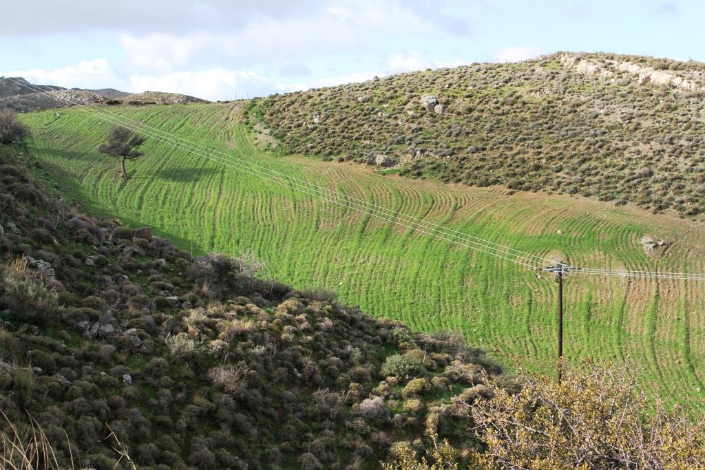
This technology consists of (a) ploughing the soil, (b) sowing the plants usually vetch or oat or in combination in November and (c) grazing the growing plants during spring. The main purpose of this technology is to increase the produced palatable biomass in a grazing land in which the biomass production is very low under natural conditions.
2.2 การอธิบายแบบละเอียดของเทคโนโลยี
คำอธิบาย:
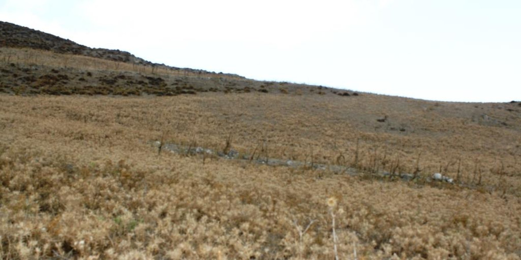
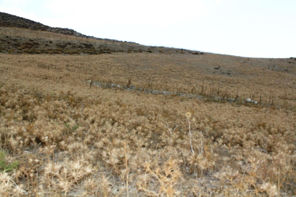
The technology is applied on semi-arid areas of Asteroussia Mountains of Crete used as grazing land with an annual rainfall between 501-750 mm. These areas are usually highly degraded, characterized by steep mountainous slopes (31-60%). This technology was mainly found in shallow (depth: 21-50 cm), moderately fine textured soils which moderate concentrations of soil organic matter (1-3%). The stock breeders in the region use a special regime for transferring livestock grazing rights from the communities to individuals. Nowadays the off farm income of breeders is between 10-50% of their total income.
Looking back, in the early 1950s to the 1980s the Asteroussia Mountains were a livestock-specialized area. Livestock production was based on controlled summer grazing in the mountains and overwintering in the lowlands. After the early 1960s, the area increasingly felt the impact of agricultural mechanization and - by consequence - excessive under-occupied rural labor force, which led to disproportionate out-migration from the area. In areas where limited natural capital was already fully utilized, such as in Asteroussia Mountains, further growth through increasing flocks was only possible by importing fodder. In a parallel, increasing intensification of agriculture in the nearby Messara plain limited the opportunities for the tradition of transhumance. Throughout the mid-1980s–2010s the economy remained livestock-dominated but the population decline continued. However, the presence of foreign migrants offering cheap labor from the early 1990s onwards contributed to keep many farms active.
Coming back to the technology, it consists of: (a) clearing natural vegetation, usually perennial shrubs accompanied with annual plants including mainly grasses, (b) sowing of high value palatable plant species for animals such as oat, vetch, etc. during winter, (c) allowing plants to grow adequately, and (d) grazing by the animals mainly during spring for a period of about one month, and (e) keeping the land bare until next wet cultivation period starts. The purpose is to increase the available biomass for the grazing animals in areas of low productivity of natural vegetation suitable for them. The major activities consists of clearing the land, plowing usually by a bulldoze type tractor, sowing the seeds and adding appropriate fertilizers. However, the establishment of this technology may face problems in clearing natural vegetation, if the existing Greek institutional framework does not allow doing it. Land degradation and desertification are very frequent processes in semi-arid areas and both processes have been enhanced in the last decades by climatic variations and human activities. The EU-funded research project DESIRE in Eastern and Western Europe, Latin America, Africa and Asia have identified soil erosion, forest fires, and overgrazing among the most important causes of land degradation. The main benefit of this technology therefore is the increase in the amount of high quality palatable biomass for the grazing animals in degraded lands. Land users like this technology, if the number of animals is high, as without the technology they face problems of feeding them. However, such an action increases the cost of animal production such as milk. In addition, soil erosion problems are expected since land remains bare for some period of the year especially after sowing the plants.
2.3 รูปภาพของเทคโนโลยี
อัลบั้มสื่อบันทึก

คำอธิบายภาพ:
Down-slope ploughing is more secure for the farmer and less energy consumption for the machine used.
2.5 ประเทศภูมิภาค หรือสถานที่ตั้งที่เทคโนโลยีได้นำไปใช้และได้รับการครอบคลุมโดยการประเมินนี้
ประเทศ:
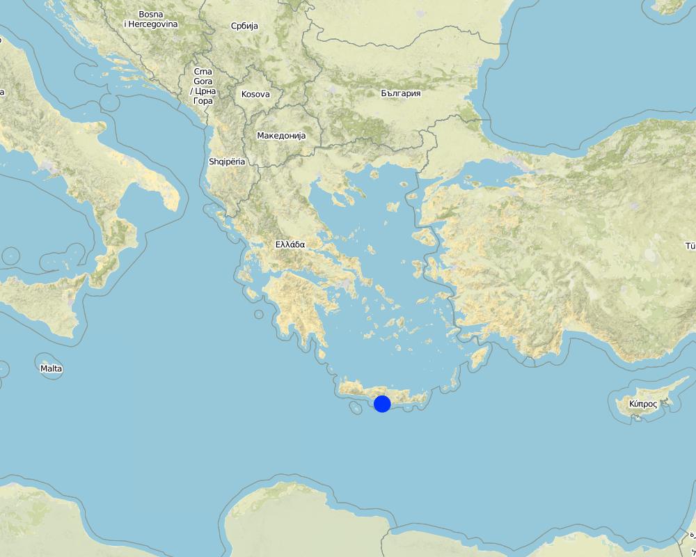
กรีซ
ภูมิภาค/รัฐ/จังหวัด:
Crete, Heraklion province
ข้อมูลจำเพาะเพิ่มเติมของสถานที่ตั้ง :
Asteroussia Mountain, Paranimfi
Map
×2.6 วันที่การดำเนินการ
ถ้าไม่รู้ปีที่แน่นอน ให้ระบุวันที่โดยประมาณ:
- 10-50 ปี
2.7 คำแนะนำของเทคโนโลยี
ให้ระบุว่าเทคโนโลยีถูกแนะนำเข้ามาอย่างไร:
- เป็นส่วนหนึ่งของระบบแบบดั้งเดิมที่ทำก้นอยู่ (> 50 ปี)
ความคิดเห็น (ประเภทของโครงการ เป็นต้น) :
The technology continues to be applied since farmers are trying to produce more palatable biomass for the grazing animals as the productivity of the land with the natural vegetation is low.
3. การจัดประเภทของเทคโนโลยี SLM
3.1 วัตถุประสงค์หลักของเทคโนโลยี
- ปรับปรุงการผลิตให้ดีขึ้น
- สร้างผลกระทบทางด้านเศรษฐกิจที่เป็นประโยชน์
3.2 ประเภทของการใช้ที่ดินในปัจจุบันที่ได้นำเทคโนโลยีไปใช้

ทุ่งหญ้าเลี้ยงสัตว์
ทุ่งหญ้าเลี้ยงสัตว์ที่ใช้พื้นที่กว้าง:
- การทำฟาร์มปศุสัตว์ (Ranching)
ทุ่งหญ้าเลี้ยงสัตว์ที่มีการจัดการแบบเข้มข้นหรือการผลิตอาหารสัตว์:
- ทุ่งหญ้าเลี้ยงสัตว์ที่ได้มีการปรับปรุง (Improved pastures)
ชนิดพันธุ์สัตว์และผลิตภัณฑ์หลัก:
Sheep and goats for meat and milk production
ถ้าการใช้ที่ดินมีการเปลี่ยนแปลงเนื่องมาจากการนำเทคโนโลยีไปปฏิบัติใช้ ให้ระบุการใช้ที่ดินก่อนนำเทคโนโลยีไปปฏิบัติใช้:
Natural vegetation consisting mainly of shruby vegetation.
3.3 ข้อมูลเพิ่มเติมเกี่ยวกับการใช้ที่ดิน
การใช้น้ำของที่ดินที่มีการใช้เทคโนโลยีอยู่:
- จากน้ำฝน
จำนวนของฤดูเพาะปลูกต่อปี:
- 1
ความหนาแน่นของปศุสัตว์ (ถ้าเกี่ยวข้อง):
20-25 animals/ha
3.4 กลุ่ม SLM ที่ตรงกับเทคโนโลยีนี้
- การจัดการปศุสัตว์และทุ่งหญ้าเลี้ยงสัตว์
3.5 กระจายตัวของเทคโนโลยี
ระบุการกระจายตัวของเทคโนโลยี:
- กระจายไปอย่างสม่ำเสมอในพื้นที่
ถ้าหากว่าเทคโนโลยีได้มีการกระจายออกไปอย่างสม่ำเสมอในพื้นที่ ให้ระบุปริมาณพื้นที่ที่ได้รับการครอบคลุมถึง:
- < 0.1 ตร.กม.(10 เฮกตาร์)
แสดงความคิดเห็น:
Isolated fields with relatively deep soils and low slope gradient
3.6 มาตรการ SLM ที่ประกอบกันเป็นเทคโนโลยี

มาตรการจัดการพืช
- A1: พืช/สิ่งปกคลุมดิน

มาตรการอนุรักษ์ด้วยวิธีพืช
- V2: หญ้าและไม้ยืนต้น
3.7 รูปแบบหลักของการเสื่อมโทรมของที่ดินที่ได้รับการแก้ไขโดยเทคโนโลยี

การกัดกร่อนของดินโดยน้ำ
- Wt (Loss of topsoil): การสูญเสียดินชั้นบนหรือการกัดกร่อนที่ผิวดิน
3.8 การป้องกัน การลดลง หรือการฟื้นฟูความเสื่อมโทรมของที่ดิน
ระบุเป้าหมายของเทคโนโลยีกับความเสื่อมโทรมของที่ดิน:
- ลดความเสื่อมโทรมของดิน
4. ข้อมูลจำเพาะด้านเทคนิค กิจกรรมการนำไปปฏิบัติใช้ ปัจจัยนำเข้า และค่าใช้จ่าย
4.1 แบบแปลนทางเทคนิคของเทคโนโลยี
ผู้เขียน:
Costas Kosmas
วันที่:
05/07/2017
4.2 ข้อมูลจำเพาะด้านเทคนิคและการอธิบายแบบแปลนทางเทคนิค
The technical specifications of the technology are known to almost all the people working on animal feeding. It requires a field of at least one hectare with the following soil characteristics: (a) soil depth of at least 30 cm, (b) soil texture medium to fine, (c) slope gradient less than 25%. In addition, the annual rainfall must be greater than 350 mm with an annual air temperature higher than 12° C.
4.3 ข้อมูลทั่วไปเกี่ยวกับการคำนวณปัจจัยนำเข้าและค่าใช้จ่าย
ให้ระบุว่าค่าใช้จ่ายและปัจจัยนำเข้าได้รับการคำนวณอย่างไร:
- ต่อพื้นที่ที่ใช้เทคโนโลยี
ระบุขนาดและหน่วยพื้นที่:
one hectare
ระบุสกุลเงินที่ใช้คำนวณค่าใช้จ่าย:
- ดอลลาร์สหรัฐ
ระบุค่าเฉลี่ยของค่าจ้างในการจ้างแรงงานต่อวัน:
40
4.4 กิจกรรมเพื่อการจัดตั้ง
| กิจกรรม | ประเภทของมาตรการ | ช่วงเวลาดำเนินการ | |
|---|---|---|---|
| 1. | Clearing the field by mouldboard plough. | จัดการพืช | November |
4.5 ค่าใช้จ่ายของปัจจัยนำเข้าที่จำเป็นสำหรับการจัดตั้ง
| ปัจจัยนำเข้า | หน่วย | ปริมาณ | ค่าใช้จ่ายต่อหน่วย | ค่าใช้จ่ายทั้งหมดต่อปัจจัยนำเข้า | %ของค่าใช้จ่ายที่ก่อให้เกิดขึ้นโดยผู้ใช้ที่ดิน | |
|---|---|---|---|---|---|---|
| แรงงาน | Clearing the field | person - days | 2.0 | 40.0 | 80.0 | 100.0 |
| อุปกรณ์ | Tractor equiped with a mouldboard | 1 | 1.0 | 60.0 | 60.0 | 100.0 |
| ค่าใช้จ่ายทั้งหมดของการจัดตั้งเทคโนโลยี | 140.0 | |||||
4.6 การบำรุงรักษาสภาพหรือกิจกรรมที่เกิดขึ้นเป็นประจำ
| กิจกรรม | ประเภทของมาตรการ | ช่วงระยะเวลา/ความถี่ | |
|---|---|---|---|
| 1. | Ploughing | จัดการพืช | once per year |
| 2. | Fertilization | จัดการพืช | once per year |
| 3. | Sowing | ด้วยวิธีพืช | once per year |
4.7 ค่าใช้จ่ายของปัจจัยนำเข้าและกิจกรรมที่เกิดขึ้นเป็นประจำที่ต้องการการบำรุงรักษา (ต่อปี)
| ปัจจัยนำเข้า | หน่วย | ปริมาณ | ค่าใช้จ่ายต่อหน่วย | ค่าใช้จ่ายทั้งหมดต่อปัจจัยนำเข้า | %ของค่าใช้จ่ายที่ก่อให้เกิดขึ้นโดยผู้ใช้ที่ดิน | |
|---|---|---|---|---|---|---|
| แรงงาน | Ploughing | person-days | 0.2 | 40.0 | 8.0 | 100.0 |
| แรงงาน | Sowing | person-days | 0.2 | 40.0 | 8.0 | 100.0 |
| แรงงาน | Fertilizing | person-days | 0.2 | 400.0 | 80.0 | 100.0 |
| อุปกรณ์ | Tractor equiped with a mouldboard | 1 | 0.5 | 60.0 | 30.0 | 100.0 |
| วัสดุด้านพืช | Seed | Kg/ha | 250.0 | 0.2 | 50.0 | 100.0 |
| ปุ๋ยและสารฆ่า/ยับยั้งการเจริญเติบโตของสิ่งมีชีวิต (ไบโอไซด์) | Fertilization | Kg/ha | 350.0 | 0.4 | 140.0 | 100.0 |
| ค่าใช้จ่ายทั้งหมดของการบำรุงรักษาสภาพเทคโนโลยี | 316.0 | |||||
4.8 ปัจจัยสำคัญที่สุดที่มีผลกระทบต่อค่าใช้จ่าย
ปัจจัยสำคัญที่สุดที่มีผลกระทบต่อค่าใช้จ่ายต่างๆ:
Fertilizers and seeds
5. สิ่งแวดล้อมทางธรรมชาติและของมนุษย์
5.1 ภูมิอากาศ
ฝนประจำปี
- < 250 ม.ม.
- 251-500 ม.ม.
- 501-750 ม.ม.
- 751-1,000 ม.ม.
- 1,001-1,500 ม.ม.
- 1,501-2,000 ม.ม.
- 2,001-3,000 ม.ม.
- 3,001-4,000 ม.ม.
- > 4,000 ม.ม.
ระบุปริมาณน้ำฝนเฉลี่ยรายปี (ถ้ารู้) :หน่วย ม.ม.
670.00
ข้อมูลจำเพาะ/ความคิดเห็นเรื่องปริมาณน้ำฝน:
Low-elevation areas receive an annual rainfall ranging between 500-750 mm, while the upper mountainous area (highest elevation: 1231 m at the sea level) receives up to 1250 mm of rain.
ระบุชื่อของสถานีตรวดวัดอากาศที่ใช้อ้างอิงคือ:
Hellenic National Meteorological Service, station of Gortina
เขตภูมิอากาศเกษตร
- กึ่งแห้งแล้ง
The majority of the area is characterized by an average air temperature ranging between 15°C and 18°C. Rainfall is falling from late fall to middle spring. The ETo (Potential Evapotranspiration) is high receiving values up to 1650 mm.
5.2 สภาพภูมิประเทศ
ค่าเฉลี่ยความลาดชัน:
- ราบเรียบ (0-2%)
- ลาดที่ไม่ชัน (3-5%)
- ปานกลาง (6-10%)
- เป็นลูกคลื่น (11-15%)
- เป็นเนิน (16-30%)
- ชัน (31-60%)
- ชันมาก (>60%)
ธรณีสัณฐาน:
- ที่ราบสูง/ที่ราบ
- สันเขา
- ไหล่เขา
- ไหล่เนินเขา
- ตีนเนิน
- หุบเขา
ระดับความสูง:
- 0-100 เมตร
- 101-500 เมตร
- 501-1,000 เมตร
- 1,001-1,500 เมตร
- 1,501-2,000 เมตร
- 2,001-2,500 เมตร
- 2,501-3,000 เมตร
- 3,001-4,000 เมตร
- > 4,000 เมตร
ให้ระบุถ้าเทคโนโลยีได้ถูกนำไปใช้:
- ไม่เกี่ยวข้อง
ความคิดเห็นและข้อมูลจำเพาะเพิ่มเติมเรื่องสภาพภูมิประเทศ:
Hilly areas of various slopes and landforms. The Technology is only suitable for slope gradients less than 25%.
5.3 ดิน
ค่าเฉลี่ยความลึกของดิน:
- ตื้นมาก (0-20 ซ.ม.)
- ตื้น (21-50 ซ.ม.)
- ลึกปานกลาง (51-80 ซ.ม.)
- ลึก (81-120 ซ.ม.)
- ลึกมาก (>120 ซ.ม.)
เนื้อดิน (ดินชั้นบน):
- ปานกลาง (ดินร่วน ทรายแป้ง)
- ละเอียด/หนัก (ดินเหนียว)
เนื้อดินล่าง (> 20 ซ.ม.ต่ำจากผิวดิน):
- ปานกลาง (ดินร่วน ทรายแป้ง)
- ละเอียด/หนัก (ดินเหนียว)
อินทรียวัตถุในดิน:
- ปานกลาง (1-3%)
(ถ้ามี) ให้แนบคำอธิบายเรื่องดินแบบเต็มหรือระบุข้อมูลที่มีอยู่ เช่น ชนิดของดิน ค่า pH ของดินหรือความเป็นกรดของดิน ความสามารถในการแลกเปลี่ยนประจุบวก ไนโตรเจน ความเค็ม เป็นต้น:
These soils are characterized by a surface A-horizon usually 12-18 cm thick and an underlying cambic B-horizon. Leptosols or Cambisols are the dominant soil units in the area. Soils are mainly moderately fine-textured. The 15-30 cm soil depth class is dominant throughout the area. Relatively deep soils (class 30-60 cm) have been mapped in patches. Some of these areas are used as cropland and grazing land. Slope gradient ranges between 2% and 60%. The slope class 35-60% is the dominant class covering the 49% of the total land. The minimum soil depth necessary for the Technology is 30 cm.
5.4 ความเป็นประโยชน์และคุณภาพของน้ำ
ระดับน้ำใต้ดิน:
> 50 เมตร
น้ำไหลบ่าที่ผิวดิน:
ไม่ดีหรือไม่มีเลย
คุณภาพน้ำ (ที่ยังไม่ได้บำบัด):
เป็นน้ำเพื่อการดื่มที่ดี
ความเค็มของน้ำเป็นปัญหาหรือไม่:
ไม่ใช่
กำลังเกิดน้ำท่วมในพื้นที่หรือไม่:
ไม่ใช่
5.5 ความหลากหลายทางชีวภาพ
ความหลากหลายทางชนิดพันธุ์:
- สูง
ความหลากหลายของแหล่งที่อยู่:
- ปานกลาง
ความคิดเห็นและข้อมูลจำเพาะเพิ่มเติมของความหลากหลายทางชีวภาพ:
The most important land cover types are schlerophyllous vegetation, transitional woodland-shrubs and sparsely vegetated areas covering the 88% of the total area. The rest of the area is covered by agricultural crops, mainly olive trees and cereals. The dominant woody plant species in the area include Olea sylvestris, Olea Europa, Salix alba (along watercourses), Pyrus amygdaliformis, Prunus webbii, Thymus capitatus, Salvia triloba, Flomis lanata, Flomis fruticosa, Sarcopoterium spinosum, Calicotome vilosa, Scilla maritime, Asfodelus aestivus, Euphorbia characias. Overgrazing coupled with frequent fires shaped the vegetation pattern in the area determining the predominance of the less palatable fire-tolerant plant species. The above-mentioned state of biodiversity existed before clearing the land even in degraded areas.
5.6 ลักษณะของผู้ใช้ที่ดินที่นำเทคโนโลยีไปปฏิบัติใช้
อยู่กับที่หรือเร่ร่อน:
- อยู่กับที่
แนวทางการตลาดของระบบการผลิต:
- ผสม (การเลี้ยงชีพ/ทำการค้า)
รายได้ที่มาจากนอกฟาร์ม:
- 10-50% ของรายได้ทั้งหมด
ระดับของความมั่งคั่งโดยเปรียบเทียบ:
- พอมีพอกิน
เป็นรายบุคคล/ครัวเรือน:
- เป็นรายบุคคล/ครัวเรือน
ระดับของการใช้เครื่องจักรกล:
- การใช้เครื่องจักรหรือเครื่องยนต์
เพศ:
- ชาย
อายุของผู้ใช้ที่ดิน:
- วัยกลางคน
5.7 พื้นที่เฉลี่ยของที่ดินที่เป็นเจ้าของหรือเช่าโดยผู้ใช้ที่ดินที่นำเทคโนโลยีไปปฏิบัติใช้
- < 0.5 เฮกตาร์
- 0.5-1 เฮกตาร์
- 1-2 เฮกตาร์
- 2-5 เฮกตาร์
- 5-15 เฮกตาร์
- 15-50 เฮกตาร์
- 50-100 เฮกตาร์
- 100-500 เฮกตาร์
- 500-1,000 เฮกตาร์
- 1,000-10,000 เฮกตาร์
- >10,000 เฮกตาร์
พิจารณาว่าเป็นขนาดเล็ก กลาง หรือขนาดใหญ่ (ซึ่งอ้างอิงถึงบริบทระดับท้องถิ่น):
- ขนาดกลาง
5.8 กรรมสิทธิ์ในที่ดิน สิทธิในการใช้ที่ดินและสิทธิในการใช้น้ำ
กรรมสิทธิ์ในที่ดิน:
- รัฐ
- รายบุคคล ได้รับสิทธิครอบครอง
สิทธิในการใช้ที่ดิน:
- เกี่ยวกับชุมชน (ถูกจัดระเบียบ)
สิทธิในการใช้น้ำ:
- เกี่ยวกับชุมชน (ถูกจัดระเบียบ)
แสดงความคิดเห็น:
Nowadays in Crete livestock grazing is allowed due to a special regime for transferring grazing rights from the communities to individuals (Papanastasis, 1993).
5.9 การเข้าถึงบริการและโครงสร้างพื้นฐาน
สุขภาพ:
- จน
- ปานกลาง
- ดี
การศึกษา:
- จน
- ปานกลาง
- ดี
ความช่วยเหลือทางด้านเทคนิค:
- จน
- ปานกลาง
- ดี
การจ้างงาน (เช่น ภายนอกฟาร์ม):
- จน
- ปานกลาง
- ดี
ตลาด:
- จน
- ปานกลาง
- ดี
พลังงาน:
- จน
- ปานกลาง
- ดี
ถนนและการขนส่ง:
- จน
- ปานกลาง
- ดี
น้ำดื่มและการสุขาภิบาล:
- จน
- ปานกลาง
- ดี
บริการด้านการเงิน:
- จน
- ปานกลาง
- ดี
6. ผลกระทบและสรุปคำบอกกล่าว
6.1 ผลกระทบในพื้นที่ดำเนินการ (On-site) จากการใช้เทคโนโลยี
ผลกระทบทางด้านเศรษฐกิจและสังคม
การผลิต
การผลิตพืชที่ใช้เลี้ยงปศุสัตว์
แสดงความคิดเห็น/ระบุ:
Increase in biomass production for feeding the animals
การผลิตสัตว์
แสดงความคิดเห็น/ระบุ:
In consequence of increased fodder production
ผลกระทบด้านนิเวศวิทยา
วัฐจักรน้ำหรือน้ำบ่า
น้ำไหลบ่าที่ผิวดิน
แสดงความคิดเห็น/ระบุ:
There are not available data on surface runoff for the area.
ดิน
ความชื้นในดิน
จำนวนก่อน SLM:
-1
หลังจาก SLM:
1
การสูญเสียดิน
จำนวนก่อน SLM:
1
หลังจาก SLM:
-1
แสดงความคิดเห็น/ระบุ:
Increase in soil erosion due to removal of natural vegetation
ความหลากหลายทางชีวภาพของพืชและสัตว์
ความหลากหลายทางชีวภาพของพืช
แสดงความคิดเห็น/ระบุ:
Because the natural vegetation is cleared.
6.2 ผลกระทบนอกพื้นที่ดำเนินการ (Off-site) จากการใช้เทคโนโลยี
น้ำท่วมพื้นที่ท้ายน้ำ
แสดงความคิดเห็น/ระบุ:
The soil sediments are transported in the low land of Messara valley or into the sea.
6.3 การเผชิญและความตอบสนองของเทคโนโลยีต่อการเปลี่ยนแปลงสภาพภูมิอากาศที่ค่อยเป็นค่อยไป และสภาพรุนแรงของภูมิอากาศ / ภัยพิบัติ (ที่รับรู้ได้โดยผู้ใช้ที่ดิน)
การเปลี่ยนแปลงสภาพภูมิอากาศที่ค่อยเป็นค่อยไป
การเปลี่ยนแปลงสภาพภูมิอากาศที่ค่อยเป็นค่อยไป
| ฤดู | ประเภทของการเปลี่ยนแปลงสภาพภูมิอากาศที่ค่อยเป็นค่อยไป และสภาพรุนแรงของภูมิอากาศ | เทคโนโลยีมีวิธีการรับมืออย่างไร | |
|---|---|---|---|
| อุณหภูมิประจำปี | เพิ่มขึ้น | ปานกลาง |
6.4 การวิเคราะห์ค่าใช้จ่ายและผลประโยชน์ที่ได้รับ
ผลประโยชน์ที่ได้รับเปรียบเทียบกับค่าใช้จ่ายในการจัดตั้งเป็นอย่างไร (จากมุมมองของผู้ใช้ที่ดิน)
ผลตอบแทนระยะสั้น:
ด้านบวก
ผลตอบแทนระยะยาว:
ด้านบวก
ผลประโยชน์ที่ได้รับเปรียบเทียบกับค่าใช้จ่ายในการบำรุงรักษาหรือต้นทุนที่เกิดขึ้นซ้ำอีก เป็นอย่างไร (จากมุมมองของผู้ใช้ที่ดิน)
ผลตอบแทนระยะสั้น:
ด้านบวก
ผลตอบแทนระยะยาว:
ด้านบวก
6.5 การปรับตัวของเทคโนโลยี
- มากกว่า 50%
จากทั้งหมดที่ได้รับเทคโนโลยีเข้ามามีจำนวนเท่าใดที่ทำแบบทันที โดยไม่ได้รับการจูงใจด้านวัสดุหรือการเงินใด ๆ:
- 90-100%
6.6 การปรับตัว
เทคโนโลยีได้รับการปรับเปลี่ยนเมื่อเร็วๆนี้ เพื่อให้ปรับตัวเข้ากับสภาพที่กำลังเปลี่ยนแปลงหรือไม่:
ไม่ใช่
6.7 จุดแข็ง / ข้อได้เปรียบ / โอกาสของเทคโนโลยี
| จุดแข็ง / ข้อได้เปรียบ / โอกาสในทัศนคติของผู้ใช้ที่ดิน |
|---|
| The advantage of the technology is the increase of biomass production for feeding the animals in areas of low natural grass production. |
| จุดแข็ง / ข้อได้เปรียบ / โอกาสในทัศนคติของผู้รวบรวมหรือวิทยากรหลัก |
|---|
| The advantage of the technology is the increase of biomass production for feeding the animals in areas of low natural grass production. |
6.8 จุดอ่อน / ข้อเสียเปรียบ / ความเสี่ยงของเทคโนโลยีและวิธีการแก้ไข
| จุดอ่อน / ข้อเสียเปรียบ / ความเสี่ยงในทัศนคติของผู้ใช้ที่ดิน | มีวิธีการแก้ไขได้อย่างไร |
|---|---|
| Decline of biodiversity | |
| Create some problems of soil erosion during installation |
| จุดอ่อน / ข้อเสียเปรียบ / ความเสี่ยงในทัศนคติของผู้รวบรวมหรือวิทยากรหลัก | มีวิธีการแก้ไขได้อย่างไร |
|---|---|
| Decline of biodiversity | |
| Soil erosion at the initial stage of ploughing the land | From the increase in soil plant cover |
7. การอ้างอิงและการเชื่อมต่อ
7.1 วิธีการและแหล่งข้อมูล
- ไปเยี่ยมชมภาคสนาม การสำรวจพื้นที่ภาคสนาม
Mapping the whole area in a scale 1:30,000
- การสัมภาษณ์กับผู้ใช้ที่ดิน
Land users have complete questionnaires during the execution of the EU research project LEDDRA
7.2 การอ้างอิงถึงสิ่งตีพิมพ์
หัวข้อ, ผู้เขียน, ปี, หมายเลข ISBN:
Costas Kosmas, Vassilis Detsis, Mina Karamesouti, Kate Kounalaki, Penny Vassiliou and Luca Salvati. 2015. Exploring Long-Term Impact of Grazing Management on Land Degradation in the Socio-Ecological System of Asteroussia Mountains, Greece Land 4:541-559 doi:10.3390/land4030541.
ชื่อเรื่อง ผู้เขียน ปี ISBN:
URL: http://www.mdpi.com/2073-445X/4/3/541/htm
หัวข้อ, ผู้เขียน, ปี, หมายเลข ISBN:
Papanastasis, V., 1993. Legal status of land tenure and use and its implication for open landscapes of western Crete. Landscape and Urban Planning, 24, 273-277.
7.3 เชื่อมโยงกับข้อมูลที่มีอยู่บนออนไลน์
ชื่อเรื่องหรือคำอธิบาย:
European framework EC-DG RTD, 7th Framework Research Programme (sub-priority ENV-2009-2.1.3.2), Research on Desertification Process and Land Degradation, project LEDDRA (243857): Land and Ecosystem Degradation and Desertification: Assessing the Fit of Responses.
ลิงก์และโมดูล
ขยายทั้งหมด ย่อทั้งหมดลิงก์
ไม่มีลิงก์
โมดูล
ไม่มีโมดูล