Odaltaal-10 Single Use Water System [Nepal]
- Creation:
- Update:
- Compiler: Jhuna Kattel
- Editor: –
- Reviewer: Renate Fleiner
Tanki
technologies_5185 - Nepal
View sections
Expand all Collapse all1. General information
1.2 Contact details of resource persons and institutions involved in the assessment and documentation of the Technology
Key resource person(s)
Water user:
Salami Kham Bahadur
N/A
Nepal
Name of project which facilitated the documentation/ evaluation of the Technology (if relevant)
Prospects and challenges of water use systems as climate adaptive option for sustainable water management in Himalayan RegionName of the institution(s) which facilitated the documentation/ evaluation of the Technology (if relevant)
Kathmandu University (KU) - Nepal1.3 Conditions regarding the use of data documented through WOCAT
The compiler and key resource person(s) accept the conditions regarding the use of data documented through WOCAT:
Yes
1.4 Declaration on sustainability of the described Technology
Is the Technology described here problematic with regard to land degradation, so that it cannot be declared a sustainable land management technology?
No
Comments:
This is a Single Use Water System implemented in order to preserve the water sources through their sustainable use.
2. Description of the SLM Technology
2.1 Short description of the Technology
Definition of the Technology:
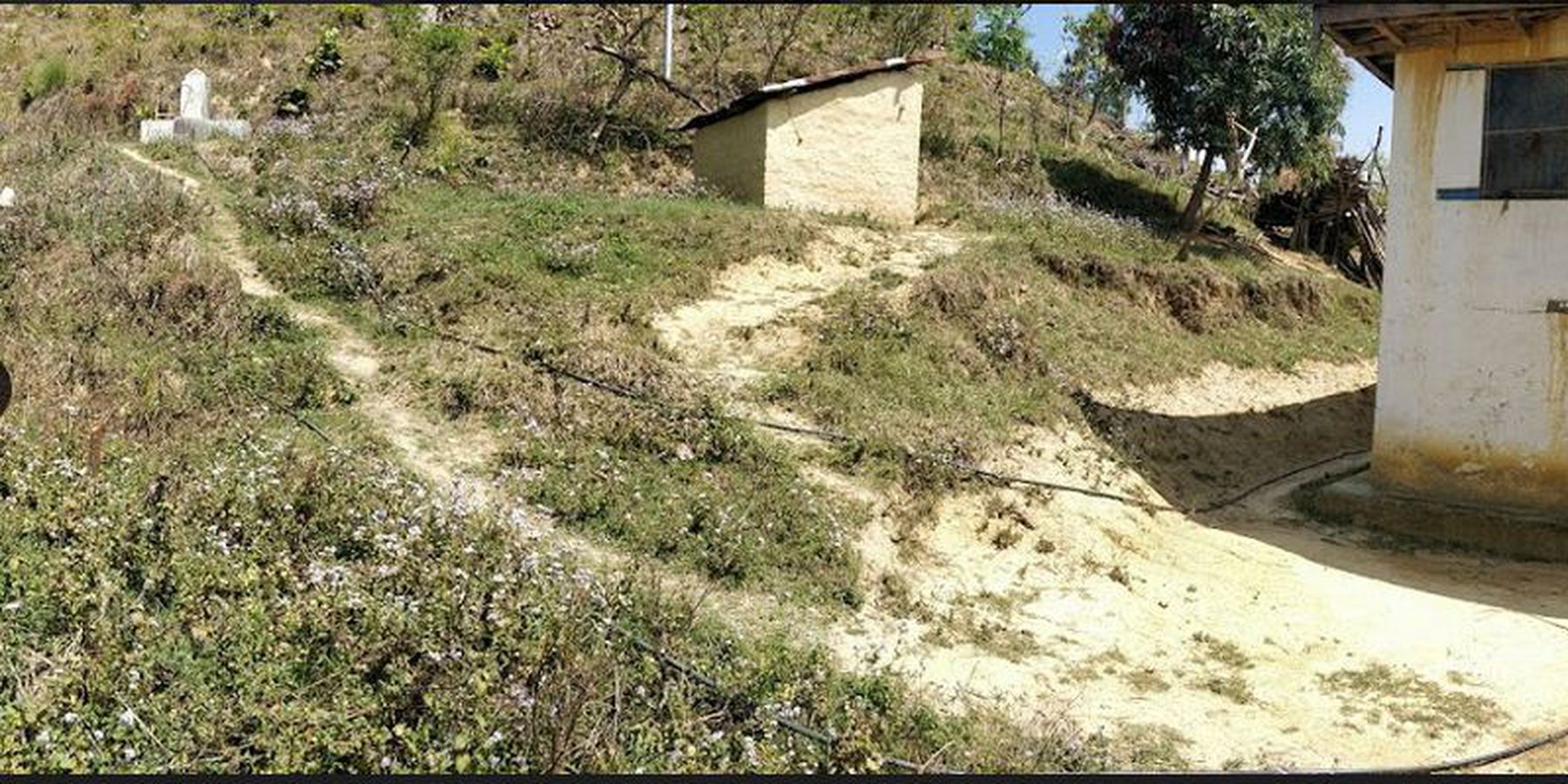
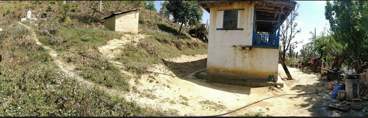
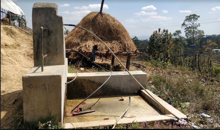
Water from source is collected in a reservoir tank ( RVT) of volume 13000 Ltr and then distributed to each household for Single Use. Traditionally, the system was constructed to serve a single purpose-drinking (hence the name "Single Use" water system). However, due to increasing demand and need to meet multiple uses, the water users are using the same water for different purposes like drinking, irrigation and other domestic uses.
2.2 Detailed description of the Technology
Description:
A Single Use Water System (SUWS) is the one in which the supplied water serves a single purpose. Traditionally, the system was constructed in order to meet the growing demand and serve a single purpose i.e. supply drinking water to households ( hence the name "Single Use" water systems). However, people's demands and needs increased and supplied water was then used for various purposes like for irrigation, animal husbandry, domestic chores like bathing, washing, etc.
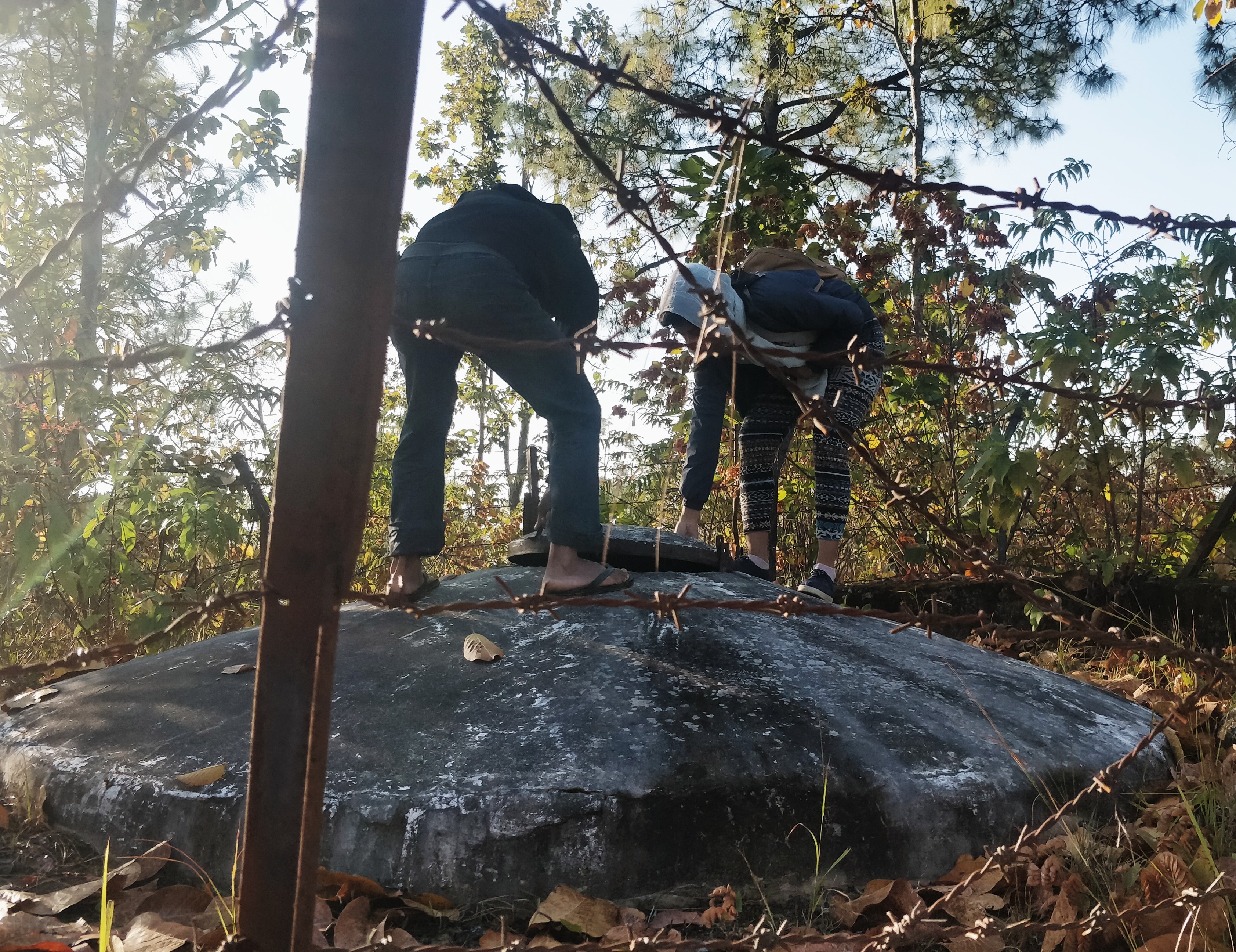
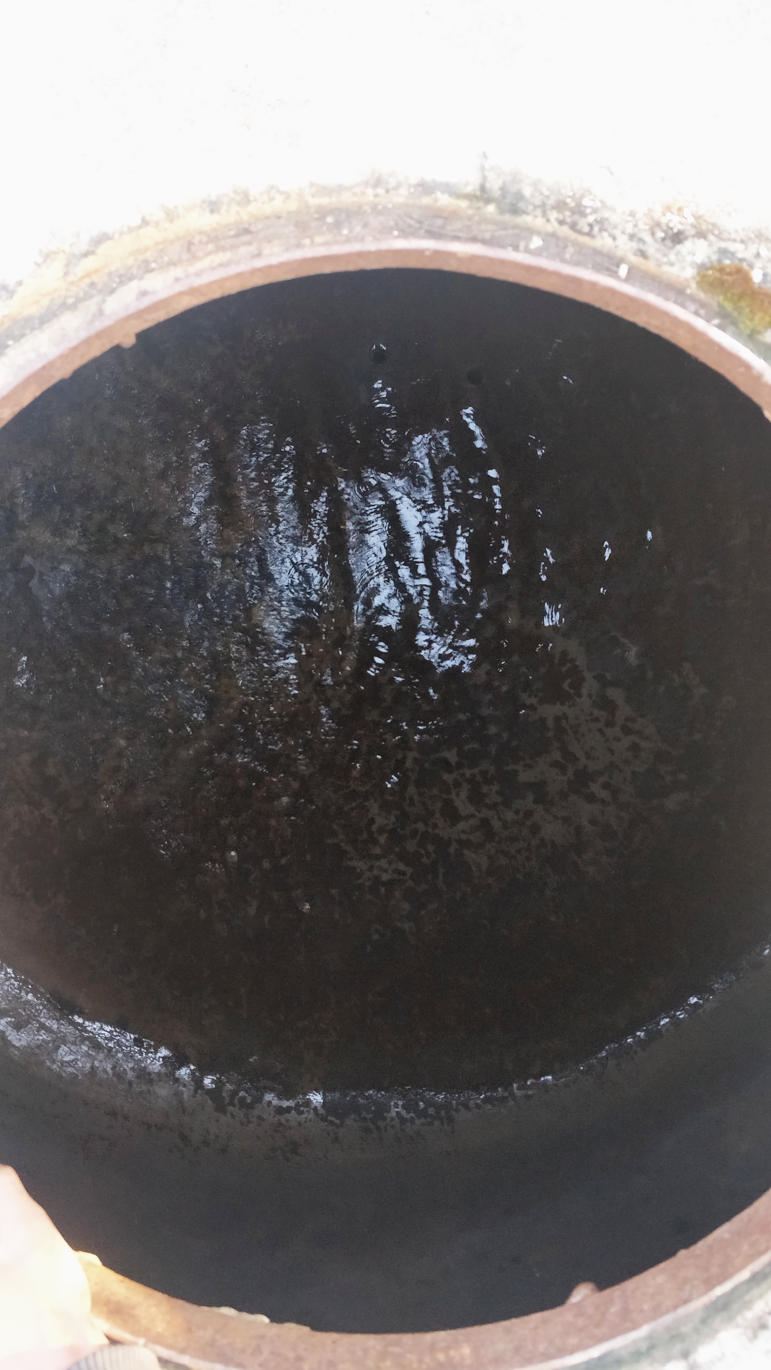
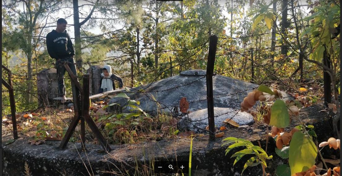
The technology is applied in a natural environment (community forest). The source of water is a natural source that lies in a community forest and hence, the availability is seasonal. The land where the source falls is owned by the government and the implementation of the technology was primarily assisted by the Village Development Committee (VDC). Its use rights falls under the water users. The main elements include a concrete Reservoir tank (RVT), pipeline and tap system or tap towers with faucets. The major functions of this technology are to store water and distribute to the 30-35 households and to ensure the preservation of natural water source through its sustainable use. Major activities are labor and construction activities for building the reservoir tank and laying down the pipeline. Maintenance work, if and when it is needed, is carried out with the help of the water users. No specific group or committee has been formed that looks onto the matters of discussion of the committee. No investment has been made by the local water users' group towards the construction of the technology. Benefits of the technology are the availability of clean drinking water at household level and the preservation of the natural source of water that ensures its perennial availability. Water users admire the overall improvement of their health status through the availability of clean drinking water.
They dislike the fact of water scarcity during dry seasons and the poor management of the system. The quantity of the water is adequate for most of the year. However, scarcity of water during the dry months (when the source dries out) is still eminent. Quality of water is good with low salinity and or iron and other elements but persistence of lime in the water remains.
2.3 Photos of the Technology
Media Gallery
2.5 Country/ region/ locations where the Technology has been applied and which are covered by this assessment
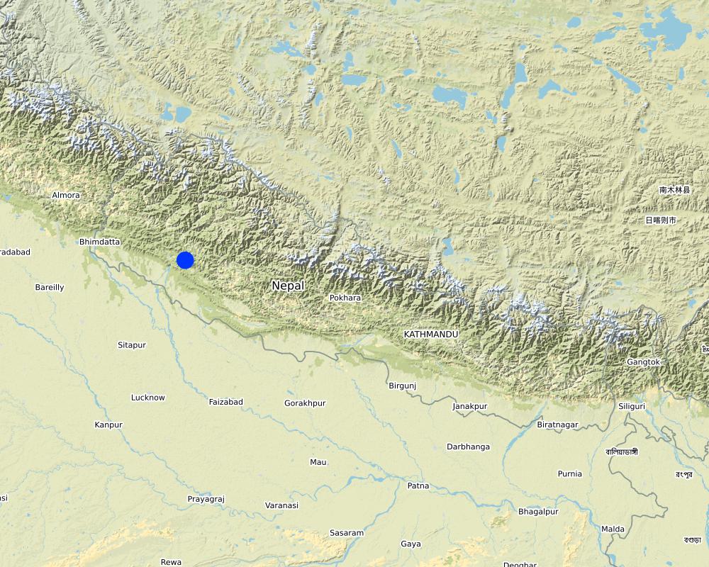
Country:
Nepal
Region/ State/ Province:
Province 6, Karnali, Mid - Western Development Region
Further specification of location:
Kunathari VDC -10, Odaltaal
Specify the spread of the Technology:
- evenly spread over an area
If precise area is not known, indicate approximate area covered:
- 1-10 km2
Is/are the technology site(s) located in a permanently protected area?
Yes
If yes, specify:
Community Forest ( Samjhana Samudayik Ban)
Map
×2.6 Date of implementation
If precise year is not known, indicate approximate date:
- 10-50 years ago
2.7 Introduction of the Technology
Specify how the Technology was introduced:
- as part of a traditional system (> 50 years)
Comments (type of project, etc.):
It is based on a traditional system, but improvised to construct a reservoir tank (RVT) and water supplied through a pipeline. The traditional system contained a reservoir pond dug up and water was supplied through feeding rubber and plastic pipes to the households with no faucets. This caused the water to flow through the pipes without stopping and there was loss of precious water due to excess drainage. The dug up pond caused sediments, dirt, insects and leaves to collect in the water, clogging the pipes and making water unsafe for drinking.
The construction of concrete RVT with lid ensured water stayed free from sediments and falling leaves. Construction of tap towers with taps and faucets ensured water was not wasted. The use of Poly-Vinyl Chloride (PVC) pipe with pipeline system was done to the traditional system of supply of water to households.
3. Classification of the SLM Technology
3.1 Main purpose(s) of the Technology
- adapt to climate change/ extremes and its impacts
- drinking water purpose ( to improve water security at a household level)
3.2 Current land use type(s) where the Technology is applied

Forest/ woodlands
- (Semi-)natural forests/ woodlands
(Semi-)natural forests/ woodlands: Specify management type:
- Selective felling
Are the trees specified above deciduous or evergreen?
- evergreen
Products and services:
- Nature conservation/ protection
Comments:
Samjhana Samudayik Ban ( Community Forest)
3.4 Water supply
other (e.g. post-flooding):
- Natural Water Source
Comments:
Natural Spring water source inside Community Forest
3.5 SLM group to which the Technology belongs
- water harvesting
- ground water management
- water management ( for Drinking purpose) - Gravity Fed Single Line
3.6 SLM measures comprising the Technology

structural measures
- S5: Dams, pans, ponds
- S6: Walls, barriers, palisades, fences
- S7: Water harvesting/ supply/ irrigation equipment
- S11: Others
3.7 Main types of land degradation addressed by the Technology

water degradation
- Hs: change in quantity of surface water
- Hp: decline of surface water quality
3.8 Prevention, reduction, or restoration of land degradation
Specify the goal of the Technology with regard to land degradation:
- not applicable
Comments:
The "intended" sole purpose of the technology was to serve a single purpose- to supply drinking water at a household level. Hence, no significant effect with regard to land degradation was intended to have been achieved; hence omitted.
4. Technical specifications, implementation activities, inputs, and costs
4.1 Technical drawing of the Technology
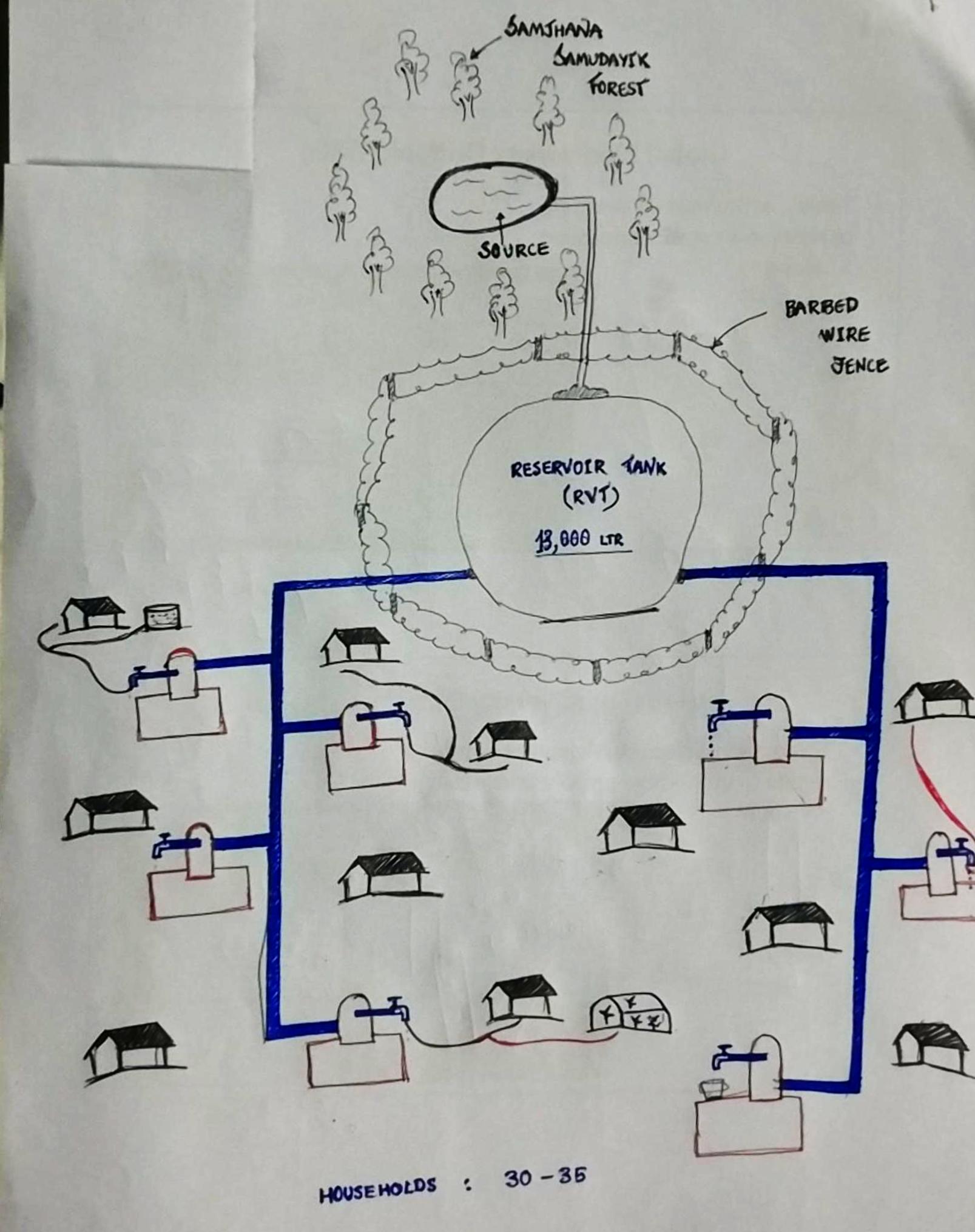
Technical specifications (related to technical drawing):
Reservoir Tank (13,000 LTR in volume). Both the source and the RVT are located inside community forest ( Samjhana Samudayik Ban). The water then flows due to the effects of gravity onto the tap towers, wherein water is supplied for 30-35 households for Single Use. Even though single use (drinking) was considered in the construction of technology, people have been fulfilling various needs with the water supplied ( eg. Drinking, irrigation, and other domestic uses).
4.2 General information regarding the calculation of inputs and costs
Specify how costs and inputs were calculated:
- per Technology area
Indicate size and area unit:
10 Dhurs
If using a local area unit, indicate conversion factor to one hectare (e.g. 1 ha = 2.47 acres): 1 ha =:
1 ha= 590.70 dhurs
other/ national currency (specify):
NPR
If relevant, indicate exchange rate from USD to local currency (e.g. 1 USD = 79.9 Brazilian Real): 1 USD =:
113.0
Indicate average wage cost of hired labour per day:
N/A
4.3 Establishment activities
| Activity | Timing (season) | |
|---|---|---|
| 1. | Construction of Reservoir Tank | |
| 2. | Laying down the pipeline |
Comments:
The SUWS system was contributed by the VDC but exact costs couldn't be recollected by the locals. Similarly, the locals vaguely remember the season of construction. As per some of the water users, the construction was started during summer, but could only be completed after winter season was over due to rains disturbing the work in between.
4.4 Costs and inputs needed for establishment
| Specify input | Unit | Quantity | Costs per Unit | Total costs per input | % of costs borne by land users | |
|---|---|---|---|---|---|---|
| Labour | Voluntary | |||||
| Equipment | Construction of RVT | |||||
| Equipment | Laying down pipeline |
If you are unable to break down the costs in the table above, give an estimation of the total costs of establishing the Technology:
1400.0
If land user bore less than 100% of costs, indicate who covered the remaining costs:
Village Development Committee contributed 100% of costs, pipeline contributed by a NGO ( RRN), DFID helped with other miscellaneous costs and Newasanstha helping with other running costs.
Comments:
Since exact estimation and/or recollection of the costs of construction of the technology was not possible; an estimation was made based upon the then prices of materials, pipes and labor costs- which estimated to be roughly 70 USD.
It has to be kept in mind that the 70 USD that was used was almost 50 years ago. Keeping in line with the inflation rates, it could be worth more than 15-20 times of the original cost ( >1400 USD).
Hence, to make it easier to compare with the construction VS maintenance costs, the figures have been rounded off to today's value as 1400 USD.
4.5 Maintenance/ recurrent activities
| Activity | Timing/ frequency | |
|---|---|---|
| 1. | Laying down pipeline ( by RRN) | Once (2056 B.S,) during winter |
| 2. | Operation and maintenance costs (borne by a NGO- DFID) | Once (2071 B.S.) during summer |
| 3. | Changing of pipes ( borne by NGO- Newasanstha and the locals) | 6-7 times ( during summer, winter and during rains) |
Comments:
The running and maintenance costs borne by various non-governmental organizations and the local community as and when required.
4.6 Costs and inputs needed for maintenance/ recurrent activities (per year)
| Specify input | Unit | Quantity | Costs per Unit | Total costs per input | % of costs borne by land users | |
|---|---|---|---|---|---|---|
| Labour | Voluntary Labour contribution by locals | 100.0 | ||||
| Equipment | Changing of PVC Pipes | 25.0 |
If you are unable to break down the costs in the table above, give an estimation of the total costs of maintaining the Technology:
700.0
If land user bore less than 100% of costs, indicate who covered the remaining costs:
Non-Governmental organizations like DFID, NewaSanstha and Village Development Committee contributed from time to time
Comments:
The exact costs couldn't be calculated. But as per the locals, the costs of changing the PVC pipes 6 times came to around 700 USD.
4.7 Most important factors affecting the costs
Describe the most determinate factors affecting the costs:
The construction materials, pipelines were the ones which costed the most.
5. Natural and human environment
5.1 Climate
Annual rainfall
- < 250 mm
- 251-500 mm
- 501-750 mm
- 751-1,000 mm
- 1,001-1,500 mm
- 1,501-2,000 mm
- 2,001-3,000 mm
- 3,001-4,000 mm
- > 4,000 mm
Specifications/ comments on rainfall:
Total annual rainfall of the region was around 1609 mm; however no literature could give an idea on the annual "average" rainfall. Thus, estimated rainfall was mentioned.
Indicate the name of the reference meteorological station considered:
Meteorological Forecasting Division, Nepal ( www.mfd.gov.np)
Agro-climatic zone
- sub-humid
The climate is overall humid with monsoon consisting of 2-3 months ( June - August) and dry and arid conditions during the winter seasons.
5.2 Topography
Slopes on average:
- flat (0-2%)
- gentle (3-5%)
- moderate (6-10%)
- rolling (11-15%)
- hilly (16-30%)
- steep (31-60%)
- very steep (>60%)
Landforms:
- plateau/plains
- ridges
- mountain slopes
- hill slopes
- footslopes
- valley floors
Altitudinal zone:
- 0-100 m a.s.l.
- 101-500 m a.s.l.
- 501-1,000 m a.s.l.
- 1,001-1,500 m a.s.l.
- 1,501-2,000 m a.s.l.
- 2,001-2,500 m a.s.l.
- 2,501-3,000 m a.s.l.
- 3,001-4,000 m a.s.l.
- > 4,000 m a.s.l.
5.3 Soils
Soil depth on average:
- very shallow (0-20 cm)
- shallow (21-50 cm)
- moderately deep (51-80 cm)
- deep (81-120 cm)
- very deep (> 120 cm)
Soil texture (topsoil):
- fine/ heavy (clay)
Soil texture (> 20 cm below surface):
- fine/ heavy (clay)
Topsoil organic matter:
- medium (1-3%)
5.4 Water availability and quality
Ground water table:
< 5 m
Availability of surface water:
medium
Water quality (untreated):
good drinking water
Water quality refers to:
both ground and surface water
Is water salinity a problem?
No
Is flooding of the area occurring?
No
5.5 Biodiversity
Species diversity:
- high
Habitat diversity:
- low
5.6 Characteristics of land users applying the Technology
Sedentary or nomadic:
- Semi-nomadic
Market orientation of production system:
- subsistence (self-supply)
Off-farm income:
- 10-50% of all income
Relative level of wealth:
- poor
Individuals or groups:
- groups/ community
Level of mechanization:
- manual work
Gender:
- women
- men
Age of land users:
- children
- youth
- middle-aged
- elderly
Indicate other relevant characteristics of the land users:
Most of the community are literate ( finished upto classes 4/5 ) . The ratio of male: female is almost equal. Most of the users are middle-aged ( 40-50 yrs age-group) . The ethnicity consists of Thakuri, Dalits and Janajatis. Total land holding of the water users is around 20 ropanis. ( 1 hectare = 19.65 ropanis)
5.7 Average area of land used by land users applying the Technology
- < 0.5 ha
- 0.5-1 ha
- 1-2 ha
- 2-5 ha
- 5-15 ha
- 15-50 ha
- 50-100 ha
- 100-500 ha
- 500-1,000 ha
- 1,000-10,000 ha
- > 10,000 ha
Is this considered small-, medium- or large-scale (referring to local context)?
- small-scale
Comments:
around 10 Dhurs of land is occupied by the technology. (1 hectare = 590.70 dhurs)
5.8 Land ownership, land use rights, and water use rights
Land ownership:
- state
Land use rights:
- communal (organized)
Water use rights:
- communal (organized)
Are land use rights based on a traditional legal system?
No
Comments:
The water source is owned by the state / government. The access to water is open ; however during the time of crisis, its use is limited to each household.
5.9 Access to services and infrastructure
health:
- poor
- moderate
- good
education:
- poor
- moderate
- good
technical assistance:
- poor
- moderate
- good
employment (e.g. off-farm):
- poor
- moderate
- good
markets:
- poor
- moderate
- good
energy:
- poor
- moderate
- good
roads and transport:
- poor
- moderate
- good
drinking water and sanitation:
- poor
- moderate
- good
financial services:
- poor
- moderate
- good
Comments:
The access to all these services is limited as the locals have to traverse a distance of almost 30 minutes to bazaar area / marketplace. The road infrastructure is good.
6. Impacts and concluding statements
6.1 On-site impacts the Technology has shown
Socio-economic impacts
Production
crop production
fodder production
forest/ woodland quality
risk of production failure
product diversity
production area
Water availability and quality
drinking water availability
drinking water quality
water availability for livestock
water quality for livestock
irrigation water availability
irrigation water quality
demand for irrigation water
Income and costs
diversity of income sources
Socio-cultural impacts
health situation
Comments/ specify:
Prior to the adoption of the technology, typhoid, jaundice, diarrhea and dysentery used to be a problem during the summer and rainy seasons. However, after the adoption of technology, the number of cases of such illnesses have drastically decreased and overall health status of the people greatly improved due to availability of clean drinking water.
Ecological impacts
Climate and disaster risk reduction
drought impacts
Specify assessment of on-site impacts (measurements):
The "intended" sole purpose of the technology was to serve a single purpose- to supply drinking water at a household level. Hence, no significant effect with regard to other ecological impacts have been achieved; hence omitted.
6.2 Off-site impacts the Technology has shown
water availability
Comments/ specify:
Water can be made available to distant places with the connection of a PVC pipe to the faucet in SUWS tap towers. Thus, more people are being benefitted from the technology.
6.3 Exposure and sensitivity of the Technology to gradual climate change and climate-related extremes/ disasters (as perceived by land users)
Gradual climate change
Gradual climate change
| Season | increase or decrease | How does the Technology cope with it? | |
|---|---|---|---|
| annual temperature | increase | not well | |
| annual rainfall | decrease | not well |
Climate-related extremes (disasters)
Climatological disasters
| How does the Technology cope with it? | |
|---|---|
| drought | moderately |
6.4 Cost-benefit analysis
How do the benefits compare with the establishment costs (from land users’ perspective)?
Short-term returns:
slightly positive
Long-term returns:
slightly positive
How do the benefits compare with the maintenance/ recurrent costs (from land users' perspective)?
Short-term returns:
slightly positive
Long-term returns:
slightly positive
Comments:
Estimated maintenance and running costs could not be exactly calculated, but weighing down the pros with the costs; the benefits outweigh the costs.
6.6 Adaptation
Has the Technology been modified recently to adapt to changing conditions?
No
6.7 Strengths/ advantages/ opportunities of the Technology
| Strengths/ advantages/ opportunities in the land user’s view |
|---|
| Availability of clean source of drinking water is ensured. |
| Need to travel long distances to fetch water not prevalent due the the availability of taps with drinking water at household levels. |
| Water being used for various purposes like drinking, irrigation, domestic purposes, etc. |
| Strengths/ advantages/ opportunities in the compiler’s or other key resource person’s view |
|---|
| Water scarcity during arid and dry winters decreased if not stopped overall. |
6.8 Weaknesses/ disadvantages/ risks of the Technology and ways of overcoming them
| Weaknesses/ disadvantages/ risks in the land user’s view | How can they be overcome? |
|---|---|
| Water not available all year-round | By construction of another reservoir tank (RVT) |
| Weaknesses/ disadvantages/ risks in the compiler’s or other key resource person’s view | How can they be overcome? |
|---|---|
| Pipeline severely damaged due to lime | Lime treatment and changing of pipes to more resistant ones ( GI ) pipes instead of feeble PVC ones used |
| No specific committee / group set up to discuss the problems | Setting up water users' committee and donating a small sum per household every month that goes onto a fund, that can be later used to address various problems that may arise in the future. |
| Water being supplied for a single use only | upgrading the technology to Multiple Use Water Systems (MUWS) in place of Single-Use Water Systems (SUWS) could address the multiple uses of water users. |
7. References and links
7.1 Methods/ sources of information
- field visits, field surveys
> 10
- interviews with land users
> 1
When were the data compiled (in the field)?
15/06/2019
Links and modules
Expand all Collapse allLinks
No links
Modules
No modules