Lake Revival: Towards Environmental Conservation [Bhutan]
- Creation:
- Update:
- Compiler: Tshering Yangzom
- Editor: Tashi Wangdi
- Reviewers: William Critchley, Rima Mekdaschi Studer
Tsho Lar Chey
technologies_6857 - Bhutan
View sections
Expand all Collapse all1. General information
1.2 Contact details of resource persons and institutions involved in the assessment and documentation of the Technology
Key resource person(s)
land user:
La Tshultrim
NA
Bhutan
land user:
Thinley Kinzang
NA
Bhutan
land user:
Wangmo Dorji
NA
Bhutan
land user:
Wangdi Yeshi
NA
Bhutan
Name of project which facilitated the documentation/ evaluation of the Technology (if relevant)
Strengthening national-level institutional and professional capacities of country Parties towards enhanced UNCCD monitoring and reporting – GEF 7 EA Umbrella II (GEF 7 UNCCD Enabling Activities_Umbrella II)Name of the institution(s) which facilitated the documentation/ evaluation of the Technology (if relevant)
National Soil Services Center, Department of Agric (National Soil Services Center, Department of Agric) - Bhutan1.3 Conditions regarding the use of data documented through WOCAT
The compiler and key resource person(s) accept the conditions regarding the use of data documented through WOCAT:
Yes
1.4 Declaration on sustainability of the described Technology
Is the Technology described here problematic with regard to land degradation, so that it cannot be declared a sustainable land management technology?
No
Comments:
Technology is not problematic with regard to land degradation as lake revival plays an important role in sustained water source and environmental conservation.
2. Description of the SLM Technology
2.1 Short description of the Technology
Definition of the Technology:
The lake conservation initiative at Tali was conceived with the vision of protecting the lake and transforming the surrounding area into a community eco-tourism hub. The initiative is a testament to how science and spirituality, and culture and the environment can coexist and benefit from one another.
2.2 Detailed description of the Technology
Description:
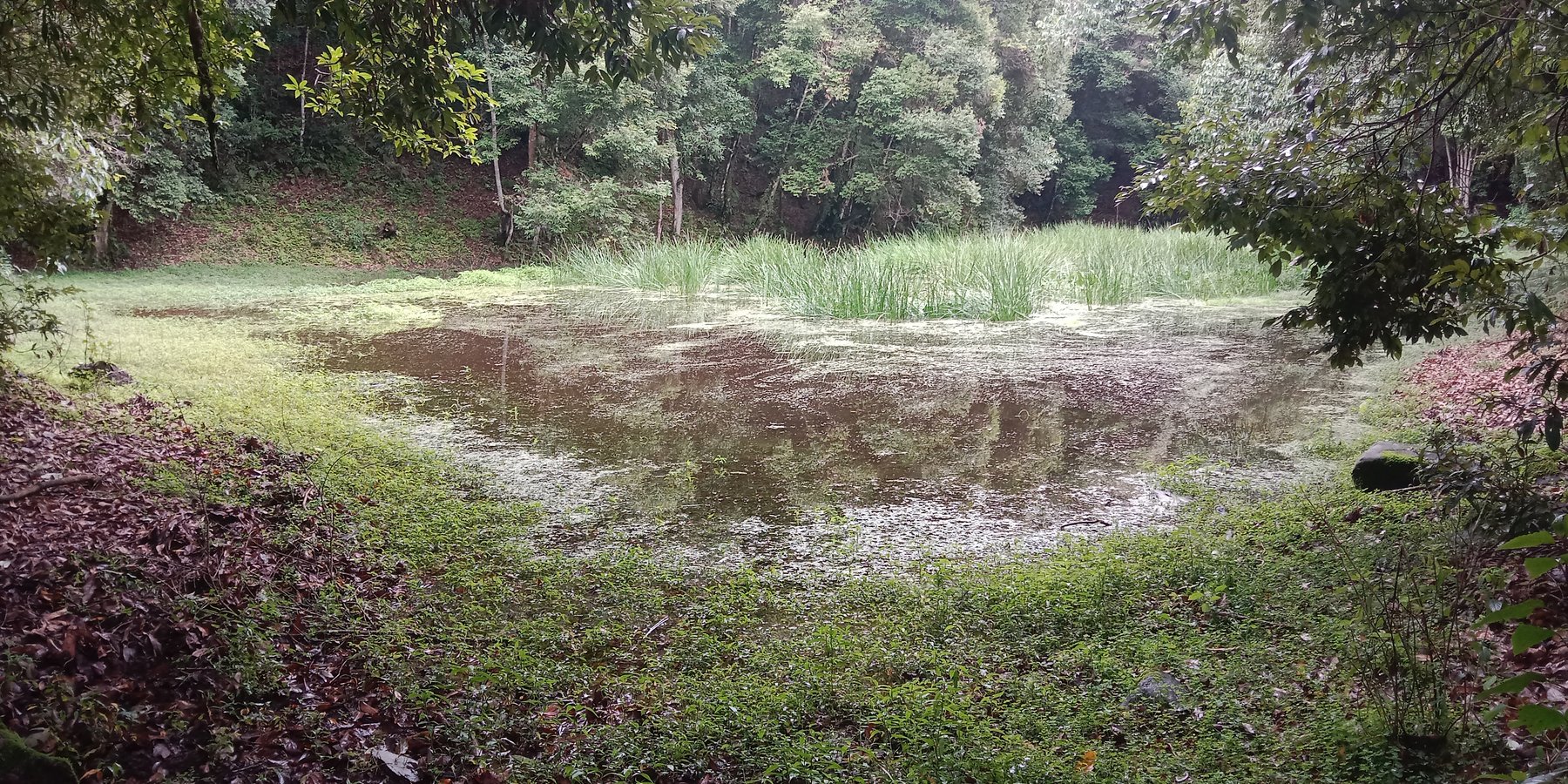
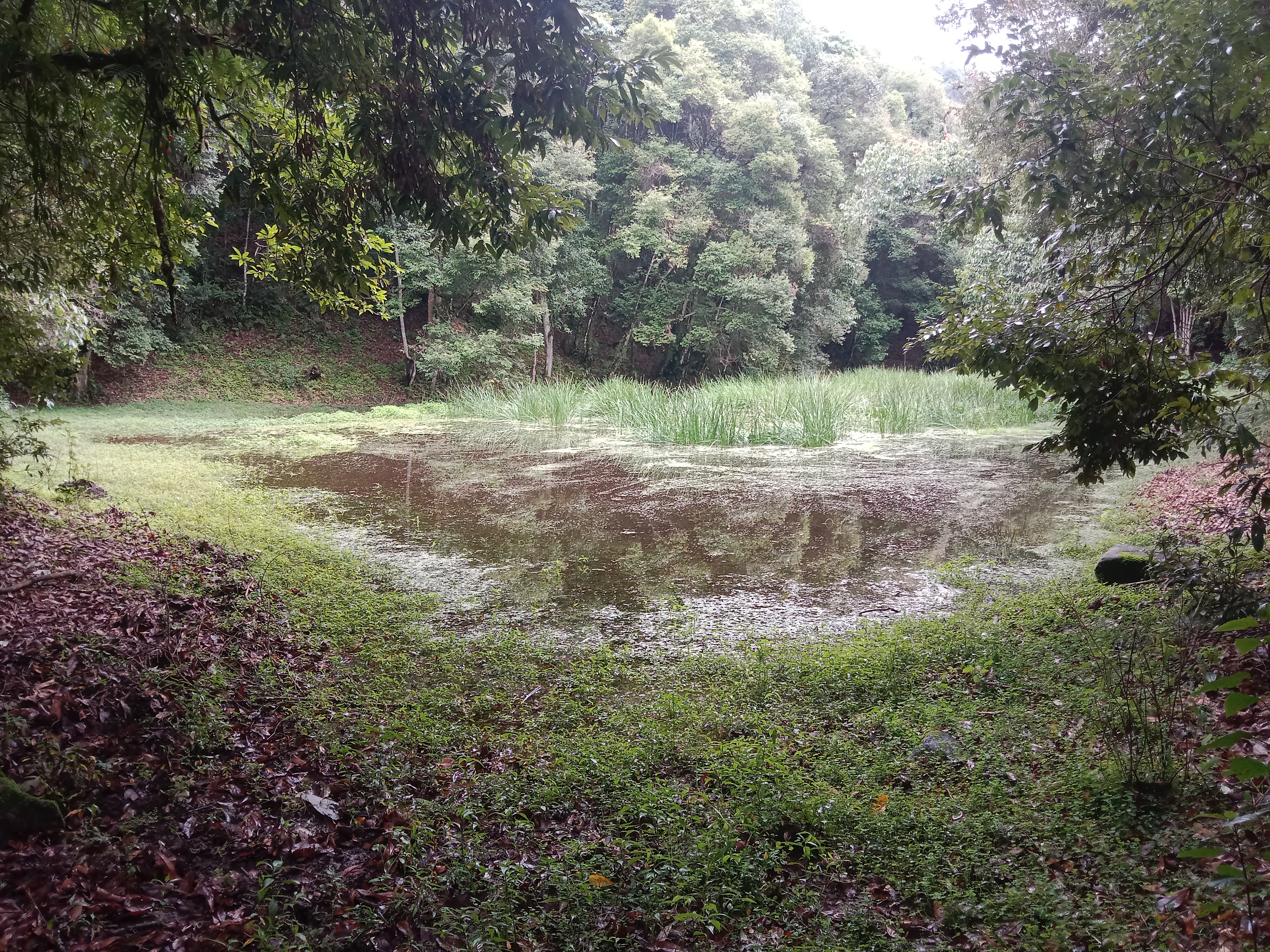
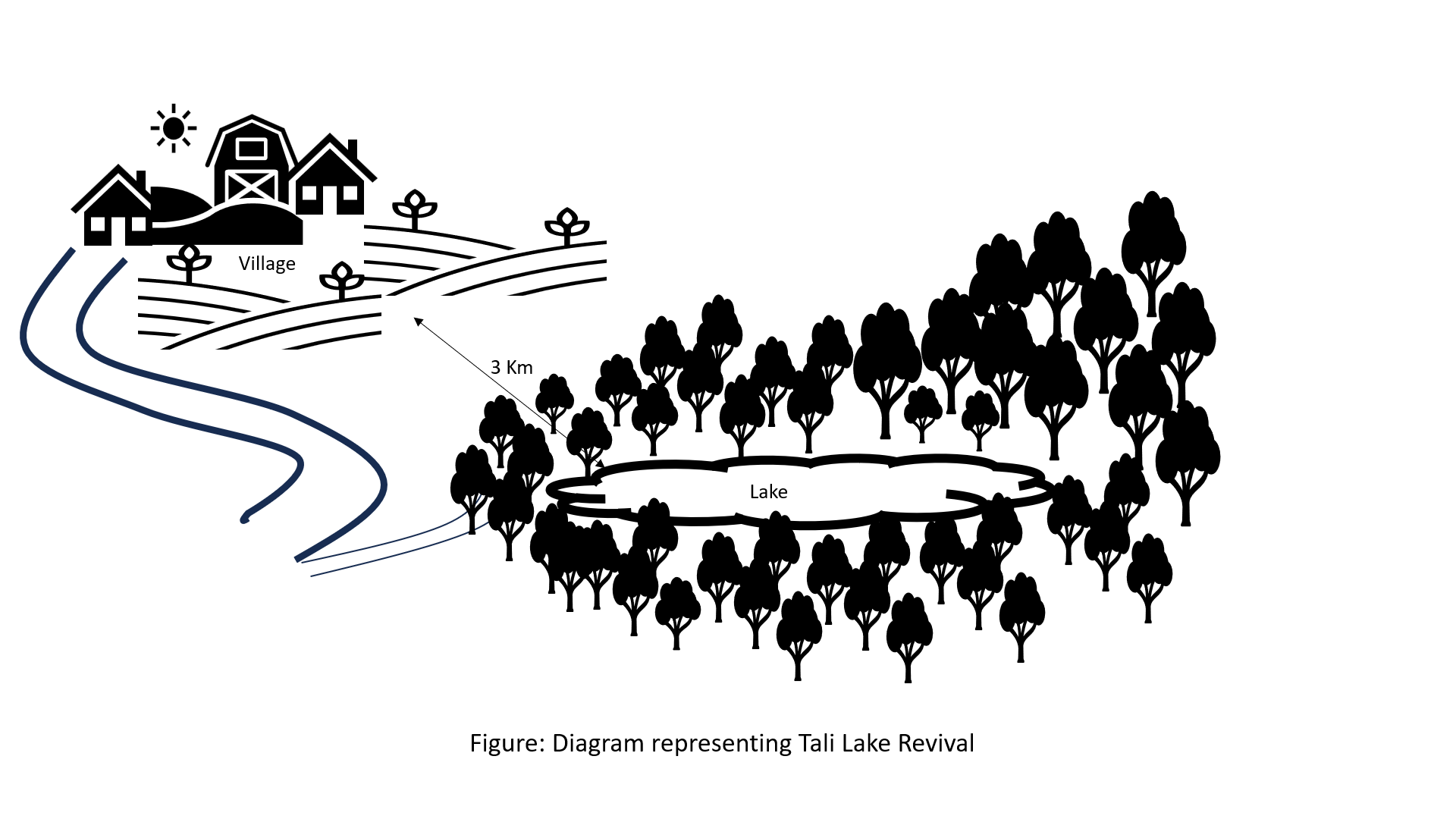
The lake conservation initiative at Tali was conceived with the vision of protecting the lake and transforming the surrounding area into a community eco-tourism hub. The initiative is a testament to how science and spirituality, and culture and the environment can coexist and benefit from one another. The Tali Lake is a major water source (both irrigation and drinking) for the community and both livestock and wild animals.
Bhutanese believe lakes to be sacred and religiously significant. Buli Lake and Tali Lake (Tangsibi Tsho) epitomise how nature and culture come together. Tali village under Nangkor gewog in Zhemgang Dzongkhag lies on the shoulder of mountains at an elevation of 1880 m.a.s.l. with broad-leaved forests. It comprises 25 households with around 280 residents. According to local legend, Tangsibi Tsho in Tali is the “Jewellery basket of Buli Tsho which was left behind when Buli Tsho moved from Tali to Buli”. Tali Lake is spread over an area of 0.40 ha. The 18.2 ha forest around the lake is dominated by species of oak. The forest around the lake harbours a very rich variety of mammals (22 species) that are ecologically important and visit the lake for water and predation. Also, 70 species of birds have been recorded in the forest around the lake.
The community, along with the Loden Foundation and the monastic body, has been engaged in reviving the lake as 90% of the surface was covered with waterweeds and grasses. The aim was to clean, beautify, and sustain the ecosystem through an integrated and holistic management project by combining scientific, social, and spiritual approaches. There was support of USD 33,550 from the United Nations Development Programme Global Environment Facility (UNDP GEF) Small Grants Programme (SGP) and USD 12,650 from the Loden Foundation and the Community.
Tangsibi Tsho in Tali has significant cultural importance which includes water for irrigation and drinking purposes both for people as well as livestock and wild animals. Thus, the initiative was aimed at conserving the lake and transforming the lake area into a community eco-tourism hub. According to the villagers and senior citizens of the community, the revival of the lake would help in mitigating water shortage problems for irrigation which they require for rice and wheat - as well as preserving the sacred location. The District Forest Division, Zhemgang under the Department of Forests and Park Services (DoFPS) conducted a survey and recorded 21 plant species (trees and shrubs) and 22 orchid species.
To commence the revival activities, meetings were held with the institutions and conservation groups, by-laws were developed, and extensive mapping and demarcation of the area around the lake were done. Then, during the site development phase of Tali Lake area management, there was development of footpaths and eco-cultural trails, identification of plants and trees and name tagging, installation of waste bins and procurement of materials, installation of signboards at the site, and access roads were completed. Research and documentation on the lake and the village were carried out, and audio-video recordings and interviews were done. Advocacy and awareness of output were also accomplished. Through community engagement and religious ceremonies, the lake was successfully cleared after consulting with the National Biodiversity Centre, advice from concerned authorities and local experts as well as recommendations contained in the biodiversity assessment report from Zhemgang Forest Division under DoFPS. Men and women from the village joined together to construct a bamboo raft to transport the weeds across the lake and over three truckloads of weeds and tree stumps were cleared to revive the lake. The National Environment Commission tested the water quality and the result showed that the pH of the water is slightly acidic (6.49), 0.95mg/L of dissolved oxygen, and chemical oxygen demand of 10.4mg/L.
The revival of Tali Tangsibi Lake has benefitted downstream water supplies for irrigation and has prevented the sacred local lake from drying up.
2.3 Photos of the Technology
Media Gallery
2.5 Country/ region/ locations where the Technology has been applied and which are covered by this assessment
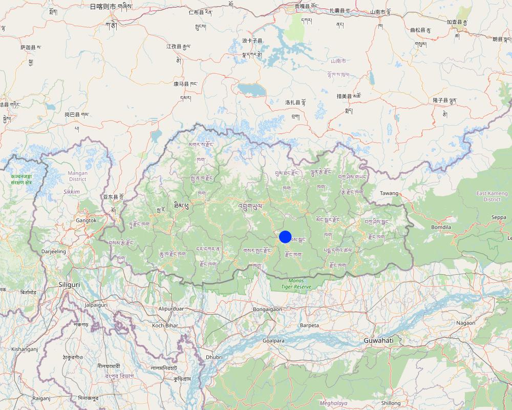
Country:
Bhutan
Region/ State/ Province:
Tali Community
Further specification of location:
Nangkhor Gewog, Zhemgang Dzongkhag
Specify the spread of the Technology:
- applied at specific points/ concentrated on a small area
Is/are the technology site(s) located in a permanently protected area?
Yes
If yes, specify:
The lake falls under the protected area 'Biological Corridor'.
Map
×2.6 Date of implementation
Indicate year of implementation:
2020
2.7 Introduction of the Technology
Specify how the Technology was introduced:
- through projects/ external interventions
Comments (type of project, etc.):
The lake revival activities were funded by UNDP GEF SGP (US$33550 ) and the Loden Foundation (US$12650) and they were all completed in 2020.
3. Classification of the SLM Technology
3.1 Main purpose(s) of the Technology
- reduce, prevent, restore land degradation
- conserve ecosystem
- preserve/ improve biodiversity
- create beneficial economic impact
- create beneficial social impact
3.2 Current land use type(s) where the Technology is applied
Land use mixed within the same land unit:
No

Forest/ woodlands
- (Semi-)natural forests/ woodlands
(Semi-)natural forests/ woodlands: Specify management type:
- Selective felling
- Non-wood forest use
Are the trees specified above deciduous or evergreen?
- mixed deciduous/ evergreen
Products and services:
- Timber
- Fuelwood
- Nature conservation/ protection
- Recreation/ tourism

Waterways, waterbodies, wetlands
Main products/ services:
Lake
3.3 Has land use changed due to the implementation of the Technology?
Has land use changed due to the implementation of the Technology?
- No (Continue with question 3.4)
3.4 Water supply
Water supply for the land on which the Technology is applied:
- mixed rainfed-irrigated
Comments:
The community benefits from five irrigation sources viz. Bangleng Chhu, Budigang Chhu, Khatoed Chhu, Dungmangla Chhu, and Kokaling Chhu. The latter three irrigation channels are equipped with cement and pipelines.
3.5 SLM group to which the Technology belongs
- surface water management (spring, river, lakes, sea)
- ecosystem-based disaster risk reduction
3.6 SLM measures comprising the Technology

other measures
Specify:
Lake revival
3.7 Main types of land degradation addressed by the Technology

biological degradation
- Bh: loss of habitats
- Bs: quality and species composition/ diversity decline

water degradation
- Hs: change in quantity of surface water
3.8 Prevention, reduction, or restoration of land degradation
Specify the goal of the Technology with regard to land degradation:
- not applicable
4. Technical specifications, implementation activities, inputs, and costs
4.1 Technical drawing of the Technology
Author:
Ongpo Lepcha
Date:
24/11/2023
4.2 General information regarding the calculation of inputs and costs
Specify how costs and inputs were calculated:
- per Technology unit
Specify currency used for cost calculations:
- USD
If relevant, indicate exchange rate from USD to local currency (e.g. 1 USD = 79.9 Brazilian Real): 1 USD =:
80.0
4.3 Establishment activities
| Activity | Timing (season) | |
|---|---|---|
| 1. | Project inception and area mapping. | |
| 2. | Lake management and eco-cultural trail development. | After crop harvest (November and December, 2020) |
| 3. | Research and documentation phase. | |
| 4. | Output dissemination. |
4.4 Costs and inputs needed for establishment
If you are unable to break down the costs in the table above, give an estimation of the total costs of establishing the Technology:
46200.0
If land user bore less than 100% of costs, indicate who covered the remaining costs:
The whole of expenditures were borne by UNDP GEF SGP (US$33550) and the Loden Foundation (US$12650).
Comments:
The unit cost breakdown was impossible due to the unavailability of the expenditure statements.
4.5 Maintenance/ recurrent activities
Comments:
Since the completion of the activity in 2020, no maintenance activities have been conducted so far. However, the physical monitoring is done by the chairman, secretary, and treasurer of the community forest management group of Tali.
5. Natural and human environment
5.1 Climate
Annual rainfall
- < 250 mm
- 251-500 mm
- 501-750 mm
- 751-1,000 mm
- 1,001-1,500 mm
- 1,501-2,000 mm
- 2,001-3,000 mm
- 3,001-4,000 mm
- > 4,000 mm
Specifications/ comments on rainfall:
Average annual rainfall: 1200-1800 mm
The rain estimate has been derived based on the agro-ecological zone (AEZ) the area falls under.
Bhutan is divided into six AEZs (source: https://www.fao.org/3/ad103e/AD103E02.htm).
Bhutan has six AEZs. The wet sub-tropical zone is from 150 to 600 m, followed by the humid sub-tropical zone from 600 to 1,200 m. The dry sub-tropical zone starts at 1,200 m and extends to 1,800 m, followed by the warm temperate zone, which reaches 2,600 m. The cool temperate zone lies between 2,600 and 3,600 m and, finally, the alpine zone between 3,600 m and 4,600 m.
Agro-climatic zone
The lake area falls under the Dry Subtropical Zone in Bhutan.
5.2 Topography
Slopes on average:
- flat (0-2%)
- gentle (3-5%)
- moderate (6-10%)
- rolling (11-15%)
- hilly (16-30%)
- steep (31-60%)
- very steep (>60%)
Landforms:
- plateau/plains
- ridges
- mountain slopes
- hill slopes
- footslopes
- valley floors
Altitudinal zone:
- 0-100 m a.s.l.
- 101-500 m a.s.l.
- 501-1,000 m a.s.l.
- 1,001-1,500 m a.s.l.
- 1,501-2,000 m a.s.l.
- 2,001-2,500 m a.s.l.
- 2,501-3,000 m a.s.l.
- 3,001-4,000 m a.s.l.
- > 4,000 m a.s.l.
Indicate if the Technology is specifically applied in:
- concave situations
Comments and further specifications on topography:
1742 m a.s.l
5.3 Soils
Soil depth on average:
- very shallow (0-20 cm)
- shallow (21-50 cm)
- moderately deep (51-80 cm)
- deep (81-120 cm)
- very deep (> 120 cm)
Soil texture (topsoil):
- medium (loamy, silty)
- fine/ heavy (clay)
Soil texture (> 20 cm below surface):
- medium (loamy, silty)
- fine/ heavy (clay)
Topsoil organic matter:
- high (>3%)
If available, attach full soil description or specify the available information, e.g. soil type, soil PH/ acidity, Cation Exchange Capacity, nitrogen, salinity etc.
Moisture content-2.95%
Organic matter-3.77%
Organic carbon-2.19%
pH-6.45
Electrical conductivity-36.27 µs/cm
Nitrogen-0.11
Phosphorus-0.95
Potassium-98.40 mg/100ml
Soil texture-Clay Loam
5.4 Water availability and quality
Ground water table:
5-50 m
Availability of surface water:
good
Water quality (untreated):
good drinking water
Water quality refers to:
surface water
Is water salinity a problem?
No
Is flooding of the area occurring?
No
5.5 Biodiversity
Species diversity:
- high
Habitat diversity:
- high
Comments and further specifications on biodiversity:
Some 21 plant species (trees and shrubs) and 22 orchid species were identified and documented by Zhemgang Forest Division during the biodiversity survey conducted in and around the lake area.
5.6 Characteristics of land users applying the Technology
Sedentary or nomadic:
- Sedentary
Market orientation of production system:
- mixed (subsistence/ commercial)
Off-farm income:
- 10-50% of all income
Relative level of wealth:
- average
Individuals or groups:
- groups/ community
Level of mechanization:
- mechanized/ motorized
Gender:
- women
- men
Age of land users:
- youth
- middle-aged
5.7 Average area of land used by land users applying the Technology
- < 0.5 ha
- 0.5-1 ha
- 1-2 ha
- 2-5 ha
- 5-15 ha
- 15-50 ha
- 50-100 ha
- 100-500 ha
- 500-1,000 ha
- 1,000-10,000 ha
- > 10,000 ha
Is this considered small-, medium- or large-scale (referring to local context)?
- large-scale
Comments:
The average handholding of the community ranges from 7 to 8 acres, falling under the large scale based on local context. In general, the average household land holding in Bhutan is 3 acres.
In the local context:
3 acres (1.2 ha) = medium scale
> 3 acres = large-scale
<3 acres = small-scale
5.8 Land ownership, land use rights, and water use rights
- Family land
Land use rights:
- individual
Water use rights:
- communal (organized)
Are land use rights based on a traditional legal system?
Yes
Specify:
The land use rights in Bhutan is based on a traditional legal system guided by formal land act and land rules and regulations.
5.9 Access to services and infrastructure
health:
- poor
- moderate
- good
education:
- poor
- moderate
- good
technical assistance:
- poor
- moderate
- good
employment (e.g. off-farm):
- poor
- moderate
- good
markets:
- poor
- moderate
- good
energy:
- poor
- moderate
- good
roads and transport:
- poor
- moderate
- good
drinking water and sanitation:
- poor
- moderate
- good
financial services:
- poor
- moderate
- good
6. Impacts and concluding statements
6.1 On-site impacts the Technology has shown
Socio-economic impacts
Production
crop production
Comments/ specify:
The lake is a critical source of irrigation water. The lake revival has aided in crop production via water availability.
animal production
Comments/ specify:
The lake is a critical source of drinking water for domestic animals. The lake revival has aided in animal production via water availability.
risk of production failure
Comments/ specify:
The risk of production failure has decreased as there are enhanced crop and animal productions due to water availability from the lake.
Water availability and quality
drinking water availability
Comments/ specify:
The lake is a source of drinking water for the Tali community and because the lake is cleaned and managed the water availability and quality have improved.
drinking water quality
Comments/ specify:
The lake is a source of drinking water for the Tali community and because the lake is cleaned and managed the water availability and quality have improved.
water availability for livestock
Comments/ specify:
The lake is a source of drinking water for domestic animals so the water availability for livestock has increased.
water quality for livestock
Comments/ specify:
The lake is a source of drinking water for domestic animals and because the lake is cleaned and managed the water quality for livestock has improved.
irrigation water availability
Comments/ specify:
The lake is a source of irrigation water and because the lake is cleaned, managed, and conserved the availability of irrigation has increased.
irrigation water quality
Comments/ specify:
The lake is a source of irrigation water and because the lake is cleaned, managed, and conserved the quality of irrigation water has improved.
Socio-cultural impacts
SLM/ land degradation knowledge
Comments/ specify:
The lake revival has created awareness among the Tali community against the irresponsible exploitation of forests. It has thrown light on the importance of water conservation.
Ecological impacts
Biodiversity: vegetation, animals
animal diversity
Comments/ specify:
The quantity is not known. However, the beneficiaries believe that the lake revival along with eco-tourism area demarcation followed by enhanced area protection could have improved the animal diversity.
habitat diversity
Comments/ specify:
The dedicated area (lake and the nearby forest) identified and protected is assumed to have diversified the habitats.
6.2 Off-site impacts the Technology has shown
water availability
Comments/ specify:
Increased water availability for drinking and irrigation.
6.3 Exposure and sensitivity of the Technology to gradual climate change and climate-related extremes/ disasters (as perceived by land users)
Gradual climate change
Gradual climate change
| Season | increase or decrease | How does the Technology cope with it? | |
|---|---|---|---|
| annual temperature | increase | very well |
Climate-related extremes (disasters)
Meteorological disasters
| How does the Technology cope with it? | |
|---|---|
| local rainstorm | very well |
| local thunderstorm | very well |
| local hailstorm | very well |
| local windstorm | very well |
Comments:
About the annual rainfall, the land users shared that the quantity over the years has remained the same. But the rainfall pattern has changed. In the earlier years (past 10 - 15 years) there used to be gentle and steady rainfall. However, in recent years, some sudden heavy rain has been following some prolonged dry spells.
6.4 Cost-benefit analysis
How do the benefits compare with the establishment costs (from land users’ perspective)?
Short-term returns:
slightly negative
Long-term returns:
negative
Comments:
No maintenance was carried out until now.
6.5 Adoption of the Technology
- > 50%
If available, quantify (no. of households and/ or area covered):
25 households of Tali
Of all those who have adopted the Technology, how many did so spontaneously, i.e. without receiving any material incentives/ payments?
- 0-10%
6.6 Adaptation
Has the Technology been modified recently to adapt to changing conditions?
No
6.7 Strengths/ advantages/ opportunities of the Technology
| Strengths/ advantages/ opportunities in the land user’s view |
|---|
| Enhance the understanding of scientific, cultural, and spiritual ecology for environmental conservation. |
| Enhance livelihood through the promotion of community-based ecotourism activities. |
| Retaine or increase water volume of the lake. |
| Continued transmission of local cultural knowledge and spiritual and scientific practices beneficial for environmental conservation. |
| Promote community stewardship of the lake and the environment. |
| Revive and conserve lake and the surrounding ecosystem. |
| Create awareness against the irresponsible exploitation of forests. |
| Increased awareness to sustain watersheds and sources for irrigation. |
6.8 Weaknesses/ disadvantages/ risks of the Technology and ways of overcoming them
| Weaknesses/ disadvantages/ risks in the land user’s view | How can they be overcome? |
|---|---|
| Internal conflicts and misunderstandings are common during group labor contribution. | Regular group meetings, guidance from District Forest Division |
| Weaknesses/ disadvantages/ risks in the compiler’s or other key resource person’s view | How can they be overcome? |
|---|---|
| Weeds cover the lake periodically. | Cleaning the lake surface by identifying certain routine time. |
| The trails and monuments near the lake are kept unmanaged. | Regular clearing of these trails and management of monuments. |
| Unmanaged water hole present above the lake. | A small water hole present above the lake can be improved and maintained, so that the pressure on the lake will be reduced and can serve as a water reservoir for the lake. |
7. References and links
7.1 Methods/ sources of information
- field visits, field surveys
Four
- interviews with land users
Four
When were the data compiled (in the field)?
15/07/2023
7.2 References to available publications
Title, author, year, ISBN:
REVIVAL: LEVERAGING CULTURAL & SCIENTIFIC KNOWLEDGE AND PRACTICES FOR ENVIRONMENTAL CONSERVATION IN TALI, The Loden Foundation, 2022
Available from where? Costs?
https://www.undp.org/bhutan/publications/revival-leveraging-cultural-scientific-knowledge-and-practices-environmental-conservation-tali
7.3 Links to relevant online information
Title/ description:
The Loden Foundation
URL:
https://loden.org/
Title/ description:
Revival: Leveraging cultural, scientific knowledge and practices for environmental conservation in Tali
URL:
https://www.undp.org/bhutan
Title/ description:
Leveraging Cultural and Scientific Knowledge and Practices for Environmental Conservation in Tali
URL:
http://3.14.34.174/spacial-itemid-projects-landing-page/spacial-itemid-project-search-results/spacial-itemid-project-detailpage.html?view=projectdetail&id=28078
Title/ description:
Jewel basket of Tali
URL:
https://kuenselonline.com/jewel-basket-of-tali/
Links and modules
Expand all Collapse allLinks
No links
Modules
No modules