Integrated Pasture Management Planning in Mountainous Regions [جورجيا]
- تاريخ الإنشاء:
- تحديث:
- جامع المعلومات: Hanns Kirchmeir
- المحررون: Natia Kobakhidze, Christian Goenner, Jonathan Etzold
- المُراجع: Rima Mekdaschi Studer
approaches_5490 - جورجيا
عرض الأقسام
توسيع الكل طي الكل1. معلومات عامة
1.2 تفاصيل الاتصال بالأشخاص الرئيسيين لمصدر المعلومات والمؤسسات المعنية بتقييم وتوثيق النهج
متخصص في الإدارة المستدامة للأراضي:
جامع المعلومات المشارك:
متخصص في الإدارة المستدامة للأراضي:
اسم المشروع الذي سهّل توثيق/تقييم النهج (إذا كان ذلك على صلة)
Integrated Biodiversity Management, South Caucasus (IBiS)اسم المؤسسة (المؤسسات) التي سهلت توثيق/تقييم النهج (إذا كان ذلك على صلة)
Deutsche Gesellschaft für Internationale Zusammenarbeit (GIZ)1.3 الشروط المتعلقة باستخدام البيانات الموثقة من خلال WOCAT
متى تم تجميع البيانات (ميدانيا)؟:
01/02/2016
يوافق جامع المعلومات والشخص (لاشخاص) الرئيسي لمصدر المعلومات على الشروط المتعلقة باستخدام البيانات الموثقة من خلال WOCAT:
نعم
1.4 المراجع الخاصة باستبيان(استبيانات) تقنيات الإدارة المستدامة للأراضي

Permanent grass cover in vineyards [هنغاريا]
Permanent grass cover under grape vines protects the soil surface against erosion and compaction - and provides better conditions for traffic within the rows during mechanised field operations
- جامع المعلومات: Brigitta Szabó
Remote Sensing as a Tool for Land Degradation … [جورجيا]
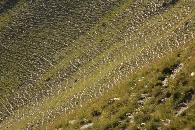
Land degradation contributes to biodiversity loss and the impoverishment of rural livelihoods in Tusheti. Above all, however, land degradation are triggered by climate change as traditional land use practise might not be adapted to new climate conditions which can cause or speed up degradation processes significantly. On the other hand, …
- جامع المعلومات: Hanns Kirchmeir
2. وصف نهج الإدارة المستدامة للأراضي
2.1 وصف موجز للنهج
The unsustainable use of pastures and forest areas has led to soil erosion, degradation, desertification and loss of biodiversity in the high mountain areas of the South Caucasus. The development of pasture passports is part of a broader approach to a strategic pasture management plan for Tusheti. This showcase includes results from the spatial planning process applied in a pilot programme for Akhmeta municipality.
2.2 وصف تفصيلي للنهج
وصف تفصيلي للنهج:
Project area and purpose
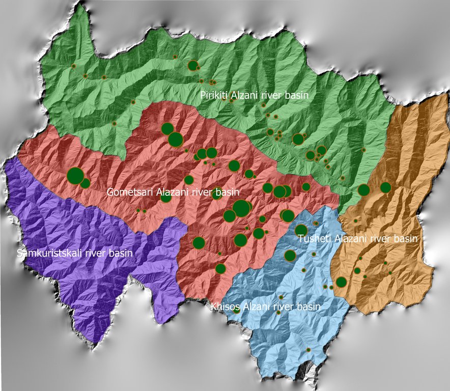
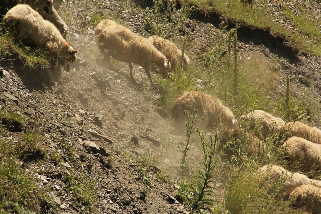
The project area comprises the Tusheti Protected Areas (PAs) on the northern slopes of the Greater Caucasus Mountains in Georgia. This group of protected areas consists of a strict nature reserve, a national park and a protected landscape with about 40 villages and settlements. Together they form a total protected area of approx. 114,000 ha. In Tusheti, overgrazing has led, especially in the eastern part with a higher number of villages and roads, to soil erosion and biodiversity loss. Especially the intensive use of summer pastures during the Soviet period resulted in a severe deterioration of the mountain slopes. So far, there are no standards or guidelines for the elaboration of sustainable pasture management plans in Georgia. Pasture passports, as a first step towards sustainable pasture management, document the actual grazing capacity for each pasture unit and serve as a guiding document for shepherds and local stakeholders and as a basis to prepare lease contracts.
Data gathering
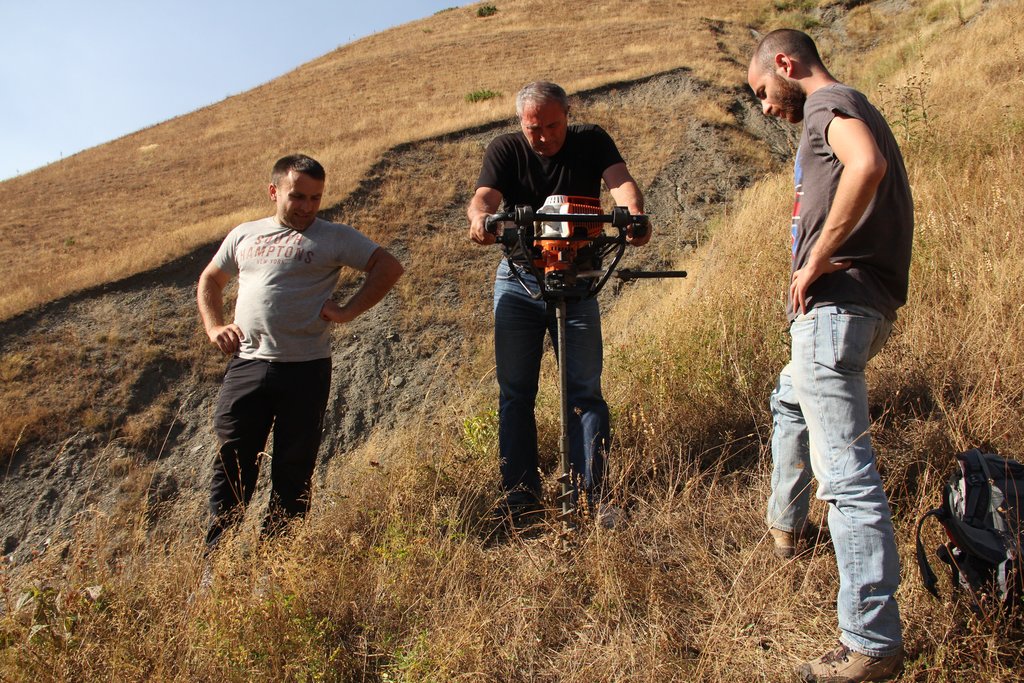
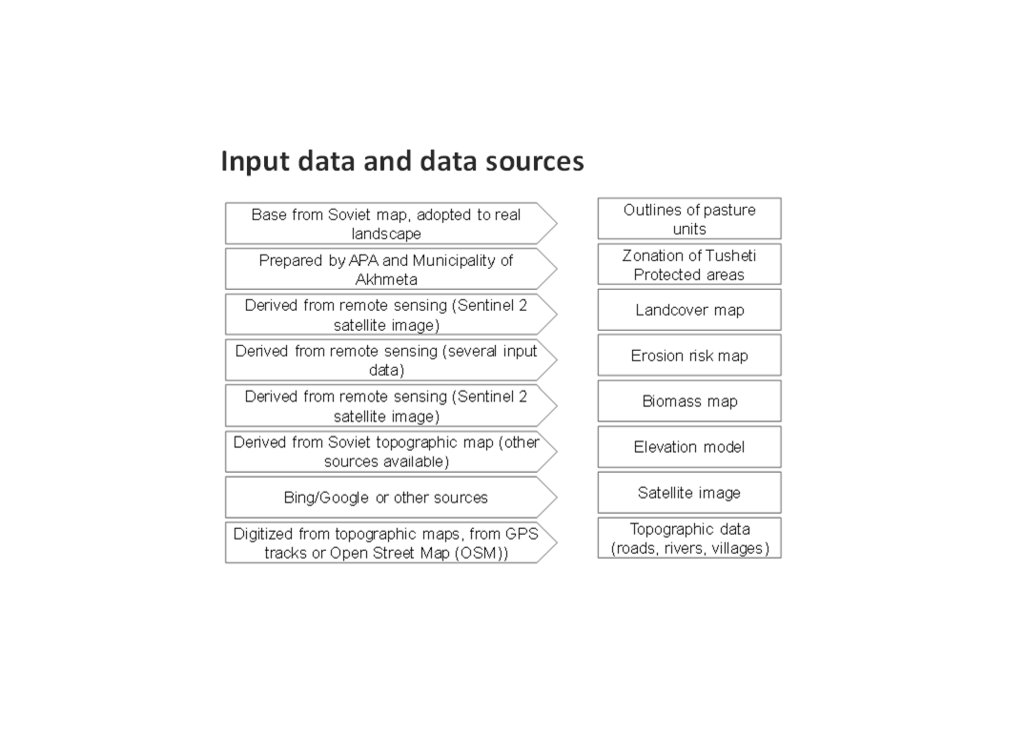
As a prerequisite for the development of pasture passports and the calculation of grazing capacity, the type of land cover, the erosion risk and the biomass of the pastureland had to be assessed for each pasture unit. This was done using remote sensing tools in combination with data collected in the field for calibration.
The details on the methodology of the Land Cover & Biomass as well as the Erosion Risk Assessment can be found in the WOCAT technology on "Remote Sensing as a Tool for Land Degradation Neutrality Monitoring" (see link).
Evaluation and Ground Truthing
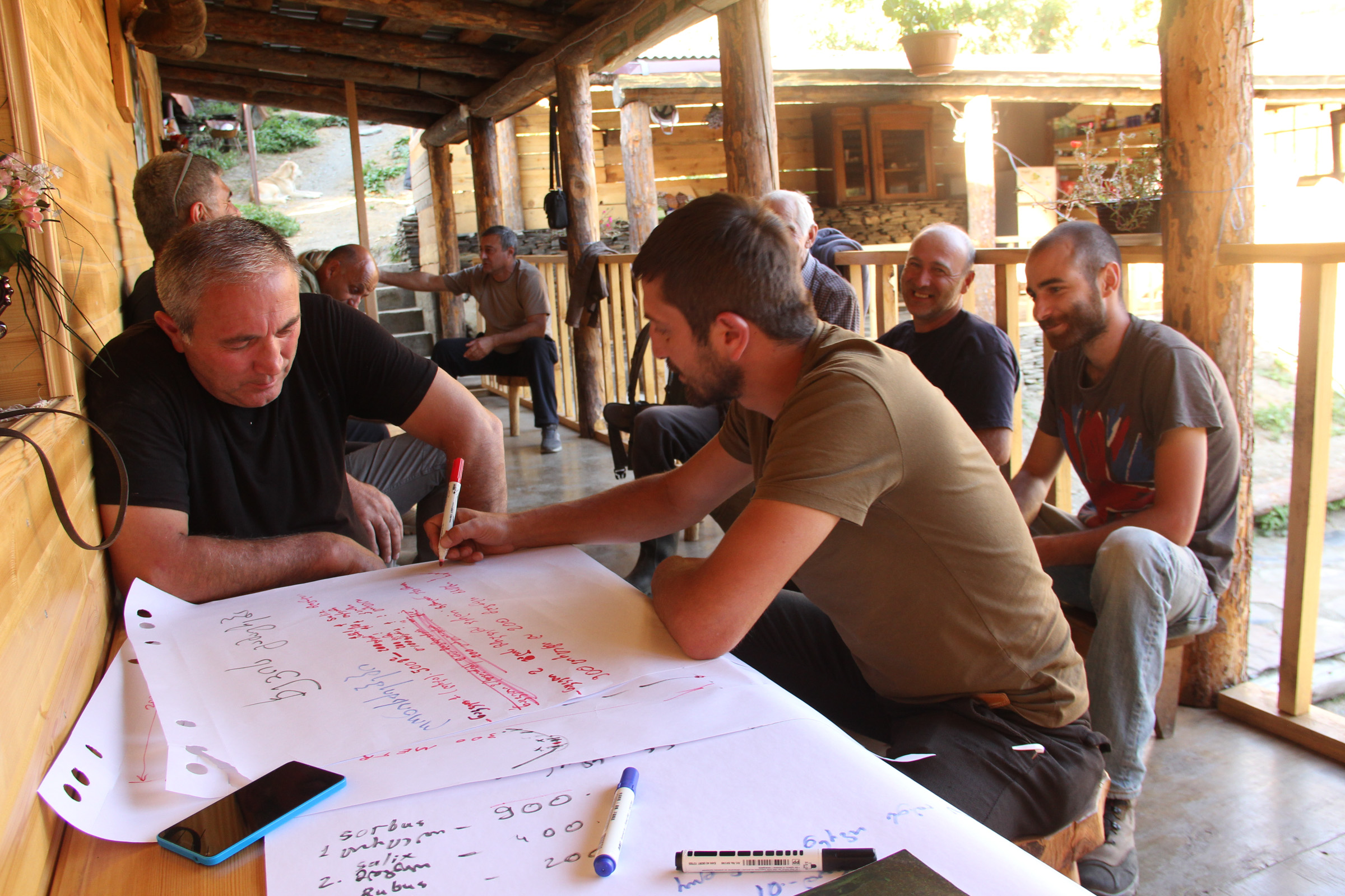
All interim results have been checked and evaluated by local stakeholders, national experts and experts from local administrations. It was important not only to conduct workshops in seminar rooms but to meet the local stakeholders in the field and to discuss the problems and challenges of pasture management on place in the field. At this workshops all levels of decision makers were included (Ministries, Donor organisations, international and national experts, local administrations and land users). This was important to create a common understanding of the current situation from different perspectives (nature conservation, administration, shepherds ...). The combination of remote sensing with calibration data from the field can be summarised as a very effective method to assess the erosion state in large areas. Neither of the two instruments would be able to provide results in this spatial dimension and quality alone.
Pasture Passports
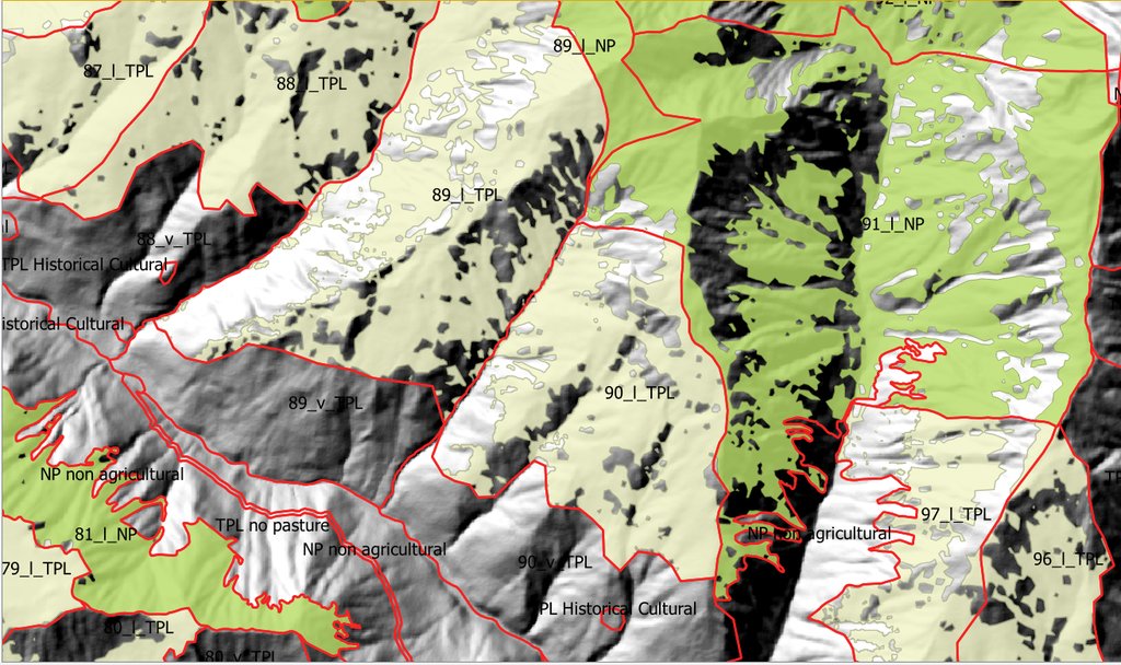
As part of the spatial planning of Akhmeta municipality, pastureland that can be leased to shepherds was separated from land used as hay meadows, farmland or pastures belonging to the villagers. The resulting map shows land available to the village and land available for lease. To understand the current use of pastureland, farms, livestock numbers and pasture units were assessed. In workshops with the local stakeholders and potential users of the results (shepherds, Tusheti Protected Landscape Administration, Tusheti NP Administration, APA), the design of the pasture passports was developed. Each pasture unit is described on four pages in the pasture passport.
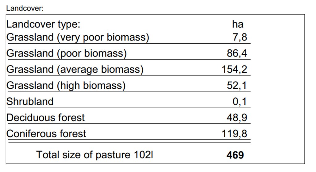
Each pasture unit is described on four pages in the pasture passport: Header: the number (code), total area; content: map of the land cover types, the area of each land cover type, map of available biomass and carrying capacity, name of farmers/shepherds and their livestock numbers using the pasture unit
Spatial Planning Department and Construction Policy (within the Ministry of Regional Development and Infrastructure MRDI), and the Agency of Protected Areas APA (within the Ministry of Environmental Protection and Agriculture MEPA), are key stakeholders to use the pasture passports and to further develop and upscale this approach to other protected areas in Georgia. Beside APA, the Tusheti Protected Landscape Administration (TPLA), located within the Akhmeta municipality administration, is the second important user of pasture passports.
The pasture passports are showing not only the boundaries of each pasture unit, but also those areas that must not be grazed because this lands are part of strict protected areas or areas of high erosion risk. This helps shepherds to guide their flocks to the right places and the park rangers to check, if the regulations are respected correctly.
2.3 صور عن النهج
2.5 البلد/المنطقة/المواقع التي تم تطبيق النهج فيها
البلد:
جورجيا
المنطقة/الولاية/المحافظة:
Tusheti
مزيد من التفاصيل حول الموقع:
Entire territory of Tusheti Protected Areas (1100 km²)
التعليقات:
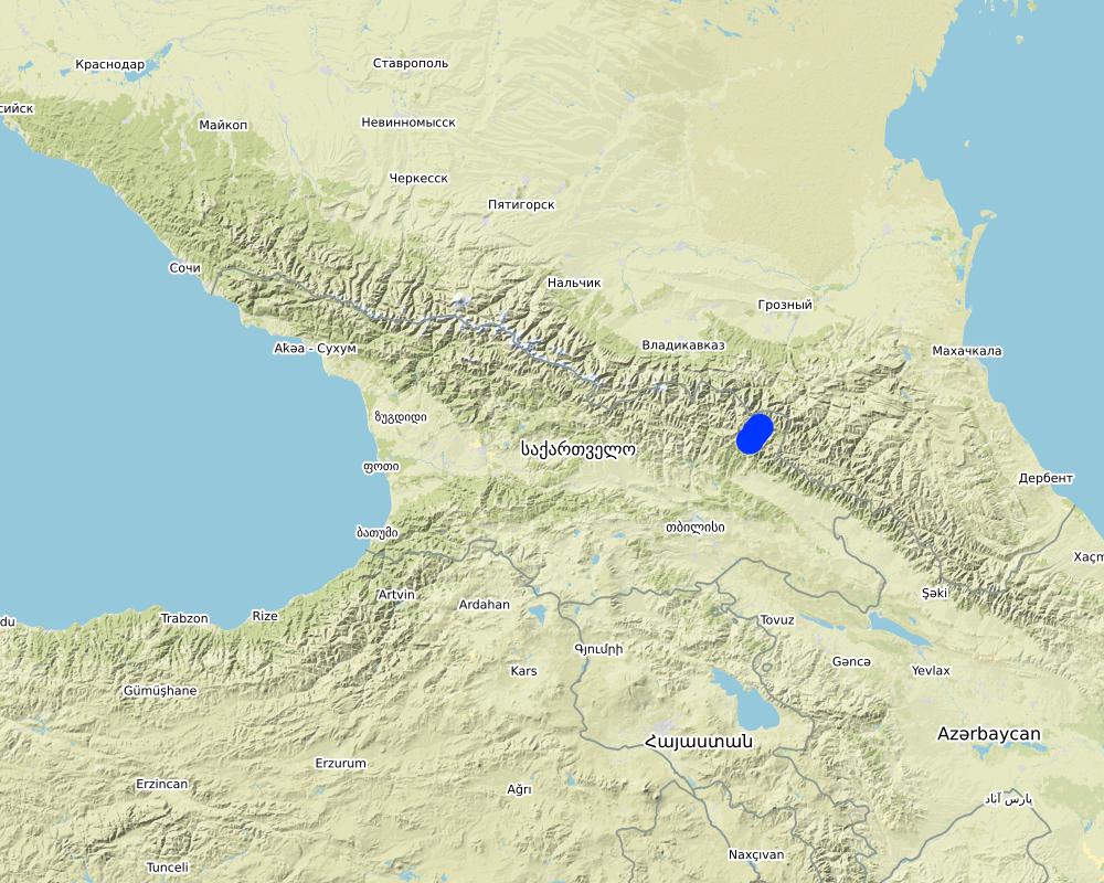
Tusheti is located in the north-eastern of Georgia in the Higher Caucasus bordering Dagestan, Russia. The territory consists of the Tusheti Strict Nature Reserve (12,627 ha), Tusheti National Park (69,515 ha), and Tusheti Protected Landscape (31,517 ha), which includes around 40 villages and settlements.
Full territory of Tusheti Protected Areas (1100 km²)
Map
×2.6 تواريخ بدء وإنهاء تنفيذ النهج
أشر إلى سنة البدء:
2016
2.7 نوع النهج
- قائم على مشروع/برنامج
2.8 الغايات/الأهداف الرئيسية للنهج
Support land use planning and decision-making processes for better management of natural resources, especially pastures.
2.9 الظروف التي تمكن أو تعيق تنفيذ التقنية/التقنيات المطبقة بموجب النهج
المعايير والقيم الاجتماعية /الثقافية/ الدينية
- تمكين/تمكيني
There is a strong identification of the local communities with the traditional pasture land use and the communities are willing to establish a long-term sustainable land management.
توفر/الوصول إلى الموارد والخدمات المالية
- معيق
Missing financial resources is hindering the implementation of the approach.
الإطار المؤسساتي
- تمكين/تمكيني
Good cooperation between the relevant institutions on the national and municipal level enabled a successful implementation. The Agency of Protected Areas (APA) located at the Ministry of Environmental Protection and Agriculture (MEPA) and the Tusheti Protected Landscape Administration (TPLA), located within the Akhmeta municipality administration are responsible for contracting lease agreements with shepherds and should not only be able to understand the technology behind the passports but should also have the capacity to handle the technology to be able to adapt the passports if needed (e.g., by changing boundaries of pasture units). For this issue, training workshops with decision-makers and technicians from the MoEPA, APA with TNP Administration and Administration of Akhmeta Munucuaplity with TPLA have been implemented.
Collaboration/ coordination of actors: All relevant national and local authorities that are dealing with spatial or environmental data participated in the workshop to discuss the approach and institutional suitability to host the sensitivity modelSoil Erosion Risk Model.
التعاون/التنسيق بين الجهات الفاعلة
- تمكين/تمكيني
All relevant national and local authorities that are dealing with spatial or environmental data participated in the workshop to discuss the approach and institutional suitability to host the Soil Erosion Risk Model.
المعرفة حول الإدارة المستدامة للأراضي، والوصول إلى الدعم الفني
- معيق
There is a high need for technical infrastructure and strong human capacity development.
3. المشاركة وأدوار الأطراف المعنية
3.1 أصحاب المصلحة المعنيون بالنهج وأدوارهم
- مستخدمو الأراضي المحليون/المجتمعات المحلية
Shephards, local communities
Participation at the workshop/meeting and
making contributions through comments,
suggestions and sharing their analytical point
of view.
- متخصصون في الإدارة المستدامة للأراضي / مستشارون زراعيون
GIS-LAB (Georgian scientific GIS service provider)
National experts on remote sensing and modelling of erosion risk.
- الباحثون
National ecologists from universities
- منظمة غير حكومية
Centre for Biodiversity Research & Conservation (NACRES);
staff and experts from FATPA (Friends Association of Tusheti Protected Areas);
local NGO's
Interviews with local stakeholders, field experts
- الحكومة المحلية
Municipality of Akhmeta and Tusheti Protected Landscape Management
Participation at the workshop where they have given input and made contributions to the topic of technical aspects of the approach.
- الحكومة الوطنية (المخططون، صانعو القرار)
National Park management and APA (Agency for Protected Areas)
Long term aplication and upscaling on national level.
- منظمة دولية
Deutsche Gesellschaft fuer Zusammenarbeit (GIZ)
Funding and supervision of the implementation process.
3.2 انخراط مستخدمي الأراضي المحليين/المجتمعات المحلية في المراحل المختلفة للنهج
| انخراط مستخدمي الأراضي المحليين/المجتمعات المحلية | حدد من شارك وصف الأنشطة | |
|---|---|---|
| المبادرة/التحفيز | سلبي | |
| التخطيط | سلبي | |
| التنفيذ | تفاعلي | Organized meetings, workshop where stakeholders, local communities discussed different technical methodologies, visited the project communities and evaluated the preliminary result maps of erosion risk in the field. |
| الرصد/التقييم | سلبي |
3.3 مخطط التدفق (إذا كان متاحًا)
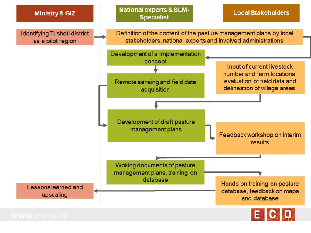
الوصف:
The process of generating pasture passports consists of several phases. The needs and expected content of the pasture management plans was defined in the early stage of the project by the local stakeholders, national experts and involved administrations. The preparation of the pasture management plans was an iterative process between the remotsensing and field sampling results and feedback and input from local stakeholders.
•
المؤلف:
Hanns Kirchmeir
3.4 اتخاذ القرار بشأن اختيار تقنية/تقنيات الإدارة المستدامة للأراضي
حدد من الذي قرر اختيار التقنية/التقنيات التي سيتم تنفيذها:
- متخصصون في الإدارة المستدامة للأراضي بشكل أساسي، بعد التشاور مع مستخدمي الأراضي
حدد على أي أساس تم اتخاذ القرارات:
- تقييم المعرفة الموثقة جيدًا بشأن الإدارة المستدامة للأراضي(اتخاذ القرارات القائمة على الأدلة)
4. الدعم الفني وبناء القدرات وإدارة المعرفة
4.1 بناء القدرات/التدريب
هل تم تقديم التدريب لمستخدمي الأراضي / الأطراف المعنيين الآخرين؟:
نعم
حدد من تم تدريبه:
- موظفون ميدانيون/ مستشارون
شكل التدريب:
- مناطق العرض
شكل التدريب:
- workshop with field mission
المواضيع المغطاة:
Evaluation of model results, preliminary result maps of erosion risk in the field, technical implementation of the sensitivity model in Georgia.
التعليقات:
The workshops were combined with field missions to evaluate model results directly in the field. The expert teams went into the project communities and evaluated the preliminary result maps of erosion risk in the field together with local stakeholders.
4.2 خدمة استشارية
هل يملك مستخدمو الأراضي وصولا إلى خدمة استشارية؟:
نعم
حدد ما إذا كانت الخدمة الاستشارية متوفرة:
- في مراكز دائمة
وصف/تعليقات:
Located on district level in Telavi
4.3 تعزيز المؤسسات (التطوير التنظيمي)
هل تم إنشاء أو تعزيز مؤسسات من خلال هذا النهج؟:
- نعم، باعتدال
حدد المستوى (المستويات) التي تم فيها تعزيز أو إنشاء المؤسسات:
- محلي
- إقليمي
- وطني
صف المؤسسة والأدوار والمسؤوليات والأعضاء وما إلى ذلك.
The results of the approach implementation in Georgia has been summarized by the Programme ”Integrated Biodiversity Management, South Caucasus” and distributed to the experts in Azerbaijan for the further implementation.
Approach and results have been handed over to the local municipality responsible for the lease contracts in the Protected Landscape and to APA, which is responsible for the land use in the national park to integrate them into their pasture management plans.
حدد نوع الدعم:
- مالي
- بناء القدرات/التدريب
- sharing the concept, approach
اعط مزيدا من التفاصيل:
The concept and approach has been shared with local municipalities and other related experts.
Pilot study financed by GIZ.
4.4 الرصد والتقييم
هل يشكل الرصد والتقييم جزءا من النهج؟:
نعم
التعليقات:
Within the project a basline was drawn with the current livestock numbers, the current available fodder biomass and the current state of erosion.
إذا كانت الإجابة بنعم، فهل من المقصود استخدام هذه الوثائق للمراقبة والتقييم؟:
نعم
التعليقات:
The remote sensing technology enables a sound methodology to compare the state of erosion and the biomass volume based on satelite data after some years with the baseline values from 2017.
4.5 البحوث
هل كانت البحوث جزءًا من النهج؟:
نعم
حدد المواضيع:
- تكنولوجيا
أعط تفاصيل إضافية وأشر إلى من قام بالبحوث:
National and international ecologists did research on vegetation details and biomass as well as on the remote sensing technology.
5. التمويل والدعم المادي الخارجي
5.1 الميزانية السنوية لمكون الإدارة المستدامة للأراضي في النهج المذكور
إذا لم تكن الميزانية السنوية الدقيقة معروفة، قم بالإشارة إلى نطاقها:
- 100,000-10,000
التعليقات (على سبيل المثال المصادر الرئيسية للتمويل/الجهات المانحة الرئيسية):
The funds came from the Integrated Erosion Control project which aas launched as part of the Integrated Biodiversity Management, South Caucasus (IBiS) Programme of the Deutsche Gesellschaft für Internationale Zusammenarbeit (GIZ)
5.2 الدعم المالي/المادي المقدم لمستخدمي الأراضي
هل حصل مستخدمو الأراضي على دعم مالي/ مادي لتنفيذ التقنية/ التقنيات؟:
كلا
5.3 إعانات لمدخلات محددة (بما في ذلك العمالة)
- غير موجود
إذا كان العمل من قبل مستخدمي الأراضي مدخلاً جوهريًا، فهل كان:
- تطوعي
التعليقات:
There was a questionnaire and land-users shared their information on land-use practice.
5.4 الائتمان
هل تم توفير ائتمان في إطار نهج أنشطة الإدارة المستدامة للأراضي؟:
كلا
5.5 حوافز أو وسائل أخرى
هل تم استخدام حوافز أو أدوات أخرى لتشجيع تنفيذ تقنيات الإدارة المستدامة للأراضي؟:
نعم
إذا كانت الإجابة بنعم، حدد:
The Agency of Protected Areas (APA) thinks about upscaling the pasture passport method on a national level and establish the approach also in other protected areas of Georgia.
6. تحليل الأثر والتصريحات الختامية
6.1 آثار النهج
هل ساهم النهج في تمكين مستخدمي الأراضي المحليين وتحسين مشاركة الأطراف المعنية؟:
- لا
- نعم، قليلا
- نعم، باعتدال
- نعم، إلى حد كبير
Through the field visits and workshops, it has involved both experts and authorities, where they have assessed, analysed and given input.
هل مكّن النهج من اتخاذ القرارات المبنية على الأدلة؟:
- لا
- نعم، قليلا
- نعم، باعتدال
- نعم، إلى حد كبير
By the assessment of biomass, the carrying capacity of each pasture unit was calculated.
هل أدى النهج إلى تحسين معرفة وقدرات مستخدمي الأراضي على تنفيذ الإدارة المستدامة للأراضي؟:
- لا
- نعم، قليلا
- نعم، باعتدال
- نعم، إلى حد كبير
The perception of the key stakeholders and management towards the importance of biodiversity and ecosystem services has become more positive.
هل أدى النهج إلى تحسين معرفة وقدرات الأطراف المعنية الأخرى؟:
- لا
- نعم، قليلا
- نعم، باعتدال
- نعم، إلى حد كبير
The implementation capacity of line ministries, their subordinate bodies and of training institutions regarding the management of biodiversity and ecosystem services is improved at the national level.
هل ساهم النهج في بناء/تعزيز المؤسسات والتعاون بين الأطراف المعنية؟:
- لا
- نعم، قليلا
- نعم، باعتدال
- نعم، إلى حد كبير
A cooperation between the local Administration of the Protected Landscape (managed by municipality) and the Administration of National Park (managed by national Agency of Protected Areas) was strengthened.
Promoted better coordination of biodiversity and ecosystem services management across sectors based on solid data.
6.2 المحفز الرئيسي لقيام مستخدمي الأراضي بتنفيذ الإدارة المستدامة للأراضي
- زيادة الإنتاج
- الحد من تدهور الأراضي
6.3 استدامة أنشطة النهج
هل يمكن لمستخدمي الأراضي المحافظة على استدامة ما تم تنفيذه من خلال النهج (بدون دعم خارجي)؟:
- نعم
إذا كانت الإجابة بنعم، صف كيف:
The remote sensing technology is not available to the land users, but the results (pasture passports) can be used by shepherds and local authorities to adjust the grazing intensity to the maximum carrying capacity of each pasture unit.
6.4 نقاط قوة/مزايا النهج
| نقاط القوة/ المزايا/ الفرص من وجهة نظر مستخدمي الأراضي |
|---|
| The pasture passports are describing each pasture unit available for lease not only by size but also by the amount of available fodder biomass. This is representing the productivity and the maps are showing the accessibility of the fodder biomass to the livestock. This is essential for a more accurate prize estimation on the value of each pasture compared to old data just giving the size of the pasture unit. |
| The pasture passports are improving the legal basis for the lease contract. Areas that should not be grazed (strict protected areas, forests, areas of high erosion risk) are clearly shown on the map. |
| During the preparation process the village related areas and the pastures for lease have been defined and mapped. This leads to clear responsibilities for the different pasture lands. |
| نقاط القوة/ المزايا/ الفرص من وجهة نظر جامع المعلومات أو غيره من الاشخاص الرئيسيين لمصدر المعلومات |
|---|
| Contribution to the work by local municipalities - the overall results have been handed over to the municipality, responsible for the lease contracts in the Protected Landscape and to APA, responsible for the land use in the National Park. |
| The remote sensing technology is an objective method to assess the state of the pasture land and can be reproduced at any future time or in other areas of the Caucasus. |
| The GIS data and databases can support the administrative process of preparing lease contracts and can additionally be used for further research activities. |
6.5 نقاط الضعف/ العيوب في المنهج وطرق التغلب عليها
| نقاط الضعف/ المساوىء/ المخاطر من وجهة نظر مستخدم الأراضي | كيف يمكن التغلب عليها؟ |
|---|---|
| Informal land use practises are now documented and fixed in lease contracts. That might lead to higher costs (lease) and reduce the profit of the shepherd/livestock owner. | It needs to be communicated that long term lease contracts guarantee the shepherds/livestock owner grazing rights for several years. Investments into pasture quality and infrastructure become more meaningful. |
| نقاط الضعف/ المساوىء/ المخاطر من وجهة نظر جامع المعلومات أو غيره من الاشخاص الرئيسيين لمصدر المعلومات | كيف يمكن التغلب عليها؟ |
|---|---|
| The preparation process includes high investment of resources in the first setup of the remote sensing data, field evaluation and database development. It needs special experts and know how. | Remote sensing becomes cheaper when applied on large areas. A distribution of field samples across the whole Caucasus range would enable to upscale from the pilot area to a much wider range with less costs per hectare pasture land. |
7. المراجع والروابط
7.1 طرق جمع/مصادر المعلومات
- زيارات ميدانية، مسوحات ميدانية
- مقابلات مع المتخصصين/الخبراء في الإدارة المستدامة للأراضي
34 experts have participated at the workshop on remote-sensing tools for erosion control and pasture management in Tusheti.
7.2 المراجع للمنشورات المتاحة
العنوان، المؤلف، السنة، النظام القياسي الدولي لترقيم الكتب ISBN:
Kirchmeir H. 12/2018: Implementation of an Erosion Risk Assessment tool on pilot regions in the Southern Caucasus. The Programme „Integrated Biodiversity Management, South Caucasus”
7.3 روابط للمعلومات ذات الصلة المتوفرة على الإنترنت
العنوان/الوصف:
The European GeoNode system
عنوان الرابط URL:
http://pegasosdi.uab.es/geoportal/
العنوان/الوصف:
Monitoring Manual for Highland Pastures in the Caucasus
عنوان الرابط URL:
https://biodivers-southcaucasus.org/uploads/files/Monitoring%20Manual%20Draft%20ENG_new%20%20amendments%20for%20Georgia_v9_acc.amend.pdf
الروابط والوحدات المواضيعية
توسيع الكل طي الكلالروابط

Permanent grass cover in vineyards [هنغاريا]
Permanent grass cover under grape vines protects the soil surface against erosion and compaction - and provides better conditions for traffic within the rows during mechanised field operations
- جامع المعلومات: Brigitta Szabó

Remote Sensing as a Tool for Land Degradation … [جورجيا]
Land degradation contributes to biodiversity loss and the impoverishment of rural livelihoods in Tusheti. Above all, however, land degradation are triggered by climate change as traditional land use practise might not be adapted to new climate conditions which can cause or speed up degradation processes significantly. On the other hand, …
- جامع المعلومات: Hanns Kirchmeir
الوحدات المواضيعية
لا يوجد وحدات مواضيعية


