Check dams from stem cuttings [Nicaragua]
- Création :
- Mise à jour :
- Compilateur : Mathias Gurtner
- Rédacteur : –
- Examinateurs : Deborah Niggli, Alexandra Gavilano
Diques de postes prendedizos (Spanish)
technologies_1719 - Nicaragua
Voir les sections
Développer tout Réduire tout1. Informations générales
1.2 Coordonnées des personnes-ressources et des institutions impliquées dans l'évaluation et la documentation de la Technologie
Spécialiste GDT:
Rodriguez Roger
PASOLAC
Nicaragua
Spécialiste GDT:
Mongalo Reinerio
Sociación Tierra y Vida (AT&V)
Nicaragua
Nom du projet qui a facilité la documentation/ l'évaluation de la Technologie (si pertinent)
Book project: where the land is greener - Case Studies and Analysis of Soil and Water Conservation Initiatives Worldwide (where the land is greener)1.3 Conditions relatives à l'utilisation par WOCAT des données documentées
Le compilateur et la(les) personne(s) ressource(s) acceptent les conditions relatives à l'utilisation par WOCAT des données documentées:
Oui
1.4 Déclaration sur la durabilité de la Technologie décrite
Est-ce que la Technologie décrite ici pose problème par rapport à la dégradation des terres, de telle sorte qu'elle ne peut pas être déclarée comme étant une technologie de gestion durable des terres?
Non
2. Description de la Technologie de GDT
2.1 Courte description de la Technologie
Définition de la Technologie:
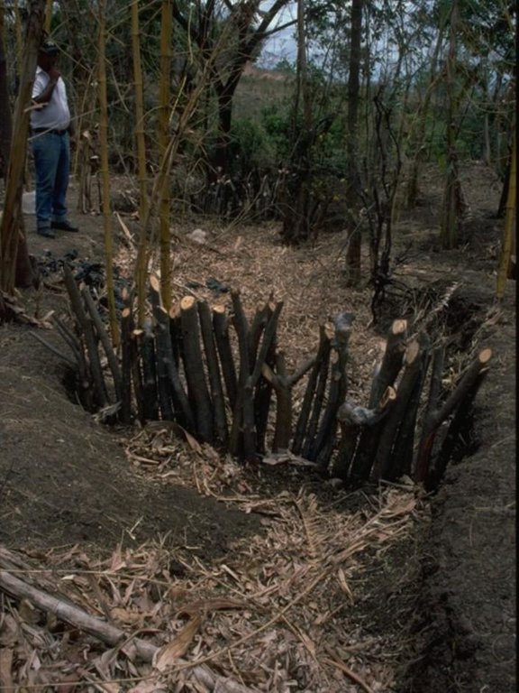
Gully rehabilitation by check dams made of stem cuttings from trees. These living barriers retard concentrated runoff and fill up the gullies gradually with sediment.
2.2 Description détaillée de la Technologie
Description:
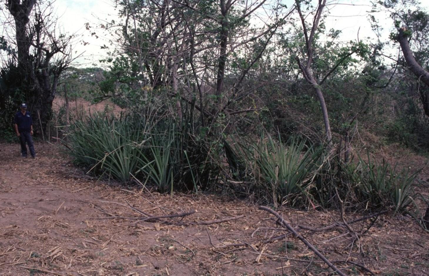
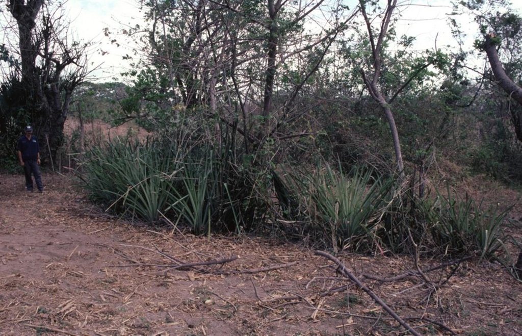
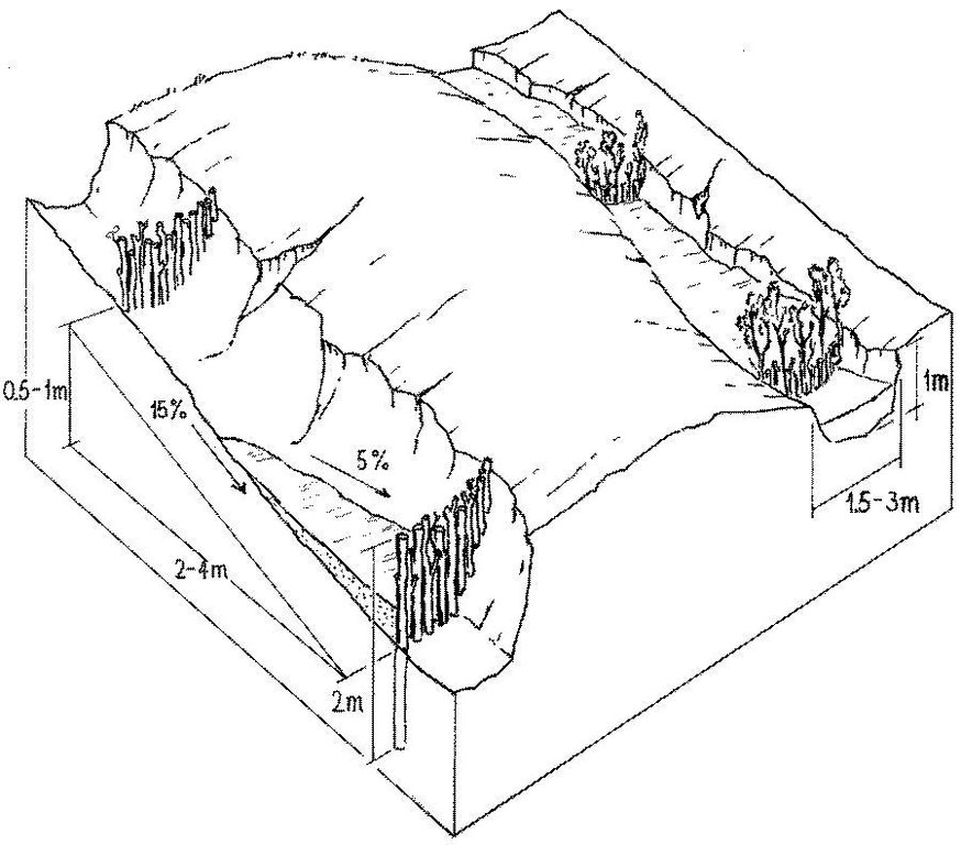
Stem cuttings from specific tree species have the ability to strike roots and continue growing after being planted into the earth. In this case study local species have been used to create check dams in gullies: these include jinocuebo (Simaroubaceaes bombacaceaes, and also jobo, tiguilote, pochote from the same family). Other suitable species are jocote (Spondias purpurea) and madero negro (Gliricidia sepium). As an option the pinapple-like piñuela (Bromelia pinguin) can be planted in association with the stem cuttings to further reinforce the system. Tree stems are cut into pieces 5-15 cm thick and 1.5-2.5 m long, depending on the depth of the gully. The cuttings are planted to half of their length, and formed into semi-circular barriers (see diagram). The dams retard runoff and thus retain eroded sediment. Spacing between dams depends on the gradient of the gully bed. For example on a 15% slope it is recommended to build a dam every 4 meters (see spacing under establishment activities). Between dams, the gully gradually fills up with eroded soil, the speed of the runoff is further reduced and agricultural land that has been divided by the gully is reconnected. Large and deep gullies may change over time into a sequence of narrow fertile terraces where crops can be grown.
However, the check dams should be seen as part of an integrated catchment management and protection plan, and thus be supported by other SWC measures on the lateral slopes, such as retention ditches and/or live barriers laid out along the contour. Erosion and runoff control on the sides of each gully is an essential part of the rehabilitation process. These check dams of rooted poles are more robust and durable than stone dams in soils of sandy/ loamy texture. On moderate and steep slopes a combination of stem cutting and stone dams is recommended.
After two to three years the barriers should be pruned - yielding wood and fodder. Dead poles should be replaced and the dam widened if necessary.
In this case study the dams are constructed in a semi-arid region with erratic rainfall where gullies are common on agricultural land, be it cropland or grazing land. The land users are mainly peasant farmers, growing crops for subsistence on smallholdings, and living in very poor conditions. This system of gully rehabilitation is promoted by an NGO entitled ‘Asociación Tierra y Vida’ through farmerto-farmer (campesino a campesino) extension.
2.3 Photos de la Technologie
2.5 Pays/ région/ lieux où la Technologie a été appliquée et qui sont couverts par cette évaluation
Pays:
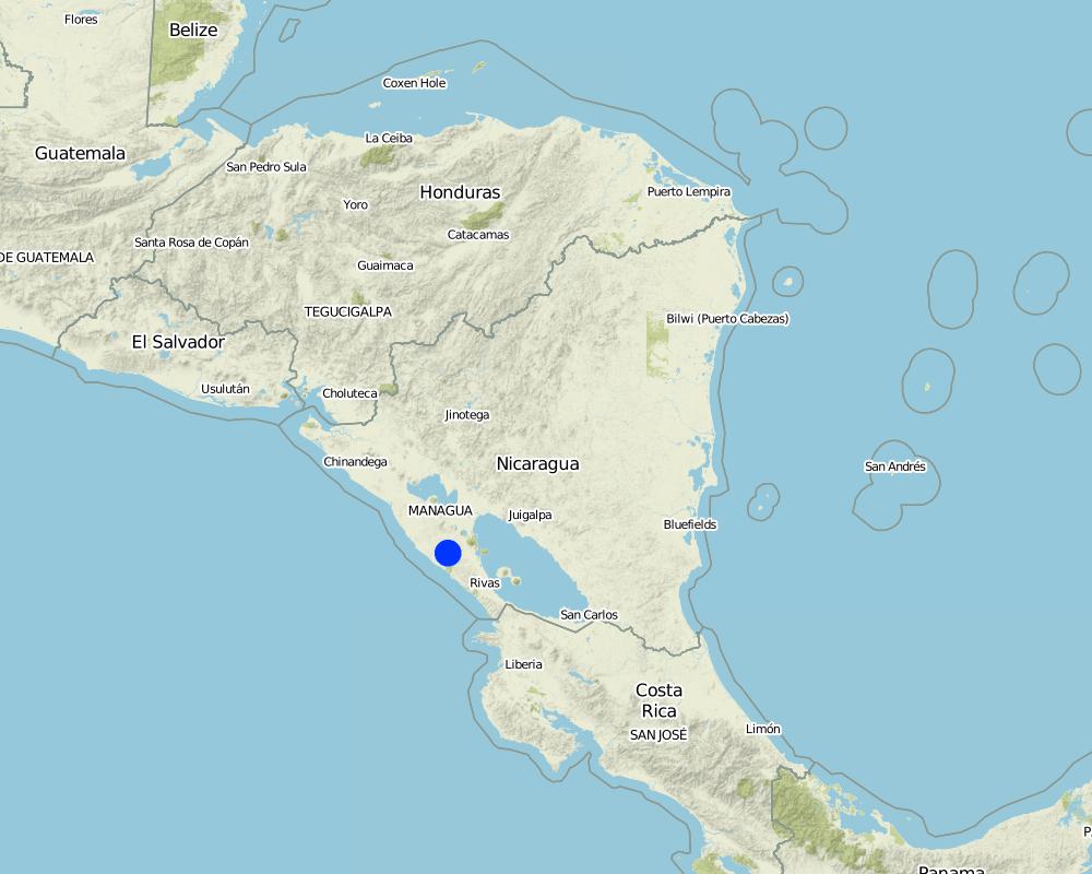
Nicaragua
Région/ Etat/ Province:
Santa Teresa, Paso de la Solera
Autres spécifications du lieu:
Carazo, Nicaragua
Commentaires:
Total area covered by the SLM Technology is 5 km2.
Map
×2.6 Date de mise en œuvre de la Technologie
Si l'année précise est inconnue, indiquez la date approximative: :
- il y a moins de 10 ans (récemment)
2.7 Introduction de la Technologie
Spécifiez comment la Technologie a été introduite: :
- par le biais de projets/ d'interventions extérieures
3. Classification de la Technologie de GDT
3.1 Principal(aux) objectif(s) de la Technologie
- réduire, prévenir, restaurer les terres dégradées
- réduire les risques de catastrophes
3.2 Type(s) actuel(s) d'utilisation des terres, là où la Technologie est appliquée

Terres cultivées
- Cultures annuelles
Précisez:
Longest growing period in days: 100, Longest growing period from month to month: May to August; Second longest growing period in days: 90, Second longest growing period from month to month: September to November

Pâturages
Commentaires:
Major land use problems (compiler’s opinion): There is a range of factors that limit agricultural production in the area: soil degradation, extensive gully formation on crop land, low soil fertility, lack of inputs for crop production, erratic precipitation. Also, lack of interest/knowledge and lack of resources hinder the implementation of SWC measures.
3.4 Approvisionnement en eau
Approvisionnement en eau des terres sur lesquelles est appliquée la Technologie:
- pluvial
3.5 Groupe de GDT auquel appartient la Technologie
- mesures en travers de la pente
3.6 Mesures de GDT constituant la Technologie

pratiques végétales
- V5: Autres

structures physiques
- S4: Fossés isohypses, trous
- S5: Barrages/retenues, micro-bassins, étangs
Commentaires:
Specification of other vegetative measures: stem cuttings; live barriers along contour (supp.)
Specification of other structural measures: check dams; retention ditches
3.7 Principaux types de dégradation des terres traités par la Technologie

érosion hydrique des sols
- Wg: ravinement/ érosion en ravines
3.8 Prévention, réduction de la dégradation ou réhabilitation des terres dégradées
Spécifiez l'objectif de la Technologie au regard de la dégradation des terres:
- restaurer/ réhabiliter des terres sévèrement dégradées
4. Spécifications techniques, activités, intrants et coûts de mise en œuvre
4.1 Dessin technique de la Technologie
Spécifications techniques (associées au dessin technique):
Stem cuttings planted in gullies to form living check dams: recently planted (left) and cuttings that have begun to take root and sprout, resulting in the gully becoming filled with trapped sediment (right).
Technical knowledge required for field staff / advisors: low
Technical knowledge required for land users: moderate
Main technical functions: control of concentrated runoff: retain / trap, levelling of land
Secondary technical functions: reduction of slope angle, reduction of slope length
Construction material (wood): jinocuebo (Simaroubaceaes bombacaceaes, and also jobo, tiguilote, pochote from the same family), j
Slope (which determines the spacing indicated above): 15%
Auteur:
Mats Gurtner
4.3 Activités de mise en place/ d'établissement
| Activité | Calendrier des activités (saisonnier) | |
|---|---|---|
| 1. | Calculate and mark spacing between structures. | efore rainy season (April/May) |
| 2. | Cut poles out of selected local trees (diameter: 5–15 cm,length: 1.5–2.5 m depending on gully depth). | before rainy season (April/May) |
| 3. | Dig small semi-circular ditches at the gully bottom (the depth of theditch is half the length of the cuttings). | before rainy season (April/May) |
| 4. | Plant the cuttings vertically into the ditch; put the thicker cuttingsin the middle of the gully where runoff velocity is higher. | efore rainy season (April/May) |
| 5. | Fill ditch with excavated earth to fix the cuttings. | before rainy season (April/May) |
| 6. | Water to encourage rooting. | before rainy season (April/May) |
4.4 Coûts et intrants nécessaires à la mise en place
| Spécifiez les intrants | Unité | Quantité | Coûts par unité | Coût total par intrant | % des coût supporté par les exploitants des terres | |
|---|---|---|---|---|---|---|
| Main d'œuvre | labour | ha | 1,0 | 100,0 | 100,0 | 100,0 |
| Equipements | tools | ha | 1,0 | 20,0 | 20,0 | |
| Equipements | wheelbarrow | ha | 1,0 | 10,0 | 10,0 | 100,0 |
| Matériaux de construction | wood | ha | 1,0 | 60,0 | 60,0 | 100,0 |
| Coût total de mise en place de la Technologie | 190,0 | |||||
| Coût total de mise en place de la Technologie en dollars américains (USD) | 190,0 | |||||
Commentaires:
Duration of establishment phase: 2 month(s)
4.5 Activités d'entretien/ récurrentes
| Activité | Calendrier/ fréquence | |
|---|---|---|
| 1. | Biotrampas: pruning the trees | every three years. |
| 2. | Cut-off drains: clearing of sediment, cutting bushes and grasses. | |
| 3. | Stone check dams: pruning trees and bushes every three years. After fullsedimentation, the dam may be increased in height. | |
| 4. | Wooden check dams: pruning trees and bushes | every three years. |
4.6 Coûts et intrants nécessaires aux activités d'entretien/ récurrentes (par an)
| Spécifiez les intrants | Unité | Quantité | Coûts par unité | Coût total par intrant | % des coût supporté par les exploitants des terres | |
|---|---|---|---|---|---|---|
| Main d'œuvre | labour | ha | 1,0 | 30,0 | 30,0 | 100,0 |
| Matériaux de construction | wood | ha | 1,0 | 5,0 | 5,0 | 100,0 |
| Coût total d'entretien de la Technologie | 35,0 | |||||
| Coût total d'entretien de la Technologie en dollars américains (USD) | 35,0 | |||||
Commentaires:
Costs are calculated for a 100 m long, 2 m wide and 1 m deep gully with check dams every 4 m, on the basis of one gully per hectare.
4.7 Facteurs les plus importants affectant les coûts
Décrivez les facteurs les plus importants affectant les coûts :
The wood (for poles) belongs to the land users themselves, thus the ‘cost’ does not involve purchase.
5. Environnement naturel et humain
5.1 Climat
Précipitations annuelles
- < 250 mm
- 251-500 mm
- 501-750 mm
- 751-1000 mm
- 1001-1500 mm
- 1501-2000 mm
- 2001-3000 mm
- 3001-4000 mm
- > 4000 mm
Zone agro-climatique
- semi-aride
5.2 Topographie
Pentes moyennes:
- plat (0-2 %)
- faible (3-5%)
- modéré (6-10%)
- onduleux (11-15%)
- vallonné (16-30%)
- raide (31-60%)
- très raide (>60%)
Reliefs:
- plateaux/ plaines
- crêtes
- flancs/ pentes de montagne
- flancs/ pentes de colline
- piémonts/ glacis (bas de pente)
- fonds de vallée/bas-fonds
Zones altitudinales:
- 0-100 m
- 101-500 m
- 501-1000 m
- 1001-1500 m
- 1501-2000 m
- 2001-2500 m
- 2501-3000 m
- 3001-4000 m
- > 4000 m
5.3 Sols
Profondeur moyenne du sol:
- très superficiel (0-20 cm)
- superficiel (21-50 cm)
- modérément profond (51-80 cm)
- profond (81-120 cm)
- très profond (>120 cm)
Texture du sol (de la couche arable):
- moyen (limoneux)
- fin/ lourd (argile)
Matière organique de la couche arable:
- faible (<1%)
5.6 Caractéristiques des exploitants des terres appliquant la Technologie
Orientation du système de production:
- subsistance (auto-approvisionnement)
- exploitation mixte (de subsistance/ commerciale)
Revenus hors exploitation:
- 10-50% de tous les revenus
Individus ou groupes:
- individu/ ménage
Indiquez toute autre caractéristique pertinente des exploitants des terres:
Off-farm income specification: temporary or permanent migration, particularly young people
5.7 Superficie moyenne des terres utilisées par les exploitants des terres appliquant la Technologie
- < 0,5 ha
- 0,5-1 ha
- 1-2 ha
- 2-5 ha
- 5-15 ha
- 15-50 ha
- 50-100 ha
- 100-500 ha
- 500-1 000 ha
- 1 000-10 000 ha
- > 10 000 ha
Cette superficie est-elle considérée comme de petite, moyenne ou grande dimension (en se référant au contexte local)?
- petite dimension
5.8 Propriété foncière, droits d’utilisation des terres et de l'eau
Propriété foncière:
- individu, sans titre de propriété
- individu, avec titre de propriété
Droits d’utilisation des terres:
- loué
- individuel
6. Impacts et conclusions
6.1 Impacts sur site que la Technologie a montrés
Impacts socio-économiques
Production
production agricole
Commentaires/ spécifiez:
where gullies planted
production fourragère
Commentaires/ spécifiez:
eg madero negro=Gliricidium sepium
production de bois
Commentaires/ spécifiez:
medium term
Revenus et coûts
revenus agricoles
charge de travail
Commentaires/ spécifiez:
during establishment phase
Impacts socioculturels
institutions communautaires
apaisement des conflits
improves relationships between land users
Impacts écologiques
Sols
humidité du sol
perte en sol
cycle/ recharge des éléments nutritifs
6.2 Impacts hors site que la Technologie a montrés
inondations en aval
envasement en aval
pollution des rivières/ nappes phréatiques
6.4 Analyse coûts-bénéfices
Quels sont les bénéfices comparativement aux coûts de mise en place (du point de vue des exploitants des terres)?
Rentabilité à court terme:
négative
Rentabilité à long terme:
positive
Quels sont les bénéfices comparativement aux coûts d'entretien récurrents (du point de vue des exploitants des terres)?
Rentabilité à court terme:
neutre / équilibrée
Rentabilité à long terme:
très positive
6.5 Adoption de la Technologie
- > 50%
Commentaires:
66% of land user families have adopted the Technology with external material support
30% of all farmers approached by the project (about 400 out of 1,200 land users) have built these check dams. Seeds, tools and credits were provided as incentives; the reasons for implementation included both the attraction of the incentives and perceived ecological benefits in terms of rehabilitation of degraded areas.
34% of land user families have adopted the Technology without any external material support
There is a strong trend towards spontaneous adoption of the Technology
6.7 Points forts/ avantages/ possibilités de la Technologie
| Points forts/ avantages/ possibilités du point de vue du compilateur ou d'une autre personne ressource clé |
|---|
| Facilitated land management: area is no longer divided by gullies |
| Retards runoff speed: decreases erosion |
| Accumulation of fertile earth above the check dams, possibility of growing crops on ‘terraces’ between the structures |
| Increased soil moisture |
6.8 Faiblesses/ inconvénients/ risques de la Technologie et moyens de les surmonter
| Faiblesses/ inconvénients/ risques du point de vue du compilateur ou d'une autre personne ressource clé | Comment peuvent-ils être surmontés? |
|---|---|
| The check dams used alone as SWC measure may not be adequate to withstand concentrated runoff | It is important to combine this technology with other SWC practices (e.g. retention ditches on slopes at both sides of gully, live fences, etc). |
| Only likely to be applied where land use rights are guaranteed. | |
| Labour intensive. |
7. Références et liens
7.1 Méthodes/ sources d'information
- visites de terrain, enquêtes sur le terrain
- interviews/entretiens avec les exploitants des terres
Quand les données ont-elles été compilées (sur le terrain)?
01/02/2004
7.2 Références des publications disponibles
Titre, auteur, année, ISBN:
Gurdiel G . La construcción de diques. Tierra Fresca, Simas-Enlace, Managua. 1993.
Titre, auteur, année, ISBN:
Guía Técnica de Conservación de Suelos y Agua. PASOLAC, Managua. 2000.
Titre, auteur, année, ISBN:
LUPE . Manual Práctico de Manejo de Suelos en Laderas. Secretaría de Recursos Naturales, Tegucigalpa, Honduras. 1994.
Liens et modules
Développer tout Réduire toutLiens
Aucun lien
Modules
Aucun module trouvé


