Grassing of Recharge Areas [République tchèque]
- Création :
- Mise à jour :
- Compilateur : Antonín Zajíček
- Rédacteur : –
- Examinateurs : William Critchley, Rima Mekdaschi Studer
Zatravnění zdrojové oblasti
technologies_5934 - République tchèque
Voir les sections
Développer tout Réduire tout1. Informations générales
1.2 Coordonnées des personnes-ressources et des institutions impliquées dans l'évaluation et la documentation de la Technologie
exploitant des terres:
Nom du projet qui a facilité la documentation/ l'évaluation de la Technologie (si pertinent)
OPtimal strategies to retAIN and re-use water and nutrients in small agricultural catchments across different soil-climatic regions in Europe (OPTAIN)Nom du projet qui a facilité la documentation/ l'évaluation de la Technologie (si pertinent)
New approaches to the revitalization of main drainage facilities in relation to drainage systems in terms of water retention in the landscape (TH02030397)Nom du projet qui a facilité la documentation/ l'évaluation de la Technologie (si pertinent)
Approaches for design and realization of complex effective measures for tile drained agricultural catchments by land consolidations (QK21010341)Nom du ou des institutions qui ont facilité la documentation/ l'évaluation de la Technologie (si pertinent)
Research Institute for Soil and Water Conservation (VUMOP) - République tchèque1.3 Conditions relatives à l'utilisation par WOCAT des données documentées
Le compilateur et la(les) personne(s) ressource(s) acceptent les conditions relatives à l'utilisation par WOCAT des données documentées:
Oui
1.4 Déclaration sur la durabilité de la Technologie décrite
Est-ce que la Technologie décrite ici pose problème par rapport à la dégradation des terres, de telle sorte qu'elle ne peut pas être déclarée comme étant une technologie de gestion durable des terres?
Non
1.5 Référence au(x) Questionnaires sur les Approches de GDT (documentées au moyen de WOCAT)
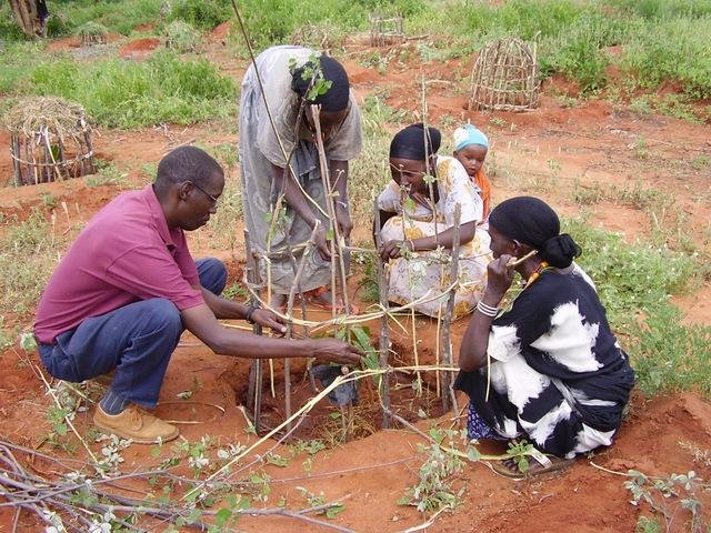
Approche par « bassin versant» [Kenya]
L’approche par « bassin versant » soutient les systèmes de gestion durable des terres par la conservation de zones définies (appelées « micro-environnements »), grâce à la participation active des communautés qui y vivent.
- Compilateur : James Gatero Njuki
2. Description de la Technologie de GDT
2.1 Courte description de la Technologie
Définition de la Technologie:
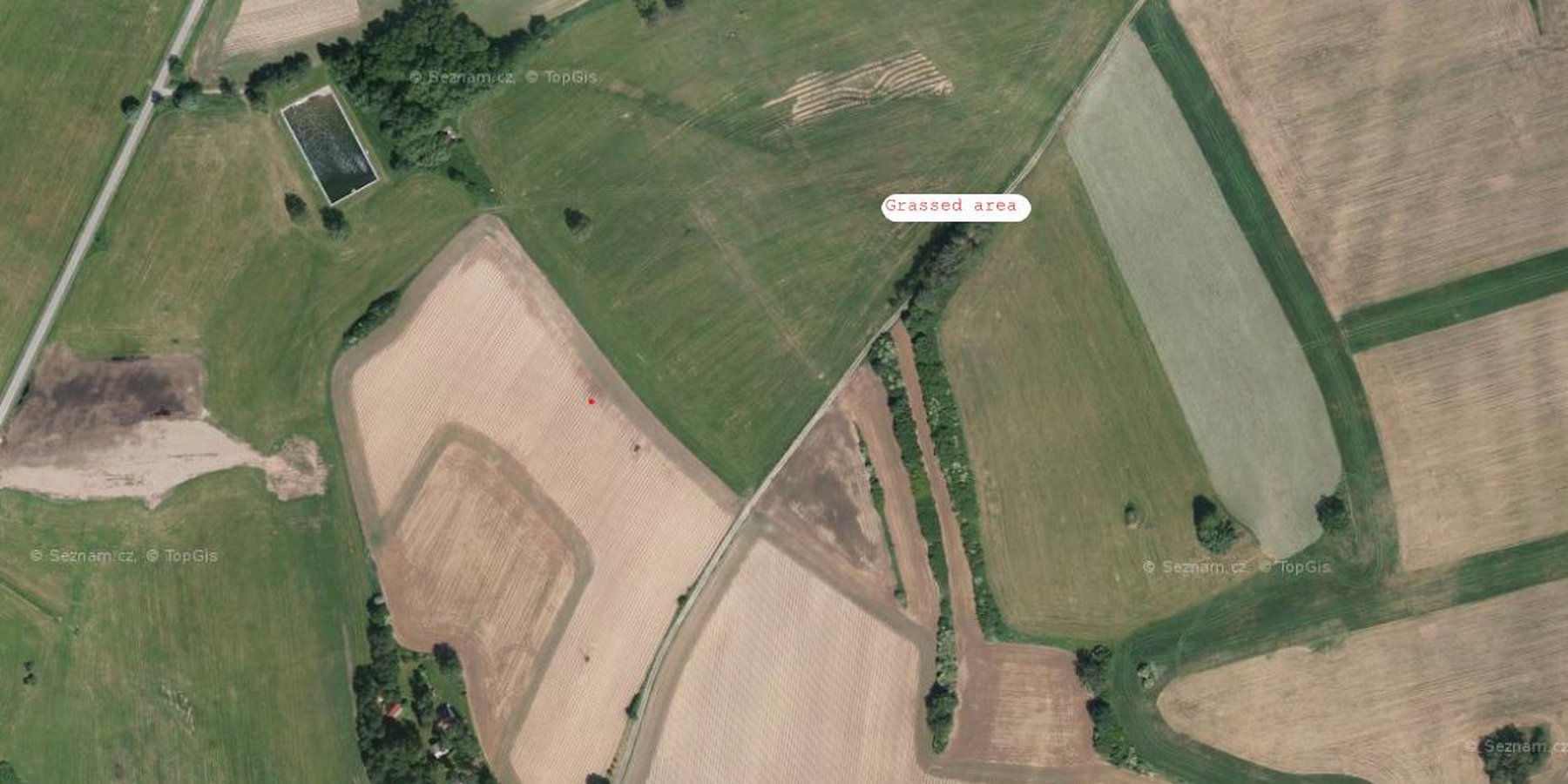
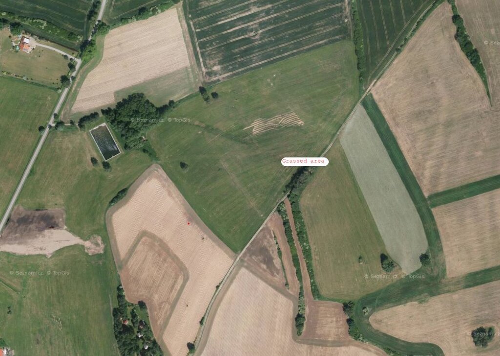
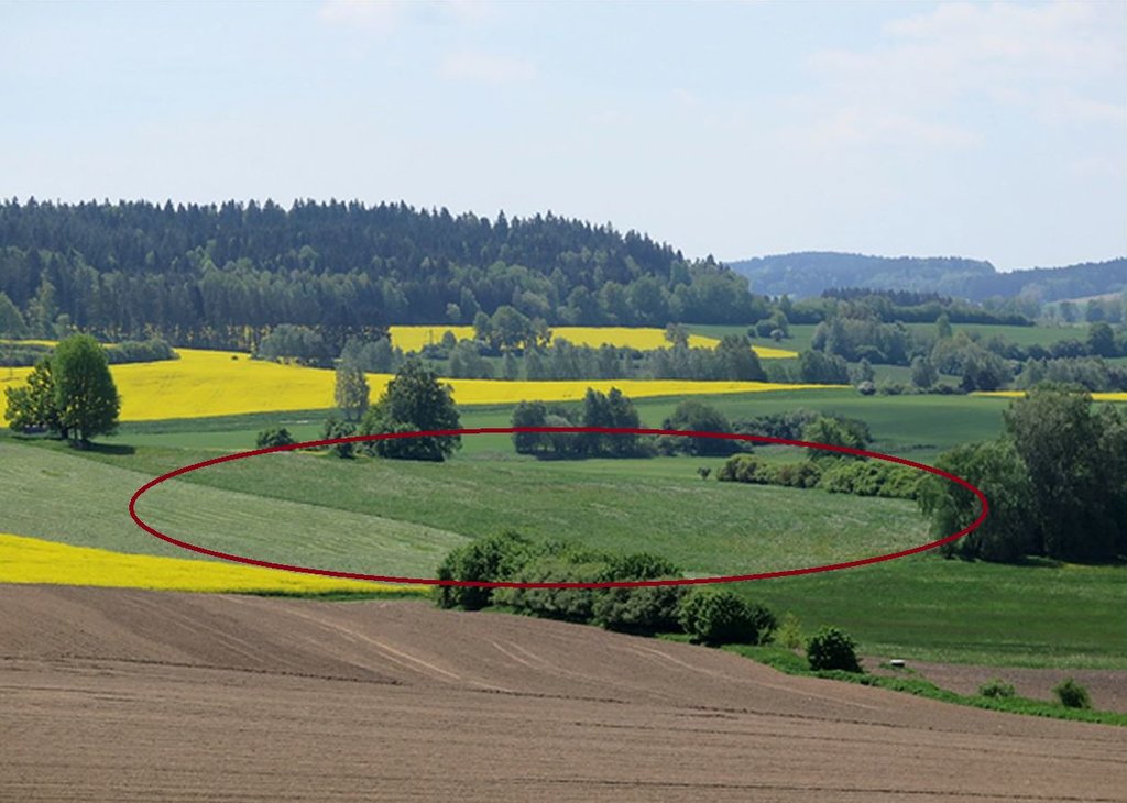
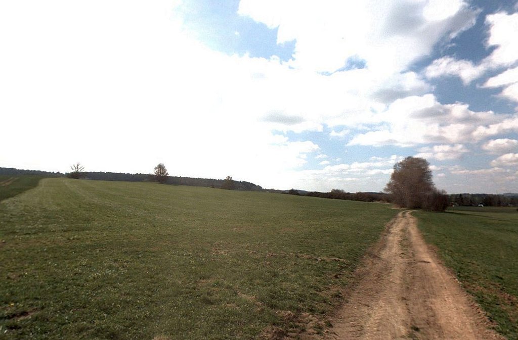
Grassing recharge zones of agricultural drainage systems significantly improves the quality of drainage water. It can be a useful, effective and relatively cheap measure for improvement of shallow groundwater quality.
2.2 Description détaillée de la Technologie
Description:
Grassing of recharge zones of agricultural drainage systems significantly improves the quality of drainage water: it can be a useful, effective and relatively cheap measure. Grassing is an effective preventative strategy to prevent nitrogen pollution. Reduction of nitrate pollution by grassland occurs mainly through grassland’s ability to absorb and use large amounts of nitrogen compared with field crops, and this capacity remains effective for a longer period of the year. Permanent grasslands cover the soil year-round and have a large stock of active subsurface biomass in the root system, which can immobilize a significant amount of soil nitrogen. Moreover, grassland has a greater amount of active soil microbes than under field crops (Griffiths et al. 2008). Besides nitrogen remedial ability, grasslands offer other regulation and supporting ecosystem service (ES) benefits (Hönigová et al., 2012) – for example carbon sequestration, erosion prevention and water flow regulation. On the other hand, used too widely, grassland can be seen as a negative ES provider, in the sense that it reduces the area of crop production (Hauck et al., 2014). That is why it is recommended to limit the use of grassing so that it acts within relatively small areas focused on the catchment area. The effectiveness of grassing has been evaluated statistically, when Fučík et al. (2008) reported that an increase in grassed area of 10% can decrease the C90 (90% probability of non-exceedance) nitrate value in the waters of streams (small water courses) by 6.4 mg/l.
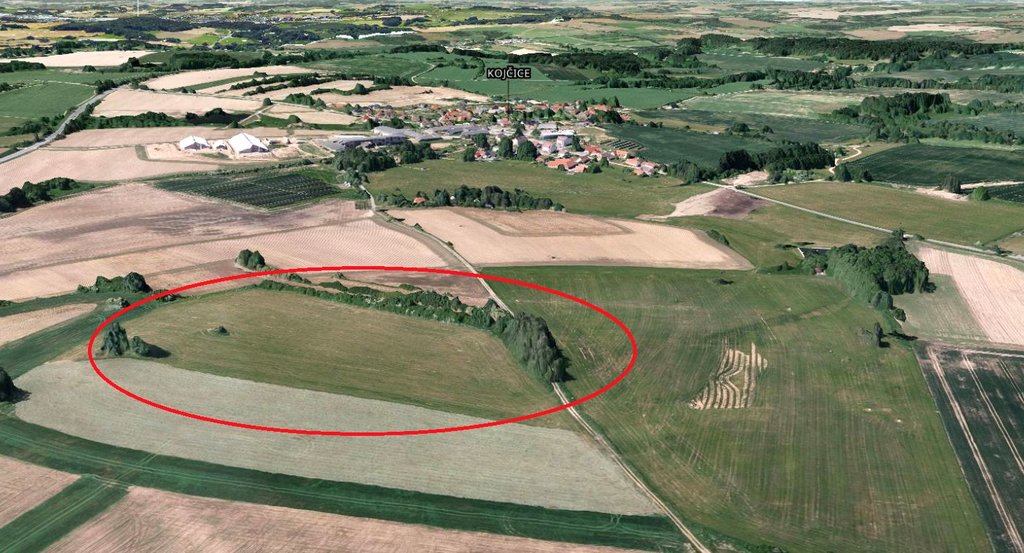
2.3 Photos de la Technologie
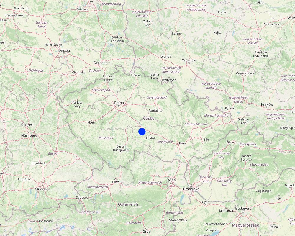
2.5 Pays/ région/ lieux où la Technologie a été appliquée et qui sont couverts par cette évaluation
Pays:
République tchèque
Région/ Etat/ Province:
Bohemian - Moravian Highlands
Autres spécifications du lieu:
Kojčice
Spécifiez la diffusion de la Technologie:
- répartie uniformément sur une zone
Si la Technologie est uniformément répartie sur une zone, précisez la superficie couverte (en km2):
0,05
S'il n'existe pas d'informations exactes sur la superficie, indiquez les limites approximatives de la zone couverte:
- < 0,1 km2 (10 ha)
Est-ce que les sites dans lesquels la Technologie est appliquée sont situés dans des zones protégées en permanence?
Non
Map
×2.6 Date de mise en œuvre de la Technologie
Indiquez l'année de mise en œuvre:
2006
2.7 Introduction de la Technologie
Spécifiez comment la Technologie a été introduite: :
- au cours d'expérimentations / de recherches
- par le biais de projets/ d'interventions extérieures
Commentaires (type de projet, etc.) :
Linking of the land use in the source areas to drainage water quality has been tested in several research projects since the first decade of the 21st Century. The methodology for defining source areas has been developed by the Research Institute for Soil and Water Conservation for a long time. Nowadays this measure has become part of the Czech Ministry of Agriculture subsidy and farmers can use it themselves.
3. Classification de la Technologie de GDT
3.1 Principal(aux) objectif(s) de la Technologie
- réduire, prévenir, restaurer les terres dégradées
- protéger un bassin versant/ des zones situées en aval - en combinaison avec d'autres technologies
- s'adapter au changement et aux extrêmes climatiques et à leurs impacts
3.2 Type(s) actuel(s) d'utilisation des terres, là où la Technologie est appliquée
Les divers types d'utilisation des terres au sein du même unité de terrain: :
Non

Terres cultivées
- Cultures pérennes (non ligneuses)
Cultures pérennes (non ligneuses) - Précisez les cultures:
- cultures fourragères - graminées
Nombre de période de croissance par an: :
- 1
Est-ce que les cultures intercalaires sont pratiquées?
Non
Est-ce que la rotation des cultures est appliquée?
Oui
3.3 Est-ce que l’utilisation des terres a changé en raison de la mise en œuvre de la Technologie ?
Est-ce que l’utilisation des terres a changé en raison de la mise en œuvre de la Technologie ?
- Oui (Veuillez remplir les questions ci-après au regard de l’utilisation des terres avant la mise en œuvre de la Technologie)
Les divers types d'utilisation des terres au sein du même unité de terrain: :
Non

Terres cultivées
- Cultures annuelles
Cultures annuelles - Précisez les cultures:
- céréales - orge
- céréales - maïs
- céréales - blé d'hiver
- cultures oléagineuses - tournesol, colza, autres
- plantes à racines et à tubercules - pommes de terre
Est-ce que les cultures intercalaires sont pratiquées?
Oui
Si oui, précisez quelles cultures sont produites en culture intercalaire:
In some seasons, spring cereal mix, legume-cereal mix or undersown clover is used as an intercrop
Est-ce que la rotation des cultures est appliquée?
Oui
Si oui, veuillez préciser:
five-year or seven-year crop rotation with winter cereals, spring cereals, potatoes, red clover, oil seed rape and maize
3.4 Approvisionnement en eau
Approvisionnement en eau des terres sur lesquelles est appliquée la Technologie:
- pluvial
3.5 Groupe de GDT auquel appartient la Technologie
- Amélioration de la couverture végétale/ du sol
3.6 Mesures de GDT constituant la Technologie

pratiques végétales
- V2: Herbes et plantes herbacées pérennes

modes de gestion
- M1: Changement du type d’utilisation des terres
3.7 Principaux types de dégradation des terres traités par la Technologie

érosion hydrique des sols
- Wt: perte de la couche superficielle des sols (couche arable)/ érosion de surface

dégradation hydrique
- Hp: baisse de la qualité des eaux de surface
- Hq: baisse de la qualité des eaux souterraines
3.8 Prévention, réduction de la dégradation ou réhabilitation des terres dégradées
Spécifiez l'objectif de la Technologie au regard de la dégradation des terres:
- réduire la dégradation des terres
4. Spécifications techniques, activités, intrants et coûts de mise en œuvre
4.1 Dessin technique de la Technologie
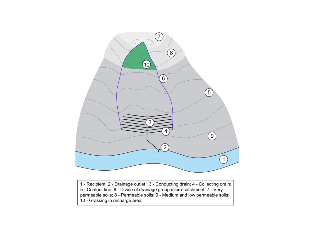
Spécifications techniques (associées au dessin technique):
The figure shows a model example of a drainage structure built at the bottom of a slope (3, 4). In this case, a substantial portion of the drainage runoff consists of water that infiltrates in areas with shallow soils that are highly permeable to water, nutrients, and other pollutants (7 and 8). In the case of drainage constructed in this way, the entire micro-catchment of the drainage group must be taken into account in terms of runoff generation and drainage water quality (6). The area where the microwatershed of a drainage group intersects with an area of shallow permeable soils is the source area for drainage runoff and it is to these locations that the grassed area should be directed (10).
Auteur:
Antonín Zajíček and Tomáš Hejduk
Date:
12/10/2022
4.2 Informations générales sur le calcul des intrants et des coûts
Spécifiez la manière dont les coûts et les intrants ont été calculés:
- par superficie de la Technologie
Indiquez la taille et l'unité de surface:
3.5 hectares
autre/ monnaie nationale (précisez):
EUR
Indiquez le taux de change des USD en devise locale, le cas échéant (p.ex. 1 USD = 79.9 réal brésilien): 1 USD = :
0,92
Indiquez le coût salarial moyen de la main d'œuvre par jour:
60
4.3 Activités de mise en place/ d'établissement
| Activité | Calendrier des activités (saisonnier) | |
|---|---|---|
| 1. | Vulnerable area delimitation | one year before establishment |
| 2. | Obtaining the consent of the owners and users of the affected land | one year before establishment |
| 3. | Grass sowing | after harvest of previous crops |
4.4 Coûts et intrants nécessaires à la mise en place
| Spécifiez les intrants | Unité | Quantité | Coûts par unité | Coût total par intrant | % des coût supporté par les exploitants des terres | |
|---|---|---|---|---|---|---|
| Main d'œuvre | Work for delimitation | person - days | 3,0 | 130,0 | 390,0 | |
| Main d'œuvre | Project and administration | person - days | 4,0 | 150,0 | 600,0 | 90,0 |
| Main d'œuvre | Manual work on the field | ha | 5,0 | 30,0 | 150,0 | 90,0 |
| Equipements | Machinery - sowing machine, chopper | ha | 5,0 | 200,0 | 1000,0 | 89,0 |
| Equipements | Fuel | ha | 5,0 | 60,0 | 300,0 | 90,0 |
| Matériel végétal | Seeds | ha | 5,0 | 40,0 | 200,0 | 90,0 |
| Engrais et biocides | Feritilizers (mostly urea and pig slurry digestate) | ha | 5,0 | 30,0 | 150,0 | 90,0 |
| Engrais et biocides | Biocides (only the year of establishment) | ha | 5,0 | 60,0 | 300,0 | 90,0 |
| Autre | Fixed costs | ha | 5,0 | 180,0 | 900,0 | 90,0 |
| Coût total de mise en place de la Technologie | 3990,0 | |||||
| Coût total de mise en place de la Technologie en dollars américains (USD) | 4336,96 | |||||
Si le coût n'est pas pris en charge à 100% par l'exploitant des terres, indiquez qui a financé le coût restant:
Czech Ministry of Agriculture
Commentaires:
The amount of agricultural subsidies in the Czech Republic is currently (2024) variable depending on the size of the farm. For a farm with an average size of 1500 ha, the subsidy is approximately EUR 160. For the conversion of arable land to permanent grassland in vulnerable areas, an additional subsidy of approximately EUR 310 per hectare is available from the Ministry of Agriculture.
4.5 Activités d'entretien/ récurrentes
| Activité | Calendrier/ fréquence | |
|---|---|---|
| 1. | re-sowing | before vegetation season if needed |
| 2. | harrowing | if needed once per season after re-sowing |
| 3. | fertilising | once or twice per season |
| 4. | harvesting | twice or three times per season |
4.6 Coûts et intrants nécessaires aux activités d'entretien/ récurrentes (par an)
| Spécifiez les intrants | Unité | Quantité | Coûts par unité | Coût total par intrant | % des coût supporté par les exploitants des terres | |
|---|---|---|---|---|---|---|
| Main d'œuvre | Manual work on the field | ha | 5,0 | 25,0 | 125,0 | 85,0 |
| Equipements | Machinery - sowing machine, chopper, tractor | ha | 5,0 | 200,0 | 1000,0 | 85,0 |
| Equipements | Fuel | ha | 5,0 | 60,0 | 300,0 | 85,0 |
| Matériel végétal | seeds | ha | 5,0 | 20,0 | 100,0 | 85,0 |
| Engrais et biocides | Feritilizers (mostly urea and pig slurry digestate) | ha | 5,0 | 25,0 | 125,0 | 85,0 |
| Engrais et biocides | Biocides (when needed) | ha | 5,0 | 30,0 | 150,0 | 85,0 |
| Autre | Fixed costs | ha | 5,0 | 150,0 | 750,0 | 85,0 |
| Coût total d'entretien de la Technologie | 2550,0 | |||||
| Coût total d'entretien de la Technologie en dollars américains (USD) | 2771,74 | |||||
Si le coût n'est pas pris en charge à 100% par l'exploitant des terres, indiquez qui a financé le coût restant:
Czech Ministry of Agriculture
4.7 Facteurs les plus importants affectant les coûts
Décrivez les facteurs les plus importants affectant les coûts :
Fuel prices, level of subsidies
5. Environnement naturel et humain
5.1 Climat
Précipitations annuelles
- < 250 mm
- 251-500 mm
- 501-750 mm
- 751-1000 mm
- 1001-1500 mm
- 1501-2000 mm
- 2001-3000 mm
- 3001-4000 mm
- > 4000 mm
Spécifiez la pluviométrie moyenne annuelle (si connue), en mm:
666,00
Zone agro-climatique
- subhumide
5.2 Topographie
Pentes moyennes:
- plat (0-2 %)
- faible (3-5%)
- modéré (6-10%)
- onduleux (11-15%)
- vallonné (16-30%)
- raide (31-60%)
- très raide (>60%)
Reliefs:
- plateaux/ plaines
- crêtes
- flancs/ pentes de montagne
- flancs/ pentes de colline
- piémonts/ glacis (bas de pente)
- fonds de vallée/bas-fonds
Zones altitudinales:
- 0-100 m
- 101-500 m
- 501-1000 m
- 1001-1500 m
- 1501-2000 m
- 2001-2500 m
- 2501-3000 m
- 3001-4000 m
- > 4000 m
Indiquez si la Technologie est spécifiquement appliquée dans des:
- non pertinent
5.3 Sols
Profondeur moyenne du sol:
- très superficiel (0-20 cm)
- superficiel (21-50 cm)
- modérément profond (51-80 cm)
- profond (81-120 cm)
- très profond (>120 cm)
Texture du sol (de la couche arable):
- grossier/ léger (sablonneux)
Matière organique de la couche arable:
- moyen (1-3%)
Si disponible, joignez une description complète du sol ou précisez les informations disponibles, par ex., type de sol, pH/ acidité du sol, capacité d'échange cationique, azote, salinité, etc.
The substrate is formed by partially migmatized paragneiss in various degrees of degradation.
Quaternary sediments are represented by slope sands and loams reaching 1–2 m thickness. The representation of soils (according to the World Reference Base for Soil Resources
2006) is variable, with Gleyed Cambisols, Gleysols, and sporadically Histosols. In the recharge area, the soil cover is more homogenous, with prevailing Modal, Ranker and Arenic Cambisols.
5.4 Disponibilité et qualité de l'eau
Profondeur estimée de l’eau dans le sol:
< 5 m
Disponibilité de l’eau de surface:
moyenne
Qualité de l’eau (non traitée):
uniquement pour usage agricole (irrigation)
La qualité de l'eau fait référence à:
à la fois les eaux souterraines et de surface
La salinité de l'eau est-elle un problème? :
Non
La zone est-elle inondée?
Non
Commentaires et précisions supplémentaires sur la qualité et la quantité d'eau:
Water quality from agricultural drainage systems
(both tiles and ditches) has been discussed by the studies which draw attention to the reduced
quality of drainage waters caused by elevated concentrations of nutrients (N, P, C) and/or
pesticides.
5.5 Biodiversité
Diversité des espèces:
- moyenne
Diversité des habitats:
- moyenne
5.6 Caractéristiques des exploitants des terres appliquant la Technologie
Sédentaire ou nomade:
- Sédentaire
Orientation du système de production:
- commercial/ de marché
Revenus hors exploitation:
- moins de 10% de tous les revenus
Niveau relatif de richesse:
- moyen
Individus ou groupes:
- coopérative
Niveau de mécanisation:
- mécanisé/ motorisé
Genre:
- femmes
- hommes
Age des exploitants des terres:
- personnes d'âge moyen
5.7 Superficie moyenne des terres utilisées par les exploitants des terres appliquant la Technologie
- < 0,5 ha
- 0,5-1 ha
- 1-2 ha
- 2-5 ha
- 5-15 ha
- 15-50 ha
- 50-100 ha
- 100-500 ha
- 500-1 000 ha
- 1 000-10 000 ha
- > 10 000 ha
Cette superficie est-elle considérée comme de petite, moyenne ou grande dimension (en se référant au contexte local)?
- moyenne dimension
Commentaires:
The Czech Republic is characterised by a significant size of agricultural holdings. During the socialist era (1948-1989), large agricultural cooperatives were established. Today, most agricultural land is still farmed by similar enterprises, whether in the form of cooperatives, limited liability companies or joint stock companies.
5.8 Propriété foncière, droits d’utilisation des terres et de l'eau
Propriété foncière:
- entreprise
- individu, sans titre de propriété
Droits d’utilisation des terres:
- loué
- individuel
Droits d’utilisation de l’eau:
- accès libre (non organisé)
Est-ce que les droits d'utilisation des terres sont fondés sur un système juridique traditionnel?
Non
5.9 Accès aux services et aux infrastructures
santé:
- pauvre
- modéré
- bonne
éducation:
- pauvre
- modéré
- bonne
assistance technique:
- pauvre
- modéré
- bonne
emploi (par ex. hors exploitation):
- pauvre
- modéré
- bonne
marchés:
- pauvre
- modéré
- bonne
énergie:
- pauvre
- modéré
- bonne
routes et transports:
- pauvre
- modéré
- bonne
eau potable et assainissement:
- pauvre
- modéré
- bonne
services financiers:
- pauvre
- modéré
- bonne
6. Impacts et conclusions
6.1 Impacts sur site que la Technologie a montrés
Impacts socio-économiques
Production
production agricole
Commentaires/ spécifiez:
Farmers will lose land for growing commercially viable crops (cereals, potatoes, rape) and grass production (hay, haylage) will increase.
Impacts socioculturels
connaissances sur la GDT/ dégradation des terres
Commentaires/ spécifiez:
Permanent grassland in the recharge area will protect the shallow soils especially from accelerated erosion.
Impacts écologiques
Cycle de l'eau/ ruissellement
quantité d'eau
Commentaires/ spécifiez:
This measure will reduce the intensity of surface and subsurface runoff from the catchment.
qualité de l'eau
ruissellement de surface
Commentaires/ spécifiez:
Grassing will slowdwn the surface runoff especially during intensive rainfall-runoff events.
Sols
humidité du sol
Commentaires/ spécifiez:
Reducing surface runoff will promote infiltration of rainwater into the soil profile and increase soil moisture.
couverture du sol
Commentaires/ spécifiez:
Permanent grasslands cover the soil year round.
perte en sol
Commentaires/ spécifiez:
This measure prevents soil loss from the accelerated erosion.
matière organique du sol/ au dessous du sol C
Commentaires/ spécifiez:
Permanent grasslands have a big stock of active subsurface biomass in the root system, which can immobilize a significant amount of soil nitrogen. Moreover, it has bigger amount and increased activity of soil microbes supporting e.g. carbon sequestration.
Biodiversité: végétale, animale
Couverture végétale
Commentaires/ spécifiez:
Unlike arable land, permanent grassland provides full land cover even in the non-growing season.
diversité animale
Commentaires/ spécifiez:
Properly managed grasslans will increase biodiversity (compared to the arable lands), especially amount of insect.
6.2 Impacts hors site que la Technologie a montrés
pollution des rivières/ nappes phréatiques
Commentaires/ spécifiez:
In intensively drained catchments, drainage structures have a significant contribution to total runoff and water pollution.Grassing in recharge zone will significantly mitigate water pollution, especially nutrients and pesticides loads.
dommages sur les champs voisins
Commentaires/ spécifiez:
Decrease in rapid erosive runoff will reduce the risk of sediment input to lower lying lands.
dommages sur les infrastructures publiques/ privées
Commentaires/ spécifiez:
Decrease in rapid erosive runoff will reduce the risk of sediment input into the intravilane of lower lying villages or public roads.
6.3 Exposition et sensibilité de la Technologie aux changements progressifs et aux évènements extrêmes/catastrophes liés au climat (telles que perçues par les exploitants des terres)
Changements climatiques progressifs
Changements climatiques progressifs
| Saison | Augmentation ou diminution | Comment la Technologie fait-elle face à cela? | |
|---|---|---|---|
| précipitations saisonnières | été | augmente | bien |
Commentaires:
Gradual climatic has been causing changes in precipitation distribution in course of year. In winter, the period with snow cover shortens and in summer, precipitation often takes the form of rapid and intense episodes. Permanent grassland will mitigate these rainfall extremes by its ability to slow down both surface and subsurface runoff and to increase water retention in agricultural catchments.
6.4 Analyse coûts-bénéfices
Quels sont les bénéfices comparativement aux coûts de mise en place (du point de vue des exploitants des terres)?
Rentabilité à court terme:
légèrement négative
Rentabilité à long terme:
légèrement négative
Quels sont les bénéfices comparativement aux coûts d'entretien récurrents (du point de vue des exploitants des terres)?
Rentabilité à court terme:
neutre / équilibrée
Rentabilité à long terme:
neutre / équilibrée
Commentaires:
From an economic point of view, the increase in the area of grasslands will clearly reduce the turnover of the agricultural entity. The fall in costs and income will also lead to a reduction in profits, which is partly offset by higher subsidies for permanent grasslands. However, the increase in dependence on subsidies is dangerous in terms of the long-term stability of the farming entity, as the amount and focus of subsidies can change from year to year. It is also important to note that the production of grass biomass only make sense if the farmer also runs livestock production or a biogas plant, taking into account the amount of grass that the farmer is able to process.
6.5 Adoption de la Technologie
- cas isolés/ expérimentaux
De tous ceux qui ont adopté la Technologie, combien d'entre eux l'ont fait spontanément, à savoir sans recevoir aucune incitation matérielle, ou aucune rémunération? :
- 91-100%
6.6 Adaptation
La Technologie a-t-elle été récemment modifiée pour s'adapter à l'évolution des conditions?
Non
6.7 Points forts/ avantages/ possibilités de la Technologie
| Points forts/ avantages/ possibilités du point de vue de l'exploitant des terres |
|---|
| A relatively low-cost measure in terms of finance and agricultural management |
| Points forts/ avantages/ possibilités du point de vue du compilateur ou d'une autre personne ressource clé |
|---|
| grassing focused to the proper catchment area (recharge zone) can be a useful, effective and relatively cheap measure for improvement of shallow groundwater quality, or optionally the quality of local drinking water sources |
| stabilise of catchment area with shallow soils - can lead to decrease in soil erosion. |
6.8 Faiblesses/ inconvénients/ risques de la Technologie et moyens de les surmonter
| Faiblesses/ inconvénients/ risques du point de vue de l’exploitant des terres | Comment peuvent-ils être surmontés? |
|---|---|
| Increasing areas of grasslands would lead to decrease of landscape productive service, farm turnover and profit and the bigger dependence on subsidies. | The grassing should be applied in small, precisely defined parts of the catchment, which are real recharge (infiltration) areas. |
| Possible sudden change in the subsidy system | It is necessary to consider the non-productive functions of grasslands also as public service, taking into account the saves in water cleaning costs and the price of increased water retention |
| Excess amout of grass or hay, especially for farms without livestock production | Balanced share of grasslands and arablale lands in cultivated field blocks, support for livestock production |
| Faiblesses/ inconvénients/ risques du point de vue du compilateur ou d'une autre personne ressource clé | Comment peuvent-ils être surmontés? |
|---|---|
| An incorrectly defined source area will lead to ineffective measures | Careful preparation |
| Unwillingness of conservative companies and farmers to adopt this measure | Properly set up subsidy policy |
7. Références et liens
7.1 Méthodes/ sources d'information
- visites de terrain, enquêtes sur le terrain
The effectiveness of this measure was tested withim the long-term survey(2006-2016) at the pilot site of Dehtáře (Bohemian-Moravian Highlands, Czech Republic). During the research, drainage water quality indicators, meteorological and hydrological characteristics of the experimental site and agricultural management were monitored.
- interviews/entretiens avec les exploitants des terres
The research was primarily carried out in cooperation with one agricultural cooperative; the implementation of the measures is being carried out in discussions with more than thirty agricultural enterprises, mainly in the catchment area of the Švihov reservoir on Želivka - the largest potable water reservoir in the central Europe.
Quand les données ont-elles été compilées (sur le terrain)?
2016
7.2 Références des publications disponibles
Titre, auteur, année, ISBN:
Kvítek, T.; Zajíček, A.; Dostál, T.; Fučík, P.; Krása, J.; Bauer, M.; Jáchymová, B.; Kulhavý, Z.; Pavel, M. Slowing Down Quick Runoff—A New Approach for the Delineation and Assessment of Critical Points, Contributing Areas, and Proposals of Measures to Reduce Non-Point Water Pollution from Agricultural Land. Water 2023, 15, 1247.
Disponible à partir d'où? Coût?
https://doi.org/10.3390/w15061247
Titre, auteur, année, ISBN:
Zajíček, A., Hejduk, T., Sychra, L., Vybíral, T., Fučík, P. (2022): How to Select a Location and a Design of Measures on Land Drainage – A Case Study from the Czech Republic. Journal of Ecological Engineering 2022, 23(4), 43–57. ISSN 2299–8993.
Disponible à partir d'où? Coût?
https://doi.org/10.12911/22998993/146270
Titre, auteur, année, ISBN:
ZAJÍČEK, A., FUČÍK, P., DUFFKOVÁ, R., MAXOVÁ, J. 2018. How does targeted grassing of arable land influence drainage water quality and farm economic indicators? Int. J. Environ. Impacts, 1(3): 344–352.
Disponible à partir d'où? Coût?
DOI 10.2495/EI-V1-N3-344-352
Titre, auteur, année, ISBN:
Fučík P., Zajíček A., Kaplická M., Duffková R., Peterková J., Maxová J., Takáčová Š. 2017. Incorporating rainfall-runoff events into nitrate-nitrogen and phosphorus load assessments for small tile-drained catchments. Water, 9, 712; (ISSN Print:2575-1867 ISSN Online: 2575-1875)
Disponible à partir d'où? Coût?
doi:10.3390/w9090712
Titre, auteur, année, ISBN:
Janglová R., Kvítek T., Novák P. 2003. Soil infiltration capacity categorization based on geoinformatic processing of soil survey data. Soil and Water Scientific Studies, 2, 61–81.
7.3 Liens vers les informations pertinentes en ligne
Titre/ description:
ZAJÍČEK, A., SYCHRA, L., VYBÍRAL, T., HEJDUK, T., ČMELÍK, M., FUČÍK, P., KAPLICKÁ, M. 2021: Design of the Revitalization measures on the Main drainage facilities and hydrologically related Detailed drainage facilities (In Czech)
URL:
DOI: 10.13140/RG.2.2.34421.50403
7.4 Observations d'ordre général
Grassing focused on the catchment area (recharge zone) can be a useful, effective and relatively cheap measure for improvement of shallow groundwater quality, or optionally the quality of local drinking water sources.
Liens et modules
Développer tout Réduire toutLiens

Approche par « bassin versant» [Kenya]
L’approche par « bassin versant » soutient les systèmes de gestion durable des terres par la conservation de zones définies (appelées « micro-environnements »), grâce à la participation active des communautés qui y vivent.
- Compilateur : James Gatero Njuki
Modules
Aucun module trouvé


