Small retention ponds in the forest [ប្រទេសន័រវែស]
- ការបង្កើត៖
- បច្ចុប្បន្នភាព
- អ្នកចងក្រង៖ Dominika Krzeminska
- អ្នកកែសម្រួល៖ Jannes Stolte
- អ្នកត្រួតពិនិត្យច្រើនទៀត៖ William Critchley, Rima Mekdaschi Studer
“Mindre” fordrøyningsdammer
technologies_6156 - ប្រទេសន័រវែស
ពិនិត្យមើលគ្រប់ផ្នែក
ពង្រីកមើលទាំងអស់ បង្រួមទាំងអស់1. ព័ត៌មានទូទៅ
1.2 ព័ត៌មានលម្អិតពីបុគ្គលសំខាន់ៗ និងស្ថាប័នដែលចូលរួមក្នុងការវាយតម្លៃ និងចងក្រងឯកសារនៃបច្ចេកទេស
អ្នកជំនាញឯកទេស SLM:
ឈ្មោះគម្រោងដែលបានចងក្រងឯកសារ/ វាយតម្លៃលើបច្ចេកទេស (បើទាក់ទង)
Preventing and Remediating degradation of soils in Europe through Land Care (EU-RECARE )ឈ្មោះគម្រោងដែលបានចងក្រងឯកសារ/ វាយតម្លៃលើបច្ចេកទេស (បើទាក់ទង)
OPtimal strategies to retAIN and re-use water and nutrients in small agricultural catchments across different soil-climatic regions in Europe (OPTAIN)ឈ្មោះអង្គភាពមួយ (ច្រើន) ដែលបានចងក្រងឯកសារ/ វាយតម្លៃបច្ចេកទេស (បើទាក់ទង)
Norwegian Institute of Bioeconomy Research (NIBIO) - ប្រទេសន័រវែស1.3 លក្ខខណ្ឌទាក់ទងទៅនឹងការប្រើប្រាស់ទិន្នន័យដែលបានចងក្រងតាមរយៈ វ៉ូខេត
អ្នកចងក្រង និង(បុគ្គលសំខាន់ៗ)យល់ព្រមទទួលយកនូវលក្ខខណ្ឌនានាទាក់ទងទៅនឹងការប្រើប្រាស់ទិន្នន័យដែលបានចងក្រងតាមរយៈវ៉ូខេត:
បាទ/ចា៎
1.4 សេចក្តីប្រកាសស្តីពីចីរភាពនៃការពណ៌នាពីបច្ចេកទេស
តើបច្ចេកទេសដែលបានពណ៌នានេះមានបញ្ហាដែលផ្តោតលើការធ្លាក់ចុះគុណភាពដី, បើដូច្នេះវាមិនអាចត្រូវបានប្រកាសថាជាបច្ចេកទេសនៃការគ្រប់គ្រងប្រកបដោយចីរភាពទេ?
ទេ
1.5 ការយោងទៅលើកម្រងបញ្ជីសំណួរ (មួយ ឬច្រើន) នៃវិធីសាស្ត្រផ្សព្វផ្សាយ SLM (ដែលបានចងក្រងដោយទស្សនៈពិភពលោកស្តីពីវិធីសាស្ត្រ និងបច្ចេកទេសងអភិរក្ស WOCAT)

Regional Environmental program [ប្រទេសន័រវែស]
Regulations and financial grants for reduction of pollution and promotion of the cultural landscape.
- អ្នកចងក្រង៖ Kamilla Skaalsveen
2. ការពណ៌នាពីបច្ចេកទេស SLM
2.1 ការពណ៌នាដោយសង្ខេបពីបច្ចេកទេស
និយមន័យបច្ចេកទេស:
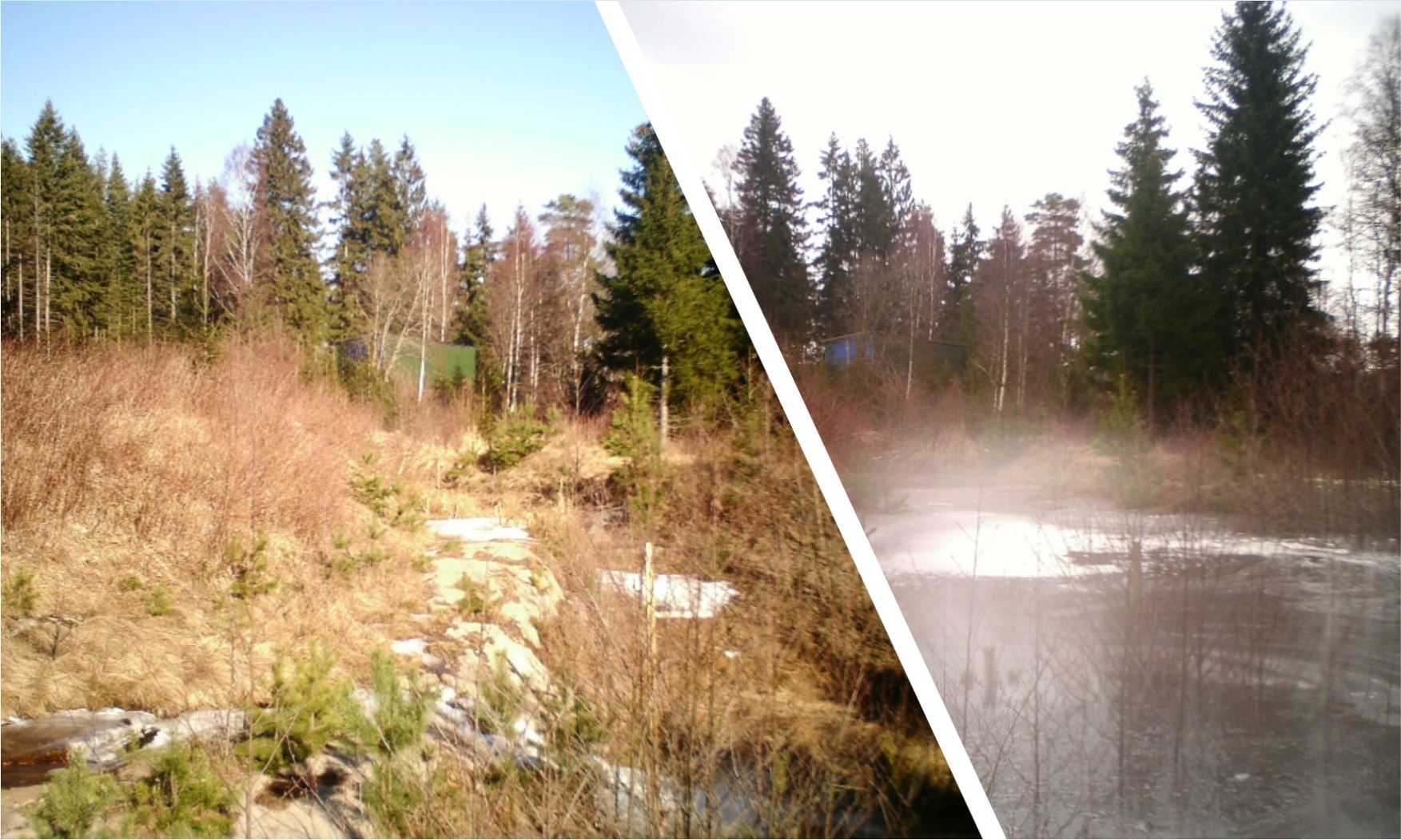
Small retention ponds, located in the forest, are ponds or pools with sufficient storage capacity to store the surface runoff to prevent flooding during heavy rainfall events. Ponds contain limited or no water during dry weather, but are designed to retain water during rain events.
2.2 ការពណ៌នាលម្អិតពីបច្ចេកទេស
ការពណ៌នា:
The aim of the small retention ponds is to provide additional storage capacity to hold runoff to attenuate surface runoff - and thus reduce its impact on flooding - during rainfall events. The measure will primarily be useful in connection with short-term extreme episodes and have less effect during prolonged rain – this is because once the dam is filled up it no longer has a flood-reducing effect.
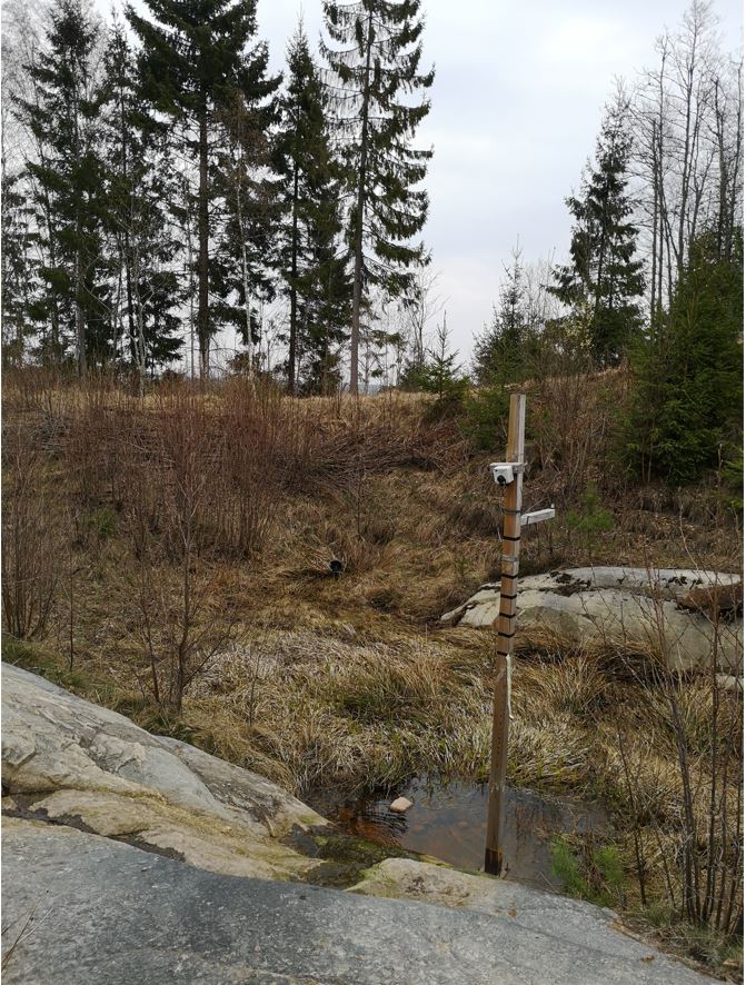
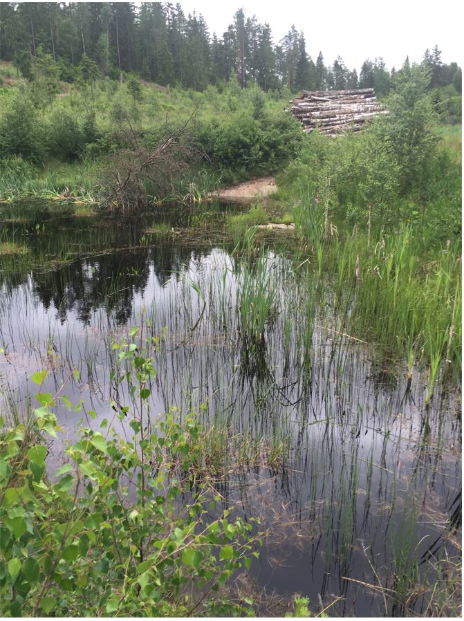
Small retention ponds located in forest areas are artificial dams (up to 2m height, for security reasons) made of soil, stone and/or gabions, with additional storage capacity to attenuate surface runoff during rainfall events. The ponds use local topography to provide space to store discharge peaks. The size of the ponds vary greatly between c. 50-150 m3. The dams can either be established in waterways, or next to the stream so that water is diverted during a flood event. Continuous water flow through the dam is ensured by a spillway located at the bottom of the dam. In this way, the dam can temporarily store water during rainfall episodes and thus decrease the flood peak downstream. The pond must be designed correctly, and calculations of cost-benefit should be carried out before implementation.
As for now, the implementation of small retention ponds in the forests are initiated by landowners. The ponds are getting more and more interest from the local communities however, they are not yet commonly implemented.
In general, there is agreement between experts (researchers) and other stakeholders about the benefits of the implementation of small retention ponds in the forest. However, it is not always the case that such retention ponds decrease floods - as the level of influence depends on the scale and the number of ponds within the catchment. When it comes to drawbacks, stakeholders were particularly worried about the cost of building and maintaining the retention ponds as well as the security of the construction. They placed less emphasis on possible decreases in forest production, which was one of the disadvantages identified by researchers.
Information about the technology is based on investigations and/or reports from different catchments in Norway. For the purpose of the OPTAIN project, the technology is further presented in the natural and human environment context of the Kråkstad River catchment - a Norwegian Case Study catchment within the OPTAIN project.
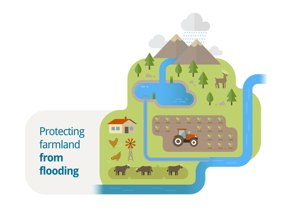
The Kråkstad River is mainly situated in Ski municipality in South-Eastern parts of Norway. The river catchment is a western tributary of the Vansjø-Hobøl watercourse, also known as the Morsa watercourse. The Kråkstad River catchment area is about 51 km², 43% of which is agricultural land, where cereals are produced on heavy clay soils. The main environmental challenge in the area is water quality (incl. high phosphorus pollution) and soil erosion (incl. riverbank erosion and quick-clay landslides).The Morsa watercourse is a drinking water resource and there are specific environmental regulations for land management followed by subsidies through the Regional Environmental Programme (RMP).
2.3 រូបភាពនៃបច្ចេកទេស
វិចិត្រសាលប្រព័ន្ធផ្សព្វផ្សាយ
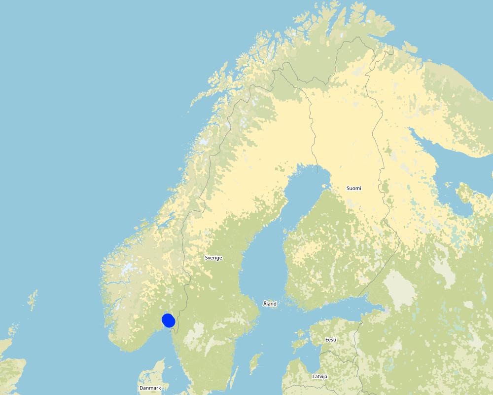
2.5 ប្រទេស/តំបន់/ទីតាំងកន្លែង ដែលបច្ចេកទេសត្រូវបានអនុវត្ត និងបានគ្រប់ដណ្តប់ដោយការវាយតម្លៃនេះ
ប្រទេស:
ប្រទេសន័រវែស
តំបន់/រដ្ឋ/ខេត្ត:
Viken county
បញ្ជាក់បន្ថែមពីលក្ខណៈនៃទីតាំង:
The Vansjø - Hobøl catchment
បញ្ជាក់ពីការសាយភាយនៃបច្ចេកទេស:
- អនុវត្តនៅកន្លែងជាក់លាក់មួយ/ ប្រមូលផ្តុំនៅតំបន់តូចៗ
តើបច្ចេកទេស (មួយ ឬច្រើន) ទាំងនោះស្ថិតនៅក្នុងតំបន់ការពារជាអចិន្ត្រៃយ៍ណាមួយដែរឬទេ?
ទេ
Map
×2.6 កាលបរិច្ឆេទនៃការអនុវត្ត
ប្រសិនបើមិនច្បាស់ឆ្នាំ សូមបញ្ជាក់កាលបរិច្ឆេទដែលប្រហាក់ប្រហែល:
- តិចជាង 10ឆ្នាំមុន (ថ្មី)
2.7 ការណែនាំពីបច្ចេកទេស
សូមបញ្ជាក់តើបច្ចេកទេសត្រូវបានណែនាំឱ្យអនុវត្តដោយរបៀបណា:
- តាមរយៈការបង្កើតថ្មីរបស់អ្នកប្រើប្រាស់ដី
- ពេលកំពុងពិសោធន៍
- SMIL
មតិយោបល់ (ប្រភេទនៃគម្រោង ។ល។):
Establishment of the retention ponds presented in this documentation was initiated by landowners. Monitoring of their effectiveness was part of the research project (RECARE: https://www.recare-hub.eu/).
Retention ponds are part of SMIL subside system (Special Environmental measures in Agriculture)
3. ចំណាត់ថ្នាក់នៃបច្ចេកទេស SLM
3.1 គោលបំណងចម្បង (១ ឬច្រើន) នៃបច្ចេកទេសនេះ
- កាត់បន្ថយ, បង្ការ, ស្តារឡើងវិញនូវការធ្លាក់ចុះគុណភាពដី
- អភិរក្ស/ធ្វើឱ្យប្រសើរឡើងជីវចម្រុះ
- កាត់បន្ថយហានិភ័យនៃគ្រោះមហន្តរាយ
- បន្ស៊ាំទៅនឹងការប្រែប្រួលអាកាសធាតុ/គ្រោះមហន្តរាយ និងផលប៉ះពាល់របស់វា
- កាត់បន្ថយការប្រែប្រួលអាកាសធាតុ និងផលប៉ះពាល់របស់វា
3.2 ប្រភេទដីប្រើប្រាស់មួយប្រភេទ (ច្រើនប្រភេទ) ដែលបានអនុវត្តបច្ចេកទេស
ដីប្រើប្រាស់ចម្រុះនៅលើដីតែមួយ:
ទេ

ដីព្រៃ/ដីដាំដើមឈើ
- natural forest
3.3 បន្ទាប់ពីអនុវត្តបច្ចេកទេស តើដីប្រើប្រាស់មានការប្រែប្រួលដែររឺទេ?
បន្ទាប់ពីអនុវត្តបច្ចេកទេស តើដីប្រើប្រាស់មានការប្រែប្រួលដែររឺទេ?
- ទេ (បន្តទៅសំណួរ 3.4)
3.4 ការផ្គត់ផ្គង់ទឹក
ការផ្គត់ផ្គង់ទឹកនៅកន្លែងអនុវត្តបច្ចេកទេស:
- ទឹកភ្លៀង
3.5 ក្រុម SLM ដែលបច្ចេកទេសស្ថិតនៅក្នុង
- ការបែងចែកទឹក និងប្រព័ន្ធបង្ហូរ
- ការគ្រប់គ្រងទឹកលើដី (ទឹកធ្លាក់ ទន្លេ បឹង សមុទ្រ)
3.6 វិធានការ SLM ដែលបញ្ចូលនូវបច្ចេកទេស

វិធានការរចនាស័ម្ពន្ធ
- S5: ទំនប់ ថ្លុក ស្រះ
3.7 កំណត់ប្រភេទនៃការធ្លាក់ចុះគុណភាពដីសំខាន់ៗដែលបច្ចេកទេសនេះបានដោះស្រាយ

ការហូរច្រោះដីដោយសារទឹក
- Wt: ការបាត់ដីស្រទាប់លើដោយការហូរច្រោះ
- Wg: ការកកើតឡើងនូវកំទេចកំទីដីស្រទាប់ក្រោម
3.8 ការពារ កាត់បន្ថយ ឬស្តារឡើងវិញនៃការធ្លាក់ចុះគុណភាពដី
បញ្ជាក់ពីគោលដៅរបស់បច្ចេកទេស ដែលផ្តោតទៅការធ្លាក់ចុះគុណភាពដី:
- ការការពារការធ្លាក់ចុះគុណភាពដី
- ការកាត់បន្ថយការធ្លាក់ចុះគុណភាពដី
4. បច្ចេកទេសជាក់លាក់ សកម្មភាពអនុវត្ត ធាតុចូល និងថ្លៃដើម
4.1 គំនូសបច្ចេកទេសនៃបច្ចេកទេសនេះ
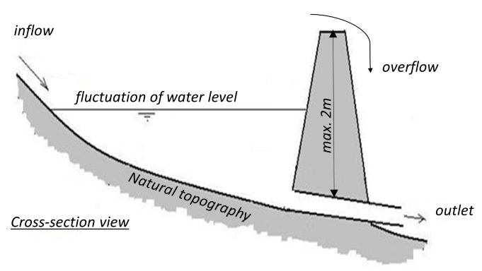
លក្ខណៈពិសេសនៃបច្ចេកទេស (ទាក់ទងនឺងគំនូរបច្ចេកទេស):
Cross-section view on the small retention pond
ឈ្មោះអ្នកនិពន្ធ:
Dominika Krzeminska
កាលបរិច្ឆេទ:
26/01/2022
4.2 ព័ត៌មានទូទៅដែលពាក់ព័ន្ធនឹងការគណនាធាតុចូល និងថ្លៃដើម
កំណត់របៀបនៃការគណនាថ្លៃដើម និងធាតុចូល:
- ក្នុងឯកតាបច្ចេកទេស
បញ្ជាក់ឯកតា:
Pond
បញ្ជាក់ពីទំហំនៃឯកតា (បើពាក់ព័ន្ធ):
c. 50-150 m3
ផ្សេងៗ/ រូបិយប័ណ្ណជាតិ (បញ្ជាក់):
NOK
បើពាក់ព័ន្ធសូមកំណត់អត្រាប្តូរប្រាក់ពីដុល្លាទៅរូបិយប័ណ្ណតំបន់ (ឧ. 1 ដុល្លារ = 79.9 រៀលនៃរូបិយប័ណ្ណប្រេស៊ីល) ៖ 1 ដុល្លារ =:
8,89
កំណត់ថ្លៃឈ្នួលជាមធ្យមនៃការជួលកម្លាំងពលកម្មក្នុងមួយថ្ងៃ:
c.a. 3000 NOK (it is only the cost of the time assuming 8h work per day, 320-500 NOK/hour; person; machinery, equipment, materials not included)
4.3 សកម្មភាពបង្កើត
| សកម្មភាព | រយៈពេល (រដូវកាល) | |
|---|---|---|
| 1. | Construct the dam | dry period of the year |
មតិយោបល់:
We are talking here about “small” dams, up to 2 m (restrictions due to safety regulations). The dams can be built with the use of typical machinery available at the farms: digger, tractor etc. or with help of company.
4.4 ថ្លៃដើម និងធាតុចូលដែលត្រូវការសម្រាប់ការបង្កើតបច្ចេកទេស
ប្រសិនបើមិនអាចបំបែកតម្លៃដើមក្នុងតារាងខាងក្រោមទេ សូមផ្តល់នូវតម្លៃប៉ាន់ស្មានសរុបក្នុងការបង្កើតបច្ចេកទេសនោះ:
35000,0
ប្រសិនបើអ្នកប្រើប្រាស់ដីមិនមានថ្លៃដើម 100% សូមបញ្ជាក់ថានរណាដែលចំណាយថ្លៃដើមដែលនៅសល់:
The landowners can apply for subsidies to establish and maintenance sedimentation pond, within SMIL system (Special Environmental measures in Agriculture). Local county authorities are responsible for the administration of these schemes.
មតិយោបល់:
Approximately NOK 35,000 has been used to establish the retention pond (monitoried withn RECARE project). It is mostly to rent the equipment and buy the material (soil). The work was done made by the landowner.
4.5 សកម្មភាពថែទាំ
| សកម្មភាព | ពេលវេលា/ ភាពញឹកញាប់ | |
|---|---|---|
| 1. | Maintenance of the dam | on demand |
| 2. | Maintenance of the pond area | on demand |
4.6 កំណត់ថ្លៃដើមសម្រាប់ការថែទាំ/ សកម្មភាពរបស់បច្ចេកទេស (ក្នុងរយៈពេលមួយឆ្នាំ)
ប្រសិនបើមិនអាចបំបែកតម្លៃដើមក្នុងតារាងខាងក្រោមទេ សូមផ្តល់នូវតម្លៃប៉ាន់ស្មានសរុបក្នុងការថែទាំបច្ចេកទេសនោះ:
10000,0
ប្រសិនបើអ្នកប្រើប្រាស់ដីមិនមានថ្លៃដើម 100% សូមបញ្ជាក់ថានរណាដែលចំណាយថ្លៃដើមដែលនៅសល់:
The landowners can apply for subsidies to establish and maintenance sedimentation pond, within SMIL system (Special Environmental measures in Agriculture). Local county authorities are responsible for the administration of these schemes.
មតិយោបល់:
An estimate for maintenance costs is set at NOK 10,000 annually, most of it is for clearing the area.
4.7 កត្តាសំខាន់បំផុតដែលមានឥទ្ធិពលដល់ការចំណាយ
ពណ៌នាពីកត្តាប៉ះពាល់ចម្បងៗទៅលើថ្លៃដើម:
- The terrain setup,
- Type of material used to construct the dam and its durability (establishment and maintenance costs).
- Need for maintenance
The landowners can apply for subsidies to establish and maintenance sedimentation pond, within SMIL system (Special Environmental measures in Agriculture). Local county authorities are responsible for the administration of these schemes.
5. លក្ខណៈបរិស្ថានធម្មជាតិ និងមនុស្ស
5.1 អាកាសធាតុ
បរិមាណទឹកភ្លៀងប្រចាំឆ្នាំ
- < 250 មម
- 251-500 មម
- 501-750 មម
- 751-1,000 មម
- 1,001-1,500 មម
- 1,501-2,000 មម
- 2,001-3,000 មម
- 3,001-4,000 មម
- > 4,000 មម
តំបន់កសិអាកាសធាតុ
- សើម
5.2 សណ្ឋានដី
ជម្រាលជាមធ្យម:
- រាបស្មើ (0-2%)
- ជម្រាលតិចតួច (3-5%)
- មធ្យម (6-10%)
- ជម្រាលខ្ពស់បន្តិច (11-15%)
- ទីទួល (16-30%)
- ទីទួលចោត (31-60%)
- ទីទួលចោតខ្លាំង (>60%)
ទម្រង់ដី:
- ខ្ពង់រាប
- កំពូលភ្នំ
- ជម្រាលភ្នំ
- ជម្រាលទួល
- ជម្រាលជើងភ្នំ
- បាតជ្រលងភ្នំ
តំបន់តាមរយៈកម្ពស់ :
- 0-100 ម
- 101-500 ម
- 501-1,000 ម
- 1,001-1,500 ម
- 1,501-2,000 ម
- 2,001-2,500 ម
- 2,501-3,000 ម
- 3,001-4,000 ម
- > 4,000 ម
5.3 ដី
ជម្រៅដីជាមធ្យម:
- រាក់ខ្លាំង (0-20 សម)
- រាក់ (21-50 សម)
- មធ្យម (51-80 សម)
- ជ្រៅ (81-120 សម)
- ជ្រៅខ្លាំង (> 120 សម)
វាយនភាពដី (ស្រទាប់លើ):
- មធ្យម (ល្បាយ, ល្បាប់)
- ម៉ត់/ ធ្ងន់ (ឥដ្ឋ)
វាយនភាពដី (> 20 សម ស្រទាប់ក្នុង):
- មធ្យម (ល្បាយ, ល្បាប់)
- ម៉ត់/ ធ្ងន់ (ឥដ្ឋ)
សារធាតុសរីរាង្គនៅស្រទាប់ដីខាងលើ:
- មធ្យម (1-3%)
5.4 ទឹកដែលអាចទាញមកប្រើប្រាស់បាន និងគុណភាពទឹក
នីវ៉ូទឹកក្រោមដី:
< 5 ម
ទឹកលើដីដែលអាចទាញយកប្រើប្រាស់បាន:
ល្អ
គុណភាពទឹក (មិនបានធ្វើប្រត្តិកម្ម):
ទឹកសម្រាប់តែការធ្វើកសិកម្ម (ស្រោចស្រព)
គុណភាពទឹក គឺផ្តោតទៅលើ៖:
ទាំងទឹកក្រោមដី និងលើផ្ទៃដី
តើមានបញ្ហាភាពទឹកប្រៃហូរចូលមកដែរឬទេ?
ទេ
តើទឹកជំនន់កំពុងកើតមាននៅតំបន់នេះដែររឺទេ?
បាទ/ចា៎
ភាពទៀងទាត់:
ញឹកញាប់
5.5 ជីវៈចម្រុះ
ភាពសម្បូរបែបនៃប្រភេទ:
- កម្រិតមធ្យម
ភាពសម្បូរបែបនៃទីជម្រក:
- កម្រិតមធ្យម
5.6 លក្ខណៈនៃអ្នកប្រើប្រាស់ដីដែលអនុវត្តបច្ចេកទេស
នៅមួយកន្លែង ឬពនេចរ :
- នៅមួយកន្លែង
ទីផ្សារនៃប្រព័ន្ធផលិតកម្ម:
- ពាក់កណ្តាលពាណិជ្ជកម្ម (ផ្គត់ផ្គង់ខ្លួនឯង/ ពាណិជ្ជកម្ម)
ចំណូលក្រៅកសិកម្ម:
- ច្រើនជាង 50% នៃចំណូល
កម្រិតជីវភាព:
- មធ្យម
- មាន
ឯកជន ឬក្រុម:
- ធ្វើខ្លួនឯង/ គ្រួសារ
កម្រិតប្រើប្រាស់គ្រឿងយន្ត:
- គ្រឿងយន្ត/ ម៉ាស៊ីន
យេនឌ័រ:
- ស្ត្រី
- បុរស
អាយុរបស់អ្នកប្រើប្រាស់ដី:
- យុវវ័យ
- វ័យកណ្តាល
5.7 ទំហំផ្ទៃដីជាមធ្យមនៃដីប្រើប្រាស់ដោយអ្នកប្រើប្រាស់ដី ក្នុងការអនុវត្តបច្ចេកទេស
- < 0.5 ហិកតា
- 0.5-1 ហិកតា
- 1-2 ហិកតា
- 2-5 ហិកតា
- 5-15 ហិកតា
- 15-50 ហិកតា
- 50-100 ហិកតា
- 100-500 ហិកតា
- 500-1,000 ហិកតា
- 1,000-10,000 ហិកតា
- > 10,000 ហិកតា
5.8 ភាពជាម្ចាស់ដី កម្មសិទ្ធប្រើប្រាស់ដី និងកម្មសិទ្ធប្រើប្រាស់ទឹក
ភាពជាម្ចាស់ដី:
- ឯកជន មានកម្មសិទ្ធ
កម្មសិទ្ធិប្រើប្រាស់ដី:
- ជាក្រុម (មានដែនកំណត់)
- ឯកជន
កម្មសិទ្ធប្រើប្រាស់ទឹក:
- អាស្រ័យផលសេរី (មិនមានការកំណត់)
5.9 ការប្រើប្រាស់សេវាកម្ម និងហេដ្ឋារចនាសម្ព័ន្ធ
សុខភាព:
- មិនល្អ
- មធ្យម
- ល្អ
ការអប់រំ:
- មិនល្អ
- មធ្យម
- ល្អ
ជំនួយបច្ចេកទេស:
- មិនល្អ
- មធ្យម
- ល្អ
ការងារ (ឧ. ការងារក្រៅកសិដ្ឋាន):
- មិនល្អ
- មធ្យម
- ល្អ
ទីផ្សារ:
- មិនល្អ
- មធ្យម
- ល្អ
ថាមពល:
- មិនល្អ
- មធ្យម
- ល្អ
ផ្លូវ និងការដឹកជញ្ជូន:
- មិនល្អ
- មធ្យម
- ល្អ
ទឹកផឹក និងអនាម័យ:
- មិនល្អ
- មធ្យម
- ល្អ
សេវាកម្មហិរញ្ញវត្ថុ:
- មិនល្អ
- មធ្យម
- ល្អ
6. ផលប៉ះពាល់ និងការសន្និដ្ឋាន
6.1 ផលប៉ះពាល់ក្នុងបរិវេណអនុវត្តបច្ចេកទេសដែលកើតមាន
ផលប៉ះពាល់លើសេដ្ឋកិច្ចសង្គម
ផលិតផល
ផលិតកម្មដំណាំ
ហានិភ័យនៃភាពបរាជ័យរបស់ផលិតកម្ម
ផ្ទៃដីផលិតកម្ម
ចំណូល និងថ្លៃដើម
ចំណូលក្នុងកសិដ្ឋាន
មតិយោបល់/ ការបញ្ជាក់:
Less flooding events--> crop grown
ផលប៉ះពាល់ទៅលើអេកូឡូស៊ី
ដី
ការបាត់បង់ដី
មតិយោបល់/ ការបញ្ជាក់:
Less flooding events--> lower soil erosion
ជីវចម្រុះ៖ ដំណាំ, សត្វ
ភាពសម្បូរបែបនៃរុក្ខជាតិ
ភាពសម្បូរបែបនៃសត្វ
ភាពសម្បូរបែបនៃទីជំរក
6.2 ផលប៉ះពាល់ក្រៅបរិវេណអនុវត្តបច្ចេកទេសដែលកើតមាន
ទឹកជំនន់ខ្សែទឹកខាងក្រោម
មតិយោបល់/ ការបញ្ជាក់:
Depending on the scale and number of retention pond in the catchment, it may affect the discharge behavior of the river system (less peak flows).
6.3 ភាពប្រឈម និងភាពរួសនៃបច្ចេកទេសទៅនឹងការប្រែប្រួលអាកាសធាតុ និងគ្រោះអាកាសធាតុ/ គ្រោះមហន្តរាយ (ដែលដឹងដោយអ្នកប្រើប្រាស់ដី)
ការប្រែប្រួលអាកាសធាតុ
ការប្រែប្រួលអាកាសធាតុ
| រដូវកាល | កើនឡើង ឬថយចុះ | លក្ខណៈឆ្លើយតបនៃបច្ចេកទេសទៅនឹងការប្រែប្រួលអាកាសធាតុ | |
|---|---|---|---|
| សីតុណ្ហភាពប្រចាំឆ្នាំ | កើនឡើង | ល្អ | |
| បរិមាណទឹកភ្លៀងប្រចាំរដូវកាល | សើម/រដូវភ្លៀង | កើនឡើង | ល្អ |
គ្រោះអាកាសធាតុ (មហន្តរាយ)
គ្រោះមហន្តរាយធម្មជាតិ
| លក្ខណៈឆ្លើយតបនៃបច្ចេកទេសទៅនឹងការប្រែប្រួលអាកាសធាតុ | |
|---|---|
| ព្យុះភ្លៀងតាមតំបន់ | មធ្យម |
| ព្យុះកំបុតត្បូងតាមតំបន់ | ល្អ |
គ្រោះមហន្តរាយទឹក
| លក្ខណៈឆ្លើយតបនៃបច្ចេកទេសទៅនឹងការប្រែប្រួលអាកាសធាតុ | |
|---|---|
| ទឹកជំនន់ទូទៅ (ទន្លេ) | ល្អ |
6.4 ការវិភាគថ្លៃដើម និងអត្ថប្រយោជន៍
តើផលចំណេញ និងថ្លៃដើមត្រូវបានប្រៀបធៀបគ្នាយ៉ាងដូចម្តេច (ទស្សនៈរបស់អ្នកប្រើប្រាស់ដី)?
រយៈពេលខ្លី:
ប៉ះពាល់តិចតួចបំផុត
រយៈពេលវែង:
វិជ្ជមាន
តើផលចំណេញ និងការថែទាំ/ ជួសជុលត្រូវបានប្រៀបធៀបគ្នាយ៉ាងដូចម្តេច (ទស្សនៈរបស់អ្នកប្រើប្រាស់ដី)?
រយៈពេលខ្លី:
វិជ្ជមានតិចតួច
រយៈពេលវែង:
វិជ្ជមាន
6.5 ការទទួលយកបច្ចេកទេស
- តែមួយករណី /ពិសោធន៍
ក្នុងចំណោមគ្រួសារទាំងអស់ដែលបានអនុវត្តបច្ចេកទេស តើមានប៉ុន្មានគ្រួសារដែលចង់ធ្វើដោយខ្លួនឯង ដោយមិនទទួលបានសម្ភារៈលើកទឹកចិត្ត/ប្រាក់ឧបត្ថម្ភ?:
- 91-100%
6.6 ការបន្សុំា
តើថ្មីៗនេះ បច្ចេកទេសនេះត្រូវបានកែតម្រូវដើម្បីបន្ស៊ាំទៅនឹងស្ថានភាពប្រែប្រួលដែរឬទេ?
ទេ
6.7 ភាពខ្លាំង/ គុណសម្បត្តិ/ ឱកាសនៃបច្ចេកទេស
| ភាពខ្លាំង/ គុណសម្បត្តិ/ ឱកាសនៅកន្លែងរបស់អ្នកប្រើប្រាស់ដី |
|---|
| Improvement of the water conditions down-slope: reduce amount of overland flow and lower erosion rate in the agriculture land located below the pond. |
| ភាពខ្លាំង/ គុណសម្បត្តិ/ ឱកាស ទស្សនៈរបស់បុគ្គលសំខាន់ៗ |
|---|
| Depending on the scale and number of retention pond in the catchment, it may affect the discharge behaviour of the river system (lower peak flows) |
6.8 ភាពខ្សោយ/ គុណវិបត្តិ/ ហានិភ័យនៃបច្ចេកទេស និងវិធីសាស្ត្រដោះស្រាយ
| ភាពខ្សោយ/ គុណវិបត្តិ/ ហានិភ័យ ទស្សនៈរបស់អ្នកប្រើប្រាស់ដី | តើបច្ចេកទេសទាំងនោះបានដោះស្រាយបញ្ហាដូចម្តេច? |
|---|---|
| Security of the construction | |
| Costs of maintenance |
| ភាពខ្សោយ/ គុណវិបត្តិ/ ហានិភ័យ ទស្សនៈរបស់អ្នកចងក្រងឬបុគ្គលសំខាន់ៗ | តើបច្ចេកទេសទាំងនោះបានដោះស្រាយបញ្ហាដូចម្តេច? |
|---|---|
| Decreases in forest prodcution |
7. ឯកសារយោង និងវេបសាយ
7.1 វិធីសាស្ត្រ/ ប្រភពនៃព័ត៌មាន
- តាមការចុះទីវាល ការស្រាវជ្រាវនៅទីវាល
Several field visits during the course of RECARE project (2014-2018).
- ការសម្ភាសន៍ជាមួយអ្នកប្រើប្រាស់ដី
Stakeholders workshops carried out within RECARE project.
- ការសម្ភាសន៍ជាមួយអ្នកជំនាញ/ ឯកទេស
NIBIO, and its SLM specialists, has been conducting several national projects related to planning and monitoring the efficiency of small retention ponds within agricultural catchments.
- ការចងក្រងពីរបាកការណ៍ និងឯកសារផ្សេងៗទៀតដែលមាន
See the references
តើពេលណាដែលទិន្នន័យបានចងក្រង (នៅទីវាល)?
26/01/2022
7.2 ឯកសារយោងដែលបានចេញផ្សាយ
ចំណងជើង អ្នកនិពន្ធ ឆ្នាំ ISBN:
Fact Sheets: Case study experiments preventing flooding through small retention ponds. Krzeminska D.; Bøe F.; Stolte J. (2018)
មានប្រភពមកពីណា? ថ្លៃដើមប៉ុន្មាន?
RECARE project website https://www.recare-hub.eu
ចំណងជើង អ្នកនិពន្ធ ឆ្នាំ ISBN:
Assessing Impacts of Soil Management Measures on Ecosystem Services. Schwilch G. et al. (2018)
មានប្រភពមកពីណា? ថ្លៃដើមប៉ុន្មាន?
Mdpi Sustainability
ចំណងជើង អ្នកនិពន្ធ ឆ្នាំ ISBN:
Helping stakeholders select and apply appraisal tools to mitigate soil threats: Researchers’ experiences from across Europe. Okpara et al (2020)
មានប្រភពមកពីណា? ថ្លៃដើមប៉ុន្មាន?
Journal of Environmental Management
ចំណងជើង អ្នកនិពន្ធ ឆ្នាំ ISBN:
Fordrøyningsdammer i tilknytning til jordbruksarealer. Stolte J and Barneveld R. (2019)
មានប្រភពមកពីណា? ថ្លៃដើមប៉ុន្មាន?
NIBIO raport
7.3 ការភ្ជាប់ទៅកាន់ព័ត៌មានពាក់ព័ន្ធលើប្រព័ន្ធអនឡាញ
ចំណងជើង/ ពណ៌នា:
Fact Sheets: Case study experiments preventing flooding through small retention ponds
វេបសាយ:
https://www.recare-hub.eu/images/articles/Case_Studies/Fact_Sheets/RECARE_Experiment_Fact_Sheet_NorwayPondsFinal.pdf
ចំណងជើង/ ពណ៌នា:
Assessing Impacts of Soil Management Measures on Ecosystem Services
វេបសាយ:
https://www.mdpi.com/2071-1050/10/12/4416
ចំណងជើង/ ពណ៌នា:
Helping stakeholders select and apply appraisal tools to mitigate soil threats: Researchers’ experiences from across Europe
វេបសាយ:
https://www.sciencedirect.com/science/article/pii/S0301479719317232?via%253Dihub
ចំណងជើង/ ពណ៌នា:
Fordrøyningsdammer i tilknytning til jordbruksarealer.
វេបសាយ:
https://nibio.brage.unit.no/nibio-xmlui/bitstream/handle/11250/2606099/NIBIO_RAPPORT_2019_5_65.pdf?sequence=1&isAllowed=y
7.4 មតិយោបល់ទូទៅ
no remarks
ការតភ្ជាប់ និងម៉ូឌុល
ពង្រីកមើលទាំងអស់ បង្រួមទាំងអស់ការតភ្ជាប់
Regional Environmental program [ប្រទេសន័រវែស]
Regulations and financial grants for reduction of pollution and promotion of the cultural landscape.
- អ្នកចងក្រង៖ Kamilla Skaalsveen
ម៉ូឌុល
គ្មានម៉ូឌុល