Contour Farming using hedgerows [ប្រទេសហ្វីលីពីន]
- ការបង្កើត៖
- បច្ចុប្បន្នភាព
- អ្នកចងក្រង៖ Philippine Overview of Conservation Approaches and Technologies
- អ្នកកែសម្រួល៖ –
- អ្នកត្រួតពិនិត្យច្រើនទៀត៖ Eduardo Alberto, Alexandra Gavilano
Contour Farming
technologies_1287 - ប្រទេសហ្វីលីពីន
ពិនិត្យមើលគ្រប់ផ្នែក
ពង្រីកមើលទាំងអស់ បង្រួមទាំងអស់1. ព័ត៌មានទូទៅ
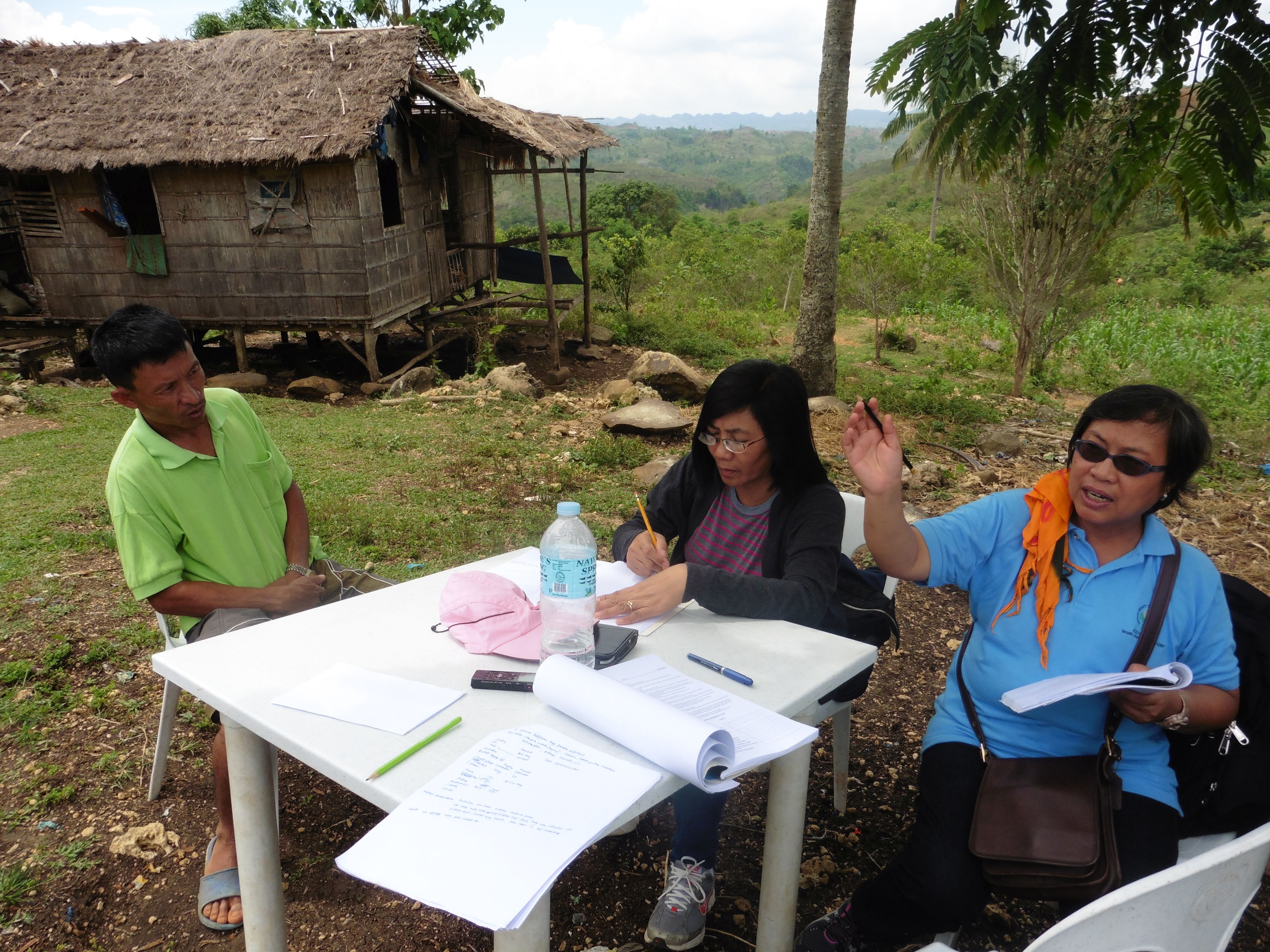
1.2 ព័ត៌មានលម្អិតពីបុគ្គលសំខាន់ៗ និងស្ថាប័នដែលចូលរួមក្នុងការវាយតម្លៃ និងចងក្រងឯកសារនៃបច្ចេកទេស
បុគ្គលសំខាន់ម្នាក់ (ច្រើននាក់)
អ្នកជំនាញឯកទេស SLM:
Luistro Aida
DA_STIARC, RFO IV-A
ប្រទេសហ្វីលីពីន
អ្នកជំនាញឯកទេស SLM:
Gregorio Elizabeth
DA_STIARC, RFO IV-A
ប្រទេសហ្វីលីពីន
អ្នកជំនាញឯកទេស SLM:
Dinamling Djolly Ma.
DA-BSWM
ប្រទេសហ្វីលីពីន
អ្នកជំនាញឯកទេស SLM:
Gutierrez Albert F.
alfergu@yahoo.com
LGU of La Libertad, Negros Oriental
ប្រទេសហ្វីលីពីន
ឈ្មោះអង្គភាពមួយ (ច្រើន) ដែលបានចងក្រងឯកសារ/ វាយតម្លៃបច្ចេកទេស (បើទាក់ទង)
LGU of La Libertad - ប្រទេសហ្វីលីពីនឈ្មោះអង្គភាពមួយ (ច្រើន) ដែលបានចងក្រងឯកសារ/ វាយតម្លៃបច្ចេកទេស (បើទាក់ទង)
Southern Tagalog Integrated Agricultural Research Center (STIARC) - ប្រទេសហ្វីលីពីនឈ្មោះអង្គភាពមួយ (ច្រើន) ដែលបានចងក្រងឯកសារ/ វាយតម្លៃបច្ចេកទេស (បើទាក់ទង)
Bureau of Soils and Water Management (Bureau of Soils and Water Management) - ប្រទេសហ្វីលីពីនឈ្មោះអង្គភាពមួយ (ច្រើន) ដែលបានចងក្រងឯកសារ/ វាយតម្លៃបច្ចេកទេស (បើទាក់ទង)
Regional Field Office N0. 4A (RFO IV-A ) - ប្រទេសហ្វីលីពីន1.3 លក្ខខណ្ឌទាក់ទងទៅនឹងការប្រើប្រាស់ទិន្នន័យដែលបានចងក្រងតាមរយៈ វ៉ូខេត
តើពេលណាដែលទិន្នន័យបានចងក្រង (នៅទីវាល)?
27/05/2015
អ្នកចងក្រង និង(បុគ្គលសំខាន់ៗ)យល់ព្រមទទួលយកនូវលក្ខខណ្ឌនានាទាក់ទងទៅនឹងការប្រើប្រាស់ទិន្នន័យដែលបានចងក្រងតាមរយៈវ៉ូខេត:
បាទ/ចា៎
1.5 ការយោងទៅលើកម្រងបញ្ជីសំណួរនៃវិធីសាស្ត្រផ្សព្វផ្សាយ SLM
Conservation Farming Village [ប្រទេសហ្វីលីពីន]
A modality in mobilizing resources for sustainable upland development which utilizes a basket of strategies, technologies, and interventions to catalyze the widespread transformation of traditional upland farming systems into resilient and sustainable upland production systems.
- អ្នកចងក្រង៖ Philippine Overview of Conservation Approaches and Technologies
2. ការពណ៌នាពីបច្ចេកទេស SLM
2.1 ការពណ៌នាដោយសង្ខេបពីបច្ចេកទេស
និយមន័យបច្ចេកទេស:
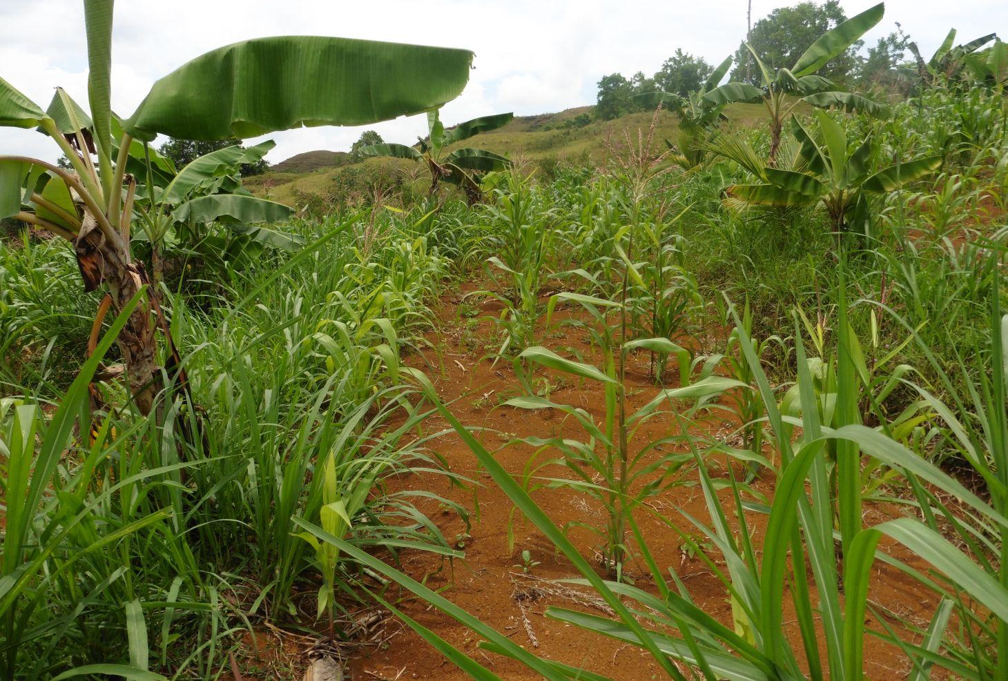
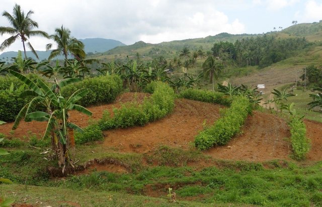
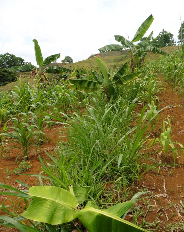
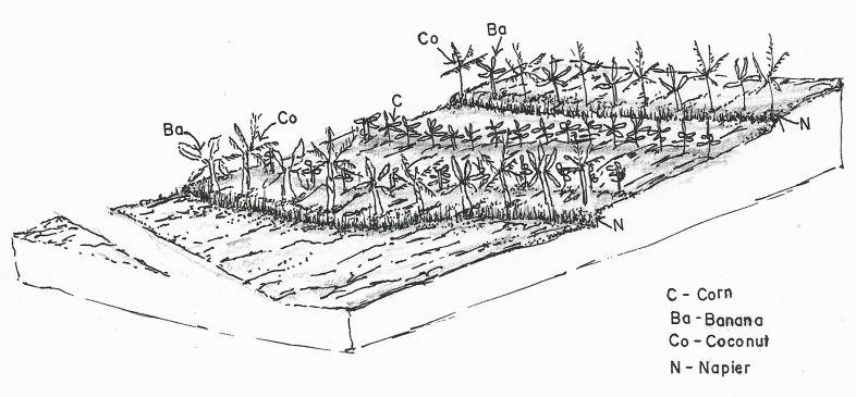
Contour farming is a technology practiced in sloping areas in which hedgerows are established along the contours and other annual/cash crops are grown in the alleys between the hedges.
2.2 ការពណ៌នាលម្អិតពីបច្ចេកទេស
ការពណ៌នា:
Contour farming is being practiced by the farmers in sloping areas to prevent or control soil erosion. Hedgerows are established along contour lines using napier grass and permanent crops like banana and coconut. In between contour lines, corn is inter-cropped with peanut. It is a traditional practice of farmers and one of the conservation techniques for the Conservation Farming Village Approach (CFV).
Purpose of the Technology: This is practiced by farmers to control surface run-off, erosion and to conserve natural soil fertility. Napier grass is also planted as source of feeds for the livestocks. The technology controls dispersed runoff, reduce slope angle and length.
Establishment / maintenance activities and inputs: Contour lines were established using an A-frame to determine the location of the hedgerows to be planted. Napier grasses are planted along the contour at 8x8m and 4X4m distance. Grafted cacao trees are also inserted in between banana at 4X4 distance. The alleys between hedges measuring 4m wide and 30m long are planted with corn and peanut. Napier grass is regularly trimmed to maintain a height of not more than a meter, using the cuttings as livestock fodder.
Natural / human environment: The area is under a humid climate condition with an average annual rainfall of 1000-1500 mm. Its elevation is 500-1000 m above mean sea level.The average cropland size of land users is less than or equal to 0. 5 hectare with a slope ranging from 18-25%. Income of land users are derived from the crops sold. The Local Government Unit (LGU) provides truck to transport the harvested crops of the farmers from the village to the town market twice a week.
2.3 រូបភាពនៃបច្ចេកទេស
វិចិត្រសាលប្រព័ន្ធផ្សព្វផ្សាយ
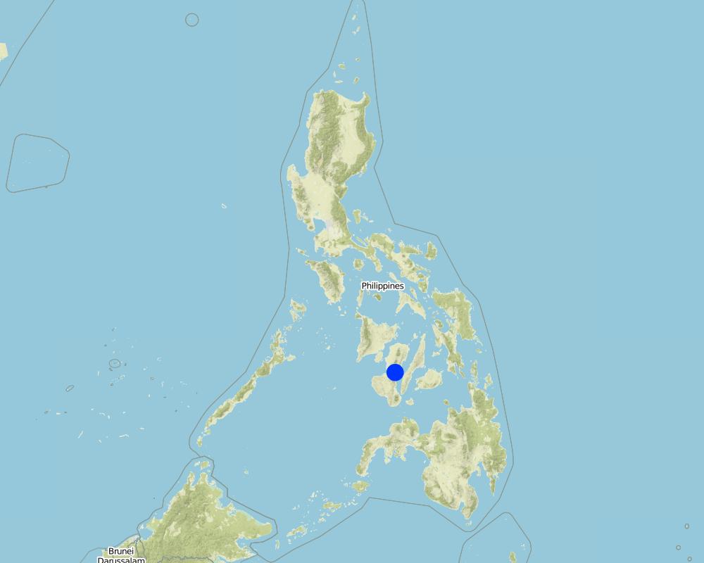
2.5 ប្រទេស/តំបន់/ទីតាំងកន្លែង ដែលបច្ចេកទេសត្រូវបានអនុវត្ត និងបានគ្រប់ដណ្តប់ដោយការវាយតម្លៃនេះ
ប្រទេស:
ប្រទេសហ្វីលីពីន
តំបន់/រដ្ឋ/ខេត្ត:
La Libertad
បញ្ជាក់បន្ថែមពីលក្ខណៈនៃទីតាំង:
Negros Oriental
Map
×2.6 កាលបរិច្ឆេទនៃការអនុវត្ត
ប្រសិនបើមិនច្បាស់ឆ្នាំ សូមបញ្ជាក់កាលបរិច្ឆេទដែលប្រហាក់ប្រហែល:
- ច្រើនជាង 50 ឆ្នាំមុន (ប្រពៃណី)
2.7 ការណែនាំពីបច្ចេកទេស
សូមបញ្ជាក់តើបច្ចេកទេសត្រូវបានណែនាំឱ្យអនុវត្តដោយរបៀបណា:
- ជាផ្នែកនៃប្រព័ន្ធប្រពៃណី (> 50 ឆ្នាំ)
មតិយោបល់ (ប្រភេទនៃគម្រោង ។ល។):
The technology is a traditional practice in the Philippines and was integrated as part of the conservation techniques under the Conservation Farming Village approach.
3. ចំណាត់ថ្នាក់នៃបច្ចេកទេស SLM
3.1 គោលបំណងចម្បង (១ ឬច្រើន) នៃបច្ចេកទេសនេះ
- កាត់បន្ថយ, បង្ការ, ស្តារឡើងវិញនូវការធ្លាក់ចុះគុណភាពដី
3.2 ប្រភេទដីប្រើប្រាស់មួយប្រភេទ (ច្រើនប្រភេទ) ដែលបានអនុវត្តបច្ចេកទេស

ដីដាំដំណាំ
- ដំណាំប្រចាំឆ្នាំ
ដំណាំចម្បង (ដំណាំកសិ-ឧស្សាហកម្ម និងដំណាំស្បៀង) :
major cash crop: peanut
major food crop: corn, banana, cacao, coconut
Other: Napier grasses
មតិយោបល់:
Major land use problems (compiler’s opinion): Soil erosion and soil fertility decline.
Major land use problems (land users’ perception): Lack of animal grazing areas and limited plain or level areas for crop production.
Livestock is grazing on crop residues
3.3 ព័ត៌មានបន្ថែមអំពីអ្នកប្រើប្រាស់ដី
ការផ្គត់ផ្គង់ទឹកនៅកន្លែងអនុវត្តបច្ចេកទេស:
- ទឹកភ្លៀង
3.4 ក្រុម SLM ដែលបច្ចេកទេសស្ថិតនៅក្នុង
- វិធានការអនុវត្តកាត់ទទឹងទីជម្រាល
3.5 ការសាយភាយនៃបច្ចេកទេស
បញ្ជាក់ពីការសាយភាយនៃបច្ចេកទេស:
- ត្រូវបានផ្សព្វផ្សាយត្រឹមតំបន់មួយ
ប្រសិនបើបច្ចេកទេសត្រូវបានសាយភាយពាសពេញតំបន់ណាមួយ សូមកំណត់ទំហំផ្ទៃដីអនុវត្តន៍:
- < 0.1 គម2 (10 ហិកតា)
មតិយោបល់:
Total area covered by the SLM Technology is 0.0025 m2.
Farmers practice contour farming only in small areas or parcels of land
3.6 វិធានការ SLM ដែលបញ្ចូលនូវបច្ចេកទេស

វិធានការក្សេត្រសាស្ត្រ
- A1: ដំណាំ/គម្របដី
- A2: សារធាតុសរីរាង្គ/ជីជាតិដី
- A3: ការរក្សាស្រទាប់ដីខាងលើ
- A4: ការរក្សាស្រទាប់ដីខាងក្នុង

វិធានការរុក្ខជាតិ
- V1: ឈើធំៗ និងដើមឈើតូចៗ
- V2: ស្មៅនិងរុក្ខជាតិៗដែលដុះមានអាយុមិនលើសពី 2ឆ្នាំ
មតិយោបល់:
Main measures: agronomic measures, vegetative measures
Type of agronomic measures: mixed cropping / intercropping, contour planting / strip cropping, legume inter-planting, manure / compost / residues, breaking crust / sealed surface
Type of vegetative measures: aligned: -contour
3.7 កំណត់ប្រភេទនៃការធ្លាក់ចុះគុណភាពដីសំខាន់ៗដែលបច្ចេកទេសនេះបានដោះស្រាយ

ការហូរច្រោះដីដោយសារទឹក
- Wt: ការបាត់ដីស្រទាប់លើដោយការហូរច្រោះ

ការធ្លាក់ចុះសារធាតុគីមីក្នុងដី
- Cn: ការថយចុះជីជាតិ និងកាត់បន្ថយបរិមាណសារធាតុសរីរាង្គ (មិនកើតឡើងដោយការហូរច្រោះទេ)

ការធ្លាក់ចុះជីវសាស្ត្រនៃដី
- Bc: ការថយចុះនូវគម្របរុក្ខជាតិ
មតិយោបល់:
Main type of degradation addressed: Wt: loss of topsoil / surface erosion, Cn: fertility decline and reduced organic matter content
Secondary types of degradation addressed: Bc: reduction of vegetation cover
Main causes of degradation: soil management (Lack of knowledge on fertilizer usage), crop management (annual, perennial, tree/shrub) (intensive tillage due to crop production), deforestation / removal of natural vegetation (incl. forest fires) (illegal logging, slash and burn), over-exploitation of vegetation for domestic use (charcoal making for livelihood)
3.8 ការពារ កាត់បន្ថយ ឬស្តារឡើងវិញនៃការធ្លាក់ចុះគុណភាពដី
បញ្ជាក់ពីគោលដៅរបស់បច្ចេកទេស ដែលផ្តោតទៅការធ្លាក់ចុះគុណភាពដី:
- ការជួសជុល/ ស្តារឡើងវិញនៃឱនភាពដីធ្ងន់ធ្ងរ
មតិយោបល់:
Main goals: rehabilitation / reclamation of denuded land
4. បច្ចេកទេសជាក់លាក់ សកម្មភាពអនុវត្ត ធាតុចូល និងថ្លៃដើម
4.1 គំនូសបច្ចេកទេសនៃបច្ចេកទេសនេះ
ឈ្មោះអ្នកនិពន្ធ:
Mr. Patricio A. Yambot, Bureau of Soils and Water Management
4.2 លក្ខណៈពិសេសនៃបច្ចេកទេស/ ពណ៌នាពីគំនូរបច្ចេកទេស
Crops planted in the contour.
Location: Brgy. Talaon. La Libertad, Negros Oriental
Date: May28, 2015
Technical knowledge required for field staff / advisors: high
Technical knowledge required for land users: moderate
Main technical functions: control of raindrop splash, control of dispersed runoff: retain / trap, Minimize soil erosion due to runoff, Serve as soil nutrient traps
Secondary technical functions: reduction of slope angle, reduction of slope length, stabilisation of soil (eg by tree roots against land slides), promotion of vegetation species and varieties (quality, eg palatable fodder)
Mixed cropping / intercropping
Material/ species: corn and peanut
Quantity/ density: 10kg/.25ha
Remarks: in between contour hedges
Contour planting / strip cropping
Material/ species: napier, banana, coconut and cacao
Quantity/ density: 20kg/.25ha
Legume inter-planting
Quantity/ density: 20kg/.25ha
Manure / compost / residues
Material/ species: vermi-compost
Quantity/ density: 500kg
Breaking crust / sealed surface
Material/ species: rotavator
Remarks: plowing two times
Aligned: -contour
Vegetative material: G : grass
Number of plants per (ha): 500
Vertical interval between rows / strips / blocks (m): 0.5
Spacing between rows / strips / blocks (m): 4
Vertical interval within rows / strips / blocks (m): drill
Width within rows / strips / blocks (m): 0.3
Vegetative measure: contour (banana)
Vegetative material: F : fruit trees / shrubs
Number of plants per (ha): 64
Vertical interval between rows / strips / blocks (m): 0.5
Spacing between rows / strips / blocks (m): 4
Vertical interval within rows / strips / blocks (m): 4
Width within rows / strips / blocks (m): 4
Vegetative measure: contour (cacao)
Vegetative material: F : fruit trees / shrubs
Number of plants per (ha): 64
Vertical interval between rows / strips / blocks (m): 0.5
Spacing between rows / strips / blocks (m): 4
Vertical interval within rows / strips / blocks (m): 1
Width within rows / strips / blocks (m): 4
Vegetative measure: contour (cococnut)
Vegetative material: F : fruit trees / shrubs
Number of plants per (ha): 32
Vertical interval between rows / strips / blocks (m): 0.5
Spacing between rows / strips / blocks (m): 4
Vertical interval within rows / strips / blocks (m): 8
Width within rows / strips / blocks (m): 8
Vegetative measure: Vegetative material: F : fruit trees / shrubs
Fruit trees / shrubs species: banana, cacao, coconut
Grass species: napier grass
Slope (which determines the spacing indicated above): 8%
If the original slope has changed as a result of the Technology, the slope today is (see figure below): 5%
Gradient along the rows / strips: 3-5%
4.3 ព័ត៌មានទូទៅដែលពាក់ព័ន្ធនឹងការគណនាធាតុចូល និងថ្លៃដើម
កំណត់របៀបនៃការគណនាថ្លៃដើម និងធាតុចូល:
- ក្នុងតំបន់អនុវត្តបច្ចេកទេស
កំណត់ទំហំ និងឯកត្តាផ្ទៃដី:
1 hectare
កំណត់រូបិយប័ណ្ណសម្រាប់ថ្លៃដើម:
- ដុល្លារអាមេរិក
កំណត់អត្រាប្តូរប្រាក់ពីដុល្លាទៅរូបិយប័ណ្ណតំបន់ (បើទាក់ទង)៖ 1 ដុល្លារ =:
49,0
កំណត់ថ្លៃឈ្នួលជាមធ្យមនៃការជួលកម្លាំងពលកម្មក្នុងមួយថ្ងៃ:
2.22
4.4 សកម្មភាពបង្កើត
| សកម្មភាព | ប្រភេទវិធានការ | ពេលវេលា | |
|---|---|---|---|
| 1. | Laying out and establishment of contour lines/hedgerows | សារពើរុក្ខជាតិ | before onset of rainy season |
| 2. | Planting of hedgerows (Napier grass) | សារពើរុក្ខជាតិ | Rainy season. one week after laying out |
| 3. | Planting of perennial crops along contour | សារពើរុក្ខជាតិ | Rainy season. 1 week after laying out |
4.5 ថ្លៃដើម និងធាតុចូលដែលត្រូវការសម្រាប់ការបង្កើតបច្ចេកទេស
បើអាច បំបែកថ្លៃដើមនៃការចាប់ផ្តើមទៅតាមតារាងខាងក្រោម កំណត់ធាតុចូល និងថ្លៃដើមក្នុងមួយឯកតា។ បើអ្នកមិនអាចបំបែកបាន សូមផ្តល់នូវតម្លៃប៉ាន់ស្មានក្នុងការបង្កើតបច្ចេកទេសជាតម្លៃសរុប:
122,77
| បញ្ជាក់ពីធាតុចូល | ឯកតា | បរិមាណ | ថ្លៃដើមក្នុងមួយឯកតា | ថ្លៃធាតុចូលសរុប | % នៃថ្លៃដើមដែលចំណាយដោយអ្នកប្រើប្រាស់ដី | |
|---|---|---|---|---|---|---|
| កម្លាំងពលកម្ម | Laying out and establishment of contour | Person/day | 3,0 | 2,22 | 6,66 | 40,0 |
| កម្លាំងពលកម្ម | Planting of crops and hedgerows | Person/day | 10,0 | 2,22 | 22,2 | 100,0 |
| សម្ភារៈដាំដុះ | napier seeds | kg | 300,0 | 0,0133 | 3,99 | 100,0 |
| សម្ភារៈដាំដុះ | banana seeds | plants | 64,0 | 0,11093 | 7,1 | 100,0 |
| សម្ភារៈដាំដុះ | cacao seeds | plants | 64,0 | 0,55565 | 35,56 | 100,0 |
| សម្ភារៈដាំដុះ | coconut seeds | plants | 32,0 | 0,88875 | 28,44 | 100,0 |
| ជី និងសារធាតុពុល | herbicide | liter | 1,0 | 17,78 | 17,78 | 40,0 |
| សម្ភារៈសាងសង់ | bamboosticks | picks | 50,0 | 0,012 | 0,6 | 40,0 |
| សម្ភារៈសាងសង់ | A-frame | unit | 1,0 | 0,44 | 0,44 | 40,0 |
| ថ្លៃដើមសរុបក្នុងការបង្កើតបច្ចេកទេស | 122,77 | |||||
4.6 សកម្មភាពថែទាំ
| សកម្មភាព | ប្រភេទវិធានការ | ពេលវេលា/ ភាពញឹកញាប់ | |
|---|---|---|---|
| 1. | Land clearing/ preparation (plowing, rotavating, harrowing) of alleys between contours | ក្សេត្រសាស្ត្រ | Before onset of rainy season |
| 2. | Furrowing | ក្សេត្រសាស្ត្រ | |
| 3. | Planting of corn (first cropping) | ក្សេត្រសាស្ត្រ | Raining season |
| 4. | Weeding, insect control | ក្សេត្រសាស្ត្រ | |
| 5. | Harvesting of first crop | ក្សេត្រសាស្ត្រ | |
| 6. | Land Preparation for the second cropping (plowing, harrowing/rotavating, furrowing) | ក្សេត្រសាស្ត្រ | |
| 7. | Planting of corn + Planting of peanut (second cropping- corn + peanut) | ក្សេត្រសាស្ត្រ | |
| 8. | Weeding / Insect control | ក្សេត្រសាស្ត្រ | |
| 9. | Harvesting of corn and peanut | ក្សេត្រសាស្ត្រ |
4.7 កំណត់ថ្លៃដើមសម្រាប់ការថែទាំ/ សកម្មភាពរបស់បច្ចេកទេស (ក្នុងរយៈពេលមួយឆ្នាំ)
បើអាច បំបែកថ្លៃដើមនៃការថែទាំទៅតាមតារាងខាងក្រោម បញ្ជាក់ធាតុចូលលម្អិត និងថ្លៃដើមក្នុងមួយឯកតា។ បើអ្នកមិនអាចបំបែកបាន សូមផ្តល់នូវតម្លៃប៉ាន់ស្មាននៃការថែទាំបច្ចេកទេសសរុប:
146,63
| បញ្ជាក់ពីធាតុចូល | ឯកតា | បរិមាណ | ថ្លៃដើមក្នុងមួយឯកតា | ថ្លៃធាតុចូលសរុប | % នៃថ្លៃដើមដែលចំណាយដោយអ្នកប្រើប្រាស់ដី | |
|---|---|---|---|---|---|---|
| កម្លាំងពលកម្ម | Land Preparation with machine / furrowing | Person/day | 3,0 | 7,11 | 21,33 | 100,0 |
| កម្លាំងពលកម្ម | Animal Labour | Person/day | 2,0 | 2,67 | 5,34 | 100,0 |
| សម្ភារៈ | Other Labour: Weeding, harvesting | Person/day | 14,0 | 2,22 | 31,08 | 100,0 |
| សម្ភារៈដាំដុះ | Corn seeds | kg | 10,0 | 0,444 | 4,44 | |
| សម្ភារៈដាំដុះ | Peanut seeds | kg | 20,0 | 2,0 | 40,0 | 100,0 |
| សម្ភារៈដាំដុះ | Seeds undefined | kg | 10,0 | 0,444 | 4,44 | 100,0 |
| ជី និងសារធាតុពុល | Fertilizer | kg | 500,0 | 0,08 | 40,0 | 100,0 |
| ថ្លៃដើមសរុបសម្រាប់ការថែទាំដំណាំតាមបច្ចេកទេស | 146,63 | |||||
មតិយោបល់:
Machinery/ tools: rotavator
4.8 កត្តាសំខាន់បំផុតដែលមានឥទ្ធិពលដល់ការចំណាយ
ពណ៌នាពីកត្តាប៉ះពាល់ចម្បងៗទៅលើថ្លៃដើម:
The slope of the area contributes to the additional labor cost in the establishment of contours.The steeper the slope, the higher labor cost will be incurred.
5. លក្ខណៈបរិស្ថានធម្មជាតិ និងមនុស្ស
5.1 អាកាសធាតុ
បរិមាណទឹកភ្លៀងប្រចាំឆ្នាំ
- < 250 មម
- 251-500 មម
- 501-750 មម
- 751-1,000 មម
- 1,001-1,500 មម
- 1,501-2,000 មម
- 2,001-3,000 មម
- 3,001-4,000 មម
- > 4,000 មម
តំបន់កសិអាកាសធាតុ
- សើម
Thermal climate class: tropics
5.2 សណ្ឋានដី
ជម្រាលជាមធ្យម:
- រាបស្មើ (0-2%)
- ជម្រាលតិចតួច (3-5%)
- មធ្យម (6-10%)
- ជម្រាលខ្ពស់បន្តិច (11-15%)
- ទីទួល (16-30%)
- ទីទួលចោត (31-60%)
- ទីទួលចោតខ្លាំង (>60%)
ទម្រង់ដី:
- ខ្ពង់រាប
- កំពូលភ្នំ
- ជម្រាលភ្នំ
- ជម្រាលទួល
- ជម្រាលជើងភ្នំ
- បាតជ្រលងភ្នំ
តំបន់តាមរយៈកម្ពស់ :
- 0-100 ម
- 101-500 ម
- 501-1,000 ម
- 1,001-1,500 ម
- 1,501-2,000 ម
- 2,001-2,500 ម
- 2,501-3,000 ម
- 3,001-4,000 ម
- > 4,000 ម
បញ្ជាក់ថាតើបច្ចេកទេសនេះត្រូវបានអនុវត្តន៍នៅក្នុង:
- មិនពាក់ព័ន្ធទាំងអស់
មតិយោបល់ និងបញ្ចាក់បន្ថែមអំពីសណ្ឋានដី :
Altitudinal zones: 720 m
5.3 ដី
ជម្រៅដីជាមធ្យម:
- រាក់ខ្លាំង (0-20 សម)
- រាក់ (21-50 សម)
- មធ្យម (51-80 សម)
- ជ្រៅ (81-120 សម)
- ជ្រៅខ្លាំង (> 120 សម)
វាយនភាពដី (ស្រទាប់លើ):
- មធ្យម (ល្បាយ, ល្បាប់)
សារធាតុសរីរាង្គនៅស្រទាប់ដីខាងលើ:
- មធ្យម (1-3%)
5.4 ទឹកដែលអាចទាញមកប្រើប្រាស់បាន និងគុណភាពទឹក
នីវ៉ូទឹកក្រោមដី:
5-50 ម
ទឹកលើដីដែលអាចទាញយកប្រើប្រាស់បាន:
ល្អ
គុណភាពទឹក (មិនបានធ្វើប្រត្តិកម្ម):
ទឹកពិសារដែលមានគុណភាពល្អ
5.5 ជីវៈចម្រុះ
ភាពសម្បូរបែបនៃប្រភេទ:
- ទាប
5.6 លក្ខណៈនៃអ្នកប្រើប្រាស់ដីដែលអនុវត្តបច្ចេកទេស
ទីផ្សារនៃប្រព័ន្ធផលិតកម្ម:
- ពាក់កណ្តាលពាណិជ្ជកម្ម (ផ្គត់ផ្គង់ខ្លួនឯង/ ពាណិជ្ជកម្ម
ចំណូលក្រៅកសិកម្ម:
- តិចជាង 10% នៃចំណូល
កម្រិតជីវភាព:
- មិនល្អ
ឯកជន ឬក្រុម:
- ធ្វើខ្លួនឯង/ គ្រួសារ
កម្រិតប្រើប្រាស់គ្រឿងយន្ត:
- ប្រើកម្លាំងពលកម្ម
- ប្រើកម្លាំងសត្វ
យេនឌ័រ:
- ស្ត្រី
- បុរស
សូមបញ្ជាក់ពីលក្ខណៈពាក់ព័ន្ធផ្សេងទៀតអំពីអ្នកប្រើប្រាស់ដី:
Land users applying the Technology are mainly disadvantaged land users
Population density: 10-50 persons/km2
Annual population growth: 1% - 2%; 2%
70% of the land users are poor and own 70% of the land.
Off-farm income specification: Hired laborers for the Department of Environment and Natural Resources (DENR) Project on National Greening Program
5.7 ទំហំផ្ទៃដីជាមធ្យមនៃដីផ្ទាល់ខ្លួន ឬជួលគេដែលបានអនុវត្តបច្ចេកទេស
- < 0.5 ហិកតា
- 0.5-1 ហិកតា
- 1-2 ហិកតា
- 2-5 ហិកតា
- 5-15 ហិកតា
- 15-50 ហិកតា
- 50-100 ហិកតា
- 100-500 ហិកតា
- 500-1,000 ហិកតា
- 1,000-10,000 ហិកតា
- > 10,000 ហិកតា
តើផ្ទៃដីនេះចាត់ទុកជាទំហំកម្រិតណាដែរ ខ្នាតតូច មធ្យម ឬខ្នាតធំ (ធៀបនឹងបរិបទតំបន់)?
- ខ្នាតតូច
5.8 ភាពជាម្ចាស់ដី កម្មសិទ្ធប្រើប្រាស់ដី និងកម្មសិទ្ធប្រើប្រាស់ទឹក
ភាពជាម្ចាស់ដី:
- ឯកជន មិនមានកម្មសិទ្ធ
កម្មសិទ្ធិប្រើប្រាស់ដី:
- ឯកជន
កម្មសិទ្ធប្រើប្រាស់ទឹក:
- ជាក្រុម (មានដែនកំណត់)
5.9 ការប្រើប្រាស់សេវាកម្ម និងហេដ្ឋារចនាសម្ព័ន្ធ
សុខភាព:
- មិនល្អ
- មធ្យម
- ល្អ
ការអប់រំ:
- មិនល្អ
- មធ្យម
- ល្អ
ជំនួយបច្ចេកទេស:
- មិនល្អ
- មធ្យម
- ល្អ
ការងារ (ឧ. ការងារក្រៅកសិដ្ឋាន):
- មិនល្អ
- មធ្យម
- ល្អ
ទីផ្សារ:
- មិនល្អ
- មធ្យម
- ល្អ
ថាមពល:
- មិនល្អ
- មធ្យម
- ល្អ
ផ្លូវ និងការដឹកជញ្ជូន:
- មិនល្អ
- មធ្យម
- ល្អ
ទឹកផឹក និងអនាម័យ:
- មិនល្អ
- មធ្យម
- ល្អ
សេវាកម្មហិរញ្ញវត្ថុ:
- មិនល្អ
- មធ្យម
- ល្អ
6. ផលប៉ះពាល់ និងការសន្និដ្ឋាន
6.1 ផលប៉ះពាល់ក្នុងបរិវេណអនុវត្តបច្ចេកទេសដែលកើតមាន
ផលប៉ះពាល់លើសេដ្ឋកិច្ចសង្គម
ផលិតផល
ផលិតកម្មដំណាំ
គុណភាពមុន SLM:
0
គុណភាពក្រោយ SLM:
10 bags
ផលិតកម្មចំណីសត្វ
គុណភាពមុន SLM:
0
គុណភាពក្រោយ SLM:
1350 bundles
គុណភាពចំណីសត្វ
ភាពសម្បូរបែបនៃផលិតផល
ការគ្រប់គ្រងដី
ចំណូល និងថ្លៃដើម
ចំណូលក្នុងកសិដ្ឋាន
ភាពសម្បូរបែបប្រភពប្រាក់ចំណូល
បន្ទុកការងារ
ផលប៉ះពាល់ទៅលើវប្បធម៌សង្គម
ឱកាសនៃការបង្កើតថ្មី
ស្ថាប័នសហគមន៍
ស្ថាប័នជាតិ
ការកាត់បន្ថយជម្លោះ
ស្ថានភាពក្រុមដែលមានបញ្ហាក្នុងសង្គម និងសេដ្ឋកិច្ច
Improved livelihood and human well-being
ផលប៉ះពាល់ទៅលើអេកូឡូស៊ី
ដី
គម្របដី
ការបាត់បង់ដី
វដ្តនៃសារធាតុចិញ្ចឹម/ការទទួលបាន
សារធាតុសរីរាង្គដី/ការបូនក្រោមដី
ជីវចម្រុះ៖ ដំណាំ, សត្វ
ជីវម៉ាស/ កាបូនលើដី
ភាពសម្បូរបែបនៃរុក្ខជាតិ
ភាពសម្បូរបែបនៃទីជំរក
ការកាត់បន្ថយហានិភ័យនៃគ្រោះមហន្តរាយ និងគ្រោះអាកាសធាតុ
ការបំភាយនៃកាបូន និងឧស្ម័នផ្ទះកញ្ចក់
ល្បឿនខ្យល់
6.3 ភាពប្រឈម និងភាពរួសនៃបច្ចេកទេសទៅនឹងការប្រែប្រួលអាកាសធាតុ និងគ្រោះអាកាសធាតុ/ គ្រោះមហន្តរាយ (ដែលដឹងដោយអ្នកប្រើប្រាស់ដី)
ការប្រែប្រួលអាកាសធាតុ
ការប្រែប្រួលអាកាសធាតុ
| រដូវកាល | ប្រភេទនៃការប្រែប្រួលអាកាសធាតុ/ព្រឹត្តិការណ៍ | លក្ខណៈឆ្លើយតបនៃបច្ចេកទេសទៅនឹងការប្រែប្រួលអាកាសធាតុ | |
|---|---|---|---|
| សីតុណ្ហភាពប្រចាំឆ្នាំ | កើនឡើង | មិនល្អ |
គ្រោះអាកាសធាតុ (មហន្តរាយ)
គ្រោះមហន្តរាយធម្មជាតិ
| លក្ខណៈឆ្លើយតបនៃបច្ចេកទេសទៅនឹងការប្រែប្រួលអាកាសធាតុ | |
|---|---|
| ព្យុះភ្លៀងតាមតំបន់ | មិនល្អ |
គ្រោះមហន្តរាយអាកាសធាតុ
| លក្ខណៈឆ្លើយតបនៃបច្ចេកទេសទៅនឹងការប្រែប្រួលអាកាសធាតុ | |
|---|---|
| រាំងស្ងួត | មិនល្អ |
គ្រោះមហន្តរាយទឹក
| លក្ខណៈឆ្លើយតបនៃបច្ចេកទេសទៅនឹងការប្រែប្រួលអាកាសធាតុ | |
|---|---|
| ទឹកជំនន់ទូទៅ (ទន្លេ) | មិនល្អ |
6.4 ការវិភាគថ្លៃដើម និងអត្ថប្រយោជន៍
តើផលចំណេញ និងថ្លៃដើមត្រូវបានប្រៀបធៀបគ្នាយ៉ាងដូចម្តេច (ទស្សនៈរបស់អ្នកប្រើប្រាស់ដី)?
រយៈពេលខ្លី:
វិជ្ជមានខ្លាំង
រយៈពេលវែង:
វិជ្ជមានខ្លាំង
តើផលចំណេញ និងការថែទាំ/ ជួសជុលត្រូវបានប្រៀបធៀបគ្នាយ៉ាងដូចម្តេច (ទស្សនៈរបស់អ្នកប្រើប្រាស់ដី)?
រយៈពេលខ្លី:
វិជ្ជមានខ្លាំង
រយៈពេលវែង:
វិជ្ជមានខ្លាំង
មតិយោបល់:
More income added from Napier grass
6.5 ការទទួលយកបច្ចេកទេស
បើអាច សូមបញ្ជាក់ពីបរិមាណ (ចំនួនគ្រួសារ និង/ ឬតំបន់គ្របដណ្តប់):
18 land user families have adopted the Technology
ក្នុងចំណោមគ្រួសារទាំងអស់ដែលអនុវត្តបច្ចេកទេស តើមានប៉ុន្មានគ្រួសារដែលចង់ធ្វើដោយខ្លួនឯង ដោយមិនទទួលបានសម្ភារៈលើកទឹកចិត្ត/ប្រាក់ឧបត្ថម្ភ?:
- 10-50%
មតិយោបល់:
Comments on acceptance with external material support: Single farmer focused on napier production and used as hedgerows
28% of land user families (4) who have adopted the Technology did it spontaneously.
4 land user families have adopted the Technology without any external material support
Comments on spontaneous adoption: Practiced contouring but some are partial adoption (rock wall)
There is a strong trend towards spontaneous adoption of the Technology
Comments on adoption trend: Additional barangays will be adopting the technology.
6.7 ភាពខ្លាំង/ គុណសម្បត្តិ/ ឱកាសនៃបច្ចេកទេស
| ភាពខ្លាំង/ គុណសម្បត្តិ/ ឱកាសនៅកន្លែងរបស់អ្នកប្រើប្រាស់ដី |
|---|
|
Availability of labor force in the community. How can they be sustained / enhanced? Encourage more farmers to adopt the technology and utilize available labor force. |
|
The technology generated jobs and increase the income of the landusers practicing the technology. How can they be sustained / enhanced? To conduct continuous capacity building to land users and their children to ensure sustainability. |
| ភាពខ្លាំង/ គុណសម្បត្តិ/ ឱកាស ទស្សនៈរបស់បុគ្គលសំខាន់ៗ |
|---|
|
Soil erosion was reduced because of the presence of the hedge rows that traps eroded soil. How can they be sustained / enhanced? Include other structural measures such as silt traps and brush dams to trap silts. |
|
The kind of hedgerows planted depends on the need of the landusers. Farmers with livestock used napier and forage grasses as hedges while others planted perennial and cash crop to supplement their food requirement. How can they be sustained / enhanced? Conduct crop suitability evaluation and market study. |
6.8 ភាពខ្សោយ/ គុណវិបត្តិ/ ហានិភ័យនៃបច្ចេកទេស និងវិធីសាស្ត្រដោះស្រាយ
| ភាពខ្សោយ/ គុណវិបត្តិ/ ហានិភ័យ ទស្សនៈរបស់អ្នកប្រើប្រាស់ដី | តើបច្ចេកទេសទាំងនោះបានដោះស្រាយបញ្ហាដូចម្តេច? |
|---|---|
| Poor road network from the center of the town to the barangay. | Construction of farm-to-market road to improve the accessibility of the barangay. |
| ភាពខ្សោយ/ គុណវិបត្តិ/ ហានិភ័យ ទស្សនៈរបស់អ្នកចងក្រងឬបុគ្គលសំខាន់ៗ | តើបច្ចេកទេសទាំងនោះបានដោះស្រាយបញ្ហាដូចម្តេច? |
|---|---|
| Lack of irrigation system in the cropping area | Provision of irrigation system such as solar pump and small farm reservoir. |
7. ឯកសារយោង និងវេបសាយ
7.1 វិធីសាស្ត្រ/ ប្រភពនៃព័ត៌មាន
- តាមការចុះទីវាល ការស្រាវជ្រាវនៅទីវាល
- ការសម្ភាសន៍ជាមួយអ្នកប្រើប្រាស់ដី
ការតភ្ជាប់ និងម៉ូឌុល
ពង្រីកមើលទាំងអស់ បង្រួមទាំងអស់ការតភ្ជាប់
Conservation Farming Village [ប្រទេសហ្វីលីពីន]
A modality in mobilizing resources for sustainable upland development which utilizes a basket of strategies, technologies, and interventions to catalyze the widespread transformation of traditional upland farming systems into resilient and sustainable upland production systems.
- អ្នកចងក្រង៖ Philippine Overview of Conservation Approaches and Technologies
ម៉ូឌុល
គ្មានម៉ូឌុល