Contour Farming using hedgerows [ฟิลิปปินส์]
- ผู้สร้างสรรค์:
- การอัพเดท:
- ผู้รวบรวม: Philippine Overview of Conservation Approaches and Technologies
- ผู้เรียบเรียง: –
- ผู้ตรวจสอบ: Eduardo Alberto, Alexandra Gavilano
Contour Farming
technologies_1287 - ฟิลิปปินส์
ดูส่วนย่อย
ขยายทั้งหมด ย่อทั้งหมด1. ข้อมูลทั่วไป
1.2 รายละเอียดที่ติดต่อได้ของผู้รวบรวมและองค์กรที่เกี่ยวข้องในการประเมินและการจัดเตรียมทำเอกสารของเทคโนโลยี
วิทยากรหลัก
ผู้เชี่ยวชาญ SLM:
Luistro Aida
DA_STIARC, RFO IV-A
ฟิลิปปินส์
ผู้เชี่ยวชาญ SLM:
Gregorio Elizabeth
DA_STIARC, RFO IV-A
ฟิลิปปินส์
ผู้เชี่ยวชาญ SLM:
Dinamling Djolly Ma.
DA-BSWM
ฟิลิปปินส์
ผู้เชี่ยวชาญ SLM:
Gutierrez Albert F.
alfergu@yahoo.com
LGU of La Libertad, Negros Oriental
ฟิลิปปินส์
ชื่อขององค์กรซึ่งอำนวยความสะดวกในการทำเอกสารหรือการประเมินเทคโนโลยี (ถ้าเกี่ยวข้อง)
LGU of La Libertad - ฟิลิปปินส์ชื่อขององค์กรซึ่งอำนวยความสะดวกในการทำเอกสารหรือการประเมินเทคโนโลยี (ถ้าเกี่ยวข้อง)
Southern Tagalog Integrated Agricultural Research Center (STIARC) - ฟิลิปปินส์ชื่อขององค์กรซึ่งอำนวยความสะดวกในการทำเอกสารหรือการประเมินเทคโนโลยี (ถ้าเกี่ยวข้อง)
Bureau of Soils and Water Management (Bureau of Soils and Water Management) - ฟิลิปปินส์ชื่อขององค์กรซึ่งอำนวยความสะดวกในการทำเอกสารหรือการประเมินเทคโนโลยี (ถ้าเกี่ยวข้อง)
Regional Field Office N0. 4A (RFO IV-A ) - ฟิลิปปินส์1.3 เงื่อนไขการใช้ข้อมูลที่ได้บันทึกผ่านทาง WOCAT
วันที่เก็บรวบรวมข้อมูล(ภาคสนาม) :
27/05/2015
ผู้รวบรวมและวิทยากรหลักยอมรับเงื่อนไขเกี่ยวกับการใช้ข้อมูลที่ถูกบันทึกผ่านทาง WOCAT:
ใช่
1.5 อ้างอิงไปที่แบบสอบถามเรื่องแนวทาง SLM
Conservation Farming Village [ฟิลิปปินส์]
A modality in mobilizing resources for sustainable upland development which utilizes a basket of strategies, technologies, and interventions to catalyze the widespread transformation of traditional upland farming systems into resilient and sustainable upland production systems.
- ผู้รวบรวม: Philippine Overview of Conservation Approaches and Technologies
2. การอธิบายลักษณะของเทคโนโลยี SLM
2.1 การอธิบายแบบสั้น ๆ ของเทคโนโลยี
คำจำกัดความของเทคโนโลยี:
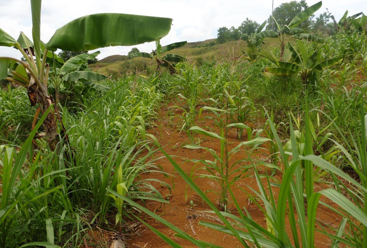
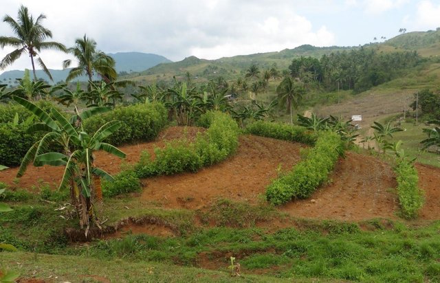
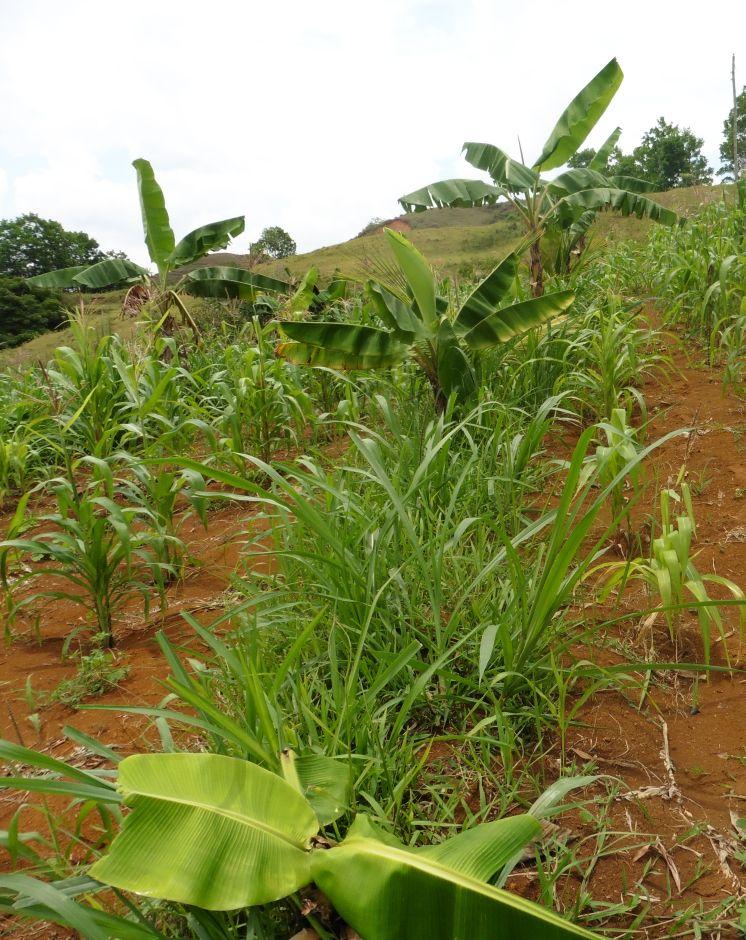
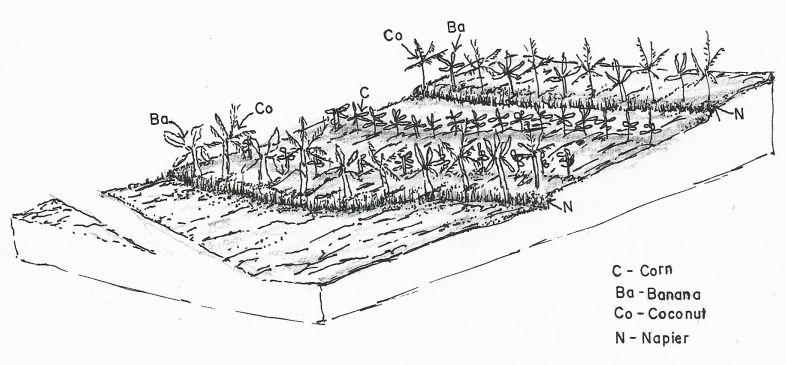
Contour farming is a technology practiced in sloping areas in which hedgerows are established along the contours and other annual/cash crops are grown in the alleys between the hedges.
2.2 การอธิบายแบบละเอียดของเทคโนโลยี
คำอธิบาย:
Contour farming is being practiced by the farmers in sloping areas to prevent or control soil erosion. Hedgerows are established along contour lines using napier grass and permanent crops like banana and coconut. In between contour lines, corn is inter-cropped with peanut. It is a traditional practice of farmers and one of the conservation techniques for the Conservation Farming Village Approach (CFV).
Purpose of the Technology: This is practiced by farmers to control surface run-off, erosion and to conserve natural soil fertility. Napier grass is also planted as source of feeds for the livestocks. The technology controls dispersed runoff, reduce slope angle and length.
Establishment / maintenance activities and inputs: Contour lines were established using an A-frame to determine the location of the hedgerows to be planted. Napier grasses are planted along the contour at 8x8m and 4X4m distance. Grafted cacao trees are also inserted in between banana at 4X4 distance. The alleys between hedges measuring 4m wide and 30m long are planted with corn and peanut. Napier grass is regularly trimmed to maintain a height of not more than a meter, using the cuttings as livestock fodder.
Natural / human environment: The area is under a humid climate condition with an average annual rainfall of 1000-1500 mm. Its elevation is 500-1000 m above mean sea level.The average cropland size of land users is less than or equal to 0. 5 hectare with a slope ranging from 18-25%. Income of land users are derived from the crops sold. The Local Government Unit (LGU) provides truck to transport the harvested crops of the farmers from the village to the town market twice a week.
2.3 รูปภาพของเทคโนโลยี
อัลบั้มสื่อบันทึก
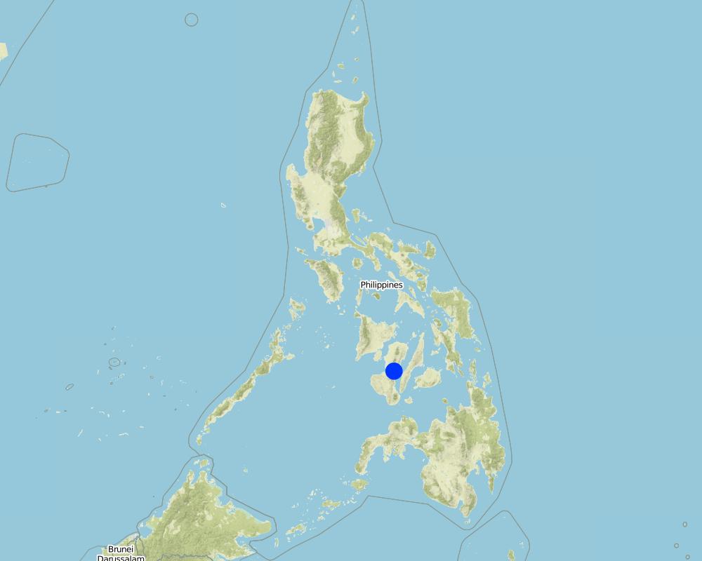
2.5 ประเทศภูมิภาค หรือสถานที่ตั้งที่เทคโนโลยีได้นำไปใช้และได้รับการครอบคลุมโดยการประเมินนี้
ประเทศ:
ฟิลิปปินส์
ภูมิภาค/รัฐ/จังหวัด:
La Libertad
ข้อมูลจำเพาะเพิ่มเติมของสถานที่ตั้ง :
Negros Oriental
Map
×2.6 วันที่การดำเนินการ
ถ้าไม่รู้ปีที่แน่นอน ให้ระบุวันที่โดยประมาณ:
- มากกว่า 50 ปี (แบบดั้งเดิม)
2.7 คำแนะนำของเทคโนโลยี
ให้ระบุว่าเทคโนโลยีถูกแนะนำเข้ามาอย่างไร:
- เป็นส่วนหนึ่งของระบบแบบดั้งเดิมที่ทำก้นอยู่ (> 50 ปี)
ความคิดเห็น (ประเภทของโครงการ เป็นต้น) :
The technology is a traditional practice in the Philippines and was integrated as part of the conservation techniques under the Conservation Farming Village approach.
3. การจัดประเภทของเทคโนโลยี SLM
3.1 วัตถุประสงค์หลักของเทคโนโลยี
- ลด ป้องกัน ฟื้นฟู การเสื่อมโทรมของที่ดิน
3.2 ประเภทของการใช้ที่ดินในปัจจุบันที่ได้นำเทคโนโลยีไปใช้

พื้นที่ปลูกพืช
- การปลูกพืชล้มลุกอายุปีเดียว
พืชหลัก (พืชเศรษฐกิจและพืชอาหาร):
major cash crop: peanut
major food crop: corn, banana, cacao, coconut
Other: Napier grasses
แสดงความคิดเห็น:
Major land use problems (compiler’s opinion): Soil erosion and soil fertility decline.
Major land use problems (land users’ perception): Lack of animal grazing areas and limited plain or level areas for crop production.
Livestock is grazing on crop residues
3.3 ข้อมูลเพิ่มเติมเกี่ยวกับการใช้ที่ดิน
การใช้น้ำของที่ดินที่มีการใช้เทคโนโลยีอยู่:
- จากน้ำฝน
3.4 กลุ่ม SLM ที่ตรงกับเทคโนโลยีนี้
- มาตรการปลูกพืชขวางความลาดชัน (cross-slope measure)
3.5 กระจายตัวของเทคโนโลยี
ระบุการกระจายตัวของเทคโนโลยี:
- กระจายไปอย่างสม่ำเสมอในพื้นที่
ถ้าหากว่าเทคโนโลยีได้มีการกระจายออกไปอย่างสม่ำเสมอในพื้นที่ ให้ระบุปริมาณพื้นที่ที่ได้รับการครอบคลุมถึง:
- < 0.1 ตร.กม.(10 เฮกตาร์)
แสดงความคิดเห็น:
Total area covered by the SLM Technology is 0.0025 m2.
Farmers practice contour farming only in small areas or parcels of land
3.6 มาตรการ SLM ที่ประกอบกันเป็นเทคโนโลยี

มาตรการจัดการพืช
- A1: พืช/สิ่งปกคลุมดิน
- A2: อินทรียวัตถุในดิน/ความอุดมสมบูรณ์ในดิน
- A3: การรักษาหน้าดิน
- A4: การรักษาดินชั้นล่าง

มาตรการอนุรักษ์ด้วยวิธีพืช
- V1: ต้นไม้และพุ่มไม้คลุมดิน
- V2: หญ้าและไม้ยืนต้น
แสดงความคิดเห็น:
Main measures: agronomic measures, vegetative measures
Type of agronomic measures: mixed cropping / intercropping, contour planting / strip cropping, legume inter-planting, manure / compost / residues, breaking crust / sealed surface
Type of vegetative measures: aligned: -contour
3.7 รูปแบบหลักของการเสื่อมโทรมของที่ดินที่ได้รับการแก้ไขโดยเทคโนโลยี

การกัดกร่อนของดินโดยน้ำ
- Wt (Loss of topsoil): การสูญเสียดินชั้นบนหรือการกัดกร่อนที่ผิวดิน

การเสื่อมโทรมของดินทางด้านเคมี
- Cn (Fertility decline): ความอุดมสมบูรณ์และปริมาณอินทรียวัตถุในดินถูกทำให้ลดลงไป (ไม่ได้เกิดจากสาเหตุการกัดกร่อน)

การเสื่อมโทรมของดินทางด้านชีวภาพ
- Bc (Reduction of vegetation cover): การลดลงของจำนวนพืชที่ปกคลุมดิน
แสดงความคิดเห็น:
Main type of degradation addressed: Wt: loss of topsoil / surface erosion, Cn: fertility decline and reduced organic matter content
Secondary types of degradation addressed: Bc: reduction of vegetation cover
Main causes of degradation: soil management (Lack of knowledge on fertilizer usage), crop management (annual, perennial, tree/shrub) (intensive tillage due to crop production), deforestation / removal of natural vegetation (incl. forest fires) (illegal logging, slash and burn), over-exploitation of vegetation for domestic use (charcoal making for livelihood)
3.8 การป้องกัน การลดลง หรือการฟื้นฟูความเสื่อมโทรมของที่ดิน
ระบุเป้าหมายของเทคโนโลยีกับความเสื่อมโทรมของที่ดิน:
- ฟื้นฟูบำบัดที่ดินที่เสื่อมโทรมลงอย่างมาก
แสดงความคิดเห็น:
Main goals: rehabilitation / reclamation of denuded land
4. ข้อมูลจำเพาะด้านเทคนิค กิจกรรมการนำไปปฏิบัติใช้ ปัจจัยนำเข้า และค่าใช้จ่าย
4.1 แบบแปลนทางเทคนิคของเทคโนโลยี
ผู้เขียน:
Mr. Patricio A. Yambot, Bureau of Soils and Water Management
4.2 ข้อมูลจำเพาะด้านเทคนิคและการอธิบายแบบแปลนทางเทคนิค
Crops planted in the contour.
Location: Brgy. Talaon. La Libertad, Negros Oriental
Date: May28, 2015
Technical knowledge required for field staff / advisors: high
Technical knowledge required for land users: moderate
Main technical functions: control of raindrop splash, control of dispersed runoff: retain / trap, Minimize soil erosion due to runoff, Serve as soil nutrient traps
Secondary technical functions: reduction of slope angle, reduction of slope length, stabilisation of soil (eg by tree roots against land slides), promotion of vegetation species and varieties (quality, eg palatable fodder)
Mixed cropping / intercropping
Material/ species: corn and peanut
Quantity/ density: 10kg/.25ha
Remarks: in between contour hedges
Contour planting / strip cropping
Material/ species: napier, banana, coconut and cacao
Quantity/ density: 20kg/.25ha
Legume inter-planting
Quantity/ density: 20kg/.25ha
Manure / compost / residues
Material/ species: vermi-compost
Quantity/ density: 500kg
Breaking crust / sealed surface
Material/ species: rotavator
Remarks: plowing two times
Aligned: -contour
Vegetative material: G : grass
Number of plants per (ha): 500
Vertical interval between rows / strips / blocks (m): 0.5
Spacing between rows / strips / blocks (m): 4
Vertical interval within rows / strips / blocks (m): drill
Width within rows / strips / blocks (m): 0.3
Vegetative measure: contour (banana)
Vegetative material: F : fruit trees / shrubs
Number of plants per (ha): 64
Vertical interval between rows / strips / blocks (m): 0.5
Spacing between rows / strips / blocks (m): 4
Vertical interval within rows / strips / blocks (m): 4
Width within rows / strips / blocks (m): 4
Vegetative measure: contour (cacao)
Vegetative material: F : fruit trees / shrubs
Number of plants per (ha): 64
Vertical interval between rows / strips / blocks (m): 0.5
Spacing between rows / strips / blocks (m): 4
Vertical interval within rows / strips / blocks (m): 1
Width within rows / strips / blocks (m): 4
Vegetative measure: contour (cococnut)
Vegetative material: F : fruit trees / shrubs
Number of plants per (ha): 32
Vertical interval between rows / strips / blocks (m): 0.5
Spacing between rows / strips / blocks (m): 4
Vertical interval within rows / strips / blocks (m): 8
Width within rows / strips / blocks (m): 8
Vegetative measure: Vegetative material: F : fruit trees / shrubs
Fruit trees / shrubs species: banana, cacao, coconut
Grass species: napier grass
Slope (which determines the spacing indicated above): 8%
If the original slope has changed as a result of the Technology, the slope today is (see figure below): 5%
Gradient along the rows / strips: 3-5%
4.3 ข้อมูลทั่วไปเกี่ยวกับการคำนวณปัจจัยนำเข้าและค่าใช้จ่าย
ให้ระบุว่าค่าใช้จ่ายและปัจจัยนำเข้าได้รับการคำนวณอย่างไร:
- ต่อพื้นที่ที่ใช้เทคโนโลยี
ระบุขนาดและหน่วยพื้นที่:
1 hectare
ระบุสกุลเงินที่ใช้คำนวณค่าใช้จ่าย:
- ดอลลาร์สหรัฐ
ระบุอัตราแลกเปลี่ยนจากดอลลาร์สหรัฐเป็นสกุลเงินท้องถิ่น (ถ้าเกี่ยวข้อง) คือ 1 เหรียญสหรัฐ =:
49.0
ระบุค่าเฉลี่ยของค่าจ้างในการจ้างแรงงานต่อวัน:
2.22
4.4 กิจกรรมเพื่อการจัดตั้ง
| กิจกรรม | ประเภทของมาตรการ | ช่วงเวลาดำเนินการ | |
|---|---|---|---|
| 1. | Laying out and establishment of contour lines/hedgerows | ด้วยวิธีพืช | before onset of rainy season |
| 2. | Planting of hedgerows (Napier grass) | ด้วยวิธีพืช | Rainy season. one week after laying out |
| 3. | Planting of perennial crops along contour | ด้วยวิธีพืช | Rainy season. 1 week after laying out |
4.5 ค่าใช้จ่ายของปัจจัยนำเข้าที่จำเป็นสำหรับการจัดตั้ง
ถ้าเป็นไปได้ให้แจกแจงรายละเอียดต้นทุนการบำรุงรักษาตามตารางข้างล่างดังต่อไปนี้ ให้ระบุลงไปถึงปัจจัยนำเข้าและค่าใช้จ่ายต่อปัจจัยนำเข้า ถ้าไม่สามารถแจกแจงรายละเอียดต้นทุนได้ ให้ทำการประมาณค่าใช้จ่ายทั้งหมดในการบำรุงรักษาเทคโนโลยี:
122.77
| ปัจจัยนำเข้า | หน่วย | ปริมาณ | ค่าใช้จ่ายต่อหน่วย | ค่าใช้จ่ายทั้งหมดต่อปัจจัยนำเข้า | %ของค่าใช้จ่ายที่ก่อให้เกิดขึ้นโดยผู้ใช้ที่ดิน | |
|---|---|---|---|---|---|---|
| แรงงาน | Laying out and establishment of contour | Person/day | 3.0 | 2.22 | 6.66 | 40.0 |
| แรงงาน | Planting of crops and hedgerows | Person/day | 10.0 | 2.22 | 22.2 | 100.0 |
| วัสดุด้านพืช | napier seeds | kg | 300.0 | 0.0133 | 3.99 | 100.0 |
| วัสดุด้านพืช | banana seeds | plants | 64.0 | 0.11093 | 7.1 | 100.0 |
| วัสดุด้านพืช | cacao seeds | plants | 64.0 | 0.55565 | 35.56 | 100.0 |
| วัสดุด้านพืช | coconut seeds | plants | 32.0 | 0.88875 | 28.44 | 100.0 |
| ปุ๋ยและสารฆ่า/ยับยั้งการเจริญเติบโตของสิ่งมีชีวิต (ไบโอไซด์) | herbicide | liter | 1.0 | 17.78 | 17.78 | 40.0 |
| วัสดุสำหรับก่อสร้าง | bamboosticks | picks | 50.0 | 0.012 | 0.6 | 40.0 |
| วัสดุสำหรับก่อสร้าง | A-frame | unit | 1.0 | 0.44 | 0.44 | 40.0 |
| ค่าใช้จ่ายทั้งหมดของการจัดตั้งเทคโนโลยี | 122.77 | |||||
4.6 การบำรุงรักษาสภาพหรือกิจกรรมที่เกิดขึ้นเป็นประจำ
| กิจกรรม | ประเภทของมาตรการ | ช่วงระยะเวลา/ความถี่ | |
|---|---|---|---|
| 1. | Land clearing/ preparation (plowing, rotavating, harrowing) of alleys between contours | จัดการพืช | Before onset of rainy season |
| 2. | Furrowing | จัดการพืช | |
| 3. | Planting of corn (first cropping) | จัดการพืช | Raining season |
| 4. | Weeding, insect control | จัดการพืช | |
| 5. | Harvesting of first crop | จัดการพืช | |
| 6. | Land Preparation for the second cropping (plowing, harrowing/rotavating, furrowing) | จัดการพืช | |
| 7. | Planting of corn + Planting of peanut (second cropping- corn + peanut) | จัดการพืช | |
| 8. | Weeding / Insect control | จัดการพืช | |
| 9. | Harvesting of corn and peanut | จัดการพืช |
4.7 ค่าใช้จ่ายของปัจจัยนำเข้าและกิจกรรมที่เกิดขึ้นเป็นประจำที่ต้องการการบำรุงรักษา (ต่อปี)
ถ้าเป็นไปได้ให้แจกแจงรายละเอียดต้นทุนการบำรุงรักษาตารางข้างล่างดังต่อไปนี้ ให้ชี้ระบุลงไปถึงปัจจัยการผลิตและค่าใช้จ่ายต่อปัจจัยการผลิต ถ้าคุณไม่สามารถแจกแจงรายละเอียดต้นทุนได้ ให้ทำการประมาณค่าใช้จ่ายทั้งหมดในการบำรุงรักษา:
146.63
| ปัจจัยนำเข้า | หน่วย | ปริมาณ | ค่าใช้จ่ายต่อหน่วย | ค่าใช้จ่ายทั้งหมดต่อปัจจัยนำเข้า | %ของค่าใช้จ่ายที่ก่อให้เกิดขึ้นโดยผู้ใช้ที่ดิน | |
|---|---|---|---|---|---|---|
| แรงงาน | Land Preparation with machine / furrowing | Person/day | 3.0 | 7.11 | 21.33 | 100.0 |
| แรงงาน | Animal Labour | Person/day | 2.0 | 2.67 | 5.34 | 100.0 |
| อุปกรณ์ | Other Labour: Weeding, harvesting | Person/day | 14.0 | 2.22 | 31.08 | 100.0 |
| วัสดุด้านพืช | Corn seeds | kg | 10.0 | 0.444 | 4.44 | |
| วัสดุด้านพืช | Peanut seeds | kg | 20.0 | 2.0 | 40.0 | 100.0 |
| วัสดุด้านพืช | Seeds undefined | kg | 10.0 | 0.444 | 4.44 | 100.0 |
| ปุ๋ยและสารฆ่า/ยับยั้งการเจริญเติบโตของสิ่งมีชีวิต (ไบโอไซด์) | Fertilizer | kg | 500.0 | 0.08 | 40.0 | 100.0 |
| ค่าใช้จ่ายทั้งหมดของการบำรุงรักษาสภาพเทคโนโลยี | 146.63 | |||||
แสดงความคิดเห็น:
Machinery/ tools: rotavator
4.8 ปัจจัยสำคัญที่สุดที่มีผลกระทบต่อค่าใช้จ่าย
ปัจจัยสำคัญที่สุดที่มีผลกระทบต่อค่าใช้จ่ายต่างๆ:
The slope of the area contributes to the additional labor cost in the establishment of contours.The steeper the slope, the higher labor cost will be incurred.
5. สิ่งแวดล้อมทางธรรมชาติและของมนุษย์
5.1 ภูมิอากาศ
ฝนประจำปี
- < 250 ม.ม.
- 251-500 ม.ม.
- 501-750 ม.ม.
- 751-1,000 ม.ม.
- 1,001-1,500 ม.ม.
- 1,501-2,000 ม.ม.
- 2,001-3,000 ม.ม.
- 3,001-4,000 ม.ม.
- > 4,000 ม.ม.
เขตภูมิอากาศเกษตร
- ชื้น
Thermal climate class: tropics
5.2 สภาพภูมิประเทศ
ค่าเฉลี่ยความลาดชัน:
- ราบเรียบ (0-2%)
- ลาดที่ไม่ชัน (3-5%)
- ปานกลาง (6-10%)
- เป็นลูกคลื่น (11-15%)
- เป็นเนิน (16-30%)
- ชัน (31-60%)
- ชันมาก (>60%)
ธรณีสัณฐาน:
- ที่ราบสูง/ที่ราบ
- สันเขา
- ไหล่เขา
- ไหล่เนินเขา
- ตีนเนิน
- หุบเขา
ระดับความสูง:
- 0-100 เมตร
- 101-500 เมตร
- 501-1,000 เมตร
- 1,001-1,500 เมตร
- 1,501-2,000 เมตร
- 2,001-2,500 เมตร
- 2,501-3,000 เมตร
- 3,001-4,000 เมตร
- > 4,000 เมตร
ให้ระบุถ้าเทคโนโลยีได้ถูกนำไปใช้:
- ไม่เกี่ยวข้อง
ความคิดเห็นและข้อมูลจำเพาะเพิ่มเติมเรื่องสภาพภูมิประเทศ:
Altitudinal zones: 720 m
5.3 ดิน
ค่าเฉลี่ยความลึกของดิน:
- ตื้นมาก (0-20 ซ.ม.)
- ตื้น (21-50 ซ.ม.)
- ลึกปานกลาง (51-80 ซ.ม.)
- ลึก (81-120 ซ.ม.)
- ลึกมาก (>120 ซ.ม.)
เนื้อดิน (ดินชั้นบน):
- ปานกลาง (ดินร่วน ทรายแป้ง)
อินทรียวัตถุในดิน:
- ปานกลาง (1-3%)
5.4 ความเป็นประโยชน์และคุณภาพของน้ำ
ระดับน้ำใต้ดิน:
5-50 เมตร
น้ำไหลบ่าที่ผิวดิน:
ดี
คุณภาพน้ำ (ที่ยังไม่ได้บำบัด):
เป็นน้ำเพื่อการดื่มที่ดี
5.5 ความหลากหลายทางชีวภาพ
ความหลากหลายทางชนิดพันธุ์:
- ต่ำ
5.6 ลักษณะของผู้ใช้ที่ดินที่นำเทคโนโลยีไปปฏิบัติใช้
แนวทางการตลาดของระบบการผลิต:
- ผสม (การเลี้ยงชีพ/ทำการค้า)
รายได้ที่มาจากนอกฟาร์ม:
- < 10% ของรายได้ทั้งหมด
ระดับของความมั่งคั่งโดยเปรียบเทียบ:
- จน
เป็นรายบุคคล/ครัวเรือน:
- เป็นรายบุคคล/ครัวเรือน
ระดับของการใช้เครื่องจักรกล:
- งานที่ใช้แรงกาย
- การใช้กำลังจากสัตว์
เพศ:
- หญิง
- ชาย
ระบุลักษณะอื่นๆที่เกี่ยวข้องของผู้ใช้ที่ดิน:
Land users applying the Technology are mainly disadvantaged land users
Population density: 10-50 persons/km2
Annual population growth: 1% - 2%; 2%
70% of the land users are poor and own 70% of the land.
Off-farm income specification: Hired laborers for the Department of Environment and Natural Resources (DENR) Project on National Greening Program
5.7 พื้นที่เฉลี่ยของที่ดินที่เป็นเจ้าของหรือเช่าโดยผู้ใช้ที่ดินที่นำเทคโนโลยีไปปฏิบัติใช้
- < 0.5 เฮกตาร์
- 0.5-1 เฮกตาร์
- 1-2 เฮกตาร์
- 2-5 เฮกตาร์
- 5-15 เฮกตาร์
- 15-50 เฮกตาร์
- 50-100 เฮกตาร์
- 100-500 เฮกตาร์
- 500-1,000 เฮกตาร์
- 1,000-10,000 เฮกตาร์
- >10,000 เฮกตาร์
พิจารณาว่าเป็นขนาดเล็ก กลาง หรือขนาดใหญ่ (ซึ่งอ้างอิงถึงบริบทระดับท้องถิ่น):
- ขนาดเล็ก
5.8 กรรมสิทธิ์ในที่ดิน สิทธิในการใช้ที่ดินและสิทธิในการใช้น้ำ
กรรมสิทธิ์ในที่ดิน:
- รายบุคคล ไม่ได้รับสิทธิครอบครอง
สิทธิในการใช้ที่ดิน:
- รายบุคคล
สิทธิในการใช้น้ำ:
- เกี่ยวกับชุมชน (ถูกจัดระเบียบ)
5.9 การเข้าถึงบริการและโครงสร้างพื้นฐาน
สุขภาพ:
- จน
- ปานกลาง
- ดี
การศึกษา:
- จน
- ปานกลาง
- ดี
ความช่วยเหลือทางด้านเทคนิค:
- จน
- ปานกลาง
- ดี
การจ้างงาน (เช่น ภายนอกฟาร์ม):
- จน
- ปานกลาง
- ดี
ตลาด:
- จน
- ปานกลาง
- ดี
พลังงาน:
- จน
- ปานกลาง
- ดี
ถนนและการขนส่ง:
- จน
- ปานกลาง
- ดี
น้ำดื่มและการสุขาภิบาล:
- จน
- ปานกลาง
- ดี
บริการด้านการเงิน:
- จน
- ปานกลาง
- ดี
6. ผลกระทบและสรุปคำบอกกล่าว
6.1 ผลกระทบในพื้นที่ดำเนินการ (On-site) จากการใช้เทคโนโลยี
ผลกระทบทางด้านเศรษฐกิจและสังคม
การผลิต
การผลิตพืชผล
จำนวนก่อน SLM:
0
หลังจาก SLM:
10 bags
การผลิตพืชที่ใช้เลี้ยงปศุสัตว์
จำนวนก่อน SLM:
0
หลังจาก SLM:
1350 bundles
คุณภาพพืชที่ใช้เลี้ยงปศุสัตว์
ความหลากหลายของผลิตภัณฑ์
การจัดการที่ดิน
รายได้และค่าใช้จ่าย
รายได้จากฟาร์ม
ความหลากหลายของแหล่งผลิตรายได้
ภาระงาน
ผลกระทบด้านสังคมวัฒนธรรมอื่น ๆ
โอกาสทางด้านสันทนาการ
สถาบันของชุมชน
สถาบันแห่งชาติ
การบรรเทาความขัดแย้ง
สถานการณ์ของกลุ่มด้อยโอกาส ทางด้านสังคมและเศรษฐกิจ
Improved livelihood and human well-being
ผลกระทบด้านนิเวศวิทยา
ดิน
สิ่งปกคลุมดิน
การสูญเสียดิน
การหมุนเวียนและการเติมของธาตุอาหาร
อินทรียวัตถุในดิน/ต่ำกว่าดินชั้น C
ความหลากหลายทางชีวภาพของพืชและสัตว์
มวลชีวภาพ/เหนือดินชั้น C
ความหลากหลายทางชีวภาพของพืช
ความหลากหลายของสัตว์
ลดความเสี่ยงของภัยพิบัติ
การปล่อยคาร์บอนและก๊าซเรือนกระจก
ความเร็วของลม
6.3 การเผชิญและความตอบสนองของเทคโนโลยีต่อการเปลี่ยนแปลงสภาพภูมิอากาศที่ค่อยเป็นค่อยไป และสภาพรุนแรงของภูมิอากาศ / ภัยพิบัติ (ที่รับรู้ได้โดยผู้ใช้ที่ดิน)
การเปลี่ยนแปลงสภาพภูมิอากาศที่ค่อยเป็นค่อยไป
การเปลี่ยนแปลงสภาพภูมิอากาศที่ค่อยเป็นค่อยไป
| ฤดู | ประเภทของการเปลี่ยนแปลงสภาพภูมิอากาศที่ค่อยเป็นค่อยไป และสภาพรุนแรงของภูมิอากาศ | เทคโนโลยีมีวิธีการรับมืออย่างไร | |
|---|---|---|---|
| อุณหภูมิประจำปี | เพิ่มขึ้น | ไม่ค่อยดี |
สภาพรุนแรงของภูมิอากาศ (ภัยพิบัติ)
ภัยพิบัติทางอุตุนิยมวิทยา
| เทคโนโลยีมีวิธีการรับมืออย่างไร | |
|---|---|
| พายุฝนประจำท้องถิ่น | ไม่ค่อยดี |
ภัยพิบัติจากสภาพภูมิอากาศ
| เทคโนโลยีมีวิธีการรับมืออย่างไร | |
|---|---|
| ภัยจากฝนแล้ง | ไม่ค่อยดี |
ภัยพิบัติจากน้ำ
| เทคโนโลยีมีวิธีการรับมืออย่างไร | |
|---|---|
| น้ำท่วมตามปกติ (แม่น้ำ) | ไม่ค่อยดี |
6.4 การวิเคราะห์ค่าใช้จ่ายและผลประโยชน์ที่ได้รับ
ผลประโยชน์ที่ได้รับเปรียบเทียบกับค่าใช้จ่ายในการจัดตั้งเป็นอย่างไร (จากมุมมองของผู้ใช้ที่ดิน)
ผลตอบแทนระยะสั้น:
ด้านบวกอย่างมาก
ผลตอบแทนระยะยาว:
ด้านบวกอย่างมาก
ผลประโยชน์ที่ได้รับเปรียบเทียบกับค่าใช้จ่ายในการบำรุงรักษาหรือต้นทุนที่เกิดขึ้นซ้ำอีก เป็นอย่างไร (จากมุมมองของผู้ใช้ที่ดิน)
ผลตอบแทนระยะสั้น:
ด้านบวกอย่างมาก
ผลตอบแทนระยะยาว:
ด้านบวกอย่างมาก
แสดงความคิดเห็น:
More income added from Napier grass
6.5 การปรับตัวของเทคโนโลยี
ถ้ามีข้อมูลให้บอกปริมาณด้วย (จำนวนของครัวเรือนหรือครอบคลุมพื้นที่):
18 land user families have adopted the Technology
จากทั้งหมดที่ได้รับเทคโนโลยีเข้ามามีจำนวนเท่าใดที่ทำแบบทันที โดยไม่ได้รับการจูงใจด้านวัสดุหรือการเงินใด ๆ:
- 10-50%
แสดงความคิดเห็น:
Comments on acceptance with external material support: Single farmer focused on napier production and used as hedgerows
28% of land user families (4) who have adopted the Technology did it spontaneously.
4 land user families have adopted the Technology without any external material support
Comments on spontaneous adoption: Practiced contouring but some are partial adoption (rock wall)
There is a strong trend towards spontaneous adoption of the Technology
Comments on adoption trend: Additional barangays will be adopting the technology.
6.7 จุดแข็ง / ข้อได้เปรียบ / โอกาสของเทคโนโลยี
| จุดแข็ง / ข้อได้เปรียบ / โอกาสในทัศนคติของผู้ใช้ที่ดิน |
|---|
|
Availability of labor force in the community. How can they be sustained / enhanced? Encourage more farmers to adopt the technology and utilize available labor force. |
|
The technology generated jobs and increase the income of the landusers practicing the technology. How can they be sustained / enhanced? To conduct continuous capacity building to land users and their children to ensure sustainability. |
| จุดแข็ง / ข้อได้เปรียบ / โอกาสในทัศนคติของผู้รวบรวมหรือวิทยากรหลัก |
|---|
|
Soil erosion was reduced because of the presence of the hedge rows that traps eroded soil. How can they be sustained / enhanced? Include other structural measures such as silt traps and brush dams to trap silts. |
|
The kind of hedgerows planted depends on the need of the landusers. Farmers with livestock used napier and forage grasses as hedges while others planted perennial and cash crop to supplement their food requirement. How can they be sustained / enhanced? Conduct crop suitability evaluation and market study. |
6.8 จุดอ่อน / ข้อเสียเปรียบ / ความเสี่ยงของเทคโนโลยีและวิธีการแก้ไข
| จุดอ่อน / ข้อเสียเปรียบ / ความเสี่ยงในทัศนคติของผู้ใช้ที่ดิน | มีวิธีการแก้ไขได้อย่างไร |
|---|---|
| Poor road network from the center of the town to the barangay. | Construction of farm-to-market road to improve the accessibility of the barangay. |
| จุดอ่อน / ข้อเสียเปรียบ / ความเสี่ยงในทัศนคติของผู้รวบรวมหรือวิทยากรหลัก | มีวิธีการแก้ไขได้อย่างไร |
|---|---|
| Lack of irrigation system in the cropping area | Provision of irrigation system such as solar pump and small farm reservoir. |
7. การอ้างอิงและการเชื่อมต่อ
7.1 วิธีการและแหล่งข้อมูล
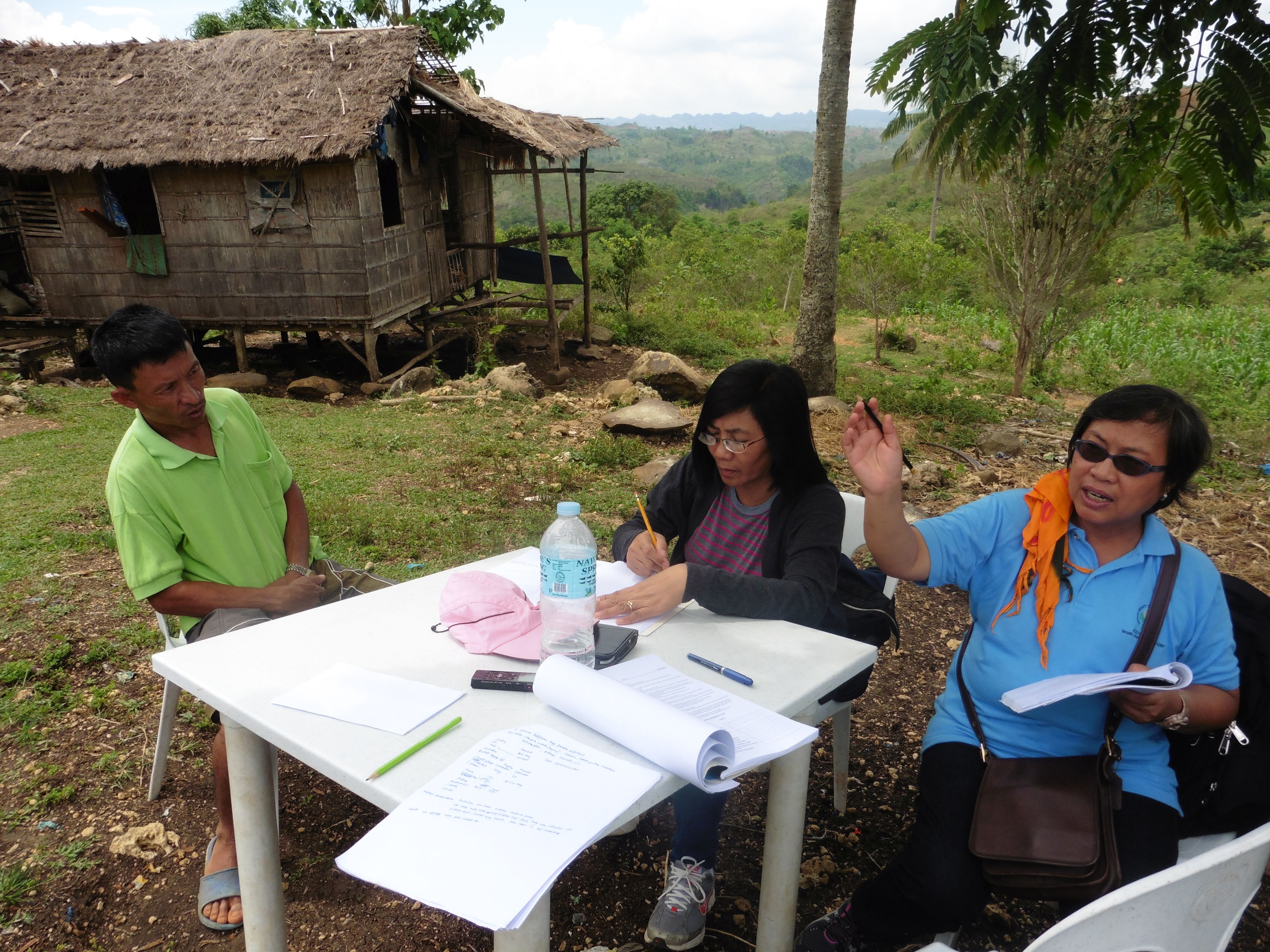
- ไปเยี่ยมชมภาคสนาม การสำรวจพื้นที่ภาคสนาม
- การสัมภาษณ์กับผู้ใช้ที่ดิน
ลิงก์และโมดูล
ขยายทั้งหมด ย่อทั้งหมดลิงก์
Conservation Farming Village [ฟิลิปปินส์]
A modality in mobilizing resources for sustainable upland development which utilizes a basket of strategies, technologies, and interventions to catalyze the widespread transformation of traditional upland farming systems into resilient and sustainable upland production systems.
- ผู้รวบรวม: Philippine Overview of Conservation Approaches and Technologies
โมดูล
ไม่มีโมดูล